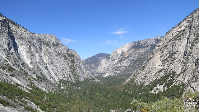
Mile for mile – and perhaps inch for inch – the Rae Lakes Loop in Kings Canyon National Park contains some of the most stunning and celebrated scenery in a mountain range world-famous for stunning and celebrated scenery. The route consists of three separate but connected trails that travel through glacially-carved canyons, a high country basin containing a chain of sapphire blue lakes set against towering granitic crags, and an alpine pass that just scrapes 12,000 feet. Throughout the route, you will observe nearly every major biotic zone (life zones characterized by specific species) in the Sierra, prime examples of glacial erosion, waterfalls, idyllic valleys, tranquil meadows, and myriad sublime scenes ranging from the intimate to the jaw-droppingly grand.
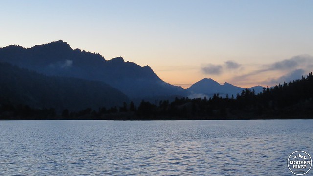
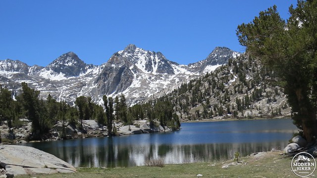
Middle Rae Lake at Dusk
This article contains detailed route information, including campsite details, natural history, and specific highlights along the way. You will also find information on permits, safety considerations, and other regulations and restrictions. Hikers intending to follow this route can use the information contained here either as a literal step-by-step guide or as a resource from which to derive any number of variations on the route.
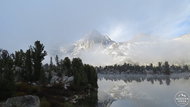
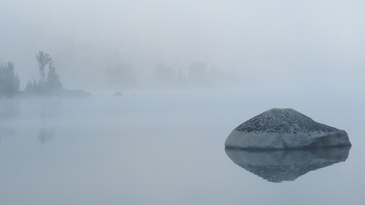
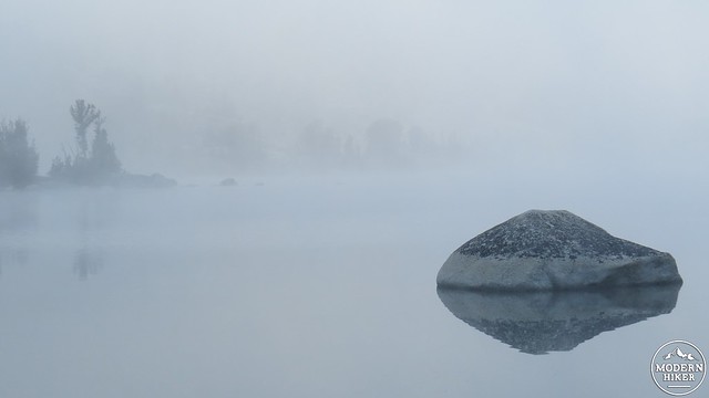
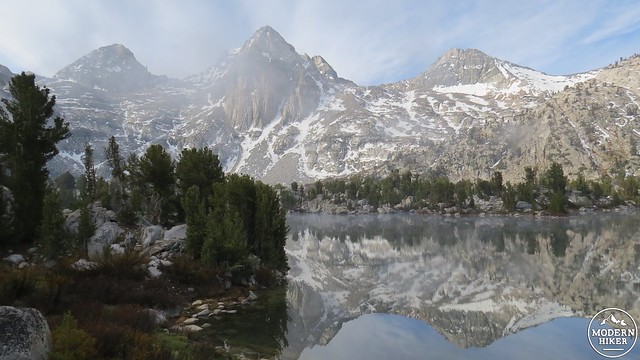
The Painted Lady shrouded in morning mist
From our personal experience in completing this route, we recommend that conditioned hikers take the route in 5 days, with one zero day in the Rae Lakes area. However, it is possible to complete this route in anywhere from 3 ambitious days to 7 leisurely days. We also recommend that hikers take this route clockwise, as the counter-clockwise route features some intense climbing in the initial stretch while pack weight is at its highest. The text below describes the route as if hiked clockwise in four days, although distances for specific destinations are indicated should hikers wish to use the information to fashion their own itinerary.
Permits
Descending to Junction Meadow
Red Tape
To hike the Rae Lakes Loop, you will need to obtain a wilderness permit from Kings Canyon National Park (managed conjointly with Sequoia National Park). The quota period for permits is currently May 16th to September 26th (at time of writing). During this time, the park restricts the number of visitors departing from a specific trailhead on a specific day. Outside of the quota period, there are no restrictions, although conditions are often less conducive to backcountry travel.
Bubbs Creek
Self-issue permits are available from the Kings Canyon Visitor Center in Grant Grove and from the Road’s End ranger station east of Cedar Grove. However, given this route’s popularity, we recommend that you reserve your permits well in advance, as there is no guarantee that walk-up permits are available. Sequoia-Kings Canyon National Parks have recently revamped their permit system. Instead of the old “spend the day waiting for your fax to go through” system, the new 3-step process requires you to fill out the application and then email it to the park. After that, you receive a confirmation email indicating that you have the reservation. After that, you go to a government pay site to pay for the permit. Remember that the permit reservation is insufficient as a permit. You will still need to pick up your permit from the Roads End Ranger Station either on the day before your hike or the day of your hike. This handy webpage allows you to see what kind of availability remains at each of Sequoia-Kings Canyon’s trailheads.
Safety and Other Considerations
The Sphinx with a sugar pine in the foreground
Cautions and Safety
The reason for picking up the permit from the ranger stems in part from the park’s desire to have the ranger review basic safety considerations. The park’s primary concern is that you carry an approved bear canister to protect your food from bears. This requirement comes in spite of the fact that there are food storage lockers placed at nearly every developed camping area along the route. Hikers should not count on the availability of space in these lockers as heavy trail use may make space unavailable or insufficient. The ranger station at Road’s End rents out a variety of bear canisters.
Just above Middle Paradise Valley
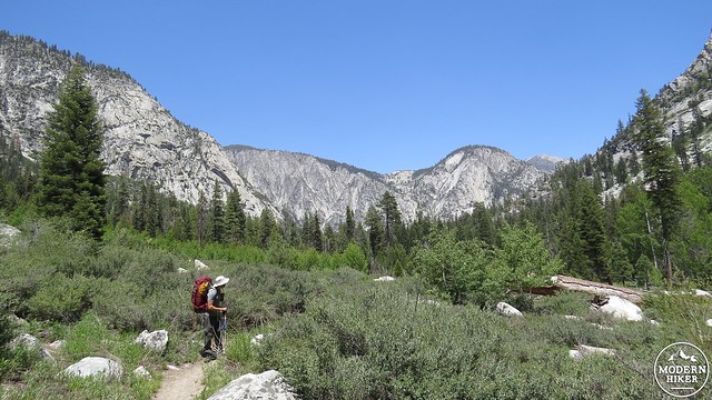
Basic safety considerations for high-altitude wilderness travel apply on this route. You will reach a maximum altitude of 11,998′ on Glen Pass at nearly the center of the route, and a considerable portion of this route occurs above 10,000′. Altitude sickness, overexposure to ultraviolet light, dehydration, fatigue, and heatstroke are all potential ailments you may encounter while hiking. In addition, the necessity of carrying up to 45 pounds of gear for 38 miles while gaining and losing over 7,000′ of elevation necessitates a certain level of physical fitness. Hikers attempting this route should be in good condition, preferably with at least some backcountry navigation skill and some experience backpacking.
Woods Creek
The availability of water is less of a concern on this route than in other areas of California. The trail parallels a reliable watercourse for nearly the entirety of the route, and the longest water-less stretch is about 5.5 miles. Regardless of how pristine the water looks, all water in the Sierra should be filtered and treated or, preferably, boiled. Giardia, viruses, and other microorganisms may be present, which can cause painful digestive disorders and spectacularly aggressive crash diets.
The Pacific Crest Trail/John Muir Trail
Hikers must also practice Leave No Trace principles on this route (and on every inch of trail you set foot on, for that matter). Specifically on the Rae Lakes Loop, that means no fires above 10,000′ or when the park mandates a fire restriction due to drought. It also means camping only in established campsites or on any flat ground that is not covered by vegetation; remember that vegetation in alpine and subalpine settings may takes years or even decades to recover from trampling. Finally, and perhaps most egregiously, all used toilet paper (but not human waste, thankfully) must be carried out. This is disgusting, yes, but far less disgusting than strolling around a lake and encountering a toilet paper bloom poorly concealed beneath a rock.
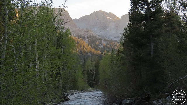
An evening stroll along the banks of Upper Rae Lake
As with all destinations around the Sierra Nevada that occur near a water source, mosquitos can be an issue on this trail. Mosquitos are generally most active around dawn and dusk, but they can be present at any time during the day. Avoiding mosquitos can be a challenge, with a combination of head nets, natural bug remedies such as lemon and eucalyptus essential oils, or more powerful chemical remedies such as DEET being options. Mosquitos are usually worse during the height of summer, and the ability to avoid being treated as if you’re a walking buffet will substantially improve your enjoyment on this route.
The Route
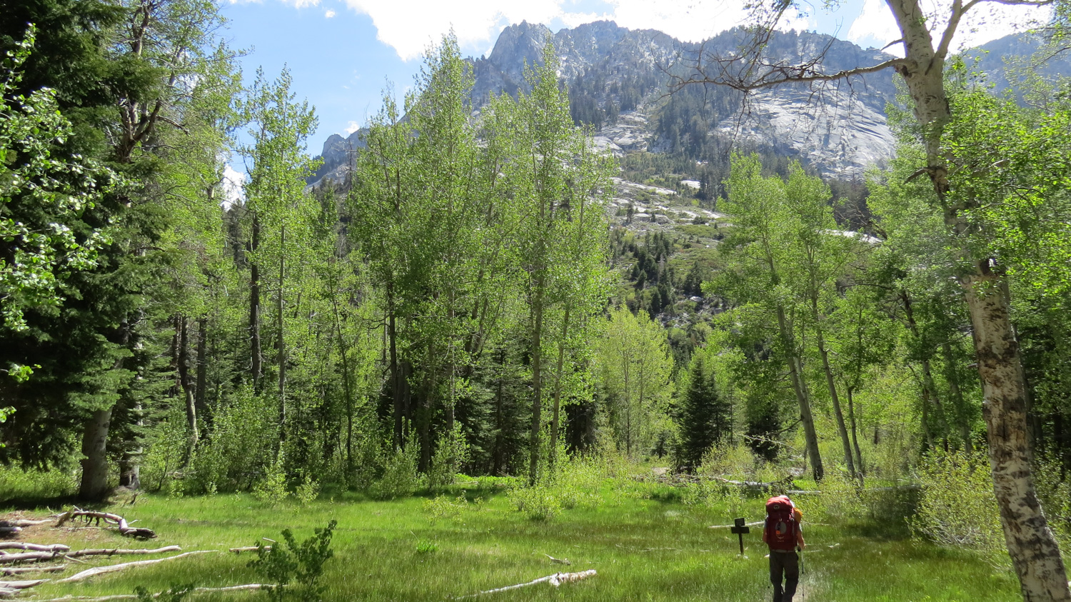
Day 1: Road’s End to Upper Paradise Valley; 8.5 Miles, 1,900 feet of gain.
The Kings River below Road’s End
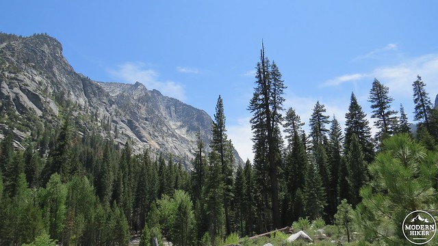
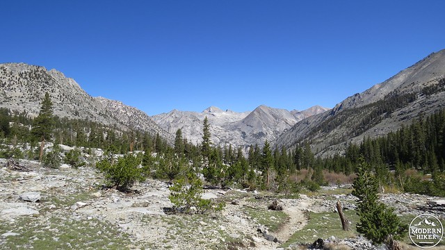
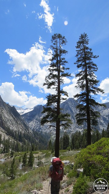
The first 8.5 miles of the Rae Lakes Loop follow the course of the South Fork of the Kings River as it makes its sometimes thundering way through towering U-shaped glacial canyons before gliding more placidly by Cedar Grove and its adjacent campgrounds. Highlights along the way include the Bailey Bridge at the confluence of the Kings River and Bubbs Creek, Mist Falls, and the aptly-named Paradise Valley.
Distorted reflections on Upper Rae Lake
Camping is not allowed at any spot below Lower Paradise Valley, which means hikers will have at least 5.8 miles of hiking before they can pitch their tents. There are three separate established camping areas in the 2.5 mile stretch between Lower Paradise Valley (5.8 miles) and Upper Paradise Valley (8.5 miles), with Middle Paradise Valley (6.6 miles) being the third of the trio and second in the sequence. Each campground has a bear locker, established sites with fire rings, and in the case of Middle Paradise Valley, an open-air pit toilet.
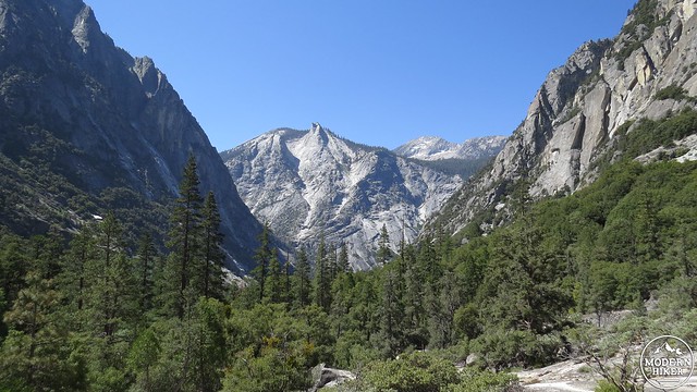
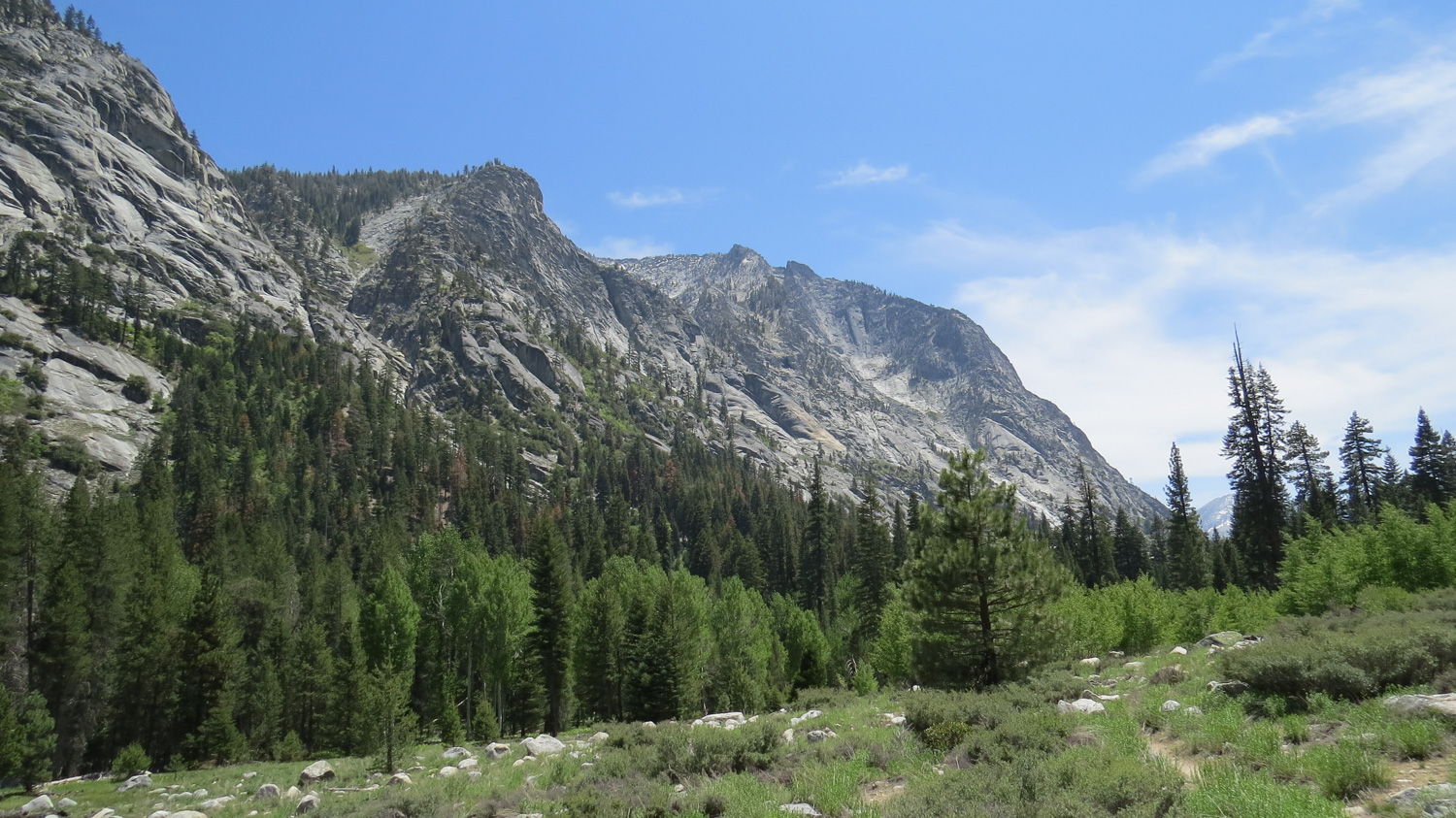
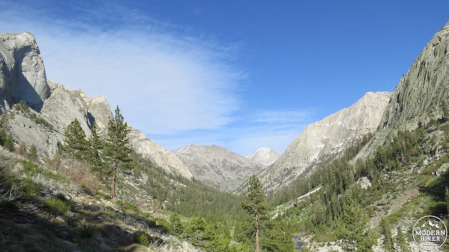
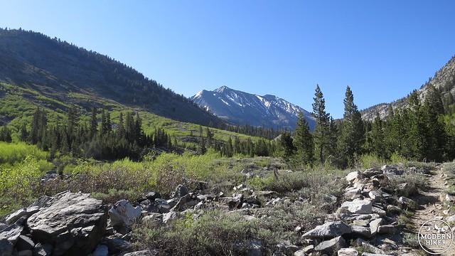
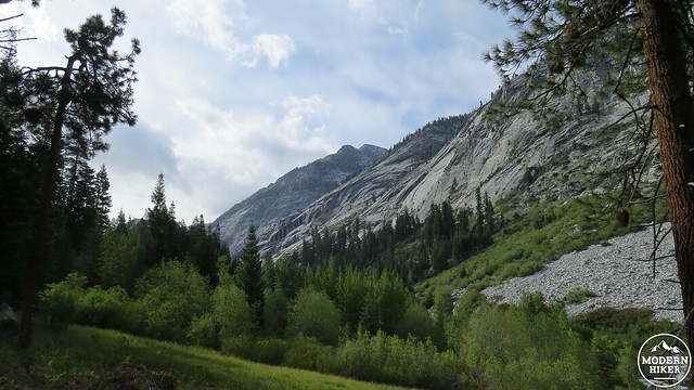
Looking down canyon toward the Sphinx
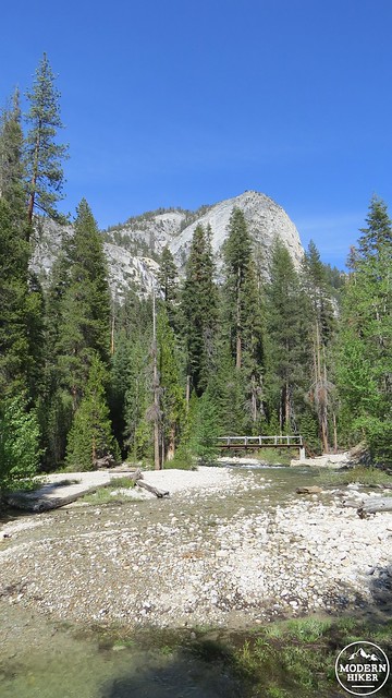
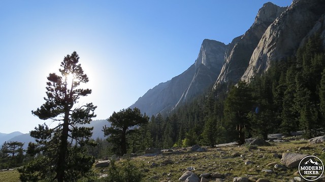
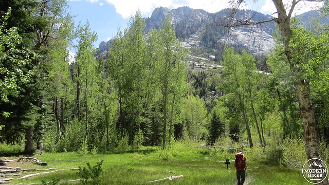
After picking up your permit and bear canister at the Road’s End ranger station, commence travel due east along a smooth, wide, and sandy path through ponderosa pines, black oaks, and cedars. This sunny and sometimes hot section of the canyon features good views of the towering granite ramparts on every side of the canyon. Kings Canyon’s signature granite formation, the Sphinx, comes into view early on. This crag of granite, which stands between two prominent avalanche chutes on the south side of the canyon about two miles east, looks like a mythical sphinx (or perhaps a lion) from just about every vantage.
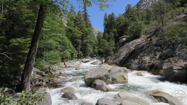
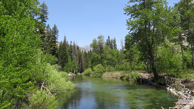
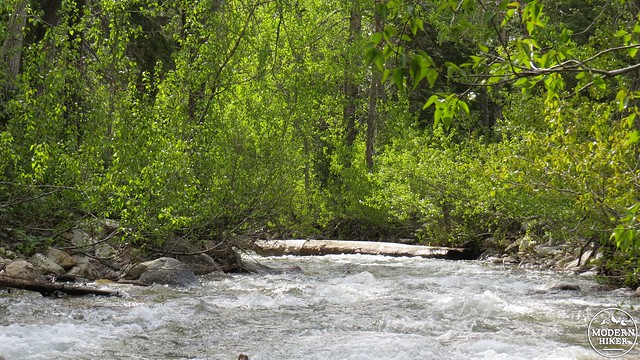
The South Fork of the Kings River
After 2 miles of travel, the trail will plunge into a cooler, wetter section of the trail closer to the river. This “mosquito alley” can be a nuisance in the warmer summer months, but the shade is a welcome relief after the balmy exposure of the previous two miles. At 2.2 miles, the trail will reach a three-way junction that marks both the beginning and end of the official loop. Your return route is on the right across the Bailey Bridge, which spans the Kings River just below the confluence of two rivers that drain major sections of the High Sierra. To commence the route clockwise toward Paradise Valley and eventually the PCT, turn left to begin a mostly gentle climb along the left bank of the Kings River on the Woods Canyon Trail.
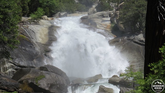
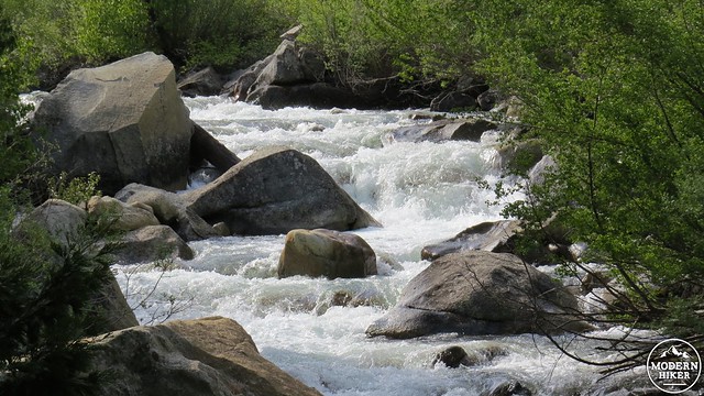
Mist Falls
For the next 2.5 miles, the trail will follow the course of the Kings at it cascades deafeningly over granite slabs and boulders. A lovely mixture of pines, cedars, oaks, and cottonwoods keep the trail mostly in shade throughout. At 4.7 miles from Roads End, the roar of the river escalates in volume and intensity as the trail approaches a sunny opening. Directly ahead, the river spills over a 100-foot-high cliff, spraying a generous amount of mist onto everything within 50 yards. This is Mist Falls, which is also a popular day-hiking destination.
The Kings River just below Paradise Valley
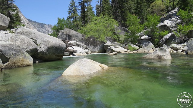
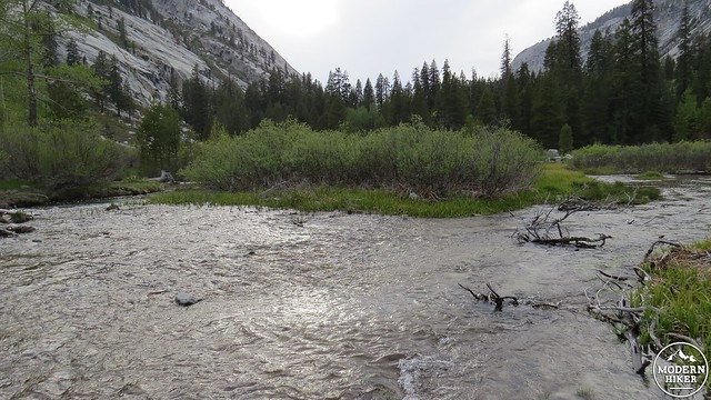
Beyond Mist Falls, the trail begins a steeper ascent, often over exposed granite. Be sure to turn around frequently at these exposed portions as the view down canyon toward the Sphinx is tremendous. At 5.4 miles, the river widens and slows at a point where several rocky barriers restrict the flow, creating a large, rocky pool. This pool looks inviting for swimming, but the current remains dangerous and the water icy. Still, it’s a fine place to cool your feet and re-fill your water bladder.
Lower Paradise Valley
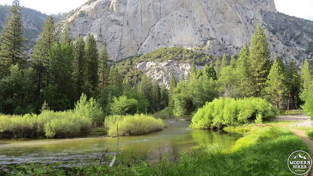
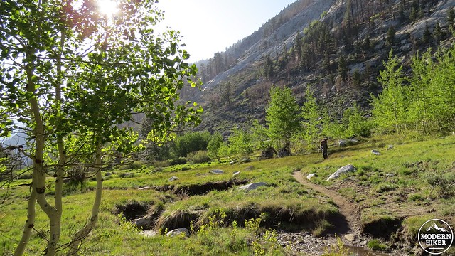
Just beyond the pool, you enter the lower portion of Paradise Valley, which is distinguished by a nearly level grade. The evenness of the terrain here causes the Kings River to flow placidly. The cottonwood-lined banks of the river and countless towering conifers – now with firs and a handful of scattered lodgepole pines – underscore the aptness of the area’s name. This is as idyllic a spot as any in the vicinity of Cedar Grove.
Middle Paradise Valley
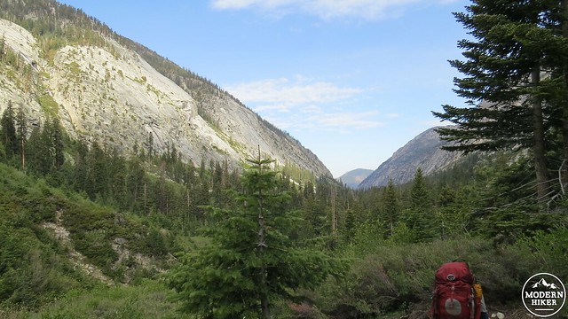
You’ll encounter the first campsite at 5.8 miles. Continuing on, the landscape does not change dramatically until after Middle Paradise Valley at 6.6 miles, after which the trail begins to approach the lodgepole-red fir vegetation belt. The trail continues to climb gradually toward the confluence of the South Fork of the Kings River and Woods Creek, which drains the Rae Lakes Basin. After passing through a sunny meadow from which you can glimpse Arrow Creek tumbling over a cliff, the trail will plunge into a deep forest before emerging just before the bridge spanning Woods Creek at 8.6 miles. This is the site of Upper Paradise Valley campground – a suitable stopping point for your first day of travel.
Upper Paradise Valley
Campsites:
Lower Paradise Valley: 5.8 Miles
Middle Paradise Valley: 6.6 Miles
Upper Paradise Valley: 8.5 Miles
Day 2: Upper Paradise Valley to Middle Rae Lake, 11.4 Miles, 3,700′
Looking down the South Fork of Kings Canyon
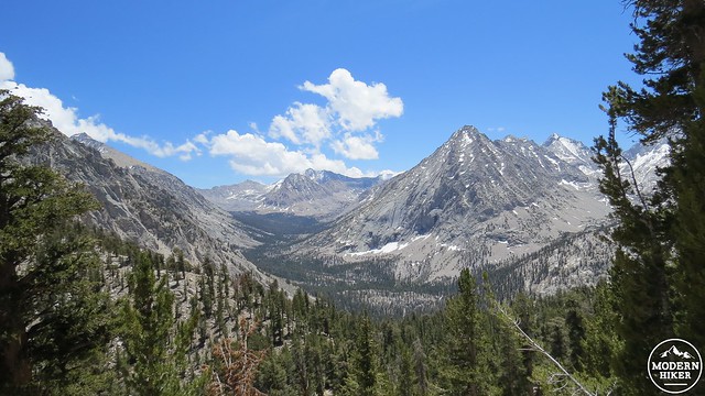
The second day of the trip ascends up and out of the South Fork Kings Canyon Canyon toward the junction with the Pacific Crest Trail at Woods Creek before reaching the open high country of the Rae Lakes Basin. The Rae Lakes, being the namesake of this route, are a high point of a trip filled with high points, and some hikers may wish to extend their stay to allow an additional zero day at the lakes for fishing and possible side trips to the nearby 60 Lakes Basin.
Looking up Woods Creek Canyon
From Upper Paradise Valley, cross the bridge and continue, now traveling generally east and northeast along the left bank of Woods Creek. For the next 3.4 miles, the trail enters a somewhat tedious stretch where it undulates up and down, sometimes approaching the creek and sometimes climbing high above it. This section also travels through a burn area where you may encounter occasional downed trees or heavy detritus along the trail.
Aspen-lined meadow
Castle Crags
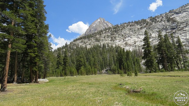
All of the tedious up-and-downs pay off when the trail descends into a spectacular meadow at 11.9 miles in a spot where the canyon widens to reveal towering craggy cliff-sides all around. Western junipers and quaking aspen now join the panopoly of trees as the wall of granite peaks ahead indicates the approaching Sierra Crest and a junction with the Pacific Crest Trail. After traversing some rocky, juniper-studded granite slabs, the trail will again plunge into deep forest along the creek before reaching a handful of scattered campsites at the junction with the Pacific Crest Trail/John Muir Trail. Keep to the right to approach the Woods Creek Bridge at 13.8 miles.
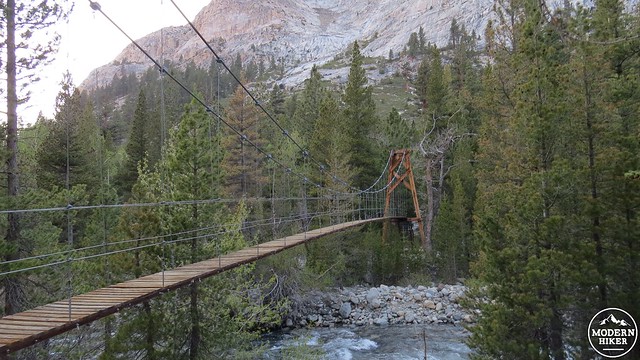
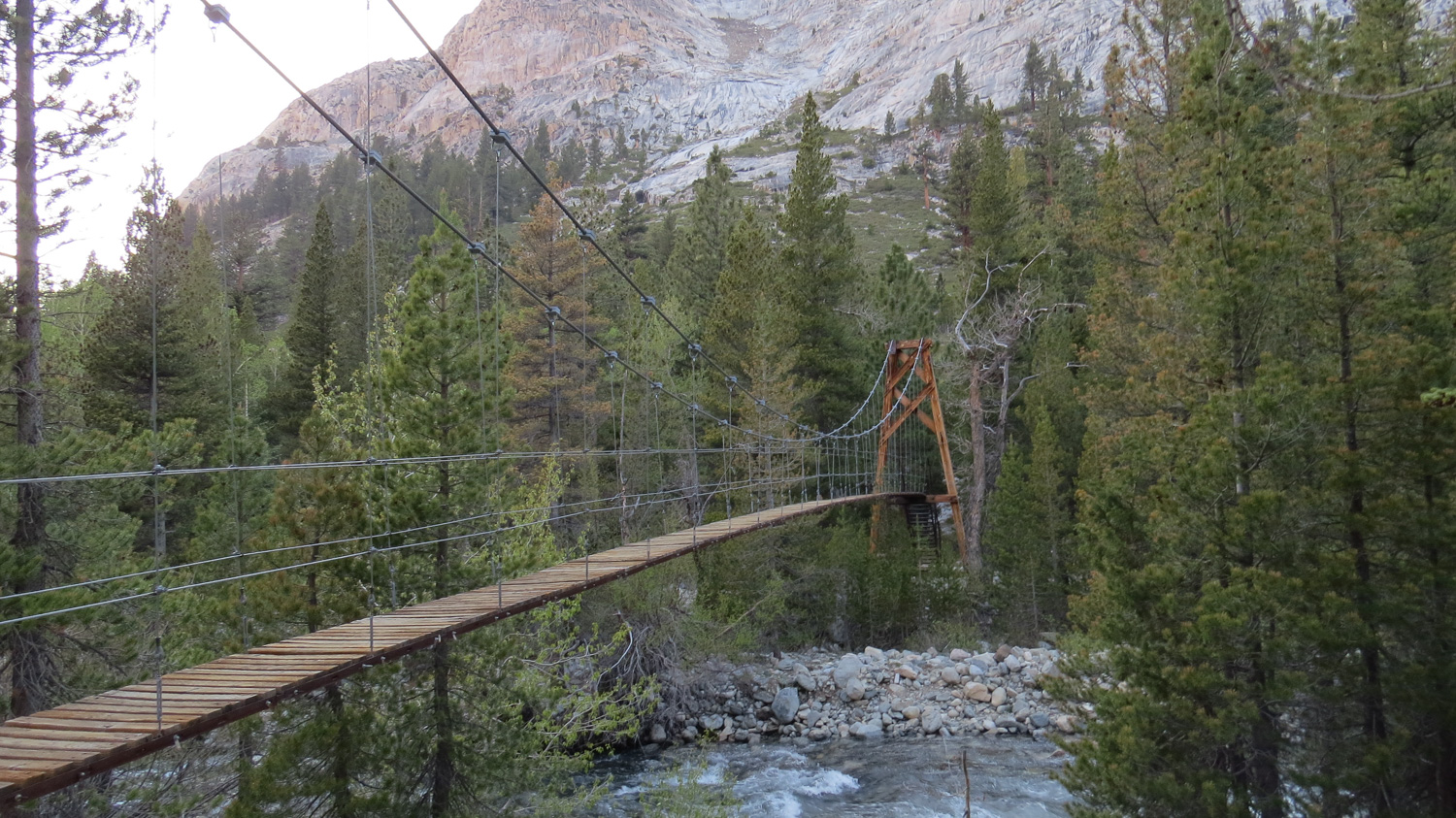
Woods Creek Bridge
The Woods Creek bridge is a rickety (and somewhat terrifying for those with a fear of heights) bridge spanning Woods Creek as it rushes along below. Campsites abound on either side of the bridge, although the bear locker and the most expansive sites are on the east side of the bridge. For those looking to take the hike on this route in much smaller chunks, this is a good stopping point.
On the Pacific Crest Trail
For those wishing to continue on, the PCT begins climbing through dense forest, now primarily lodgepole with some scattered red firs and junipers, on the right bank of the Woods Creek’s south fork. The view to the Woods Creek Junction area behind you becomes more impressive with each step as you gain elevation. Meanwhile, the trees start to grow smaller and more spaced out around large grassy areas dotted with wildflowers and laced with streams. This area signals the beginning of the Sierra Nevada High Country, which usually begins above 9,000′.
Dollar Lake
The trail meanders through several miles of this beautiful country until reaching a marker indicating the 10,000′ contour, which is also the boundary where campfires are prohibited. At 17.4 miles, the trail reaches Dollar Lake, a round alpine lake with a stunning view of Fin Dome to the south. You will find one camping area on the west side of Dollar Lake, but keep in mind that there is a one night limit due to heavy foot traffic.
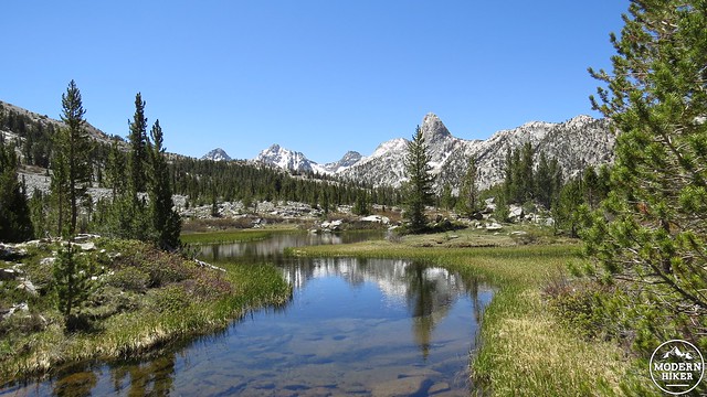
Sublime spot just above Dollar Lake
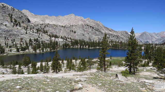
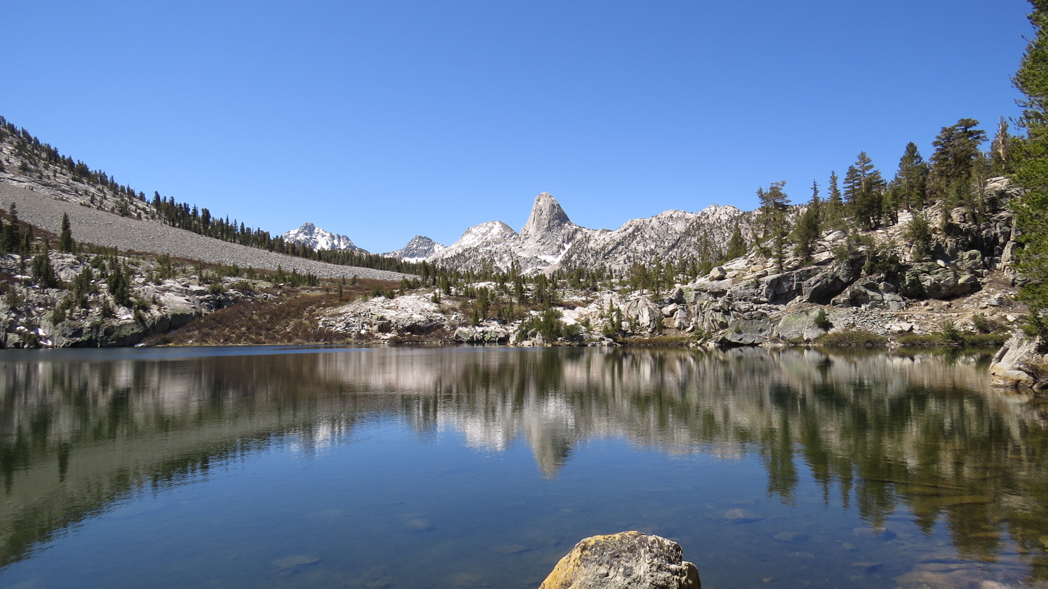
Arrowhead Lake
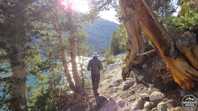
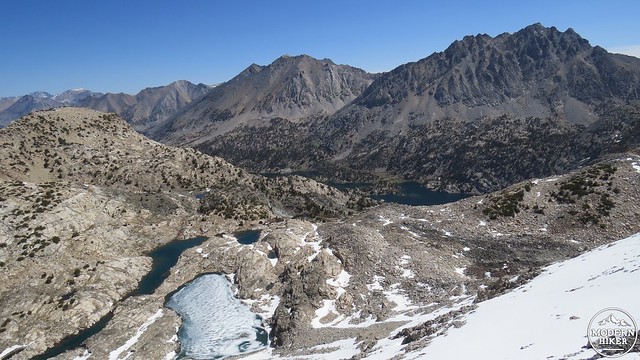
The trail wraps around Dollar Lake’s shore and then passes through one of those sublime Sierran scenes where streams flow placidly through grassy tussocks and willows while 12-13,000′ peaks tower above on all sides. This sort of scenery would be a desirable destination anywhere else, but in this region of the Sierra Nevada, it seems like a casual afterthought. .In 7 mile after Dollar Lake you encounter Arrowhead, named for its resemblance (at least from above) to an arrowhead. Arrowhead lake has a bear locker and several campsites, but it is less scenic than the nearby Rae Lakes, which are now only less than a mile away.
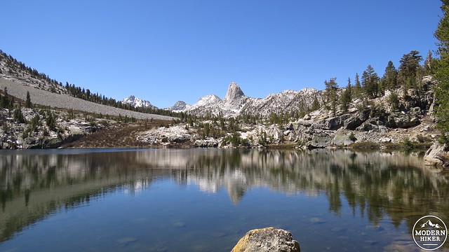
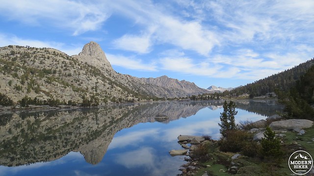
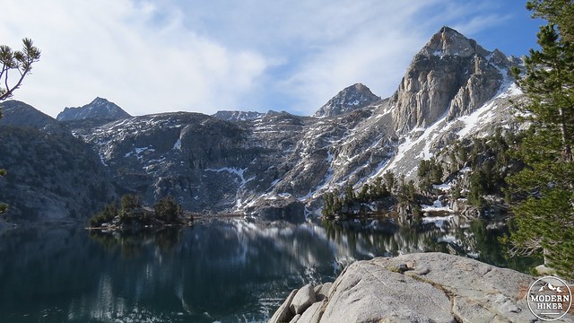
Lower Rae Lake
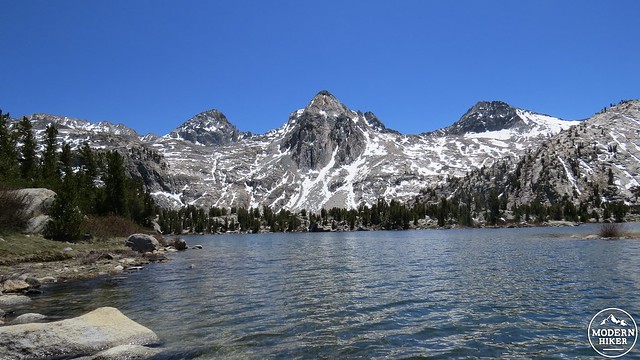
Middle Rae Lake
Not long after ascending away from Arrowhead Lake, the trail drops down to follow the northern bank of the smallest of the three Rae Lakes. After another brief climb, the trail approaches the eastern shore of the middle and largest of the Rae Lakes. A sign indicating food storage will direct you toward a pair of bear locker and myriad possible campsites.
Mist over Middle Rae Lake at dawn
Middle Rae Lake
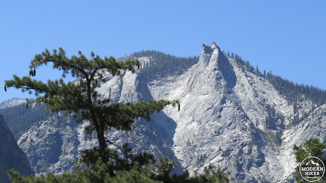
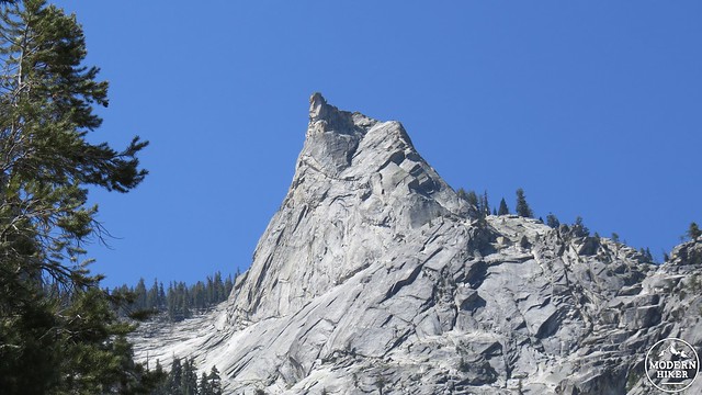
This is an ideal place to stop, regardless of how you’re dividing the segments of trail. Indeed, whether you layover here or not, an extended exploration of the Rae Lakes at a leisurely pace is so crucial as to seem almost mandatory. Be sure to allow yourself plenty of time to stay here and soak in the spectacular richness of the landscape. Even among the many sights both large and small, two landmarks stand out above all others. The Painted Lady, with bands of sedimentary rock adding vivid splashes of color to an symmetrical and perfectly placed peak, towers over the upper Rae Lake while constantly drawing the eye no matter where you’re standing. Directly across the east bank of the middle Rae Lake stands Fin Dome, a thin, towering glacial arete that hides the numerous lakes of the 60 Lakes basin.
Mist clearing
Campsites:
Arrowhead Lake: 18.1 Miles
Middle Rae Lake: 20 Miles
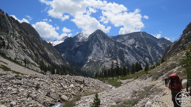
Day 3: Middle Rae Lake to Junction Meadow: 8 Miles, 1,400′ of gain, 3,800′ of loss
Passing on the west shore of Upper Rae Lake
Day 3 includes some of the highest elevation, toughest climbing, and most spectacular high country scenery on the entire loop. The initial 2.1 miles of this route include the ascent of 11,998′ Glen Pass, which divides the Woods Creek and Bubbs Creek watersheds and presents this route’s high point. Glen Pass’ north-facing slope aspect means that it frequently holds snow late into the season, presenting a possibly formidable challenge to hikers looking to ascend it.
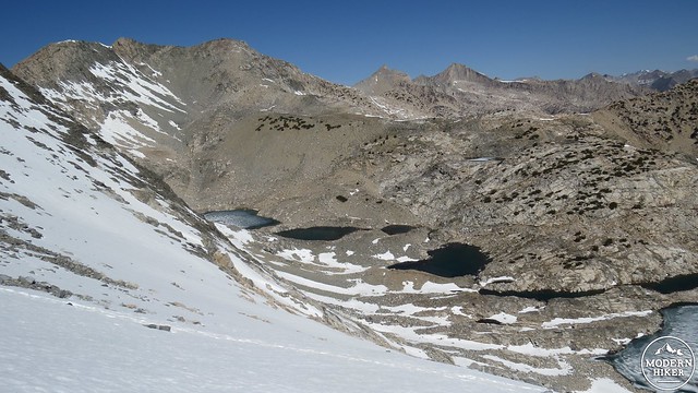
Upper basin above Rae Lakes
From Middle Rae Lake, commence travel south as you wrap around the north and west banks of Upper Rae Lake. On the west bank of the lake, the PCT begins climbing vigorously away from the Rae Lakes Basin through scattered pines and across numerous streams. Before long, the track leaves the cover of the trees behind to enter a broad glacial basin studded with austere lakes and a formidable wall of granite directly ahead.
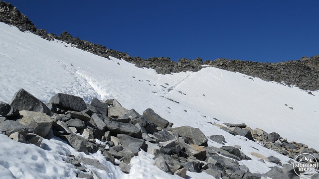
Snow-bound Glen Pass
If the trail is snow-free, the hike won’t be too challenging, at least from a terrain standpoint. Simply choose a slow, deliberate pace that avoids excessive exertion. This section is probably where most people prone to altitude sickness will feel the effects, although the slow, deliberate pace and two days of acclimation should mitigate the effects somewhat. If the pass is snowbound, you will likely face a challenge. Some people say slushy snow is easier to navigate as you won’t need crampons. Other people say icy, firm snow is better since you won’t posthole (sink into deep pockets of snow), even though carrying cramp-ons would be helpful to avoid slipping. If there is snow, you’re in for a time regardless of the conditions, although I found that a morning ascent on icy, but still somewhat yielding snow produced the best footing.
Looking back over the Rae Lakes Basin
Once atop the pass, you can revel in an impressive panorama of the two separate watersheds. The sky attains a deep, nearly purple hue at this altitude, and living things are virtually non-existent beyond a few hardy shrubs. The highlights here are long chains of craggy peaks stretching in all directions. Breath-taking, humbling, and fairly intimidating, this scene of high country splendor is one of the chief highlights along the route.
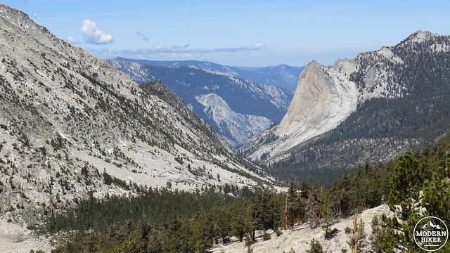
Looking west over Charlotte Dome
Now on the north side of Glen Pass, the trail descends aggressively through a steep, rocky canyon before emerging onto a mountainside above the deep-blue oval of Charlotte Lake, 500′ below. The trail begins a gradual descent trending to the southeast through dry lodgepole and foxtail pine forest before reaching a junction with a trail leading east to Kearsarge Pass at 24 miles and then a second junction leading west toward Charlotte Lake at 24.2 miles. The second junction is the continuation for the PCT, which skirts a dry, open meadow before commencing the precipitous descent toward Vidette Meadow, 1,200′ below. Charlotte Lake, which is .9 mile off of the PCT, is a possible overnight option with bear lockers and a fairly attractive setting.
Bubbs Creek Canyon and East Vidette Mountain
Vidette Meadow
As you descend toward Vidette Meadow and the junction with the Bubbs Creek Trail, the U-shaped Bubbs Creek Drainage, dominated by East and West Vidette Mountains close at hand beckons and impresses in its scale and immensity. Ahead north lies Forester Pass, the highest point on the PCT at 13,200′. However, this route stops 7 miles short of this challenging obstacles, instead veering right onto Bubbs Creek at 25.8 miles. After a few hundred yards, the trail skirts the edge of Vidette Meadow, where you will find bear boxes and campsites.
Toward East Junction
Vidette Meadow is a fine option for camping, and your return journey from here will be a manageable 11.8 miles back to Roads End. However, we recommend continuing the next 2.2 miles to Junction Meadow, which is a smaller meadow, but rich with numerous subtle highlights in its intimate setting. The trail between the two meadows is spectacular, as it descends through a steep, narrow canyon toward a junction with a beautiful side canyon. This junction, which also lends its name to the eponymous meadow, is eminently picturesque, adding to the embarrassment of scenic riches along the Rae Lakes Loop.
Junction Meadow
At 28 miles, you’ll reach a junction in a grassy meadow shaded by aspens and towering red firs. The trail heading east fords Bubbs Creek and climbs up to East Lake, a possible stopping point for the ambitious. Numerous campsites abound from the junction to perhaps .25 mile downstream.
A pair of Red Firs
Campsites:
Charlotte Lake: 25.1 Miles
Vidette Meadow: 25.8 Miles
Junction Meadow: 28 Miles
Day 4: Junction Meadow to Roads End: 9.6 Miles, 3,200′ of loss
Bubbs Creek
The final stretch of the Rae Lakes Loop descends steeply at times through Lower Bubbs Creek Canyon before passing its tributary, Sphinx Creek, and dropping into the floor of Kings Canyon. This stretch is not as scenic, at least in the jaw-dropping sense of the rest of the trip, but it features more than its share of highlights. Amateur naturalist will enjoy several obvious transitions through a number of biotic zones indicating some of the principal vegetation belts of the western Sierra.
Red fir and lodgepole belt
Briefly, a biotic zone indicates a band of vegetation, usually defined by altitude and slope aspect (which direction a slop faces), that is dominated by specific species of trees. From bottom to top, Sierran biotic zones include foothill woodland and chaparral, mixed conifer and oak woodland, oak and pinyon pine woodland (on sunny south-facing slopes), yellow pine forest (dominated by Jeffrey and ponderosa pines), lodgepole-red fir forest, subalpine forest (lodgepole pines and foxtail pines), and alpine vegetation above treeline. You encounter all of this on the Rae Lakes loop, and on your final day, you’ll see everything but subalpine and alpine species.
Bubbs Creek
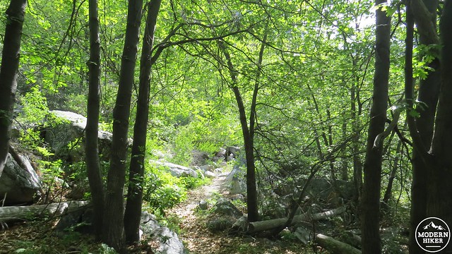
Starting from Junction Meadow, the trail continues its descent through thick lodgepole and red fir forest with the occasional aspen-lined meadow to break up the merest hint of monotony. Occasionally, the trail strays close to the river and then away again, but for the duration of this section, the river remains pleasingly within earshot.
Last of the meadows below Junction Meadow
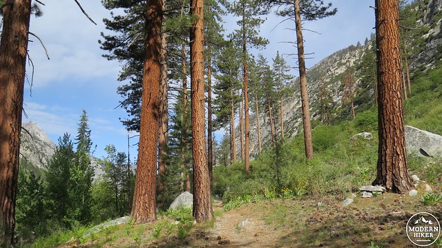
Jeffrey Pines
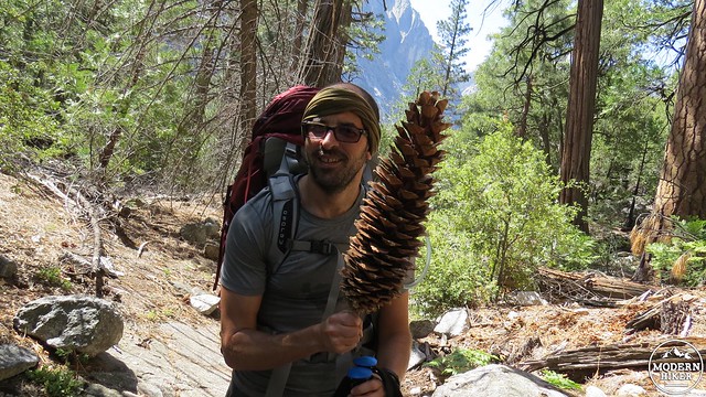
Around the 7,500′ contour, the red firs, lodgepoles, and aspens fade out to be replaced by white firs and fragrant Jeffrey pines. Jeffrey pines everywhere produce a pleasing vanilla/butterscotch scent, but the specimens in the Sierra produce the strongest scent of the species. This impressive pine shows up around 8,000′ and stays with you until about 6,000′. It often dominates in dryer section of the forest and can often be found on drier, rockier hillsides. It’s hard to distinguish it from its close relative, the ponderosa pine, but you can spot the tree by the copious amount of pine cones, each about the size of a Nerf football, scattered around the base of the tree. If you don’t feel too silly about it, I highly recommend that you press your nose close to the fissures in the bark and inhale deeply; you won’t be sorry.
Black Oaks
Good views above you toward Charlotte Dome and numerous other granitic crags that would give Yosemite a run for its money highlight the next 5 miles. The forest undergoes another transition around 7,500′ as Jeffrey pines are joined by black oaks and incense cedars. The black oak, a deciduous species that produces colorful foliage in spring and fall, coupled with black cottonwoods along the banks of Bubbs Creek, produce a pleasing foliage show in the middle of fall.
A sugar pine cone
Around 6,500′ feet of elevation, towering sugar pines with their 12-18″ long pine cones join the forest, producing one of the richest and most varied biotic zones along the route. This is the “yellow pine” forest, dominated principally by Jeffrey pines, but also including red and white fir, sugar pines, incense cedars, black and canyon oaks, and an understory of fragrant ceanothus and red-barked manzanita. At 34.1 miles, you’ll reach a junction with Sphinx Creek. Your final spot for camping lies just past the Sphinx Creek bridge beneath a towering sugar pine. A handful of sites and a bear locker are present here.
Kings Canyon
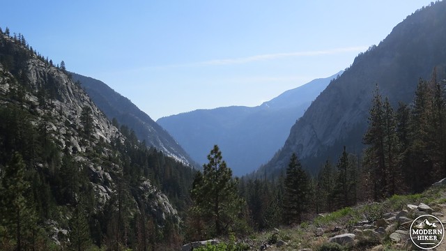
Beyond the Sphinx Creek junction, the trail begins a rapid, switchbacking descent into Kings Canyon. Bubbs Creek’s thundering cascade is heard, but not seen, as the trail passes through dry live oak and pinyon pine woodland on its way down. The trail traverses back and forth between two precipitous cliffs, and at the switchbacks within these boundaries, the views west and north through the main Kings Canyon and the smaller South Fork of Kings Canyon (the initial leg of the loop) are impressive.
The Sphinx
At 35.5 miles, the trail bottoms out to cross fingers of Bubbs Creek on three successive wooden bridges before crossing the river’s main channel via the steel Bailey Bridge at 35.7 miles. Just beyond Bailey Bridge, the Bubbs Creek Trail junctions with the trail back to Roads End. From this point, it’s a flat and somewhat impatient 2 miles back to Roads End, where your car, and – most importantly – a hot meal at Cedar Grove Lodge await you.
Campsites:
Sphinx Creek: 34.1 Miles
Tags: Arrowhead Lake, biotic zonation, Charlotte Lake, Dollar Lake, Glen Pass, John Muir Trail, Junction Meadow, Mist Falls, Pacific Crest Trail, Painted Lady, Paradise Valley, Rae Lakes, Rae Lakes Loop, Vidette Meadow, Woods Creek