The Road to Hana is one of those quintessential Maui activities that, along with whale watching or watching the sunrise from Haleakala, every visitor feels obliged to do. This 64.4 mile drive along Maui’s northeast shore winds in and out of countless gullies, passing waterfalls and ocean vistas. For most people, the drive is the highlight itself, since the town of Hana is a fairly sleepy place where not much happens.
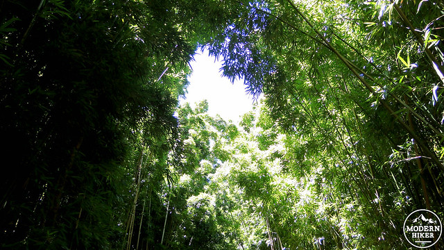
Bamboo forest
A second popular destination beyond Hana is a series of cascading waterfalls plunging into grottos that have received the fanciful colloquial title of “The Seven Sacred Pools.” The real name of this beautiful landmark is actually Oheo Gulch. There are more than seven pools, and they aren’t sacred. For most visitors, a brief stroll down to the pools is about the extent of their bipedal exploration. This is all well and good, given that the falls are gorgeous. However, we at Modern Hiker struggle to see the sense in spending three to four hours in a car if all of that sitting doesn’t culminate in some good uphills, a memorable jaunt through a bamboo forest, and a 400′ waterfall.
After visiting Oheo Gulch, we recommend taking the Pipiwai Trail uphill away from the Oheo Gulch Parking lot for an eventful two miles toward the sort of waterfall that most people blow hundreds of dollars to see up close in a helicopter. This short, but jam-packed-with-scenery trail climbs a windswept bluff before plunging into tropical forest along side a robust creek, passes through a dense bamboo forest, and then emerges into an amphitheater containing Waimoku Falls.
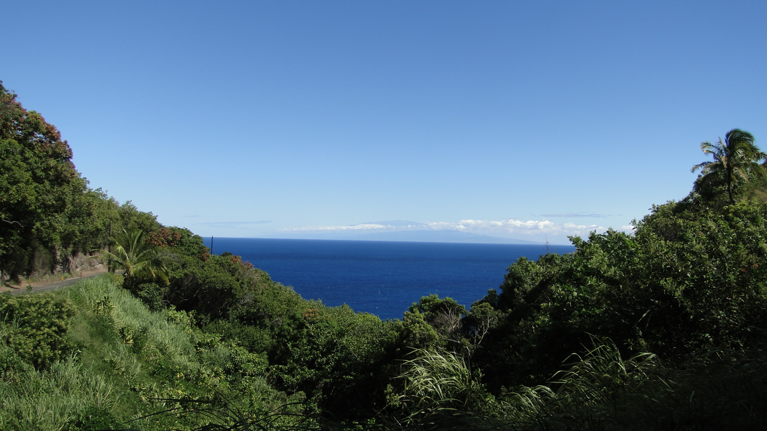
Looking southwest toward Mauna Kea on the Big Island
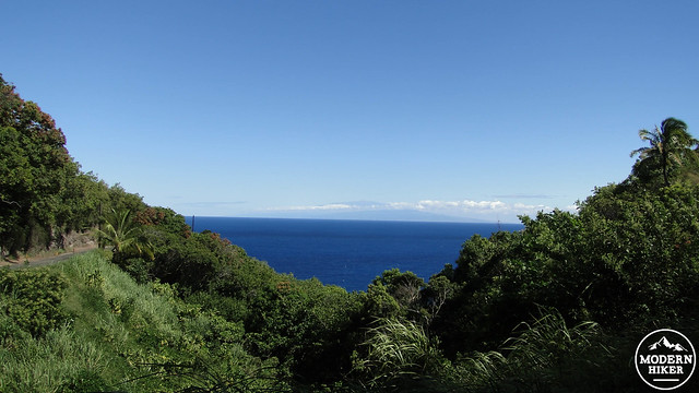
After crossing the Hana Highway to find the Pipiwai Trailhead, step onto the trail and begin climbing along the aforementioned windswept bluff. If it’s clear, you should be able to spot the cloud-crowned, 13,796′ Mauna Kea directly across the channel atop the Big Island.
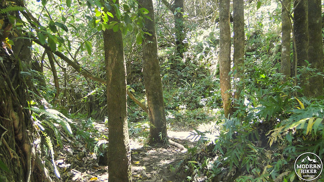
 The trail approaches the edge of the cliff and plunges into rain forest right around the same time, all the while maintaining a fairly brisk uphill grade. At about half a mile, the trail approaches this cliff’s edge, from which you might be able to catch a glimpse through vegetation of a lesser waterfall tumbling through Oheo Gulch.
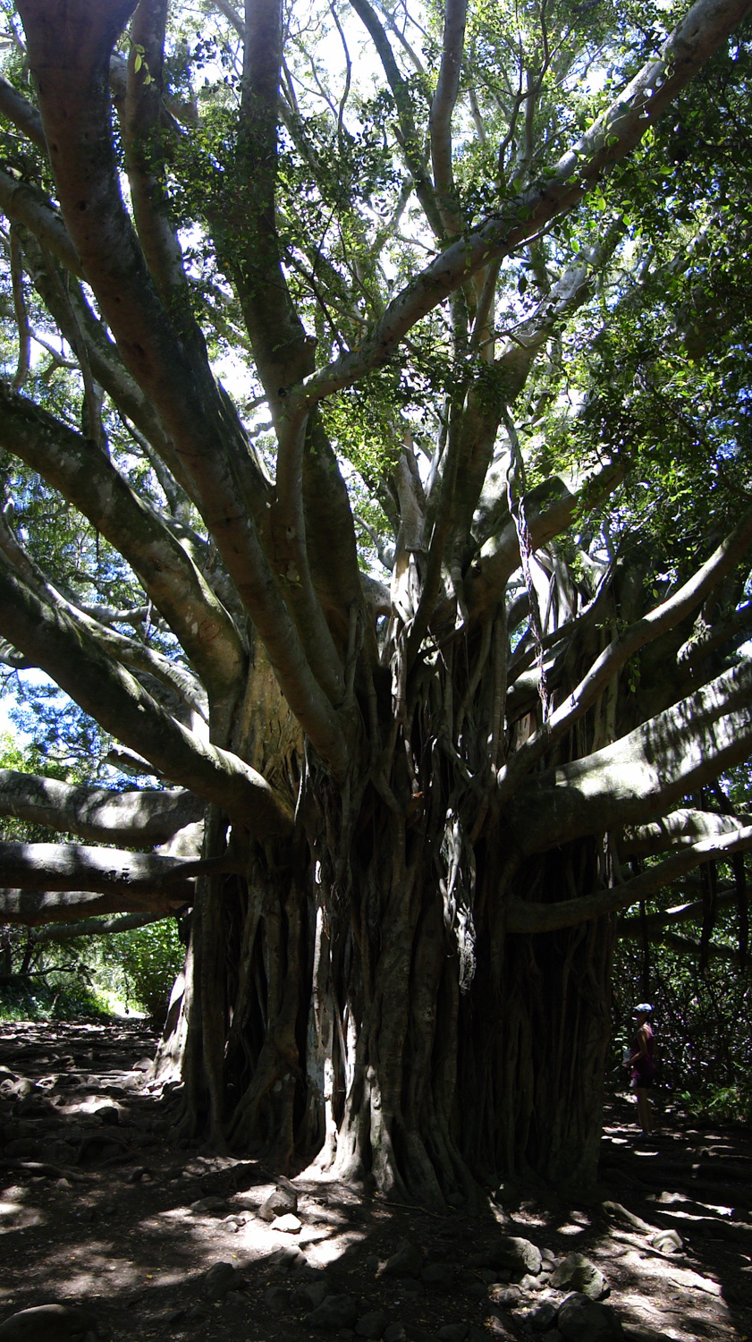
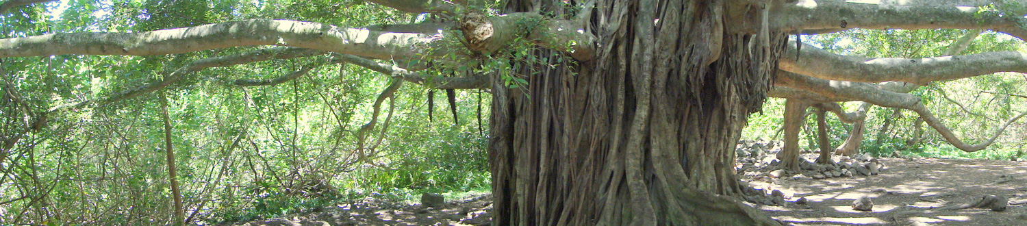
Banyan Tree
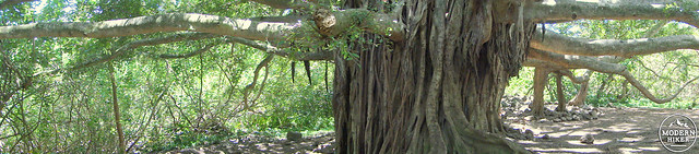
Around .6 mile, Look for a large, spreading banyan tree. These trees can cover an impressive amount of ground due to their ability to drop roots down from their branches. These roots serve to support branches that can reach dozens of yards away from the trunk. This banyan is a fairly impressive specimen, but for one of the largest banyans in the world, visit the banyan in Lahaina Banyan Court Park. This single tree spreads out over the space of an entire city block.
 The trail continues to climb alongside the edge of the gorge for the next .8 mile. Most of the time you keep to the trees, but at a few spots a side trail will lead you to a steep drop looking down into Oheo Gulch’s creek. This creek, fed by frequent storms hitting the east side of the island, has done impressive work carving into the volcanic rock, creating a number of grottos and depressions so deep that they look more like sinkholes in some spots.
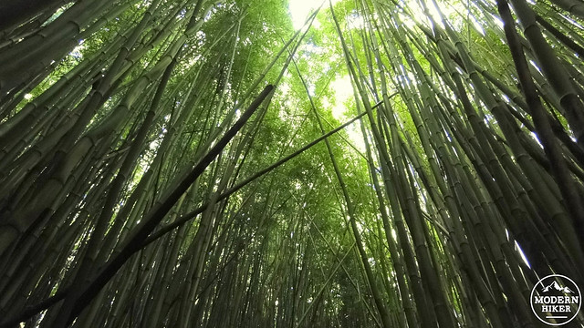
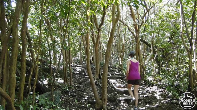
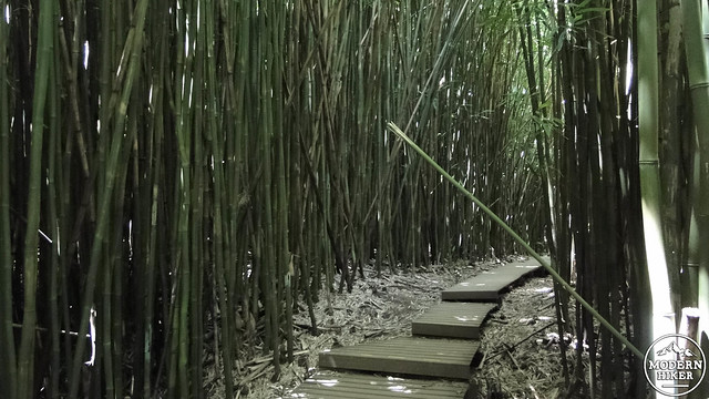 At 1.3 miles, you enter what is, after the waterfall at least, one of the highlights of the trail and one of the cooler bits of hiking you can find on the island. A forest of bamboo so tall and dense that it blots out the sun surrounds you here. As you pass the through this forest for a fascinating mile, be sure to stop at moments when the breeze picks up so you can enjoy the slightly spooky, slightly soothing sound of the bamboo stalks rattling against each other like a primitive wind chime. If there was no waterfall, the bamboo forest would be a worthy destination on its own.
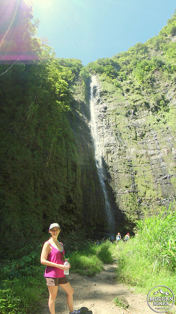
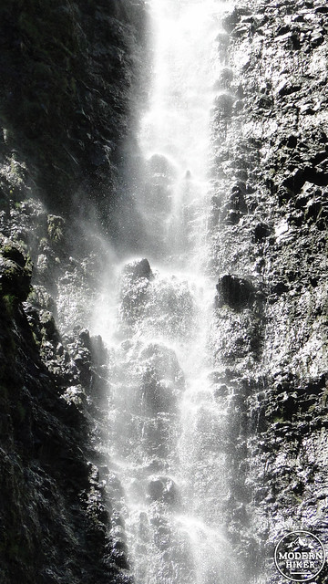
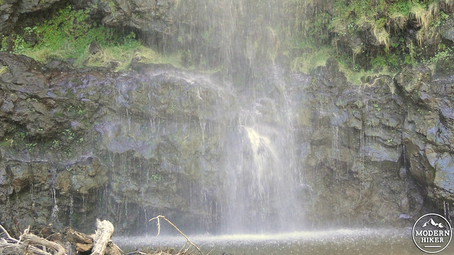
Waimoku Falls being totally upstaged by my wife
Happily, there is a waterfall, and you will pass through the last stands of bamboo before entering a deep, round basin into which pours Waimoku Falls. These sorts of waterfalls are actually really common on the islands northeast side, which receives vastly higher quantities of rainfall than the rest of the island. However, they are usually really difficult to reach; most of the time, they are only visible from helicopters that cost a lot more money than a hike. This then is one of the better spots on Maui to enjoy just the sort of tropical paradise you expect when you book your vacation.
Tags: Haleakala National Park, Maui, Oheo Gulch, Pipiwai Trail, Road to Hana, Seven Sacred Pools, Waimoku Falls, waterfalls