If you want to glimpse fall color, but you are also looking for an epic adventure up glacially carved canyons, past cascading waterfalls, through dense thickets of aspen and pine, and into an alpine lake basin full of shimmering, aquamarine lakes fed directly by one of the largest glaciers in the Sierra Nevada Mountains, then the North Fork of Big Pine Creek will be your dream come true. This moderately challenging 9.2 mile trip will deliver all of those things in one of the most satisfying day hikes you are likely to find in the Eastern Sierra.
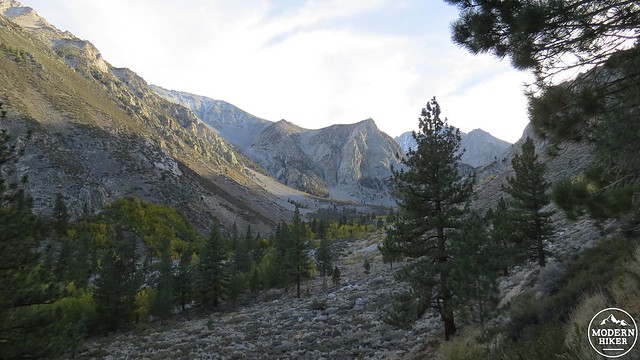
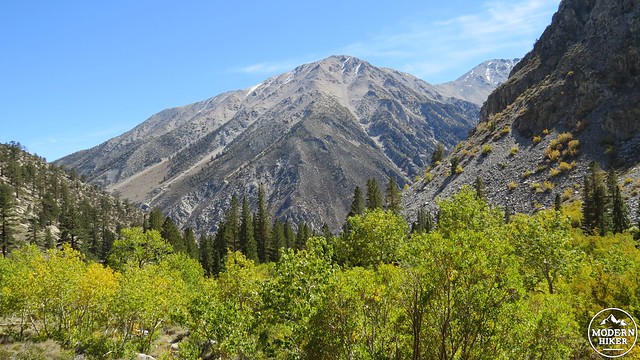
Both forks of Big Pine Creek Canyon tumble down from glacial sources on the northeast side of the Palisades, a group of 14,000’+ peaks on the Sierra Crest. The north faces of these peaks remain sufficiently cold and shaded to hold onto the remnants of what was once a much more expansive system of glaciers. These glaciers, like many other glaciers around the world, are currently retreating as the climate warms. Palisade Glacier can be reached using a continuation of this route, which would add another 5 miles and 2,000’+ of climbing, approximately. If you wish to visit Palisade Glacier, I recommend overnight camping at one of the many lakes in the basin below, as 19 miles and 5,000’ is a very ambitious day hike.
The North Fork of Big Pine Creek Canyon is a very popular spot for backpacking. The aforementioned scenery plus the variety of spectacular lakes are a magnet for backcountry campers and fishermen alike. As this hike occurs largely within the John Muir Wilderness, the usual permit requirements and leave-no-trace principles apply. If you wish to backpack here, you will want to reserve your permit through Inyo National Forest and obtain your reservations as early as possible. Permits can be reserved up to six months in advance.
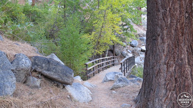
The trail begins at a trailhead adjacent to Glacier Lodge at the end of Glacier Lodge Road. There is another trailhead slightly down the road before the lodge, but this alternative trailhead accesses the canyon via a long hike over exposed terrain, making it much less pleasant. Pass through the gate to enter the access road and follow along the bank of Big Pine Creek. This access road reaches the handful of cabins you’ll see above on the right, but you will reach the proper trail long before reaching the cabins.
First Falls
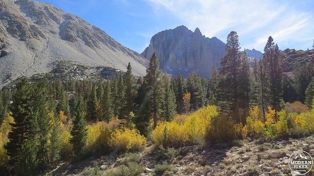
South Fork of Big Pine Creek Canyon
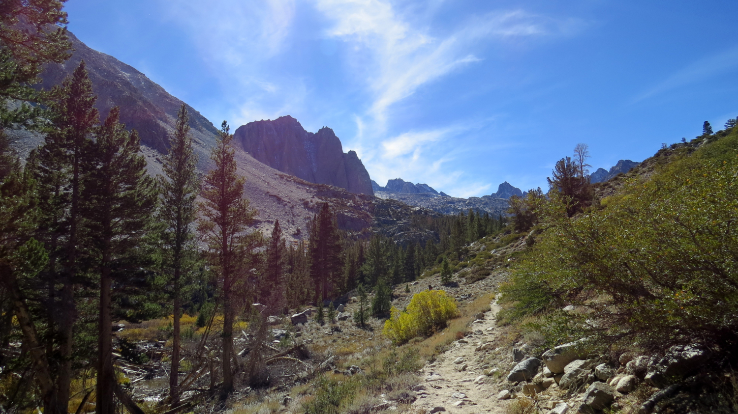
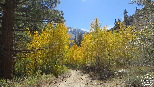
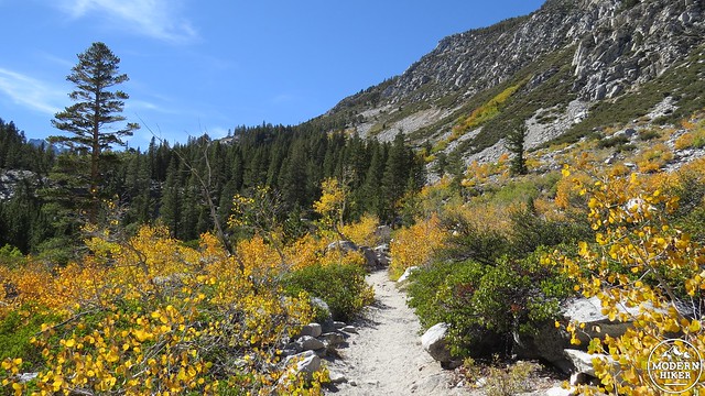
Turn left onto the main trail, cross a bridge over the cascading north fork of the creek, and commence climbing up switchbacks shaded by mountains birches and Jeffrey pines. The birches are one of the four trees on this trail that will provide a fall color show, which includes willows, cottonwoods, and aspens. Spectacular views up the South Fork Big Pine Canyon toward the Palisades will emerge on the left as you climb.
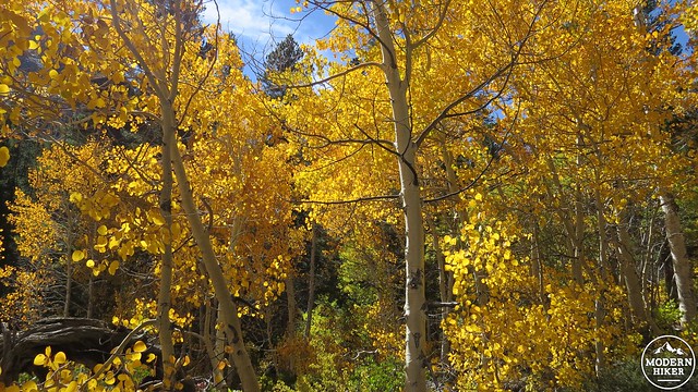
Aspen
Mountain birch
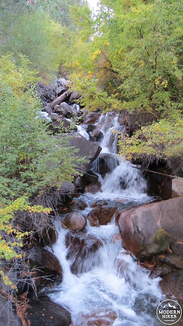
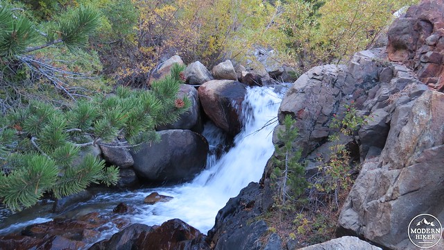
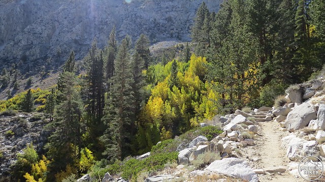
When the trail comes to an old road bed, turn right while admiring a small grove of aspen trees on the left. Next you will climb gradually along the right bank of the creek, occasionally passing beneath cool cottonwoods and birches. Two striking views will begin to emerge. Behind you, the ramparts of the canyon’s south wall tower above you, while a fiery patch of birches and cottonwoods mark the spot where the second set of cascading falls tumble out of a hanging valley. The trail will switchback up the dry slope to your right to eventually reach these falls.
Second Falls
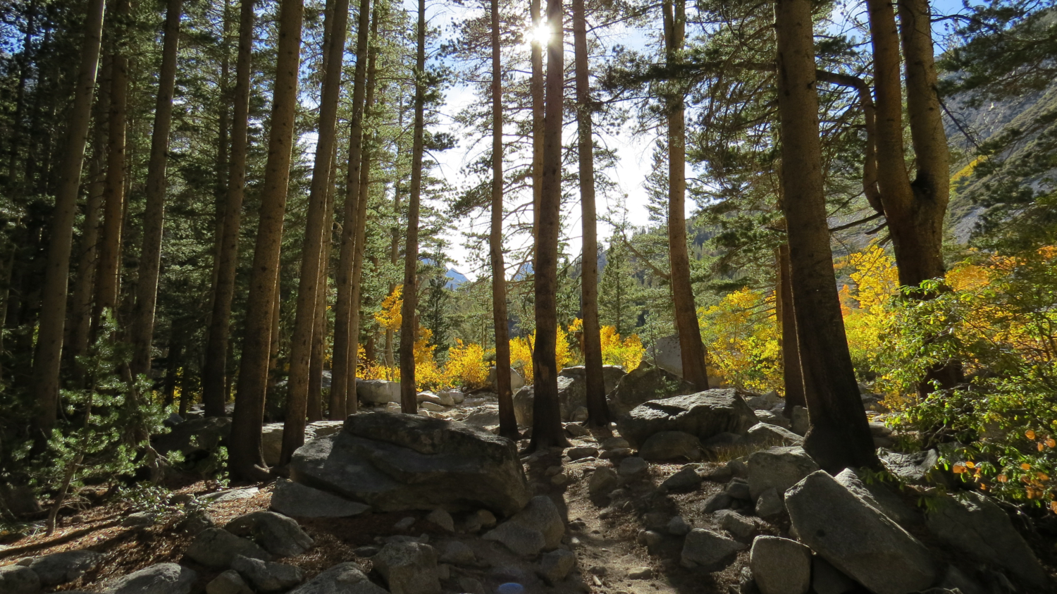
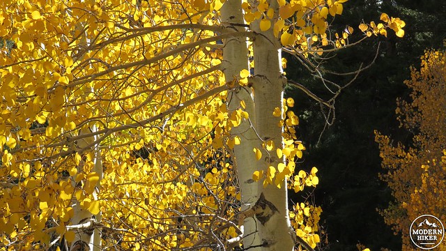
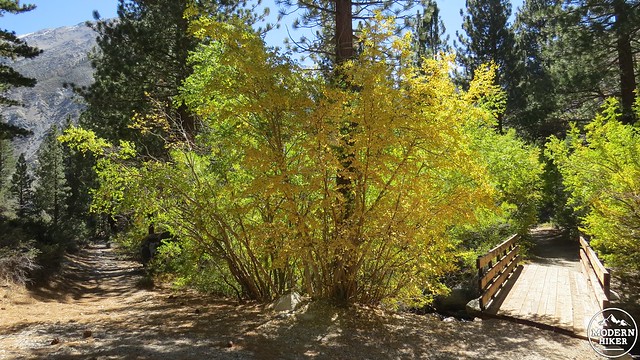
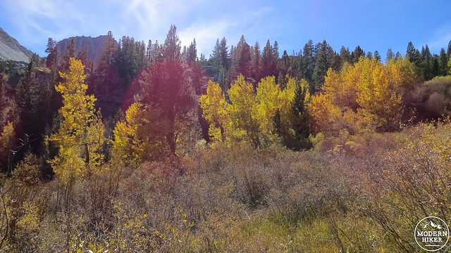
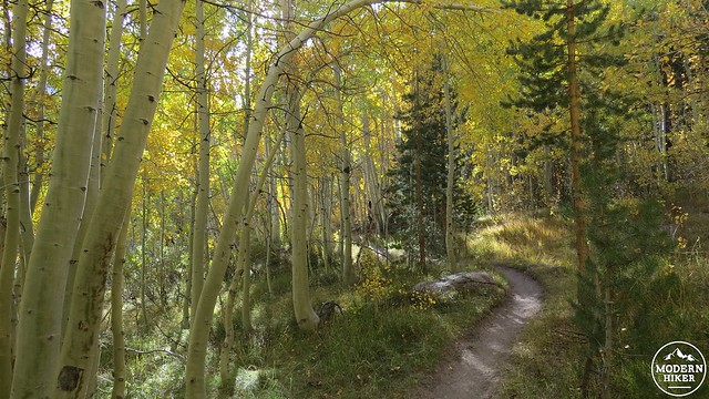
Once at the falls, enjoy a well-earned break in the shade after a long, exposed climb while perhaps splashing some water over your face to cool off. The next section of the hike between the falls and the lake will feature the best of the canyon’s fall colors. You will soon enter a grove of aspens intermixed with lodgepole and Jeffrey pine. This dense grove will turn gorgeous shades of lime green, yellow, orange, and red during the first week of October or last week of September. As the aspens over the next 1.5 miles sit above 8,000’, they are likely to turn earlier than in some of the lower spots, but if you time it right, you will see some spectacular color.
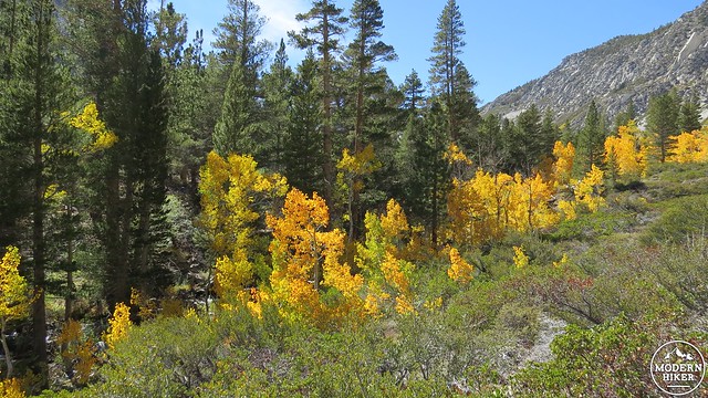
The fall color in this canyon tends to be overshadowed by the more accessible and famous locations at the nearby June Lakes Loop, Bishop Creek Canyon, McGee Creek Canyon, and the nearby Mammoth Lakes Basin. However, there is nothing lacking in the handful of aspen groves, which when combined with the other attractions of the area, make for a stunning leaf peeping experience.
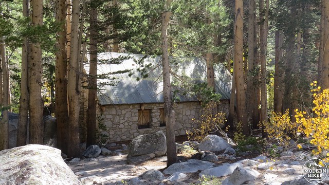
Lon Chaney’s cabin
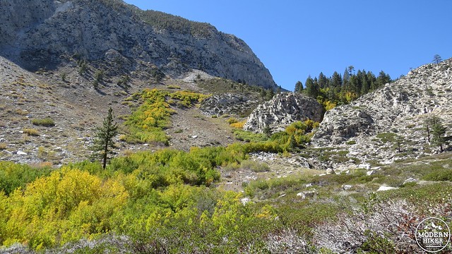
After passing through the flat section through the aspens, the trail will commence its climb through a patchwork of dense forest, spring-fed patches of willows and aspens, and open areas from which to view streaks of orange and yellow deciduous leaves streaking up the canyon walls. You will come to an old cabin built by the Man of a Thousand Faces – actor Lon Chaney. A Forest Service sign identifies it as an old ranger cabin, but Chaney built this structure as a getaway from the bustle of Hollywood. Chaney and his wife would stay up here for weeks cooking fish caught in the creek and attempting to climb high enough to reach the nearby glaciers. Lon Chaney was a smart guy.
Editor’s Note: the architect of Chaney’s cabin was none-other than Paul Revere Williams, a prolific and renowned African-American architect who more than left his mark on Southern California. He designed more than 2,000 homes and many more public buildings, including homes for Frank Sinatra, Lucille Ball, and Barbara Stanwyck, as well as the Los Angeles County Courthouse, the Hollywood YMCA, the Arrowhead Springs Hotel in San Bernardino, and a redesign and remodel of the Beverly Hills Hotel. He also designed the Tropical Terrace House in Solstice Canyon.
First Lake
After the cabin, the trail will resume switchbacking through the upper limits of the aspen and willow groves along the moraine that contains First Lake. This lake is the first of seven lakes, which are named according to their order in the sequence moving clockwise along the trail. When the trail gains the top of the moraine, you will find that you actually came out above the lake, which will sparkle a few hundred feet below. You will then reach a junction with two trails that loop together to visit the majority of the lakes in this basin. Turn left to get to Second Lake.
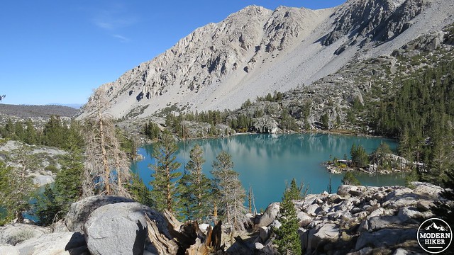
Second Lake with Temple Crag in the background
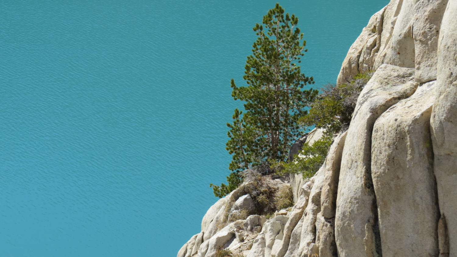
The main trail will pass to the right of Second Lake, but this track will follow an unsigned use trail that descends through lodgepole pines toward the outlet of the lake. Cross over the steel bridge and climb up onto the old stone dam that holds in the eastern end of Second Lake. Once you gain the top of the dam, a spectacular scene reveals itself. towering Temple Crag looms high above a large, glacial basin, inviting rock climbing enthusiasts to try their luck. To the right, the Sierra Crest’s jagged peaks scrape at the sky, while the milky aquamarine waters of Second Lake shimmer below.
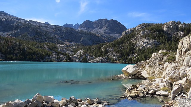
Most lakes in the Sierra Nevada mountains are a deep, transparent blue. Second Lake’s clouded appearance is due to the large amount of glacial silt suspended in the water. As Palisade Glacier continues to melt it sheds its water, which bears a large concentration of glacial particles, into the lake, creating the cloudy turquoise color. It is a stunning shade that contrasts nicely against the fiery hues of the aspens down canyon.

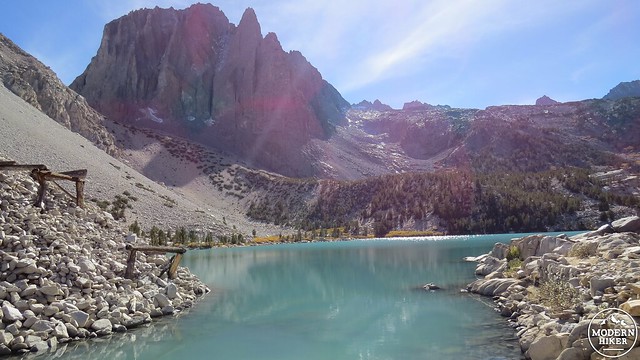
The presence of the dam here, along with the abandoned, rusted out equipment atop a large boulder pile, invites curiosity as to its origins. Unfortunately, I could not find any information that explains the function, purpose, and year of construction for the dam, although it appears to have been here for some time. Regardless of that information, the dam makes a fine place to sit and admire the scene, which is as dramatic as any glacial basin in the Sierra Nevada Mountains.
If you are coming here for an overnight camping trip, you will probably have to engage in further exploration to find a suitable campsite. The dam is not suitable, even though it is flat – remember that you must camp 100 feet away from water sources. I do not have any specific recommendations for good sites in the area, as I turned back at this point for the return journey. A little exploration on your own of the area around the trail leading to the dam should yield good results.
From this point, you will return to the main trail by way of the use trail you hiked in on. You have the option of turning left for further exploration, which can either include the loop reaching the other lakes in the basin or the continuation of the out-and-back trail up to Palisade Glacier. The loop is about another 5 miles plus at least another 1,000’ (probably more) of climbing, which is doable as an ambitious day hike. The glacier is even further and is probably best attempted during an overnight trip.
If you are only attempting to visit Second Lake, this is your turnaround point. Backtrack your way down the canyon, and make sure to stop and enjoy the effect of the later afternoon light backlighting the aspens on your way down. This change in the light will cause the leaves to glow more brightly, causing the already spectacular color to intensify. Eventually, you will return to your car after stopping frequently to admire the changing views in the opposite direction.
Tags: aspens, Big Pine Creek, Big Pine Lakes, fall color, First Lake, foliage, Glacier Lodge, Lon Chaney Cabin, Palisade Glacier, Palisades, Second Lake