Moderate

The Maze

Distance 6.5 mi
Time 4 hrs
Elevation Gain 400 ft
Season Spring, Fall, Winter
Hike Info Hiker Info
Weather

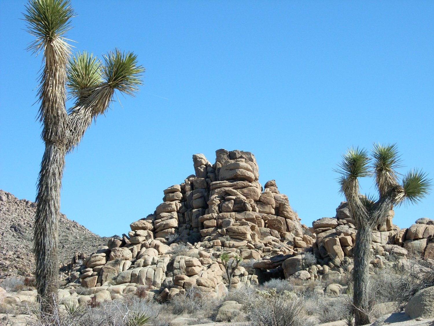
This loop encompasses parts of the North View, Maze, and Window Rock trails. It’s a fantastic route that winds through large boulder formations, desert washes, slot canyons, and Joshua tree forests, this path encompasses just about everything people love about Joshua Tree in one lightly-traveled trail. Highly recommended.

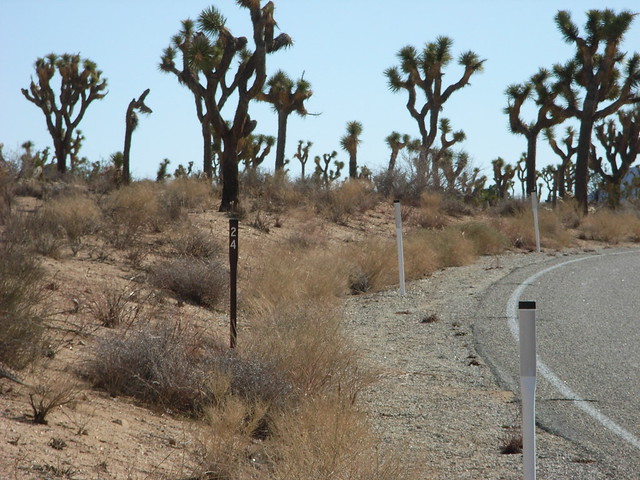
There aren’t any signs pointing you toward the trailhead, which is why this trail isn’t very crowded. If you’re headed into the park from the West Entrance, you’ll see a small off-road dirt area near a barely-noticeable metal rod marked 24. It’s a little over 1.7 miles from the gate. There’s a chance you may see a few cars parked off the road here, too.

Much in the same way that it’s a bit challenging to find the trailhead, it can be just as challenging to find the trail itself. There are no visible markers and — let’s face it, you’re out in the desert. There is a worn trail going in a north – northwest direction from the parking area. If you take this path you’ll eventually get to a “Maze Loop” sign pointing you back in the direction you came from.

Instead, travel east past a small gravel pit on your right. Right after the pit, you’ll find yourself in a wash. Stay in the wash until you see a small grouping of rocks urging you to the north. You can continue in the wash if you like, but you’ll miss all of the great rock formations and vistas on the North View Trail.

The North View Trail turns abruptly north at about 0.2 mile, and leaves the flat, sandy wash to start winding its way through some of the most secluded rock formations in Joshua Tree. Immediately, you’ll be surrounded on all sides by enormous piles of rocks, and you’ll feel a world away from your car.

The trail scrambles across some sheer rock surface, rising and falling with the boulders it skips across. While you’re surrounded by stone from almost every angle, there are still a few places where you’ll be able to get a peek out at the vast Mojave to the north of the park.

As I zig-zagged through several large boulder formations, I couldn’t help but stop every once in awhile just to admire the bizarre scenery. Even though they’re all over Joshua Tree, I never get tired of this odd, otherworldly environment. This trail, in particular, highlights some of the weirder side of the landscape, including some lines of rock-wall that are so perfectly straight, you’d swear they’re man made.


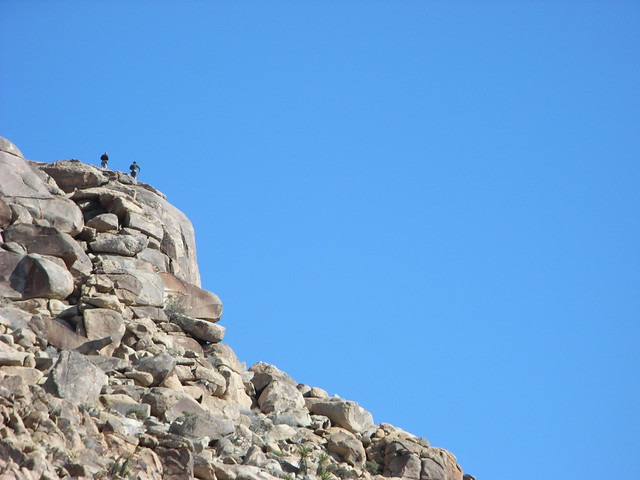
And if you keep you eyes and ears open, you might catch a glimpse of some climbers scrambling up boulders.

After winding your way up and down among more rock formations, the trail levels out a bit and makes a gradual ascent to two spur trails — one offering views north of the park (Copper Mountain View) and another looking in on the rest of the park (West Hills View) at about the 1.7 mile mark.

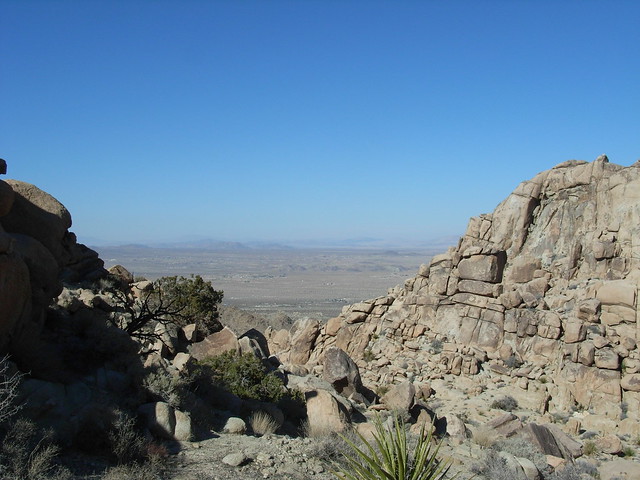
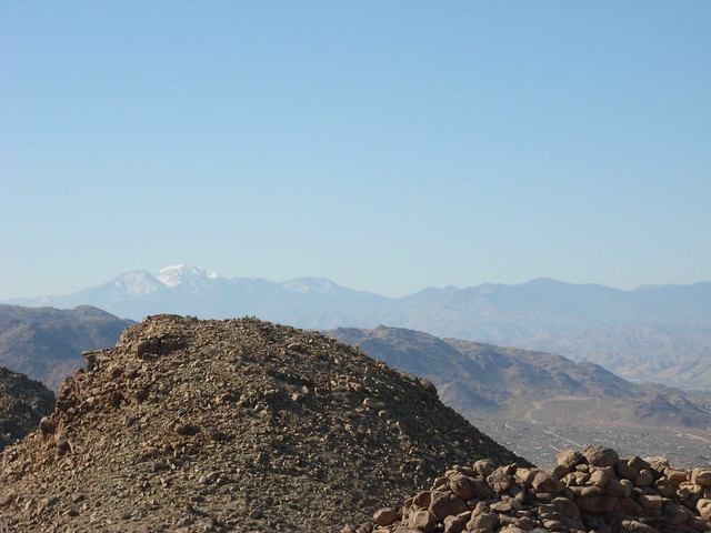
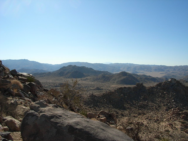
The West Hills View is particularly impressive. On a clear day, you can see all the way to San Gorgonio Mountain to the west, and deep into the interior of the park. You’ll also probably be able to make out the cars at the trailhead – if not at least the road leading to the trailhead. 

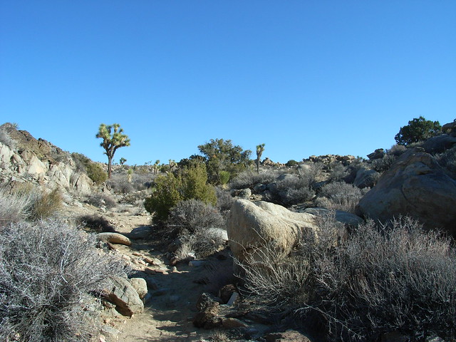
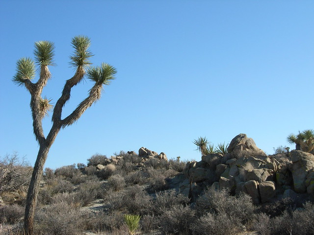
From there, the trail leaves the barren rock formations, skirts along a wide ridge, and drops down into a gulch and several washes, where you’ll finally start to see those ever-present Joshua trees again.

Congratulations. Now you’ve reached the second confusing part of this loop trail.

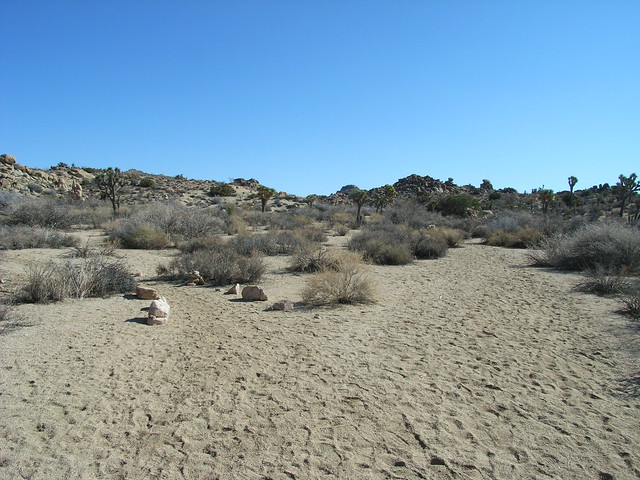
Almost as soon as you drop down into the sandy wash at 2.7 miles, you’ll see a branch of the wash leading to your right. Skip this and continue east in the wider wash. You’ll circle around a small plateau, eventually turning south. Keep your eyes peeled for a small sign marking the intersection with the Big Pine Trail, and continue in another wide wash as it moves southwest.

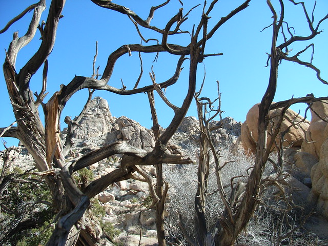
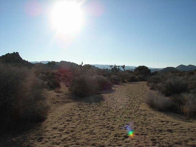
Here, you’ll get up close and personal with some smaller Joshua trees, but keep scanning for landmarks — it’s easy to get lost here. Following footprints in washes only helps if the hiker before you didn’t get lost — and you can’t always count on that.

Continue hiking in a generally southwestern direction until you get to another fork in the wash at 3 miles. If you take a right and travel west, you’ll head down a long, flat wash back to the trailhead. But you don’t want that. You want to see some more of Joshua Tree, so bear straight instead and continue south.

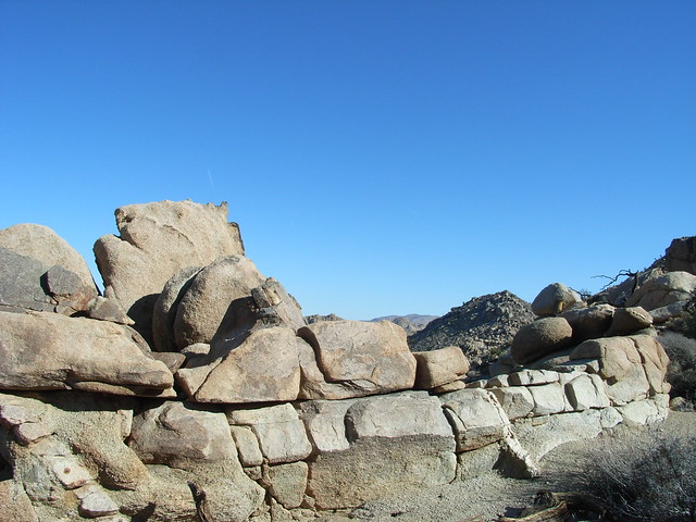
This path will continue in wash and dirt until it gets to a section that cuts through some of the unpolished boulders. This other potentially confusing area is The Maze.

As the name would imply, it could be easy to get lost in this area. The trail is marked with cairns along the way, but the high walls, twisting canyons, and natural rock formations can make the area confusing. You’ll be tempted to do a little scrambling and explore the area — just make sure you keep your bearings.

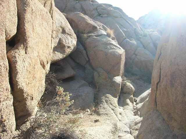
For being called “The Maze Loop,” this trail actually doesn’t spend that much time in the Maze itself. It’s a bit of a misnomer, I’d say, but still, the terrain is definitely worth the trip.

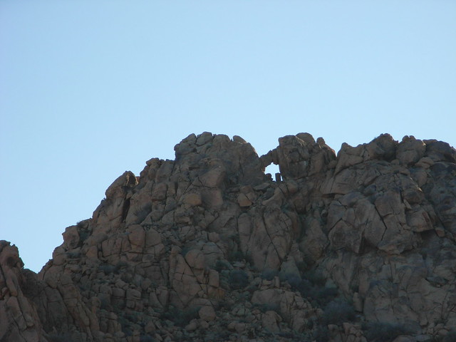
Once you leave The Maze area and continue south along the flat desert floor, and keep an eye looking south — and up toward the prominent peak directly in front of you. Toward the top of this formation is Window Rock, which when viewed from certain locations has the appearance of an eagle with its head turned sideways.

Yes, you’ll have to use a bit of imagination, but you can see it. As you get closer to the formation, though, you’ll see that the actual space in the rocks doesn’t look like anything special — it’s only from the first moments that you can see the bird shape.

When you run into another broad wash at 4.2 miles, you can either cross it, continuing south and looping behind the Window Rock formation, or turn right and follow the wash westward as this GPS route does.

When following the wash, be sure to keep alert for a small path leaving the north side of the wash at around 4.7 miles. This trail will turn northwest and take you back toward the trailhead, while the wash will take you in a more southwestern direction. You’ll still end up at the road — you’ll just have a slightly farther walk back to your car.

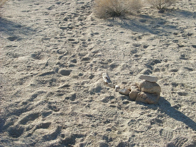
The cairn marking this junction is small and easy to lose in the surrounding landscape.

From here, it’s mostly level, easy walking through a sparse forest of Joshua trees back to the trailhead. Take time to enjoy the scenery and the remote feeling of walking through a desert — even if you know there’s a road just a few miles ahead.

Tags: , , , , , , ,

Accommodations near The Maze

Trail Conditions

Finding the initial trail can be difficult, but the North View Trail is very well marked and easy to follow. One the trail starts getting into washes, it can be a bit disorienting, and easy to get lost. There are not many trail signs past the North View section, and cairns and footprints can be tough to spot or misleading.

Download GPX

Download KMZ/KML

Camping Info

Hidden Valley is your closest campground but it's small and often fills up. A better bet may be Indian Rocks Campground. Although it's further away and requires a drive to this trailhead, it takes reservations - and you can hike into the northern section of the Maze right from the campground!

Website

How to Get There

From the West Entrance, travel about 1.7 miles east until Marker 24 on the east side of the road. There is a small, unmarked parking lot at the trailhead.

Driving Directions

Use the ModernHiker mobile app to download this map and complete trail description for offline access.

Download Details & Map