If you’re in the mood for some terrain and rock formations that will make you think you’re on another planet, this loop in the Needles District of Canyonlands National Park via the Chesler Park and Joint Trails needs to go on the top of your to-hike list ASAP.
This 10.4 mile loop takes you into some of the most seemingly unnavigable terrain in Canyonlands, through a series of impossibly shaped canyons surrounded by otherworldly, melting-ice-cream rock formations through a broad, grassy meadow that seems to come out of nowhere … then drops you underground into the Joint Trail, where you’ll have to squeeze through shoulder-width cracks in giant boulders.
This is one of my all-time favorite trails, and I’m pretty certain the entire time I was hiking it I had a giant grin on my face. I’m willing to bet you’ll have a similar experience.
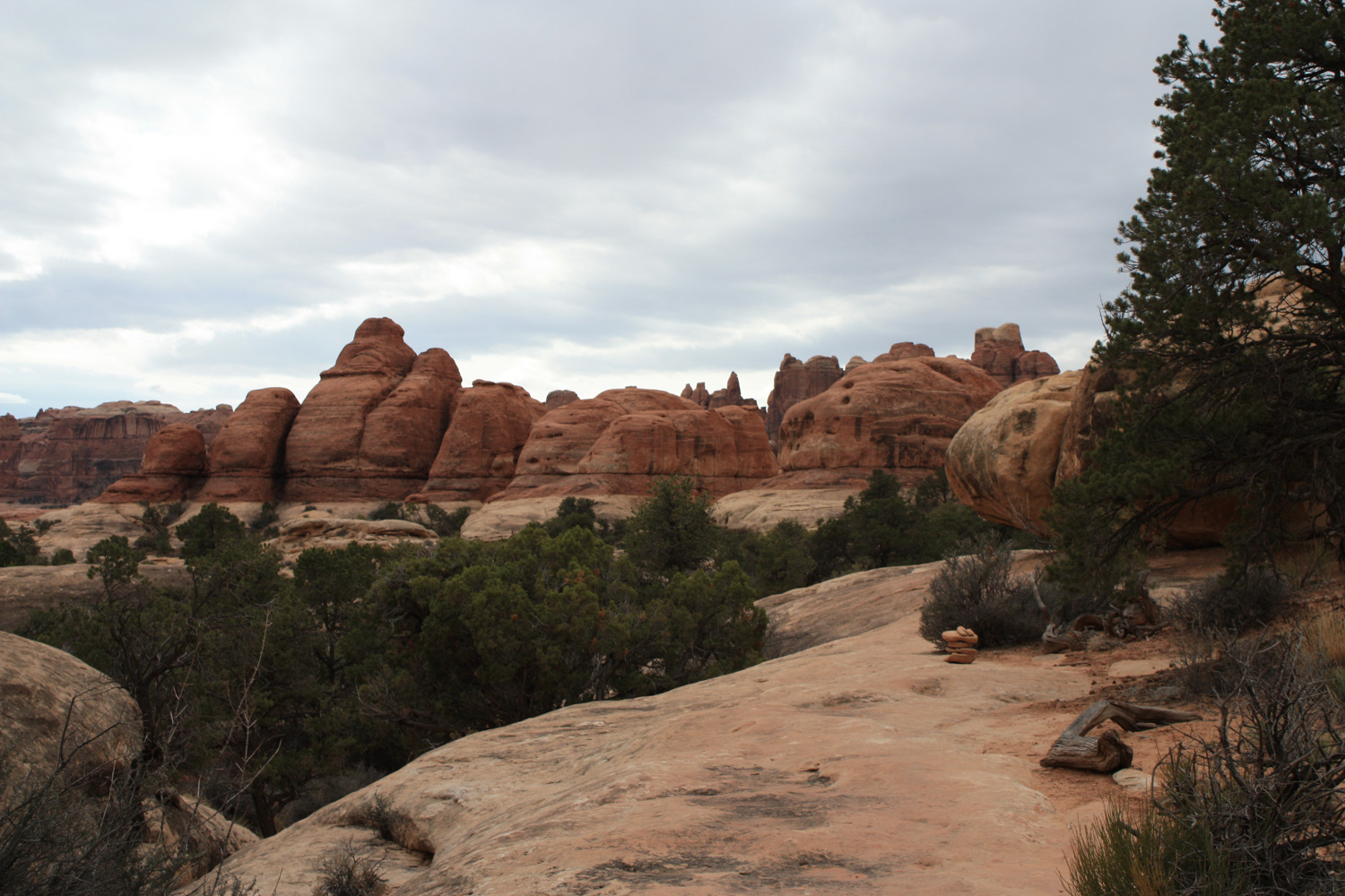
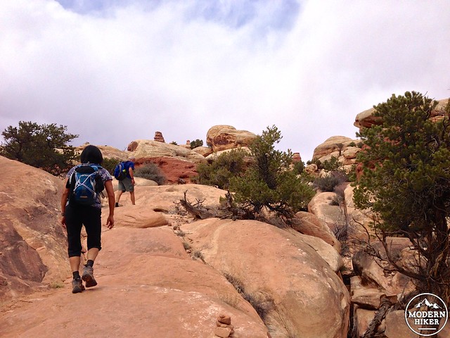
The trail starts at Soda Spring at the Elephant Hill Trailhead, reached after driving over a navigable but still semi-harrowing dirt road for 3 miles. The trailhead is clearly marked, and you’ll probably hear 4WD ATVs revving their engines as they continue on the challenging drive to Devil’s Kitchen Campground. Don’t worry about noise, though – the trail and the 4WD road head off in different directions. You’ll start off on a rough dirt and slickrock trail that initially looks mostly similar to other trails in the region.
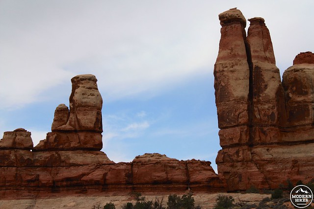
But as the trail climbs and snakes through some of these rock formations, it will eventually deposit you on top of them – and that’s where you get your first idea of just how weird everything looks over here.
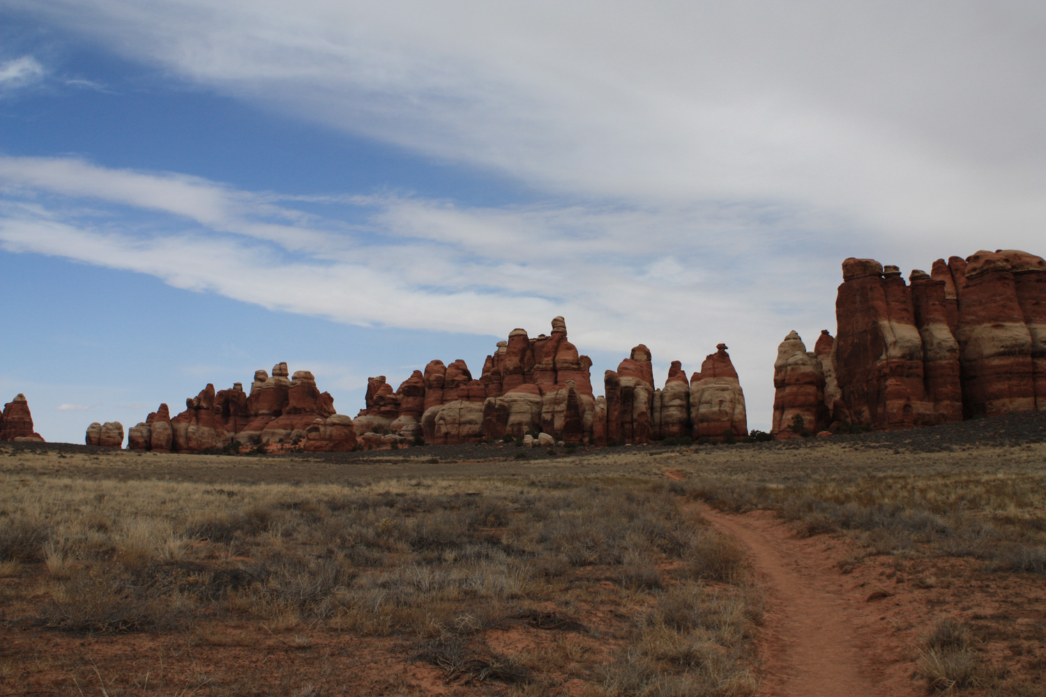
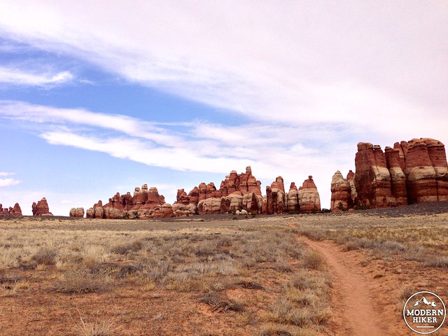
The trail continues climbing, and by the half-mile mark you’ll see rising hulk of Elephant Hill … as well as a glimpse of the seemingly impenetrable Needles formation that you’ll be hiking right through in just a few miles.
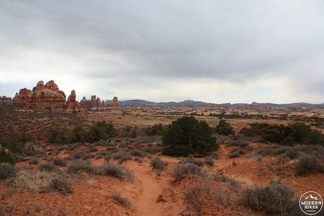
Most of the first mile and a half of the trail is spent following a faint trail in the dirt or chasing cairns from rock to rock … with the occasional narrow staircase through some boulders thrown in for good measure.
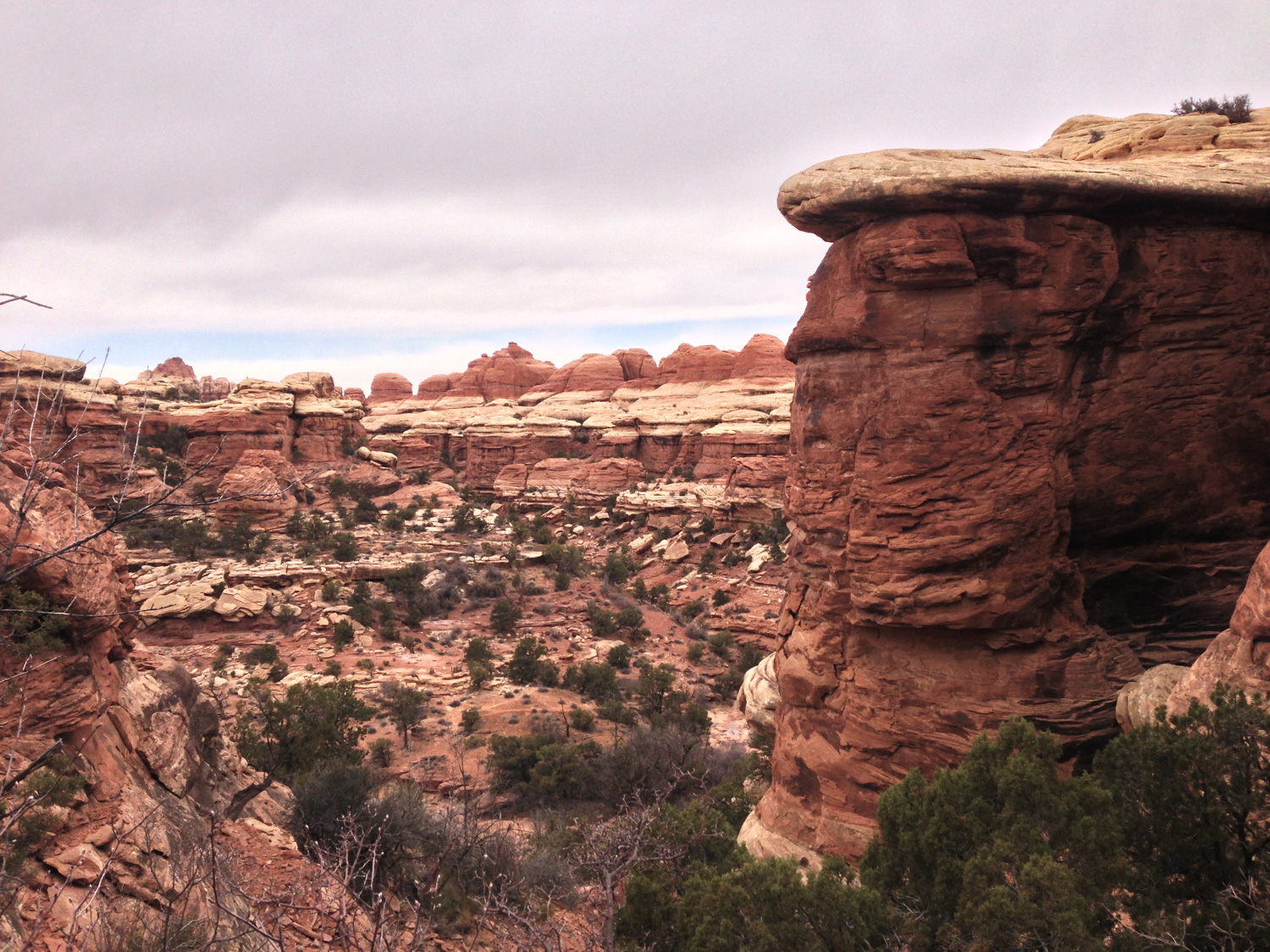
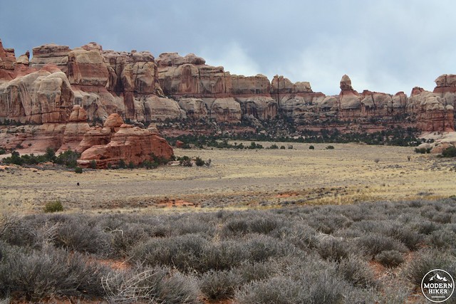
At the 1.5 mile mark, you’ll also hit your first junction with the veritable spider web of trails that criss-crosses the entire region. Stay to the right to continue hiking toward Chesler Park as the trail descends into a wash in about another half mile. Just north of this wash is the first backcountry campsite on this route (Camp EC1 – permit required), and to the south is the trail to Druid Arch, an impressive sandstone formation at the end of another narrow canyon. It’s a worthy side trip but if you head to it from here you’ll miss the entire Chesler Park section, so instead continue hiking to the west as the trail climbs back up out of the wash.
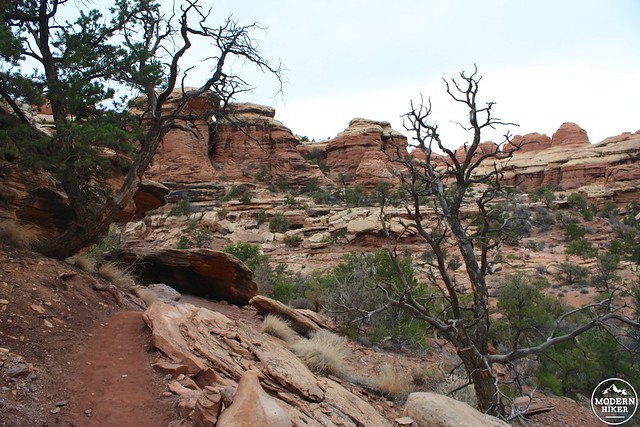
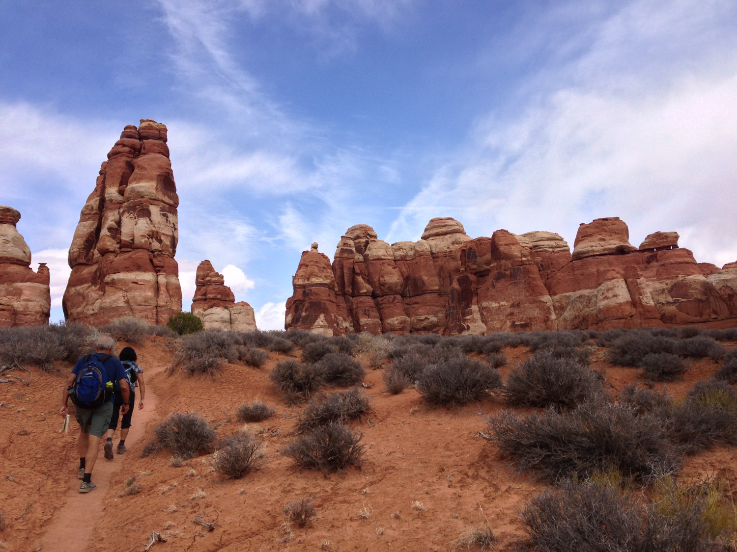
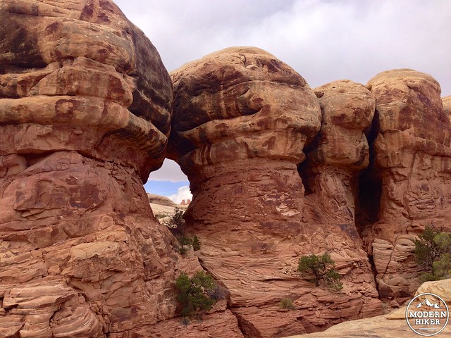
The trail makes a relatively steep ascent climbing out of the wash. There are some steep drop-offs and tight switchbacks but nothing that’s inherently dangerous as long as you watch where you’re hiking. At the 2.4 mile mark, stay to the left to climb up through two large spires and venture into the Needles.
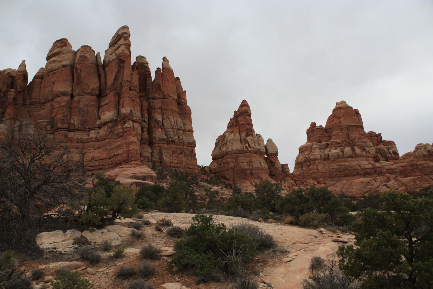
This is one of the highest points on the hike, and a great place to stop to look around at the terrain you’ve already hiked through.
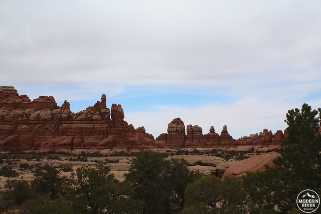
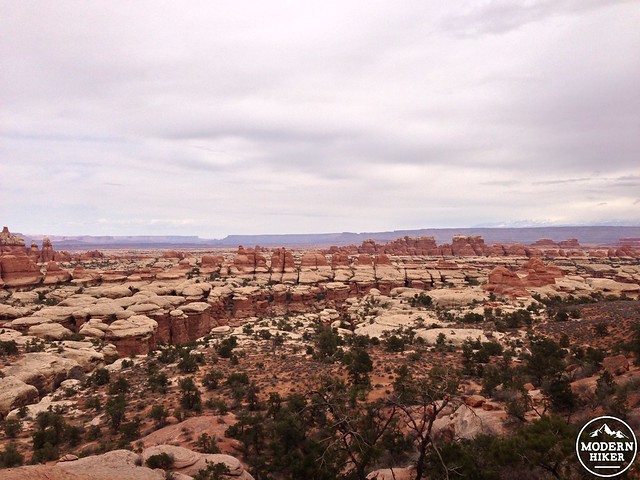
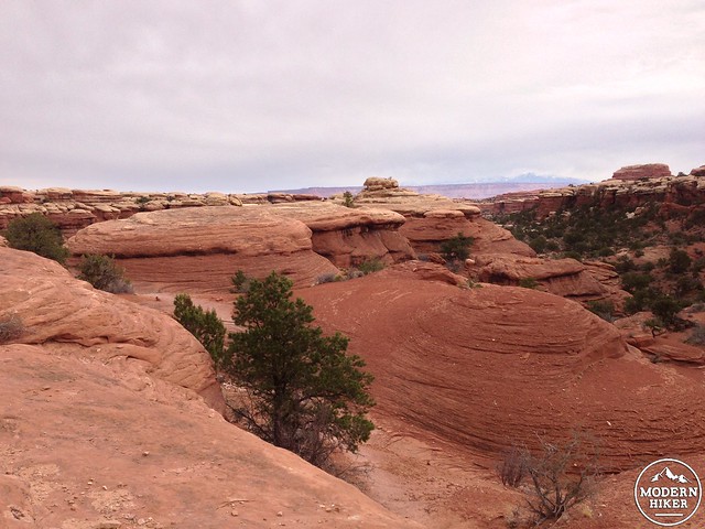
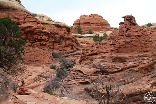
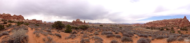
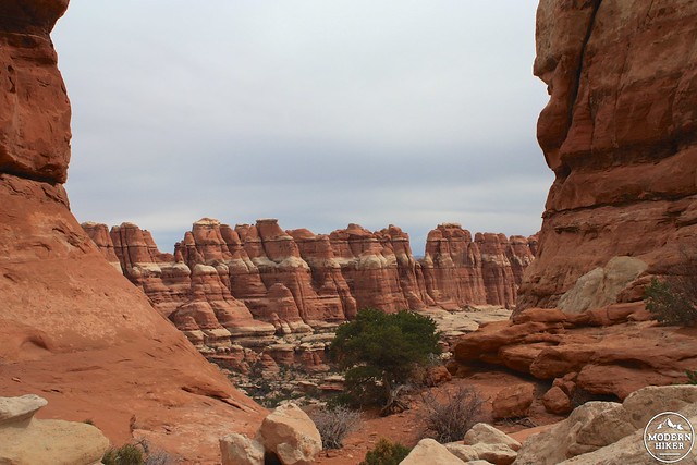
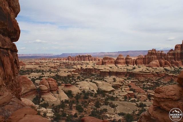
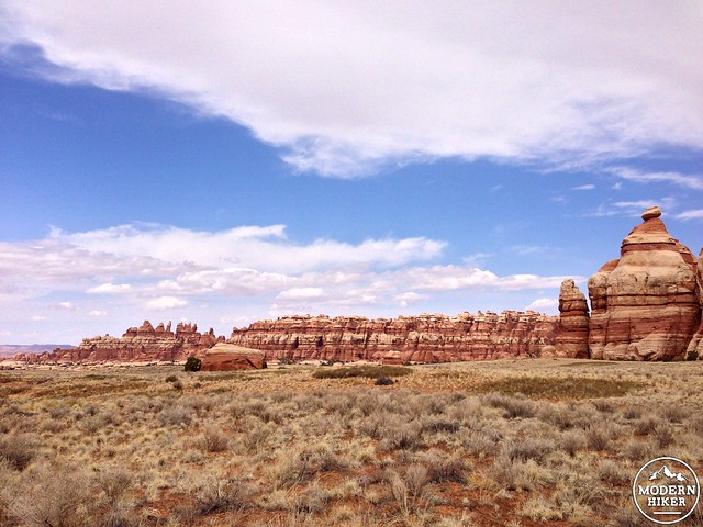
And finally – at the 2.5 mile mark – you’ll walk through the Needles formations and see Chesler Park for the first time – a large, broad valley filled with scrub, chaparral, and grasses and surrounded on almost every side with towering multicolored rock formations.
You’ll want to take a minute to soak it all in.
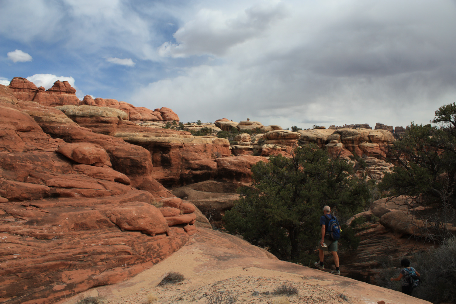
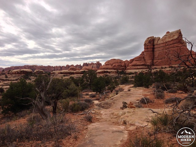
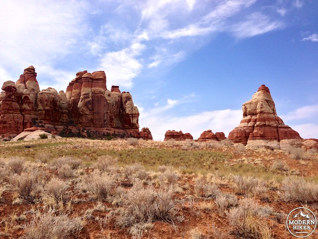
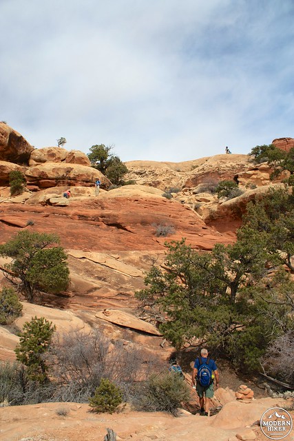
From here, the trail descends inside of Chesler Park and makes a clockwise route that begins by hugging the rocky northeastern perimeter of the valley. You’ll pass another backcountry camp site in this northeastern section (CP1), as well as getting to explore some cracks in the rock formations that allow you to gaze back at where you started your hike.
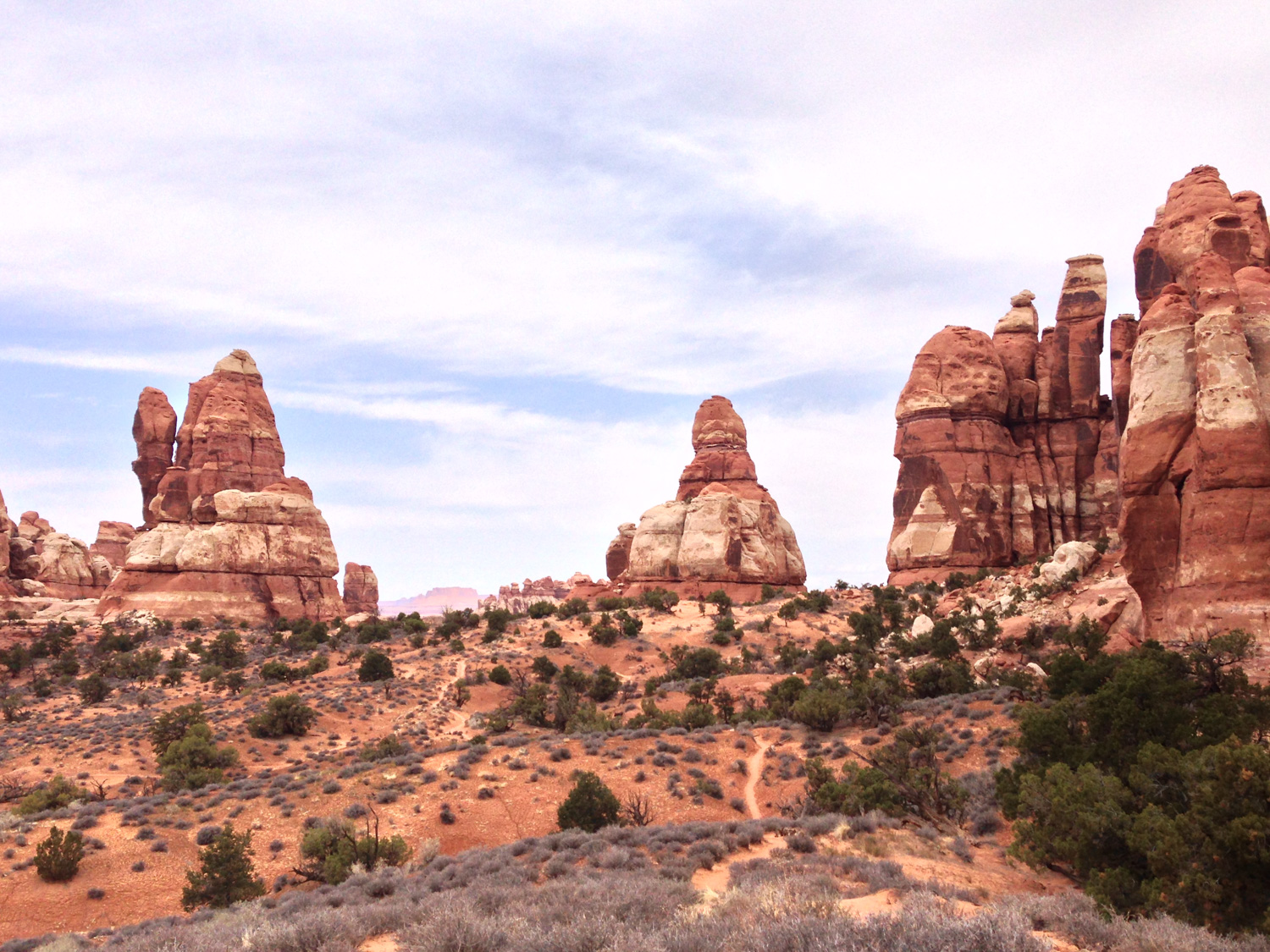
Follow the trail as it bends to the southwest, cutting directly across the grassland.
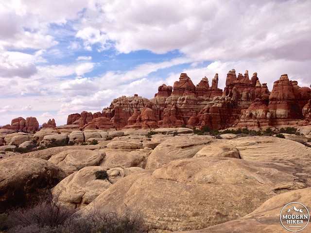
As you hike across the broad plain, be sure to look to the west where, on a clear day, you can see across the Colorado River deep into The Fins of the Maze District.
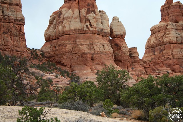
From here, in the open space of Chesler Park, you’ll have some phenomenal opportunities to soak in the full beauty of the valley. I mean, look at this!
At the 4 mile mark, stay to the right to hike on the Joint Trail. But if you were looking for a side trip to Druid Arch, this is the place to take it – but be warned, backtracking back to the Joint Trail would be a 5 mile round trip. It’s more realistic, I think, to do the Joint Trail and Druid Arch as separate trips – or from a base camp inside Chesler Park.
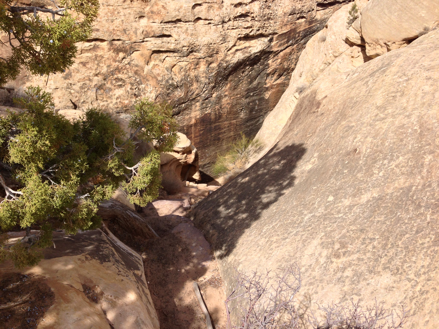
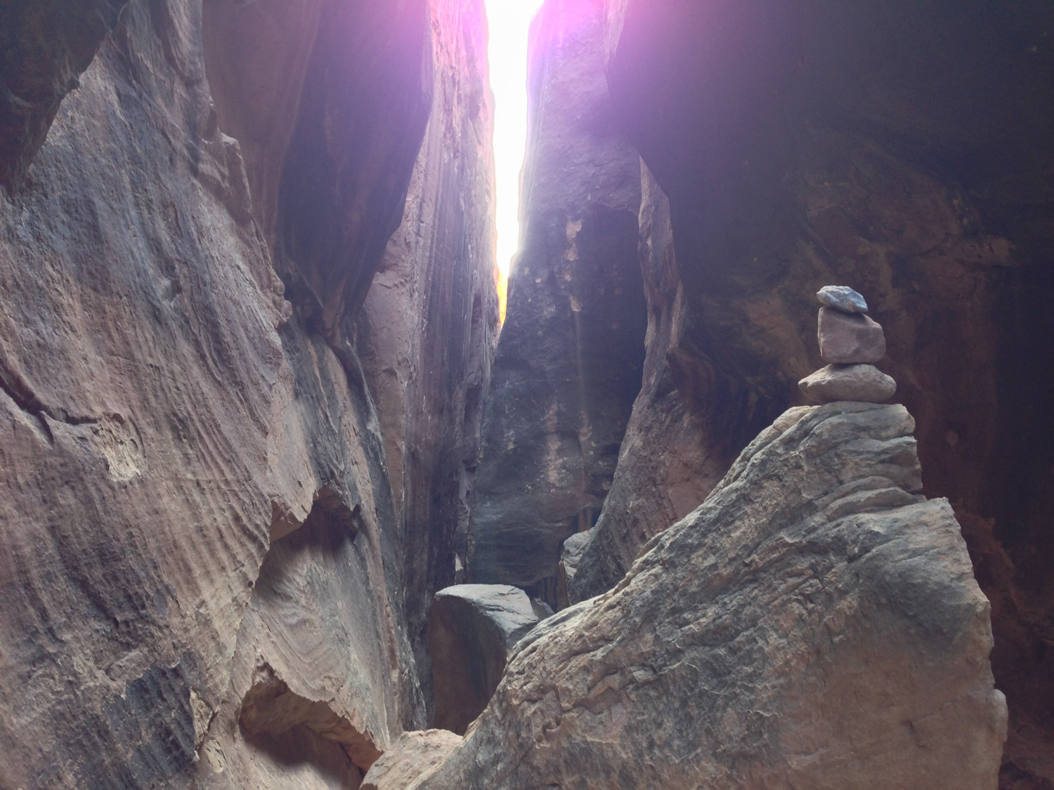
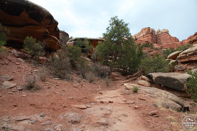
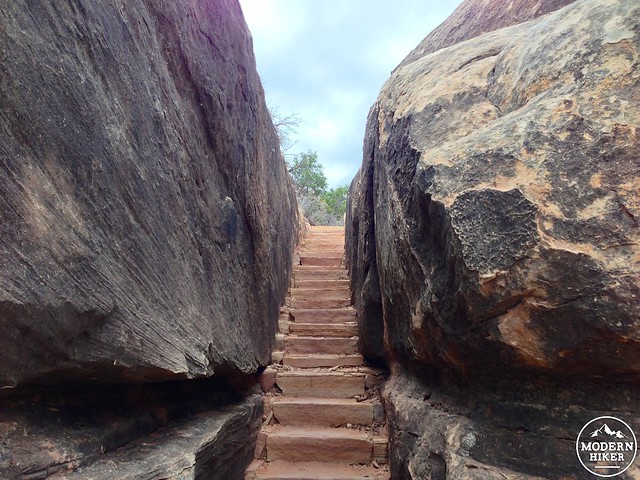
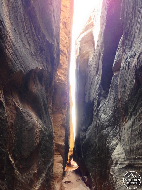
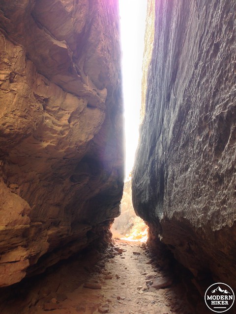
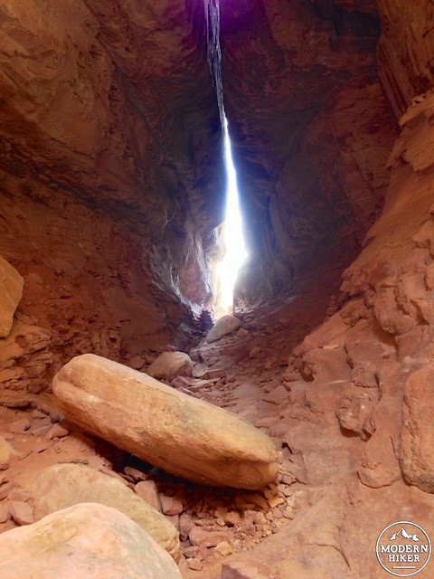
Back to the Joint – the Joint is an incredibly fun mile and a half stretch of trail that descends below Chesler Park and squeezes its way through enormous boulders – sometimes only with a shoulder’s width between them. It’s one of the best trails in the entire Park, and one of the best things about it is you can’t even see it until you’re right on top of it.
Going down?
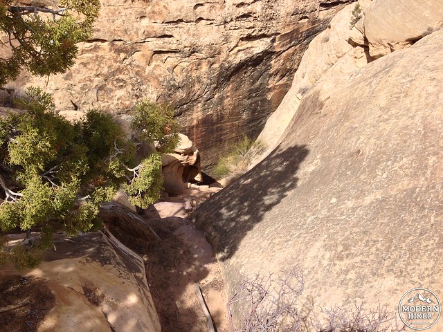
Once you get inside the Joint Trail, this hike becomes an entirely different experience. The strange multicolored rocks and wide open vistas of canyons and mesas all fade away into the distance as you descend into a few-foot wide crack between two giant boulders.
C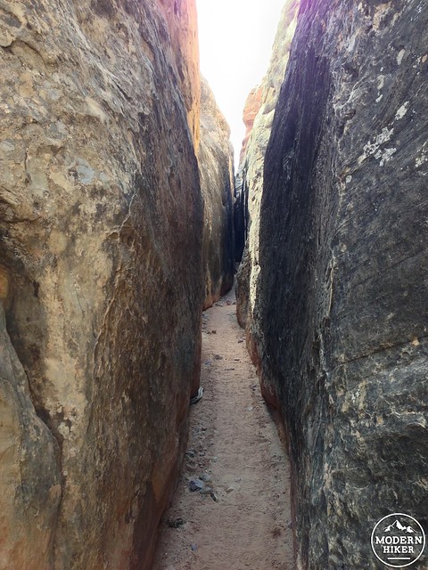
You’ll walk along the sandy bottom here – occasionally climbing down some short wooden ladders or scrambling around boulder formations. The width of the Joint Trail is variable – sometimes it feels like you’re in a giant cave, while other times you’ll have to shimmy sideways to continue on the trail. Keep an eye out for cairns marking the proper path along the way – but if you take a wrong turn here you’ll hit a dead end fairly quickly.
When the trail breaks free of the boulders around the 4.5 mile mark, you’ll find yourself once again meandering through the rock formations and low washes of the Needles formations. The single track eventually turns into a broad, very rough 4WD road and at the 5.84 mark you’ll reach a small picnic area along the 4WD road. It has a bit of shade, some picnic tables, and an outhouse, and makes for a nice break before continuing the Chesler Park Loop.
The trail leaves the 4WD road just 0.4 miles after the picnic area, at which point you’ll find yourself climbing and walking across the slickrock bottoms of the rock formations that make the northern boundary of Chesler. Just before the 6.5 mile mark, ignore the trail to Devil’s Kitchen Camp and stay to the right to continue back toward Elephant Hill.
You’ll gain a fair amount of elevation on the return as you clamor up, over, and through the Needles – but it’s not terribly difficult and, as you’ve noticed by now, the scenery is phenomenal.
At the 7.7 mile mark you’ll rejoin the northern end of the Chesler Park Loop. Return back through the saddle and stay on the Chesler Park Trail on your way back to the trailhead.
Tags: Backpacking, Canyonlands National Park, Chesler Park, Druid Arch, geology, Joint Trail, Needles District