A figure-8 loop across the border into British Columbia that passes the Continental Divide and three stunning alpine lakes beyond a popular ski resort. With waterfalls and snow in the early summer, spectacular wildflower displays later in the season, and golden larches in the fall, this is often called Canada’s best day hike … and for good reason.
Sunshine Meadows is often called Canada’s best day hike – and it starts out rather inconspicuously at the bottom of a popular ski run.
From the large and busy parking area, you can either hike up a steep dirt road (a route described as one of the most disappointing treks in the excellent series “Don’t Waste Your Time in the Canadian Rockies“), or you can spring for a ticket on an old school bus to the top of the road – where the good hiking begins.
The shuttle has a set schedule of departure and return times and tickets can be purchased departing from the bottom of the ski hill or from the town of Banff (for a higher fee). We highly recommend making advance reservations. Also note that while dogs are allowed on the trails here, they are not allowed on the shuttle bus. If you choose to hike, it’s about 4.5 kilometers from on the road to the beginning of the route described here.
One you finish climbing the long and twisting road you’ll be let off at the same place you’ll be picked up at the end of your hike. For your future planning, there is also a little pub in this building that may be a welcome sight after a day spent hiking at high altitude.
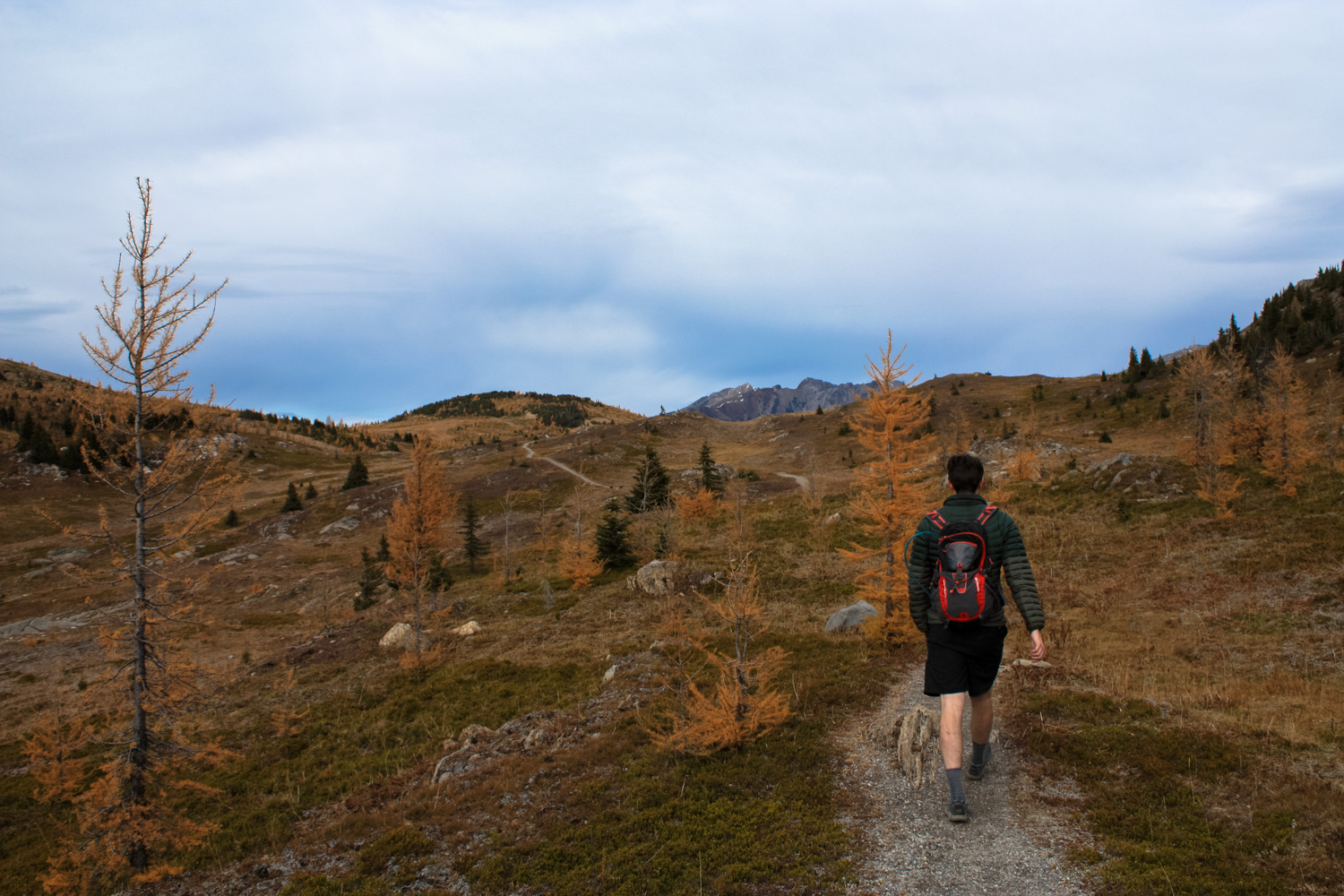
The hike begins along a wide gravel path heading south from the drop-off point. Just 0.1 mile on this path, keep left to begin on the Citadel Pass Trail. Although you’re still hiking through some ski infrastructure here, you’re also gaining a bit of elevation and a better perspective on the surrounding landscape.


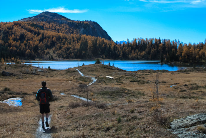
The Citadel Pass Trail continues south, passing through scattered patches of Englemann Spruce, Alpine Larch, and Alpine Fir trees. Each species has adapted strategies to deal with the harsh conditions found at this altitude, where snow lasts from Fall through Summer, gusty winds routinely tear through the mountain passes, and temperatures fall below freezing nearly year-round. The spruce and fir trees here have waxy, upturned needles that help to protect against wind and ice, while the larches have needles that turn orange and drop in the fall like their broad-leaved cousins. The larches have developed a much higher photosynthetic rate than other conifers, meaning they store up enough energy in the summer to resprout replacement needles in the spring … and put on quite a show during the fall for us hikers!

 At just before the 0.8 mile mark, you’ll have gained about 380 feet in elevation and you’ll pass a sign marking the Continental Divide. This also marks the boundary between Alberta and Canada and the place where the Assiniboine Trail departs toward Citadel Pass (another excellent way to enjoy the scenery up here). Keep to the right to continue toward Rock Isle Lake in this wide open alpine meadow and the lake itself will soon come into view.


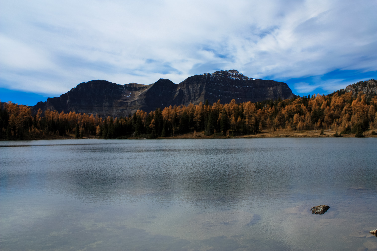
At 1.1 miles, a short spur trail leaves the Rock Isle Trail to a boardwalk overlook of this stunning alpine lake.
Although it may be tempting to jump off the trail and trek down to the lake’s shore, the alpine meadows here are extremely, extremely fragile. While you may personally be able to tread lightly off-trail here, multiply that effect by the thousands of potentially less-careful visitors who may follow in your footsteps and you can see how much harm might be caused. So please, just enjoy the view.
Return to the Rock Isle Trail and keep left at the junction at 1.4 miles to head south toward Larix and Grizzly Lakes. Along this stretch of trail, you’ll also have some really nice different angles on Rock Isle Lake as well.


The trail begins a quick descent on the western shore of Rock Isle Lake. A short wooden staircase assists the decline along a lovely little creek that flows into the two lower lakes. Just before the 1.9 mile mark, the trail split. Although it doesn’t matter which direction you travel in from here, to follow this route, stay left to head toward Larix Lake first.

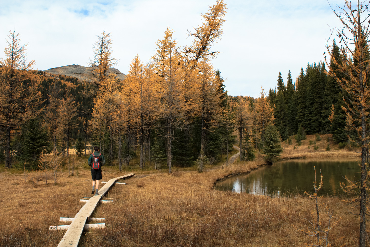
Here, the trail meanders through a low, rolling meadow / partial wetland to the east shore of Larix Lake. The trail crosses a few short wooden plank bridges and hugs the southeastern shore of the lake before heading west. There are a few short spur trails to lovely groves that are perfect for an alpine picnic — or just a rest stop.

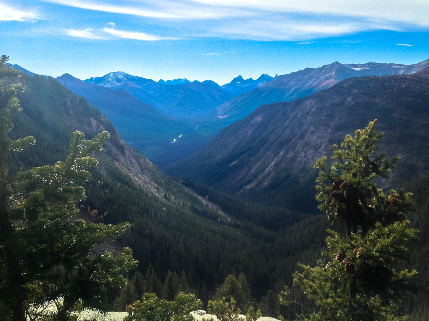
At 2.8 miles, another short spur trail leads you to the Simpson Viewpoint. This overlook peers past into the deep gorge of Larix Creek and the Simpson River Valley. The Simpson River — visible amidst the thick pine and peak landscape — will eventually join the Kootenay River, dip south into Montana and Idaho, then join the Columbia River back in British Columbia before emptying into the Pacific Ocean between Oregon and Washington State.

This is an incredible spot on the trail and you’ll likely want to soak in these views for a while … just be prepared for a very steady and cold wind blowing through the pass while you’re here. That’s what those extra outer layers are for, right?
The trail bends north now, heading toward Grizzly Lake. Here, the trail makes more extensive use of those plank-walks as it crosses some seasonally flooded wetlands. When it reaches the shores of Grizzly, it basically comes as close to its eastern shore as it can get without actually putting you in the water itself. Expect some mud and maybe a bit of ice here, too.


If you visit Sunset Meadows during the high season and found Rock Isle Lake to be a bit too crowded for your tastes, you can expect a bit more solitude at Larix and Grizzly Lakes.
You’ll close the loop at 3.5 miles and backtrack to the junction northwest of Rock Isle Lake at 4 miles. Keep left here to join the Twin Cairns / Meadow Park Trail and take a right at 4.3 miles to make a short but steep ascent up to the Standish Viewpoint.
Here, a short wooden staircase brings you to an elevated viewpoint with a simply tremendous panorama — and some nice perspective on the lakes you’ve just visited.


A short loop trail circles the summit of Standish Hump. Add this to your route or return back down the path to rejoin the Twin Cairns / Meadow Park Trail and head north.
Here, the trail treks through a broad valley between the Twin Cairns to your west and Standish Hump to your east. It’s gently graded and mostly level.

As you hike, you may notice some sections of the terrain where it seems like the ground is bubbling up into rounded mounds, sometimes with small ephemeral puddles caught in between them. These formations are called hummocks, and their origin is probably not what you’d expect.

Many of these diminutive hills have existed in this landscape for upwards of a thousand years. The irregularity in the otherwise flat terrain is caused by underground upheaval when moist depressions with a lot of volcanic ash become frozen or frosted over. The disparity in density in the frozen ground means the frost is able to expand certain types of soil more easily, causing the hummocks to rise and fall. Near other areas where volcanoes are prominent, you can often see hummocks on a larger scale — the hills near Mount Shasta, for instance, were formed in the same manner.

The hummock hills near Mount Shasta (L) and Black Butte. Image by S.R. Brantley for the USGS. Public domain.
The ash that formed the hummocks in Sunshine Meadows wasn’t necessarily local. Around 5600 BCE, the 12,000-foot tall volcano known as Mount Mazama exploded in a cataclysmic fashion, covering nearly 500,000 square miles of North America — including this area of the Canadian Rockies. Today, we can visit the remains of that volcano as Crater Lake National Park.
At the 6 mile mark, turn right onto the Simpson Pass Trail to return back to the shuttle stop and pub on a trail that follows the path of a forested ski run.
Tags: alberta, Banff, British Columbia, canada, foliage, Grassy Lake, Larix Lake, Rock Isle Lake, Standish Hump, Sunshine Meadows, wildflowers