With countless geological oddities including mud hills, wind caves, synclines, anticlines, and a deep cut straight through a mountain range, the Split Mountain/Fish Creek Wash region of Anza-Borrego Desert State Park is a geologist’s dream. Even those with only a casual interest in geology will find no shortage of fascination on this varied hike, which visits everything mentioned above and more.

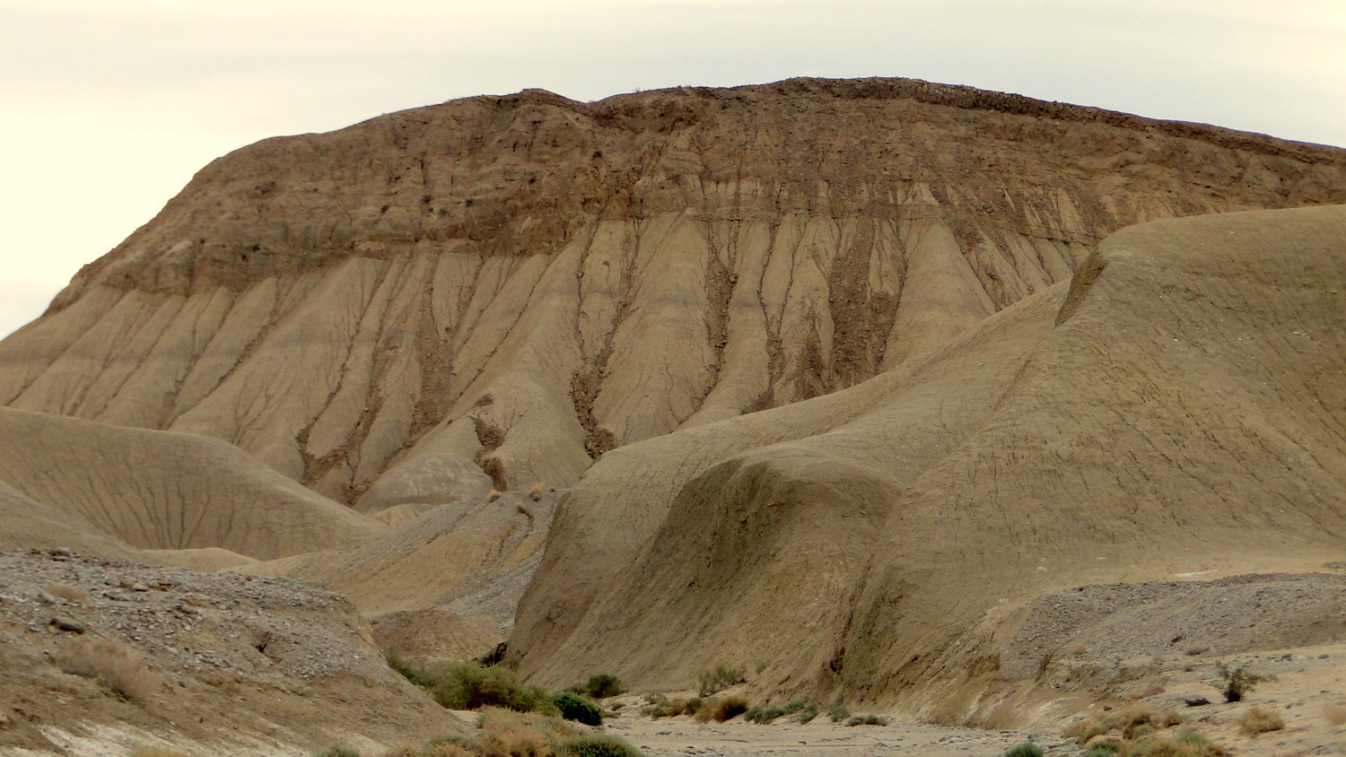
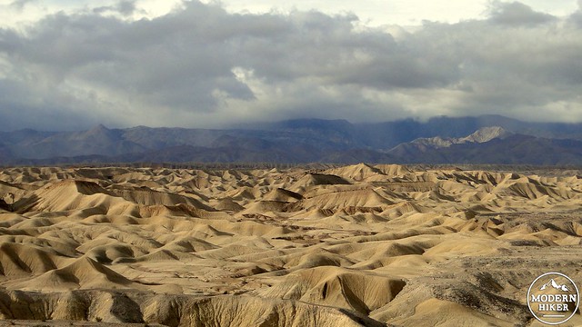
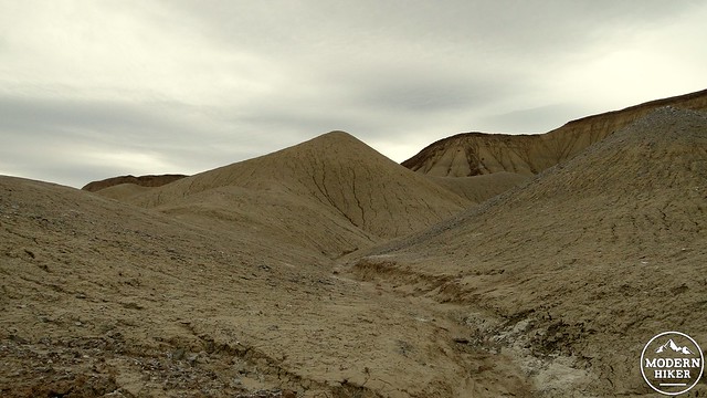
Mud Hills
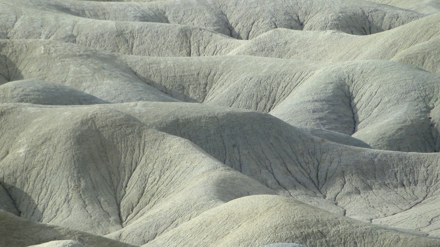
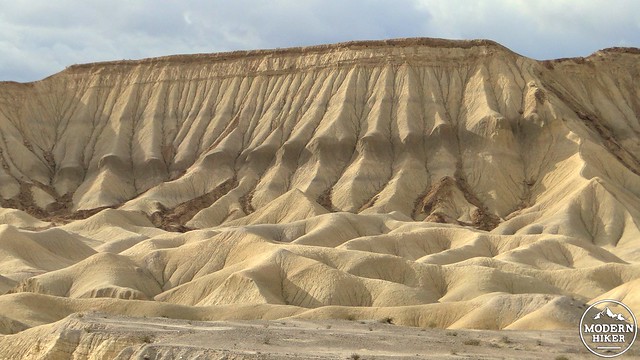
This hike travels into the eastern corner of the Carrizo Badlands, a rumpled and corrugated landscape that contains some of the most famous and popular features in Anza-Borrego Desert, including Arroyo Tapiado and the Mud Caves. The landscape you will travel through was once the bottom of a huge inland sea that retreated and expanded along with vacillations in the climate. This sea left behind a thick layer of muddy sediment, which eventually “solidified” into the soft, crumbling hills that characterized this region. These seas also left behind layers of ancient reef beds, which fossilized into hard limestone formations.
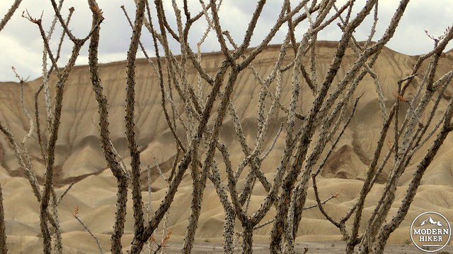
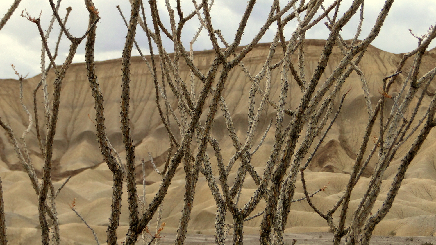
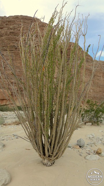
Ocotillo
Rain and wind erosion removed the edges on the rock, creating the smooth, rounded forms spreading out for miles and miles to the west. Storm runoff carved out a maze of washes and channels that one could wander through (and potentially get lost in) for days. In the places where the harder, erosion-resistant fossilized reef beds remain, the underlying mud layers erode rapidly except where capped by fossils. This arrangement of a hard cap of rock atop a softer layer of rock has resulted in the beautifully eroded Elephant Knees formation.
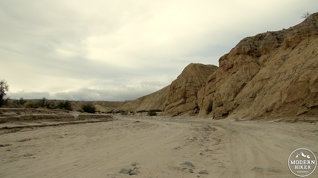
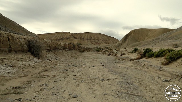
Fish Creek Wash
Getting to this point, however, is its own geological odyssey. To reach the mud hills, you must first pass through Split Mountain. At Split Mountain, Fish Creek Wash cuts directly through a mountain range, separating the Vallecito Mountains from the southern Fish Creek Mountains. This occurred as the waters of the now-vanished Fish Creek progressively cut through the rock in the mountain as the mountain rose gradually due to fault action. The erosion was able to keep pace with the rising land, leading to a perfectly cut gorge.
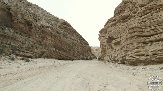
Split Mountain
This cut exposes some fantastic rock formations carved out of sandstone and other layers of rock. In some places, these stratified layers of rock are bent into bows and curves called anticlines and synclines. This geological oddity is the result of massive prehistoric landslides that solidified into a stratum of rock. Over time, compressional stress caused by tectonic activity via fault movement forced the stratified layers to bend. Anticlines bend upward (convex), while synclines bend downward (concave). This geological game of Twister resulted in one particularly prominent U-shaped anticline occurring at the outlet of Fish Creek Wash.
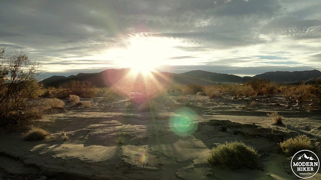
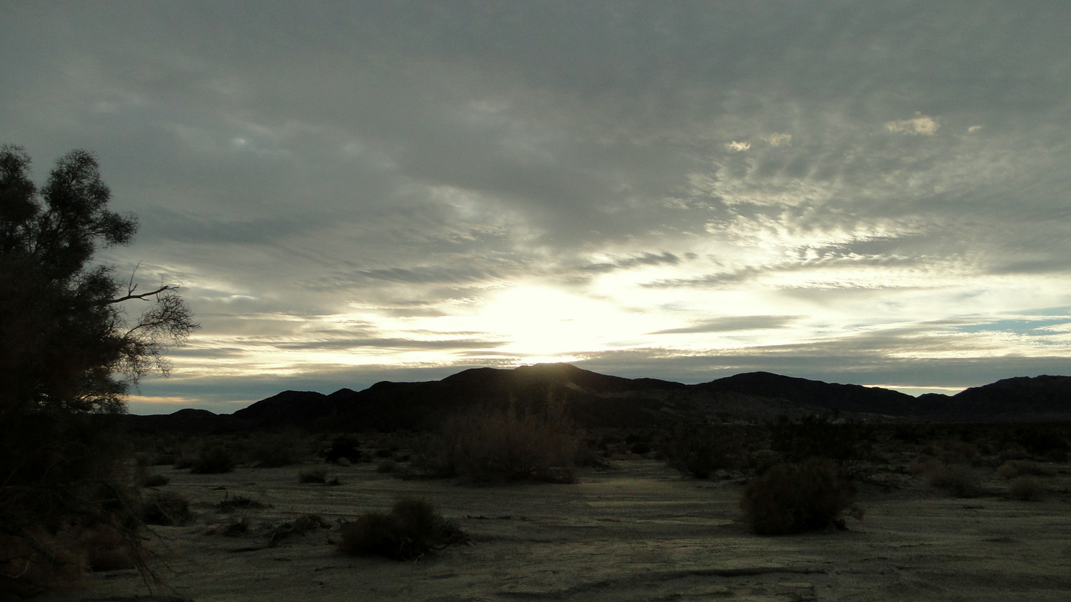
View from Fish Creek Campground at dawn
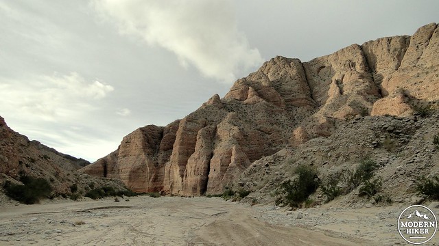
Entering Split Mountan
Starting out from the Fish Creek Primitive Campground, begin walking toward the entrance of gorge-like Fish Creek Wash. The track occurs on a smooth, sandy wash that can be soft and laborious to walk through at times. The route occurs along what is also a popular road-way for 4wd enthusiasts. You may find yourself sharing the road with vehicles, but if you get an earlier start or come here on a weekday, you will be able to avoid most traffic. As you enter the gorge, you will encounter a massive, reddish wall to your right. This is the first taste of the non-stop geologic drama that is about to unfold.
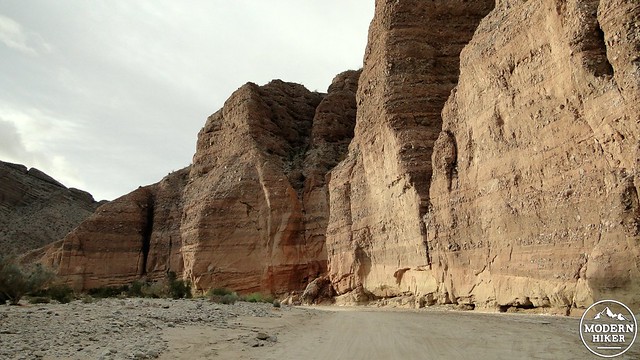
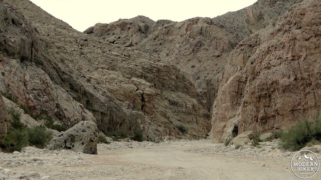
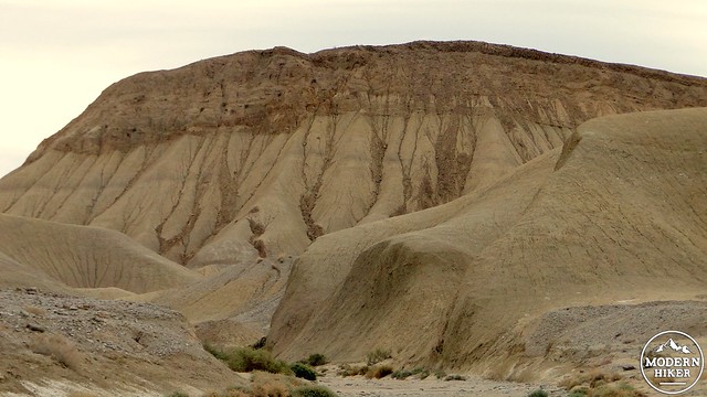
As you continue through the canyon, you’ll see stratified rock walls rising up to occasionally impressive heights on either side of you. Closer afoot, you’ll see a variety of scrubs and cacti, along with the occasional desert willow, mesquite tree, or smoke tree. In the cool quiet of the morning, bird song and your own footsteps will echo faintly off of the multi-colored rock layers. Discontinuities in the layers caused by more recent faulting will change up the rocks around you to avoid even the tiniest modicum of tediousness as you continue to make your way to the wonderland on the other side of the mountain.
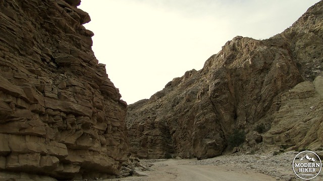
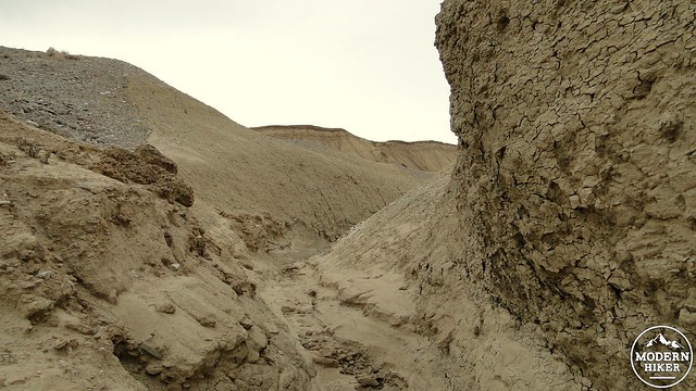
Leaving Split Mountain
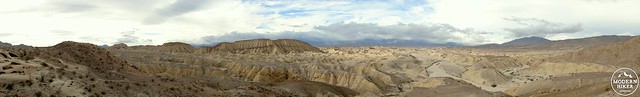
Carrizo Badlands Panorama
After passing the anticline, you will leave the sheltering walls and enter a large, open area leading into the eastern section of the Carrizo Badlands. The rock abruptly changes from stratified sandstone to the rolling, rippling mud hills. As you continue, a side trail off to the right leads off to yet another set of geological oddities called the Wind Caves.
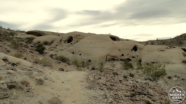
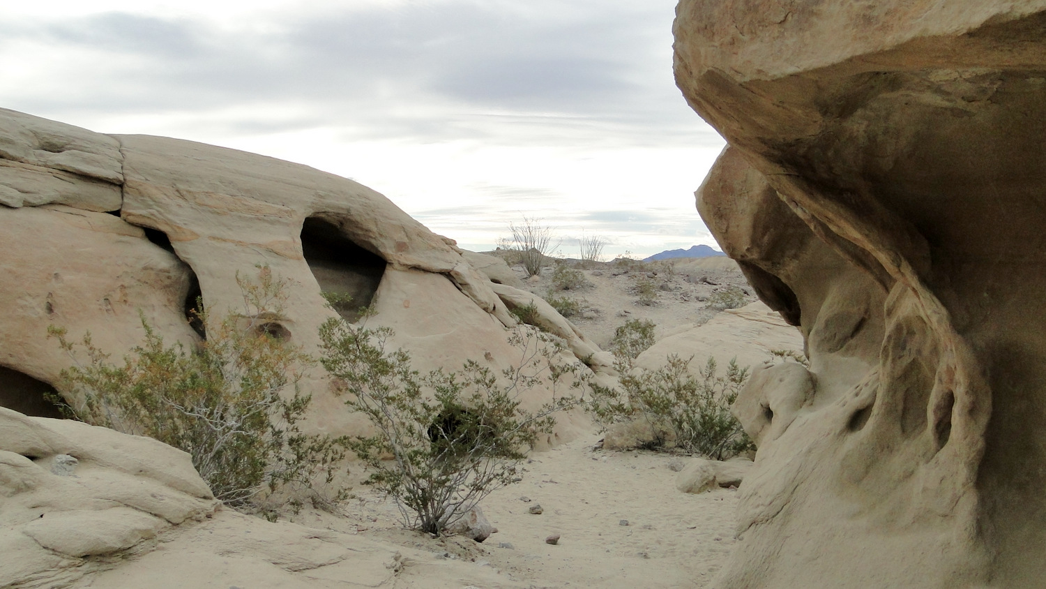
Wind Caves
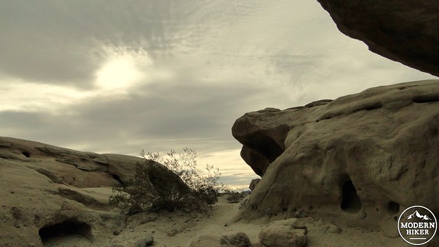
Inside the Wind Caves
View from the Wind Caves
Desert winds have been chipping away at the block of sandstone here for a very long time, creating cavities and whimsical formations that you can crawl through. Unfortunately, vandals have left their mark on this area, including some of their empty beer bottles. The area is still beautiful, but the frustration that comes with this lack of consideration can be a bit of a come-down. Still, after following the short climb up the spur trail, you will find yourself atop a bluff that offers some of the best views over the Mud Hills, as well as some fun time poking around the Wind Caves.
Mud Hills Wash
You can come back down to Fish Creek Wash or find your way down any one of the side trails that scramble through smaller, rockier washes to come to a junction that also forms a nice campsite for those that are driving in or backpacking. To the left, you will notice a fairly prominent wash that leads into the Mud Hills. This is Mud Hills Wash, and you can turn left here to continue your expedition into Anza-Borrego’s Heart of Weirdness.
Here is a quick warning though for those who wish to explore beyond the confines of this write-up. This wash can lead you to an intricate and complex maze of washes traveling through the badlands. Given the lack of identifying features in the smooth, uniformly beige-gold mud hills, it could be very easy to become disoriented in your exploration. Disorientation here could mean becoming very lost in an extremely arid and remote corner of the desert. Bad, bad news. We only recommend further exploration if you are or are with an extremely experienced an accomplished desert hiker.
Elephant Knees
If you follow along, however, you will continue along the wash as it enters this maze of mud. The rippling furrows in the earth aren’t as smooth as they appear from a distance, but they are still remarkably round and equally weird. If you continue to follow the wash, you will approach and then wrap around the Elephant Knees formation, which has likely been drawing your gaze for some time. It’s a bad idea to walk on Elephant Knees as this is a rare and unusual formation that deserves every protection afforded to wilderness areas.
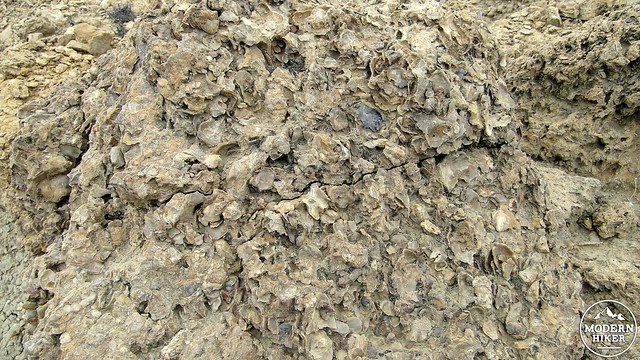
Fossilized scallops
As you approach the formation, you are likely to see hunks or patches of fossilized coral reef scattered about. These fossils come from ancient mussels and scallops that once covered the area when the seas reached this point. Remember the Leave No Trace principles and avoid moving, taking, or otherwise disturbing these ancient fossil beds.
Ocotillo
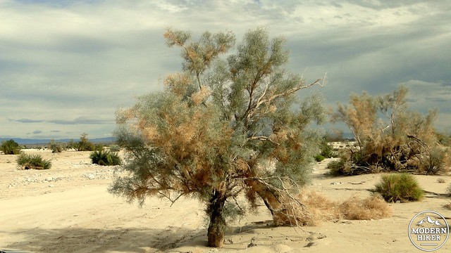
Smoke Tree
Once you’ve satisfied your curiosity, retrace your steps back to Fish Creek Wash and travel back through Split Mountain to reach your car near the campground. You are unlikely to find such a fantastic geological smorgasbord anywhere else in San Diego, and this is an essential treat for all desert-lovers.
Tags: Borrego Springs, Carrizo Badlands, Elephant Knees, Fish Creek Wash, Mud Hills, Split Mountain, wind caves