Rising like a towering monolith, Mount Yamnuska looms 7,349 feet above the prairies west of Calgary at the entry to the deeper Canadian Rockies. Popular with rock climbers and adventurous hikers, this trail requires some scrambling skills or lots of patience with nearly vertical scree ascents and cable sections. But if you’re up for the challenge, the views and feeling of summit exhilaration are well worth the effort.
In the Stoney/Nakoda language spoken by the First Nations people of the area, “Yamnuska” roughly translates into “wall of stone” or “flat-faced mountain.” It’s an extremely accurate description for this massive chunk of rock, which rises in shockingly steep relief from the plains below. The mountain is also known by its official name, Mount John Laurie. It was named in 1961 at the request of the Stoney Nakoda First Nation to honor the co-founder of the Indian Association of Alberta, a province-wide First Nations rights organization.
This challenging full-day adventure is rife with subtle beauty and harrowing challenges, and should only be attempted by hikers with scrambling confidence or mountaineering skills — and only during good weather in the warmer months. Most of the technical challenges are on the north side of the mountain, so snow and ice can linger later in the season than you’d expect them to. Once you’ve triple checked your gear and packed a good lunch, the trailhead begins in sight of the massive mountain — and with plenty of helpful signs and maps to warn you about the difficulties of this route.
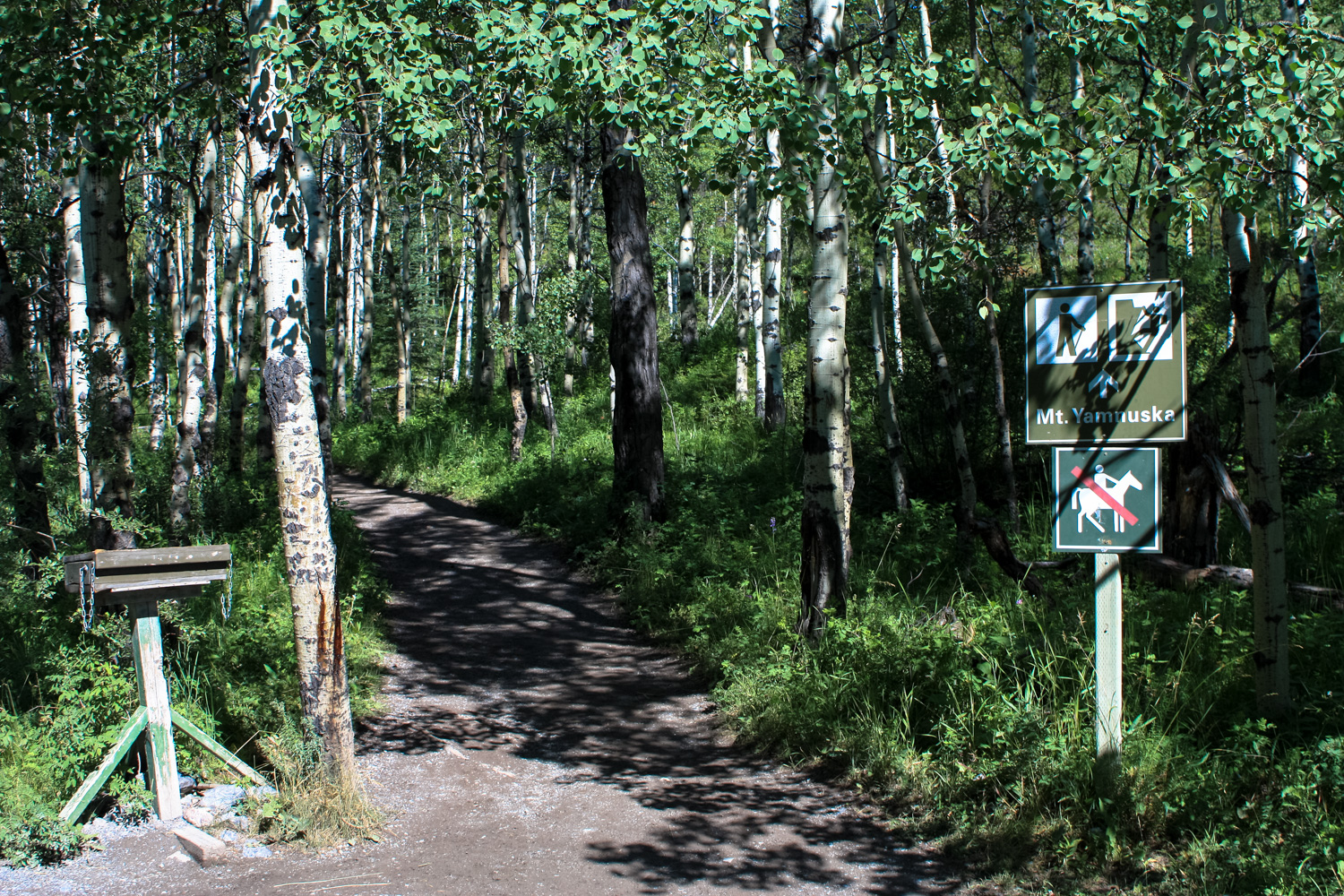
Yamnuska is much-loved by Alberta rock climbers, and you’re likely to see just as many climbers at this trailhead as you are hikers — perhaps even more. There are more than 130 (!) climbing routes to the summit here, but hikers can reach the summit if they have decent scrambling experience. From one of the signs near the trailhead:
Hikers intent on reaching the summit need to be aware that this is a scramble route, involving exposure to the hazards of an alpine environment. Scramblers need to be familiar with and prepared for difficult route finding, exposure to sheer drop-offs, scrambling on narrow ledges, rockfall, and drastic weather changes.
This unusually helpful sign also has photos of the three main technical challenges you’ll face on the route. We recommend taking photos for yourself before you head out, just in case.
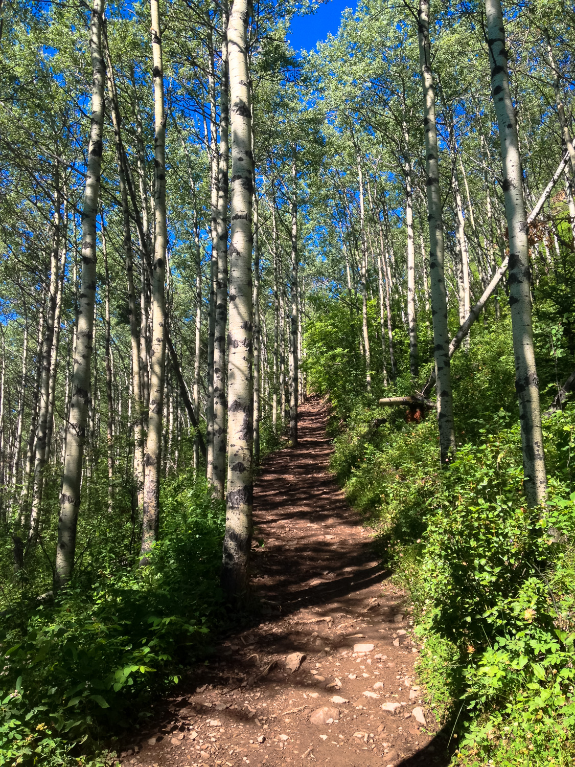
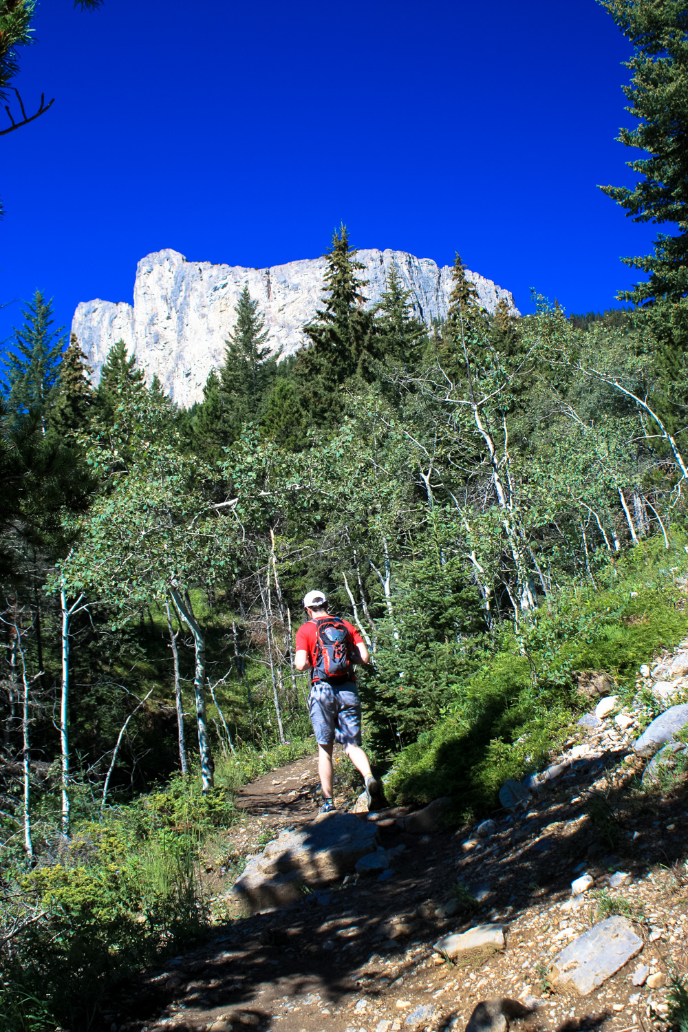
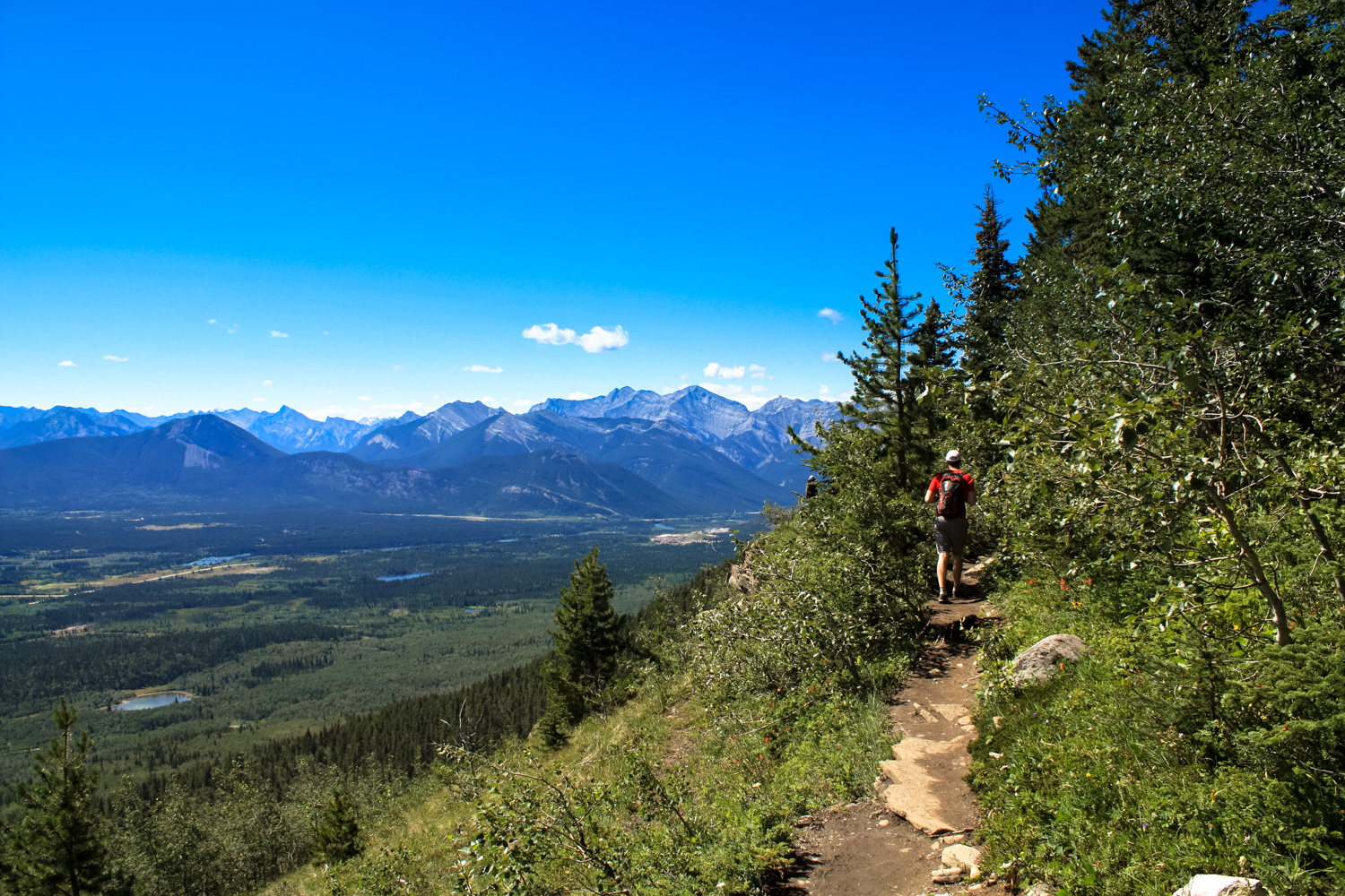
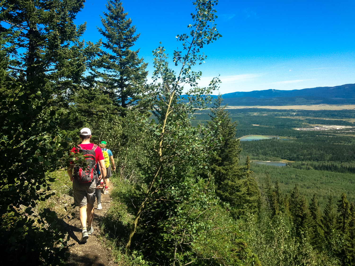
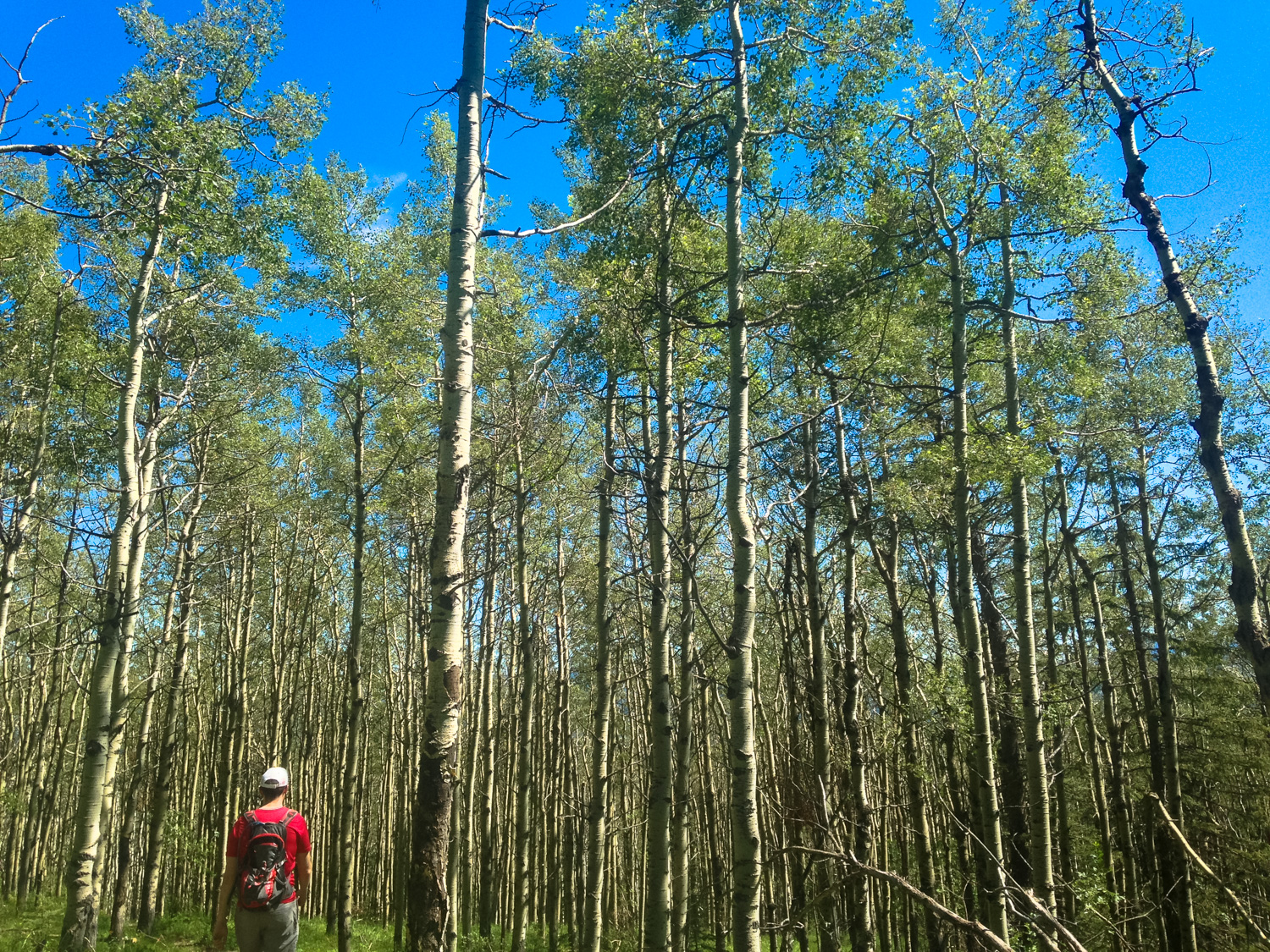
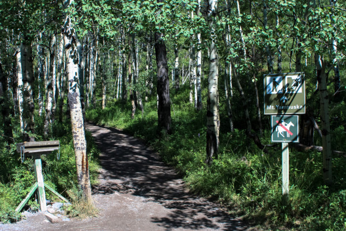
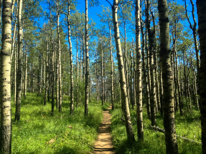
The trail begins on an extremely pleasant hike from the north end of the parking area. Follow the signed trail for hikers and climbers through a beautiful aspen forest, which becomes full of blazing orange and yellow in the autumn months.
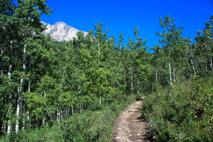
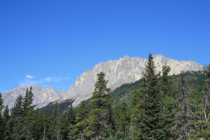
A glimpse of the mountain above the trees
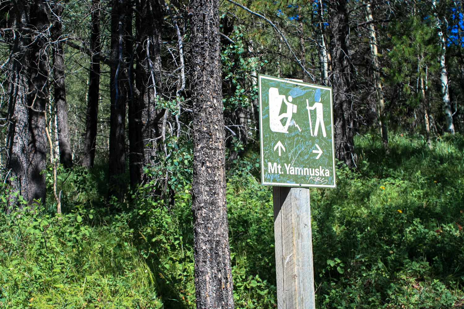
After about 0.5 mile of pleasant woodland hiking, the trail reaches a signed junction. Climbers are directed straight ahead while hikers are encouraged to keep to the right.
To follow the route described here, follow the direction of the hiker. We should note, though, that if you’re looking to get to the summit and don’t want to deal with scrambles or chains, heading in the direction of the climbers’ routes does offer an option — but it basically involves long, tedious marches up steep scree slopes. Head that way if you want, but consider yourself warned.
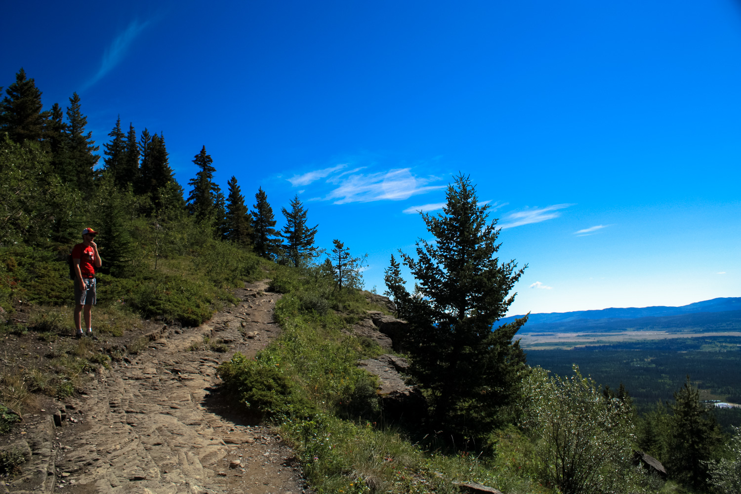
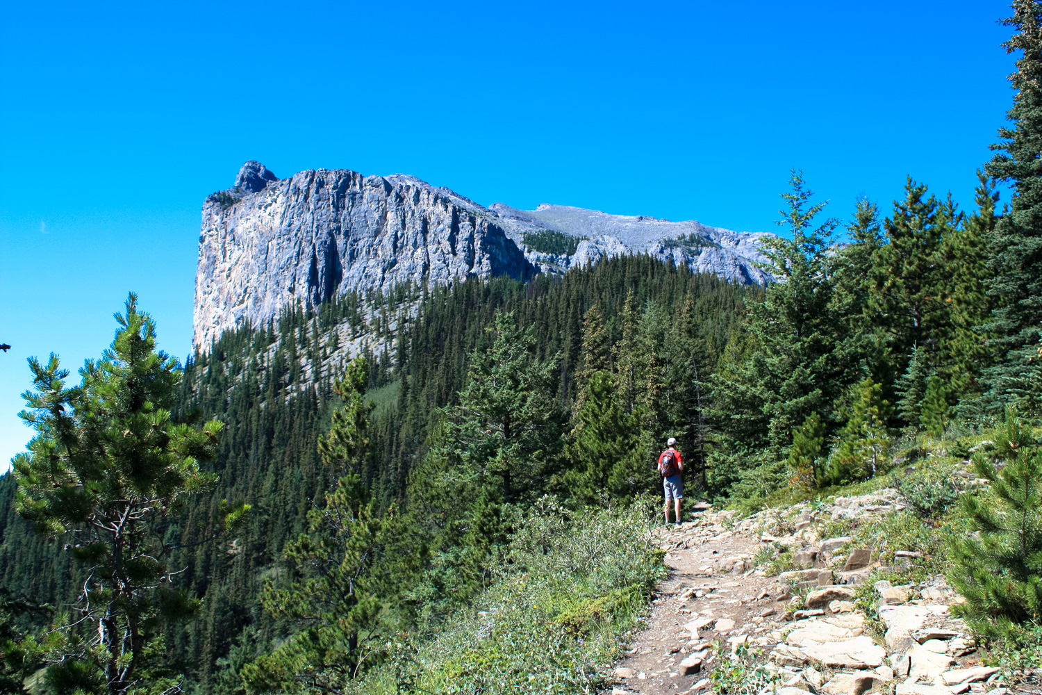
Sticking with the hikers’ path means you’re going to spend a little more time beneath the shade of pine, aspen, and birch trees as you head north. There aren’t a ton of nice views here but the shade is welcome — and when the tree cover does break, it’s pretty spectacular.

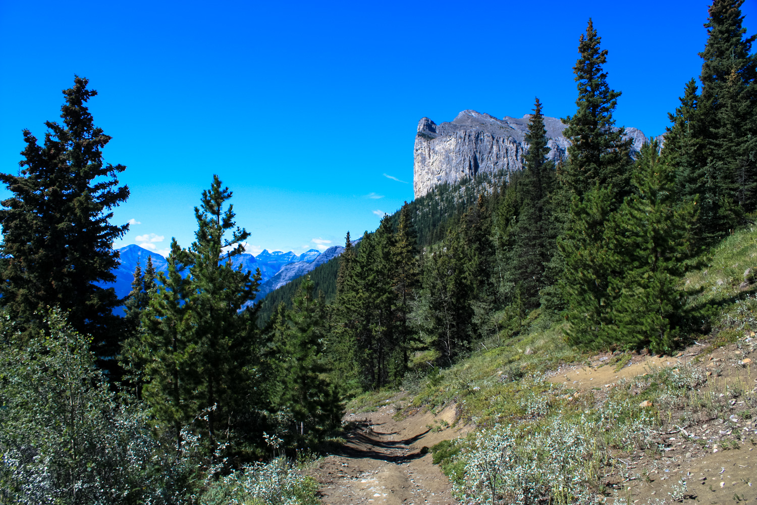
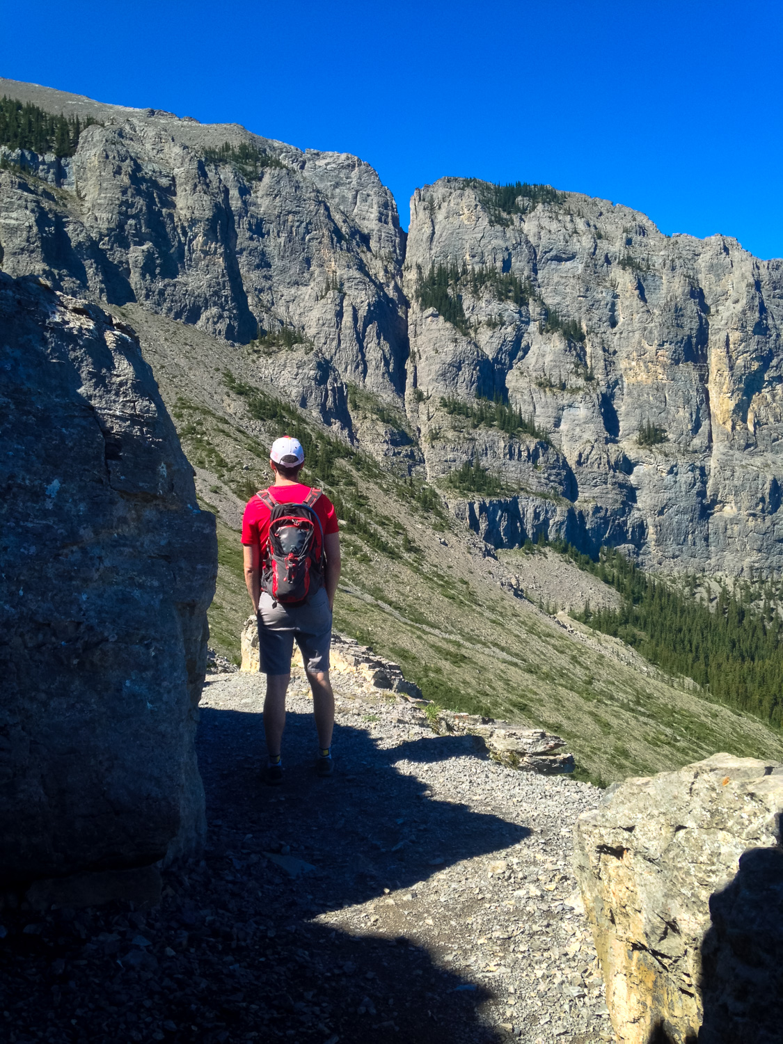
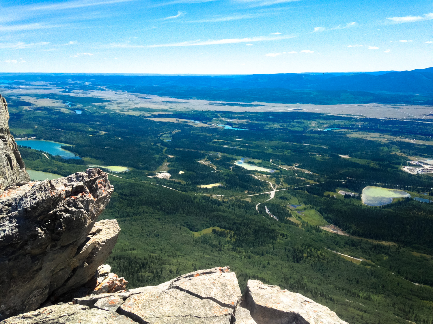
Yamnuska in sight
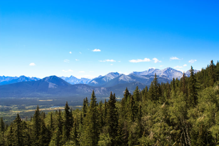
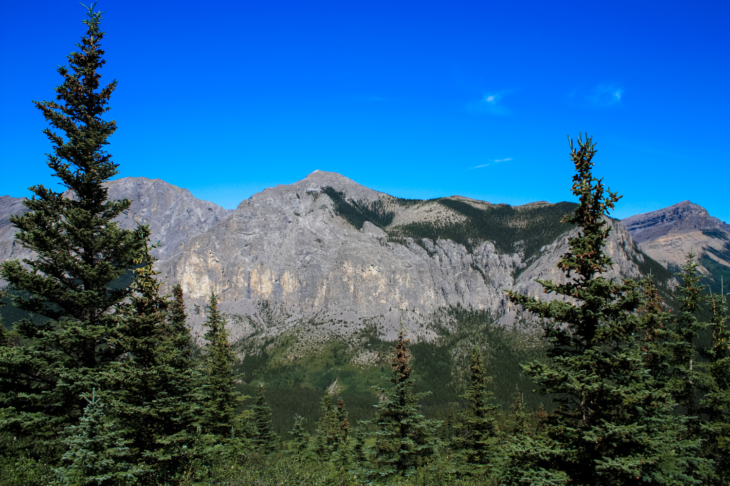
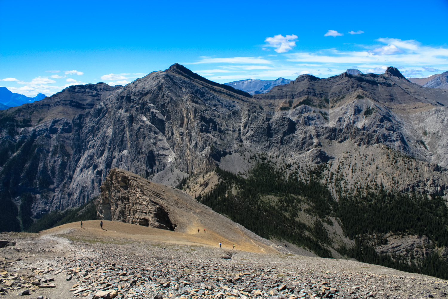
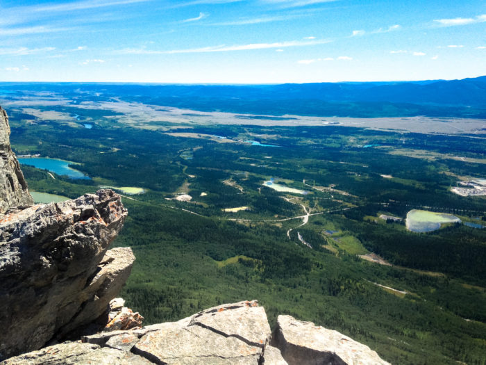
looking south toward Mount Baldy, Mount Lorette, and Kananaskis Country
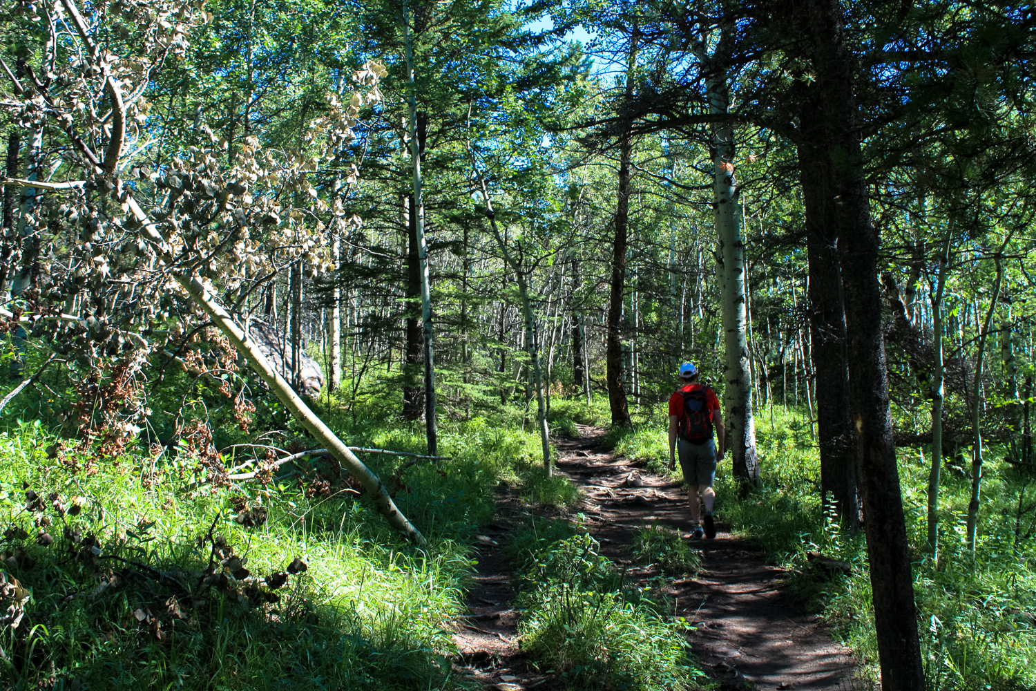
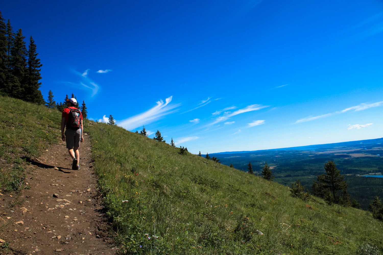
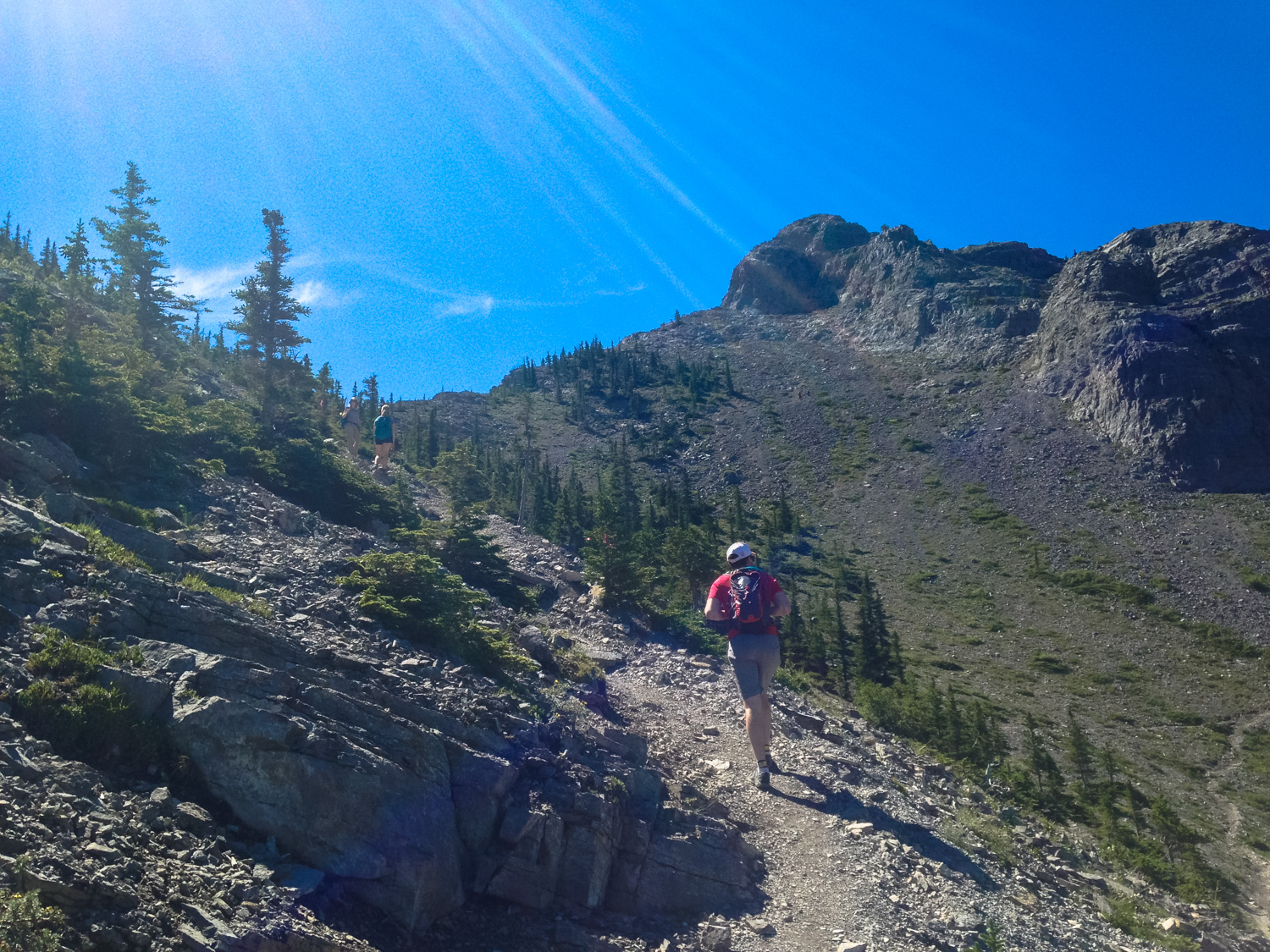
The well-worn path continues in and out of the woods, making its way upward. There are a few use trails that seem to wander off on their own, but stay with the path-more-taken and you should be fine. Occasional arrow markers nailed into the trees and on the ground will help keep you on the right path.

At 1.6 miles, the trail reaches its northernmost point and makes a sharp left to turn toward the north face of Yamnuska. There is a use trail that continues to the northeast but it’s easy to keep on the main route.
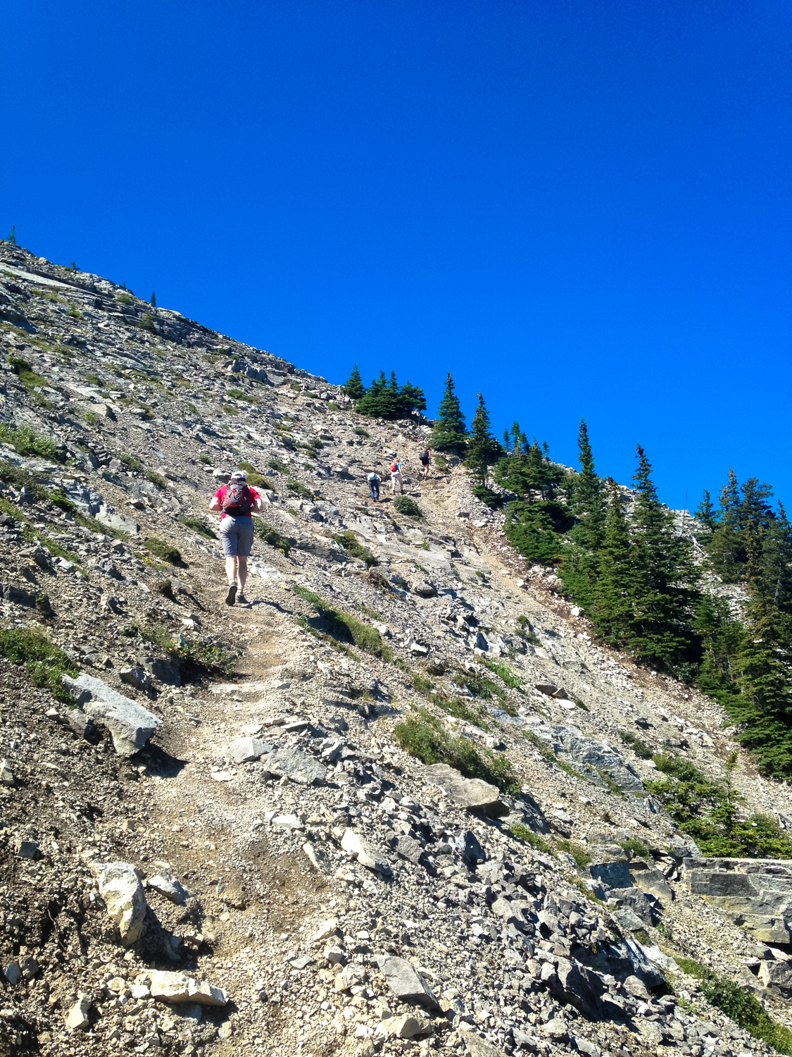
From here, the character of the hike changes dramatically — gone are the gently graded dirt paths and tree cover; now you’re tromping along rocky paths on scree slopes in the full sun, with the occasional alpine meadow to break up the rocky panorama.
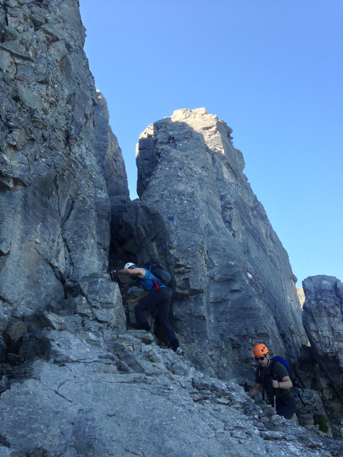
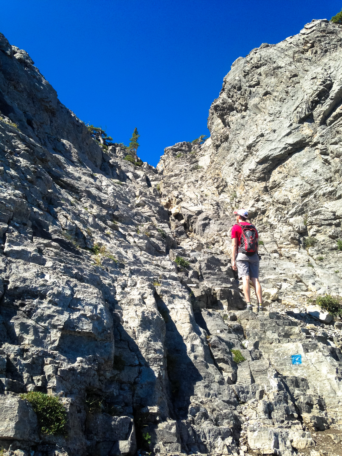
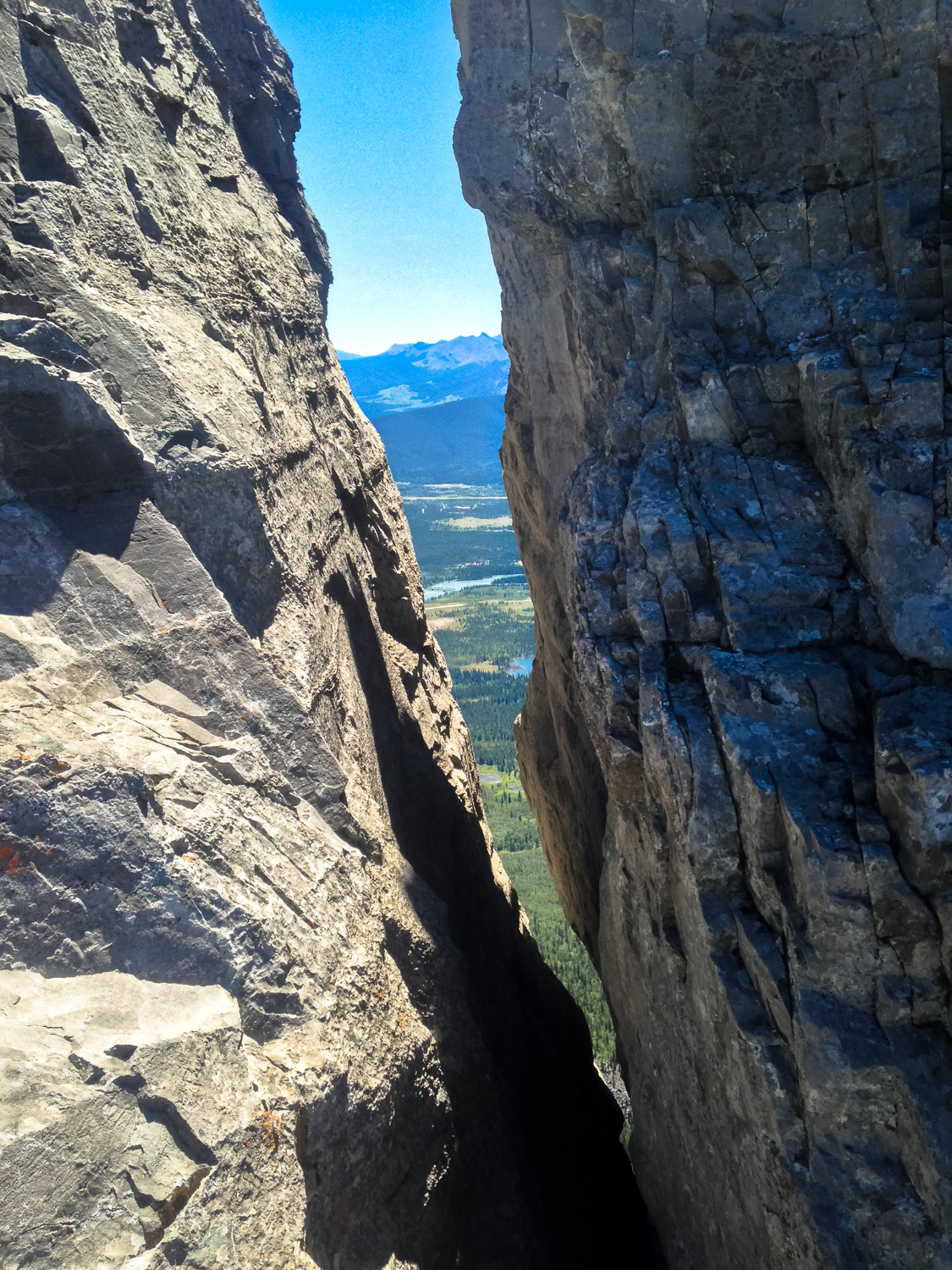
You’ll reach the first technical challenge shortly after turning onto the rockier mountain section of the trail: the chimney.
Here, the trail squeezes through a narrow crack in the rock before moving forward. While you’ll need your hands and feet to get through this short climb, it’s not especially difficult nor is it really that exposed. Look for the blue blaze painted onto the rock if you’re not sure where you should start climbing.

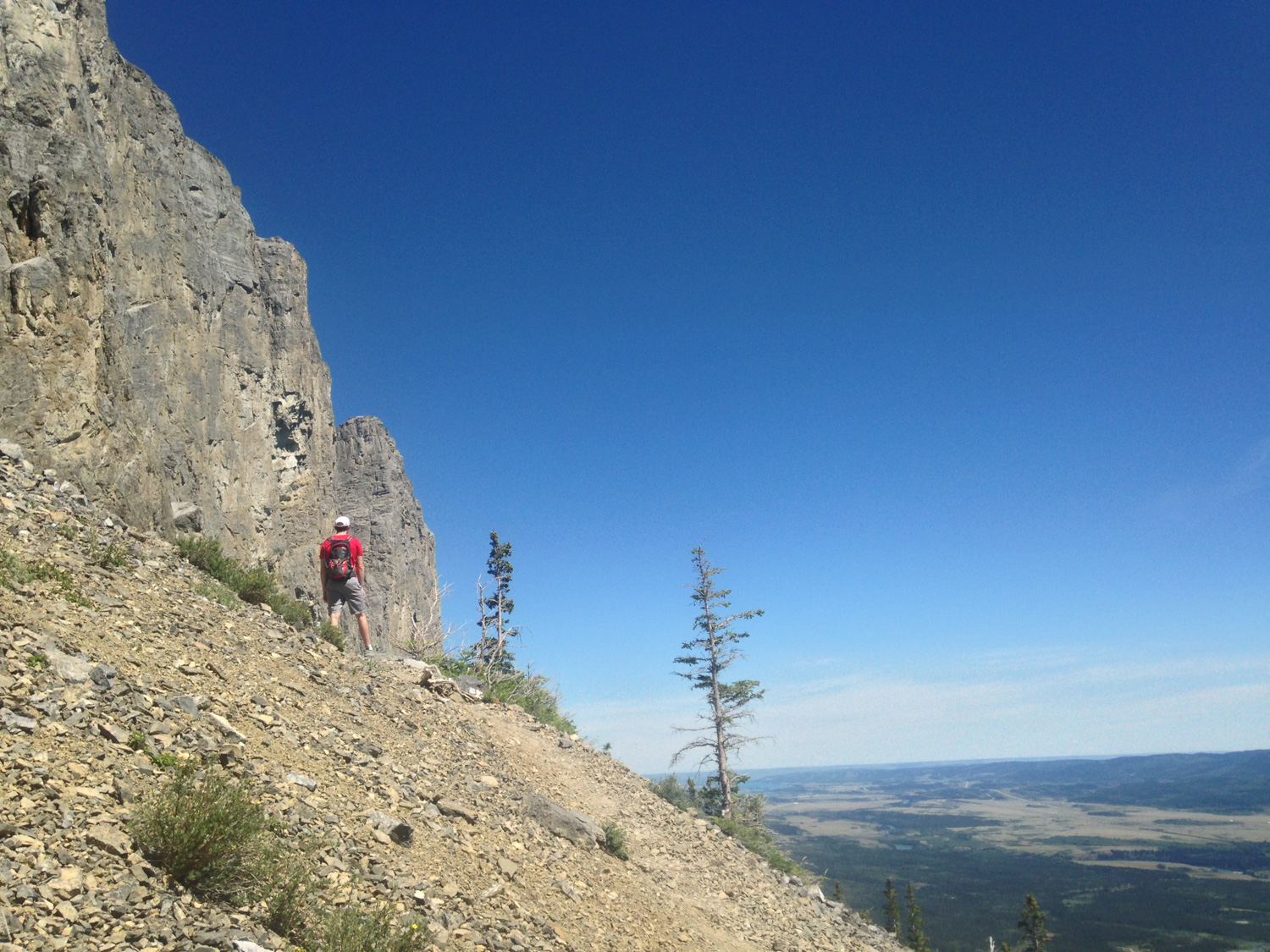
Beyond this, the trail opens up again, providing you with a stellar view of most of the mountain’s northern slopes.

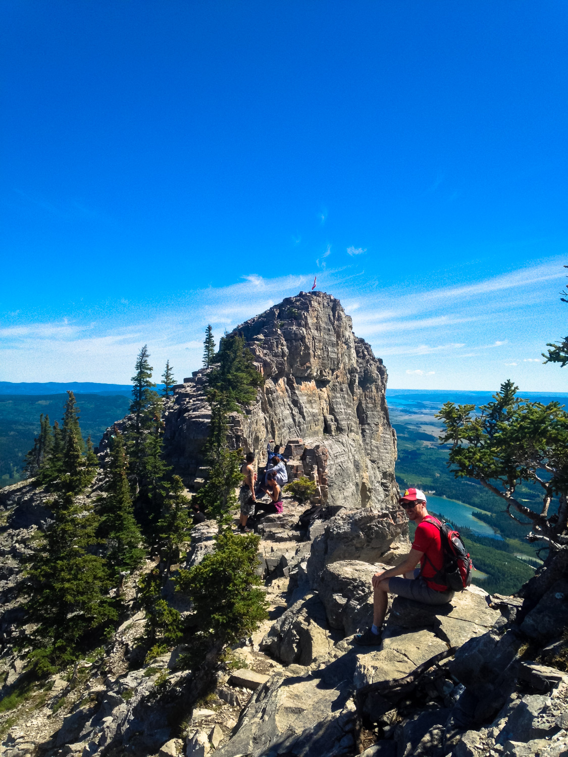
From here, it’s a steady uphill slog along a narrow trail that crawls its way up to a small notch between the ridge of the mountain and a prominent pinnacle where a Canadian flag has been mounted.

“crawl” is the operative word here
We should note that when you’re sitting on the edge of the ledge near the Canadian flag, you are sitting at a sheer drop several hundred feet long. If you’re afraid of heights, you probably shouldn’t be on this hike in the first place — but even if you aren’t you may want to sit slightly back from the edge here.

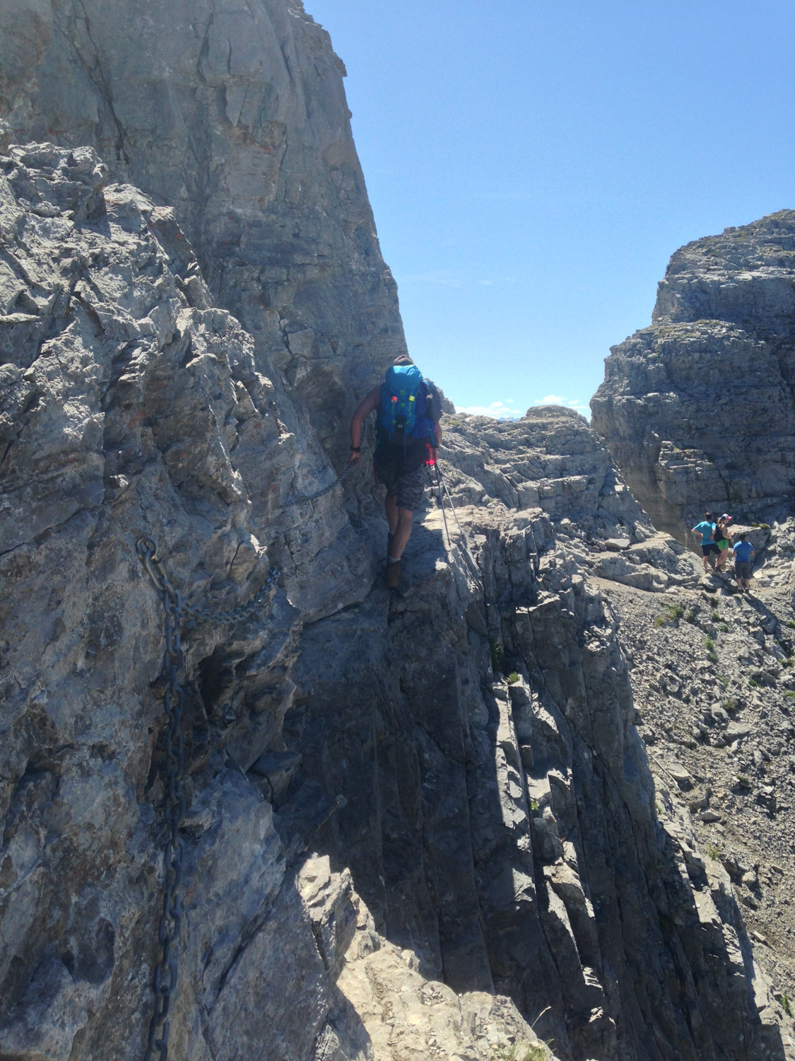
The trail continues and at the 2.3 mile mark, you’ll encounter the second technical challenge — the chains. The chain section of trail is significantly more harrowing than the chimney.
About 50 feet long and no more than a few inches across, this section requires one side-step technique where you’ll have to put a healthy amount of faith in your feet and that chain bolted into the rock wall. I won’t lie — I wasn’t a huge fan of this part of the trail and it took me a while to make it across, but the good news is that once you’re done with this, the tough technical sections are pretty much over.

Once you’ve made it safely across, be sure to peer through some of the cracks along the ridge line for a bit of height perspective.

Or, you know, maybe skip that part.
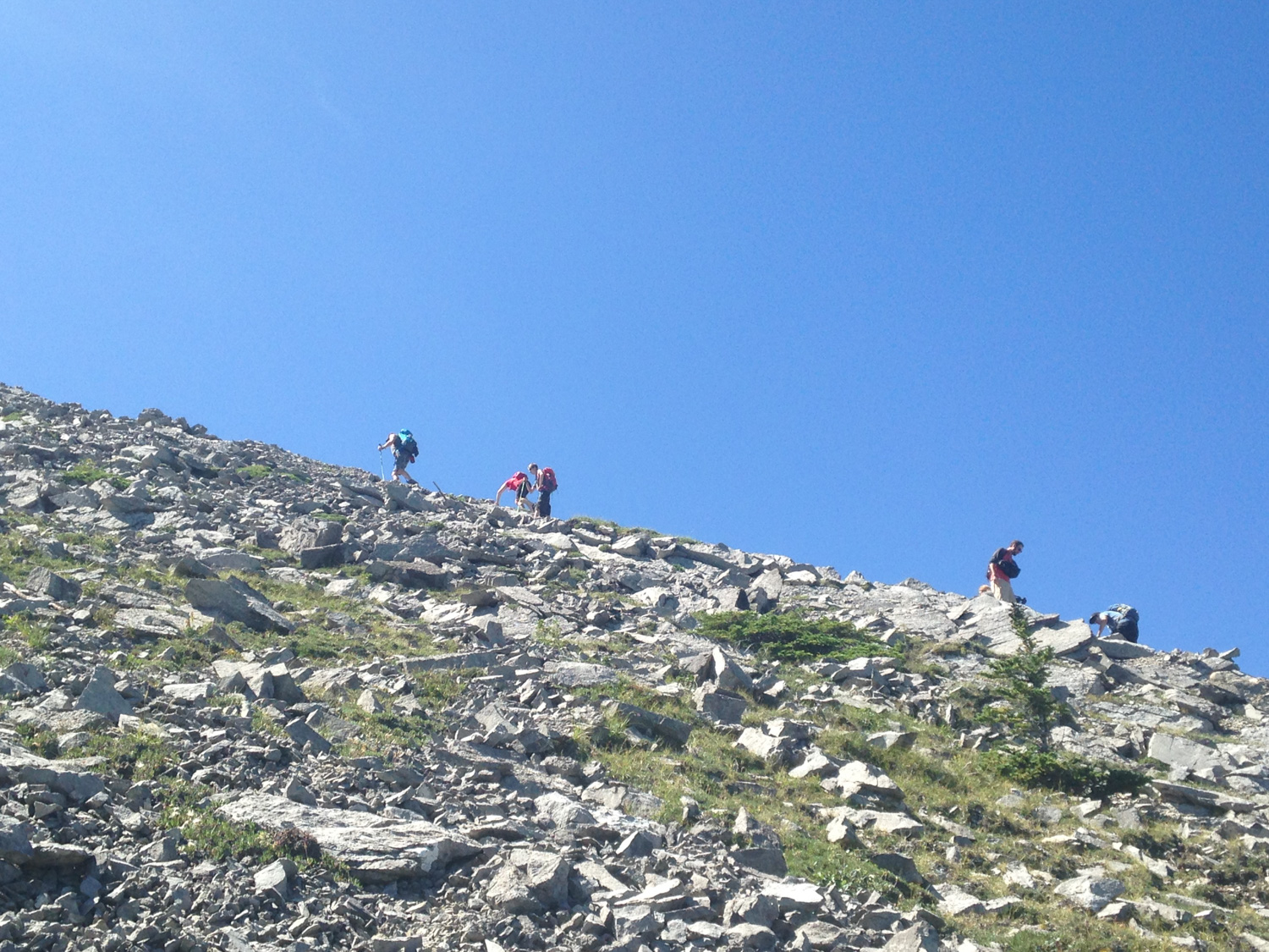
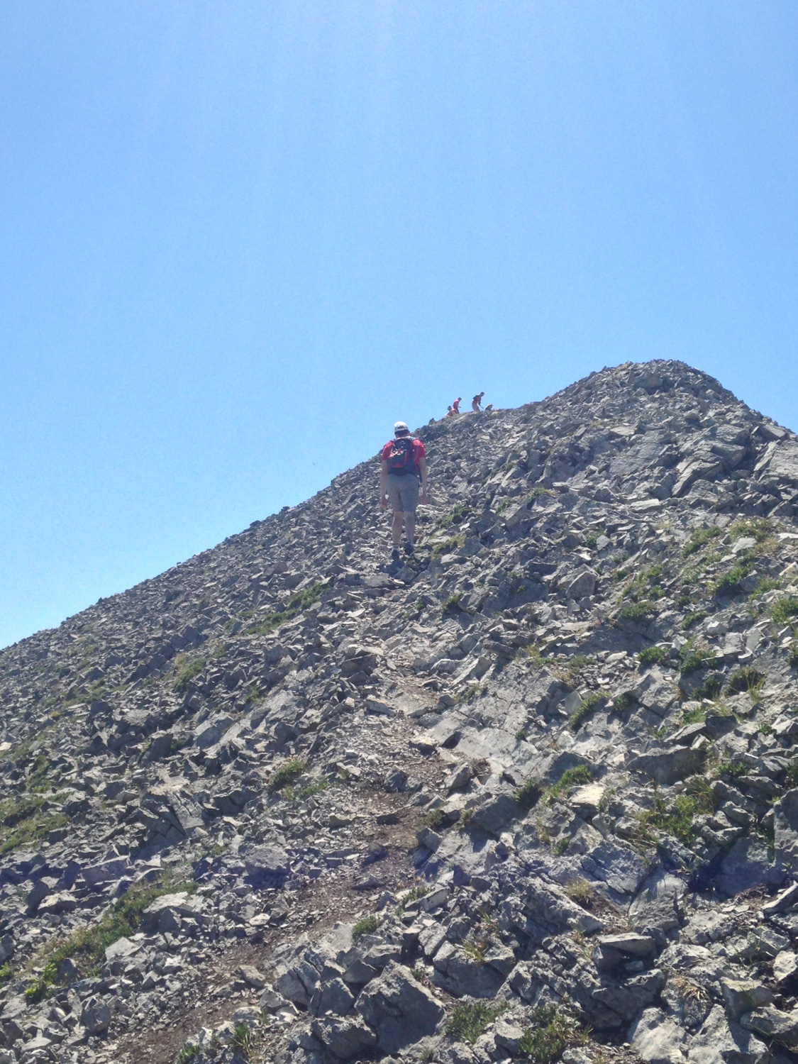
The trail from here to the summit is relatively straightforward — just steep and narrow. There are several different use trails along the rocky scree slopes, but if you’re hiking during a nice warm day you’re apt to have company ahead of you that can help lead the way.
Just keep on following the ridge line and climbing upward. At 3.1 miles, the trail follows the north ridge just below the summit, then makes a sharp turn toward the actual summit itself. Steel your quads and get going — you’re almost there!
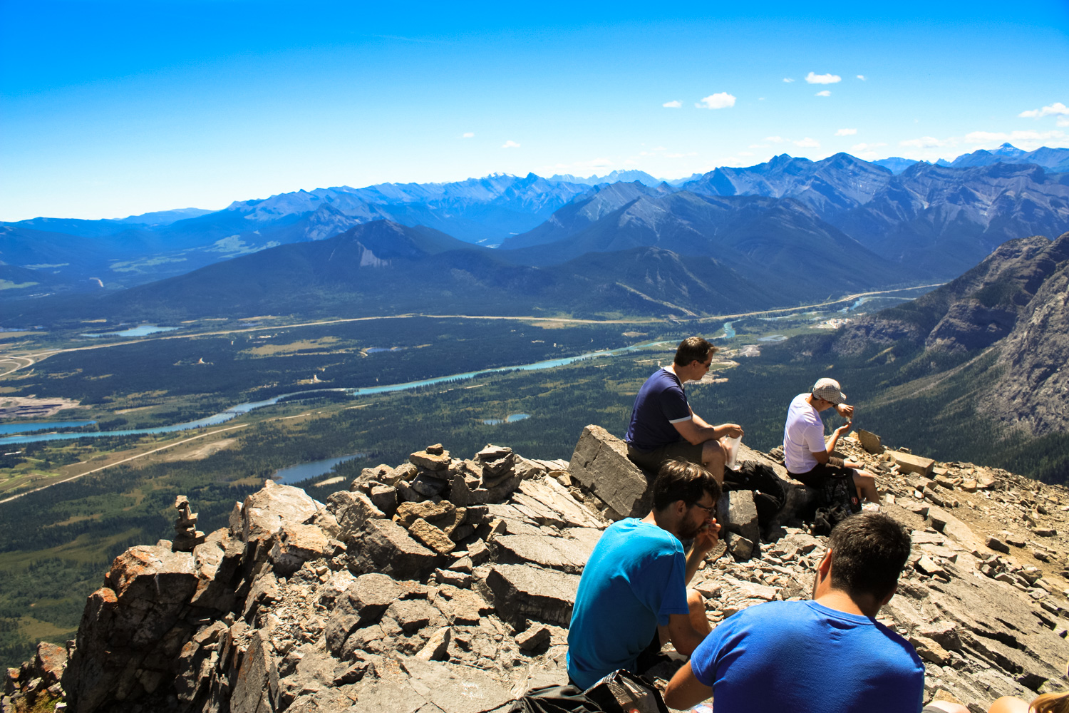
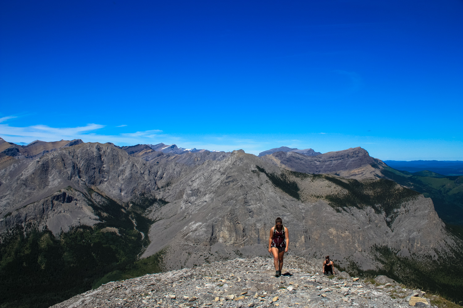
You’ll reach the summit at 3.2 miles, and topping out on this bare, narrow perch is quite a feeling. It almost seems as if the entire world is opening up around you in every direction — and you’ll probably have a small handful of fellow exhausted travelers to share that elation with.
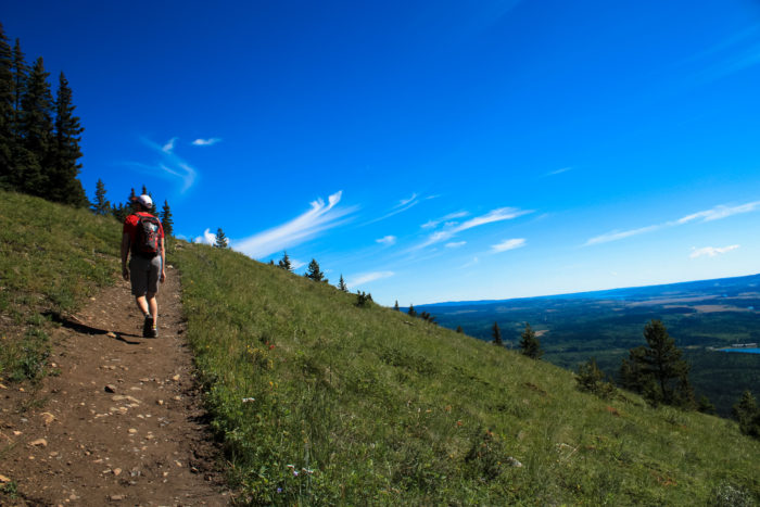
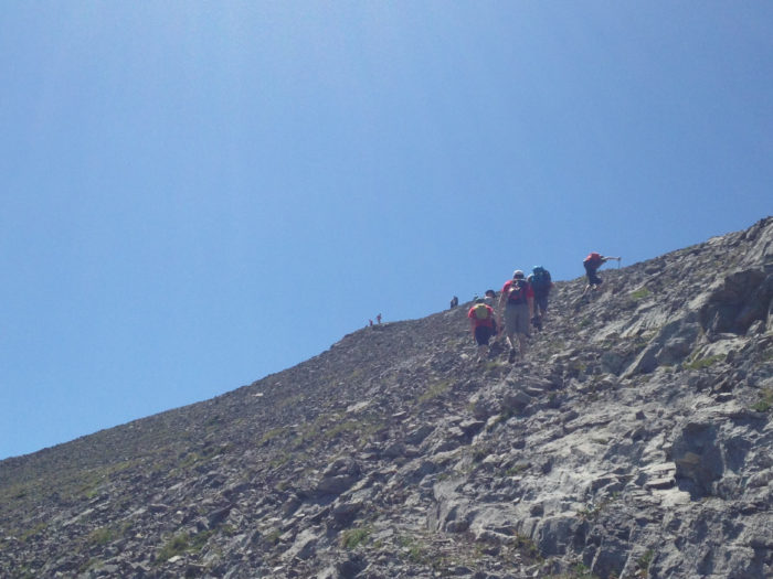
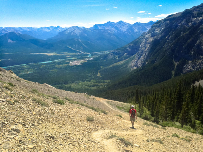
hikers making the final push up the scree slope

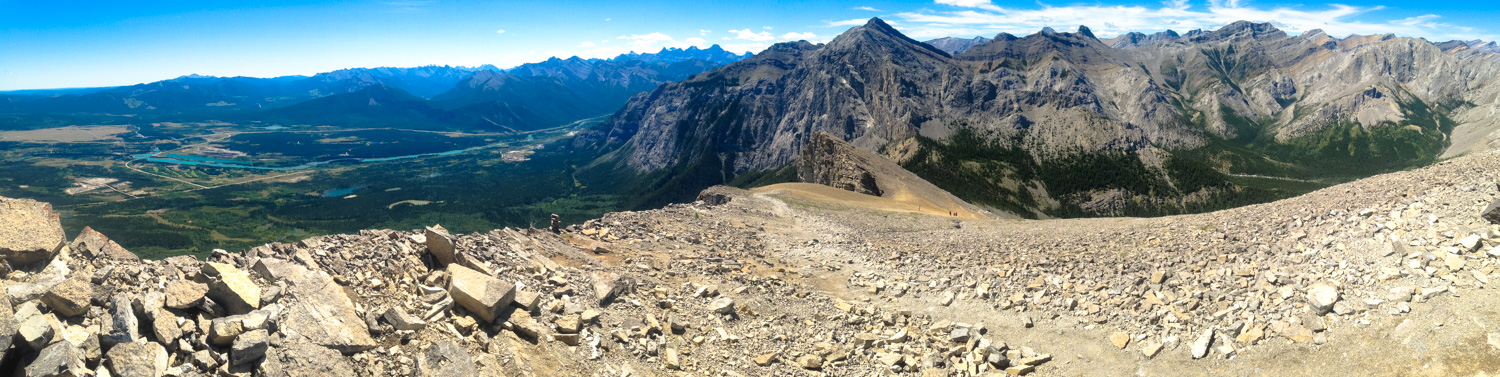
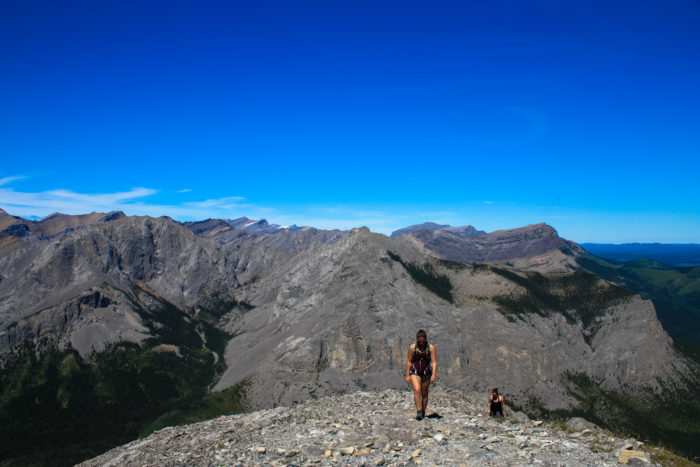
The Bow River and Kananasakis Country in the background

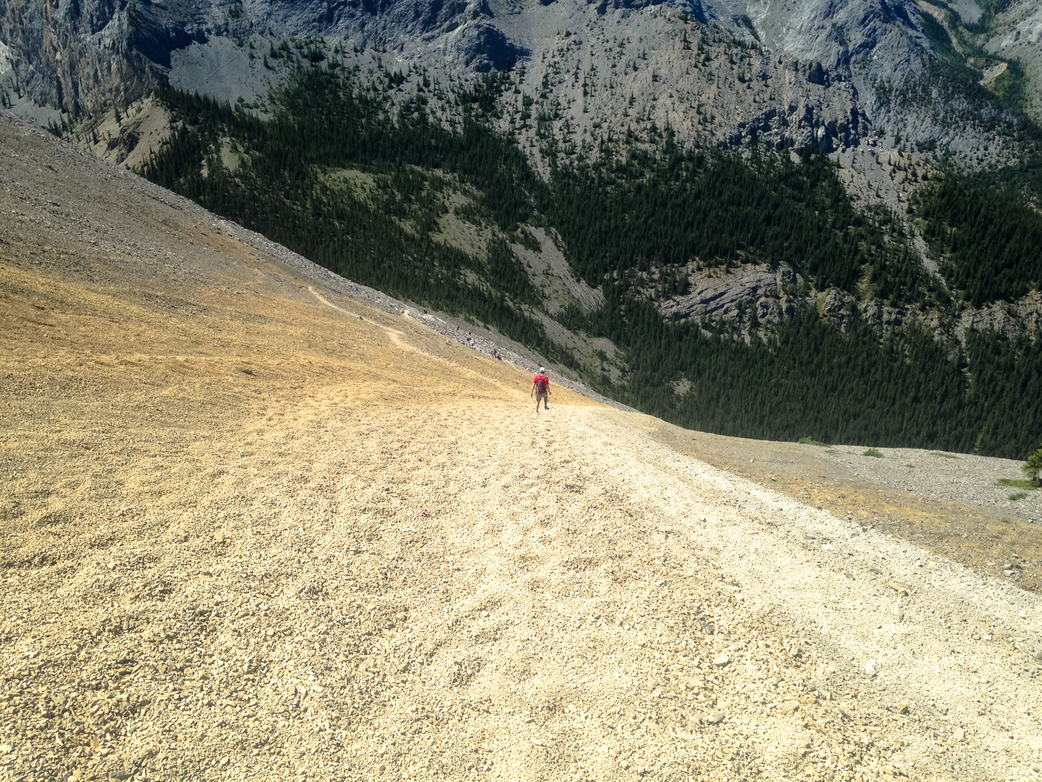
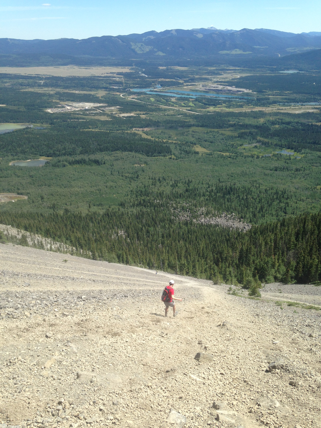
Enjoy your time at the summit. When you’re ready to descend, just point your feet southwest for the summit. See those long, steep trails down scree slopes? That’s your way down, buddy.

The scree here, as you can see, is much finer than the bouldery chunks you’ve climbed up on. It’s also pretty thick, which means you can — as my partner Daniel is doing here — just sort of scree-ski downhill. You’ll want to lean back a bit and just push your feet into the scree. It looks a lot scarier in images than it actually is … so look straight ahead if this gives you a bit of vertigo.
By 3.8 miles, the scree slide hits a bit of level ground and the trail makes its way into a saddle between Yamnuska and Goat Mountain and swings to the north face of the peak.
After a bit of level hiking, by 4.1 miles, you’re just about ready to do another round of scree-skiing.
You’ll note that there seem to be many, many routes down from here — and you’re right. There is a climbers’ trail that hugs the top of the scree slope here, providing access to numerous climbing routes up the face of the mountain … so basically, when you see a scree slope that doesn’t look too steep to slide down, go for it!

Whee!
By 4.4 miles, you’ll be back on a proper trail and it’s easy hiking through that lovely aspen forest back down to the trailhead.

Wherever you’re going for food after this, order double. You’ve earned it!
Tags: alberta, calgary, canada, canadian rockies, Canmore, Kananaskis Country, mount john laurie, mount yamnuska, scrambling