How would you like to bag two Southern California County high points in one go? Sounds unrealistic? Too much work? Well, perhaps if you were trying to tag San Gorgonio and San Jacinto all in one day. Yes, some hardy souls attempt this feat as part of Adventure 16’s Three Peak Challenge, and more power too them. However, if you are looking for something a little more reasonable, consider tag-teaming the twin high points of Mount Pinos and Sawmill Mountain.

These two peaks represent the highest point in their respective counties, Ventura and Kern. Because both peaks sit atop a ridge standing high above the San Andreas Rift Zone, and because they are a mere 1.1 linear miles apart across a saddle split by the Ventura-Kern County line, all it takes is a moderately difficult hike to connect the two peaks. If you harbor ambitions of hiking all of SoCal’s County High Points as I do, you can’t help but appreciate such efficiency.

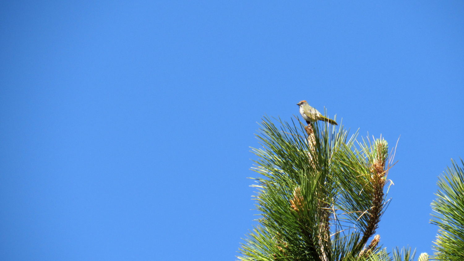
In addition to bucket list-style peak bagging, this hike features a fascinating landscape full of interesting cultural, geological, avian, and scenic highlights. Several large dry meadows and a lovely wet meadow bound by forests of Jeffrey pines characterize the landscape, and at the highest points, the ever-flexible limber pines, yogis of the natural world, oversee the vast, rippling landscape of the San Emigdo Mountains as they recede into the San Joaquin Valley. Late spring brings a number of wildflowers, and the extremely lucky may possibly spot a California condor soaring high above from the Condor Observation Site.


Start from the large parking area that serves the Mt. Pinos Nordic Area and several other trails radiating from this hub. An access road climbs away from the west side of the lot. Just before the road bends to the west, look off to the right and spy a wet meadow glistening in the high altitude sunshine. You can split off from the main road to approach the edge of the meadow so as to observe the spring wildflowers or simply to marvel that enough water exists in this dry environment to support such a natural feature.


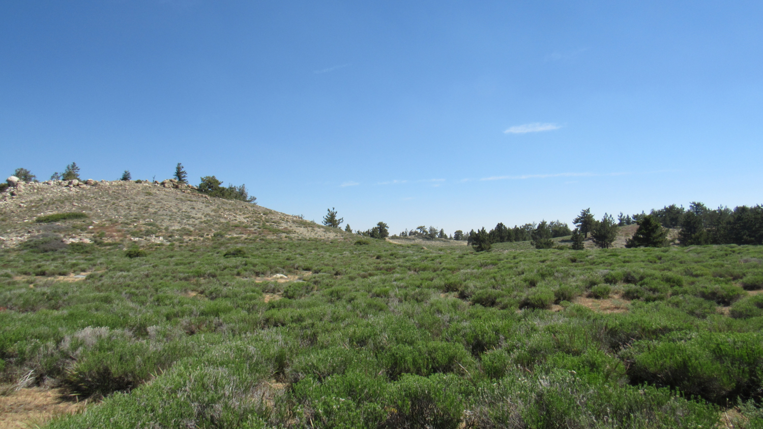
Otherwise, follow the road west into Jeffrey pine forest on a gentle incline. After .9 mile, the road leaves the cover of the forest as it reaches the first of several large, dry meadows. A side road branches off to the north to a knob overlooking the San Joaquin Valley (or at least its persistent smog cover).

Continue generally west across the open, sunny dry meadow. During May and June, this meadow may be dotted with a variety of wildflowers. Scattered pines dot the meadow here and there. The radio towers atop Mount Pinos comes into view before long, providing visual confirmation of your first target. You will reach Mount Pinos after dipping back into the forest at 1.5 miles and coming out again .1 mile later. An access road splits off on the right to lead to the summit.

As summits go, Mount Pinos is a bit of an anti-climax. The peak itself is round and indistinct, and much of the view is dominated by radar antennae. Additionally, there are far more interesting views from the Condor Observation Site about a quarter-mile east, which is only a few feet lower than the peak itself. However, you cannot consider the peak bagged if you don’t fart around on it for a least a few minutes.

Anti-climax or not, Mount Pinos once occupied a central spot in the imagination of the Chumash Indians, after whom the adjacent wilderness area is named. When I say central, I mean it literally: The Chumash believed that Mount Pinos, which they called Ihihinmu, was the actual center of the universe, and as such they held it sacred. The presence of the radio antennae on its summit draws a contemplative contrast between modern man and the Chumash. Modern man sees the peak as a convenient high point with open site lines. The Chumash saw themselves as a small part of a universe with the peak at the center.

Once you’ve done your due diligence by tucking Mount Pinos into your back pocket (an eminently modern approach to Mount Pinos), return to the main road and continue heading west toward the Condor Observation Site. From this point, you can see more of the view that you were enjoying from Mount Pinos, but with a greater expanse of view to the south, including Pine Mountain, the Sespe River watershed, and the heights of the Sespe Condor Sanctuary.

The road ends here, but the single track Vincent Tunamait Trail, named in honor of a Chumash elder statesman, leading to Sawmill Mountain begins at the Observation Site. After you find the trail, follow it downhill as it switchbacks toward the saddle connecting Mount Pinos and Sawmill Mountain. Initially, the descent, which crosses into the Chumash Wildernes, is initially pretty easy. At 2.6 miles, the trail loses its patient with the slow and steady approach and drops down a steep, rocky, and sometimes slippery hillside like its got places to be before resettling itself on a more moderate grade along the spine of the saddle. Take a look back; you get to climb back up that descent, which is the primary reason for this hike’s Moderate-Difficult rating.

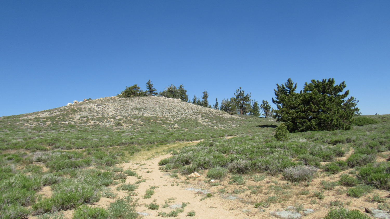
After a brief stretch of flat walking, the climb resumes as you approach the gently swelling summit of Sawmill Mountain. At 3.5 miles, an unmarked spur trail branches off from the main trail, leading away on the right. Follow this spur for .2 mile toward a massive cairn that marks the summit. The views here aren’t quite as good as the Condor Observation Site, partially because of a few trees obscuring the line of sight. This summit feels much more like a typical peak-bagging experience than Mount Pinos, though, and the wild country to the west and north may inspire you to continue your hike.


If you do have the stamina, you can continue west along the Vincent Tunamait Trail past a junction leading downhill toward a spring and Sheep Camp toward a spur trail heading south to 8,512’ Grouse Mountain. This point is not as high as Sawmill Mountain, but its views are just as good.
Tags: Chumash Wilderness, Kern County, Los Padres National Forest, Mount Pinos, Mount Pinos Recreation Area, Sawmill Mountain, snowshoe, Ventura County, Vincent Tanamait, wildflowers