Distance (round-trip)
4.5 mi
Time
2.5 hrs
Elevation Gain
925 ft
Season
Spring
Summer
Fall
Winter
Weather
–
4.5 mi
2.5 hrs
925 ft
Spring
Summer
Fall
Winter
–
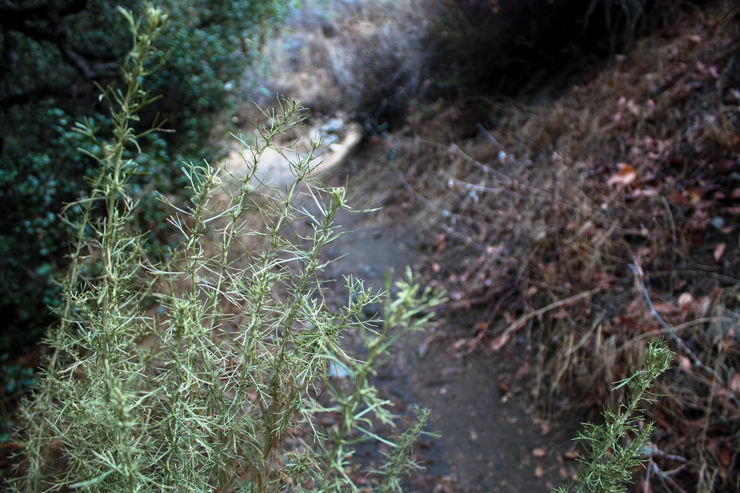
If you’re looking for a trail with a bit of that “off the beaten path” feel but still wouldn’t mind keeping an eye on civilization from its vista points, the La Tuna Canyon Trail is a good bet. This meandering 4.3 mile trail provides some decent elevation gain in sections and a surprising variety of scenery — from deep, shaded riparian canyons to thick sage scrub and exposed ridgelines. You’ll have great views of the nearby cities and mountains on clear days, lots of fragrant sages to keep you company along the way, and you’ll also pass the remnants of a few rusted out old cars deep in the canyons!
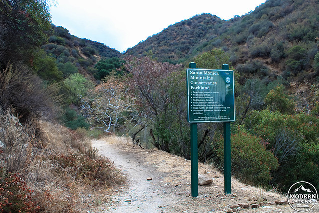
Begin your hike at an odd-looking turn off on the south side of La Tuna Canyon Road. It’s easy to miss the green sign marking the trailhead and its rules from the road, but once you’re out on foot it should be pretty clearly in sight.
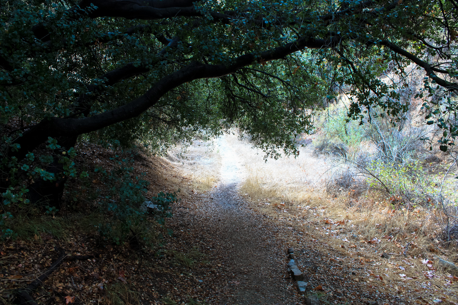
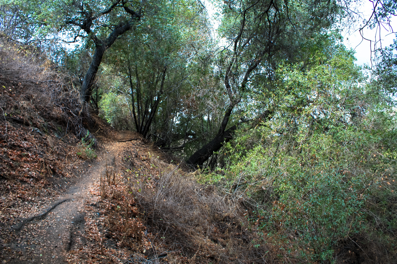
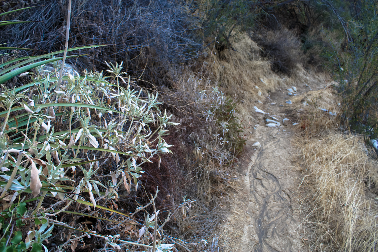
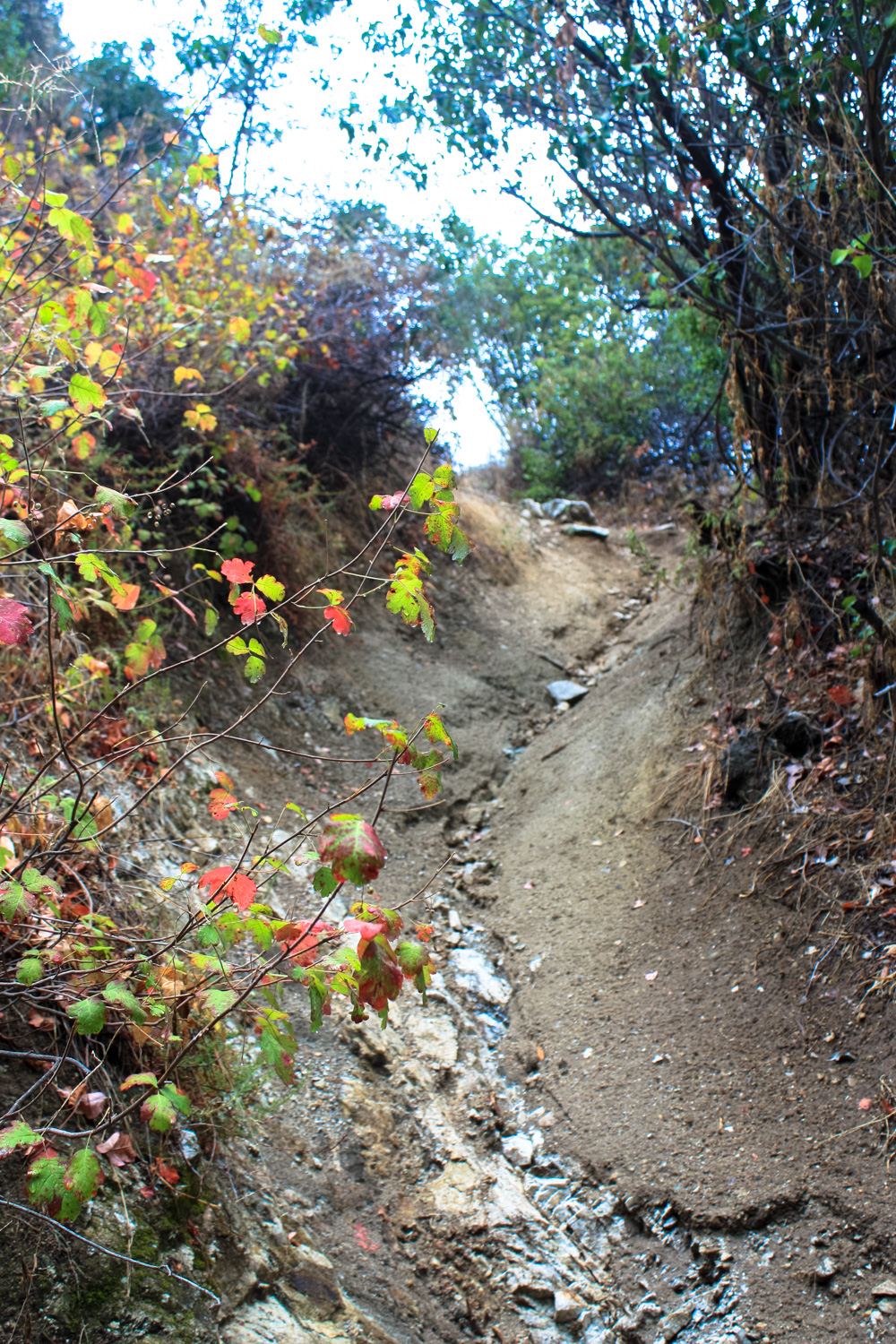
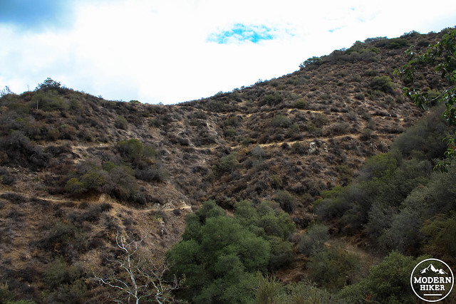
The trail starts some sharp and moderately steep switchbacks almost immediately. Be on the look out for some trail erosion caused by cutting switchbacks (and possibly exacerbated by winter rainfall) on your way up. You’ll be seeing a lot of the same scenery for the first mile as the route doubles back on itself numerous times.
Remember: Don’t cut the switchbacks.
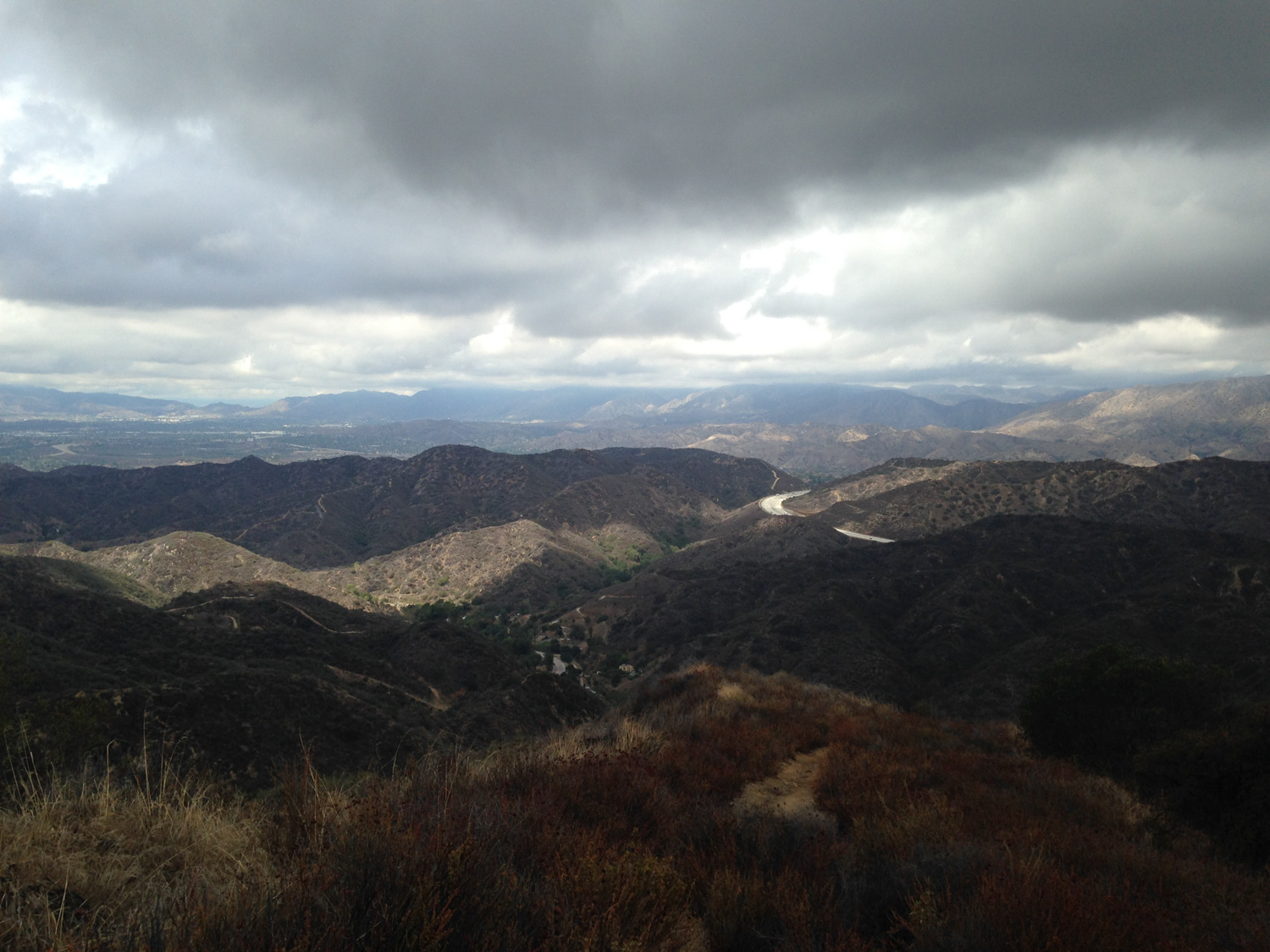
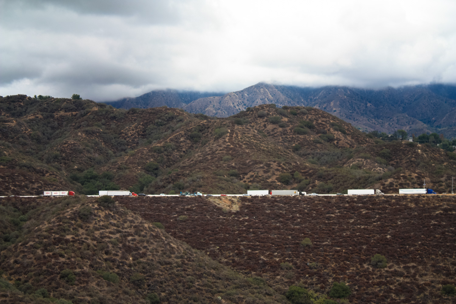
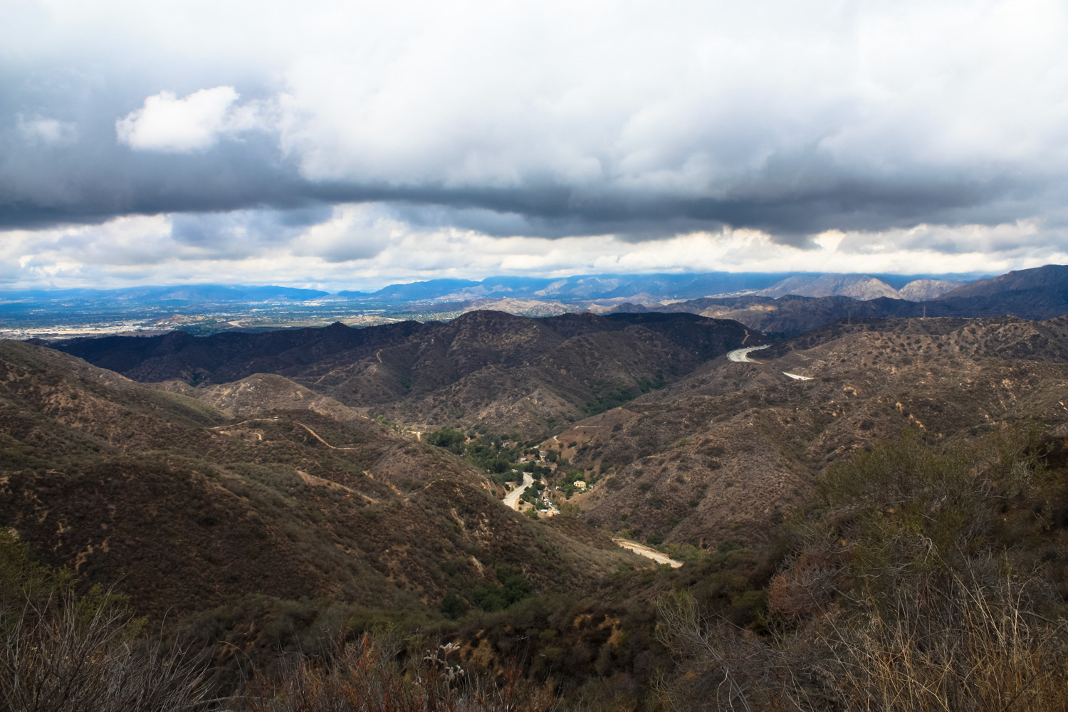
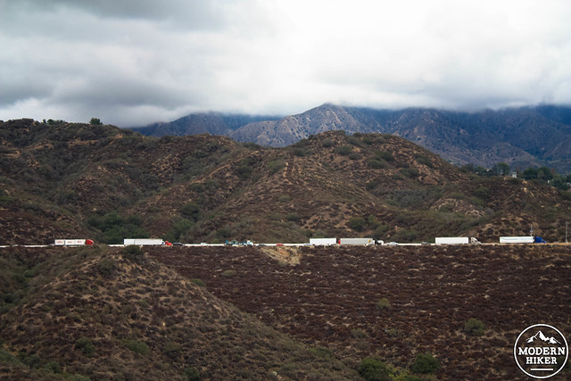
By 0.8 miles the trail makes a sharp turn to the east, traversing a narrow (but safe) stretch of trail paralleling La Tuna Canyon Road. The 210 and (cloud cover willing) the San Gabriels are in sight from here as well, giving you the chance to get some odd photos of lines of cars waiting to make their way through what otherwise looks like a rugged wilderness area.
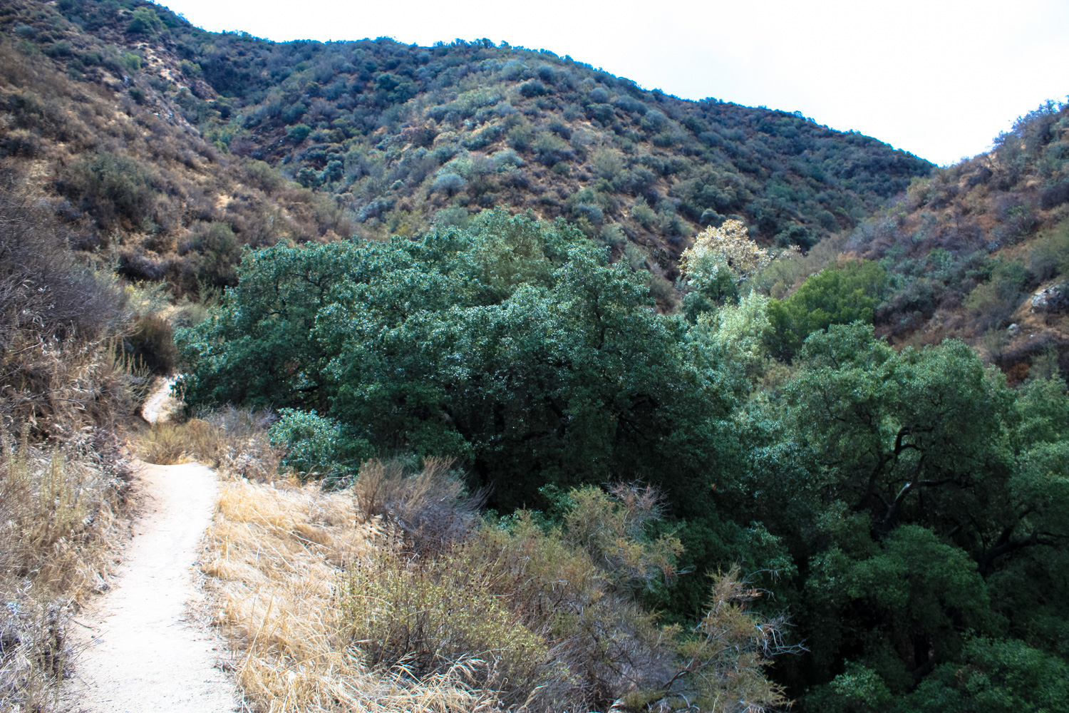
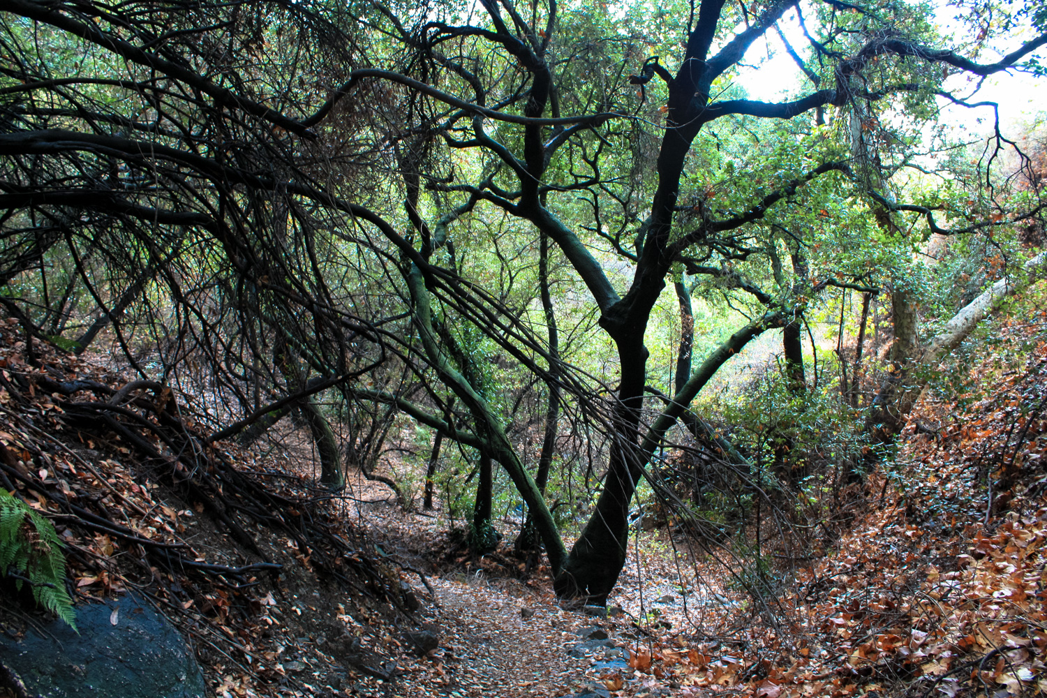
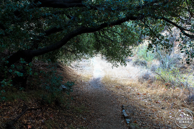
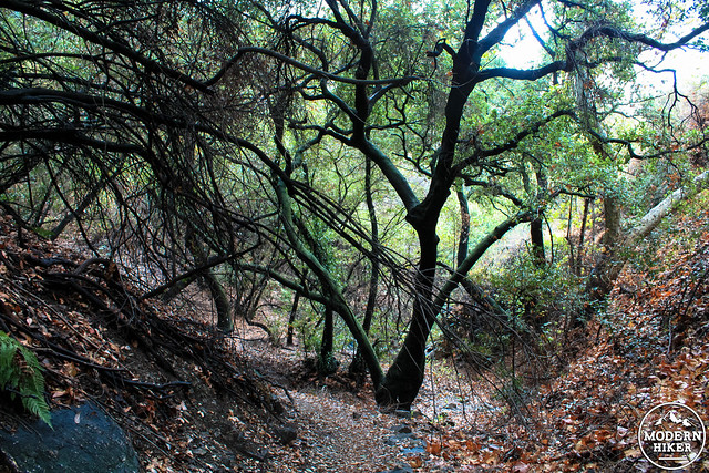
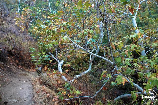
At about 1.2 miles, ignore the use trail to the left, which will head back to La Tuna Canyon Road. The trail crosses the canyon’s arroyo bed and hugs its eastern bank, taking you through a small but beautiful grove of oak and sycamore trees (put this on your foliage list when the temperatures drop!).
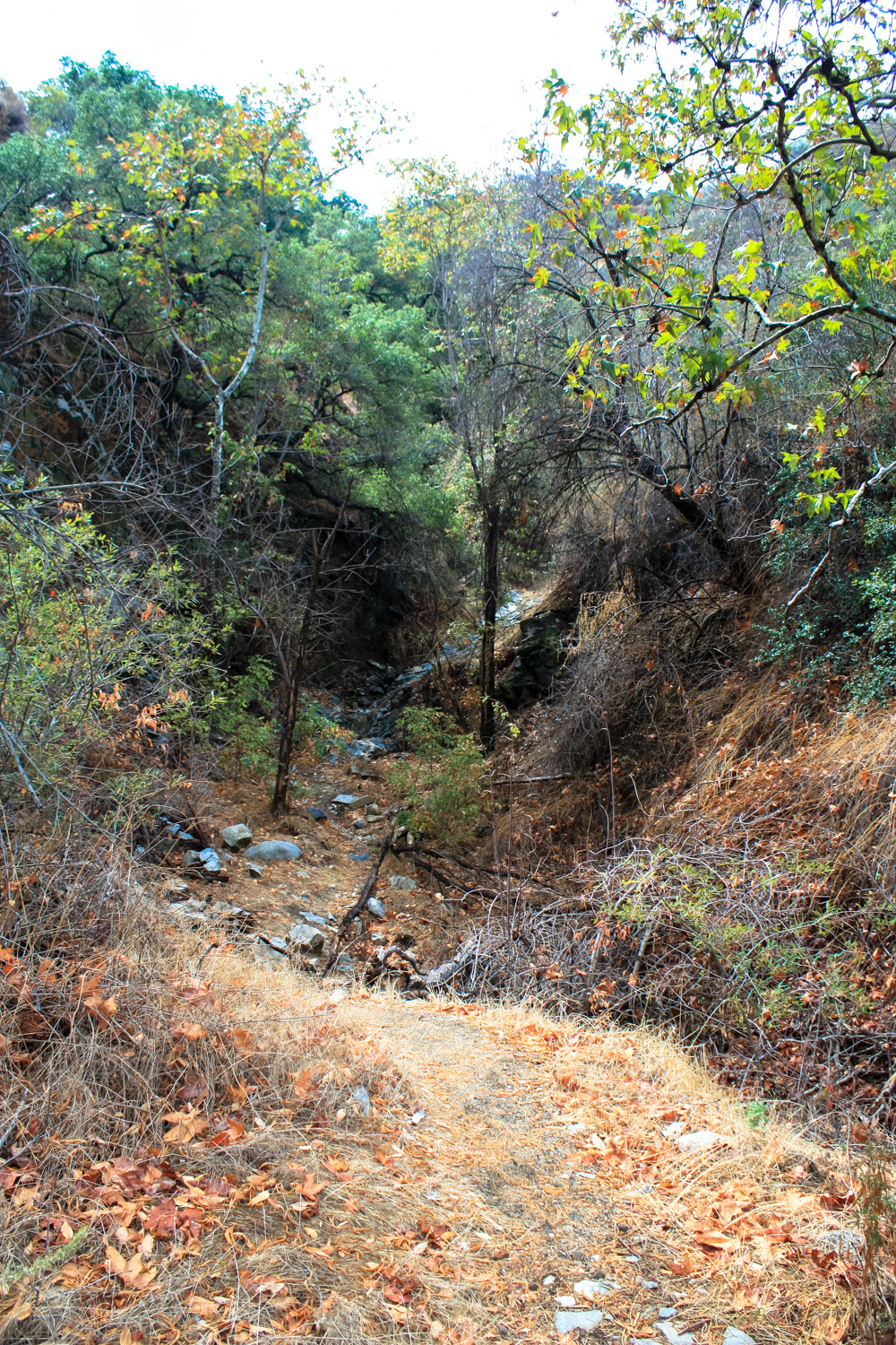
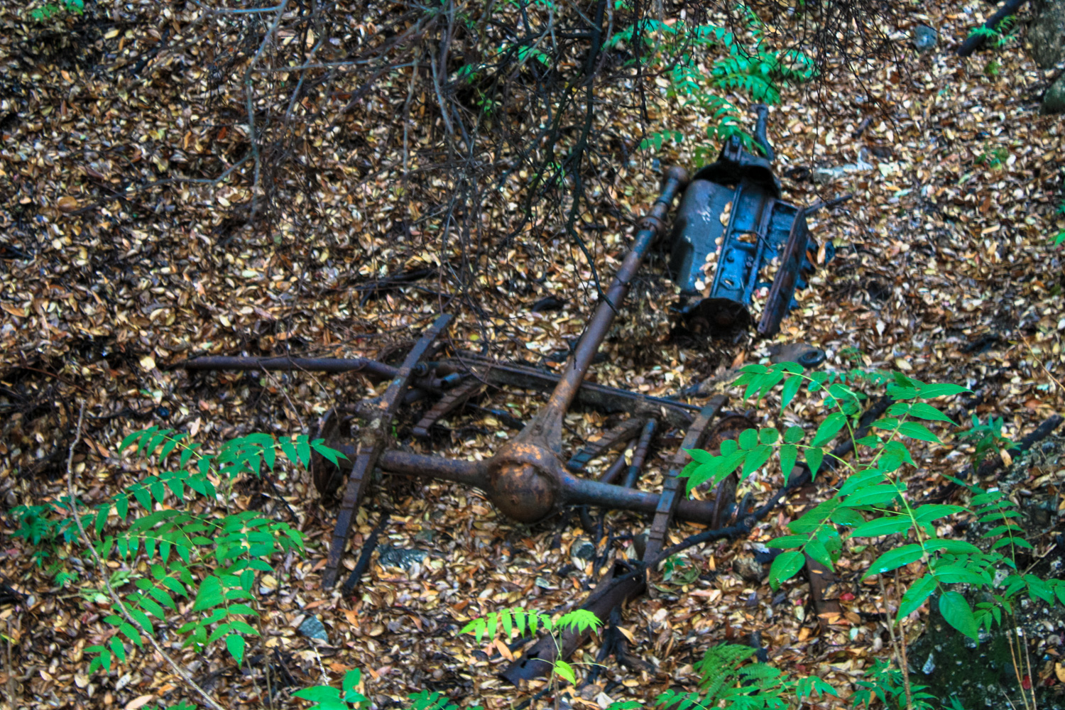
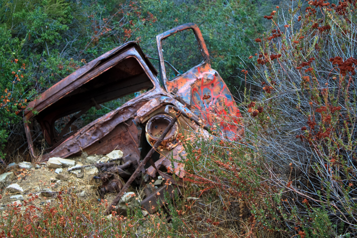
Keen eyes will be able to spot what appear to be the remnants of a small vehicle’s chassis near mile 1.5 just before a the steep incline kicks into gear again. Just around the corner, though, is an even better photo op:
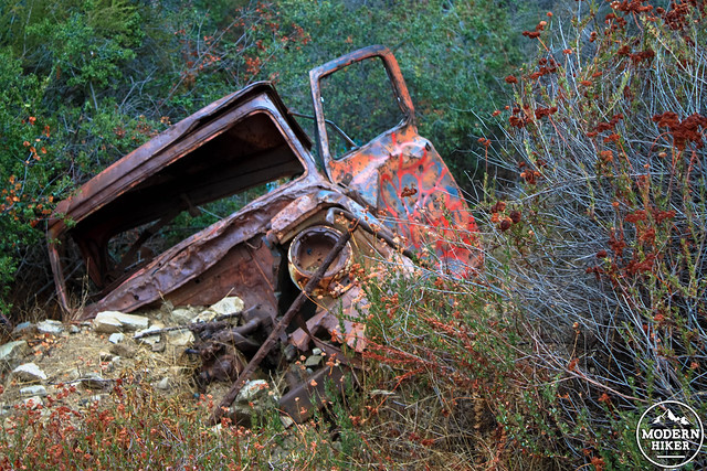
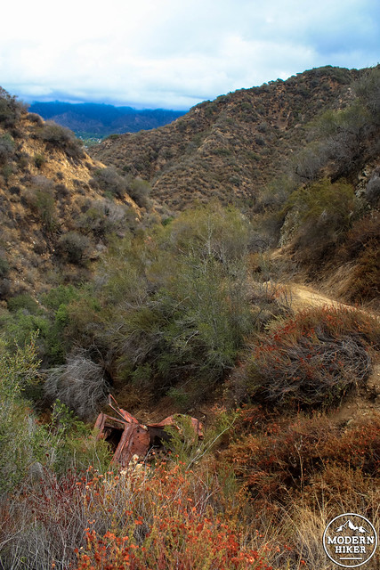
I wasn’t able to dig up any information on how this truck ended up here – but an educated guess would be that it fell off the wider fire roads on the Verdugos and was brought to its current location by erosion and some good winter rains. Maybe in a few more years, it’ll make it down to the canyon floor completely.
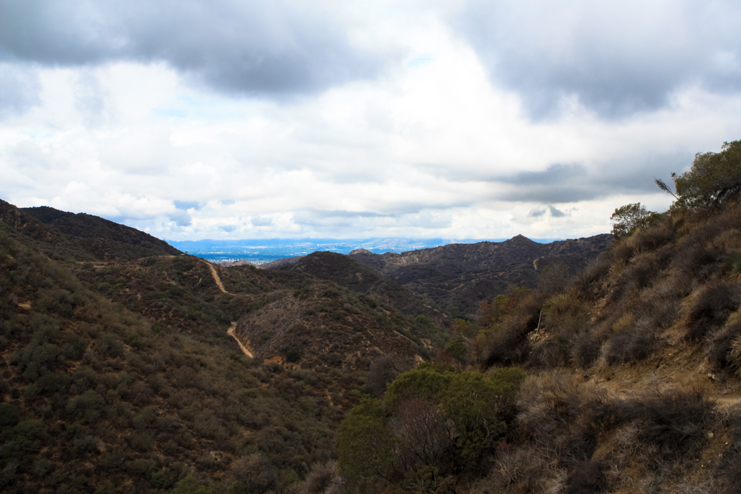
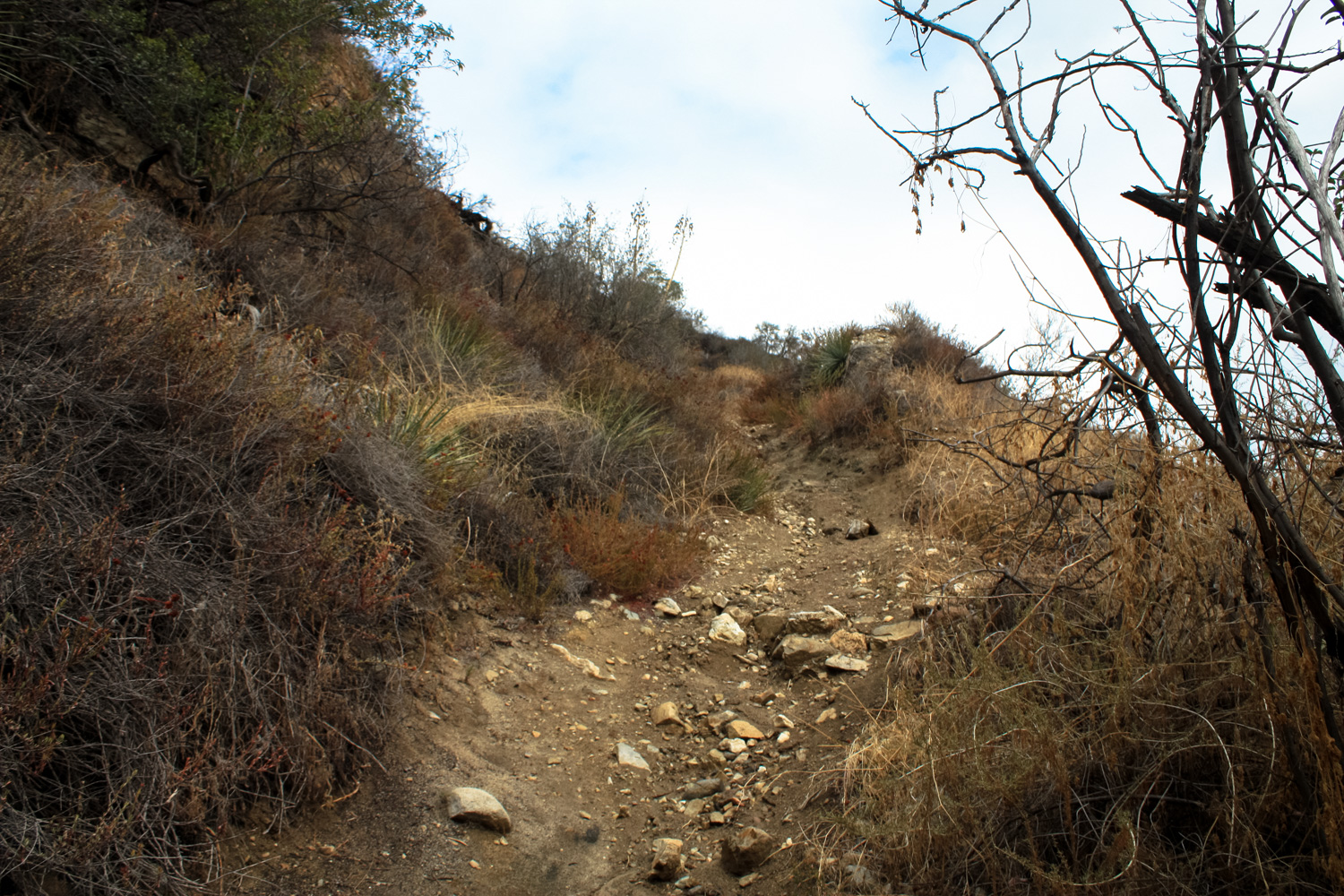
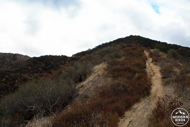
From here, the trail picks up some noticeable incline. The steepest section is just before 1.8 miles, where the trail ends at a ridgeline firebreak. To the north, adventurous types could bushwhack through a rough use trail and descend a very steep and slippery firebreak on the return trip. To complete this route, head south along the ridge, enjoying the unfolding views of the mountains and San Fernando Valley around you on the way up.
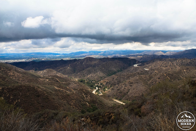
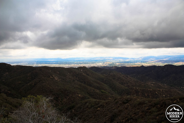
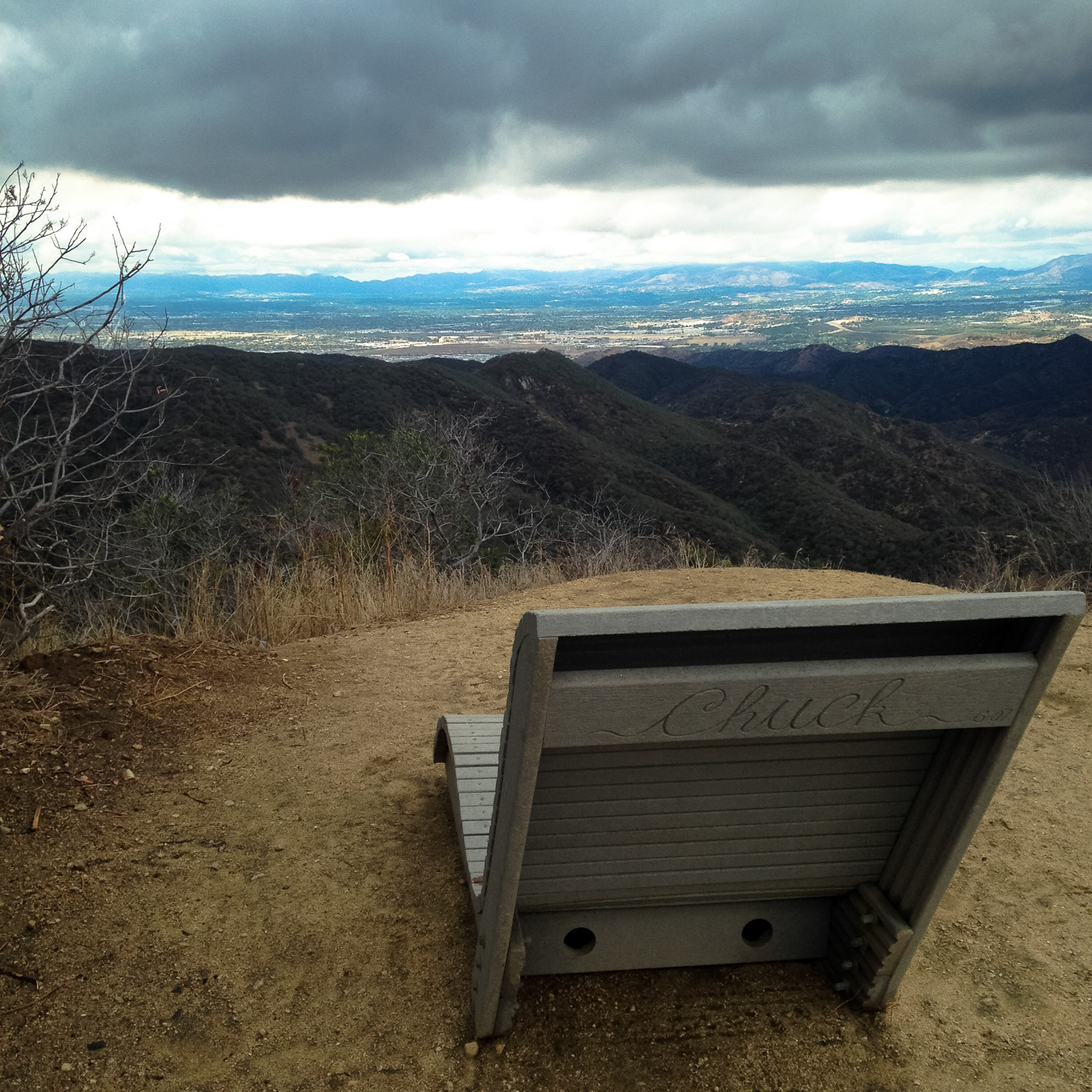
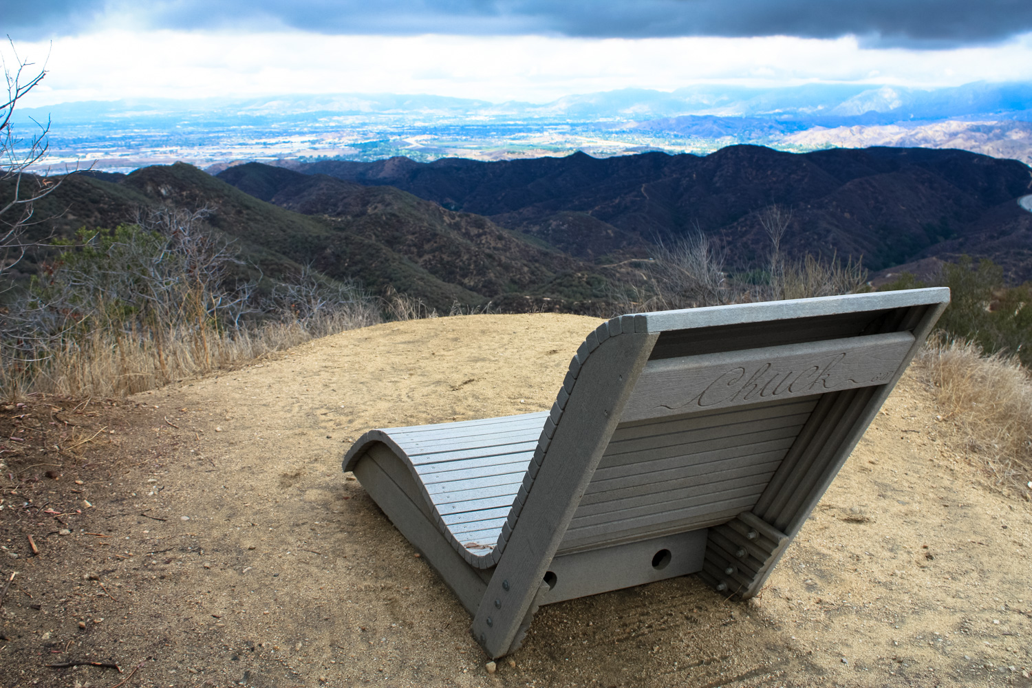
At the 2.1 mile mark, a well-positioned lounge chair looks out over the distant sprawl – a fantastic place to enjoy some peace and quiet (and maybe a lunch) before heading back the way you came in.
Good. The trail is moderately eroded in a few places and some use trails make the route potentially confusing, but for the most part this is easy to follow.
The nondescript trailhead is on the southern side of La Tuna Canyon Road in Sun Valley, just east of the 210 freeway. From the 210, take exit 14 (La Tuna Canyon Road) and travel west for 1.4 miles. From the 5, take exit 150B (Sunland Blvd) and head north. In 0.8 miles, turn right onto La Tuna Canyon Road and continue for 3.3 miles. There is a small pull-out on the south side of the road for parking and a green sign marking the trailhead.
11 Comments
Ooh, good catch.
The trail guide as described enters through an MRCA parkland trailhead. Please try to stick to this route and keep off private property nearby. As users of public lands, it's important that we respect those who live near the places we love to hike ... who knows? That landowner may be in talks to donate land or set up an easement for hiker access, and we wouldn't want to give them a reason not to do that! :)
It sounds like you're trying to cut through 8633 La Tuna Canyon Rd, a private residence that owns the lot at the end of the road. Though it might not be sightly, the land-owners have their right to use their property, including passthrough. It may seem selfish, but am not sure if we should expect the land owners to accommodate strangers cutting through their property.
I was trying today to access the wildwood trailhead at the round house at 8618 La Tuna Canyon Rd. Tried several approaches and ended up on a high ridge looking down to try to see where to access the trail. Was shocked to see a homestead behind a locked gate with a hugh junk yard and rusting vehicles filling up every inch of the canyon and blocking everyone from hiking this beautiful 2 mile trail up to the Verdugo Motorway. This is a health hazard and a selfish act of keeping people from enjoying this part of the Verdugos !
I can't believe that the city would allow this travesty to go on !
This trail was heavily damaged in the La Tuna Canyon Fire of 2017. To my knowledge, no major trail work has been done to repair these routes since then. I've been on the south end of the fire's burn area and the trails are in good shape but haven't been back in La Tuna Canyon itself since then. Expect this route to be pretty messy even though the area is open.
Echoing what a few other hikers had to say. Went out this afternoon. Hiked well into the riverbed on no identifiable trail. Had to climb up and over a number of rock formations, finally went back to the trailhead and found a means for getting onto what we believed to be the trail you hiked, Casey. It's very hard to find at the trailhead, the riverbed is much more obvious, and also much more strenuous. Once we were on the trail the switchbacks were as described though incredible grown over. Highly recommend wearing pants rather than shorts. We hiked for quite a ways, but never found the chair :(
Went there yesterday, May 25, 2019. The good news: this is a beautiful trail, really overgrown with pretty wildflowers, we were covered in butterflies at several points. Really the most beautiful trail on the Verdugo Mountains, many other trails are bleak and sun baked. The bad: the trail is really obscure once you drop into the river bed: super overgrown, really difficult to find the path. We wasted about a half hour trying to bush wack and find our way up out of the riverbed and almost gave up. But of course, this ultimately added to the adventure. We took the shortcut straight down to the trail head rather than doing an out and back and I highly recommend that.
We came in January 2019 and the trail was open but once we reached the canyon floor the trail seemed to have been partially washed away by some of our late-2018 rains. We ended up just following some other hiker’s boot prints and blindly walked through the wide stream bed (which seemed questionable) and then climbed around guessing as to where a trail might be — at some point (maybe after the fires in 2017?) the trail overgrew on the east side. Once we finally saw a switchback above us, we went straight up, and still couldn’t tell if we were making it up until we saw the burned out trucks. It was fun but we would have given up early if those footprints weren’t there.
We found this area and the trails closed (15 Oct 2017) because of the fire.
well played :)
Here's hoping the landscape wasn't TOO badly damaged. La Tuna Canyon was a really beautiful place!
With recent wildfire damage and ongoing waves of COVID-19 infections and restrictions, National Forest, National Park, and other public land closures, restrictions, or social distancing guidelines may be in-effect.
If infection rates are on the rise, please do your best to remain local for your hikes. If you do travel, please be mindful of small gateway communities and avoid as much interaction as you can. Also remember to be extra prepared with supplies so you don't have to stop somewhere outside your local community for gas, food, or anything else.
Please be sure to contact the local land management agency BEFORE you head out, as these conditions are likely to change without enough notice for us to fully stay on top of them. Thanks, and stay safe!
Click here to read the current CDC guidelines for traveling during the COVID-19 pandemic.