If you’ve ever devoted a substantial period of time to your television set, you may have at one point become familiar with those happy cows who claim to hail from California. These contented, conversing cattle would graze on impossibly verdant hillsides, chewing the cud while doing their best to give Wisconsin an inferiority complex. Anybody with an ounce of skepticism knows that there is no such iconic pasture with gently rolling hills, blissful bovines, and shady trees. For one, the only truly happy cows are owned by vegan animal rights activists. For seconds. . . well, it’s not for a hiking blog to discuss how and where cows really live.

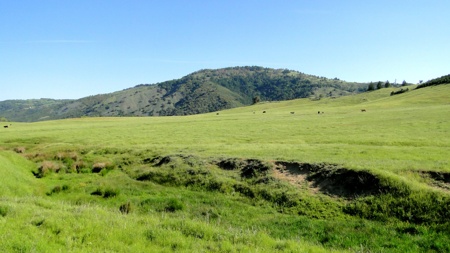
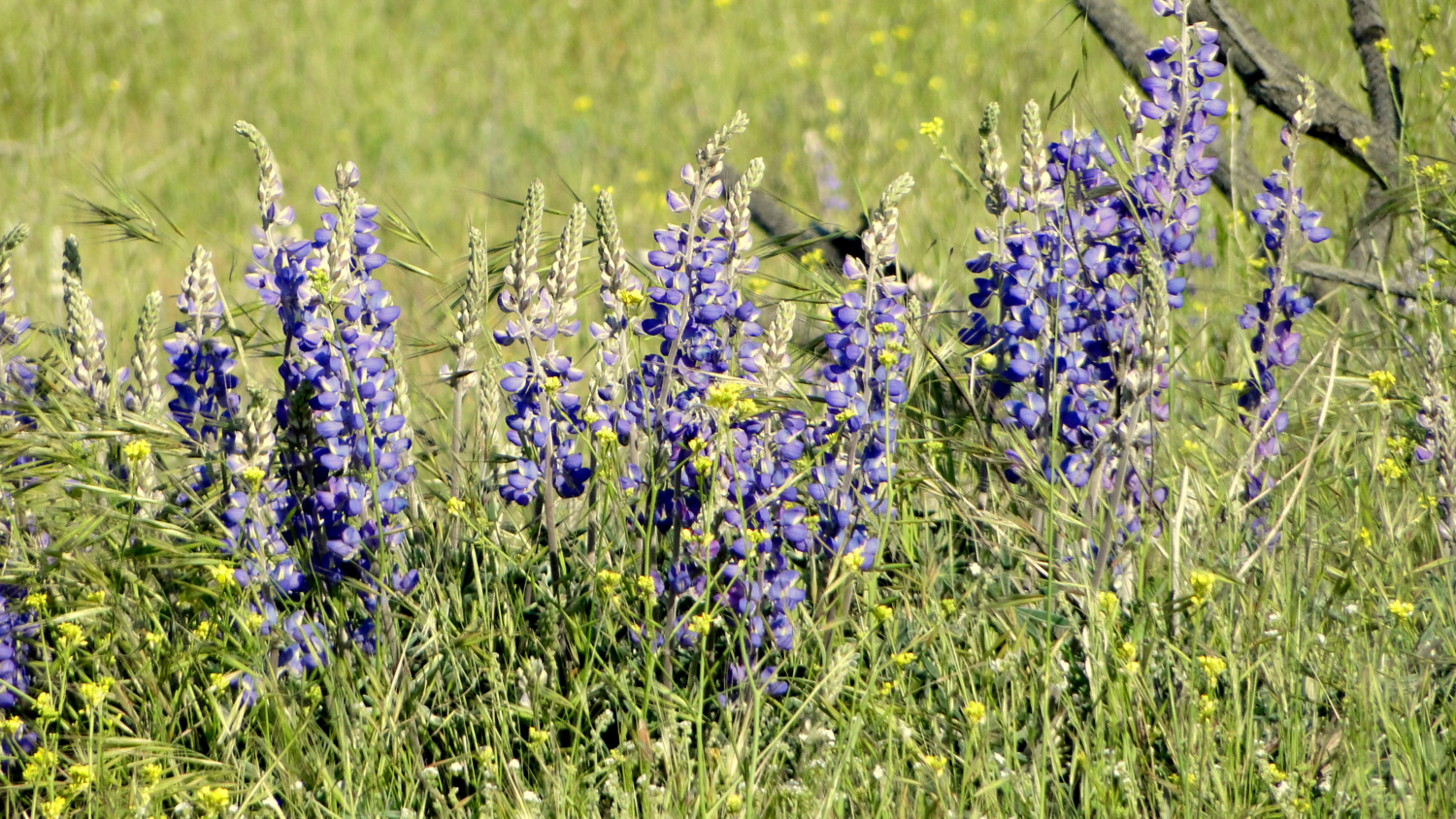
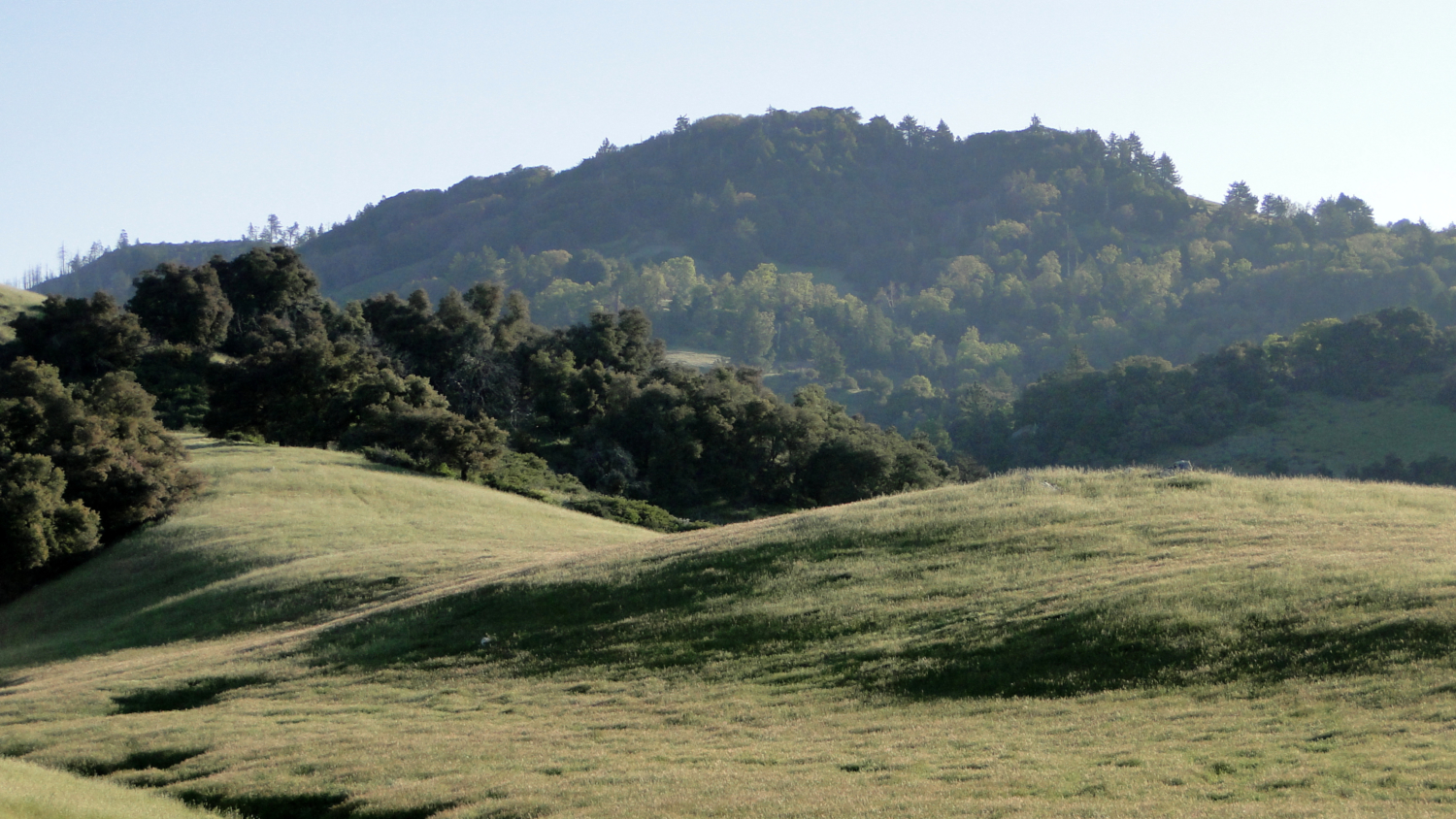
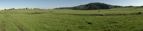
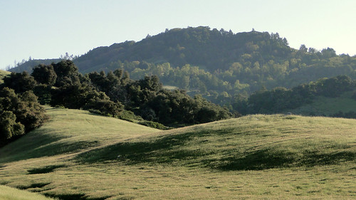
Except, it is true! I found where they live. The contented cows of California live on Kanaka Flat, a gorgeous, rolling mesa contained within the Santa Ysabel Open Space Preserve north of the town of Julian. Granted, I think they still end up being hamburgers, but for the duration of their life, they stroll blissfully over gently sloping, grassy hillsides dotted with wildflowers during the spring. Santa Ysabel Creek runs through the shallow valley below the flat, while the flat itself recalls Montana’s Big Sky Country. A moderate lollipop loop allows the hiker to enjoy the iconic pastoral scenery (and earn that slice of Julian pie on the way out of town).
Purchased in 2001 by the Nature Conservancy, Santa Ysabel Preserve is part of the San Dieguito River Park, which is part of San Diego County’s ambition to preserve this watershed and simultaneously provide a coast-to-crest multi-use trail connecting the San Dieguito Lagoon in Del Mar with the summit of Volcan Mountain just north of Julian. The completed trail has not come to fruition yet, although one very long stretch exists from Lake Hodges to the Wild Animal Park in Escondido. Ambitions aside, the decision and ability to preserve this park was a fortunate one, as this landscape was one of the few in this region that mostly escaped the wrath of the 2003 Cedar Fire.
The recent date of purchase for this land means cattle come with the package, as their liberty to graze this property has been grandfathered into the agreement. This can either be a lot of fun or surprisingly nerve-wracking. I advise caution when hiking near and around cows. They are generally docile, but they remain massive and irritable when provoked. While much hay is made about the dangers of mountain lions, you are far more likely to get attacked by a bovine. Consider this: there have been fifteen recorded mountain lion attacks in California since 1986 (!), including three fatalities. Meanwhile, the U.S. Department of Labor estimates that cows kill about 22 people per year. So, be very careful when approaching cows.
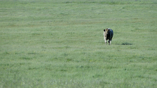
Now that I’ve got you totally pumped up about sharing the trail with a bunch of rabid, rampaging ruminants, know that the cows will do nothing but stare at you dully so long as you keep a respectful distance However, if you find it nerve-wracking to walk through herds of cows who will stare unabashedly at you as you pass, this trail may not be for you.
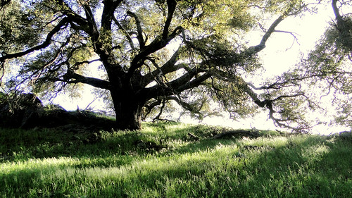
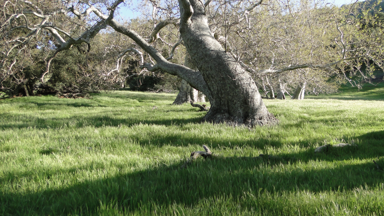
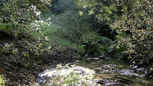
To enjoy this beautiful landscape, start at the staging area on Farmer Road, just north of Julian. Exit the parking lot through a pipe gate and follow the wide fire road as it undulates gently through a modest canyon carved out by Santa Ysabel Creek, which bubbles along within ear shot. As you make your way, you’ll see a number of stately sycamores standing off on their own. Interpretive signs tell you about this broadleaf deciduous tree common to Southern California. Further along, the trail dives in and out of the shade of oak trees as it approaches and recedes away from the creek bed before it comes to a crossing of the actual creek.
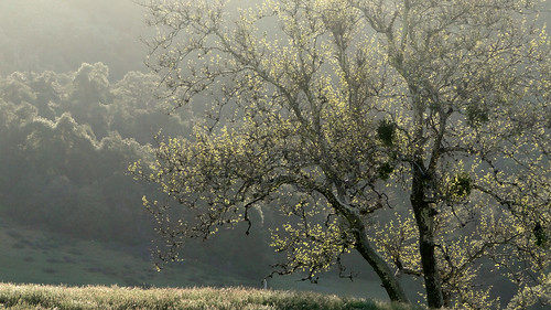
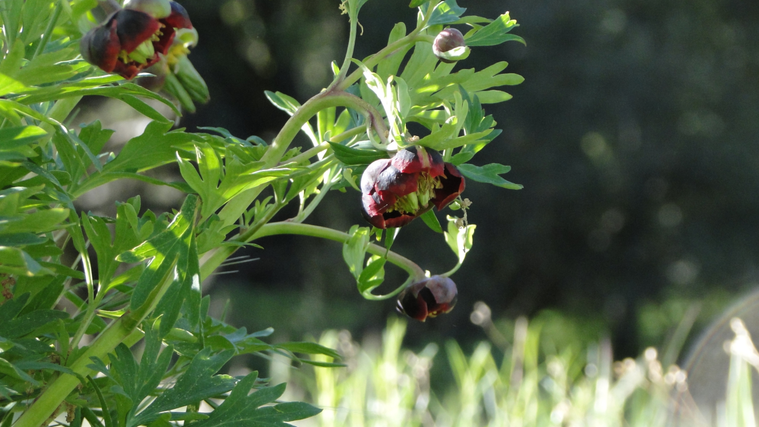
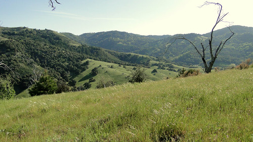
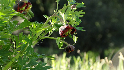
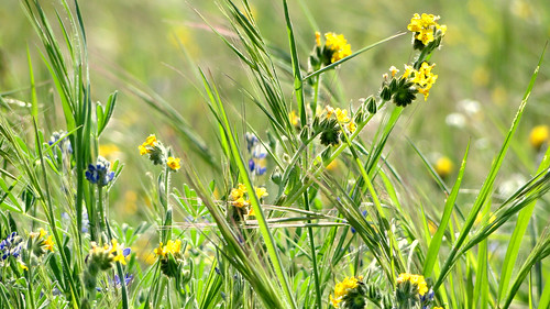
A picnic bench lays waiting for you at this creek crossing, and it is both a great spot for a picnic and a great spot to turn around if you’re looking for a brief stroll instead of the more strenuous effort of completing the full hike. Keep this in mind because beyond the creek, the trail begins a no nonsense ascent up to Kanaka Flat. Springtime visitors might spy patches of wild peonies nodding their heads in the shade of spreading black oaks. Views begin to open up as you rise, with the dark Volcan Mountains dominating the scene while glimpses of Palomar and the coast open up north and west, respectively.
Soon, you reach the expansive flat stretching out in grassy splendor on all sides. If you didn’t see any cows before, you are almost guaranteed to see them up here. You’ll reach a junction in which you can go left or right. This choice is more philosophical than functional – going left means getting the climb over with right away while going right means postponing the inevitable. I predict you will turn right, in which case follow the trail up through a charred woodland of Coulter pines burnt during the catastrophic Cedar Fire.
After huffing your way up a ridge on the east end of the flat, you’ll dip back down along the edge of private property and then climb back up again to the south side of the flat. Here, you’ll approach a holding pen for the cattle. Many of the cattle congregate here as there’s generally water present at a nearby trough. Pick your way calmly and respectfully through the cattle while enjoying the image of wide grasslands melting into forested slopes and clear, blue skies, possibly painted with wispy cirrus clouds.
When you reach the junction where you took the left turn earlier, ignore another trail branching off to the left, which will take you down a steep hill and deposit you far away from your car. After returning to the junction, it’s back down to the creek, where that picnic bench is waiting faithfully to offer you a break. From here, it’s a simple and pleasant walk back to the staging area.
Some things to know:
– Santa Ysabel Open Space Preserve is usually closed after significant rain events to prevent rain erosion. Should you wish to hike here after a rain storm, contact the park at (760) 765-4098 to determine whether it’s open.
– There are two other trailheads into Santa Ysabel Open Space Preserve. It becomes even more confusing when you consider that the Preserve is divided into two parcels several miles apart. Be clear that this is the eastern preserve, and that the trailhead is on Farmer Road, not Highway 79.
– The town of Julian, rich with mining history and hot, gooey slabs of apple pie, is a short drive away, should you be seeking a leisurely saunter down the high street in order to replace all of those calories you so dutifully burnt off with a slice of hot dutch crumb apple pie slathered with caramel sauce and vanilla ice cream. Twist your arm, right?
Updated and 1st Revision: 3/19/2018
Tags: Coast-to-Crest Trail, Hiking, Julian, Kanaka Flat, San Diego County, San Diego COunty Open Space Presere, San Dieguito River Park, Santa Ysabel Open Space Preserve, Trail Write-Ups, wildflowers