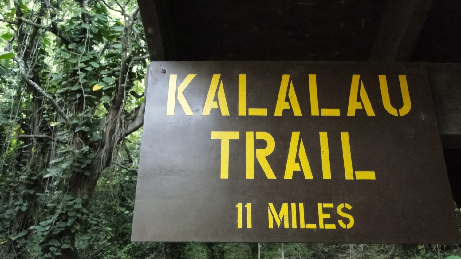
The best way to get a taste of the Na Pali Coast’s legendary beauty is not to pay hundreds of dollars for a helicopter ride. Nor is it to pay slightly less to take a boat ride with 50 strangers up and down the coast. The best way to see Kauai’s stunning north shore is to step onto the Kalalau Trail.
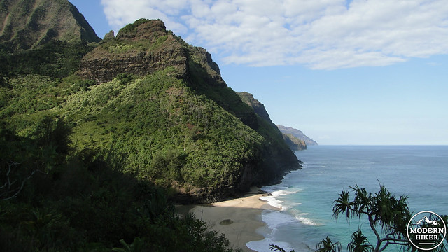
This beautifully engineered, 11-mile trail alternates between climbs along the faces of precipitous cliffs and descents and re-ascents into and out of spectacular valleys. The full Kalalau Trail is often spoken of as Hawaii’s best hiking experience, although one does not have to take the full multi-day route in order to sample its charms. This 8-mile out-and-back route features views of verdant, sheer cliffs marching out to the horizon as well as a trip into Hanakapi’ai Valley to visit the eponymous, 500-foot waterfall.
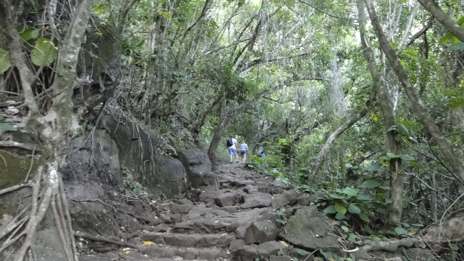
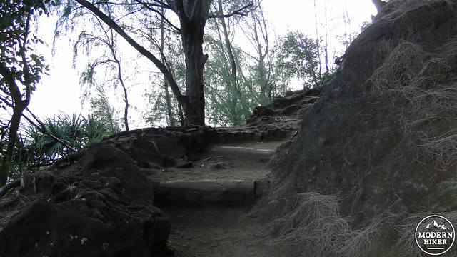
Although the trail rarely reaches elevations greater than 500′, accumulated elevation gains on the Kalalau Trail often achieve surprising numbers. This is due to the undulating nature of the trail; the lack of easy terrain has caused trail builders to follow whichever patch of land will actually support the trail, and the trail sometimes dips and rises in ways that may seem unnecessary but for the fact that the land often vanishes abruptly in vertical drops. Additionally, warm temperatures and high humidity often tax hikers a bit faster than climates elsewhere. Proper hydration and sun protection are crucial elements essential for a successful hike. Bring a lot of water and a lot of sunscreen. For these reasons, we rate this trail as more difficult than the statistics suggest.
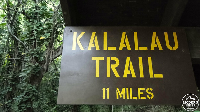
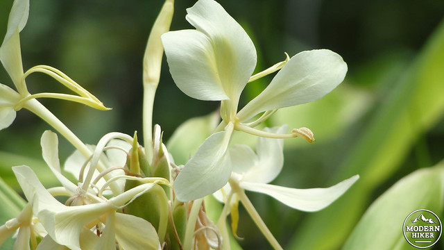
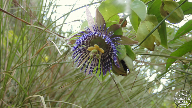
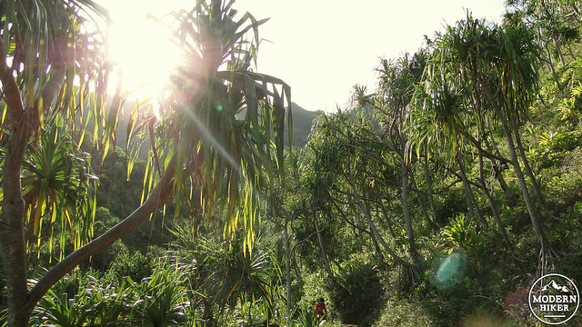
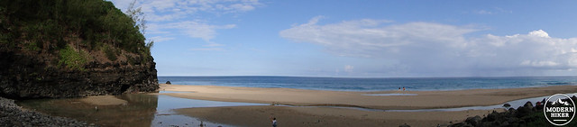
The trail begins at the end of State Route 560 just past the village of Wainiha. Where the trail ends, you will find a small lot with street parking that continues for some distance west from the road’s end. Access to nearby Ke’e Beach from the trailhead provides an opportunity to cool down in the silky waters of the tropical Pacific after the hike. Once you find the trail, commence a climb up a rough path through a dense rain forest that is rich with exotic sounds, colors, and scents.
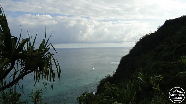
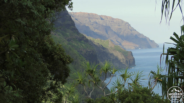
After the initial climb, the trail will emerge into a section with open lines of sight north and west. Looking west, you’ll see a line of cliffs coated in vivid green vegetation stretching out for several miles. These cliffs and the valleys between them have been featured in the Jurassic Park films, usually in establishing shots where the Na Pali Coast doubles as the fictional island of Isla Nublar. You won’t see any velociraptors here, but you are likely to catch glimpses of feral cats prowling the jungle within Hanakapi’ai valley.
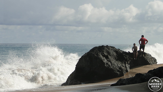
The trail undulates over ridges and into gullies while dipping in and out of dense vegetation for two miles before switchbacking sharply down to the floor of Hanakapi’ai Valley. The trail bottoms out alongside a creek, and a side trail leads down to a secluded cove and beach with some shallow sea caves. As tempting as the water may look, it’s best to avoid swimming here as the surf and current can be powerful, especially in the winter time.
After exploring the beach, return back to the Kalalau Trail, and cross Hanakapi’ai Creek. As you approach the creek, remember that the highlands above this valley are among some of the rainiest places in the world. Although the creek is usually tranquil and there are plenty of places to rock-hop across, occasional flash floods can make crossing treacherous. If you wish to cross the creek from either direction, and the water is high, just wait for a bit and the water will soon begin to recede back to safe levels.
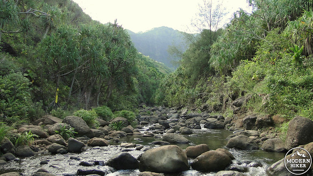
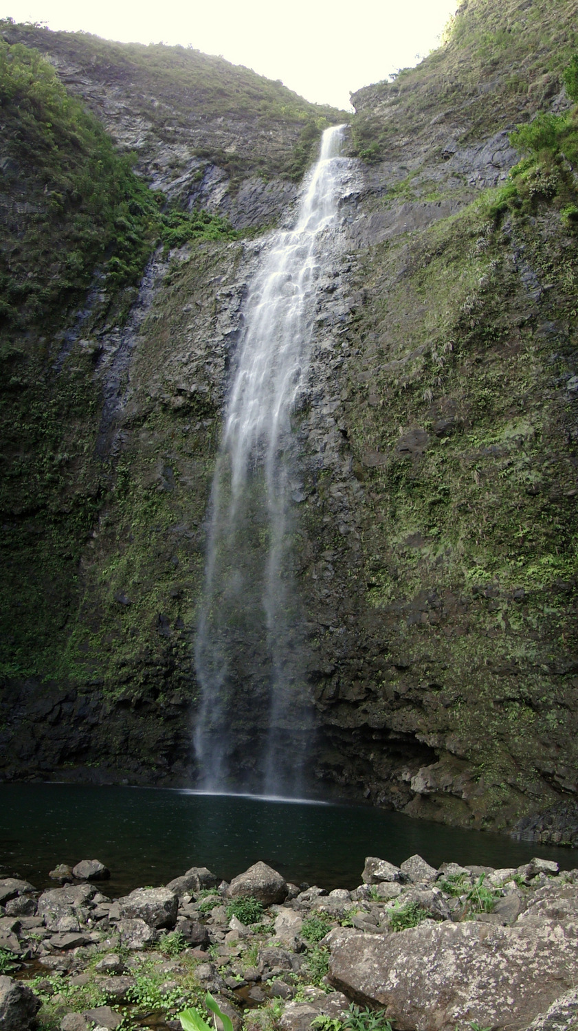
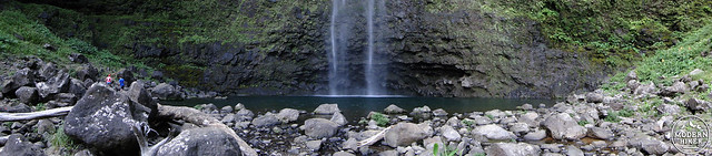
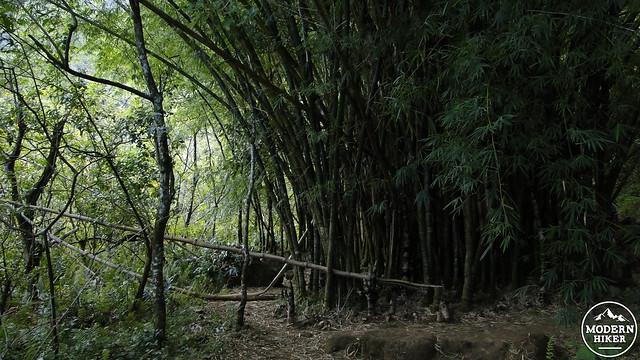
Once on the west side of the creek, find a trail that turns left to head south into Hanakapi’ai Valley. The trail immediately plunges into the deep shade of tropical rain forest, passing a series of often-occupied campsites just beyond the junction. The narrow trail, with its numerous twists, turns, and minor obstacles is terrific fun to hike. At times, you’ll pass through an enchanting rain-forest while at other times the trail approaches the creek illuminated by brilliant patches of sunlight. At 3.5 miles, a break in the rain forest canopy reveals your first sight of the falls tumbling out of a crevasse in a feathery, white ribbon.
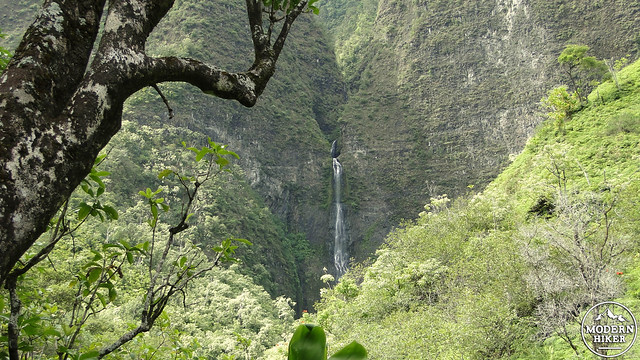
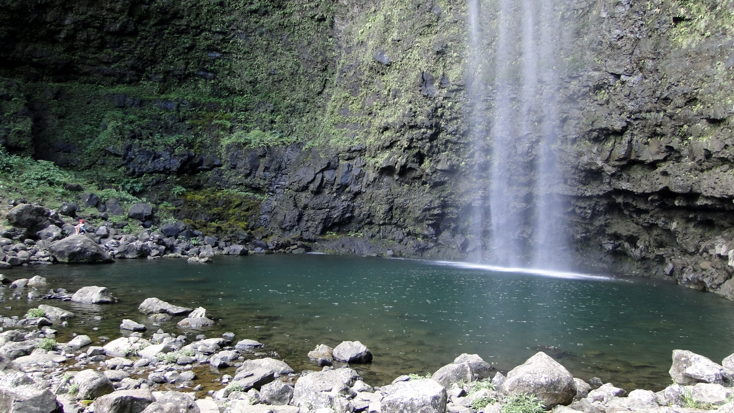
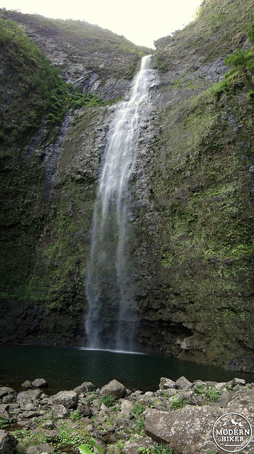
At 4 miles, the trail leaves the rain forest and enters an amphitheatre-like grotto. Hanakapi’ai falls lies directly in front of you. The water tumbles 500′ (not 1000′ as commonly reported, which includes obscured cascades further upstream) into a wide pool. You can walk up to the water’s edge and even slip into the cold, opaque pool for a swim, or you can find a quiet vantage point to enjoy the gentle rumble of the falls echoing throughout the grotto. You won’t be alone at this wild, semi-secluded spot, but the beauty is so overwhelming that you will struggle to be too bothered with the antics of other hikers. But that might just be Hawaii; it’s hard to be too bothered about anything here.
For the return trip, be sure to keep enough energy in reserve to re-visit the ups-and-downs you traversed on your way in. Having to hike the undulating terrain on both legs of the trip is part of what makes this a challenging route, especially since the temperature is likely to be a lot warmer on the way back. After much sweaty effort, you’ll soon return to the trailhead, where you can ditch the hiking boots and slide into the warm waters at Ke’e Beach.
Tags: Hanakapi'ai Falls, Hanakapi'ai Valley, Hawaiian Islands, Kalalau Trail, kauai, Na Pali Coast, Napali Coast