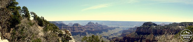
The Grand Canyon is a massive gorge carved by the Colorado River into a high plateau in Northern Arizona. This iconic landmark is perhaps the most famous natural feature in the United States, and for many hikers, a trip into the canyon is a memorable, possibly even essential experience. While there is a fine network of trails that hug the relatively cool, forested southern and northern rims, the best way to experience the canyon is to step into it. The depth to which you step in is up to your determination, time, and conditioning, but those prepared for the classic Rim-to-Rim-to-Rim route will enjoy one of the great American outdoor experiences.
The Bright Angel Trail
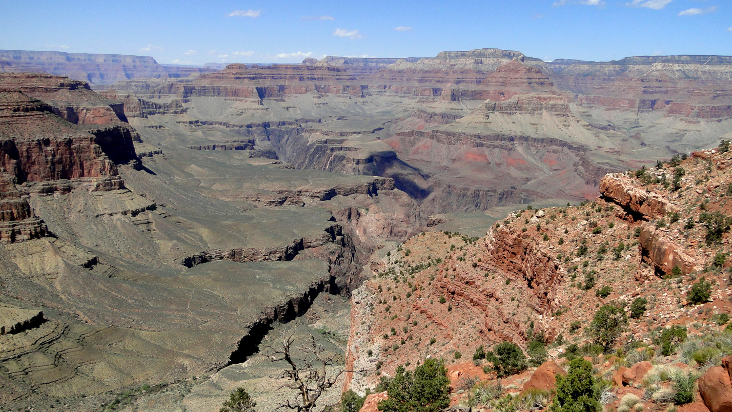
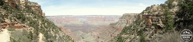
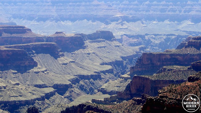
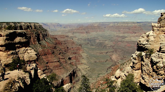
A trip across the Grand Canyon is an exercise in extremes and variety. Should you cross the Grand Canyon and return, you will pass through every desert and nearly every montane ecosystem found in the American Southwest. You will encounter temperature extremes from the 30’s to the 100’s and may find yourself in blistering sunshine one day while trudging through waste-high snow the next. You will descend through a geological record spanning over a billion years. And you will encounter a vast spectrum of natural scenes ranging from idyllic private waterfalls to panoramas of incomprehensible scope.
Bright Angel Canyon
In this article, we will review some basic safety considerations, review the process of obtaining the permit, and provide directions and descriptions of the South Kaibab Trail, North Kaibab Trail, and Bright Angel Trail in addition to a handful of worthwhile side trips along the Rim-to-Rim-to-Rim route.
Safety
Grand Canyon National Park rangers conduct a large volume of rescues each year due to lack of preparation, and part of the permit process includes education on the factors in the environment that are most likely to ruin your trip. Safety considerations include appropriate conditioning for a hike of this difficulty, understanding the hazards inherent in desert hiking, which includes dehydration, heat stroke, exposure, encounters with dangerous plants and animals, and hypothermia. Furthermore, it is important not to underestimate the mental challenges of hiking the Grand Canyon. All hiking within the canyon follows the maxim of “what goes down must come up.” You will drop 3,000′ down a rugged, sometimes slippery trail when your pack is at its heaviest. You will return up an exposed route likely during the warmest part of the day when you are at your most exhausted. Expect this to be even more difficult than it sounds and prepare accordingly. We therefore recommend that you spend adequate time preparing yourself physically, mentally, and logistically for this hike. This can be done by attempting any number of challenging desert or mountain hikes during the appropriate season to improve stamina and develop the kind of mental resilience necessary for strenuous multi-day hikes. We recommend that you become well-versed in basic backpacking skills and leave no trace principles. We also recommend that, should you wish to backpack, that you attempt backpacking at least once, preferably more, in another less challenging location in order to gain familiarity and comfort with the particular challenges inherent in the activity.
Permits
Ribbon Falls
Like Mt. Whitney, Half Dome, and the John Muir Trail starting at Happy Isles, obtaining a permit for the Grand Canyon can be a challenge. Given the popularity of this hike, the earlier you plan and request your permits, the more likely you are to get them. According to the Grand Canyon’s website, the park receives 30,000 backcountry permit applications but only grants 13,000. If you wait too long, you will be stuck without a permit. Grand Canyon’s permit office allows you to request your permit on the first day of the month four months before the month you wish to hike. If you are looking to hike this on November 15, you could apply on July 1st. That may seem excessively early to some, but at least it would give you four and a half months to prepare. You begin by filling out the Backcountry Permit Request Form. After filling out the form while outlining a variety of itineraries and providing payment for the $10 per permit plus $5 per person fee (at time of writing), you may fax, mail, or deliver in person the form to the backcountry office by following the directions included in the form. Once you’ve submitted the request, the permit office will consider your request and grant it or deny based on the availability of permits. The Grand Canyon provides this .PDF file containing additional information to guide you through the permit process. For day hikes or long-distance runners, there is no permit required, although you will want to contact the park rangers to discuss whether you are following park rules while attempting to dayhike the entirety of this route. You are not likely to complete this hike in 24 hours, and even if you do, you will complete a substantial fraction of it at night.
Transportation
Redbud Tree
This route starts at the South Kaibab trailhead and ends at the Bright Angel trailhead, which are several miles apart. The standard practice is to park at the backpacker’s lot at the Backcountry Information Center, which is about 1/4 of a mile from the Bright Angel Trailhead. From this lot, you can take the free shuttle to the South Kaibab Trailhead to begin your hike. If you are intending to hike this as a one-way shuttle hike, you will have the added challenge of arranging one car on the North Rim and one car on the South Rim. While the linear distance is relatively trivial, the driving distance from the North to South Rim is 212 miles, which takes about four and a half hours. Furthermore, the road to the North Rim is usually closed between the end of October and the middle of April, which would preclude a one-way hike during the best times for hiking this route.
The Route
The Bright Angel Trail’s brutal switchbacks
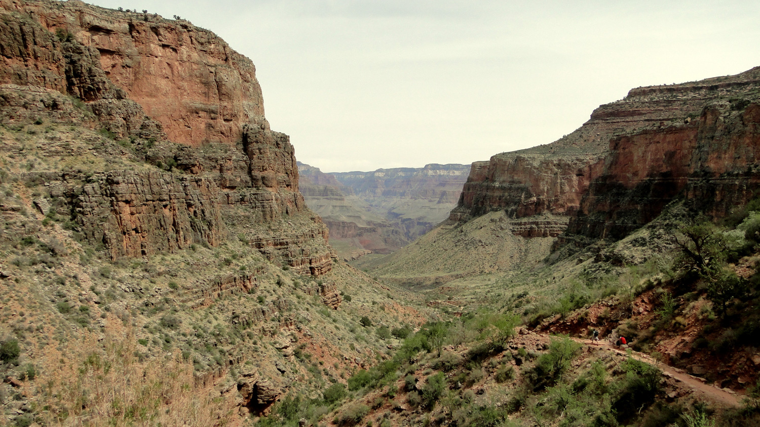
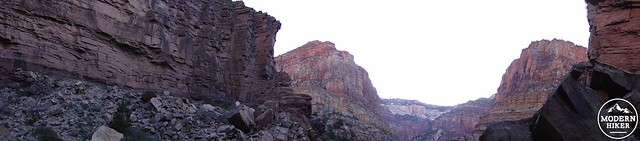
Our route through the Grand Canyon begins at the South Kaibab Trail and descends to the Inner Gorge and Phantom Ranch. From there it passes through the Box toward Ribbon Falls and Cottonwood Campground. After Cottonwood, the North Kaibab Trail climbs out of the canyon to the forested North Rim, from which you will turn around and walk back to Phantom Ranch. On the return journey, we recommend taking the Bright Angel Trail back up to the south rim both due to the availability of water and shade, but also because you will be going with the general flow of traffic. This route follows what the park calls the “corridor trails,” which include all of the trails mentioned above. The vast majority of foot traffic in the canyon occurs on this route. We feel that this route can be comfortably done in 5 days by a reasonably well-conditioned hiker. For more ambitious hikers with good conditioning, a three day route with two nights at Cottonwood Campground is possible, although you would be wise to be prepared for 3 days of 15+ miles and two days gaining over 5,000′ of elevation. For the even more determined and ambitious hikers, you can attempt to day hike or run the Grand Canyon. Personally, I find the slower pace and smaller distances preferable, as it allows more time to explore side attractions, puts less stress on your body, and allows you to fully soak in the magnitude of your surroundings. Based on that preference, I will present this route as a five day/four night trip. Please note that, due to the narrowness of the Box past Bright Angel Campground, the GPS track becomes erratic. It won’t affect your hike since there are very few choices available in this section of the trip.
Day 1: South Kaibab Trail to Phantom Ranch
Distance: 7.2 miles with a loss of 4,750′
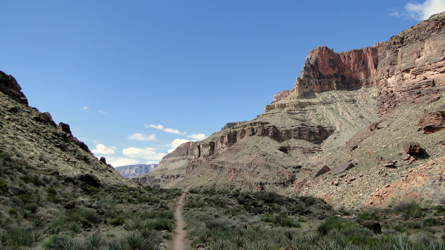
The South Kaibab Trail
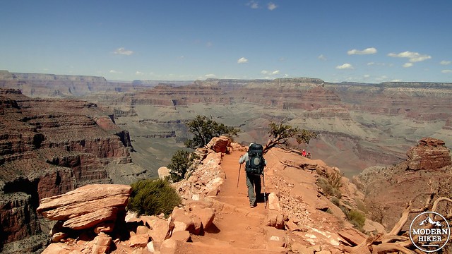
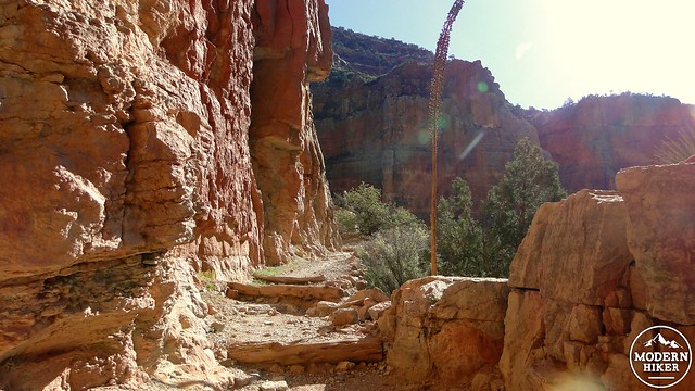
As mentioned before, we recommend taking South Kaibab into the Inner Gorge. South Kaibab follows an exposed ridgeline with some of the most spectacular views on the entire hike. It is relatively comfortable to take this route downhill as the hiking is less strenuous at least in terms of cardiovascular exertion while you are under full sun exposure. Since South Kaibab has the most iconic and expansive views of the hike, a leisurely downhill pace will allow you to soak in the spectacle unfolding all around you.
The trail begins by switchbacking along the precipitous edge of the south rim through a sparse forest of pinyon pines and junipers with an occasional ponderosa pine here and there. The initial stretches can hold ice due to a north-facing slope aspect, and the first mile is the most likely section in which you might require crampons during the colder months. Remember that the south rim sits around 7,000-7,500′, which means that it can carry a lot of snow following a cold winter storm.
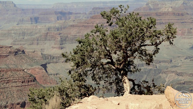
Pinyon Pine
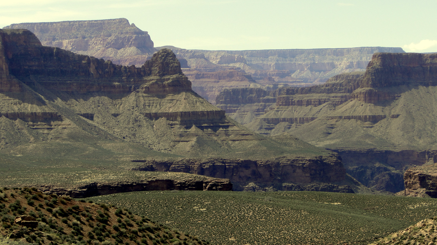
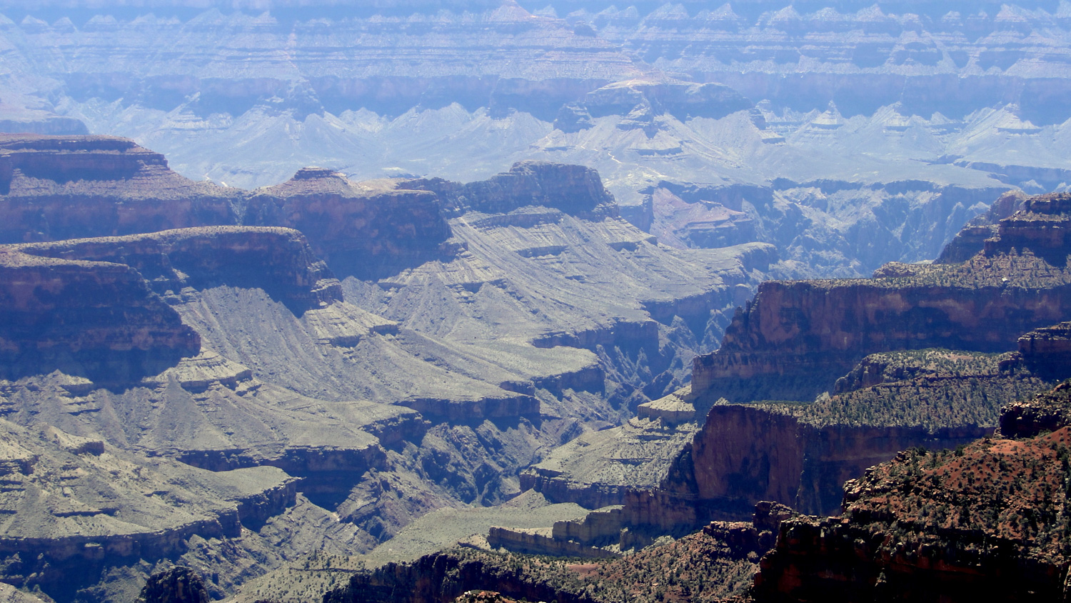
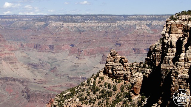
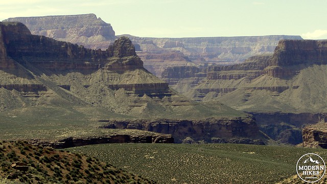
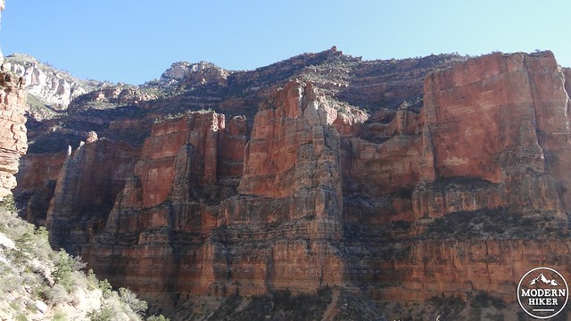
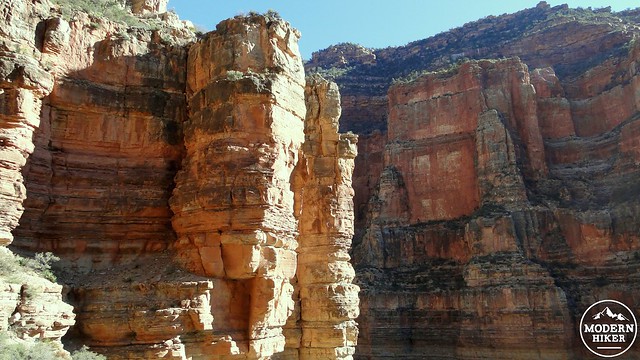
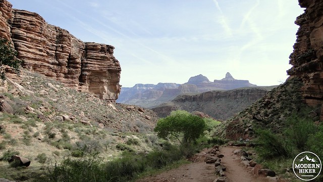
Eventually, the trail leaves the shadows of the cliffs just below the upper rim. This article’s scope will not include the staggering amount of geological information available about what rocks you are seeing and when and where they transition. I recommend reading the National Park’s page on the canyon’s geology as well as this more thorough exploration if you wish to know more. For those who don’t know Coconino from Navajo sandstone, suffice it to say that one of the pleasures of hiking into the canyon is the way in which the shades and textures of the rock change nearly every mile. From the rim, the Grand Canyon appears to be a massive layer cake carved through by a tremendously wide and blunt knife. Up close, every step reveals some new subtlety to contrast against the sheer vastness of your surroundings.
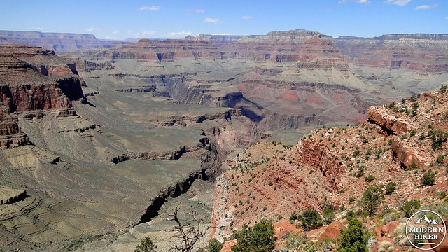
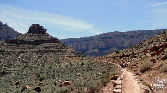
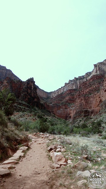
As you descend along a shade-less ridgeline, you will pass several panoramic points with names like “Ooh Aah Point” or “Yaki Point” and then finally Skeleton Point, which is just past Cedar Ridge. With every successive view point, the crowds thin out as day hikers remember that for every step down comes a corresponding step back up. You are also likely to encounter mule trains coming up from Phantom Ranch either carrying supplies or hauling out visitors to the ranch. Always yield to the mules. You won’t win that battle for right-of-way.
Tonto Platform
After Skeleton Point, the descent becomes more precipitous as the trail is often quite literally carved out of the surrounding limestone. The trail eventually flattens out at the Tonto Platform, which is a fairly wide shelf that has eroded more slowly than other layers and thus provides a relatively flat segment of the trail. You will soon come to the Tip Off, which is something of a portal to the Inner Gorge. Just before the Tip Off, you will come to a junction with the Tonto Trail, which runs east-to-west along the Tonto Platform to connect just below Indian Gardens. Continue straight to begin the descent into the Canyon’s Inner Gorge.
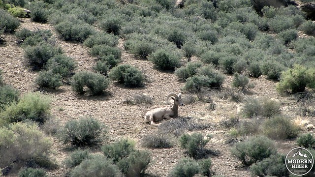
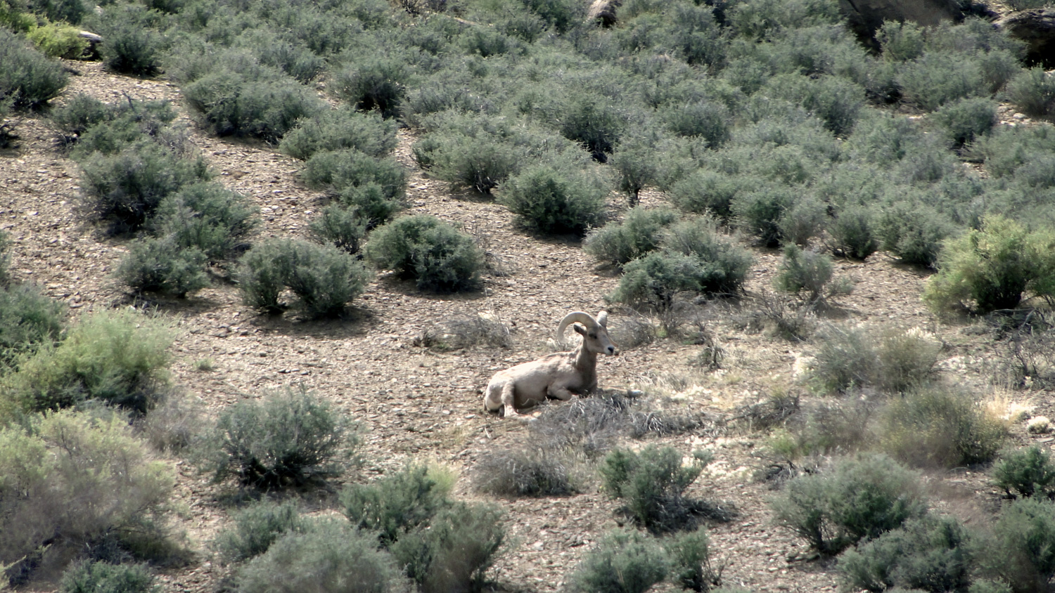
Bighorn Sheep
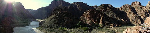
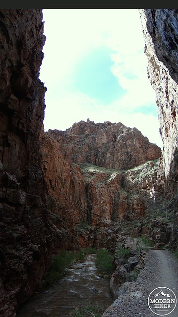
The Inner Gorge
The Tip-Off
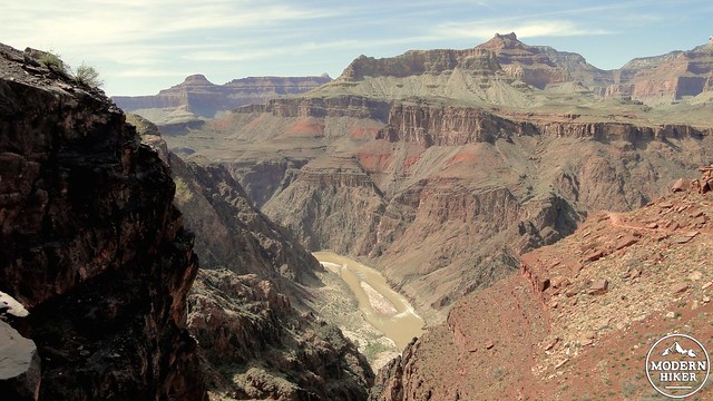
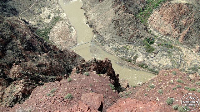
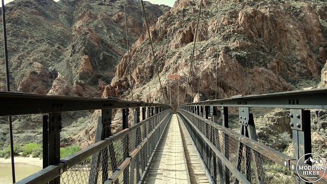
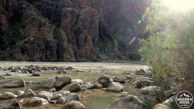
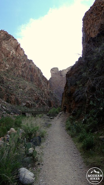
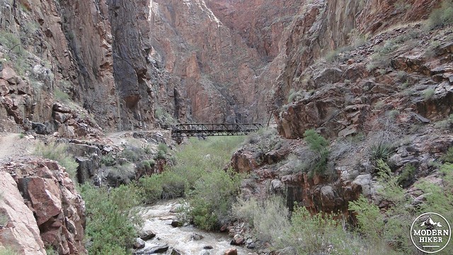
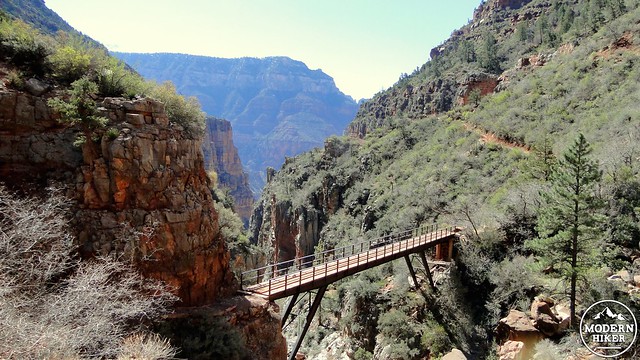
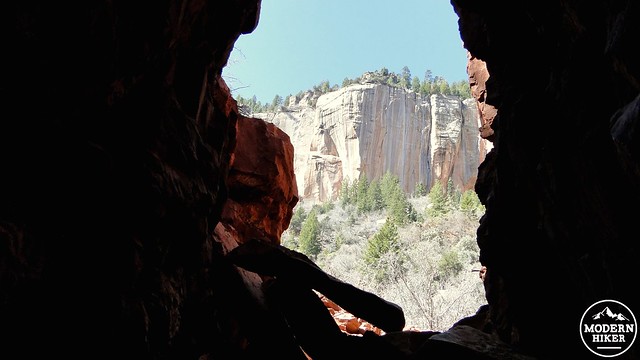
Just past the Tip-Off, the rock takes on a deep purple hue that is probably the most dramatic color of any of the formations you’ve so far encountered. The trail continues its descent through these beautiful rocks before arriving at the edge of the inner gorge. A few more switchbacks down, and you will come to a tunnel leading to one of the two suspension bridges spanning the river. This bridge, called the Black Bridge, was built in 1928 and is a remarkable feat of engineering that still impresses today.
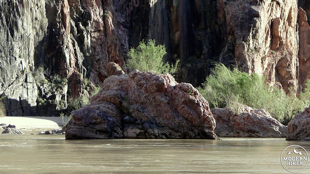
The Colorado River
Black Bridge
Near Bright Angel Campground
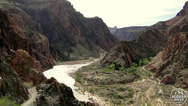
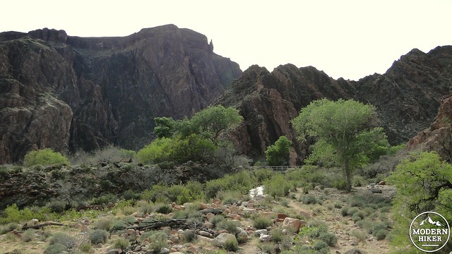
On the other side of the bridge, the trail will bend left to lead to Phantom Ranch and the adjacent Bright Angel campground. The trail skirts the river offering access to a nice beach on which you can sunbathe and dip your toes into the river. Be warned that swimming in the river is a terrible idea, as the water is cold and the current is swift. However, there are gentle sections of the river that may be safe to wade into, but we don’t recommend going any further than up to your knees lest you be swept off to Lake Havasu. Near this beach you will also find Anasazi ruins left from the time when the Anasazi inhabited this spot. The trail then bends right from the junction with the Bright Angel Trail to reach Phantom Ranch.
Silver Bridge and the Colorado River
View from the River Loop Trail
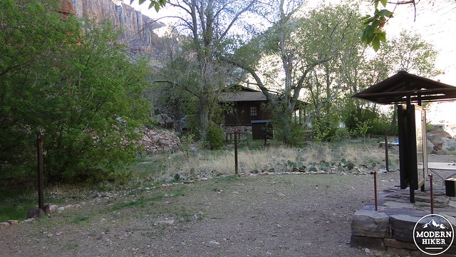
If you are backpacking and intend to stay at Bright Angel Campground or Phantom Ranch, you will pass a series of well-developed campsites nestled along Bright Angel Creek beneath tall cottonwood trees. This will be the end of the line for your first day, although we do recommend two possible side trips from here. The first is to walk toward the Phantom Ranch canteen where you can get a hot meal that you will need to reserve in advance. If you’re opting to skip the hot meal and eat what you packed, you can still order a cold beer. I can tell you from personal experience that a can of Budweiser at the bottom of the Grand Canyon tastes better than just about all of the microbrews combined. Well, not really, but it will certainly seem that way at the time.
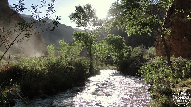
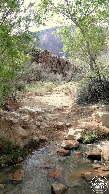
Bright Angel Creek
The other side trip is a loop trip that hugs the river. From the campground, follow the Bright Angel Trail toward and then over Silver Bridge, which will take you back to the south shore of the river. From there, turn left onto a trail that will hug the edge of the inner gorge about 100-200′ above the river. This trail will take you back to the tunnel for Black Bridge, and you can then retrace your steps to Phantom Ranch. This brief “dessert” hike is a great way to cap off the long descent. It is best taken in the late afternoon when the shadows get long and the light starts getting more dramatic.
Day Two: Phantom Ranch to Cottonwood Campground
Distance: 7.2 miles with 1,600′ of elevation gained. Add another 3.2 miles if you wish to visit Ribbon Falls after establishing your campsite.
The Box
 On day two, you will find yourself leaving Phantom Ranch on the North Kaibab Trail, which stretches from the ranch to the North Rim of the Grand Canyon. Should you be here during the winter or spring, trail traffic should diminish considerably past Phantom Ranch, partially due to most hikers turning around to head back to the South Rim but also because the North Rim is closed during those seasons.
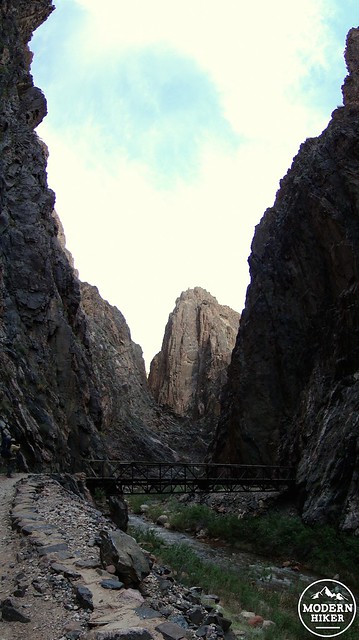
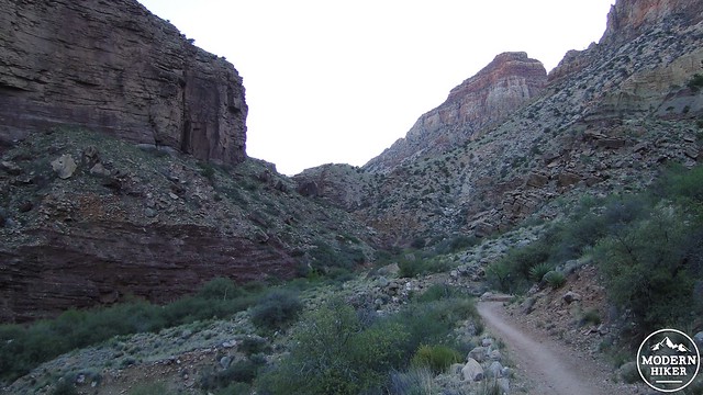
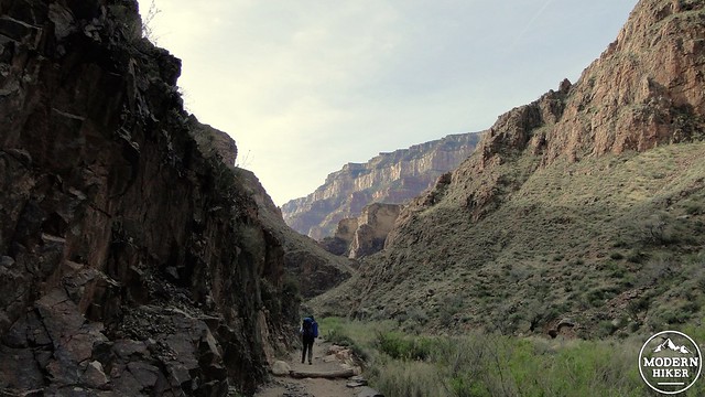
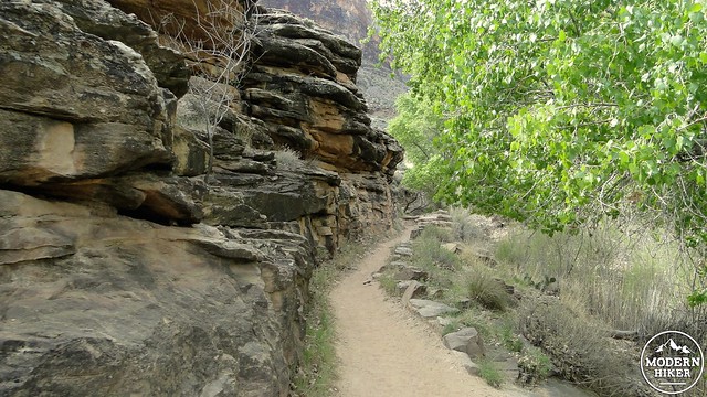
This segment of the trail will be the only day on this trip without significant elevation gain or loss, and it is the easiest day on this route. After leaving the ranch, the trail travels through a narrow, twisted gorge called “The Box.” Bright Angel Creek has carved this gorge out of the Vishnu schist formation that forms the inner gorge of the canyon, and the dark purple rocks shot through with lighter igneous rocks rise up almost vertically. Occasionally, the walls of this canyon are little more than 30 yards wide, and the trail tightly hugs the base of the cliffs rising up above you.
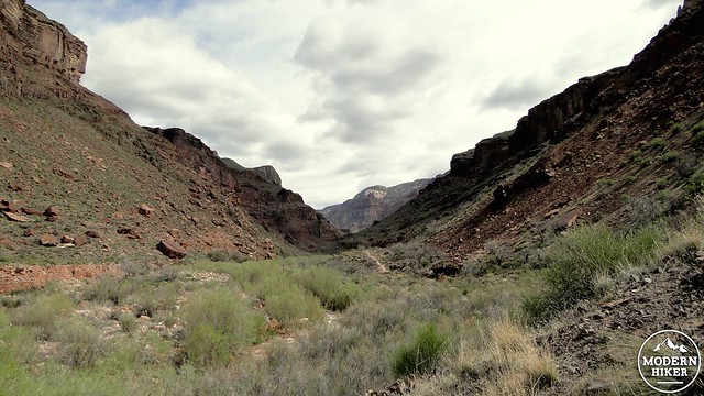
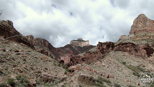
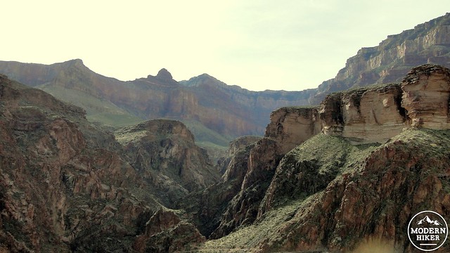
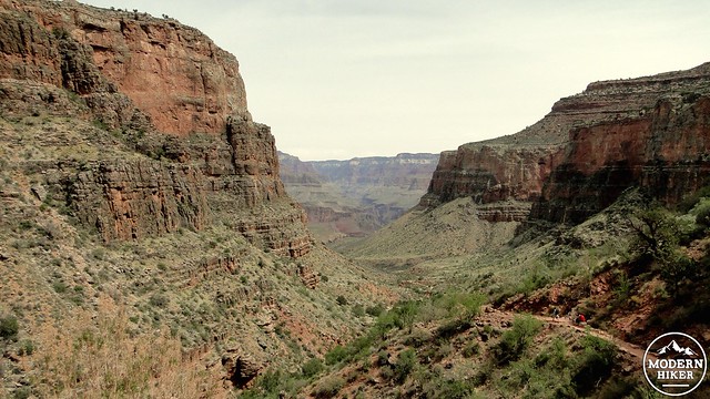
As you wind through the box, you will pass over Bright Angel Creek on several picturesque bridges before the trail gains enough elevation to leave the Vishnu schist formation and emerge at a flatter northern extension of the Tonto Formation. While the platform on the south side of the canyon forms a broad shelf, the formation here serves mainly as the gently sloping plain in the center of linear Bright Angel Canyon. Massive buttes of variously colored rocks rise up spectacularly on either side of the canyon. These buttes and “temples” are the same ones you might have admired on your way down from the South Kaibab Trail, but from this angle they recall Zion Canyon.


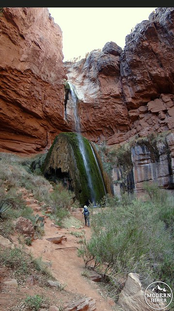
The trail continues on this way for several miles as it climbs gradually up to Cottonwood Campground. There are few switchbacks or severe slopes, and the bulk of this hike is gentle and easy-going, which is probably not something you want to get used to. About 1.6 miles before you reach Cottonwood Campground, you will encounter a side trail leading off to the left toward one of the most beautiful sights in the entire canyon: Ribbon Falls. You have the choice of stopping as soon as you reach the falls or of continuing on the campground to set up your site and return later without the weight of your pack.
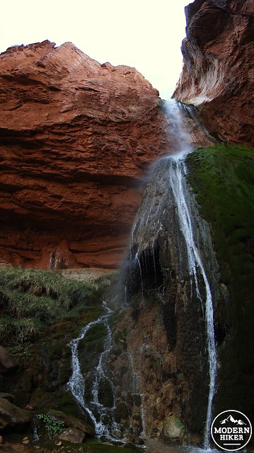
The side trail to Ribbon Falls crosses over a marshy section of Bright Angel Creek before climbing into a cool, mossy grotto. Ribbon Falls drifts down over successive terraces in a delicate, lacy cascade before landing on a large rock outcrop that is covered in moss. It is possible to climb further into the grotto to approach the falls from behind and enjoy the splatter of water on sandstone from up close. In a place of such imposing scale as the Grand Canyon, Ribbon Falls is a remarkably intimate contrast.
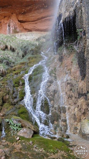
We suggest getting to the campground to set up your site because Ribbon Falls is the sort of place where you can easily spend hours relaxing around the waterfall and enjoying the quiet solitude of this peaceful grotto. It’s better to get the work out of the way so that you can enjoy your leisure without the specter of setting up camp lingering over you. Unlike most waterfalls, Ribbon Falls is at least 14 miles and 4,800′ of climbing from the nearest parking spot, which means that you will often have the place to yourself. The solitude is part of what gives Ribbon Falls its charm, but there is no denying the beauty of this place. Even set against the jaw-dropping views, Ribbon Falls is a highlight, perhaps even the highlight of a trip across the Grand Canyon.
Cottonwood Campground is another 1.6 miles past the Ribbon Falls junction, and it occupies a partially shaded bench beneath the towering buttes above you. It’s a nice spot for a campground, but it is not all that remarkable compared to everything else you’ve seen. It serves well as a stopping point before commencing the magnificent and very strenuous journey up to the North Rim that lies ahead of you on Day 3.
Day 3: The North Rim
Distance: 17 miles with 4,400′ of gain and loss
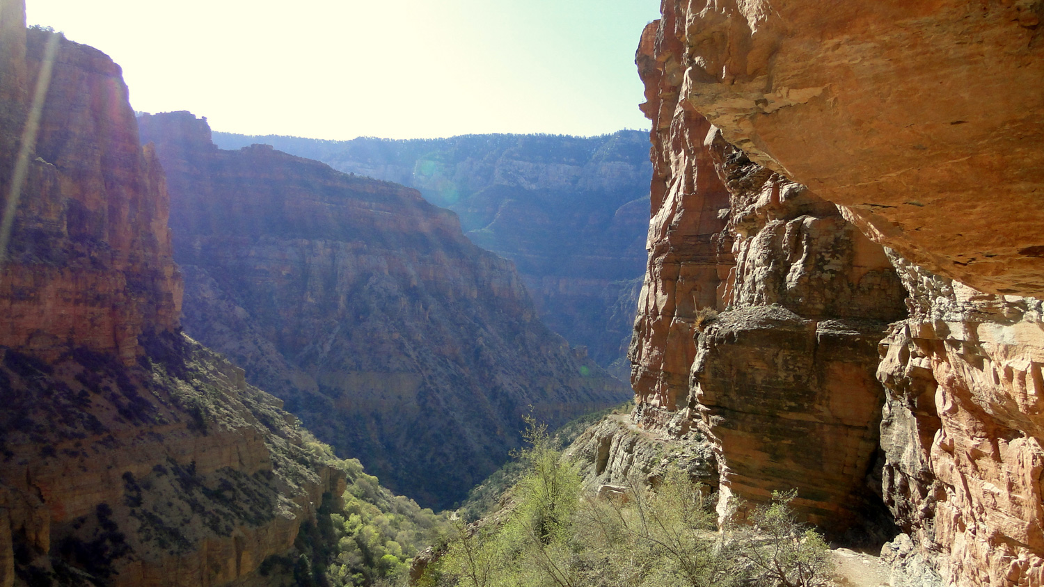
The Redwall Section
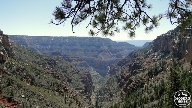
As a day hike, the section from Cottonwood Campground to the North Rim of the Grand Canyon ranks as one of three best stretches of hiking I have ever undertaken in my time hiking – the other two being Mt. Whitney and Haleakala Crater. Nowhere else have I experienced such a bewildering array of scenes, ecosystems, geological change, spectacular views, jaw-dropping trail construction, and sense of accomplishment. This hike goes from the low desert to subalpine forest while including every conceivable southwestern ecosystem along the way. It travels through preposterous canyons on an even more preposterous trail. It passes a gushing torrent pouring straight out of the side of the canyon. And if you hike it during the offseason, you will likely have the entirety of the village on the North Rim all to yourself.
If you’re following the route as outlined here, you can do the trip from Cottonwood Campground to the North Rim as an ambitious, albeit difficult day hike. The equivalent in elevation gain and distance is somewhere along the lines of day hiking Mt. San Bernadino from Angelus Oaks or Mt. San Jacinto via the Devils Slide Trail. It is a challenge in every sense of the word, but the end result will be all the more rewarding for the tremendous amount of effort and commitment it takes to experience this section of the trail in this way.
The Pumphouse Residence
Starting from Cottonwood Campground, make your gently ascending way through the upper reaches of Bright Angel Canyon as it approaches a convergence with other, smaller canyons. Soon you will leave the low desert ecosystem and enter the pinyon-juniper belt that signals the beginning of high-elevation ecosystems. At 1.4 miles, you will reach the historic Pumphouse Residence. Artist and park employee Bruce Aiken called this location home for many years, but today it is now a spot for hikers to rest in the shade and fill up their water bladders to prepare for the relentless assault on the spectacular sheer walls of Roaring Springs Canyon.

Roaring Springs
After the Pumphouse, the trail takes a bend to the left to begin following the western wall of Roaring Springs Canyon as it begins to climb. You’ll notice Roaring Springs on your right as it thunders out of a hole in the canyon’s wall. This is a waterfall springing seemingly out of nowhere, although this water originates from precipitation on the vast plateau beyond the North Rim. Here’s an interesting tidbit: while the Colorado River provides the water to large parts of Southern California via aqueducts, it is Roaring Springs that provides the water to the Grand Canyon region. If you look carefully below Silver Bridge back by Phantom Ranch, you will see the pipe that carries the water up to the South Rim.
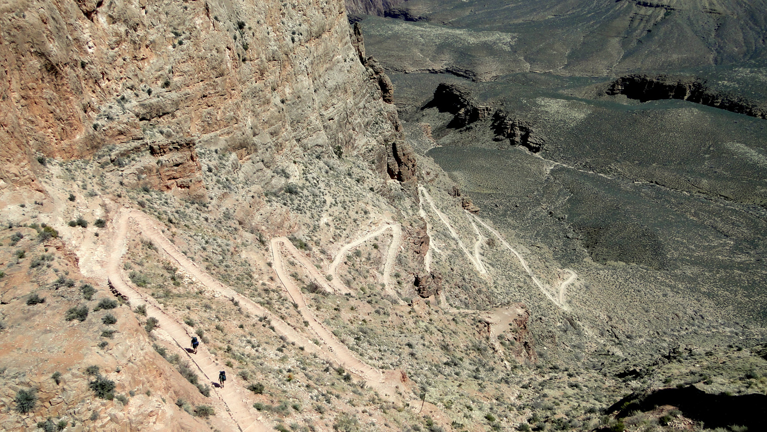
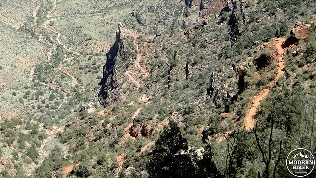
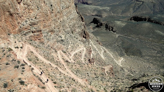
You will continue to switchback your way onto a ridge that approaches the upper reaches of the canyon as you gradually leave the springs behind. As you look ahead, you may wonder exactly how the trail is going to make it up the nearly sheer walls of Roaring Springs Canyon. The section that comes next is both inspiring, terrifying, and a wonder to behold. Trail crews in the 1920’s literally blasted large chunks of the trail out of the rock to enable a route that reaches the canyon bottom from the North Rim. Words fail to do any justice to what you will see in this section of the trail, and the pictures are little more than a pale, inadequate imitation. The Redwall section is, without a doubt, hiking at its finest.
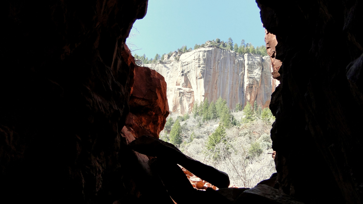
Supai Tunnel
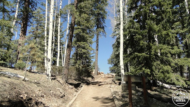
Soon after the Redwall section, you will reach Supai Tunnel. Just beyond the tunnel, you’ll encounter a restroom, water spigot, and an emergency phone. The park shuts the water off during the cooler months, so don’t count on it for your water needs during the winter and early spring. It’s best to fill up with way more than you need at the pumphouse. You will also notice that the vegetation has been changing gradually during your climb through the canyon. Gone are the pinyons and junipers. White fir, Douglas fir, ponderosa pine, and spruces take over as the dominant trees, although you will also pass through groves of deciduous gambel oaks. Fall color fans will enjoy hiking the North Rim in October as several large stands of aspens intermingle with the coniferous forests ahead on the North Rim.
North Kaibab Trailhead after crossing the canyon
Past Supai Tunnel, the trail will continue to switchback as the canyon gets narrower and the view behind you gets more and more impressive. After entering a dense bit of forest, the trail will come to an inconspicuous crest, and before you realize it, you are standing at the North Kaibab Trailhead.
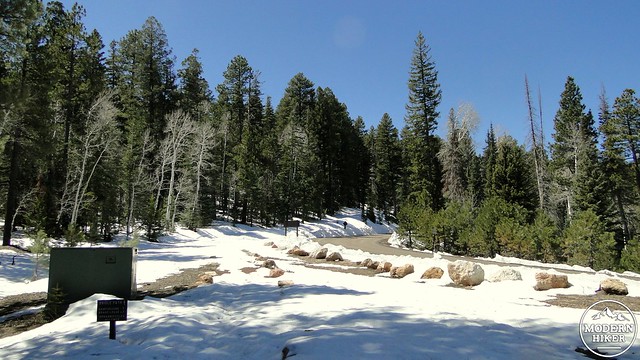
Snow on the North Rim
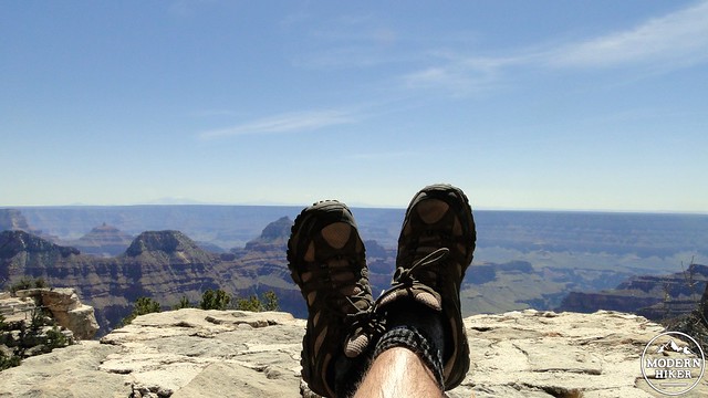
View from Bright Angel Point
After you high-five yourself for achieving your goal, you have two options remaining: you can turn around and head back down to Cottonwood Campground to call it a day. Or, you can continue on trails leading to the North Rim lodge and resort area, which offers a commanding view back over the canyon you just crossed. During winter and spring, much of this trail can be snowbound, in which case you can follow the more obvious path of the road. For some people who seek to shuttle this hike, this will be the end of the line. For others, the lodge is a great place to stop and enjoy the accomplishment of hiking across the Grand Canyon before you get to. . . wait for it. . . hike back across the Grand Canyon. When you’ve finished your exploration of the North Rim, turn around and retrace every spectacular step back to Cottonwood Campground. The trail is every bit as marvelous the second time around, and perhaps even more so since you get to enjoy a completely different perspective on the return journey.
Day 4: Cottonwood Campground to Indian Gardens
Distance: 11.9 Miles with 1,320’s of gain.
After the stunning beauty of the North Rim, heading back up the South Rim might seem like a bit of an anti-climax due to its redundancy and the fact that there might not be any topping what you just saw. However, after the first 7.2 miles on the return trip from Cottonwood Campground to Bright Angel Campground, you will enter a completely new trail with views and charms very much its own. The Bright Angel Trail is preferable to the return journey up South Kaibab because there is a greater availability of shade in addition to regularly spaced water sources that come in particularly handy when it’s warm.
I should also note that, at this point, there may be some temptation to just get the hike over with and climb all the way out of the canyon from here. This is certainly the approach I took when I hiked the Grand Canyon, but having done so, I now feel that I would recommend taking your time for two reasons. First, the last three miles of that 17.1 mile journey are excruciatingly difficult following nearly 50 miles of hiking – if you include the side trips. Second, you miss the opportunity to explore the cool shade of Indian Gardens while missing the optional side trip out to Plateau Point. For those reasons, we recommend that you break up what could potentially be a one day hike into two to allow yourself to enjoy the canyon some more and make the climb easier.
From Cottonwood campground, you will retrace your steps down Bright Angel Canyon, through the Box, past Phantom Ranch, until you reach Bright Angel Campground. At the campground, you will reach a point where you can turn left to turn back to South Kaibab Trail or turn right to reach the Bright Angel Trail. For folks who took the optional River Loop on day 1, this should be a familiar route. For those who did not, turn right and hike toward Silver Bridge, which will carry you back across the Colorado River.
Once on the other side, the trail will undulate along the south bank of the river while providing many fine views of rapids and towering buttes. After 1.5 miles of travel, you will reach the River Resthouse, which is the first stop that will allow you to rest in the shade and tank up on water from the stream flowing down from Indian Gardens. From here, you will commence a tough bit of climbing through a bowl-shaped drainage known ominously as the Devil’s Corkscrew. This area can be excessively hot during the summer, and even during the fall and spring months it may be wise to avoid climbing through it during the middle hours of the day.
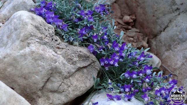
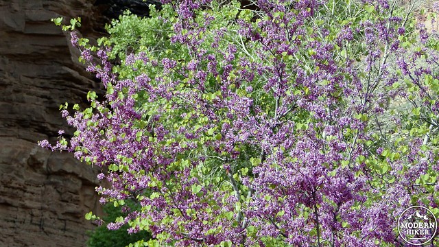
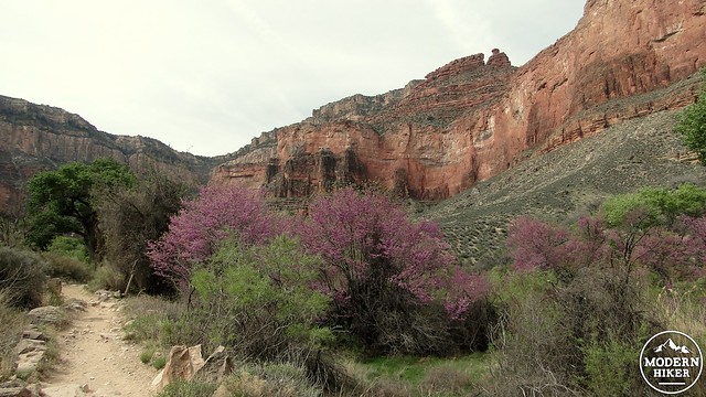
Following the Devil’s Corkscrew, the trail will enter a meandering canyon with beautifully eroded walls that climbs up to the Tonto Plateau. Along the way, you’ll pass beautiful examples of Fremont cottonwoods and red bud trees. The latter tree puts out countless purple blossoms in the spring, creating a beautiful color contrast against the warm colors in the surrounding rocks. The creek through this region will provide plenty of opportunities to replenish your water supplies. It was along this section that I learned the trick of dumping ice cold water over my head and body to cool my core temperature off. Not only did it cool me down and mitigate against the exhausting effects of heat, but I felt reinvigorated for the long climb after Indian Gardens.
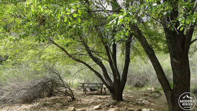
The trail comes out of this tributary canyon and enters the relatively flat Tonto Formation as the trail completes the last few tenths of a mile to Indian Gardens. At Indian Gardens, you will find a lot of shade from planted and native trees, campgrounds, regular water sources, and restrooms. This is the end of the line for the day as far as your backpacking is concerned.
Indian Gardens
If you wish to take the side trip to Plateau Point, a spur trail leaving from Indian Gardens will take you to the brink of the Tonto Formation and allow great views out over the Inner Gorge. For many people who day hike the Bright Angel Trail, this is the extreme limit of where one should attempt to go from the South Rim. The spur trail is 1.5 miles each way. The out-and-back nature of the trip is simple enough to follow and rewarding enough to make a very satisfying diversion.
Day 5: Indian Gardens to the South Rim
Distance: 4.8 Miles with 3,200′ of climbing 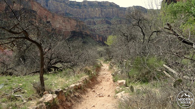
By this point, you will probably be grimy, tired, and pretty well satisfied with your Grand Canyon venture. Distance-wise, you have a “mere” 4.8 miles remaining before you reach the southern rim of the canyon, thus concluding your journey. However, what may sound like a simple hike out becomes much more intimidating when you consider that you will have to gain over 3,000′ of elevation over 4.8 miles at the very end of your journey just to get out. This is where hikers pay the piper, and there is no way to avoid saving the hardest part for the very end.
Fortunately, your pack should have lightened considerably, and the slope aspect for much of the route favors shade if you climb out early in the day or late in the evening. Given the potential for intense heat, one should not attempt to conclude this journey during the warmest parts of the day from mid-April to early October, as the combination of heat and fatigue is what causes the vast majority of incidents and injuries along the Bright Angel Trail. Fortunately, the park has stationed water sources and rest areas at approximately every 1.5 miles to allow hikes to replenish water reservoirs and rest against the onslaught of the climb. Please note that the water at the rest houses gets turned off during the cooler months from November to April. Check ahead to see if the water is flowing.
During the cooler months, this will be less of an issue, although you should still take care to load up on water at Indian Gardens as the climb will sap your strength and precious bodily fluids regardless of the temperature. The park turns off the water at the resthouses during the cooler months, which means that you’re going to have to carry everything with you. I learned this the hard way as I ran out of water with over 3 miles to go. I did fine since it wasn’t particularly hot, but the lack of regular water intake made the climbing much more laborious than it needed to be. From Indian Gardens, commence hiking toward the beautiful but intimidating wall of the South Rim. At first, the going is pretty easy as you wind along the upper reaches of the tributary canyon you had been traveling through on the previous day. However, the trail soon bends to the left, and the switchback-a-thon is on like a barrel-throwing simian. The rest of the directions are limited to “keep on climbing until you can’t climb any longer,” but there are a few notable spots along the way to consider. At 1.5 and 3 miles (approximately) from Indian Gardens, you will encounter the resthouses, which feature shaded ramadas, water sources, and a restroom at which you can recover your strength, replenish water supplies, and enjoy the ever-improving views that you have been missing since you descended down the South Kaibab Trail. These are great places to soak in views as the difficulty of the climb usually precludes a lot of sight-seeing.
You still can’t help but notice the subtle changes in the rock layers as you travel upward again, even if you are only looking at your feet to make sure you don’t stumble. You’ll pass through desert scrub before re-entering the pinyon-juniper belt and then finally, after so many endless steps, you will emerge on the South Rim against the cool shade of ponderosa and pinyon pines with the alluring promise of cold beverages, hot showers, and a meal or two to replenish the reserves that you’ve undoubtedly drained over your five day trip. Congratulations will be very much in order.
Note: For those wishing to reach the South Rim by way up public transportation, there are shuttles that leave from Flagstaff and Williams via the Arizona Shuttle. Schedules and fares can be reviewed at this site. Both Amtrak and Greyhound offer service to and from Flagstaff. Additionally, hikers looking to traverse the canyon without having to re-trace their steps can take advantage of the Trans-Canyon Shuttle, which travels between the North and South Rims twice daily between May 15th and October 16th and once daily between October 17th and November 30th (at time of writing). More information can be found by visiting their site: http://www.trans-canyonshuttle.com/
Tags: Bright Angel Campground, Bright Angel Trail, North Kaibab Trail, Phantom Ranch, Ribbon Falls, Rim-to-rim, rim-to-rim-to-rim, South Kaibab Trail