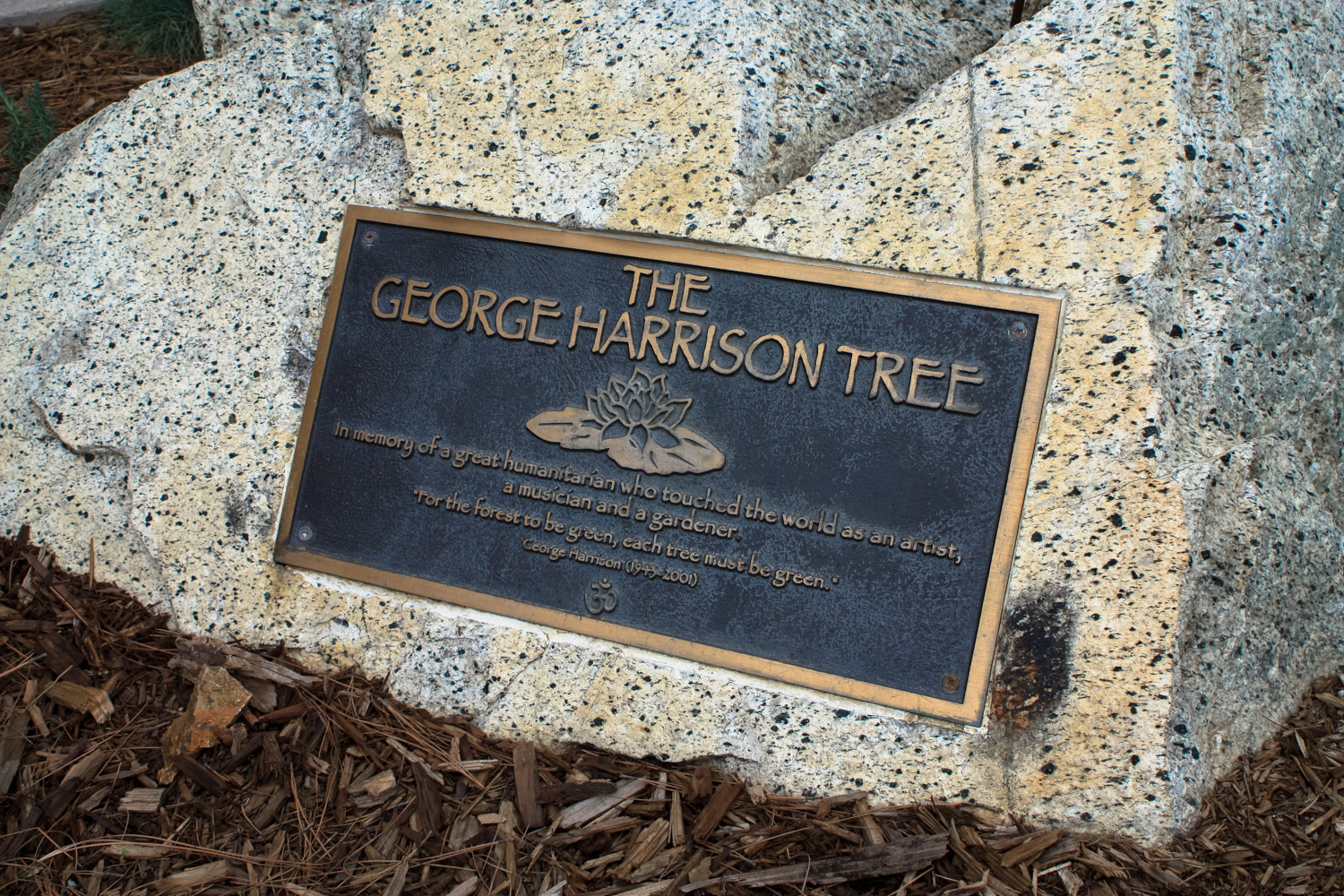
The remote and rarely visited Taco Peak in the middle of Griffith Park got a huge boost in visibility in mid 2015, when a group of artists sent a collection of journalists a mysterious note telling them to meet at sunrise on June 30th.
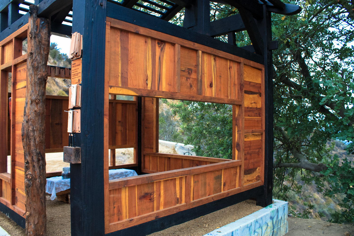
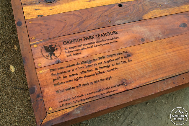
Those who followed the instructions were greeted with a pop-up teahouse on the north slope of the perhaps unofficially named Taco Peak (media coverage has attributed this tea house to Mount Bell, which actually lies slightly to the northwest) — and in this case, “pop-up” was pretty literal. Overnight, a group of artists hauled in all the materials to erect the structure without any permission from park officials. The structure was built with wood reclaimed from the 2007 Griffith Park wildfire, assembled almost completely without metal, and built atop existing concrete foundations for a former water tower.
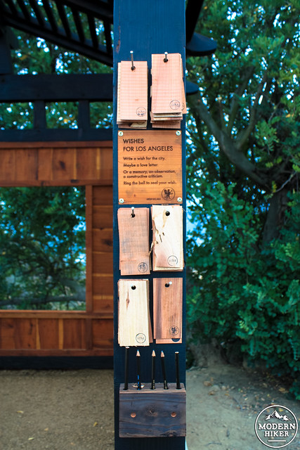
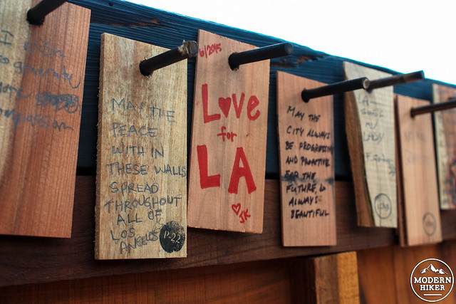
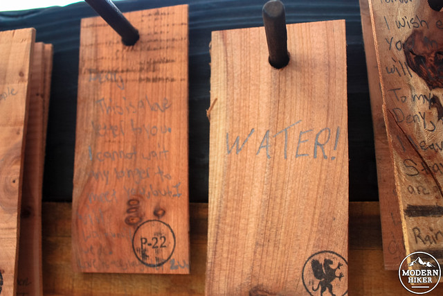
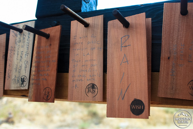
In the morning, they held a traditional Japanese tea ceremony and encouraged attendees to write prayers or wishes on wooden cards and hang them inside the tea house.
Needless to say, once the word got out about this, it spread pretty quickly. We’d already written about Taco Peak as part of our larger Griffith Park Northside Loop, but we figured now the peak deserved its own entry … and, we wanted to see the teahouse in case it gets destroyed soon!
This route starts near the Berlin Forest at the Griffith Park Observatory Lot and is a loop hike, returning along Mount Hollywood Drive. Parking here can be a special kind of nightmare, even by Los Angeles standards. If you’re up for a longer hike, consider starting near Fern Dell and coming up via the West Observatory Trail or Western Canyon or starting near the Greek Theater and taking the East Observatory Trail or the longer route to Mount Hollywood along the Hogback Trail.
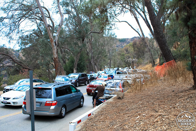
traffic at 2PM on a Wednesday, just in case you’re thinking of driving in
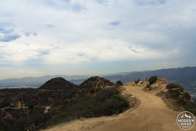
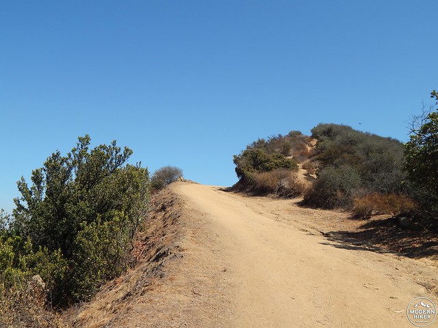
If you’re braving the Observatory lot, start early at the Charlie Turner Trailhead, passing through the Berlin Forest and over the tunnel toward Mount Hollywood.
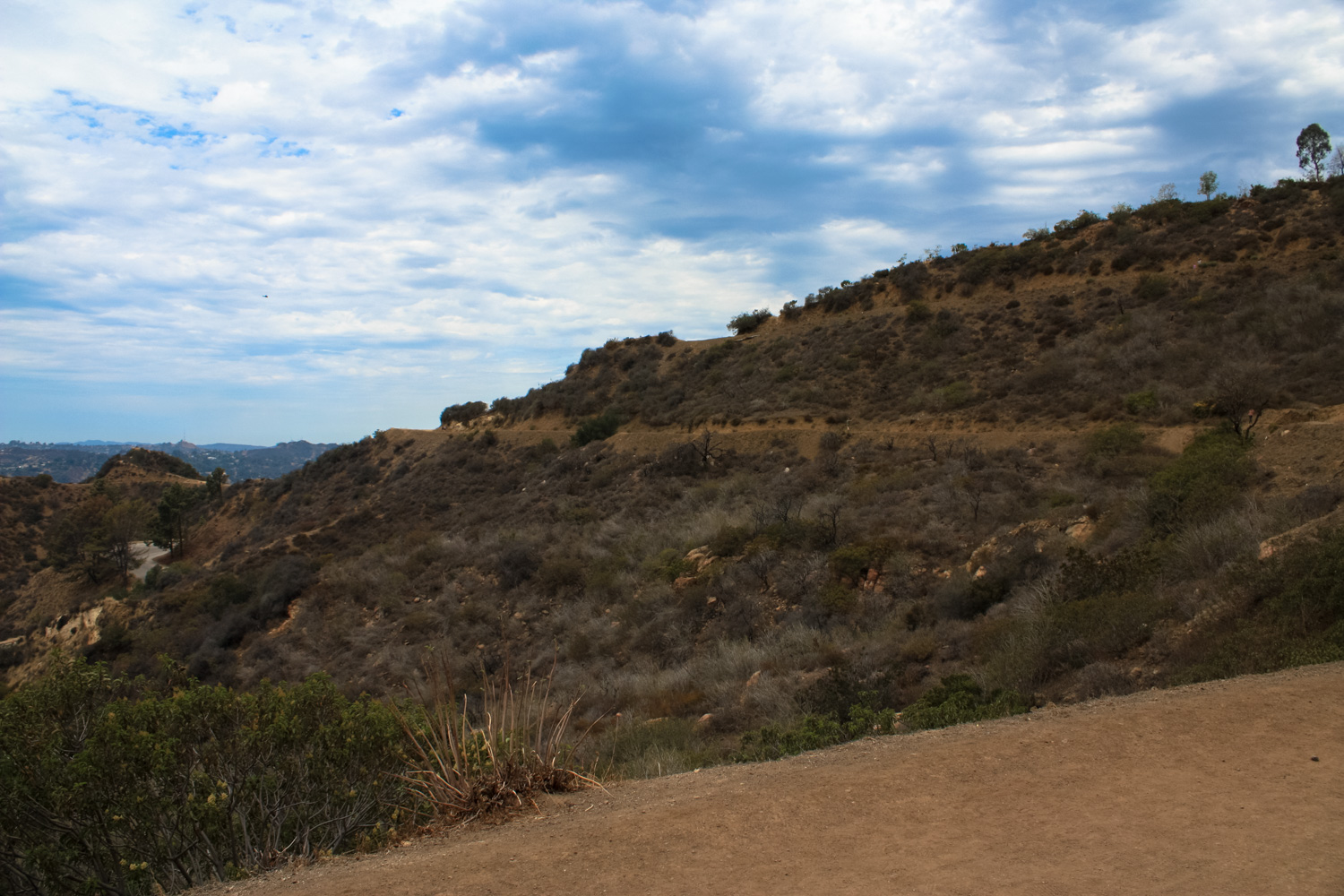
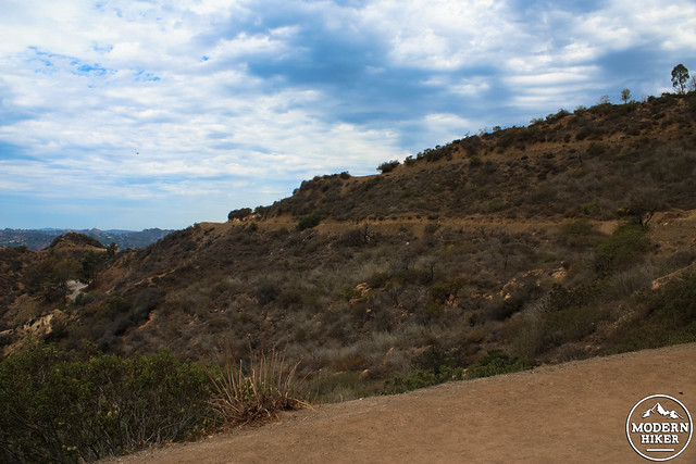
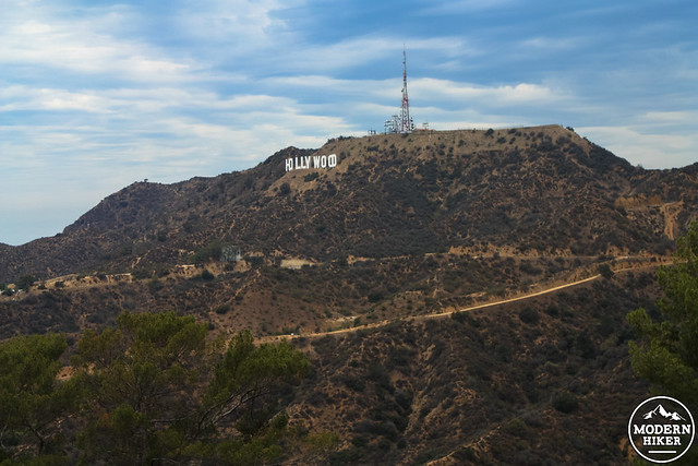
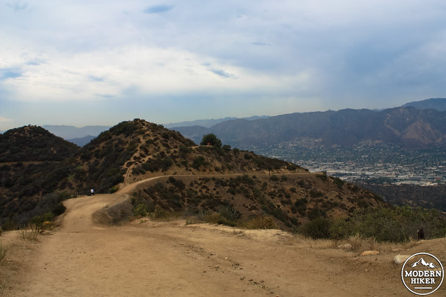
Just across the tunnel overpass, stay to the left to continue on the fire road, where you’ll get one of the best views of the Hollywood Sign at the 0.6 mile mark and at 0.9 miles, stay to the left to continue on the fire road on Mount Hollywood’s western flank.
For an additional challenge, consider scrambling up the steep and slippery use-trail that makes a straight-shot up to this junction at 0.9 miles, or continue straight up to the summit of Mount Hollywood itself. At the 0.9 mile mark, you can also head along the eastern road around Mount Hollywood for a quick stop at Dante’s View, too.
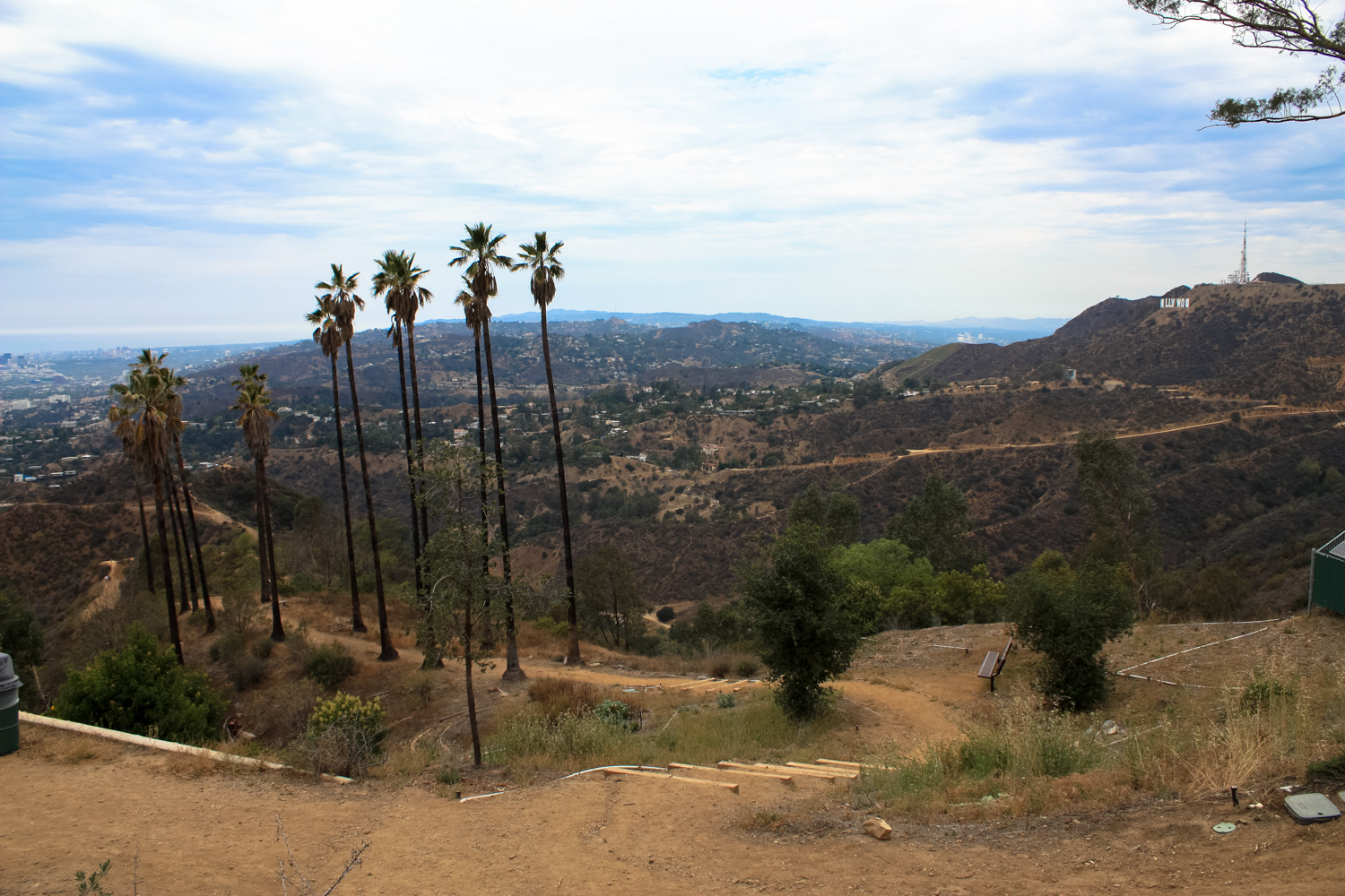
If you stay on the western road, you’ll pass the remnants of Captain’s Roost at about the 1 mile mark. Look for the rows of palm trees – down this firebreak, a man known as “The Captain” began Griffith Park’s first ‘folk garden’ in the 1940s. There is an excellent first-hand remembrance of meeting both The Captain and the caretaker who maintained the garden after he retired.
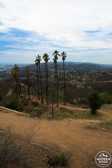
Captain’s Roost, 2015
Sadly, the Roost was very badly damaged in that 2007 wildfire and is struggling to bounce back. Volunteers from the Friends of Griffith Park do occasionally work up there, but the drought has made it difficult for many of the non-native plants to bounce back. If you walk down the fire break, you will see some pieces of how the Roost used to look – and hopefully with some native plantings (and some much needed rain), the volunteers can restore it to its former glory.
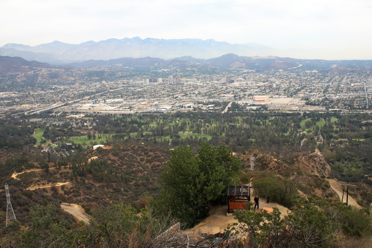
At 1.3 miles, stay straight on the fire road or take a short trip to the summit of Mount Hollywood my hanging a quick right. The trail makes a short descent and you’ll encounter a large four-way junction. Head straight to the narrow fire road that makes its way north on a narrow ridge – and look out for the tiny tea house structure on the north flank of Taco Peak.
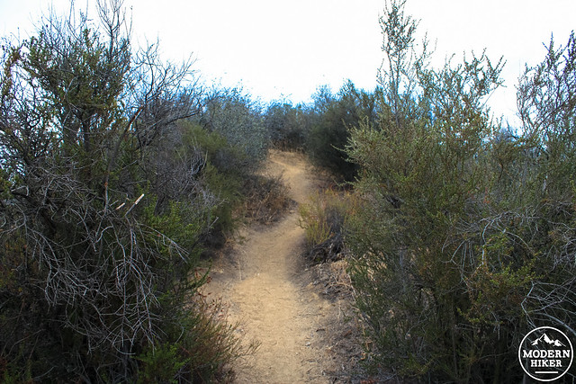
At 1.5 miles, look for this use-trail roughly following a water pipe. Hop off the fire road and follow this route, which quickly hits another old road grade.
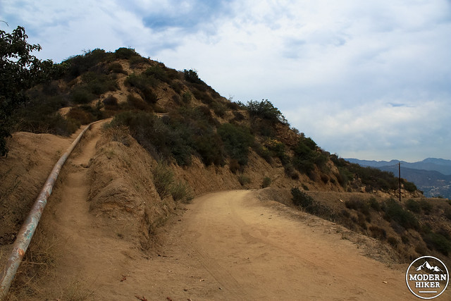
Just around the bend, the teahouse comes into view.
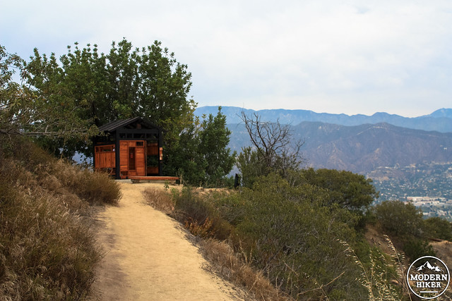
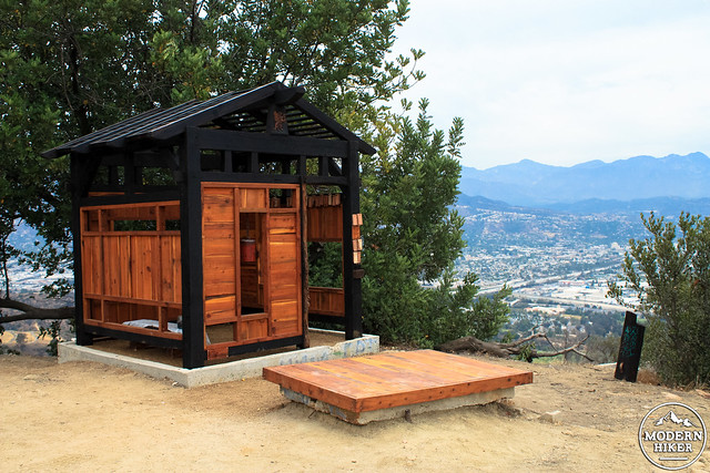
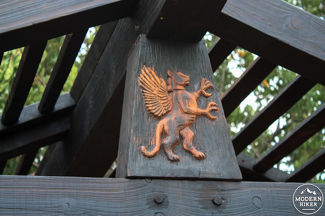
The structure itself is small and surprisingly beautiful. Supposedly, all of the wood used in the structure and its neighboring bench were reclaimed from trees that were downed or killed in the 2007 wildfire. The detail work is charming – and the griffin that protects the structure is, according to a note on the bench, a combination of a red-tailed hawk and mountain lion combination (note the radio collar on the griffin’s neck!)
Inside, you’ll find people’s prayer cards and a small metal bell with a great, soothing timbre. Visitors are encouraged to leave their thoughts inside and ring the bell afterward.
When I visited, there was also some free leftover oolong tea from the previous morning’s ceremonies, but I can’t promise that will be here when you visit.
In fact, I can’t promise any of this will be here when you visit – the structure was put up illegally and there’s a strong case for removing it just for simple liability reasons (not to mention, as nice as this is, Griffith Park may not want to set a precedent where people can just come up and build stuff in the park). This building seems to have been done with an incredibly light footprint, but not all people who want to build things in the Park may have those motivations or that awareness in mind.
When I was there, I met a few Griffith Park employees who were inspecting the structure. I expected them to be gearing up to take the whole thing down, but they actually seemed fairly charmed by it. They noted the construction was good, was limited to the already existing concrete, and seemed to be an improvement. Gesturing toward a rock wall covered in spray paint directly across from the fire road, one said, “We’d definitely rather have something like this than graffiti like that.”
We chatted for a while about what it’s like to work in the park and every time a hiker strolled by, he would ask them what they thought of the structure. Overwhelmingly, people seemed very hopeful it would stand.
A petition is currently in circulation to keep the structure permanent, and hopefully after some inspection and an OK from the Park Rangers, the artist group that built this can organize a volunteer group to help maintain it if the Park decides to keep it. One of the park employees I spoke to said he didn’t think it would require much in the way of maintenance, either – “maybe just a trash can.”
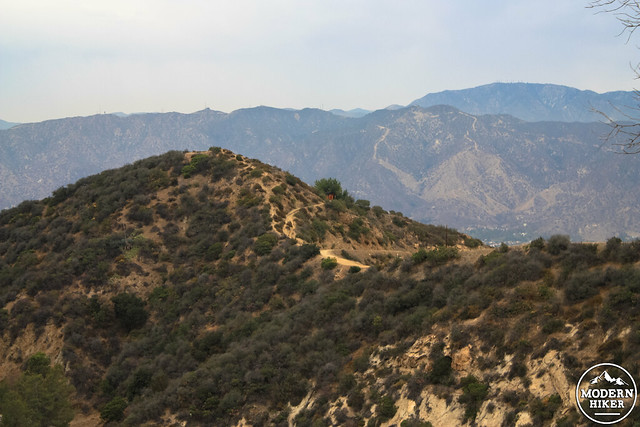
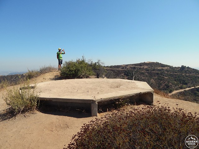
To hit the summit of Taco Peak, continue on the fire road and look for a steep use-trail on the south side of the road.
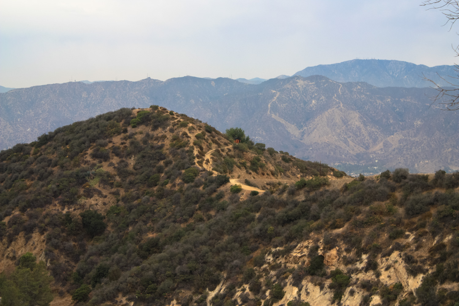
Climb up this steep and slippery trail to the summit of Taco Peak (1568′), where an old octagonal piece of concrete sits. You’ll have great views of the Verdugos and San Gabriels from here, as well as side-views of the Hollywood Sign and the interior of Griffith Park.
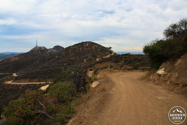
You can either scramble down the south side of Taco Peak and return back the way you came, or return down the use-trail you came up and head west. At 2 miles, there’s a fun, steep route to the summit of Mount Bell, and at 2.1 miles an alternate, easier approach to Bell and a side trip to neighboring “Baby Bell” (see our Northside Loop for more info).
At 2.2 miles, take a sharp left to descend onto the paved Mount Hollywood Drive. You can follow this road all the way down to the tunnel near the intersection with Observatory Road. From there, you can hike back up through Berlin Forest or on the sidewalk to the Griffith Observatory, or descend via Western Canyon or one of the Observatory Trails.
UPDATE: According to LAist, the artists who created the teahouse have donated it to the City. The City has not decided what they’re going to do with the building, but odds are that it will likely be moved to another location.
As of July 28th, 2015, the Tea House is no longer on Taco Peak. We will keep you up to date on wherever its foundation rests in the future.
Thank you, LA. We’ll see you again. (Photo by Jeff Adam Ingalls.) pic.twitter.com/YkE1HbMGWv
— GriffithParkTeahouse (@GParkTeahouse) July 28, 2015
In the meantime, you can visit the Tea House virtually via this 360-degree VR YouTube video from the folks at local VR firm Beard and Glasses VR. The experience is best with headphones, and is also compatible with Google Cardboard and it will also work on your smartphone’s YouTube app, allowing you to move your phone around to see what it was like up at the Tea House. Direct link is here, just in case the embedded version is giving you guff.
Tags: art installations, captain's roost, Griffith Park, griffith park teahouse, Mount Bell, Taco Peak, transit accessible, vandalism