If your inner Julie Andrews is just dying to bust out with “The hills are alive with the sound of music. . .” while twirling through idyllic verdancy above a subalpine valley, let me whet your whistle about Monarch Lakes. The Sawtooth Pass trail will carry you past a cascading waterfall, through a lush meadow bursting with wildflowers, and then through a damp, spring-riddled forest of red fir and Western white pine that alternatively crosses over rocky promontories dotted with Western junipers. After that, the trail wraps around a bend through the stark, richly-colored upper reaches of Monarch Canyon, where it will traverse the southern slope before emerging at the marshy outlet of lower Monarch Lake. So, you get to indulge that guilty pleasure for musicals AND attain killer views at a stunning subalpine lake.
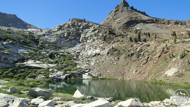
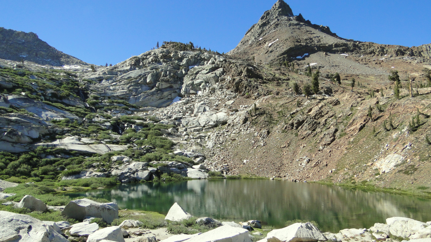
Monarch Lake
The trail begins from the Sawtooth Parking Lot on the north end of Mineral King Valley. At the parking lot, you may consider wrapping a tarp around the underside of your vehicle to ward off Mineral King’s large population of yellow-bellied marmots. In early season, the marmots have a tendency to chew on belts and hoses inside engine compartments, which would turn a great trip into a nightmare in a hurry. At the very least, you’ll want to pop the hood on your car. I don’t really know what this does, but as many people do this, including myself, and because nobody’s cars were attacked by marmots while I was there, it might be a good thing to do. If you find this advice dubious, stop by the Mineral King ranger station about half a mile down the road and seek their advice.
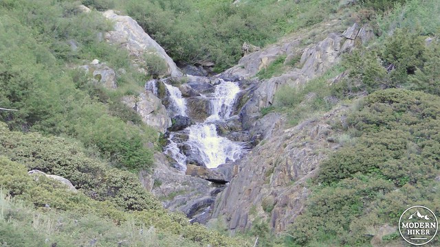
Monarch Creek
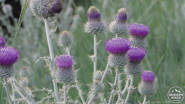
Thistles at the beginning of the trail
The trail will immediately begin an ascent up an open slope covered in manzanita, sagebrush, and ceanothus. The first leg of the ascent is a brutal way to start a trip, but it will warm up your leg muscles for the climb to come. As the climb proceeds, views down valley toward Farewell Gap will consistently improve, allowing for iconic Mineral King views. After the trail hits a bend that offers a nice view of cascading Monarch Creek, the ascent mellows substantially, and the climb is a lot easier from here.
Vandever Mountain with White Chief Bowl to the right
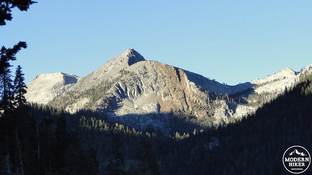
Sawtooth Peak
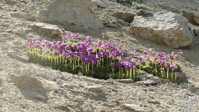
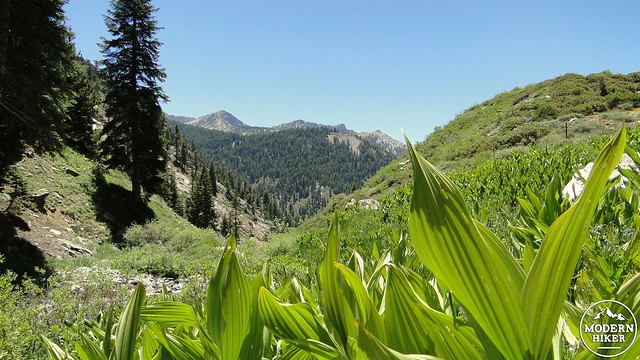
The trail will continue to switchback up sagebrush covered slopes dotted by junipers and Jeffrey pines, past a junction with Timber Gap Trail, before it reaches a gap indicating a hanging valley. After passing through the gap, you emerge into a gorgeous meadow, which is a lovely reward for the first mile of climbing. This meadow is dotted with paintbrushes, shooting stars, corn lillies, and a host of other wildlflowers I could not identify. The creek tumbles across the trail, and the low roar of a nearby waterfall indicates the source. This meadow is so lovely that even if you found yourself pooped by the first leg of the climb, you would not be stinting yourself if you turned back.
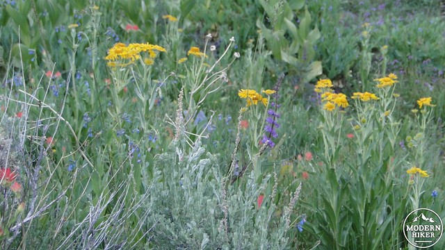
Lots of flowers
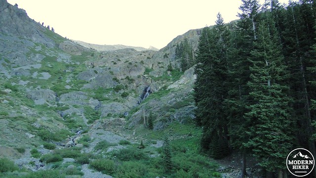
Cascading Monarch Creek
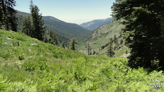
But you won’t do that, because there is so much more to see. The trail passes into a dense woods of red fir and Western white pine. It begins to switchback up the northeast slope of Mineral King valley, with ever-improving views along the way. Beneath the forest canopy, numerous hillside meadows, fed by streams, promote a lush understory of ferns, grasses, flowers, and corn lillies. In the cool of the morning, this is as peaceful and serene a trail as one could hope for. In the afternoon, the dense pockets of shade cast by the trees provide welcome relief from the relentless sun.
Monarch Lake Trail
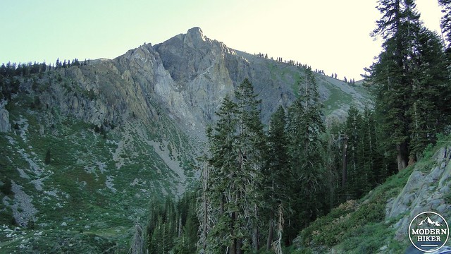
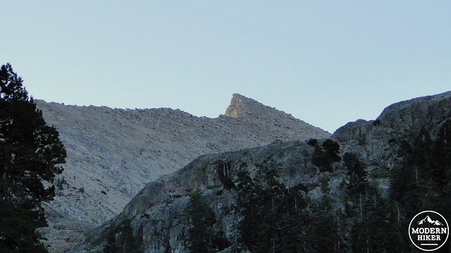
Empire Mountain
The trail will continue in this way for some time before coming to a dryer and more open slope. Views west toward San Joaquin Valley will either be smogged in, or maybe even surprsingly clear as they were on the day I hiked. The trail will round a rocky bend, switchback some more, and then reach a junction with the Crystal Lakes Trail. Turn left to continue following the Monarch Lakes trail.
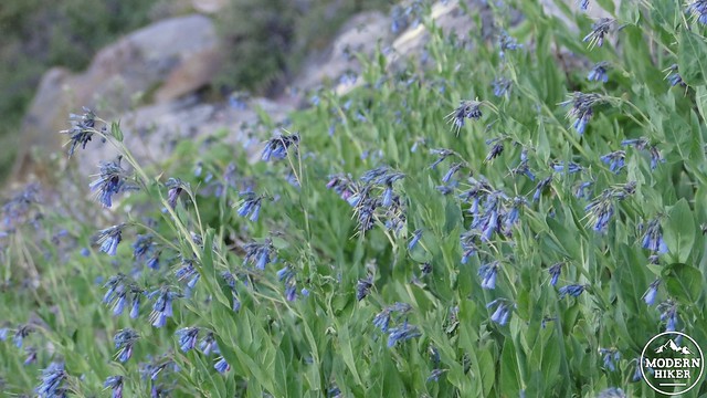
Not sure what flower this is. Maybe blue bells?
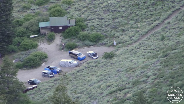
This author’s loyal Civic is in the center of the frame
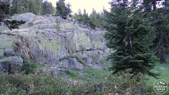
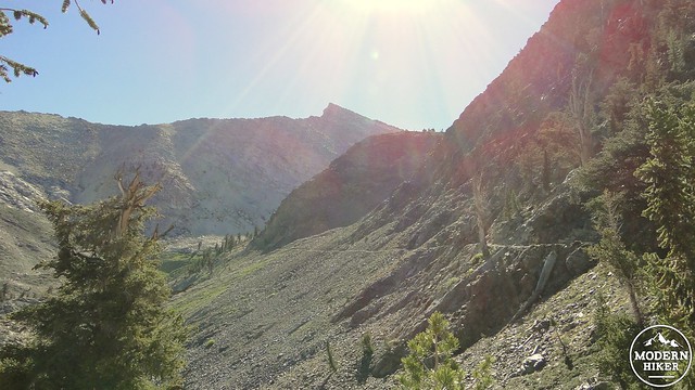
After the junction, the trail will become increasingly rocky as the trees begin to thin. Hints of the view about to open up to you are present from the slopes of domineering Empire Mountain directly to the north. The trail will pass over a rise dotted by foxtail pines before bending right to traverse the rocky and exposed slopes of Monarch Canyon. Monarch Canyon is expansive and wide, and the sounds of falling water echo up from the lower reaches. The rock on the south side is sedimentary, and is flakier and darker than the usual Sierran granite. This adds to some of the richer hues present throughout the canyon. The steep slope ascending down to your left adds a bit of drama for seasoning.
Leaving the tree cover
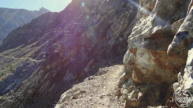
Clinging to the side of the canyon
The trail follows this slope for about a mile before it bends to the right and passes through some lush spring-fed growths of grasses and wildflowers. Past this marshy spot, the trail will cross over two branches of Monarch Creek, indicating that the lake is almost near. The trail will climb up another low rise, which is actually the moraine that holds the lake into its small glacial basin. At the top of the moraine, the lake appears, along with the first of a number of campsites. If you come here during the morning or afternoon on a warm day, be prepared for dreadful swarms of mosquitos. If you’re prepared with bug repellent and mosquito netting, the bugs will merely be a nuisance. Without those things, they may become a nightmare from which there is no waking.
???
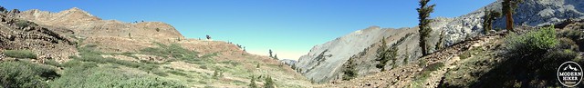
Monarch Canyon as seen from the outlet of Monarch Lake
A use trail leads left past the first campsite to another campsite with a bear box. Past this campsite is an open air pit toilet that might offer one of the nicest views of any toilet in California. Should you wish to conclude your trip here before retracing your steps or setting up camp, you will have enjoyed a richly varied hike with many amazing scenes (No, I’m not implying that you should hike all this way just to use a toilet). There are a number of easily climbed granite boulders from which to consider the lake. Or, one may follow a continuation of the use trail up and over a second moraine leading to the larger but less accessible second Monarch Lake.
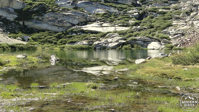
Monarch Lake outlet
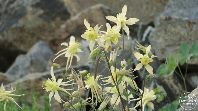
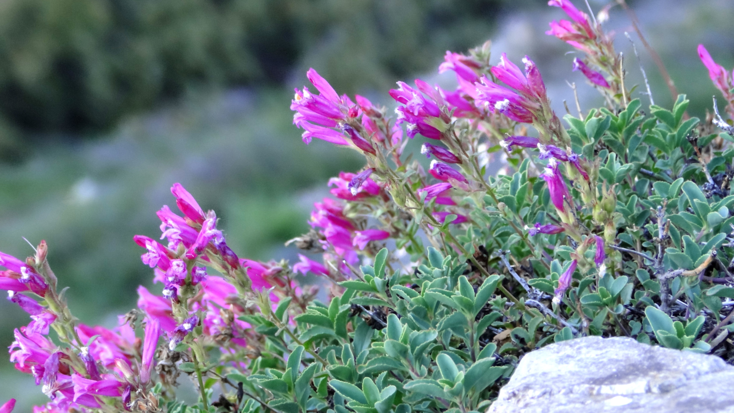
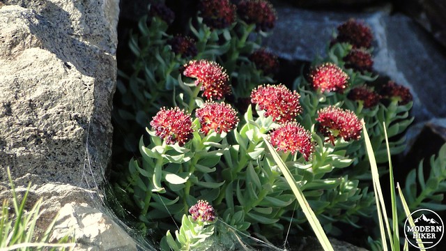
Sierra Columbine
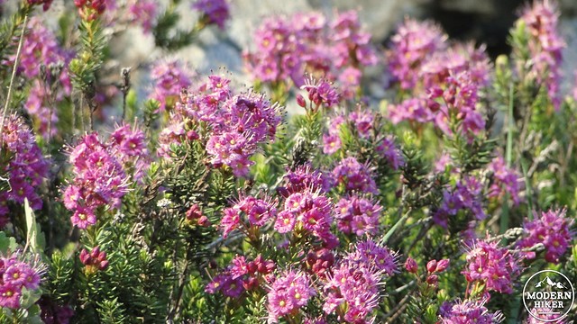
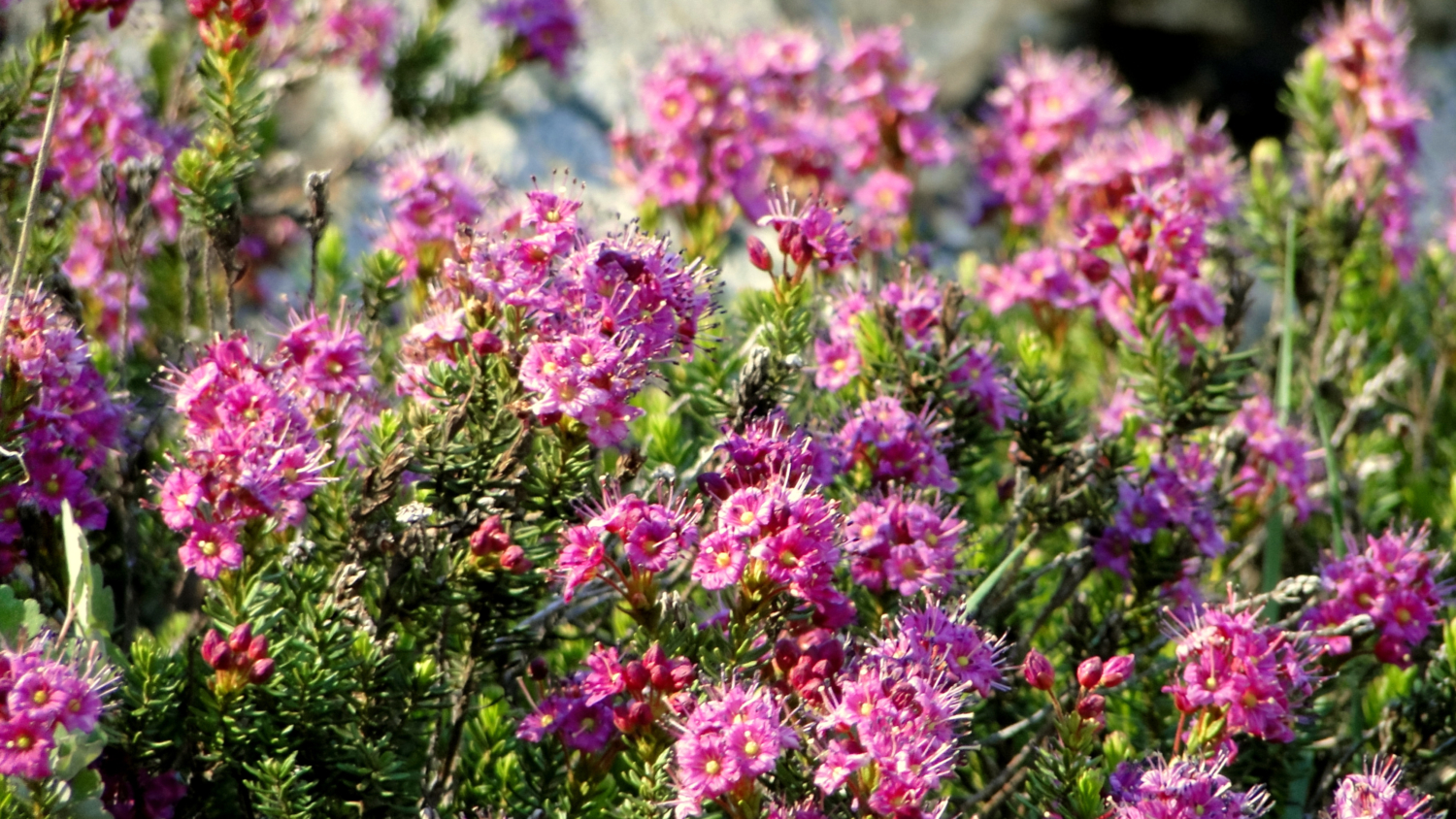
Heather
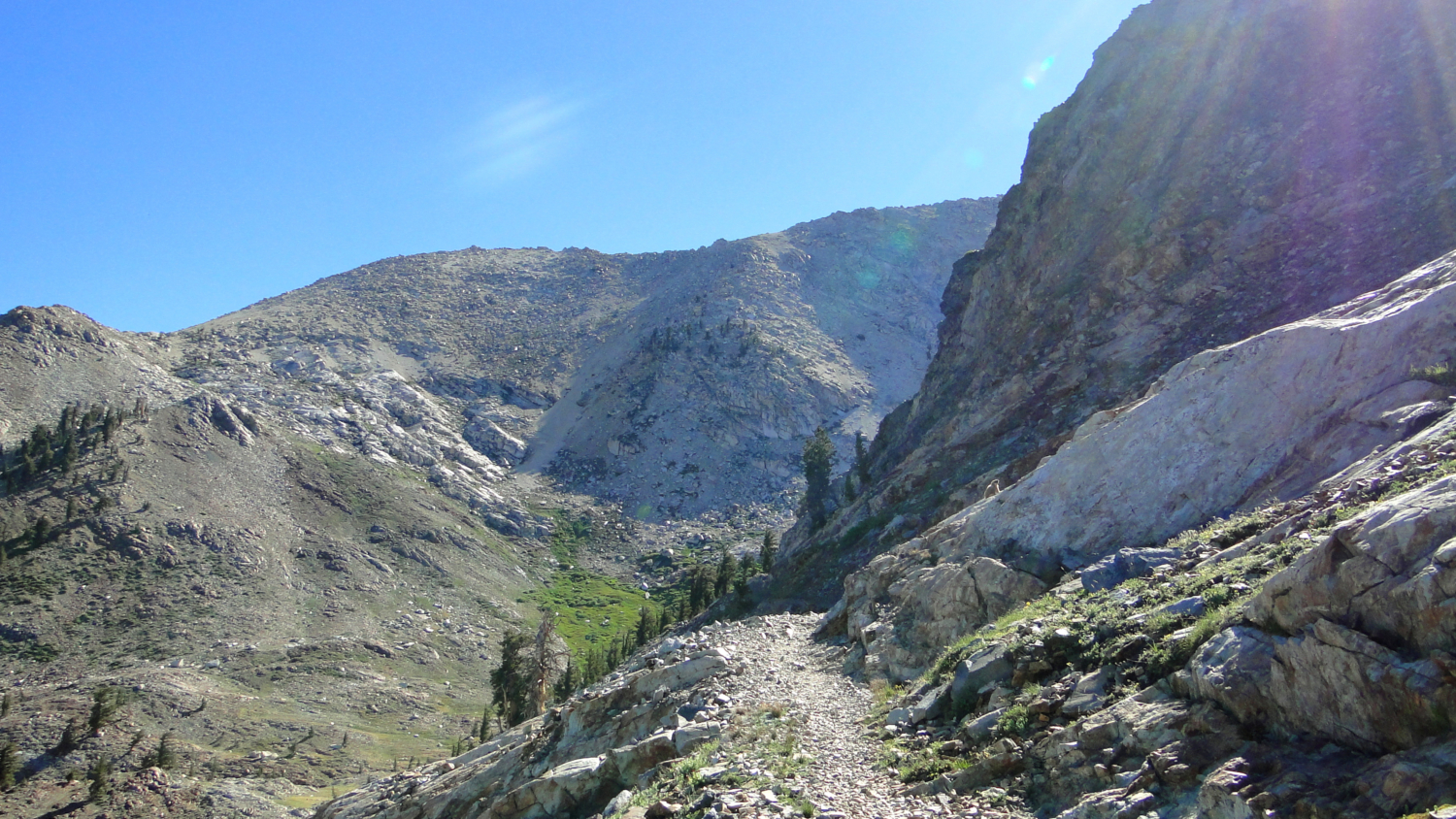
If you are a glutton for punishment and want to drag yourself up a steep, difficulty, sandy, slippery slope, you can follow a different use trail off to the left. The trail will meander through some boulders before beginning to climb in earnest. The scree appears almost immediately, and the first 500 feet of climbing occurs on brutally steep switchbacks traced through the scree. Occasional patches of firm ground exist, providing a moment of temporary relief. However, expect scree from start to finish, and do not expect any part of the trail to be easy.
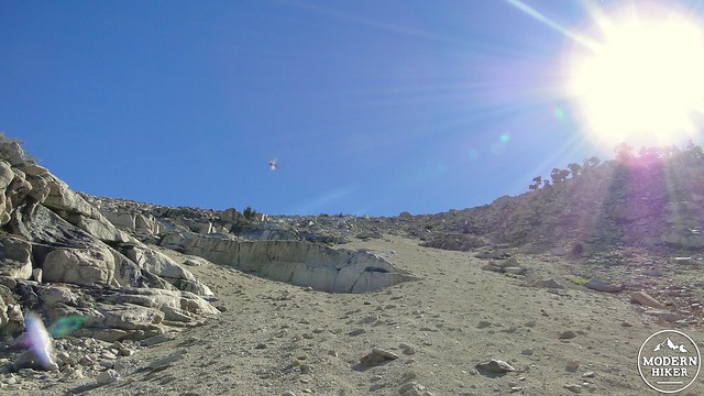
The ascent. That dark blur center-left is a mosquito. The bastards were everywhere.
Although, the ascent was not without its merits
If you’re following the GPS track here, this might be a good time to abandon it. I did not properly research the location of the pass, and I diverged from the appropriate route and arrived at what I thought might be the pass. Most passes occur at the low point of a mountain ridge, but not so with Sawtooth Pass. Because the terrain on the other side of the low point of Sawtooth Ridge is a sheer 1,000’ drop, the actual pass itself occurs slightly up slope to the north. I climbed pretty close to it, but I ended up tracing the ridge to the lowpoint, which I mistook for a pass. From here, there was a use trail leading off to Sawtooth Peak, but as I was never comfortable atop the ridge, I decided that the peak would be even worse, and turned back.
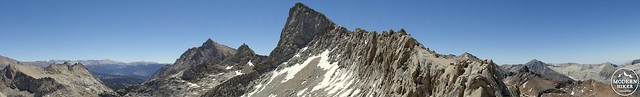
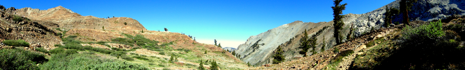
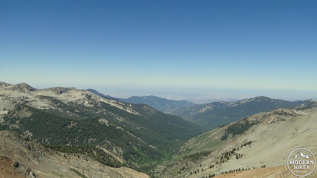
Sawtooth Pass pano
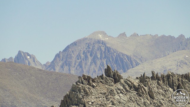
Mt. Whitney
So, strictly speaking, this is not intended to be a guide up Sawtooth Pass. Instead, it’s more a record of what it was like to make an attempt. Personally, I do not feel it added a lot to the overall experience, at least in a positive, enjoyable manner. I’m not the most adventurous hiker, and I don’t do this for adrenaline rushes. I like being relaxed. I don’t like being scared. The pass was kind of scary. However, I will acknowledge that the views were sublime. From the pass, I enjoyed views of Columbine Lake 1000’ below. The Kaweah formation loomed darkly to the north, while Mt. Whitney and Mt. Langley dominated the skyline to the east. The dark forest of the Kern Plateau stretched out for many miles inbetween, and this was a rare glimpse from the western angle of the rugged interior of the central Sierras.
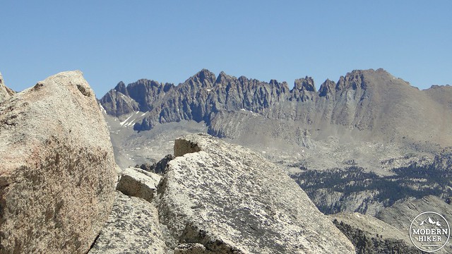
The Kaweah Formation
The San Joaquin Valley. It’s surprisingly clear for the end of June. You can actually make out the Coast Ranges
To get back down, I mostly slid, occasionally on my backside. Fortunately, the scree softens the impact on the knees, which is a considerable consolation considering that the “trail” I was on dropped 1,200’ on an extremely steep slope. Follow the paths carved into the slope and drop down slowly and carefully, preferably using trekking poles to retard your momentum. You may wish to stop periodically to appreciate the views, but, after nearly three hours of nightmarish wallowing in the scree, you may just wish to get it over with.
Looking down into Mineral King
Back through the meadow
Once you reach the lake, trace your way back along the shore, over the moraine, along the slope of Monarch Canyon, and then back down through the woods, through the meadow, past the cascades of Monarch Creek, and, thoroughly exhausted, back to your car. If the pass ascent is not enjoyable, it is certainly memorable. The rest of the hike is wonderful, and comes highly recommended. While a dayhike will certainly be a nice way to go, it appears that the best way to enjoy the landscape is to spend the night at Monarch Lake in order to soak in the combination of alpine beauty, high elevation sunsets, and countless stars in the clear mountain skies. Just remember to bring the bug spray.
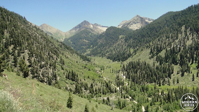
Mineral King Valley
Tags: Mineral King, Monarch Creek, Monarch Lake, Sawtooth Pass, Sawtooth Peak