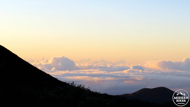
The island of Hawai’i, colloquially known as the “Big Island,” features a number of remarkable extremes that set it apart not just from the other Hawaiian Islands, but from most other places throughout the world. Here is a place with barren volcanic deserts and lush rain forests receiving 240″ of rainfall a year separated by a few dozen miles. On Hawai’i, you can swim with manta rays, stand on the rim of a boiling caldera, and get an epic sunburn while consuming rum-laden cocktails. However, the most spectacular extreme you can experience here is a trip to the summit of Mauna Kea.
 Mauna Kea is the highest point in the Hawaiian Islands, topping out at 13,796′. When considered in terms of prominence, a term that refers to the elevation of a mountain in relation to the lowest contour line surrounding it, many people consider Mauna Kea to be among the tallest mountains in the world. Mauna Kea achieves this because its base is at least 18,000′ below the surface of the ocean – although this varies depending on where geologists measure from. In that regard, Mauna Kea is taller than Mt. Everest, even though Everest has a higher elevation.
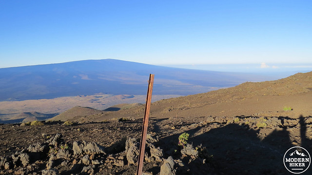
Hualalai Mountain
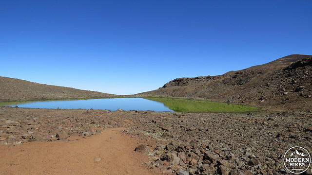
Mauna Kea’s height and geographic position also result in a number of geologic and meteorologic oddities that have given it a different kind of prominence within the scientific community. Mauna Kea is one of those rare places in the tropics that has experienced glaciation during past ice age episodes. Glaciation on the peak has created an alpine lake basin, also on the southwest side of the peak, that contains the highest lake in the Pacific Basin, Lake Waiau. This lake has no visible water source in the form of a creek, river, or spring. Instead, the lake is fed by melting permafrost left over from the last period of glaciation. Mauna Kea also receives regular snow during the winter and spring months, and it’s not uncommon for the summit to be snowcapped. Even in June, it’s not uncommon to see snow fields near the summit. The presence of snow gives Mauna Kea its name. Mauna in Hawaiian means “mountain,” while Kea means “white.”
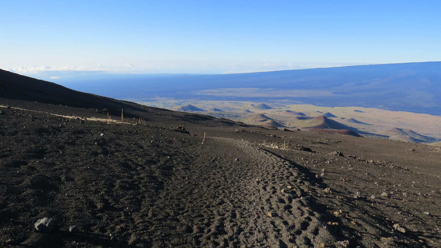
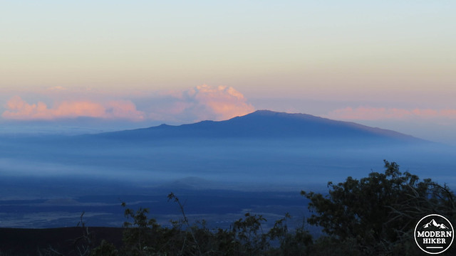
Looking south toward Mauna Loa
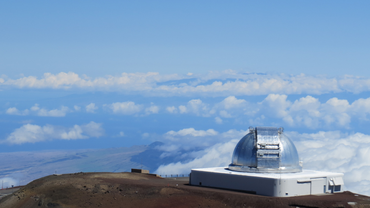
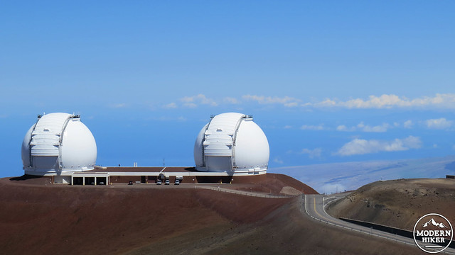
Given Mauna Kea’s position on the Hawaiian Islands, which are one of the most geographically remote places on the planet, and given the exceptional clarity of the atmosphere due to low humidity and a much thinner atmosphere, the summit happens to be one of the best places in the world to conduct astronomical research. Mauna Kea’s summit region features a number of world famous telescopes, including the Subaru telescope, the twin Keck telescopes, and NASA’s infrared telescope facility. 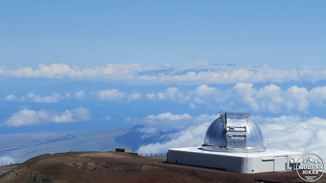
The presence of so much science and the desire to further develop the summit area has led to considerable amount of controversy due to conflict between the scientific community and the local Hawaiians. The summits on the island of Hawaii are considered sacred to the Hawaiian people, and none are considered more sacred than the summit of Mauna Kea. According to Hawaiian mythology, the sky god Wakea and the earth goddess Papa married and gave birth to the Hawaiian Islands, with Mauna Kea being the first born son. Ancient Hawaiians believed that the mountain was a residence for gods and spirits, in addition to it being a crucial resource for their survival.
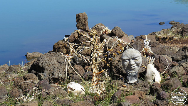
Hawaiian shrine on the banks of Lake Waiau
Today, the mountain is embroiled in controversy between the scientific community, which seeks to build a new 30-meter telescope and the Hawaiian people, who consider any further development of the summit a violation of the mountain’s sanctity. In April of 2015, native Hawaiians and others sympathetic to the cause temporarily halted the construction of the telescope through protest. At the time I conducted scouting for this trip, protests were ongoing, and the commissions behind the telescope had agreed to restart construction. It is likely that the clash between scientific progress and the rights of native Hawaiians will continue for some time to come. Protests and construction may impact your ability to hike the mountain, and it would be wise to contact Mauna Kea Visitor Center in advance to ensure that it’s possible to hike to the summit. 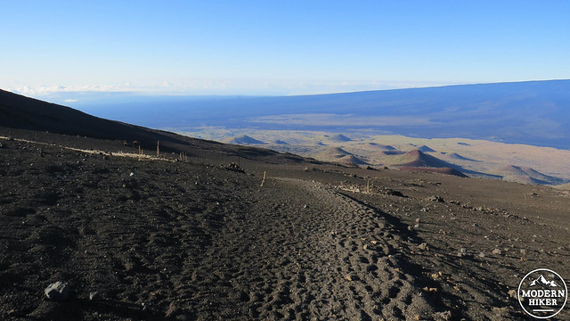
Reaching the summit is no easy feat. It is a 6 mile hike gaining 4,500′ of elevation to reach the summit from the visitor center. Furthermore, the starting point at the visitor center is at 9,300′, which gives hikers absolutely no time to acclimate. This is even more problematic given that most of the island’s population centers lie on the coast, and most visitors to Mauna Kea will attempt to go from sea level to just shy of 14,000′ without any acclimation. For any hike of this elevation, we usually recommending taking at least a day to acclimate. For day hikes, this is impossible, and you can reasonably expect no more than an hour or two at the visitor center to prepare for the climb, given that an early start is essential. There are cabins that one can rent in the nearby Mauna Kea State Recreation Area located at 6,500′ where one can spend the night for acclimation. This is not a perfect elevation to acclimate for a climb reaching more than double that elevation, but 6,500′ is better than 0′ in regards to acclimating. Even with acclimation, this may not be a safe hike for people who consistently struggle with high altitudes.
 Additional safety concerns include sun exposure, extreme temperatures, and hydration. There is absolutely no cover on this trail, and the entire route is exposed to tropical sunlight, which can often be directly overhead. On the day I hiked this route, I wore two shirts with UPF protection and two sweatshirts to stave off the bitter early morning cold. I still managed to get a sunburn on my shoulders. Use as much sun protection as you possibly can. The mountain can also be bitterly cold no matter the season. I started at 5:45 and the temperature at 9,300′ was about 30 degrees. Dehydration happens at an accelerated rate at elevation, and it is therefore wise to bring abundant water (at least a gallon) as well as electrolyte supplements or beverages.
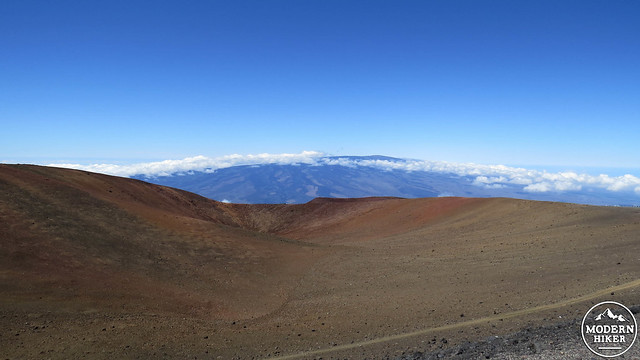
Starting from the visitor center, walk up the paved Mauna Kea summit access road for about 100 yards until you reach a wide, rutted dirt road branching away on the left. Turn left here and commence a steep climb up the dirt road until you reach the signed Mauna Kea Humu’Ula Trail on the right. For the first 2.5 miles, the climb gains an average of 1,000′ per mile, which is the point where nearly all hikers begin to struggle – and this at an elevation range between 9,300 and 11,800′.
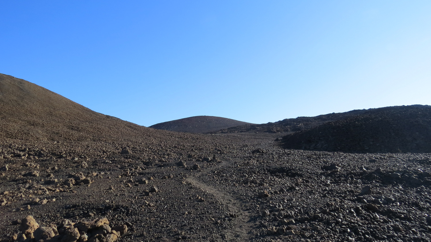
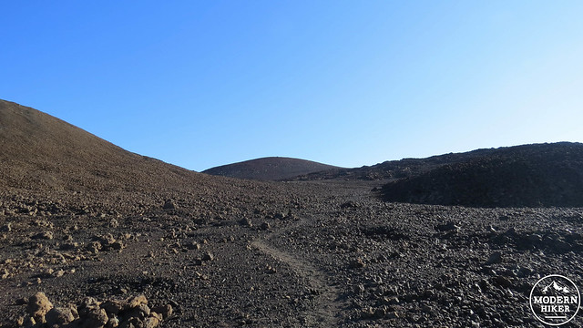 The terrain on this route is rocky, barren, and a deep, dark red. What few stunted shrubs cling to life at 9,300′ rapidly disappear, and by 11,000′ there is almost no vegetation visible. Along with no vegetation comes almost no animal life, although occasional insects will find themselves blown up the mountain, and an introduced population of bighorn sheep will occasionally wander to the upper elevations as well. However, for the first 4 miles, the terrain is almost entirely volcanic rock with a number of cinder cones providing relief from the nearly uniform steep slope. Of course, the terrain is not the principal attraction here. The view south, east, and west are jaw-dropping, as the bulk of the Big Island and much of the surrounding ocean for over 100 miles is easily visible when the atmosphere is clear.
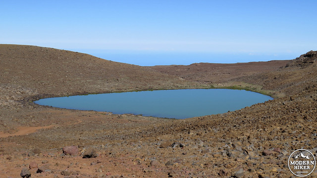
Lake Waiau
At 4.1 miles, the trail comes to a junction with a second trail that approaches from the east. By this point, you have entered the Mauna Kea Ice Age Natural Area. This is an access trail from a parking lot on the road to the summit that allows a casual approach to Lake Waiau. Turn left here and climb up and over a small rise to drop down to the shores of green, mostly opaque Lake Waiau. The basin the lake sits in was formed during recent period of glaciation, and the lake itself is fed by permafrost. You’ll also notice a handful of shrines left on the lake’s shore. Hawaiian in past times used to dip the umbilical cords of their babies in the water to imbibe their children with the strength of the mountain. The lake has historical significance, and visitors shall not disturb the shrines nor enter the water. Of course, you’d be insane to get into a lake at 13,200′ anyway, but just in case you’re tempted, remember to respect Hawaiian culture and tradition.
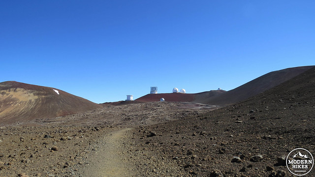 Beyond this junction, the trail continues north along the base of a massive cinder cone. After crossing a broad crest, the surreal site of numerous massive structures housing spectacularly sophisticated telescopes greets you. You are now quite close to the summit, although the most tedious part of the climb awaits. The campus of telescopes is mainly accessible by roads, and from the point where the trail terminates at the road, there will be no further trails to get to the top. If you wish to continue, you will need to follow the shoulder of the road as it climbs toward the Keck Telescope close to the summit.
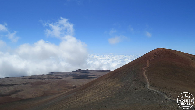
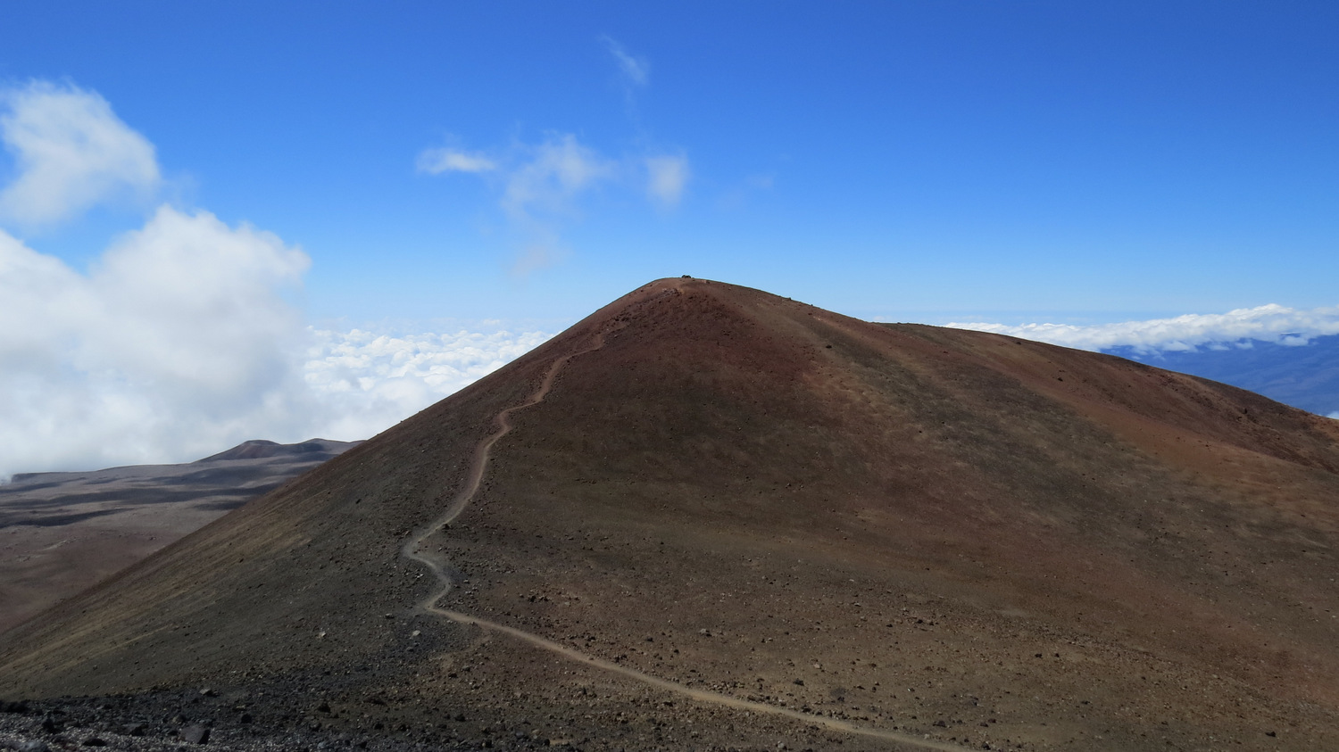
The forbidden summit of Mauna Kea
You’ll come across the trail to the summit right before you reach the Keck telescope. As tempting as it will be to stand 100 yards from the state’s highest point, we ask you not to attempt to climb to the summit. Remember that this is one of the most sacred spots on the Hawaiian Islands. It is so sacred to Hawaiians that they are currently doing everything they can to derail the construction of a billion-dollar telescope. I know it’s disappointing to climb the mountain and not summit, but you’ll end up standing a mere 20 feet lower than the actual summit itself. In fact, the top of the Keck telescope is several dozen feet higher than the actual summit, so you wouldn’t be reaching the high point anyway.
 After exploring the telescope area and summit while taking in the jaw-dropping views and the surreal Mars-scape, you must begin the arduous process of heading back down the mountain. One potential option is to hitch your way back down. The summit is accessible to public traffic, and automobile traffic is an infrequent presence. Determined hikers, however, must hoof it back.
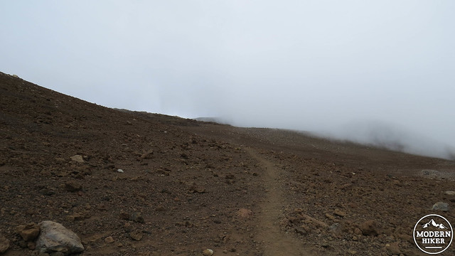
It bears repeating that this is an incredibly challenging hike reserved for determined and very well-conditioned hikes. In fact, some may wonder why a hike like this is worth taking if there is no vegetation, no opportunity to bag a peak, and no opportunity to sufficiently acclimate. It’s probably not a hike for everybody, but after hiking it, I can say that it was an absolutely phenomenal experience that I will not soon forget. Yes, it was incredibly difficult – probably one of the hardest hikes I’ve ever taken – but there is no other place on the planet like this, and I would not turn that opportunity down just for a few mai tais on the beach.
Of course, it is possible to drive up to the summit. You miss the opportunity for an exceptionally challenging hike, but the summit is absolutely worth seeing either way. You also have the option to dayhike to Lake Waiau from the road to the summit. This route is about 1.5 miles and 400′ of gain (all starting around 13,000′, however).
Tags: Big Island, hawaii, Keck Telescope, Lake Waiau, Mauna Kea, Mauna Kea Humu'Ula Trail, Mauna Kea Ice Age Natural Area, Mauna Kea Observatory, Mauna Kea Visitor Center, Subaru Telescope