This loop hike takes you up the backside of Hazard Peak, via Islay Creek and the Barrance connector trail. Since there is very little shade over these 9 miles it’s advisable to get an early start. There are three distinct sections on this hike: a flat stroll up Islay Creek, a steep climb and ridge ramble on the Barrance Trail, and then an effortless descent along the Hazard Peak Trail.
0 – 2.9 Miles – Islay Creek Road
Start out from the Hazard Peak trailhead parking lot located on the coastal side of Pecho Valley Road. Follow the road south for 0.1 miles, curving around the bend, until you see a small dirt parking area on your left. This is the junction with Islay Creek Road which you will be walking up for 2.9 miles on the first portion of the hike.
The first half-mile parallels Islay Creek Campground which offers 52 reservable campsites, pit toilets, and water. This is a great campground to stay at if you want to explore other parts of the park — just remember to keep your food stored inside a vehicle at night with the windows rolled up. The raccoons are very aggressive here and will crawl inside your tent or car seeking out food (even with people present!)
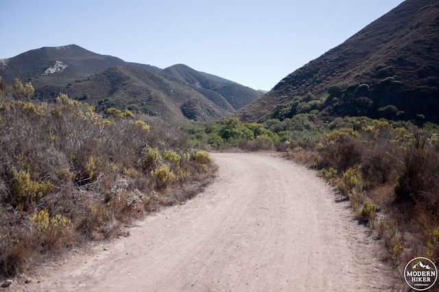
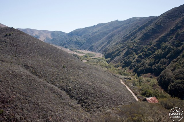
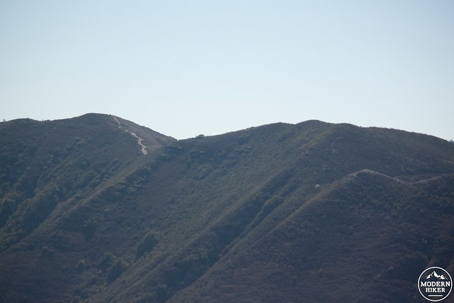
At mile 1.1 you pass the junction with Reservoir Flats Trail. This trail takes you up Oats Peak, one of Montana de Oro’s highest points. The prominent pyramid-shaped mountain to your south is Valencia Peak, which can be accessed via a 4.8 mile hike from Spooners Cove. Continue along the road as it crosses over a variety of tributaries (mile 2.0), passes a hanging cypress grove (mile 2.5), and eventually joins up with the next leg of this loop — the Barrance Trail (mile 2.9). You will know you’ve gone too far if you reach a large rundown barn.
A quick reminder about trail etiquette. There are a number of different user groups (hikers, mountain bikers, horseback riders) who frequent this trail, so keep in mind who has the right-of-way. Hikers should always yield to horseback riders, and while mountain bikers should yield to hikers it is often easier and more courteous to step aside and let them ride by. You will likely see horses on the Islay Creek section, and mountain bikers on the Hazard Peak section.
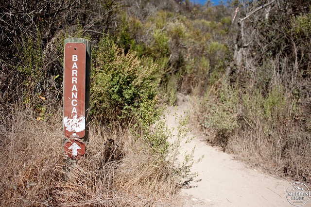
2.9 – 4.0 Miles – Barrance Trail
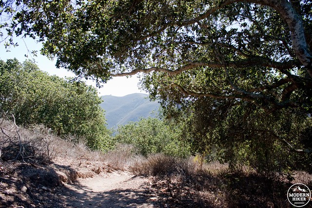
At mile 2.9, a thin dirt trail branches off to your left: this is the start of the Barrance Trail. The next 1.1 miles of trail climbs 690 feet and emerges from the Islay Creek valley. This is the steepest and longest climb of the hike, but there are some great views looking up the valley and a grove of scrub oak which provides some shade along the way.
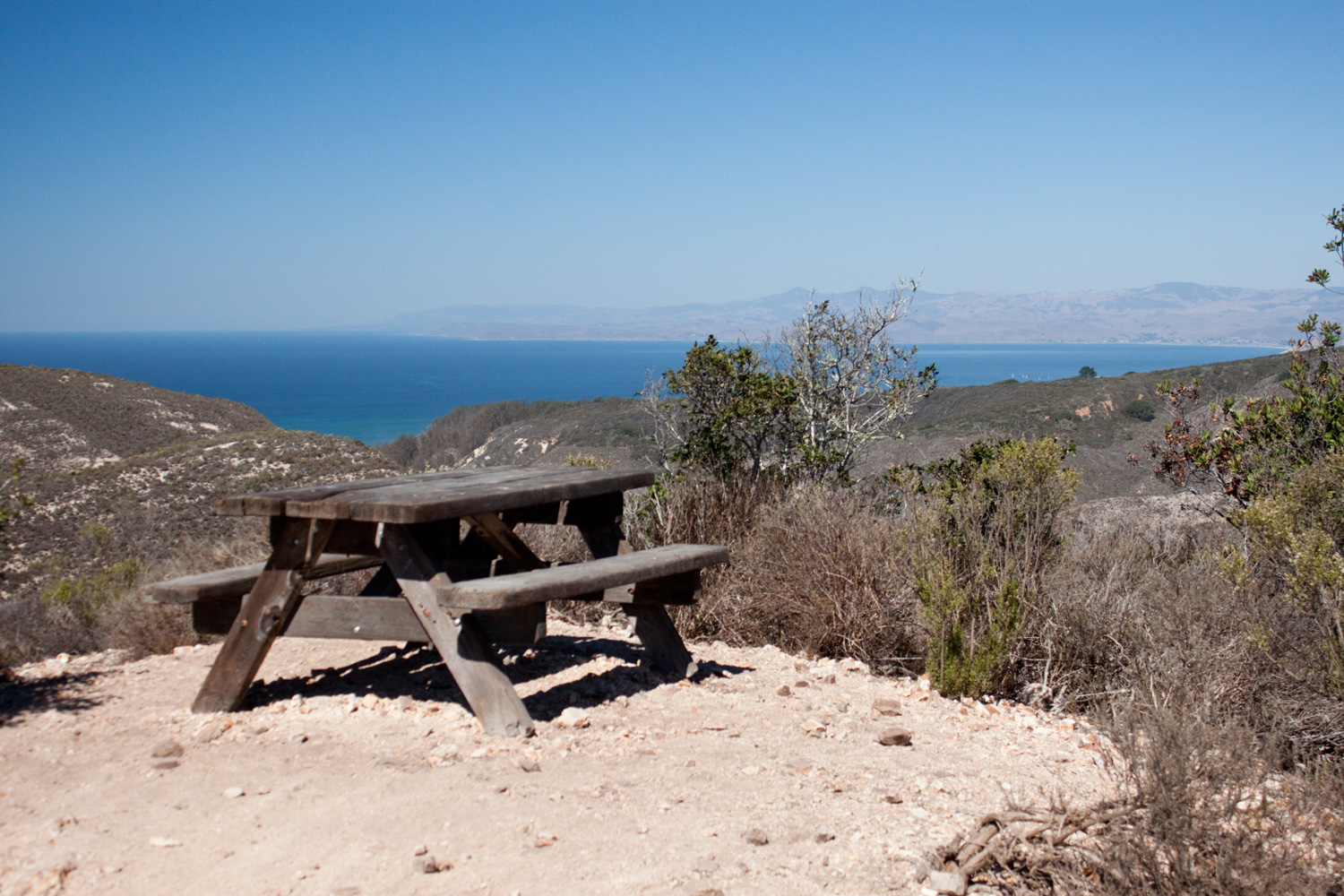
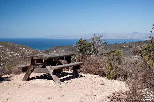
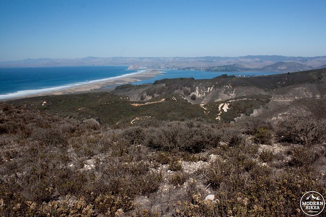
At the top of the climb (mile 4) you are rewarded with the first views of Morro Bay and the coastline to the north. A picnic table provides a space to soak in these views before dropping back onto the trail.
4.0 – 6.3 Miles – East Boundary Peak Linkup
Over the next 2.3 mile you will be transitioning between a series of trails. The route you want to follow roughly follows the ridgeline towards Hazard Peak. This trail network was recently overhauled resulting in some nice new trails but also has many sucker and social trails which should be avoided. From the picnic table at mile 4, retrace your steps to get moving north again on the Barrance Trail.
You will descend for 0.3 miles and reach a junction with East Boundary Peak Trail. Take a left, avoid the old trail immediately on your next left, and continue north as you wind your way down seven switchbacks.
At mile 4.75 (0.35 miles from the East Boundary Peak junction) turn left onto the Hazard Peak Trail, then continue straight past the Manzanita Trail junction just ahead.
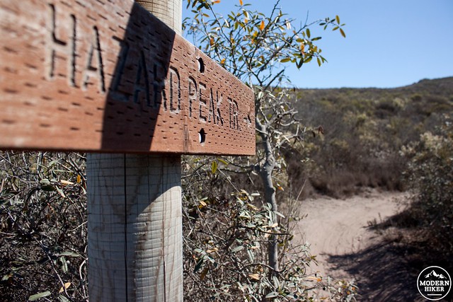
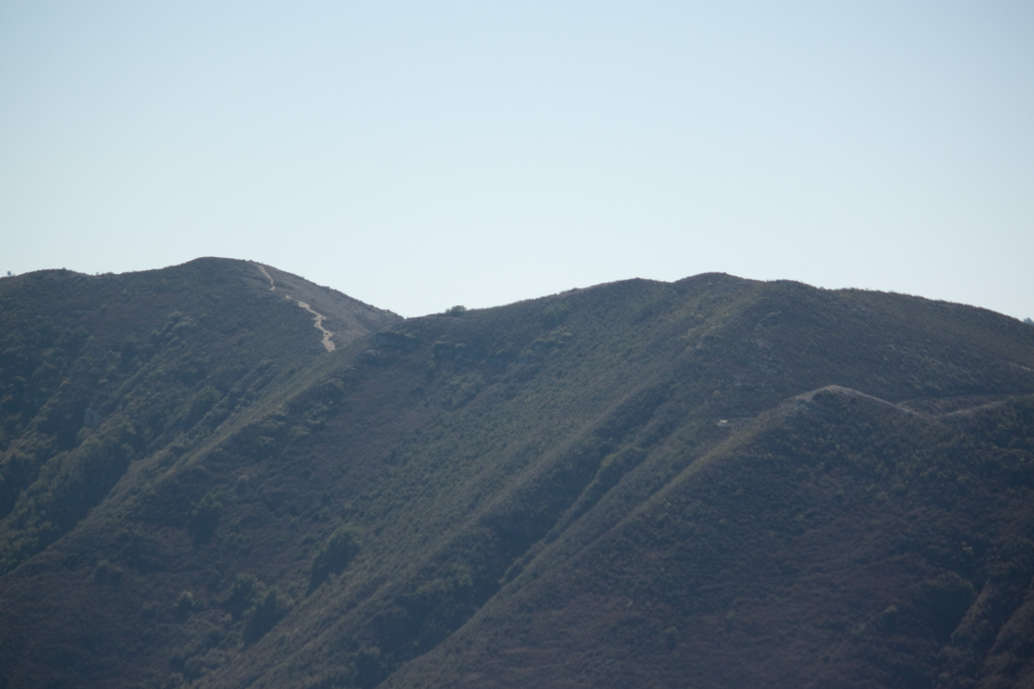
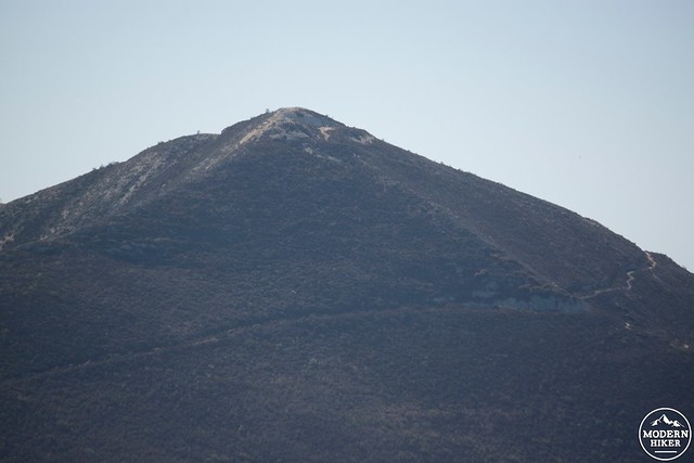
Now the trail takes a more direct route west towards Hazard Peak. At mile 5.35 you will see an old trail off to your right which travels down the south side of Hazard Canyon (to the north). Continue on as the trail starts to pick up some elevation gain once again. Another 0.8 miles of ridge rambling will deposit you on the summit of Hazards Peak (at mile 6.1).
From the summit of Hazards you can look north to Morro Rock, the town of Morro Bay, and the estuary; southeast to Oats Peak; southwest to Valencia Peak; and west to the Bluff Trail and coastline.
6.1 – 8.3 Miles – Hazard Peak Trail
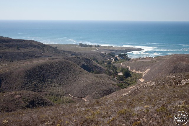
After some well earned rest it’s time to finish the loop by descending on the Hazard Peak Trail. This section of the trail is more frequently used because it provides a quicker approach to the peak’s summit. Be especially mindful of mountain bikers as you start cruising down towards the coastline.
This section of trail is awesome. A comfortable downward slope, spectacular views of the coastline, and a well maintained trail solidify this section as the best part of the loop. At mile 7.2 you get a nice view of the campground and bluffs to the southwest.
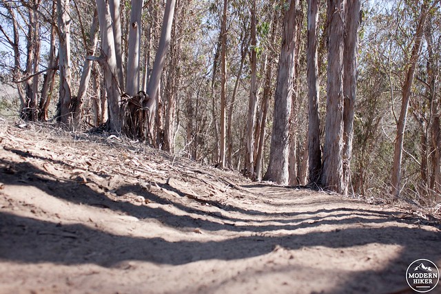
At mile 8.0 the trail briefly dips into a eucalyptus grove. Back in the early 1900’s, Alexander Hazard (the land owner at the time) decided to try and cash in on California’s need for timber. He planted multiple groves of eucalyptus which, as it turns out, isn’t the best commercial lumber. To this day the eucalyptus trees still stand in groves on the northern edge of the park.
1.1 miles of travel past the grove spits you out at the Hazard Peak trailhead for a total of 9.1 miles and 1550 feet. Head down to Spooners Cove, just to the south, for some relaxing beach time to wrap up the day.
Tags: Barrance Trail, Central Coast, Hazard Peak, Irish Hills, Islay Creek Road, Montana de Oro State Park, Morro Bay, San Luis Obispo