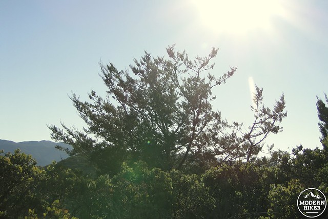
Weighing in at 4,875′, Guatay Mountain comes a few hairs and a stepstool short of being counted into the 5,000′ club like its nearby siblings in Cuyamaca Rancho State Park. Unlike these other nearby peaks, Guatay Mountain boasts one of the last remaining old growth populations of Tecate cypress, a now rare tree that was once far more common prior to a very long term drying trend and an increase in frequency for wildfires. Guatay is the most accessible point to view these rare trees in San Diego, and the views aren’t bad either.
Tecate cypress
There isn’t a ton of information about the history of Guatay Mountain, largely because so little of Kwaaymii, a band of the Kumeyaay Indians, culture was preserved. Some of the nearby peaks such as Viejas Mountain were considered sacred, although it is unknown whether Guatay Mountain held any particular place in Kwaaymii lore. Guatay means “Counsel House” or “Big Chief’s House” in the Kumeyaay language, although that appears to refer to the Descanso area – an important residence for the semi-nomadic Kwaaymii who would come down from their summer camps in the Laguna Mountains at the approach of winter to stay in the Big Pine Valley area.
Pine Creek Wilderness
Significant or not, the mountain is still a good bit of fun to climb. Starting out from the parking lot, backtrack on the road for about half a mile before coming to an unassuming trail head leading off into the bush. This trail will pass along the east flank of Guatay Mountain through an oak woodland that shades an undergrowth of silvery, pungent sagebrush. A creek flows through here when it rains, although the area is usually dry. This section of the trail will climb gradually before making a sharp left turn at a point where the climbing will become more severe.
Elfin forest of Manzanita
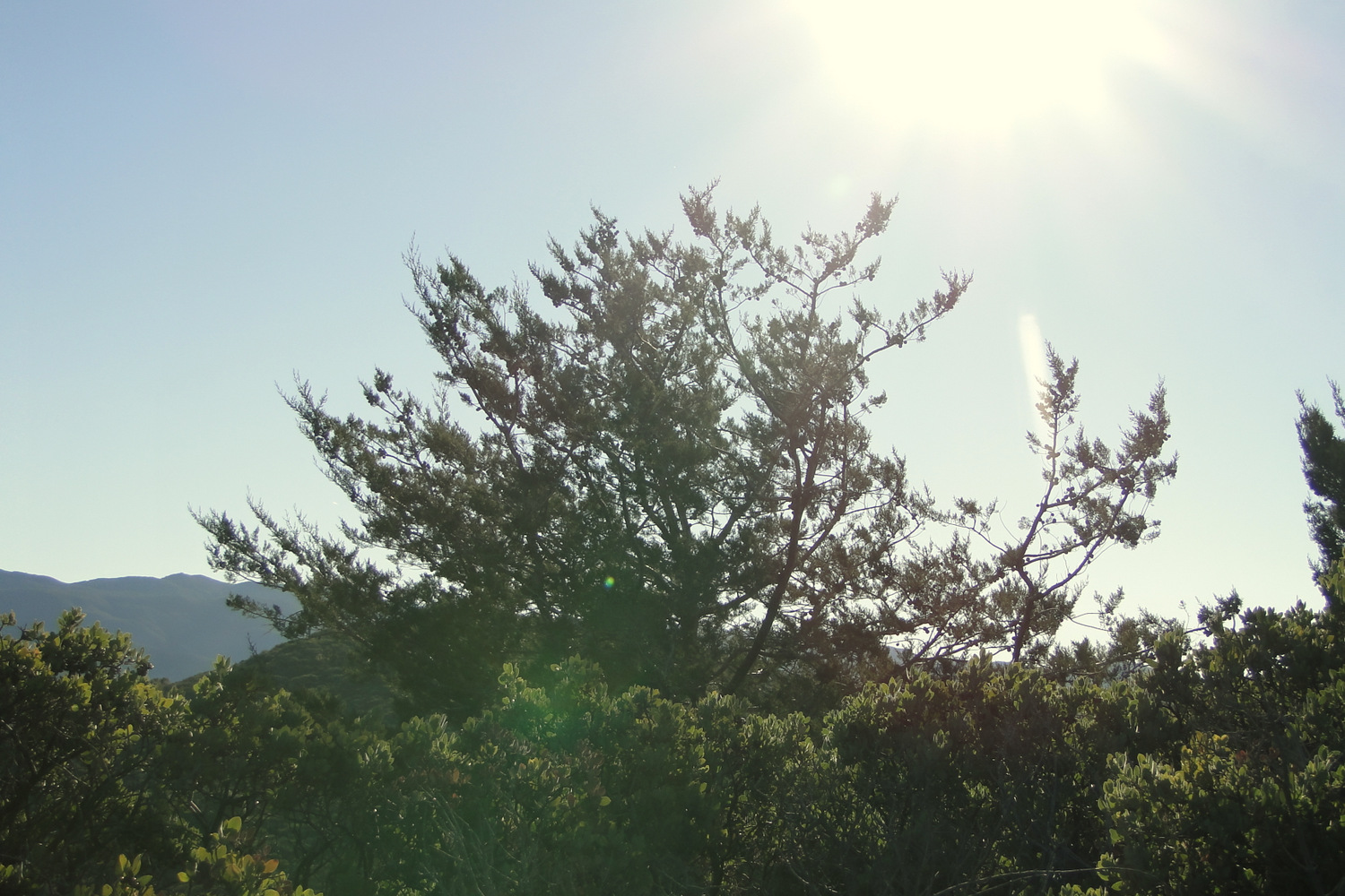
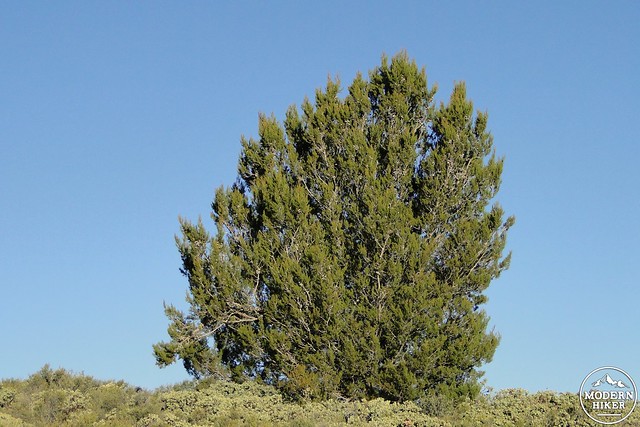
After making this turn, begin climbing up a slope through chaparral dominated by ceanothus, mountain mahogany, Manzanita, and chamise. Ceanothus in particular creates a nice flower show in spring with its blue or white flower clusters emitting a honey-like smell. As the trail climbs, views south over the Pine Creek Wilderness and its attendant peaks will attract the eye, along with the snaking line of Interstate 8. To the north, views of Cuyamaca Rancho State Park, dominated by Cuyamaca Peak, will fill in the rest of the scene. From this angle, Cuyamaca Peak looks distinctly like a cresting wave, which is a perfect geological representation of what half of San Diego is probably doing at the moment.
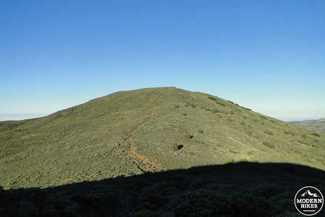
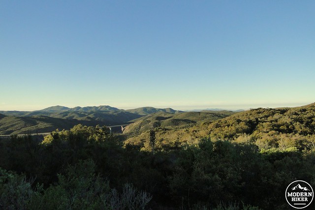
The mountain’s main ridge
The trail evens out a bit as it gains the mountain’s main ridge. From here, the view to the west emerges as well, and when you’re not distracted by the stitch in your chest or the burn in your quads and hamstrings, you can enjoy a fairly panoramic view. That enjoyment may have to wait, however, as the trail begins the first of a short series of steep climbs up rough and rocky trail. Steep inclines like this are mercifully rare, but not on Guatay, where there are a handful. You will earn your lunch on this one.
Summit views to the west
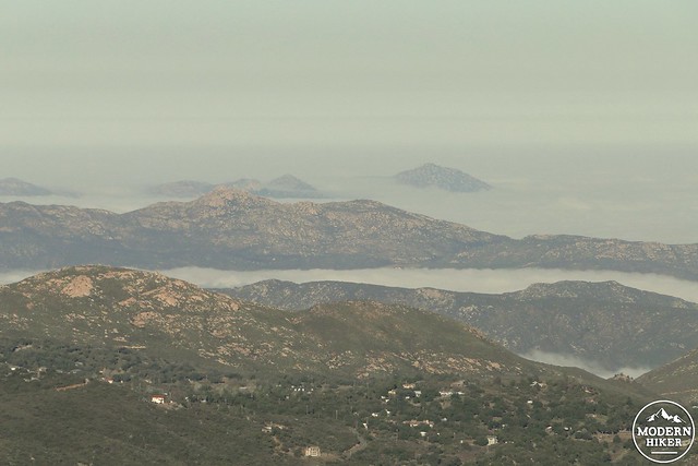
Islands in a marine layer sea
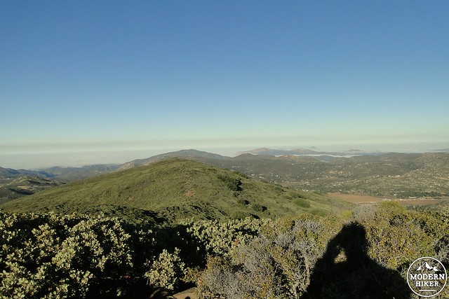
At the end of one of these inclines, you may notice a junction with a trail veering off on the right. Mark this junction in your memory, as this trail will lead you to the largest and oldest grove of Tecate Cypresses on the mountain. You’re nearing the summit, which is just up ahead. Continue climbing, ignoring any smaller use trails cutting off to the right, until you reach a rocky summit partially ringed with rocks. There are places to squat somewhat comfortably while enjoying a snack and the now expansive 360 degree views. To the south, Pine Creek Wilderness, including Los Pinos Peak/fire lookout; to the west, El Cajon Mountain and the surrounding communities spreading out to the ocean; to the north, Cuyamaca Peak and Rancho; and to the east, Mt. Laguna’s broad, flat, conifer-crowned upper reaches.
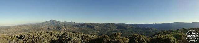
Panorama looking north to Cuyamaca Rancho State Park
Return the way you came from, taking extra care going down the loose, rocky inclines. A pair of trekking poles is especially helpful here. Extend the poles to about 10cm beyond what you’re accustomed to and keep them out in front of you to arrest your downward momentum. Take short, deliberate steps, using great patience lest you hurtle down the slope. Your knees will thank you. When you reach the junction you had noted earlier, bear left and begin a descent down an unmaintained trail to a small grove of bushy looking trees emerging out of the chaparral. These are the Tecate Cypresses.
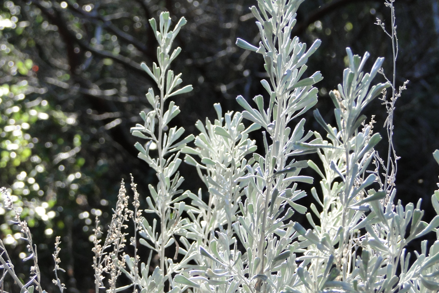
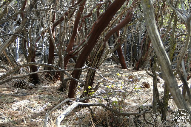
Tecate cypress
As trees go, they are not particularly large. In fact, they look more bushy than tree-like. However, if you are a tree lover or are fascinated with rare or nearly extinct species, you may wish to visit these cypresses. In the past, fires would sweep through this region about every 50 years. Fire was necessary to open the tree’s cones and perpetuate the species. However, fires have increased to one every 20-30 years, which does not allow the trees enough time to properly regenerate. The result is that saplings are destroyed before they can become proper trees, thus leading to further diminishment of what was once an expansive tree species. The remaining groves, located here, at Tecate Peak, Otay Peak, and Coal Canyon in the Santa Ana Mountains, are constantly at risk of destruction from the frequent wildfires that sweep the area. Just like your Thanksgiving turkeys, you better get them before they’re gone.
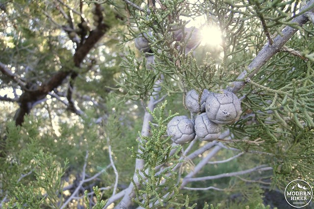
The soccer ball-shaped cones
From here, retrace your steps up the rugged use-trail, connecting back with the main trail. Carefully make your way down the frequently rough and uneven trail until you have completely re-traced your steps back to the road and the parking lot. If you’ve had your fill of hiking for the day and don’t wish to swing by some other nearby hikes in the Cuyamaca area or in the Laguna Mountain area, hop back on the freeway and head to your favorite lunch spot for a well-earned meal.
Note:
– As this hike is on Cleveland National Forest land, you must display an Adventure Pass in the parking lot.
Tags: Cleveland National Forest, Guatay Mountain, Tecate Cypress