NOTE: Due to the San Gabriel Complex Fire, this trail and trailhead are closed as of June, 2016.
Fish Canyon Falls has been a somewhat elusive beast since I moved here. Because the mouth of the canyon is occupied by a Vulcan Materials quarry, access to the canyon’s famed three-tier waterfall has always seemed just a little bit too much trouble. You either had to hike on the one day a month the company would provide a limited shuttle through the property to get to the trailhead or you could hike a “compromise” access trail the company built in 1999 over nearby Van Tassel Ridge that added an extra three miles and almost 2400 feet of elevation gain – a route the venerable Dan Simpson called “a ridiculous option … only for diehard adventurers willing to endure the absurd.”
Well, after years of litigation and waiting, a brand new, 365-days-a-year access trail at the mouth of the canyon was opened to the public on June 18, 2014. Now, as long as hikers pay attention to the varying rules and regulations, they are able to access the canyon and the waterfalls whenever they’d like – as long as they’re willing to endure a short trip through an active quarry.
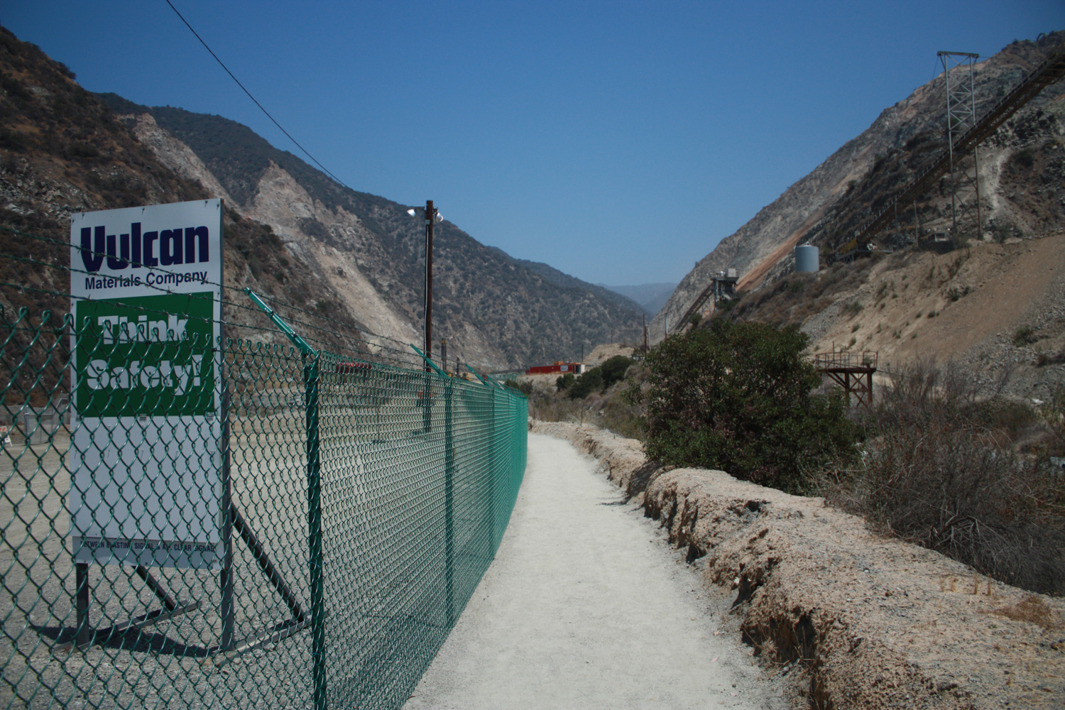
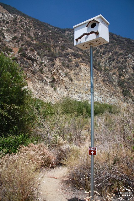
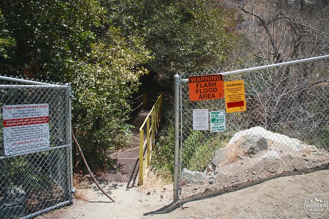
While you’re driving down Encanto Parkway, it crosses over into the private property of Vulcan and becomes a rougher, slower road. At the end of this street you’ll reach a large fence with three different routes – the center route will most likely be the only one open and that’s the one for hikers. Look for a small white sign that says “TRAIL” and you’re on the right path. At the end of this short gravel road is a surprisingly large, fenced-in parking area with a few informational kiosks detailing the access trail’s rules and regulations, which are as follows:
The trail open seven days a week, all-year round. From April – September the hours are 7AM to 7PM; from October – March they’re 7AM to 5PM. Gates to the access trail and parking area are promptly closed at those times and any cars left in the parking area will be towed at their owners’ expense. Trespassing on quarry land is strictly forbidden and the trail is for hikers only – no bikes or equestrians. Dogs are allowed, but only on Saturdays and Sundays.
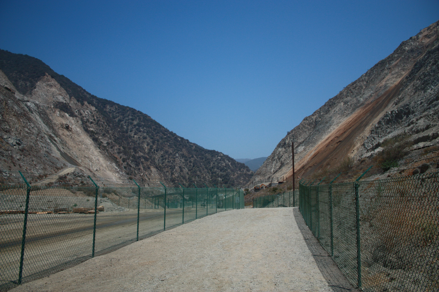
Once all that rule-reading is out of the way, head past the info kiosk and start your hike on the access trail. The scenery isn’t exactly pristine, but I have to imagine it’s pretty dang unique as far as hiking trails go.
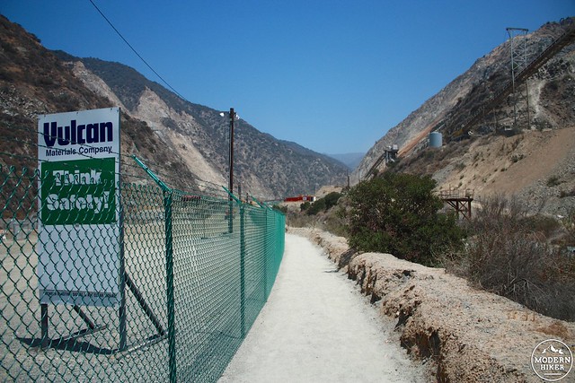
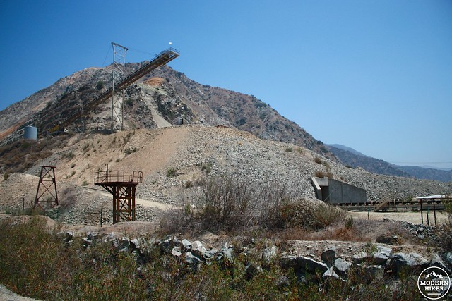
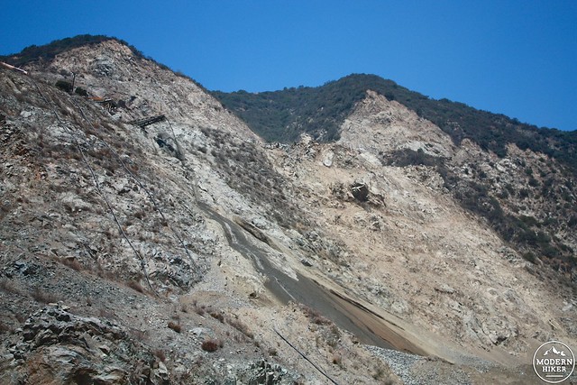
If you hike during the week like I did, be prepared for a lot of noise and some extra dust in the air as you walk through the Vulcan Materials quarry. When I went they were blasting on both sides of the canyon, sending constant rockslides tumbling down the slopes.
Like I said, pretty unique for a hiking trail.
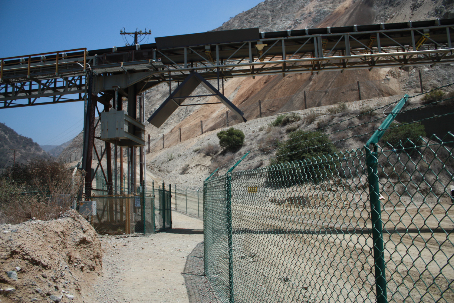
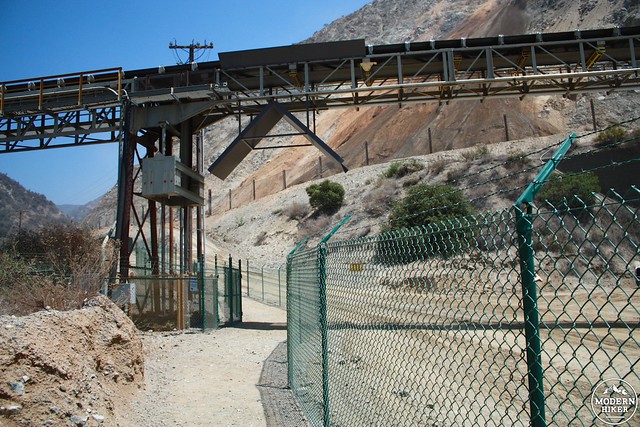
The first half mile is all on industrial territory – you’ll pass large machinery, underneath a giant conveyer belt, watch rocks tumble down slopes – and maybe hear a blast or two if you’re lucky. All while walking on what is basically a fenced-off section of their already-existing road that will leave you wondering why it took them so long to come up with such a simple and cheap access solution.
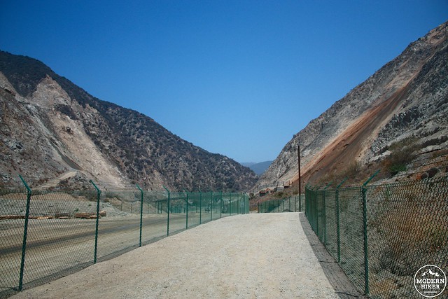
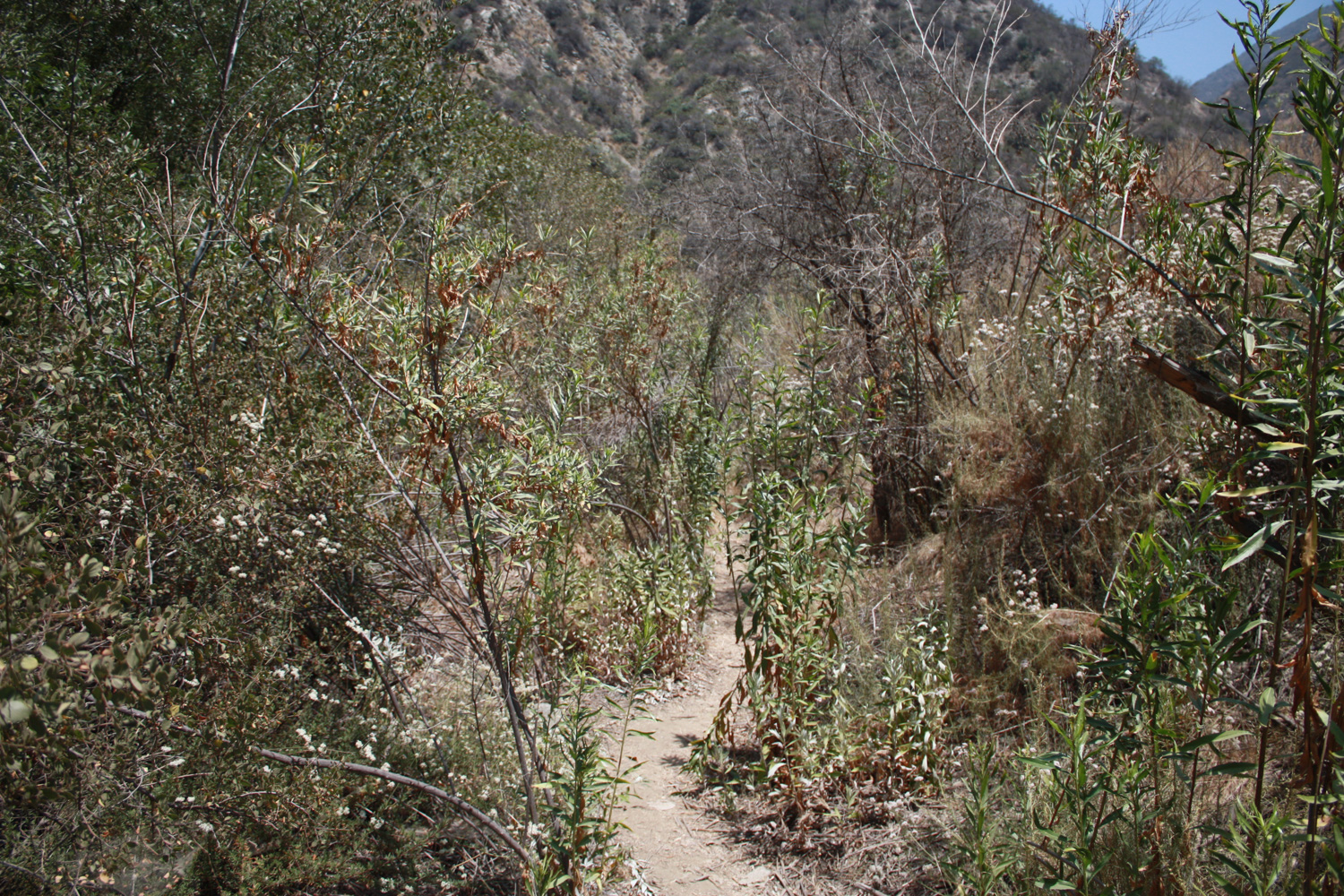
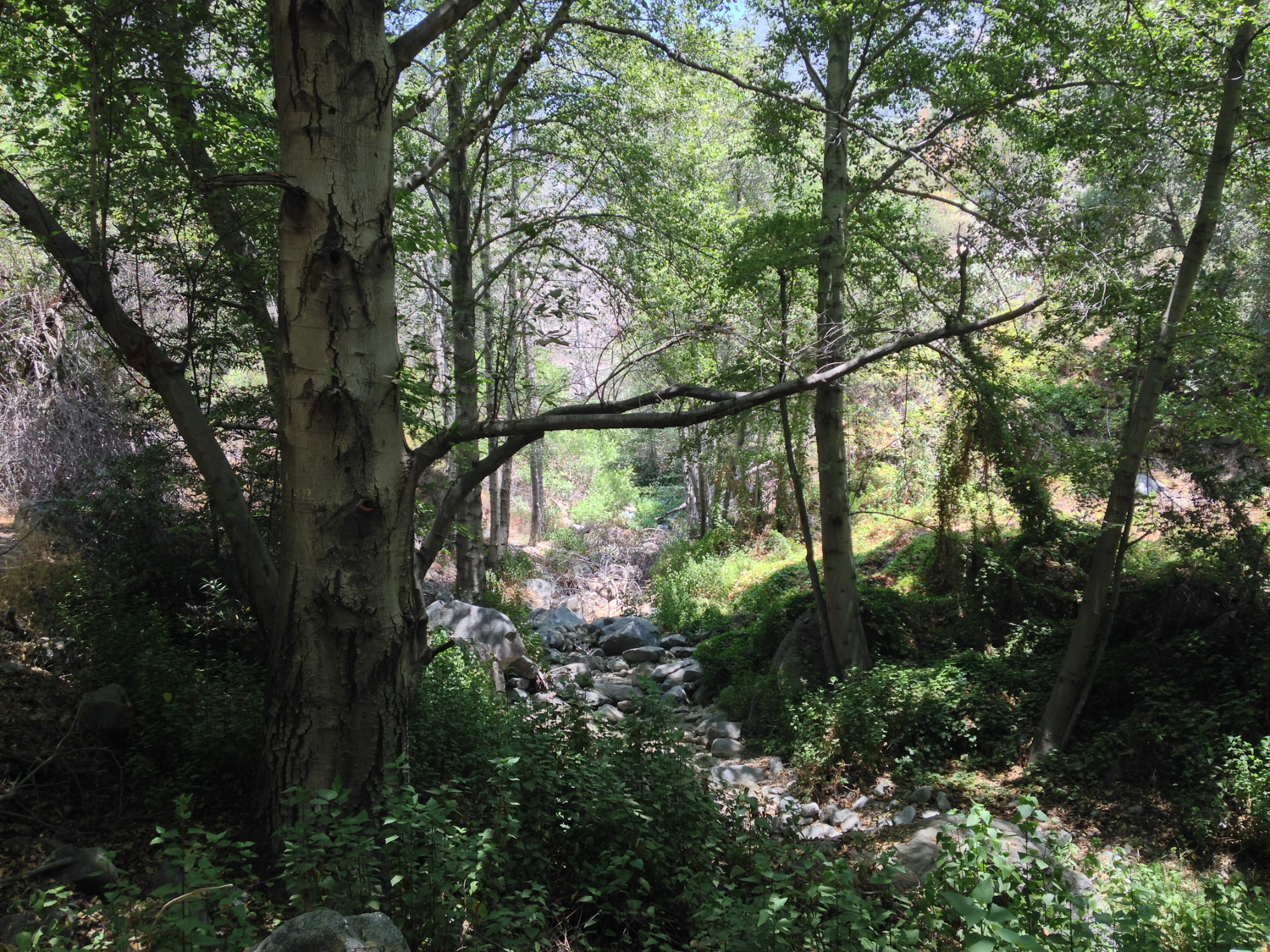
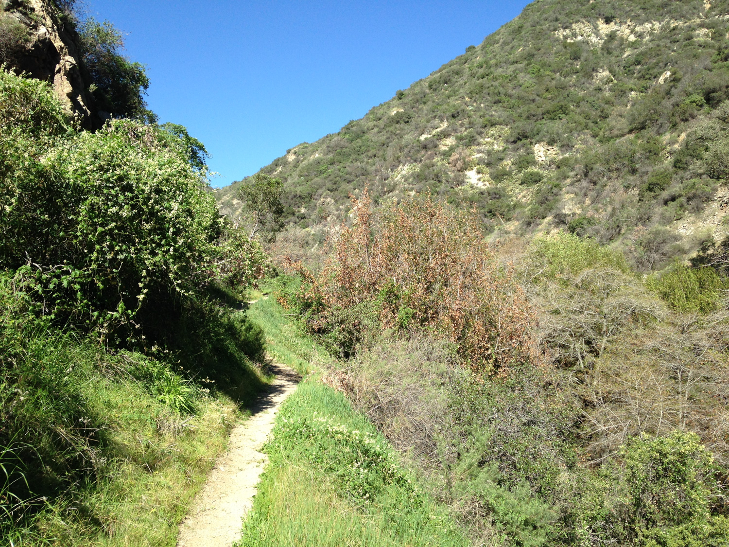
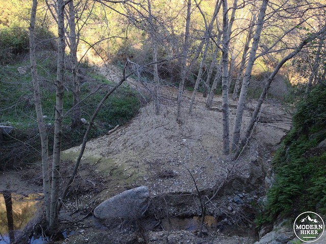
After that half mile mark, the trail ducks under the access road and hugs the bed of Fish Canyon Creek. This area has been left in a mostly-natural state and its the first time you’ll feel like you’re actually hiking in the wilderness on this route.
As part of its lease to work in the area, Vulcan is working with the Wildlife Habitat Council to ensure the safety and preservation of Fish Canyon Creek’s riparian woodlands. This lower stretch of the canyon is lined with California sagebrush, brittlebush, white sage, and towering ceanothus bushes. In the late winter and early spring, the sage and ceanothus may be blooming – while the the brittlebush usually wait until it’s a little bit hotter. It should be noted that the soil, vegetation, and water in this area is protected and not part of the trail. Hiking off the trail here is prohibited and punishable by fines or incarceration.
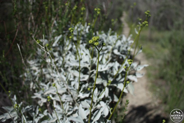
brittlebush getting ready to flower
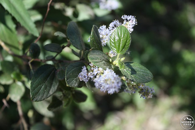
ceanothus flowers on display
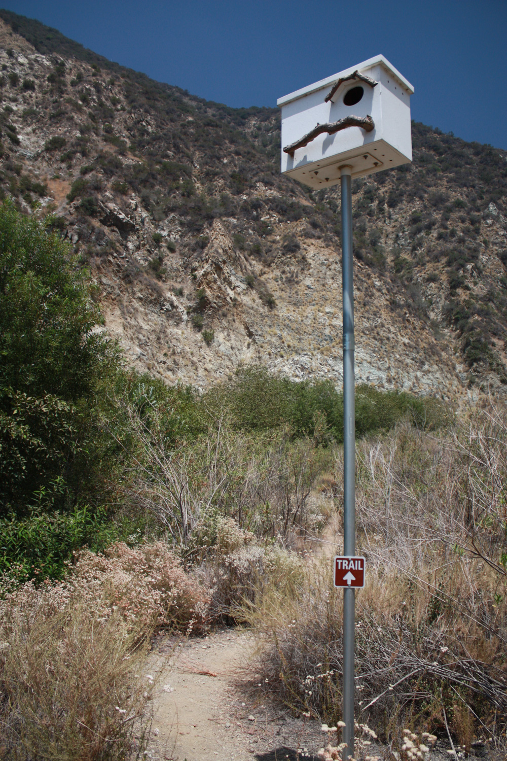
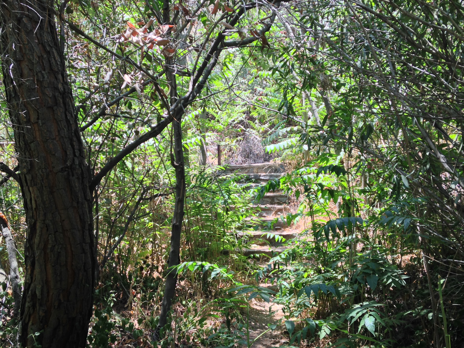
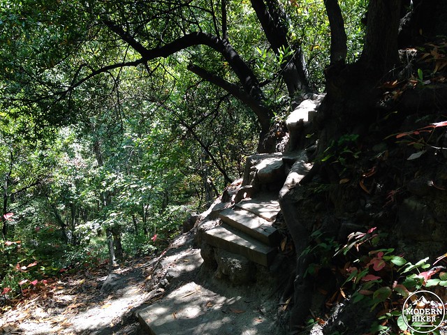
At the 0.7 mile mark, you’ll reach the northern boundary of the Vulcan property and cross a bridge across the creek and you’ll be back on the historic Fish Canyon Trail in earnest.
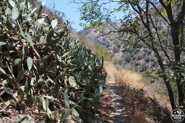
The juxtaposition between the trail you’ve been walking on and the trail you’re currently walking on is shocking to say the least. Gone are the dust and heavy machinery (although you’ll still be able to hear and smell them for a short while), replaced by thick sagebrush and cacti, lush canyon oaks, and a rustic trail. Now this is hiking!
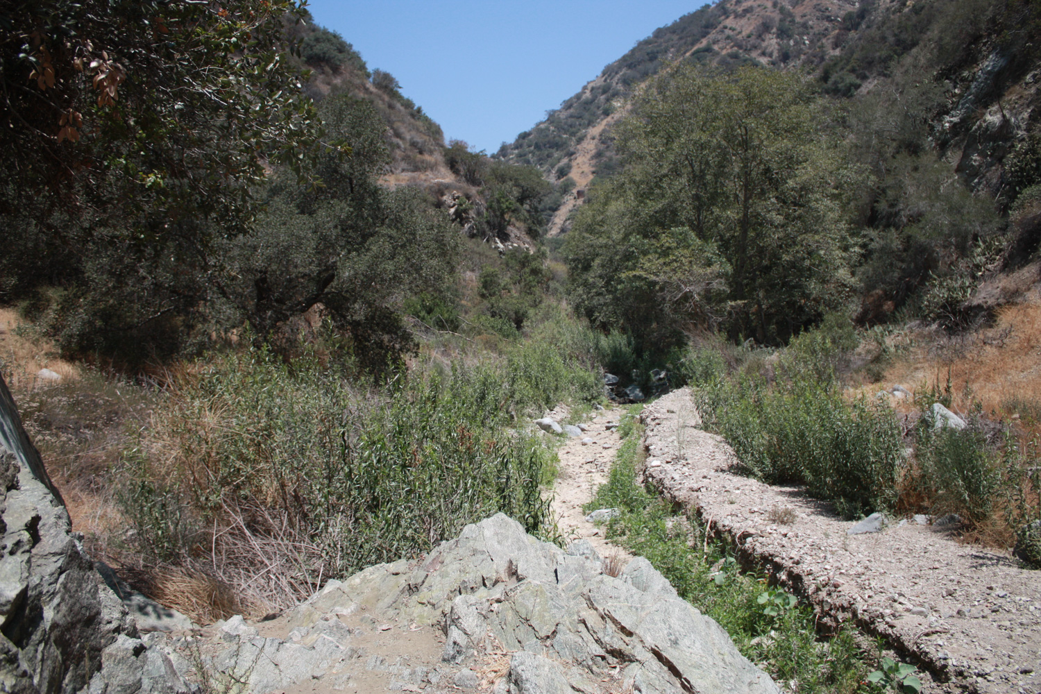
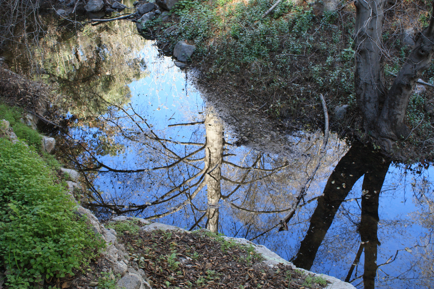
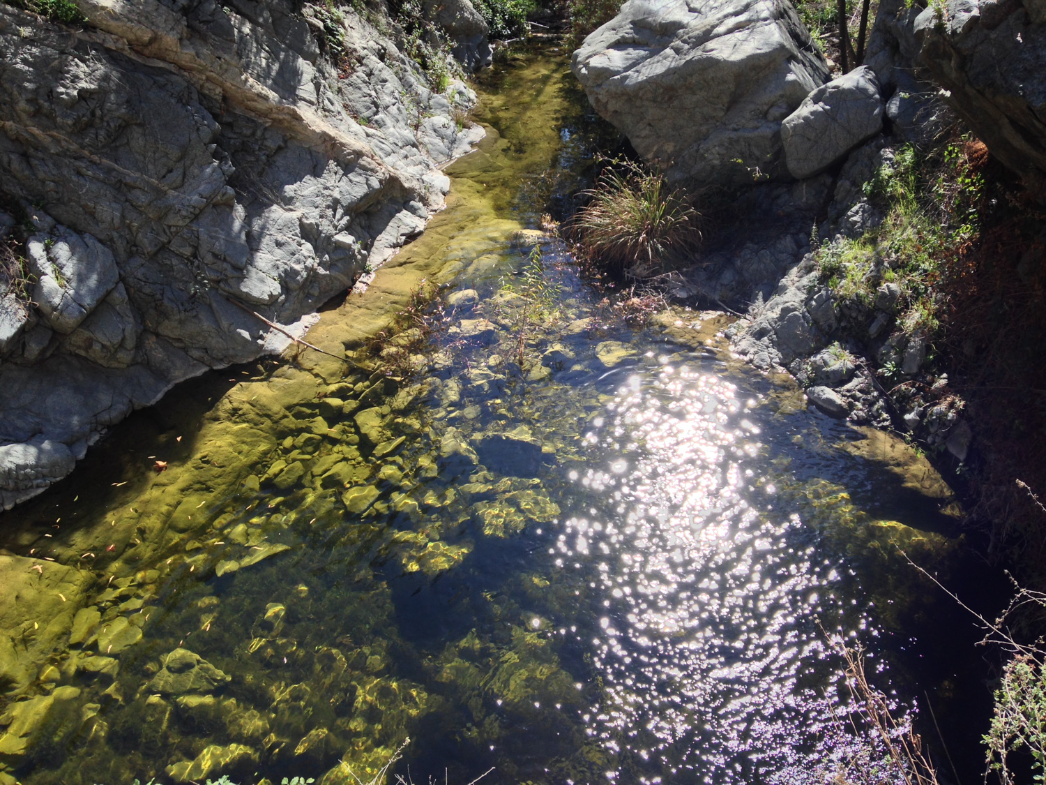
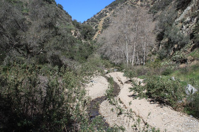
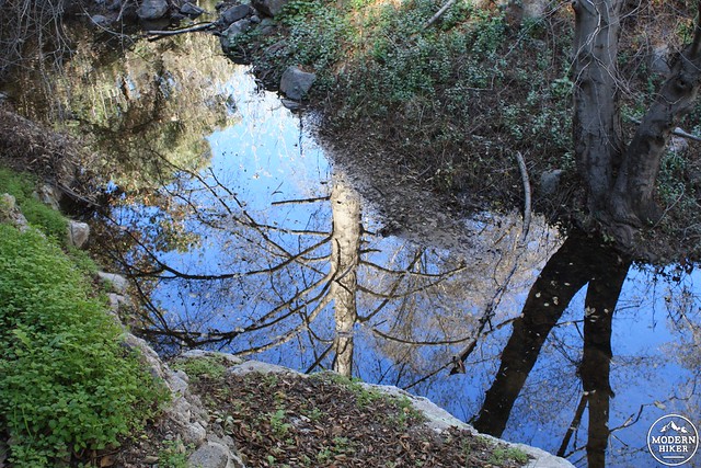
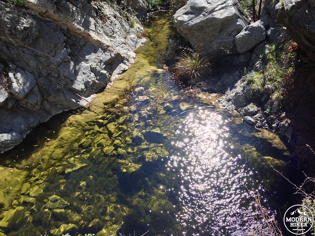
A series of storms in late December, 2014 did some damage to the trail and canyon – but ended up being a good thing overall. The San Gabriel Mountains Trailbuilders were able to get into the canyon to cut back some of the overgrown vegetation, and their trail restoration in the landslide-damaged areas made noticeable improvements to the trail in many areas. The storms also restored water flow to the parched canyon, which restored quite a bit of plant life along the way (not to mention at the waterfall itself!), although in the late Winter of 2015 you could still see many areas of intense silt buildup in the creek.
water in the creek!
a large landslide on the east side of the canyon with silt buildup in the creek below
As you come around the first bend in the trail, you’ll see an old plaque dedicated to the history of Fish Canyon. There are a scattering of others along the rest of the canyon and they provide some good background and nice historic photos … along with a little bit of white-washing about the old Van Tassel Ridge Trail, too.
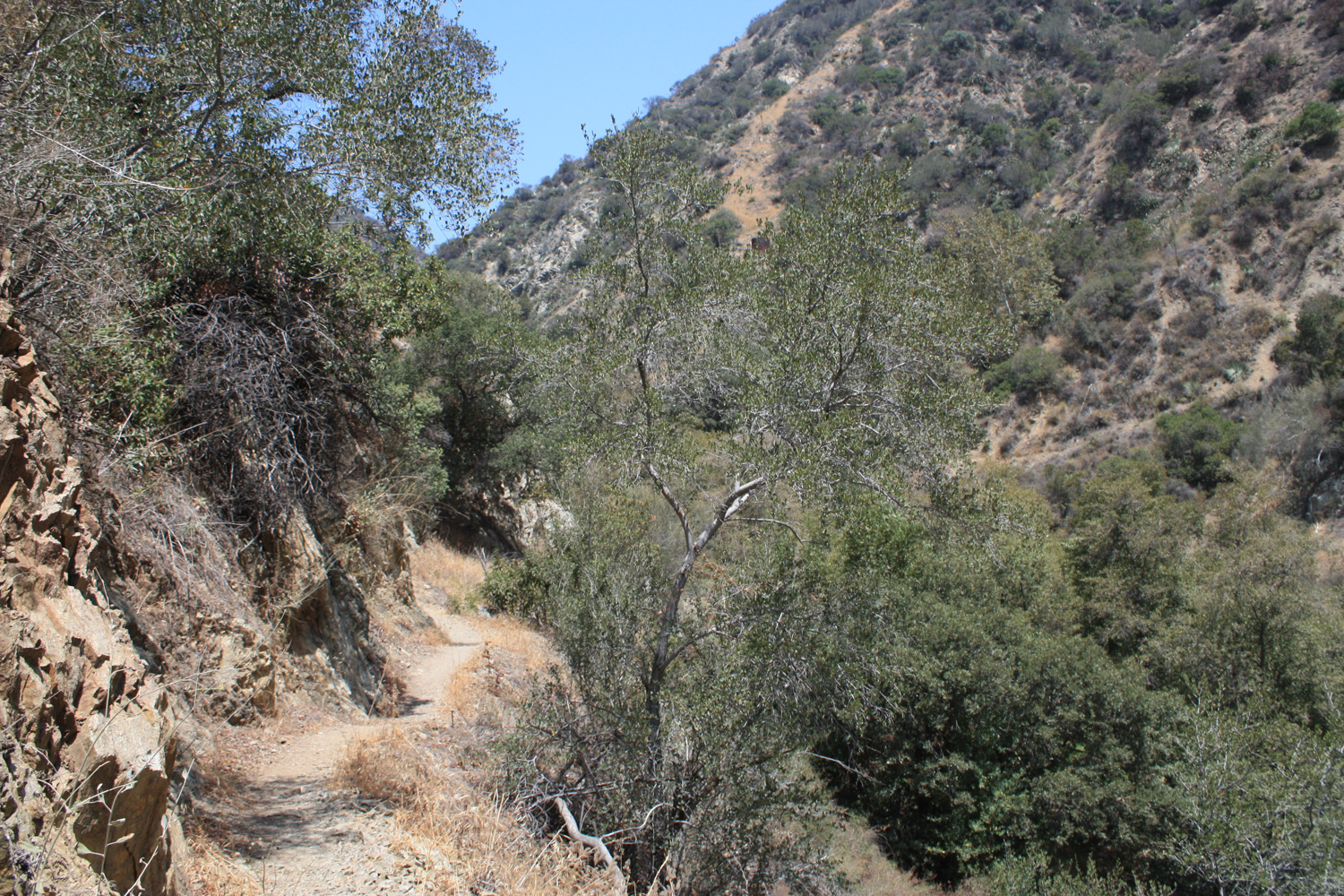
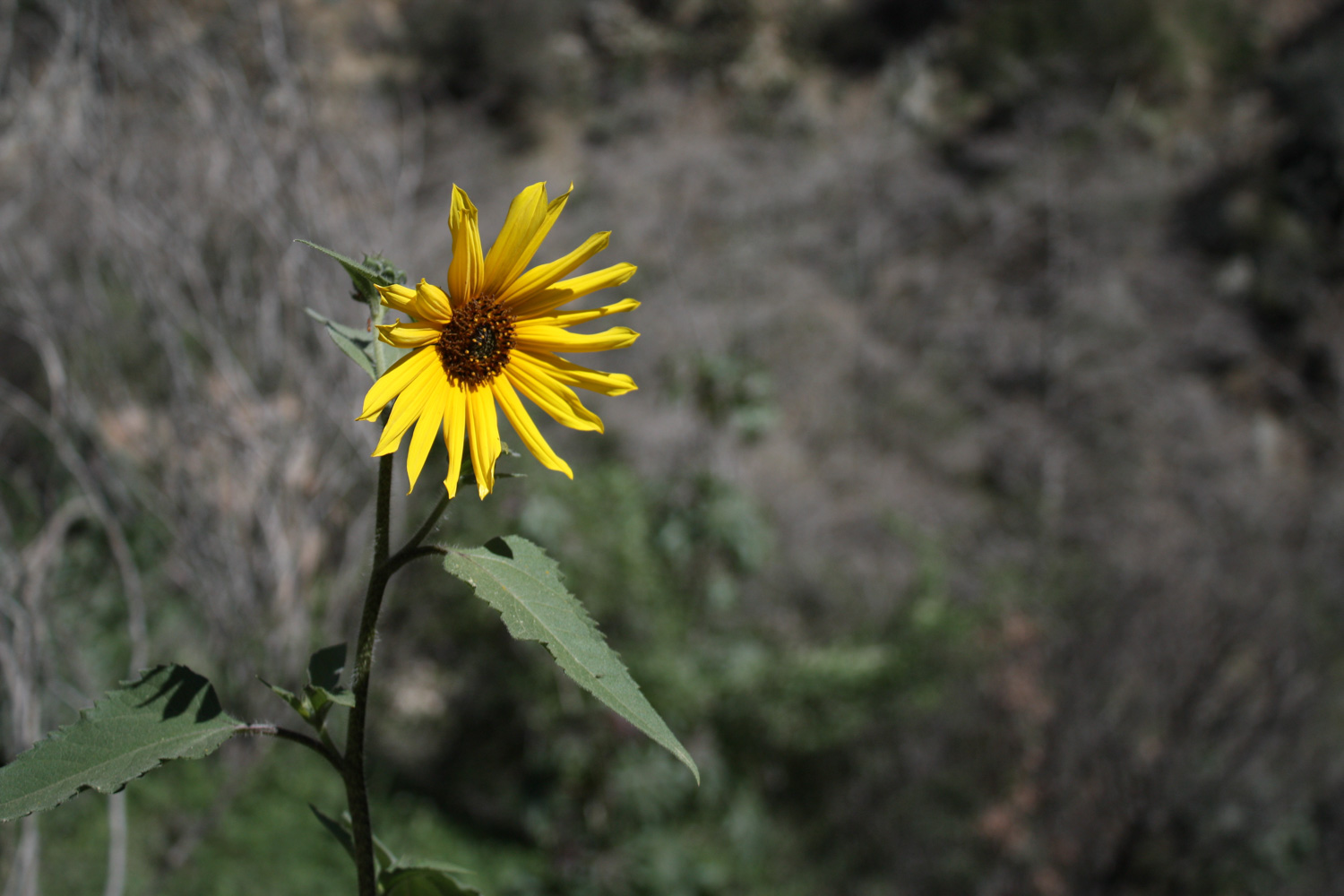
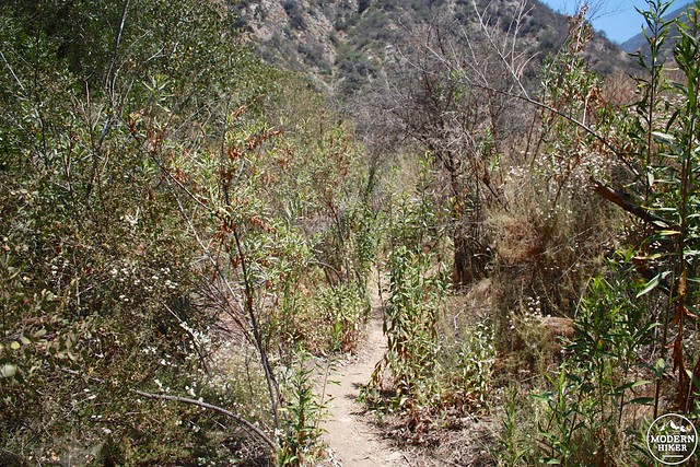
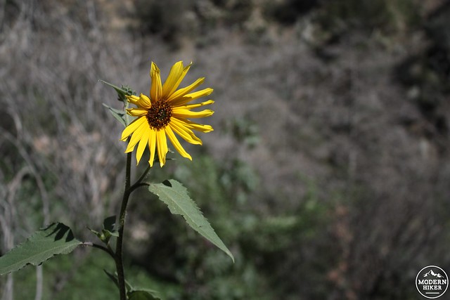
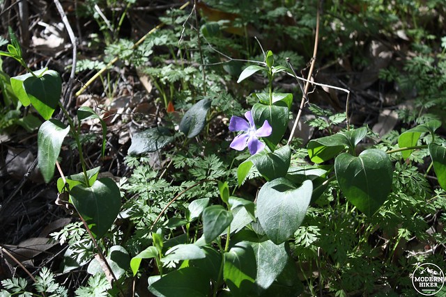
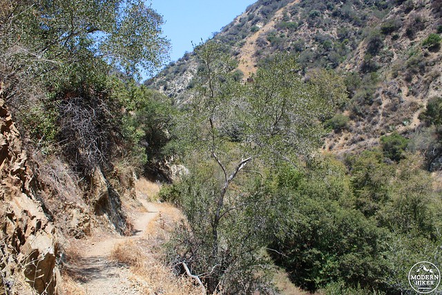
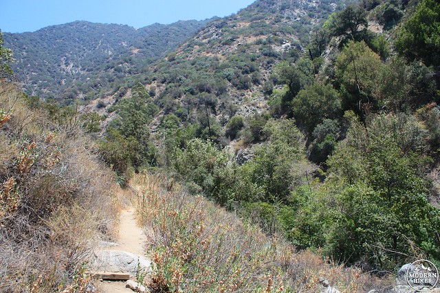
The trail leaves the creek bed rather quickly and travels north into the canyon on a ridge. Visually and character-wise, the trail reminded me a lot of a split-difference between the Santa Anita Canyon trail (especially during the shadier parts) and the East Fork Trail (especially the sunnier parts). Canyon views begin to open up as you hike and after a little bit of elevation gain, the trail levels out a bit around the 0.86 mark. If you are hiking in the cool months, look out for lots of blooming wildflowers, vines, and bushes along the way.

Keep your eyes peeled as you hike – some of the cabin remains are still visible.
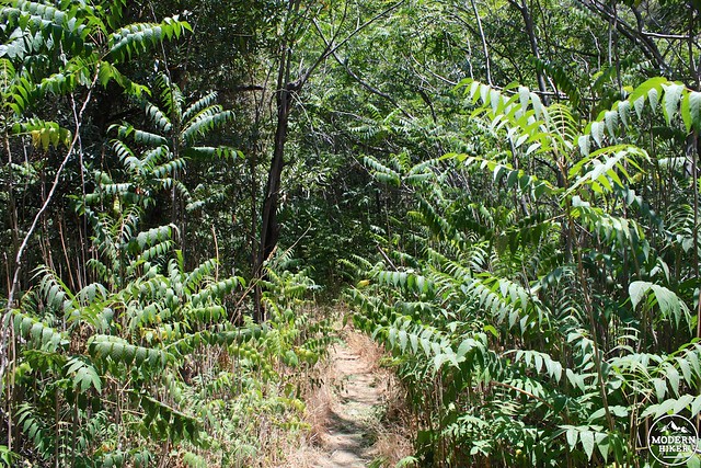
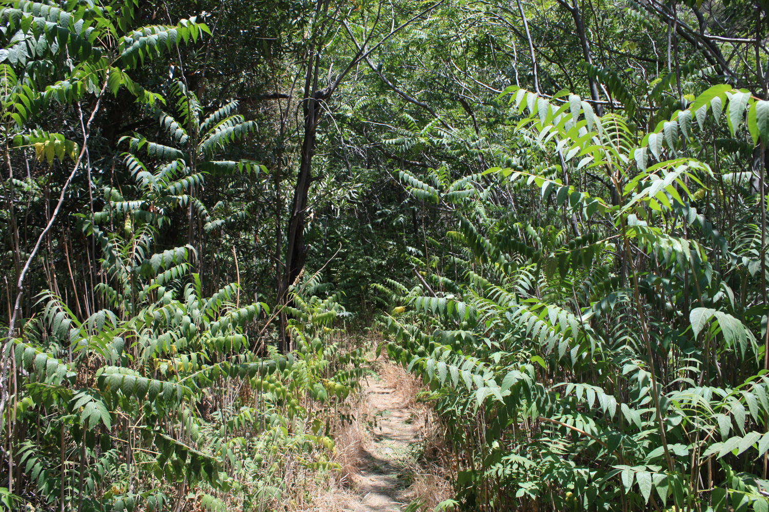
The Trailbuilders did a lot of hacking back these plants in this section of trail. It helps that many of these plants are deciduous and lose their leaves in the winter, but now you don’t have to worry quite as much about getting jabbed by cacti or swallowed up in a jungle.

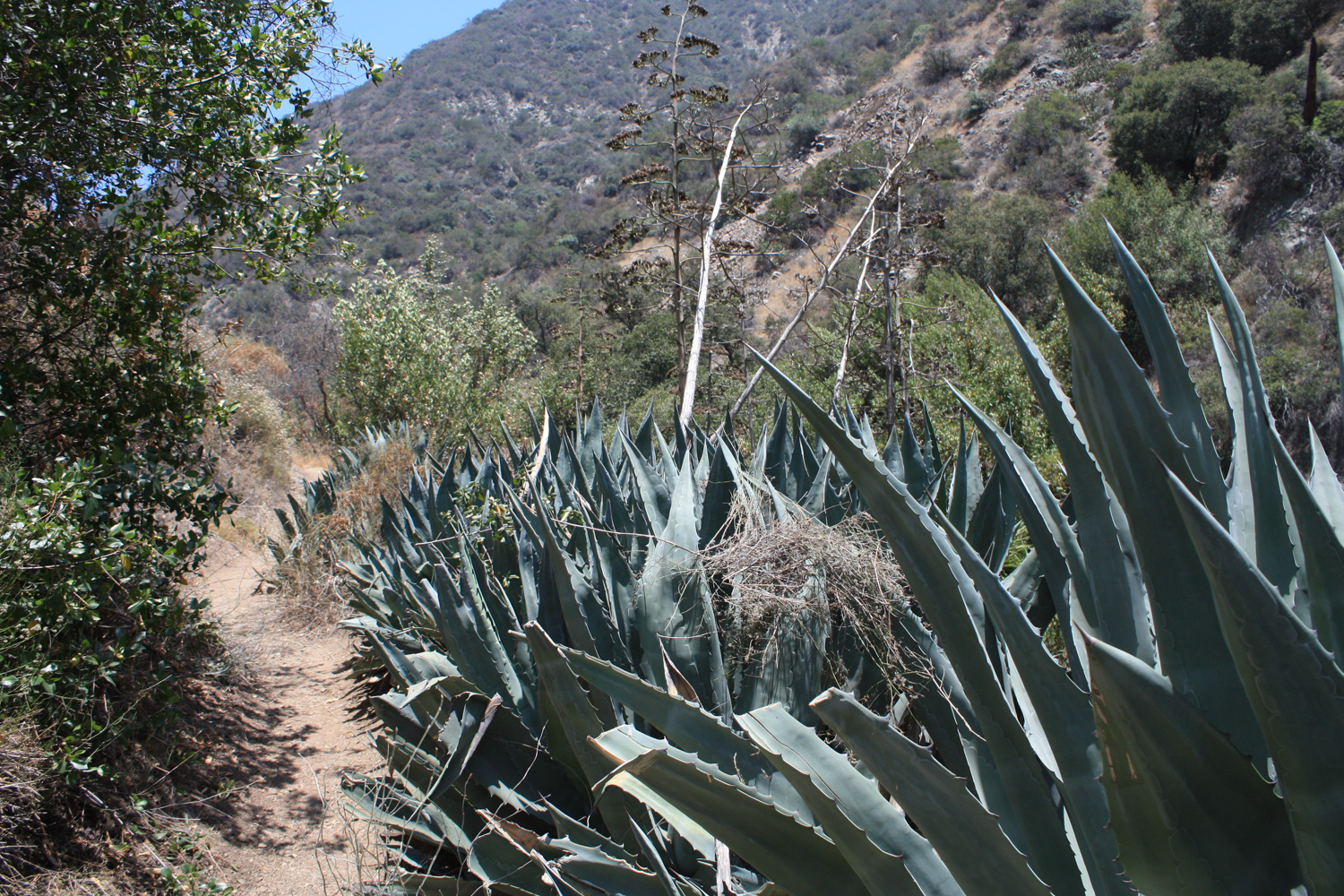
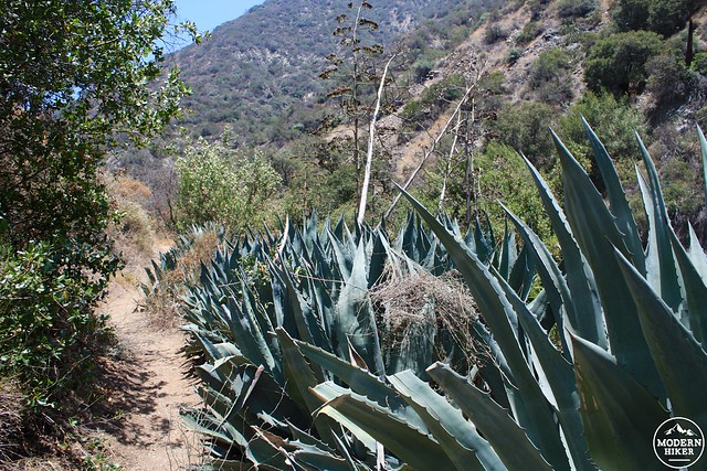
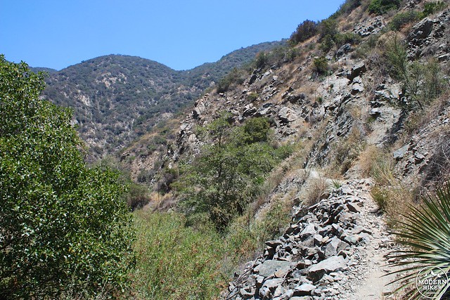
At the 1.2 mile mark, the trail hops the seasonal creek coming out of Fern Canyon and hangs a right to continue in Fish Canyon and make its most substantial gain in elevation so far – about 240 feet in 2/3 of a mile. It’s not terribly difficult, but you’ll definitely feel it on a hot day on the shadeless stretches – so make sure you drink enough water and take rests if you need them. There are some pockets of very lovely shade along this part of the trail but most of it is in full-sun. While the heat might bug you, be on the look out for some HUGE desert agave along the way. Unflowered, they’ll come up to or surpass your shoulders – if they’ve flowered, the stalk is probably 20-30 feet above you.
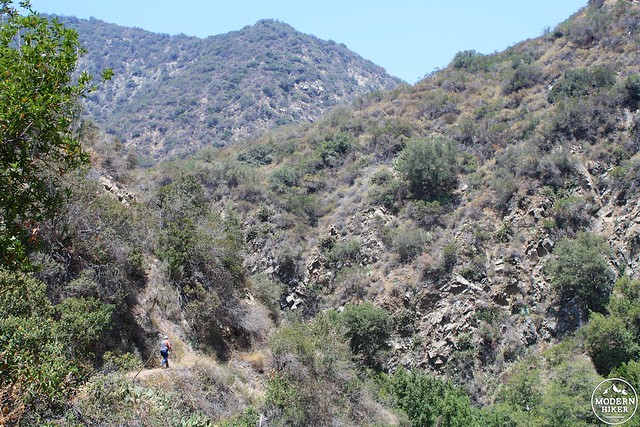
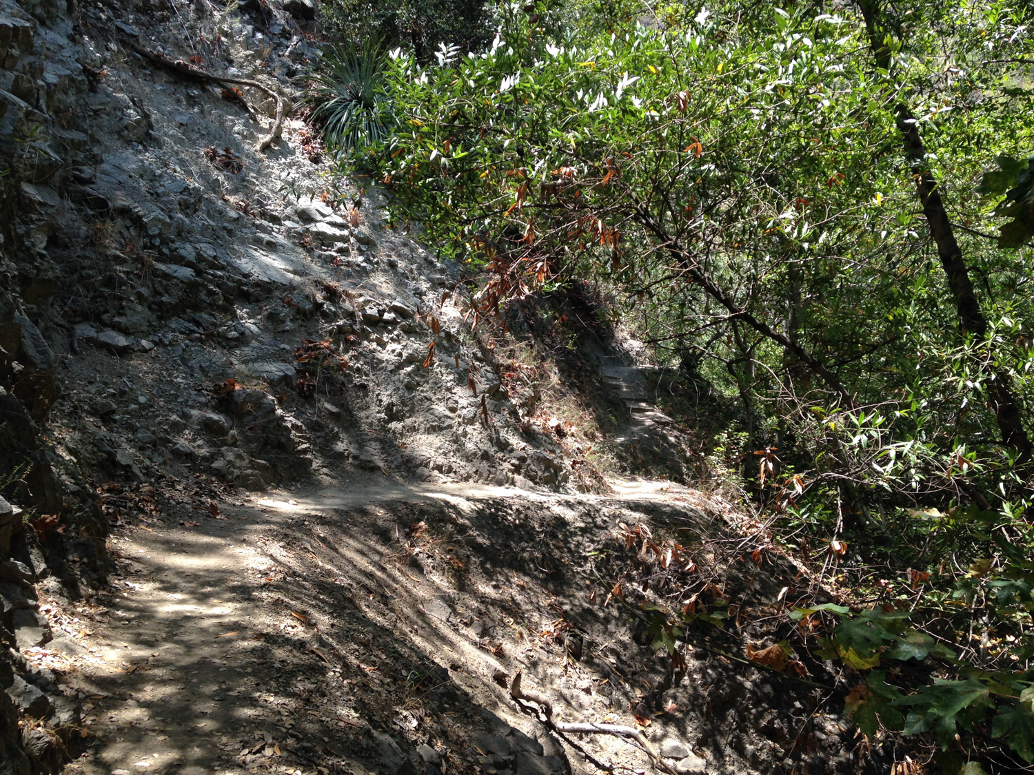
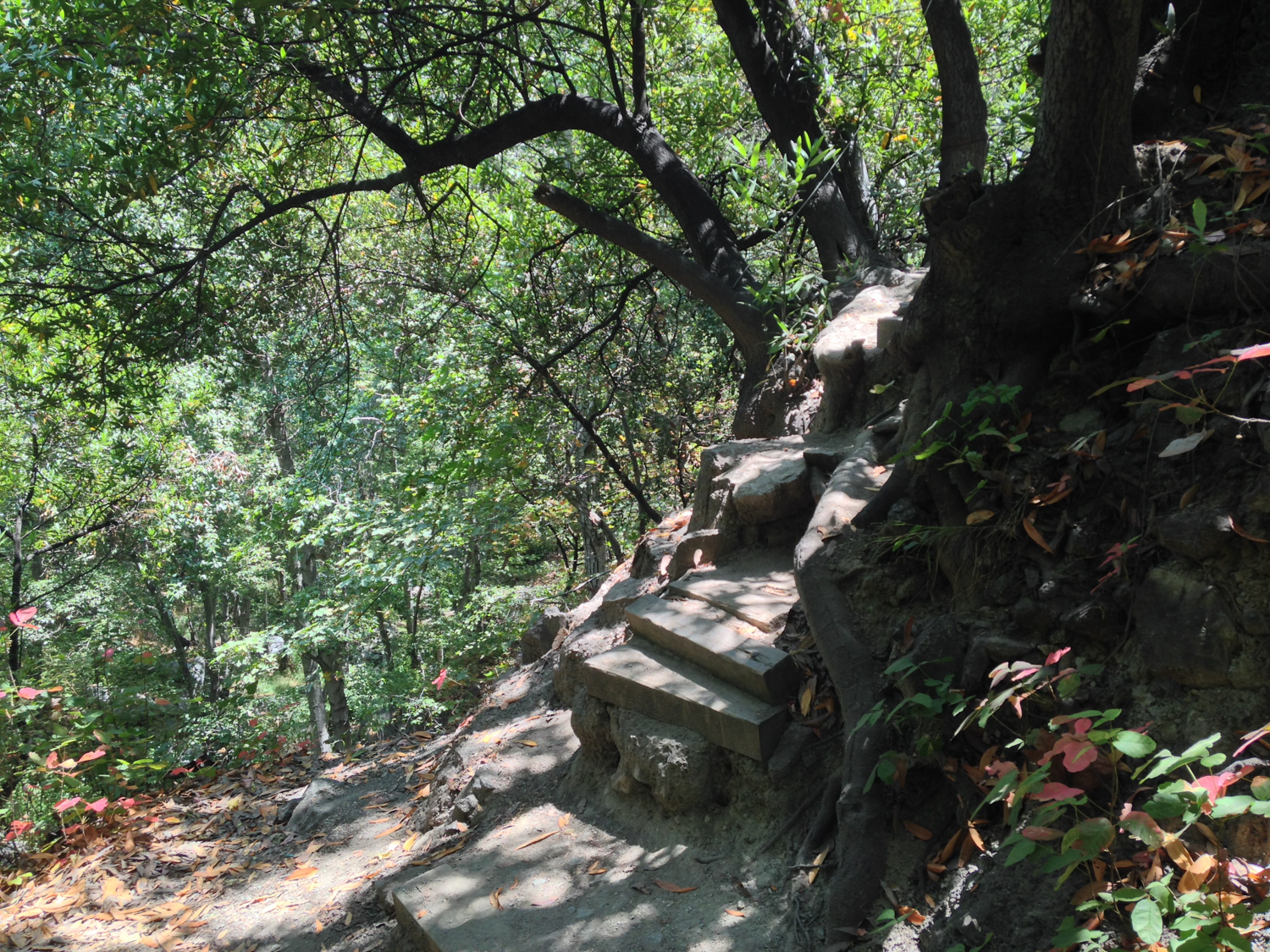
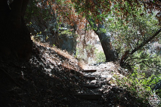
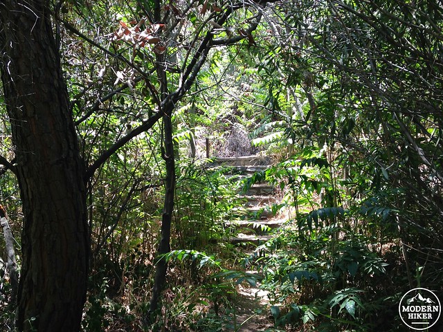
At about the 1.7 mile mark the trail levels out again for a short while and even makes a short descent as it rounds the last major bend in the canyon before Fish Canyon Falls. There are some very beautiful sections of trail cut into the rock here, along with one very short and very steep switchback that might slow you down a bit as you hike.
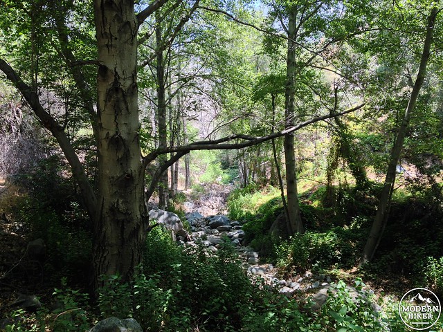
Near the 1.9 mile mark, it appears the trail forks at an intersection with a steep canyon. Ignore this side canyon on the left and continue to the right as the trail descends a broad ridge and dives into the creek bed itself (during the wet months, you may need to do a bit of boulder hopping here).
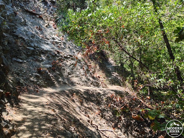
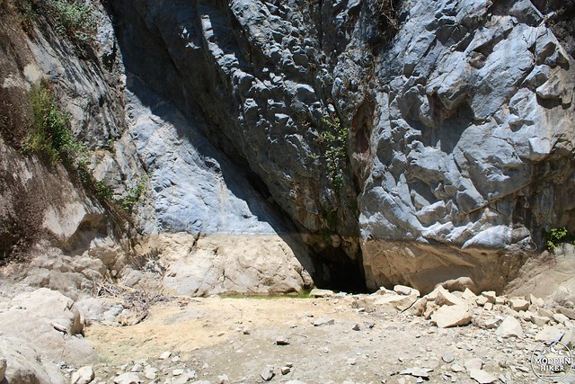
The trail quickly leaves the rocky creekbed and crawls up the eastern granite wall of the canyon on a narrow path that marks your final stretch of trail before you reach the falls.
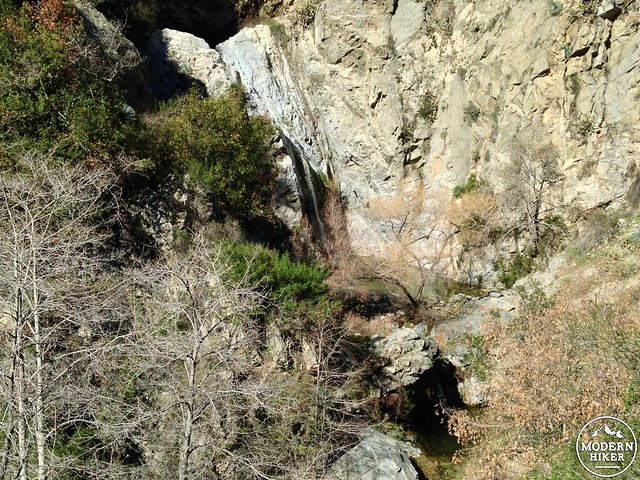
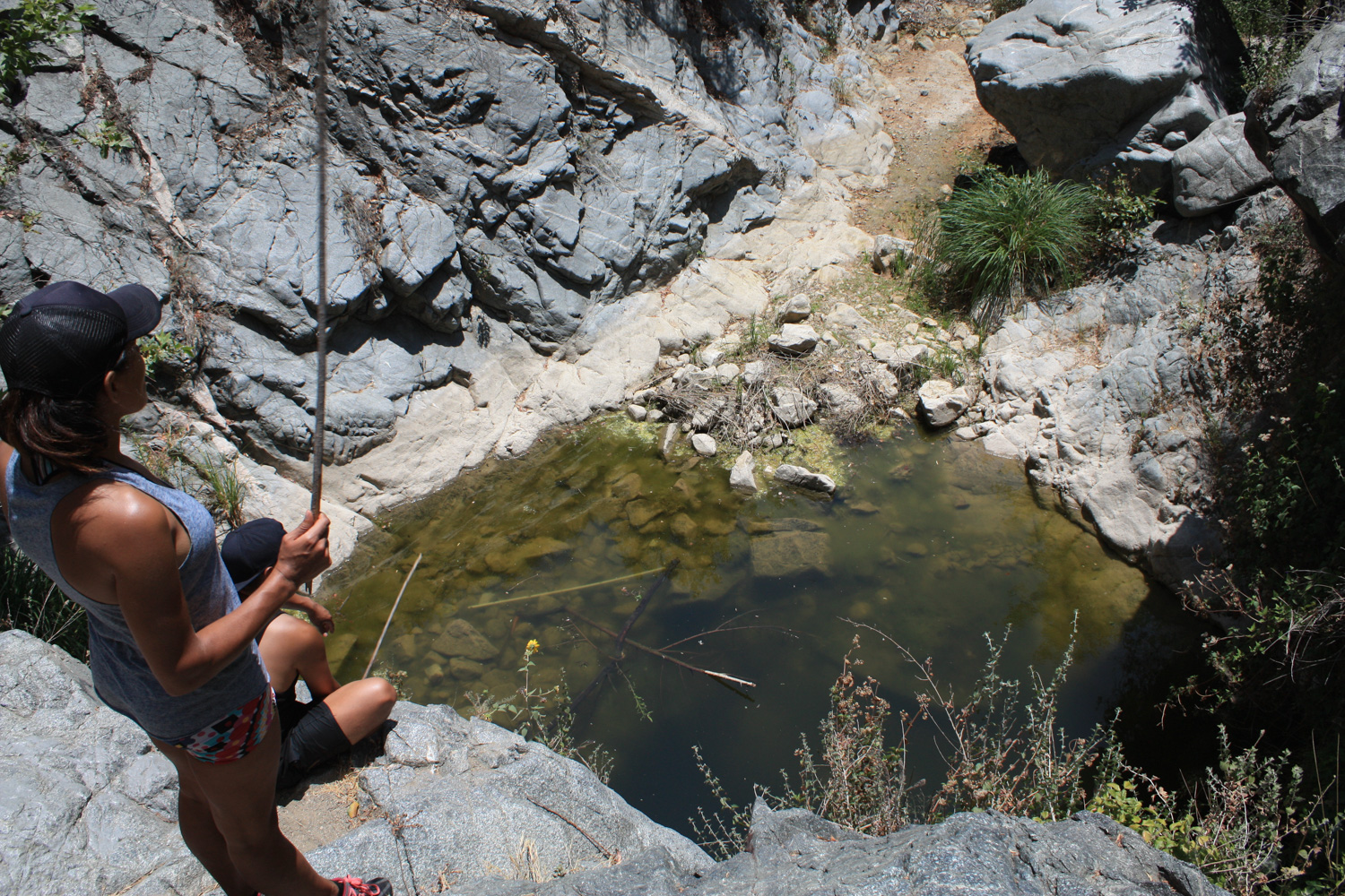
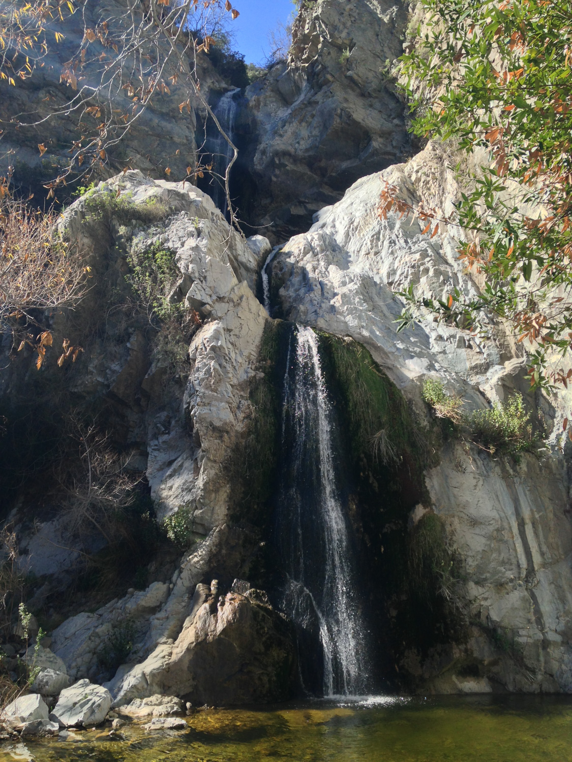
The trail winds its way to the base of the falls, sliding down one short slickrock section along the way. If there’s water, you’ll be treated to a three-tiered waterfall with two sizable swimming holes. If there isn’t, you’ll see the high water mark on the rocks at the base of the falls and will just have to use your imagination instead.
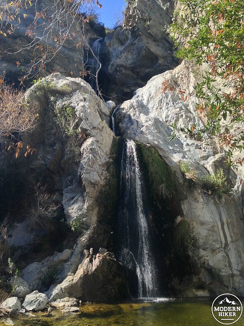
the waterfall in action, February, 2015
The same pool in the summer of 2014
The lower pool
While obviously the main draw of this hike is the waterfall, even if there’s zero water coming down over those cascades this is still a lovely trail and a decent little workout. If you come in the late winter or spring after a few rainstorms, though, this trail absolutely sings. The waterfall is definitely one of – if not the loveliest in the San Gabriel Mountains.
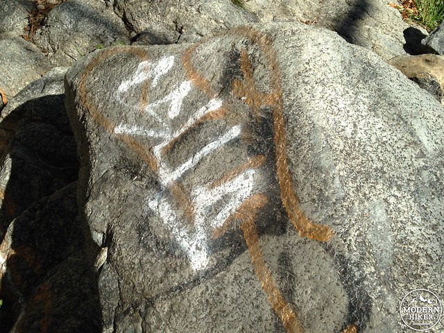
As the new, easily-accessed trailhead becomes more popular, it will be important for hikers to watch out for signs of overuse and graffiti. Sadly, there remain several instances of graffiti on the trail and at the waterfall itself – although it seemed like many had been there for some time.
If you’re coming from the west, Line 187 stops at the Gold Line Sierra Madre Villa stop.
The city of Duarte also operates a free shuttle on Saturdays, which runs from the Duarte Gold Line stop to the trailhead from 7AM to 6PM from April through June. This shuttle service began in 2016 and does not appear to have a set annual schedule yet, so be sure to check the Duarte web site for more information.
Tags: Angeles National Forest, azusa, duarte, fish canyon falls, Hiking, historic cabins, history, quarry, ruins, transit accessible, vulcan materials, Waterfall