If you think sparkling aquamarine lakes and shimmering frosted peaks are the stuff of faraway epic adventures, you’ll be surprised at just how quickly you’re immersed in stunning scenery on this spectacular hike just a short drive from the bustling ski town of Mammoth Lakes, California.
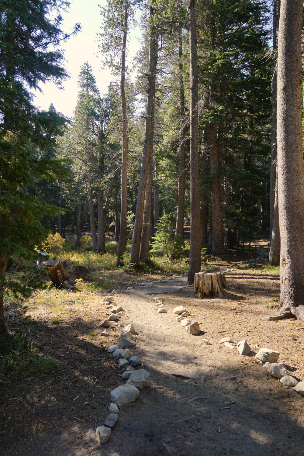
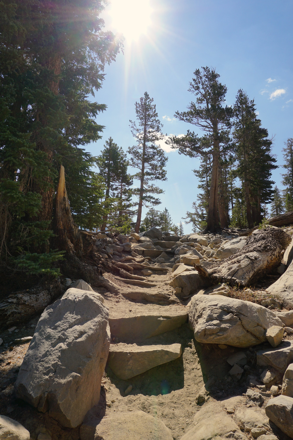
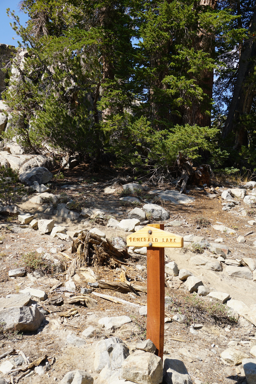
Your journey begins at the Duck Pass trailhead (elevation 9,128’), where you’ll find ample parking, flush toilets, garbage cans, and a water spigot. In the summer months, you can take the Lakes Basin Trolley (orange line) from Mammoth Lakes to the Lake Mary Marina. From there, you’d walk east on Around Lake Mary Road, then take a right on Coldwater Creek Campground Road, reaching the trailhead at the bottom of the road in about a mile. The soft, dusty trail follows a stone-lined path to left of the bathrooms where you’ll quickly reach a T-junction – a path to Emerald Lake branches off to the right, but you’ll head left towards Duck Pass, and eventually, Duck Lake. The trail wastes no time racing uphill, so give your quads a pep talk and keep it slow and steady, since you have a sweaty trek ahead.
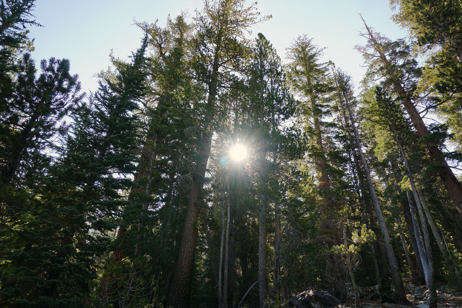
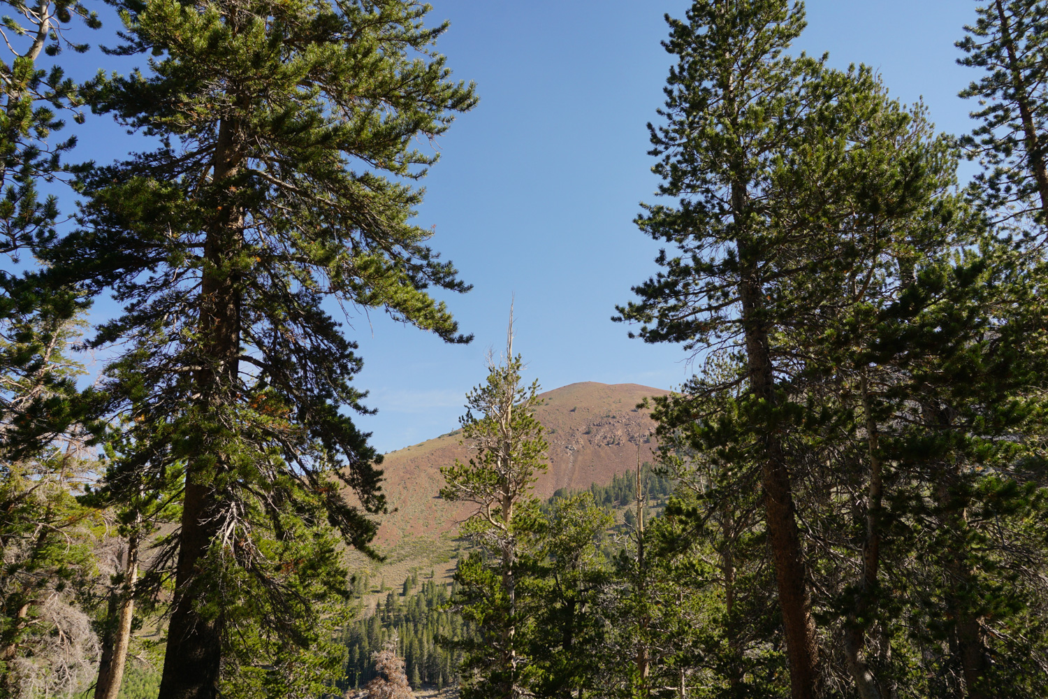
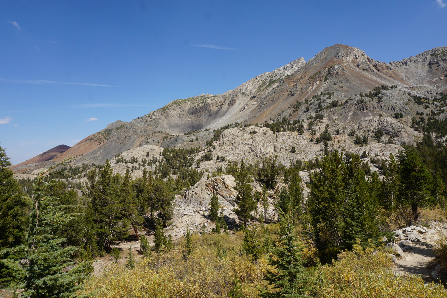
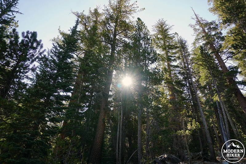
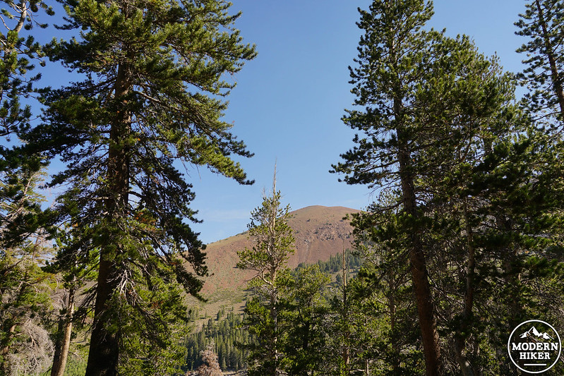
As you move up through thick lodgepole pine forest, you’ll reach the John Muir Wilderness boundary at just under a quarter mile. From here, keep your eyes peeled for breaks in the trees – you’ll be able to make out hulking Mammoth Mountain poking through back to the north, and will eventually start to catch glimpses of reddish cliffs to the east. The area you’re traveling through sits just outside the still active Long Valley Caldera, a volcanic depression caused by an eruption that occurred a mere 760,000 years ago, and the bright color is likely a mixture of rhyolite and basalt dug up from that ancient volcanic activity.
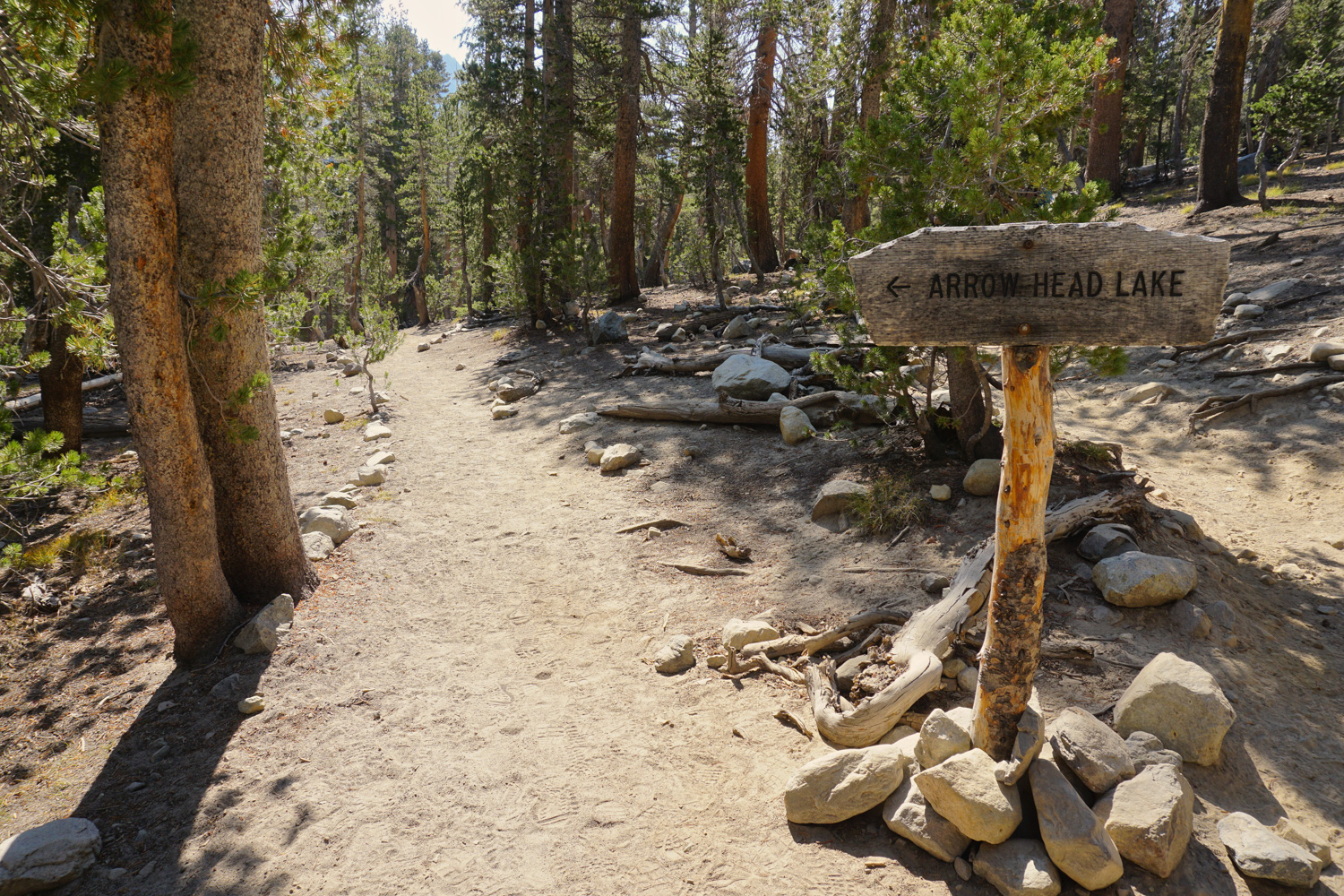
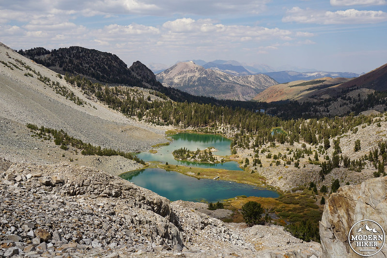
As you climb, you’ll start to hear the soothing sound of water flowing far below – that’s Mammoth Creek, which links together the chain of lakes you’re strolling through, and you’re just about to hit the first one! Ignore a use trail at 0.8 mile and look for a fork at the 1-mile mark – if you want to make a detour to check out Arrowhead Lake (shaped like, you guessed it, an arrowhead when viewed from above), pick up the official signed trail to the lake and head left. If not, will your legs to continue uphill and catch a quick glimpse of the lake peeking out down below.
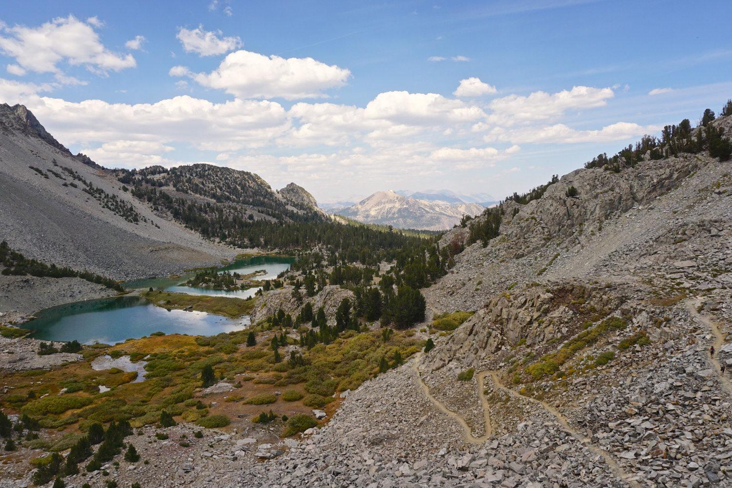
At 1.3 miles, you’ll pass a side trail on the right that will lead you down to Emerald Lake and eventually back to the trailhead – but unless you’ve already reached a state of Gorgeous Scenery Overload, stay straight, since you have more fantastic lakes to visit. Just ahead, you’ll see the first of several use trails that head down to the left towards Skelton Lake (this one, to the outlet). The creek is very close here, so if you need to top off your water bottles, it’s a great time to break out your filter and have at it. If you want to visit the main lake, however, continue ahead to the 1.7 mile mark, where you’ll reach a set of use trails descending to the left towards a large pool of shimmering blue – it’s just a hop-skip from the trail, so pop down and enjoy the peaceful surroundings.
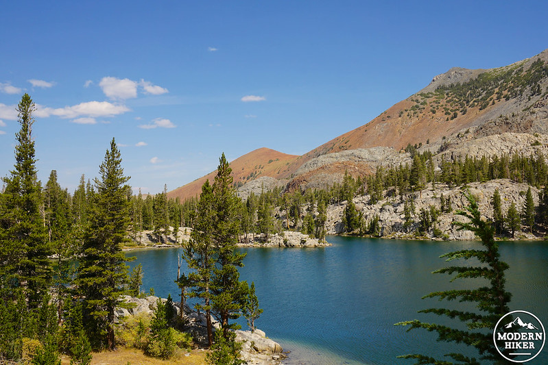
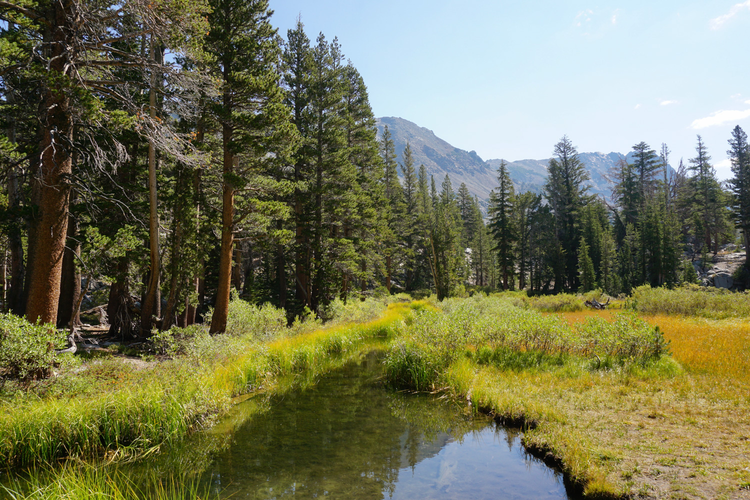
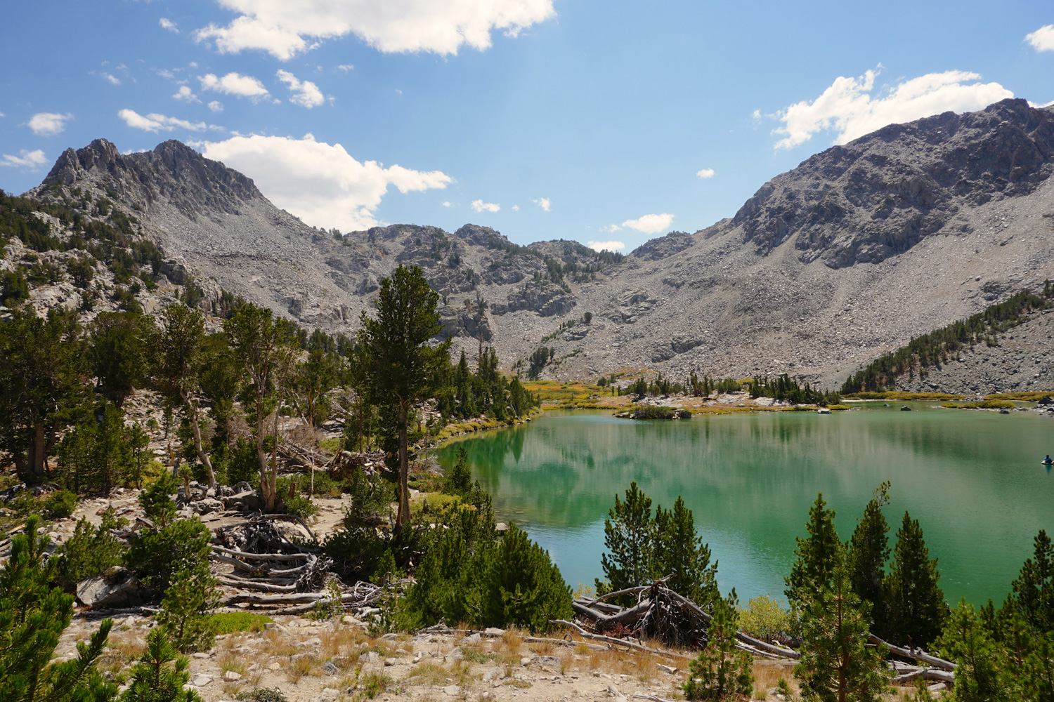
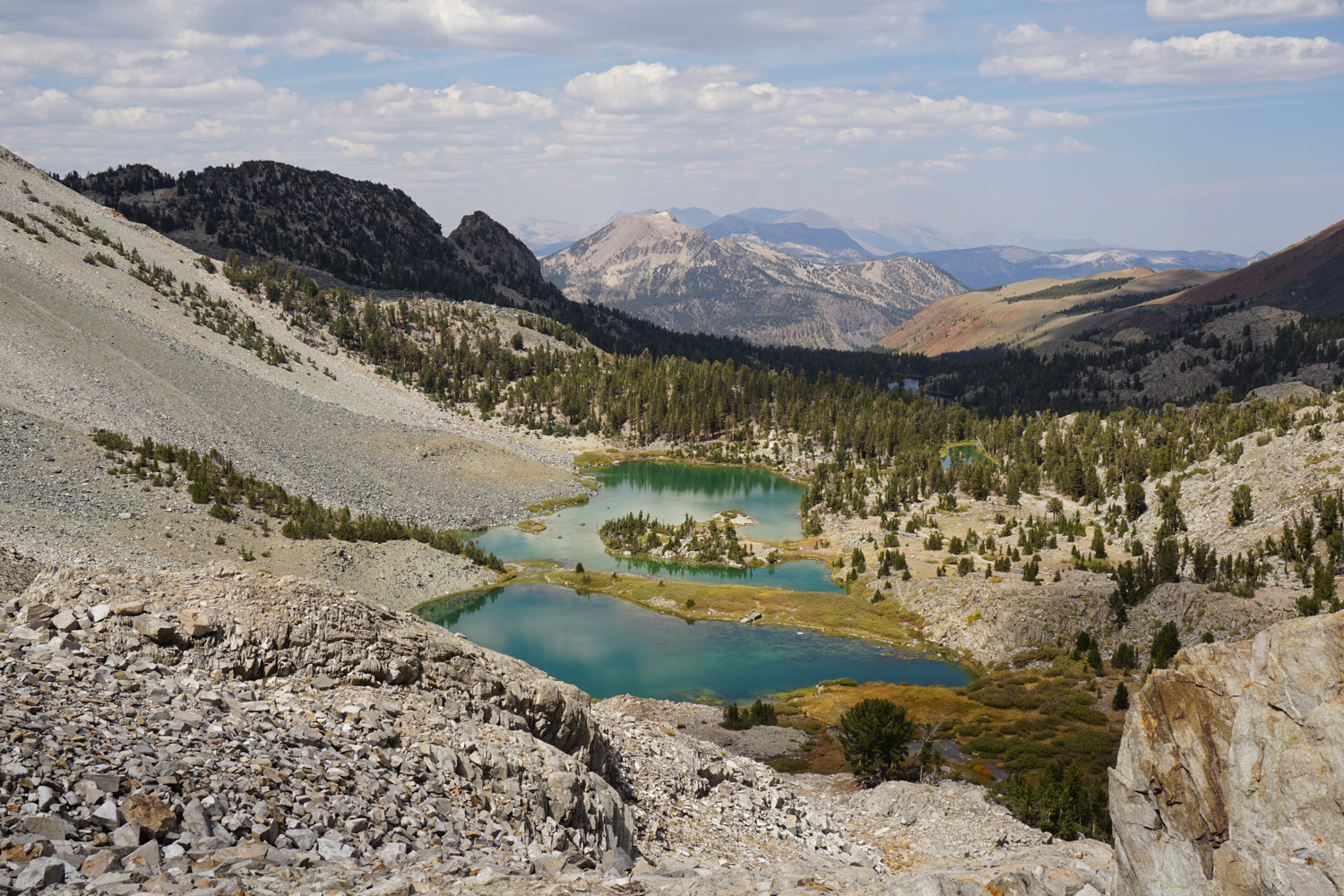
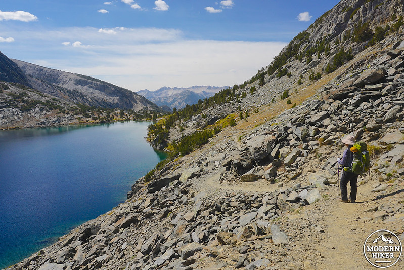
Moving past Skelton Lake, the terrain begins to change. You’re out of the thick forest cover, now surrounded by boulders and meadows, and can see the impressive Mammoth Crest rising up like a fortress in front of you – while it may seem intimidating that you’re going to have to breach that daunting ridgeline to access Duck Lake, the gorgeous scenery will distract you from the task at hand. In fact, right before you begin the final ascent to Duck Pass, you’ll encounter one of the absolute gems of this trip, Barney Lake, set into a curve below the Crest. You’ll hit the heavenly bright turquoise pool around 2.7 miles and will probably want to linger – in fact, I saw several people picnicking on the shores and one intrepid fisherperson floating out in a small raft.
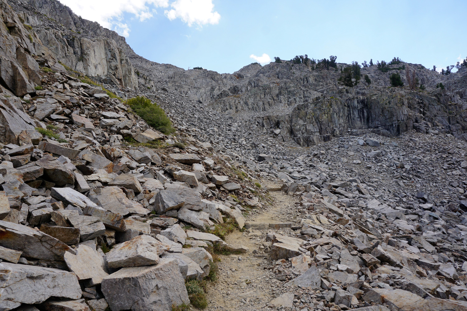
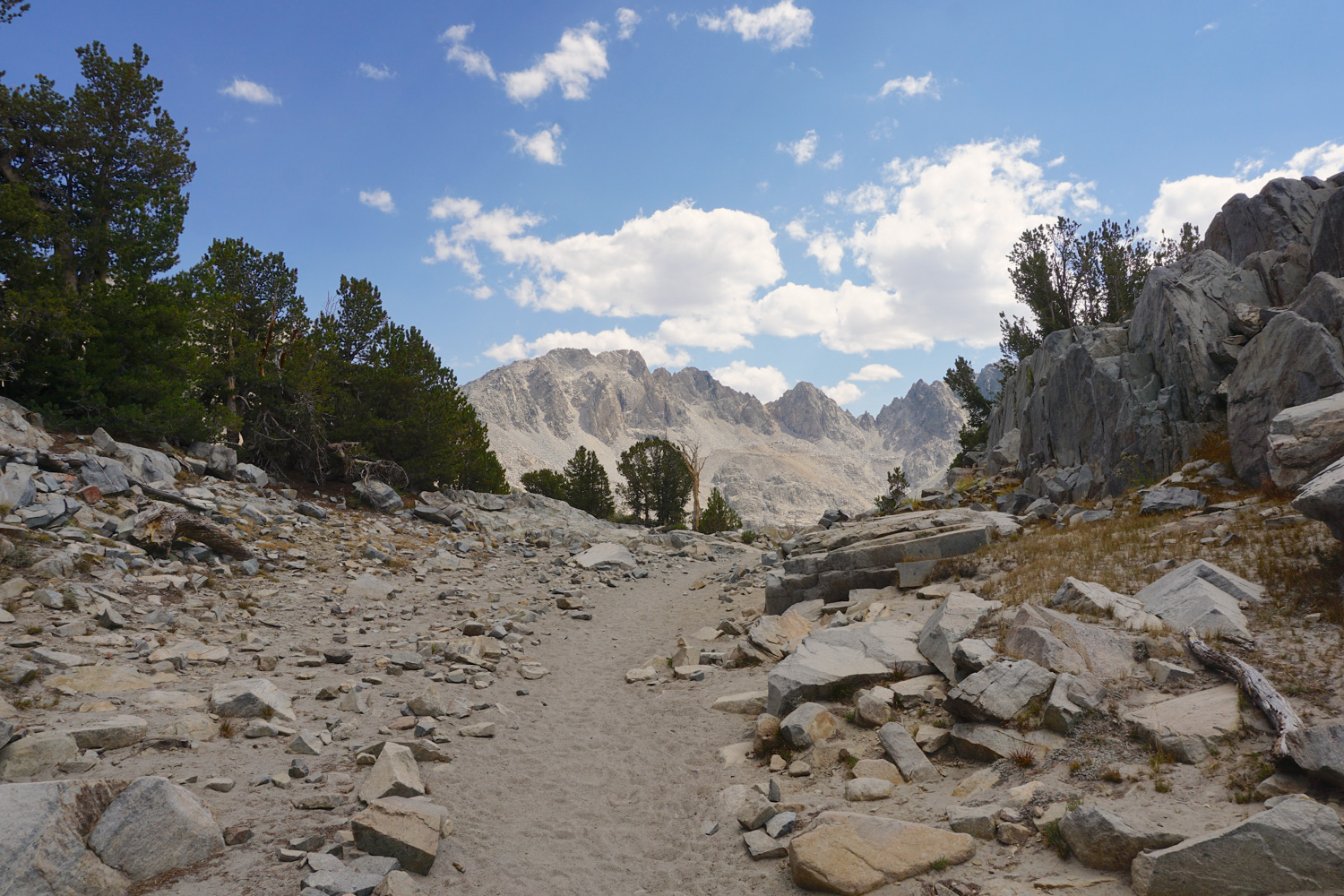
It’ll be tough to tear away from such a stunning sight, but I promise there are more goods ahead. Make a small creek crossing over a low log bridge, pass much smaller Red Lake tucked away on your left, and stay straight to head into the dark gray talus that marks your way above treeline. This north-facing slope can hold snow well into the summer months, so check with rangers before your hike to find out if you’ll end up tromping through some white stuff.
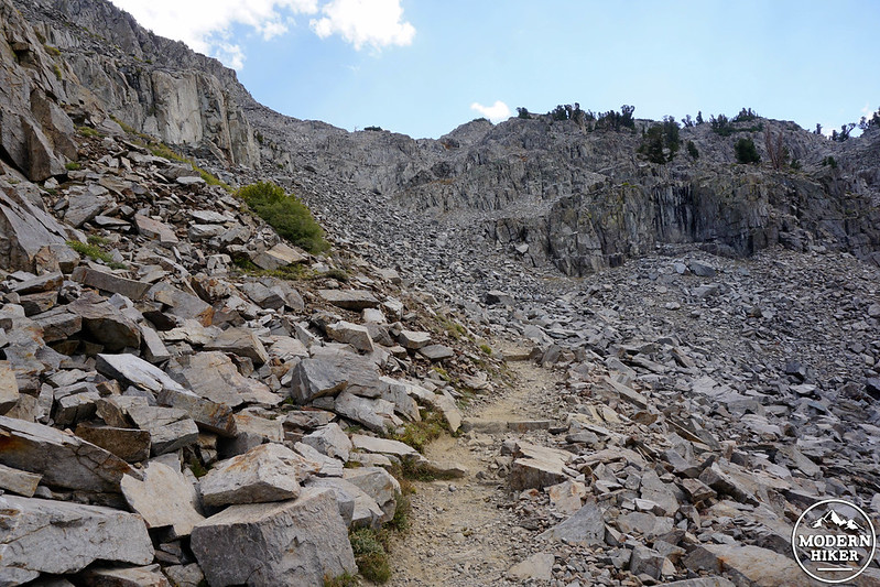
Zig-zag your way steeply uphill through the flaky blocks, heading towards the notch that marks Duck Pass. For some of the best vistas of the entire hike, make sure you turn around frequently and look back to snag epic views of Barney Lake absolutely glowing below you, and catch glimpses of some of the other lakes and distant peaks to the north. This is a great time to snap photos, since the pass itself doesn’t offer much in the way of views.
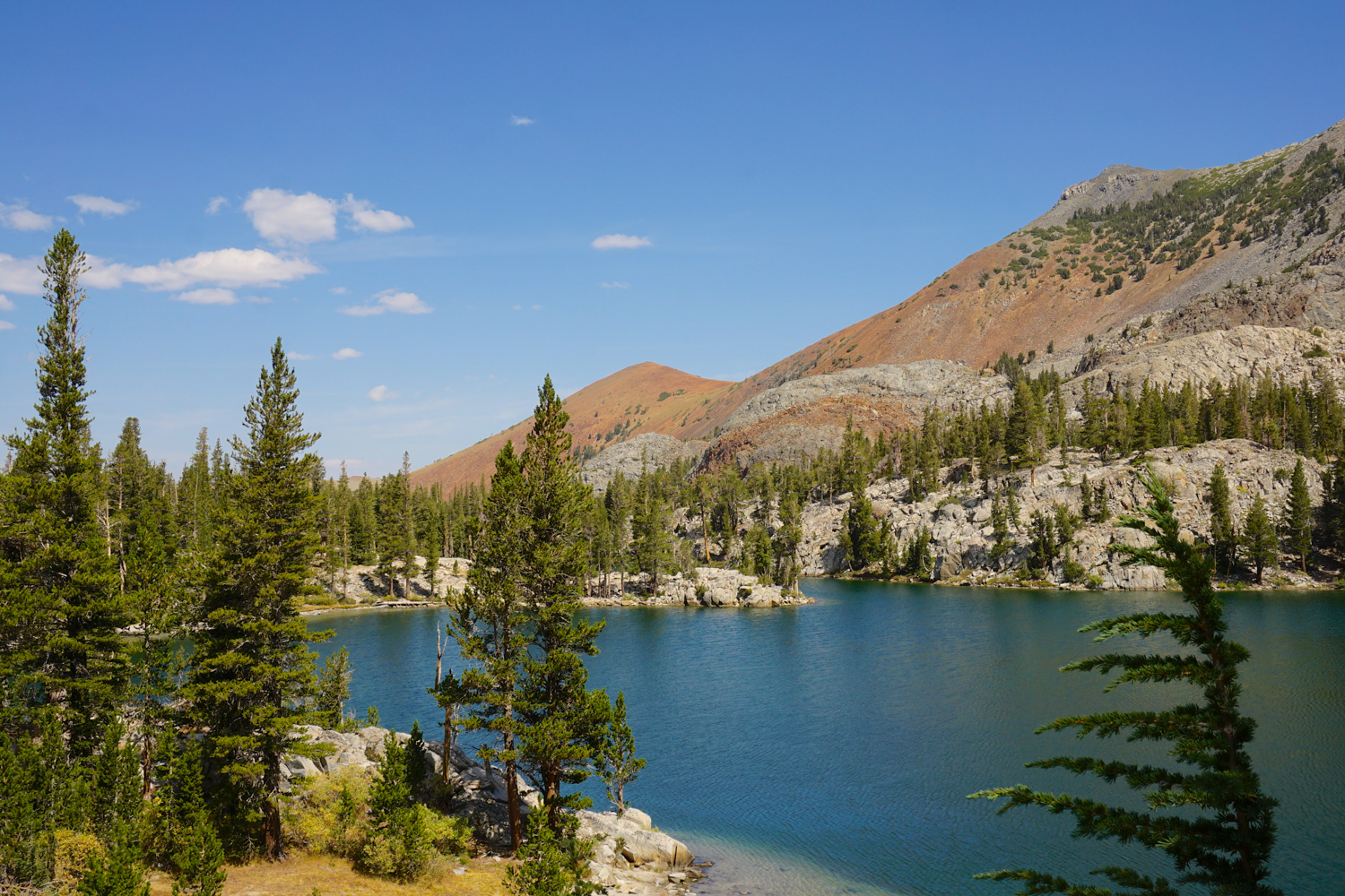
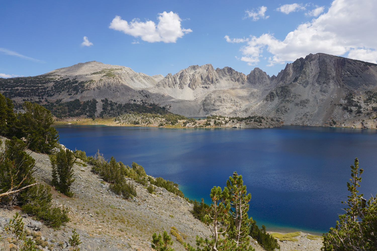
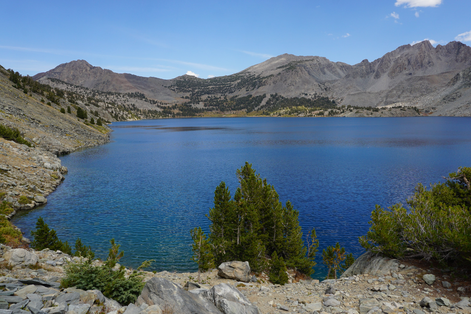
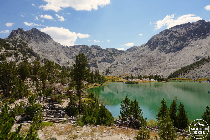
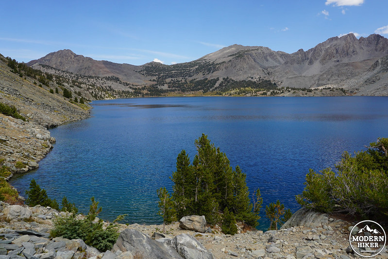
You’ll finally reach the highpoint around the 4-mile mark – 10,814 breath-stealing feet above sea level – and once you start heading down the other side, you’ll cross over from Mono County into Fresno County. The pass quickly gives way to views of the Silver Divide peaks to the south and your first glimpse of the deep sapphire waters of Duck Lake below.
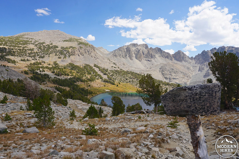
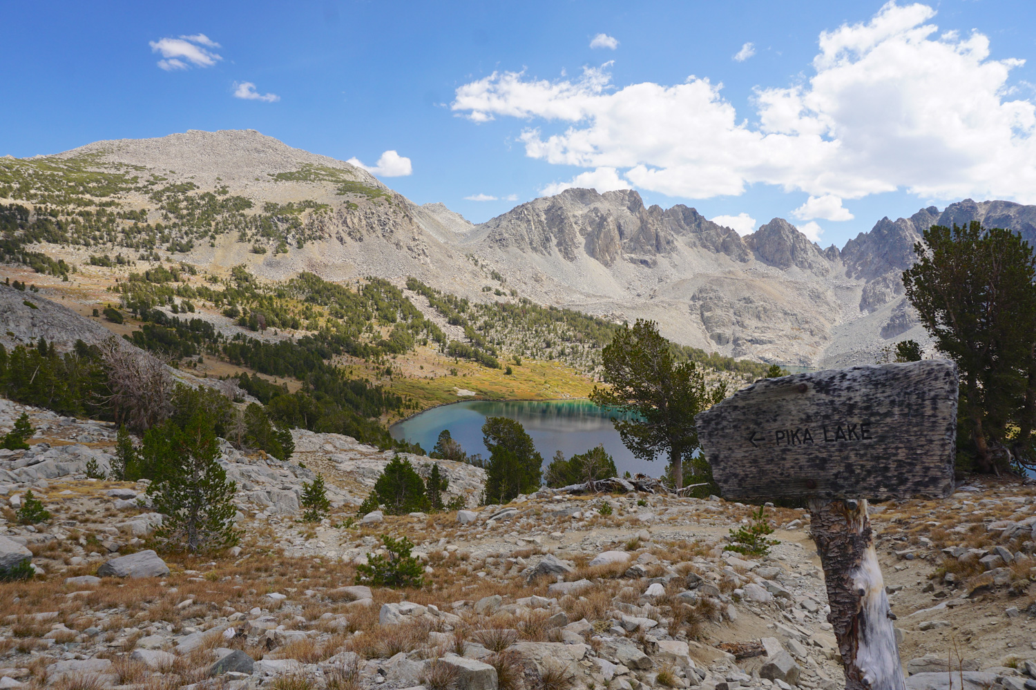
Coasting down, you’ll quickly reach a signed intersection with the Pika Lake trail – if you want to stay overnight in the area, head left here, since there’s no camping allowed within 300’ of the Duck Lake outlet and its shores are too steep and rocky to offer any truly great tent spots. Pika Lake, named after the adorable little critter you frequently see scampering around the rocks in the high mountains, is tucked to the east of Duck Lake and becomes more visible as you head down along the Duck Pass Trail.
Continue descending on the western slopes until you reach your final destination, the Duck Lake outlet, at 5.1 miles. There’s a small wooden sign here that directs stock users to head right and hikers to head left; you’ll want to do the latter to find a few open spots suitable for an afternoon picnic and perhaps a breezy lakeside nap. Ahhh…this is the life!
If this is a day trip, retrace your steps (thankfully, mostly downhill after you crest the pass) back to the parking lot. However, if you have a wilderness permit and want to continue on, head another 0.7 miles down the Duck Pass Trail past the lake to join up with the Pacific Crest Trail / John Muir Trail and a world of backpacking possibilities, including stops at Purple Lake and Lake Virginia to the south, and Crater Meadow and Red Cones – and if you’re up for it, Canada – to the north.
Notables
- A wilderness permit is required for overnight use between May 1st and November 1st
- Approved bear-resistant containers are required for overnight trips
- Dogs are allowed on the trail
- Camping is not allowed within 300’ of the Duck Lake outlet
- Fires are not allowed above 10,000’; additional fire restrictions may be posted at the trailhead depending on conditions
Tags: Alpine, Arrowhead Lake, Backpacking, Barney Lake, Duck Lake, Duck Pass, eastern sierra, Emerald Lake, geology, JMT, John Muir Trail, John Muir Wilderness, mammoth, Mammoth Lakes, Pacific Crest Trail, PCT, Pika Lake, Red Lake, Sierra, Skelton Lake, transit accesible, volcanic