Dog Mountain is a well-trod 6-miler that will allow you to choose between two difficulties, hard and harder. Thankfully, it’s a lot more accessible than it sounds, and will give you that sense of accomplishment afterward. Plus, you’ll also get the chance to hike through a cloud-infused fog or soak in expansive views of the Columbia River Gorge dependent on the weather’s mood that day.
Note: Between April and June, a permit is required to access this trail system. Permits are available beginning in March and can be purchased in advance here.
At the trailhead, begin your ascent and get used to the posture of an uphill battle — this trail is pretty consistent in its incline. Just past the start of the trail, you’ll pass a bathroom. The first 0.65 miles is a series of switchbacks up an unrelenting gradient. The Columbia River Gorge blinks in through the breaks in the trees. While tough, this section is a good slog to get your legs acclimatized to all the climbing.

As you reach the 0.65 mile mark, you’ll reach a forked intersection, and your first of two choices:
To the right is a trail marked difficult. It is slightly longer than the other option but with a more forgiving elevation gain. This is the route to take if you want a more leisurely, scenic climb. For the route described, ignore it. These boons will be enjoyed on your return trip down.
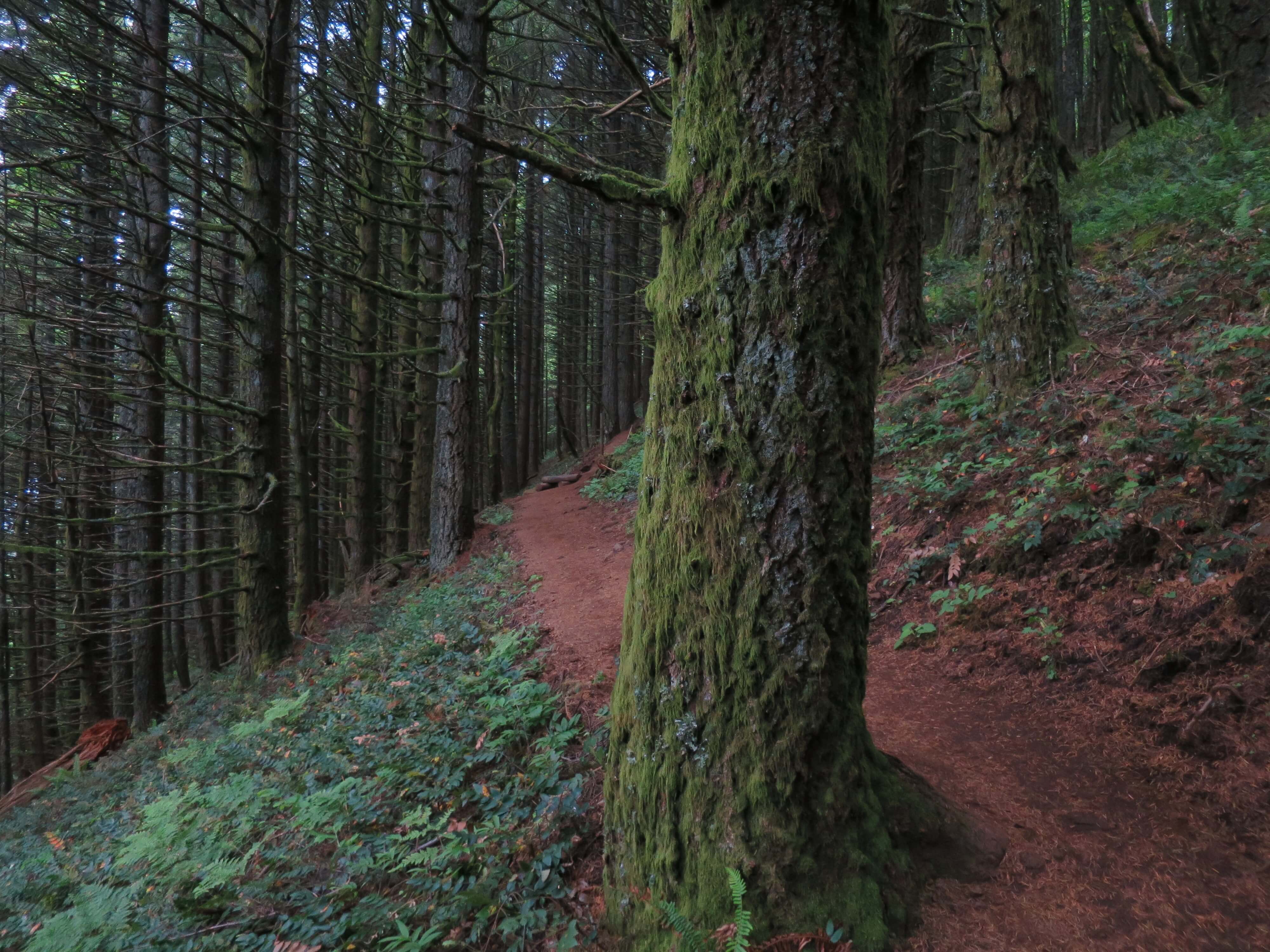
To the left is a trail marked more difficult. It is slightly shorter, and has a much steeper elevation gain. For the route described, take a left and head up the hard way. This route lacks a bit of the scenery in the early stages as the forest starts thick and then slowly thins out the higher you climb. Bush and brush make way for a carpet of ferns at the feet of tall, slender trees.
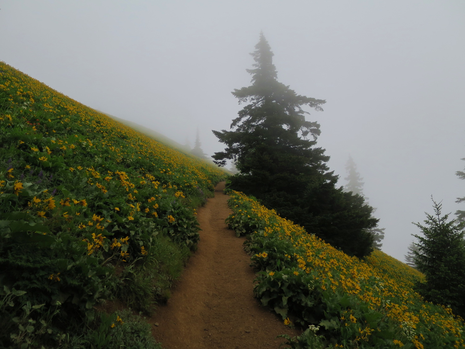
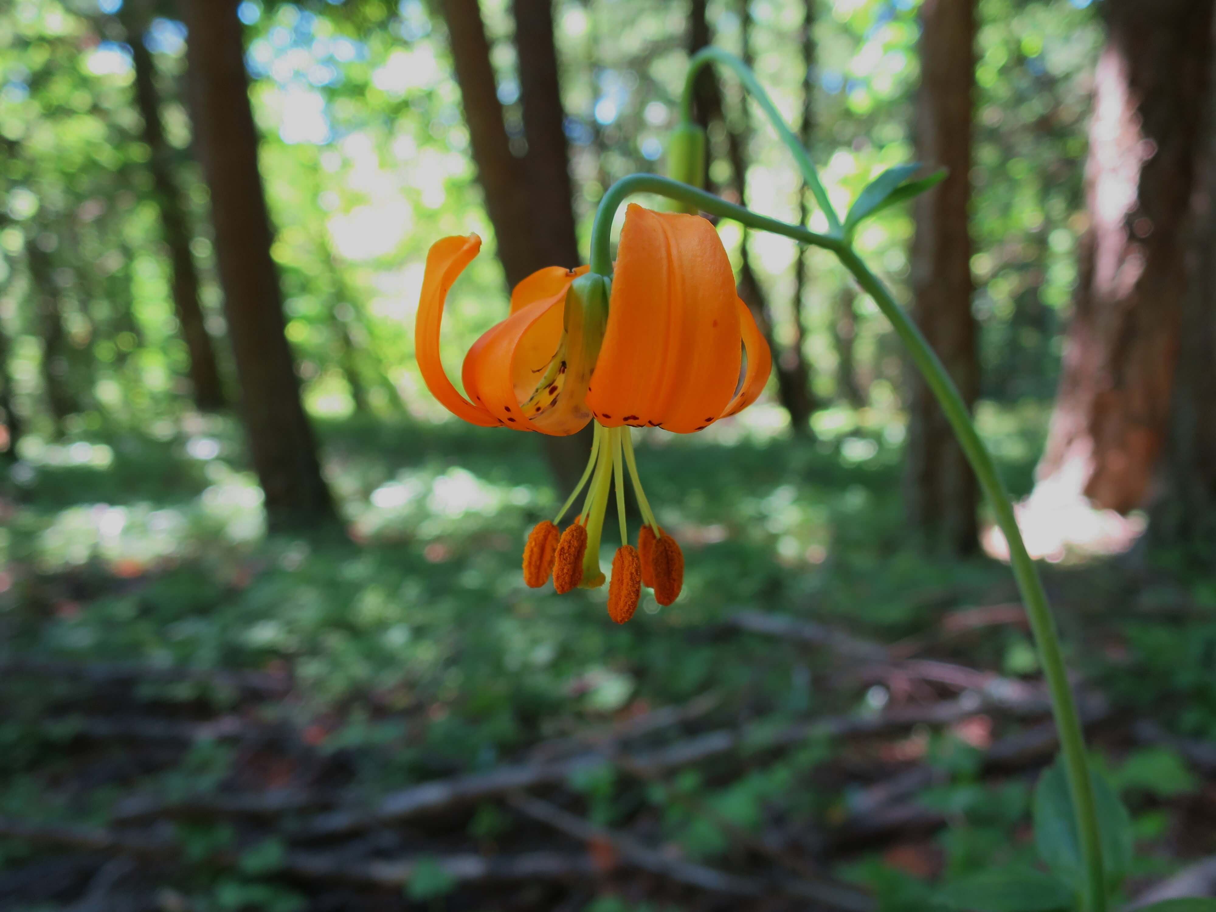
At just under 2 miles, you’ll reach an intersection that joins you back up with the easier route. Take a left and then proceed up the harshest of the inclines on the entire route. Whether you chose left or right previously, this tougher section is unavoidable. With the near-constant moisture that funnels down the Columbia River Gorge, there is also a strong likelihood that it will be muddy. Try to soak in some views here as best as you can since you will, most likely, have your eyes glued to your feet as you lean into the steepness (and potential slipperiness). After a few switchbacks, you’ll begin to notice the shrinking of the treeline. If you’re hiking in spring, wildflowers will increasingly make their presence known.

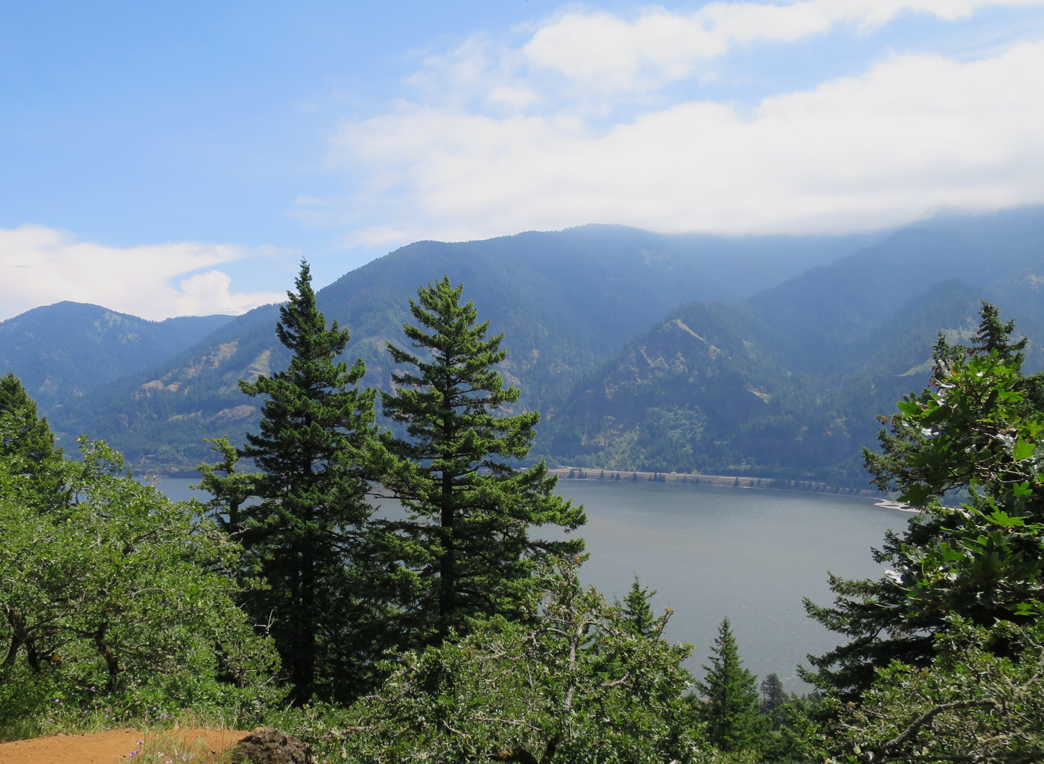
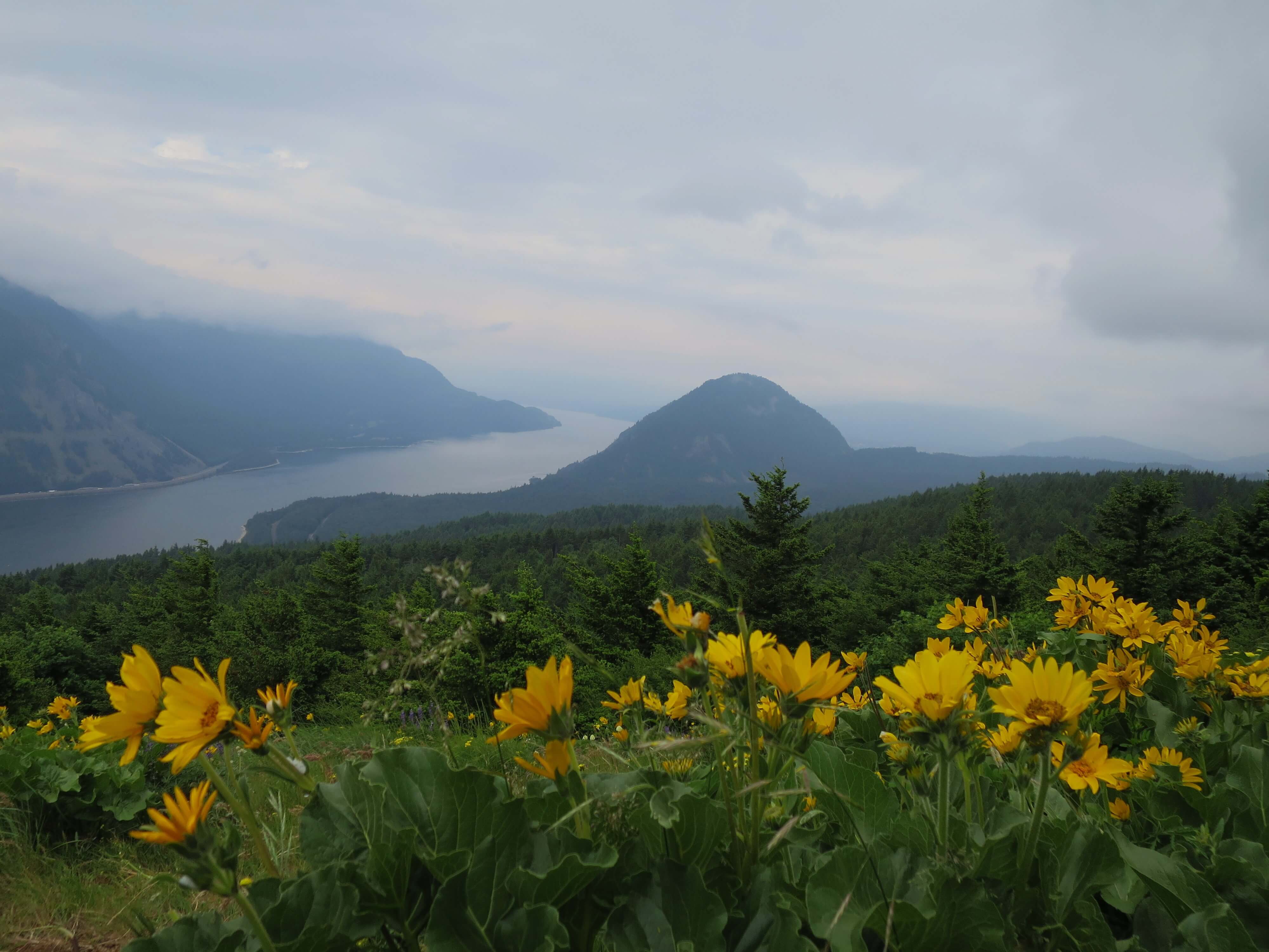
At around the 2.3 mile mark, the treeline drastically cuts away, expanding your views of the Columbia River Gorge and a full on wildflower showcase if your timing is right. May and June are primetime for balsamroot blooms. Both of the times I hiked the trail, the experience couldn’t have been more different: Opaque veils of fog one week and sun-soaked, far-off vistas the next. Here you’ll get your truest glimpse of the capriciousness of the Columbia River’s weather system. It might even look completely different when you pass on your return trip down!

Keep climbing up the switchbacks and through the views. At around the 2.5 mile mark, you’ll reach a switchback turn onto an expansive, flat shelf. On a clear day, further views into the eastern side of the Columbia River Gorge really open up from this lookout.

There is a vague forked intersection at this switchback turn. To the right is a trail so overgrown that it can be hard to notice. Ignore it.
Instead, take the trail to the left. It’s only a short hike from here to the top. The incessant, muscle-bulging climbing will soon become the incessant, joint-bouncing of descending.

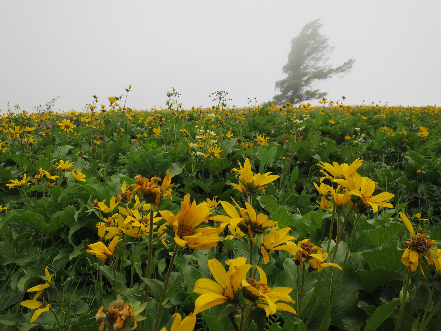
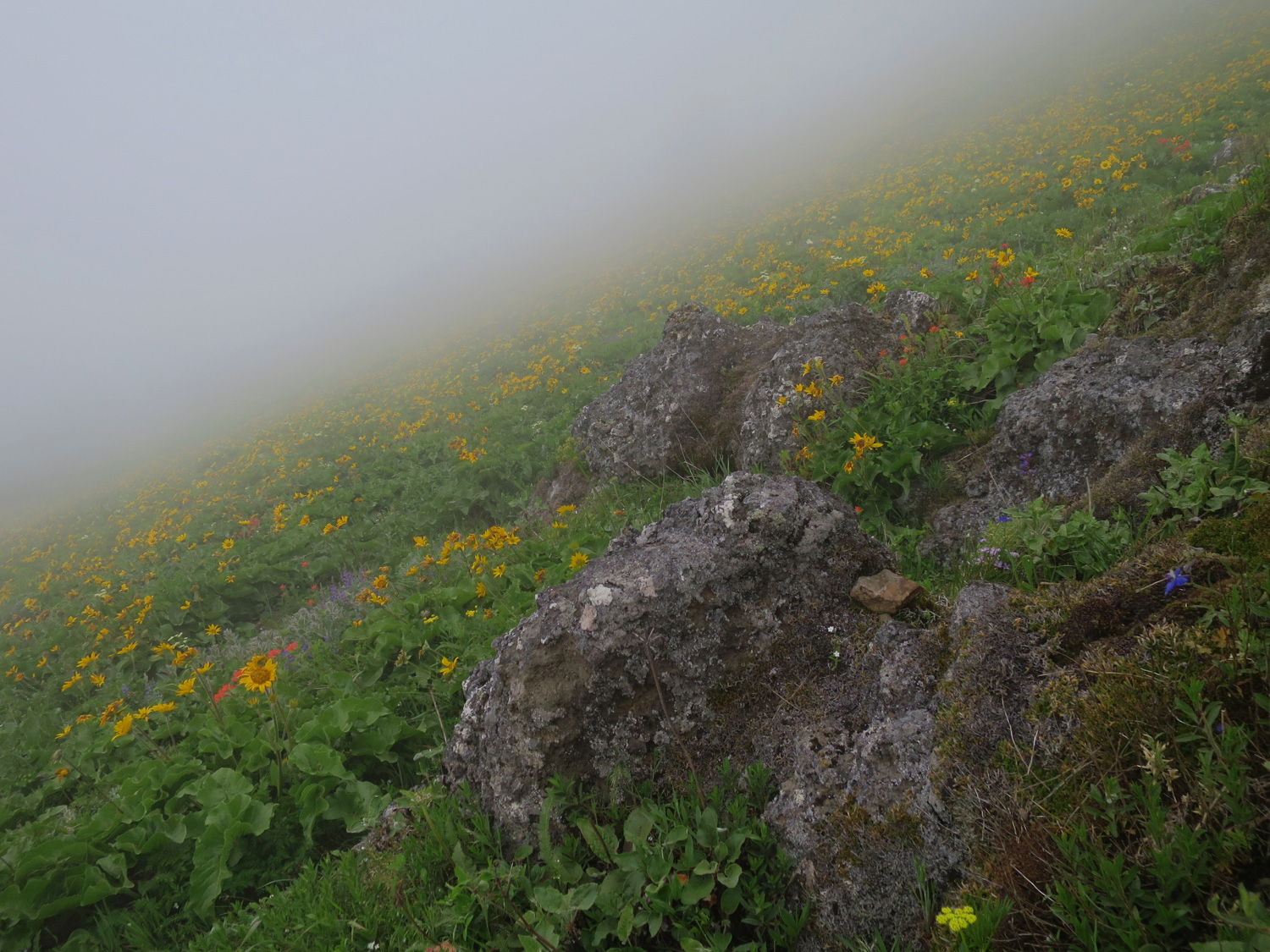
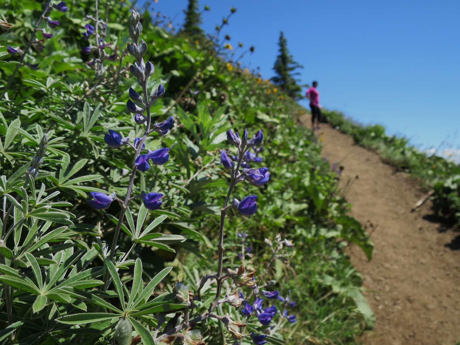
The final ascent will showcase the western-facing direction of your view into the Gorge as you take a break between switchbacks. If the wildflowers are showing, you’ll be walking an aisle between myriad yellows, reds, oranges, and blues arranged in a chaotic profusion. Rocks armored with a coat of moss and lichen jut out in sparse contrast. You’ll reach an intersection with the Augspurger Trail, heading left and down. Avoid it, though it is an alternate route back to the parking area.

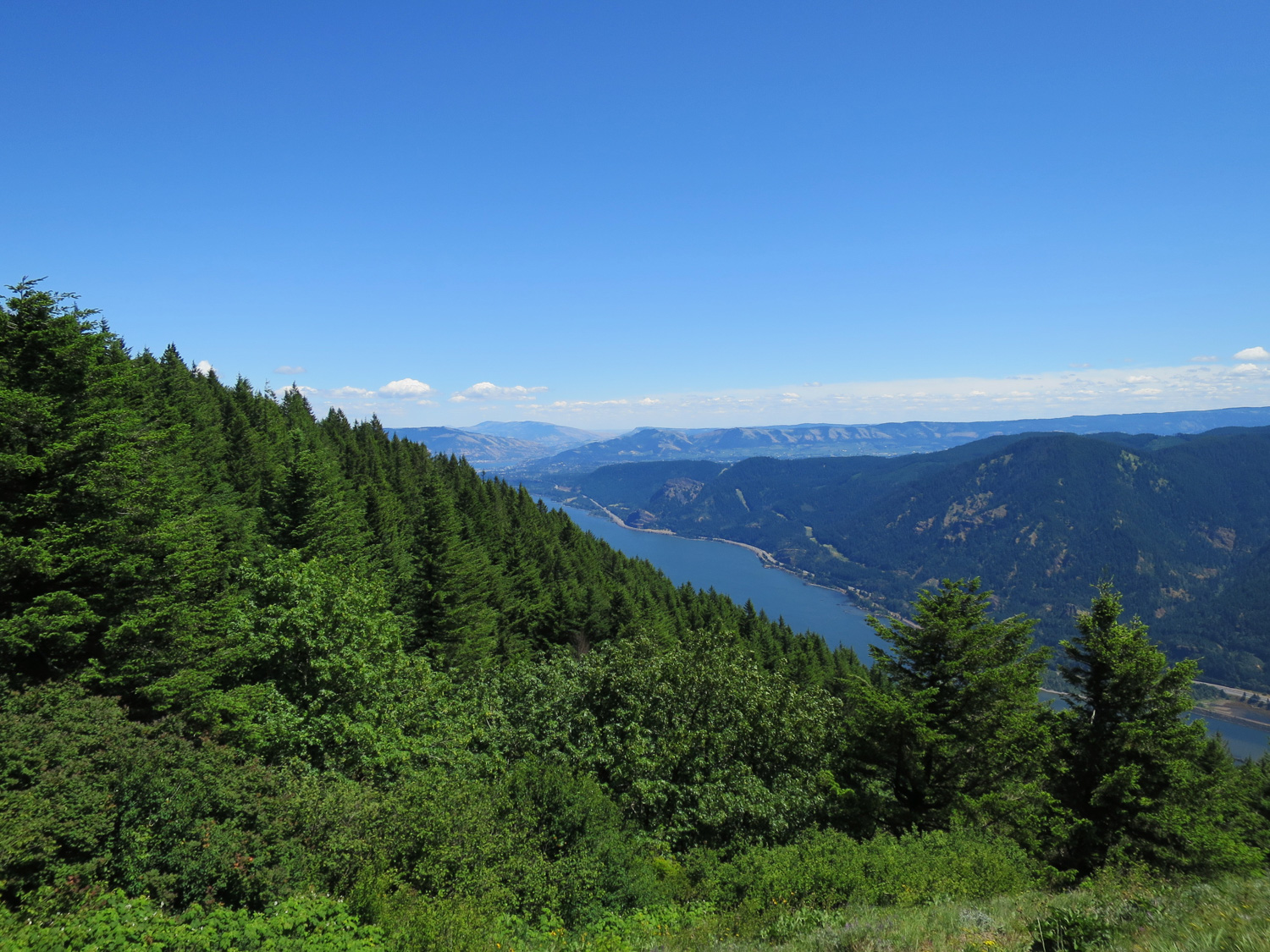
At about the 2.7 mile mark, avoid the turn to the right and stay left. You’ll reach the top of Dog Mountain, mainly composed of a south-facing, stadium-seat-graded patch of grass and dirt framed by the beginnings of another dense forest on the northern slope. The Columbia River Gorge can be seen with a nearly 180-degree view to the south. Take a moment to rest up and eat a well-earned snack. There’s plenty of room to stretch out, and the proximity of a forest canopy behind you can help cool you down if it’s a particularly hot day. Just sit back and enjoy the view.

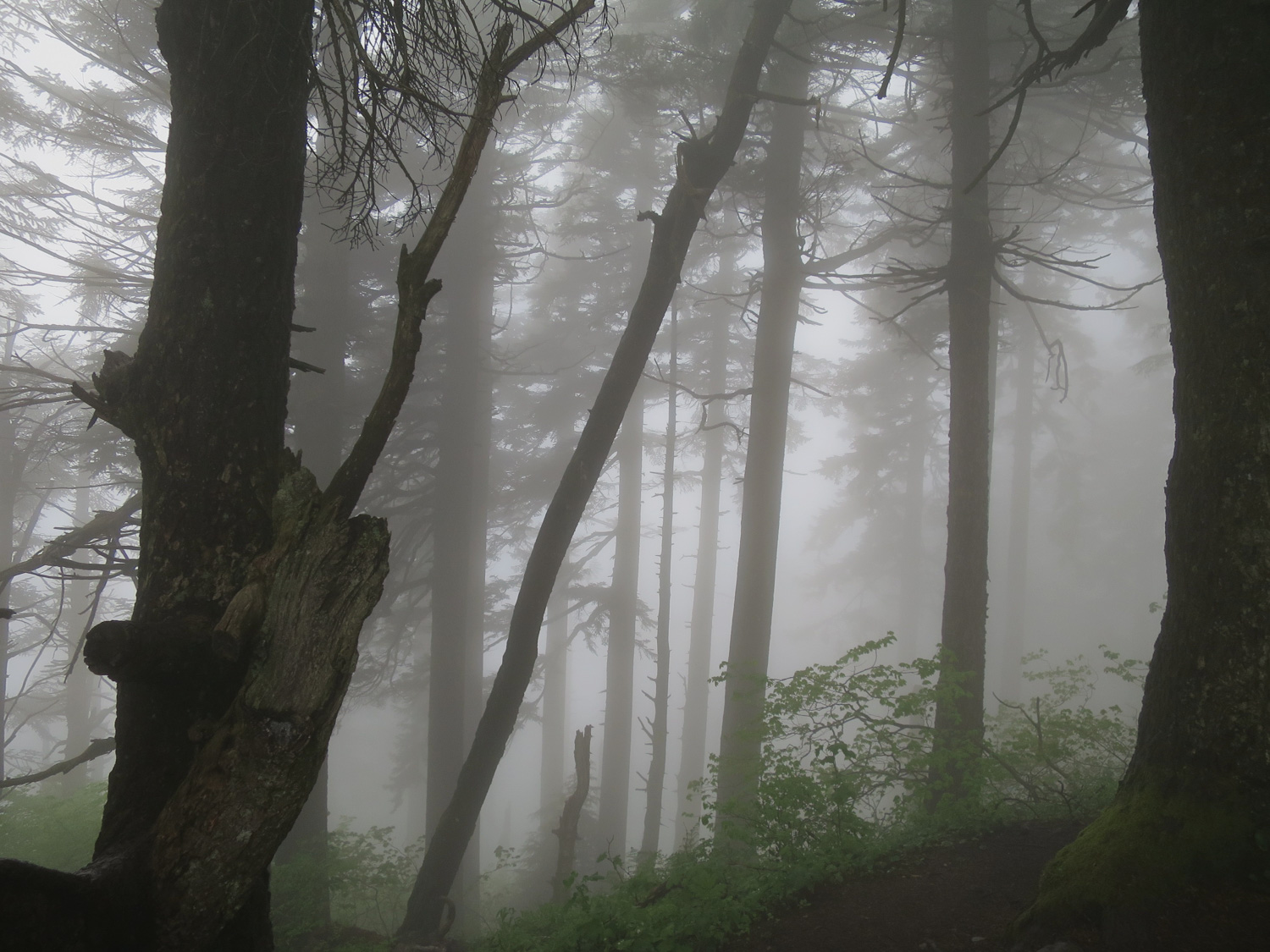
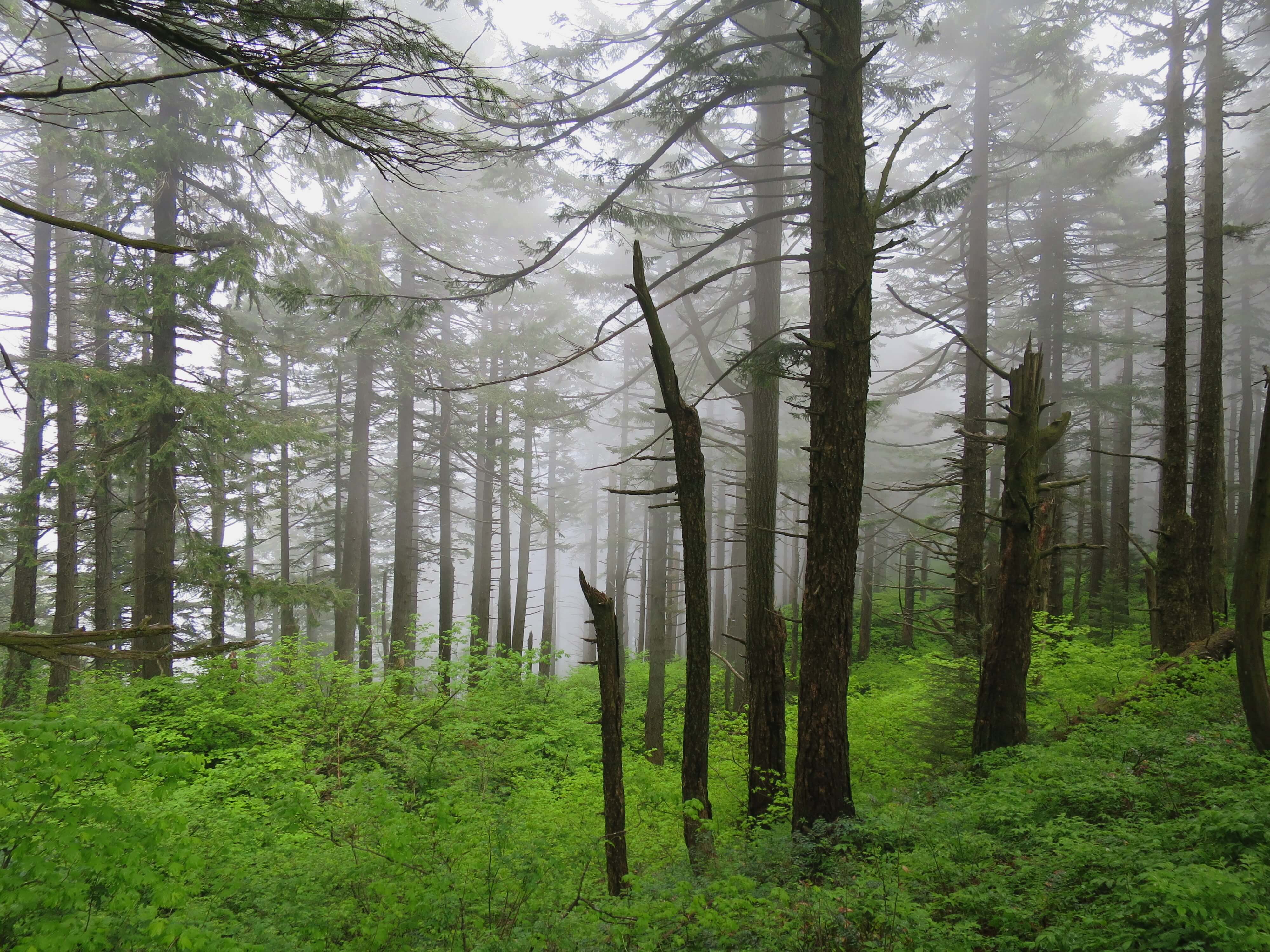
If the day is misty, I would recommend venturing a bit into the forest to the north. It’s perfect for moody captures.

As soon as you’ve had your fill and are ready to head out, just travel back down the way you came. Enjoy these open views while you can. They will soon be swallowed up by your return through the forest canopy below.

For a more rugged option down, stay straight on the left trail at around the 2.72 mile marker, just below Dog Mountain’s summit. (Note that this trail was not maintained at the time of this writing. You can avoid this by instead taking the trail to the right from which you initially came up and retracing your steps. This will not remarkably impact the distance of your hike.)
By taking the trail to the left, it won’t be long until you are deep in that forest on the northern slope of Dog Mountain. In parts, the canopy shortens to the point of smothering you. Most of the going is best done from a slightly crouched position with both arms up to protect your face from being scraped by twigs or branches. Long sleeves and pants are recommended. Despite the obvious lack of trail maintenance, you do get glimpses of a vibrant forest and definitely have a better chance at enjoying it in solitude.

This half of the loop is only 0.5 miles but it feels twice as long as its looping counterpart. Every break in the meddlesome vegetation is a relief, but they are markedly fewer and farther between.
At about the 3.25 mile mark, you’ll meet back up with the other trail on that flat shelf from earlier. Follow the trail back down from here, retracing your steps to the intersection where the first loop joined up. Say goodbye to the views, as you return to the underside of tree branches.

Before reaching the intersection, you’ll find yourself on that steepest section of incline yet now from a downward facing angle. Be careful. The surest footholds will be the closest approximation to both flat and dry. Usually, the edge of the trail that slopes the least is the safest bet. At about the 3.75 mile mark, you’ll reach the intersection. Take a left and head down the slightly longer and easier half of the loop. At this point in the trail, you’ll notice a similarity to the more difficult half of the loop you initially ascended — the tops of the trees are thick with growth while the bottoms are spiky and bare.
At about the 4.25 mile mark, you’ll reach another bald patch in the mountain’s canopy and find yourself at a lookout. A bench marks a resting spot and the Columbia River Gorge once again becomes the star of the show. This same view, from any elevation, never gets old.
When you’re ready to finish your hike out, continue left down the trail. After walking through a narrow corridor of leaves less than a shoulder’s width between them, you’ll find yourself emerging into a wide, open area. Trees grow lean and tall, skeletal in their bare lower limbs, and spaced farther apart. The ground slopes in a strange geometry as you follow it down to the first intersection you passed, reaching it at around the 5.35 mile mark. Take the left and switchback your way down for the final 0.65 miles. Upon reaching the parking area at around the 6 mile mark, give your knees and calves a nice stretch. (And I would recommend giving your whole body a thorough tick check if you decided on bushwhacking through the overgrown areas.)
The three miles of uphill and three miles of downhill are a good way to up your fitness level for more strenuous hikes. And the dynamics between the plant-life and weather should make it interesting year-round. However, I wholeheartedly recommend a jaunt in Spring.
Notehere: During the busy summer season, there are some transit options to get to this trailhead. Head to learn more about some car-less ways to enjoy this hike!
Tags: Bridge of the Gods, Columbia River Gorge National Scenic Area, Dog Mountain, fitness, oregon, transit accessible, washington