There is a spot within Phoenix’s South Mountain where a natural and enchanting playground exists. This area, known as Hidden Valley, is a bit more concealed from the weather than nearby landscapes, which creates special rock formations that make this a unique trail to explore.
This short half-mile loop will take you through a narrow rock formation (known as Fat Man’s Pass), a wash area full of wildlife and a naturally formed rock tunnel to walk through.
In order to get to this wild play area, we first need to take a couple of hiking trails. Seeing as how Hidden Valley is located off of National Trail (which runs the entire length of South Mountain), there are multiple ways of getting there. The most direct path is to take Mormon Trail to National and then to Hidden Valley.
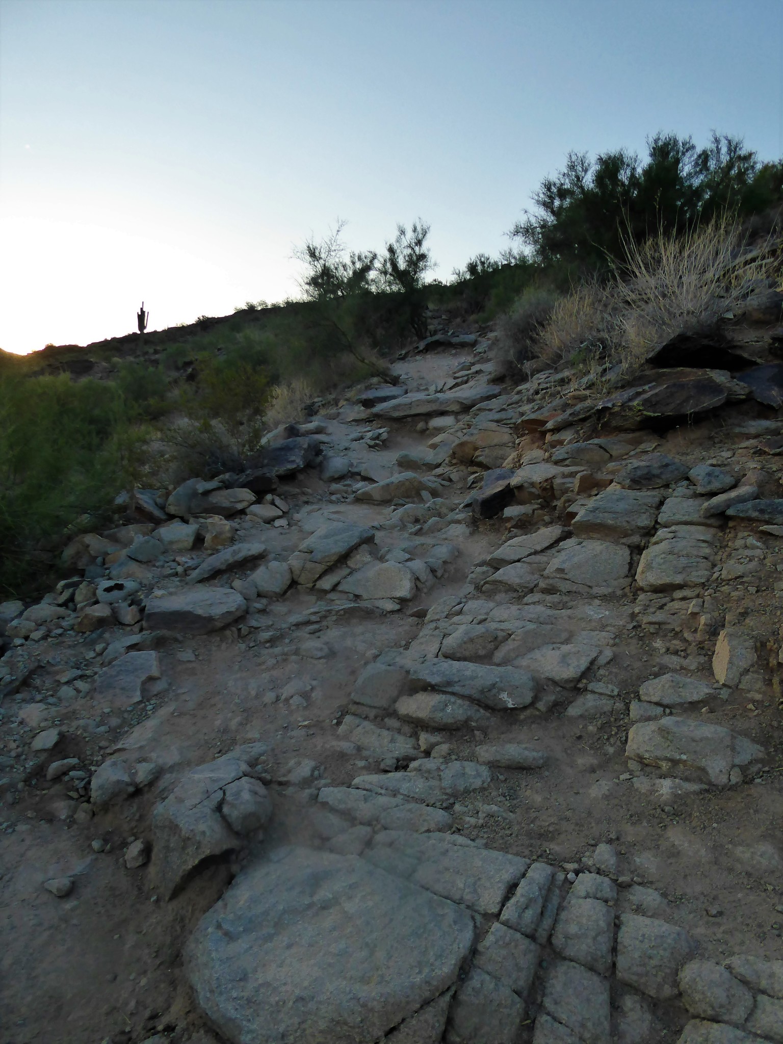
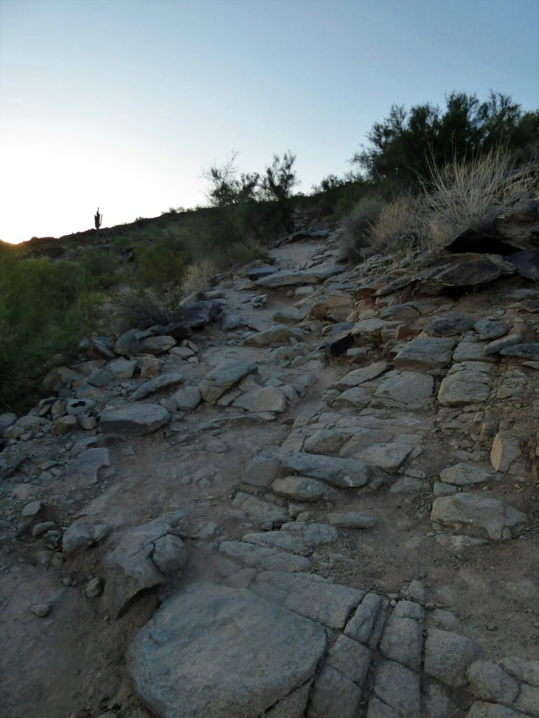
The Mormon Trail begins with an immediate incline and it doesn’t let up until you are at the junction with National Trail. Mormon Trail is pretty short seeing as how it is a little bit over a mile long. So while it may get you breathing heavy and your heart rate up, it won’t take too long to do so.
Mormon Trail
Once you have reached the ending trail marker for Mormon Trail you’ll see two trail markers. One for Mormon Loop on your left and another for National Trail straight ahead. From here you will proceed to hike forward toward National Trail for only about 0.1 of a mile. The trail will dip down and then flatten itself out.
Hidden Valley is a loop trail that branches off of National. Therefore you will see two separate trail markers for Hidden Valley. The first trail marker (at around 1.3 miles) will indicate that it’s in tunnel side of Hidden Valley. If you go down further on National, you will see the second trail marker (at around 1.6 miles) indicating that it’s the Fat Man’s Pass side of Hidden Valley.
I would suggest starting Hidden Valley at the Fat Man’s Pass end. The reason is because from Fat Man’s Pass you will be hiking down, and will be able to see the paths laid out better. Coming up in the opposite direction, much of your view would be blocked by the boulders and it might be more difficult to navigate.
For this article, I started Hidden Valley at Fat Man’s Pass.
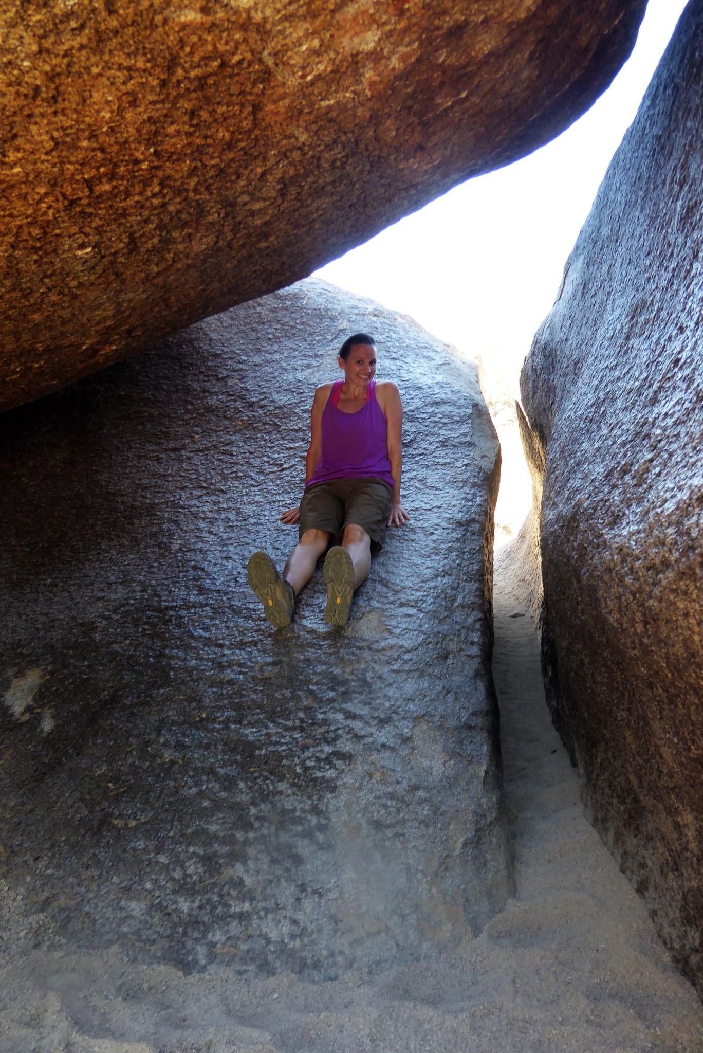
As you have probably imagined so far, Fat Man’s Pass is a very narrow path that is incorporated into the trail. There are two big boulders that are very close together, creating a narrow pathway for hikers to go through. And by narrow, I really mean narrow! I had to take off my hydration pack in order to squeeze through. But, in case you are not able to fit, no worries! You can actually walk on top of the rock and then hop down onto the trail below. Or you can also slide down on one of the rocks as well. The rocks are extremely smooth, due to being hidden and protected from weather erosion so sliding down is as easy as sliding down any other slide in a playground.

Sliding down Fat Man’s Pass or you can walk through the narrow pathway
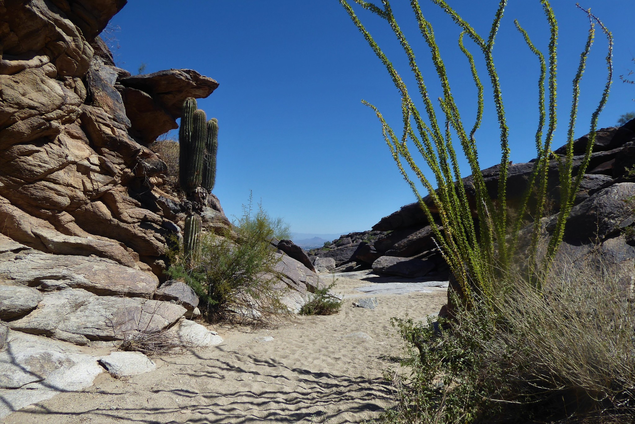
After getting through Fat Man’s Pass, you then will be walking in a sandy wash area. There is a lot of wildlife, and it’s not uncommon to see hummingbirds fluttering around. This area feels like a magical place, as most of the other trails can be too populated to see this type of wildlife freely roaming on the trail.

There are moments where you will see scenes, unlike anything else found on South Mountain. You will be surrounded by rocks that are laying on top of each other in exceptional ways, creating different formations against the blue sky above.
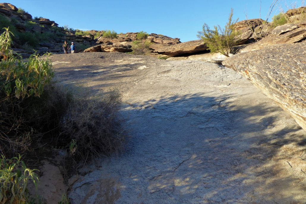
This area is so wide that you are able to walk up to these rocks and climb, inspect and explore what is around them. Or, they can offer a relaxing space to sit and breathe in all the nature around you.
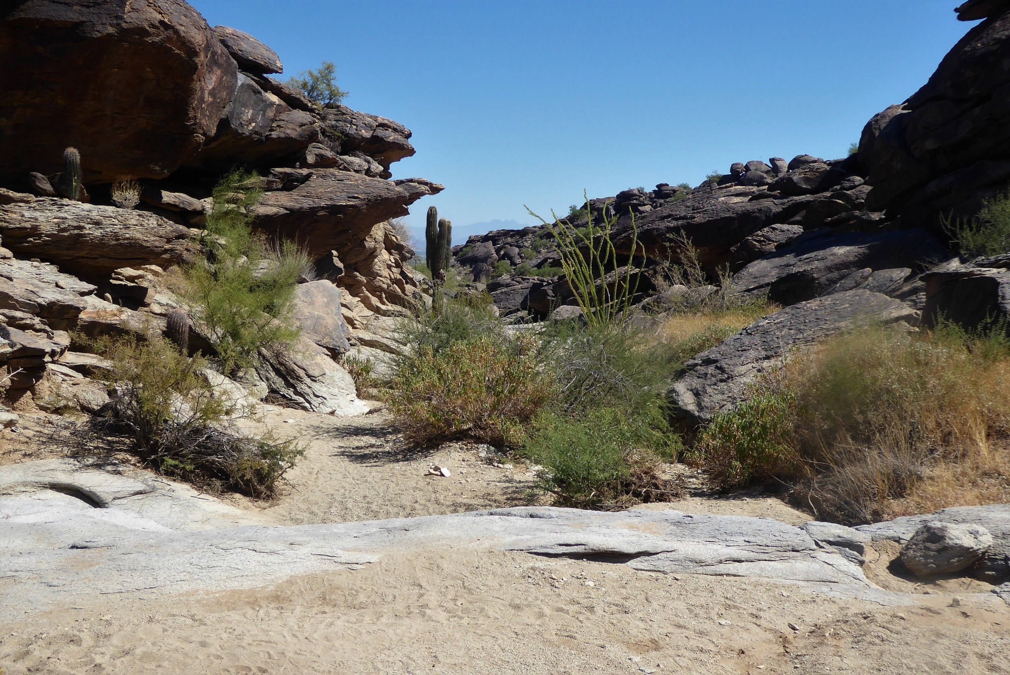
As you continue on, there will some areas where the trail will abruptly have these large rocks that have seemingly stopped the trail dead in its tracks. In fact, though, when you walk up to the end of these rocks you’ll notice that the trail continues. There are no markers within this area so it’s up to you to decide how you want to navigate down these sections of rocks. Again, this is nothing technical, it’s just how you want to decide what is the best way for you.
At around a total of 1.9 miles there may be some confusion. The route will lead you to a section where you are standing on a big rock looking out at the trail below you. These rocks are very slippery and smooth so walking down them can be unstable. Instead of hiking down the rocks below, if you look to the right you will notice a little side path where you can get down by walking around the bigger rocks which feels much safer.
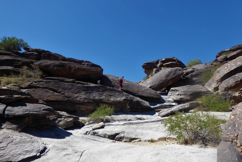
Around 1.9 miles you can go down the steep rock, or there is another path to the right
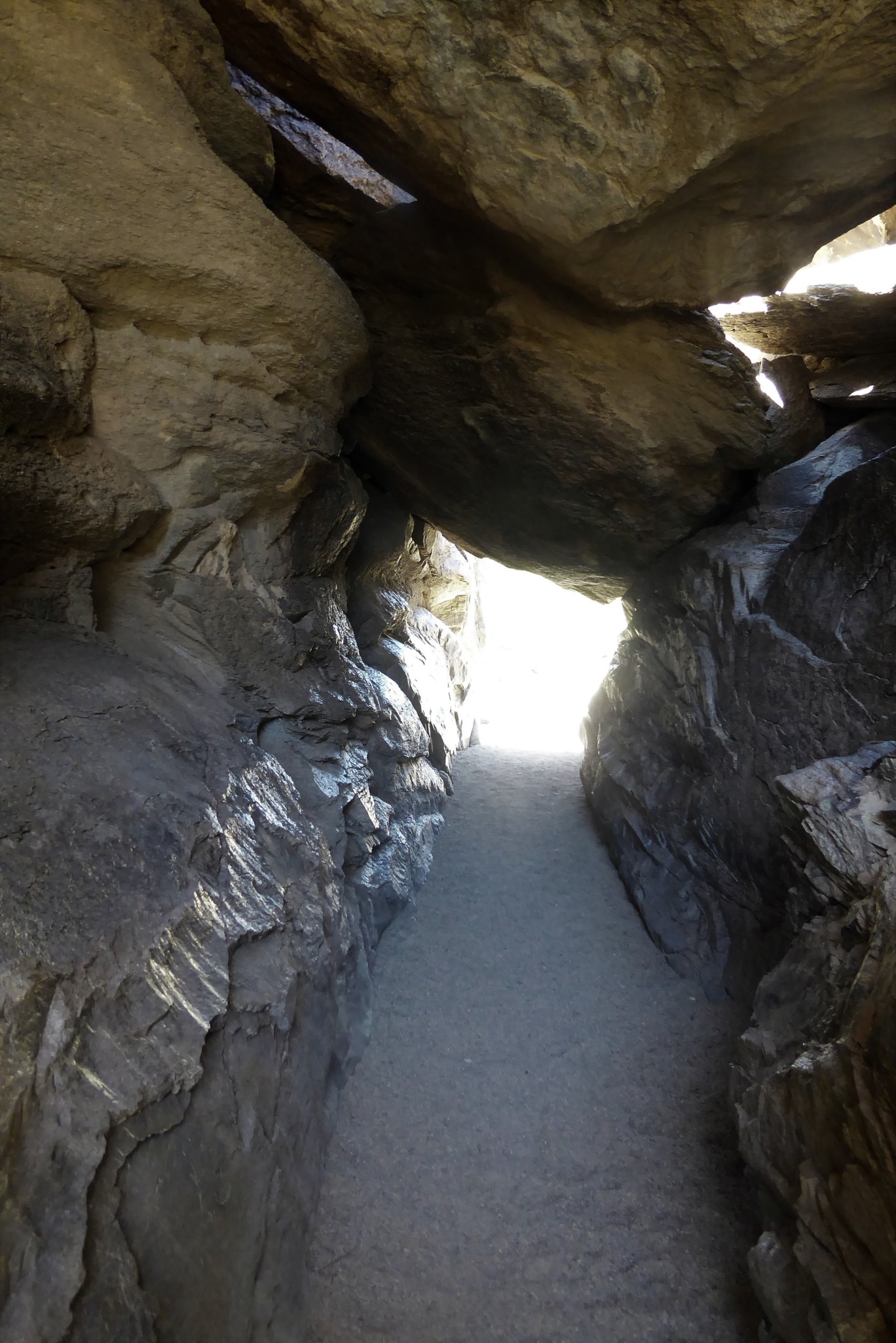
As you continue, the ending of this loop will not disappoint. Just as it started off with the unique Fat Man’s Pass, it will end with another unique formation, a natural rock tunnel that you can enter. As you enter you will immediately feel a cooler breeze hit your face and the temperature drop. Throughout this entire hike the rocks have been very smooth, but they are almost fake looking in the tunnel. It looks like it could be a plastic mold of the rock tunnel, and that it can’t be real.
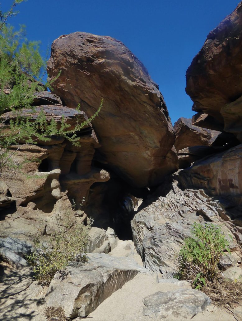
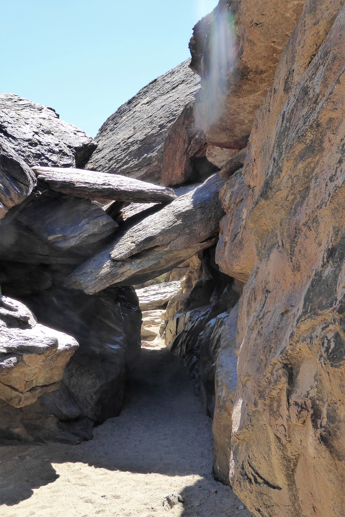
Tunnel at a distance
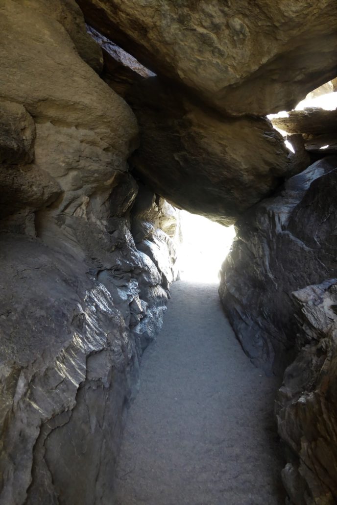
Inside the tunnel
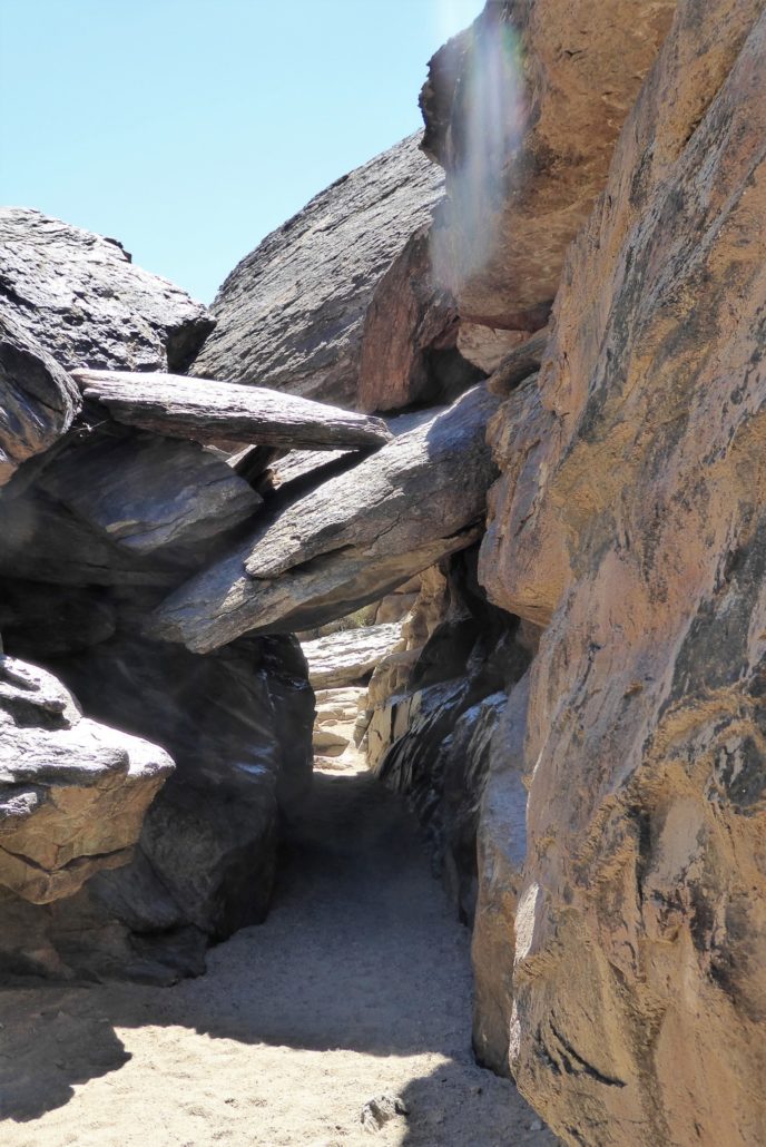
View of tunnel on other side
Once past the tunnel, the trail continues a little further and you will see a trail marker directing you to turn left to get back to the area where the Mormon and National Trail junction is located. Then after a short distance you will meet up with a second marker indicating to turn right onto National to get you back to the Mormon Trail and head back to the parking lot.
Tags: Arizona, AZ, dog-friendly, Fat Mans Pass, hidden valley, hike, Hiking, Mormon Trail, National Trail, Phoenix, Photography, South Mountain, State Park, Trail Write-Ups