Cold creek crossings, wildflowers, waterfalls, and glacier views — that’s what you can expect from Heliotrope Ridge. The falls and flowers alone would be worth the trek. Lupine and paintbrush color the slopes in July; heather and berries arrive in August and September. But the true draw of this trail is Mount Baker — this 10,781’ glaciated stratovolcano attracts summit-seeking mountaineers and day hikers alike.

The Heliotrope Ridge Trail is relatively easy, gaining just 1,600’ in 5.5 miles round trip. But the creek crossings can be challenging or even downright dangerous. Consider leaving the kids and dogs at home for this one.
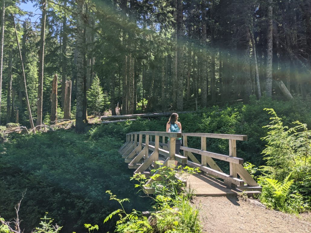
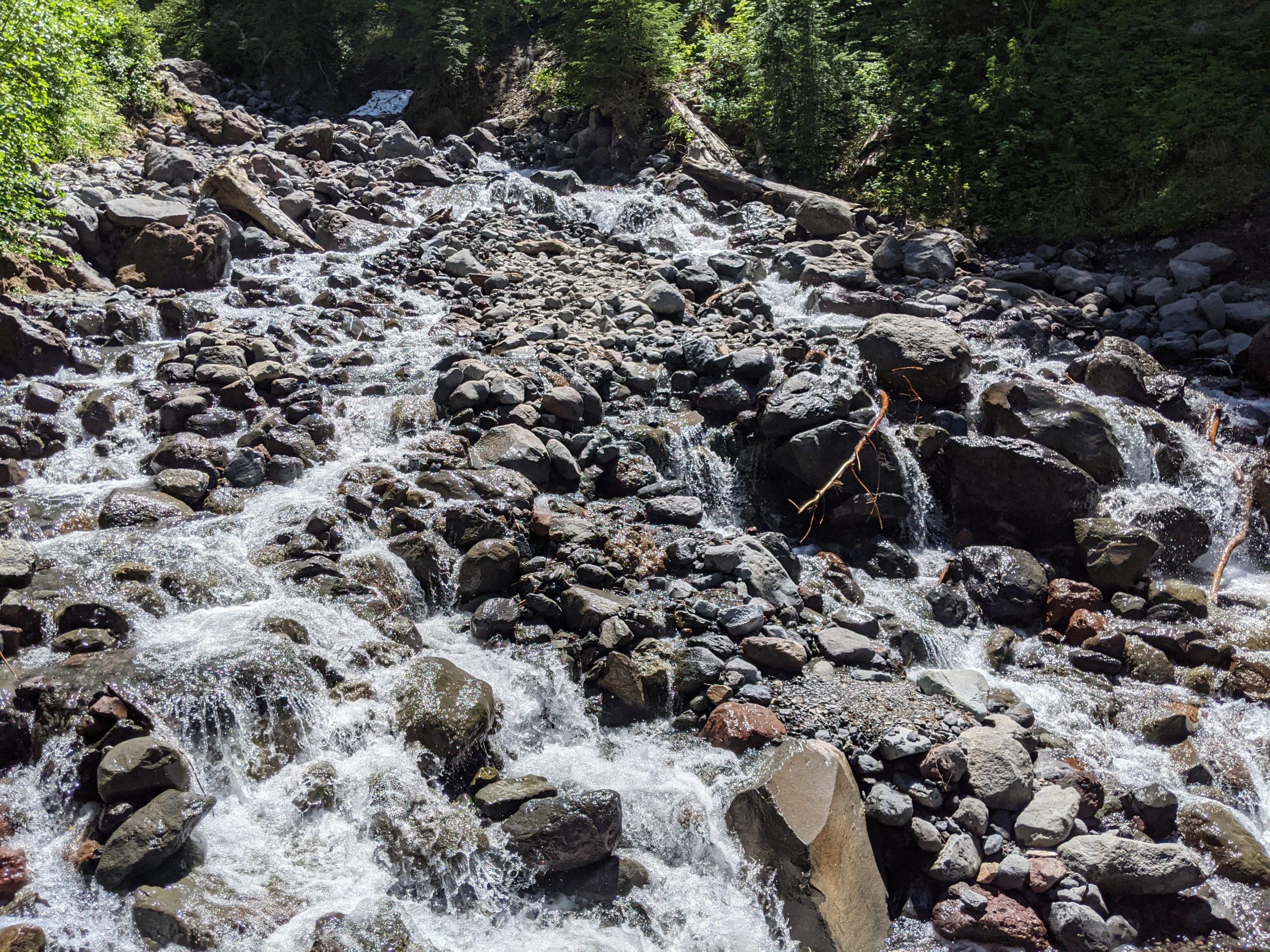
From the signed trailhead, the trail drops to a bridge over Grouse Creek before entering the Mount Baker Wilderness. This is the first and last creek you’ll cross via bridge on this trail — all others require fording. Begin climbing the rocky, rooty trail through shaded forest, gaining steadily and reaching a waterfall at 1.4 miles. This is a good place to practice your rock-hopping skills before the first significant creek crossing up ahead. Views begin to open up to the north, with the most prominent peak being Bald Mountain near the US-Canadian border.
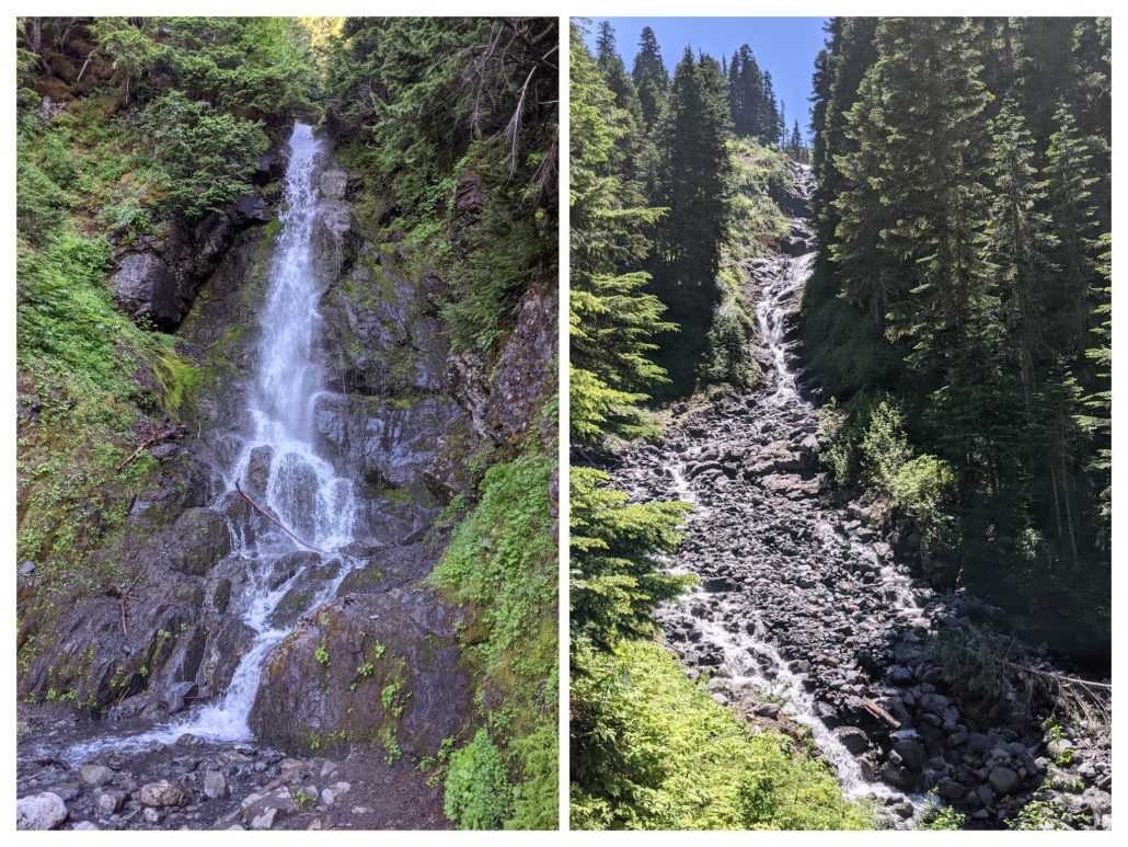
At 1.5 miles, carefully cross Kulshan Creek. At 2 miles, a large waterfall crashes down into Kulshan Creek, making for a nice photo-opp. Shortly thereafter, reach a backcountry toilet junction and stay right for the main trail. Just beyond the junction, a curiously flat clearing appears off to the left. This was the site of the former Kulshan Cabin, built in 1925 by the Mount Baker Club.

Kulshan Creek
At 2.4 miles, reach a junction with the climber’s trail. Continue straight for the Coleman Glacier overlook. However, if Heliotrope Creek is running too hard, you can always backtrack to this junction and take the climber’s path. See below for more info.
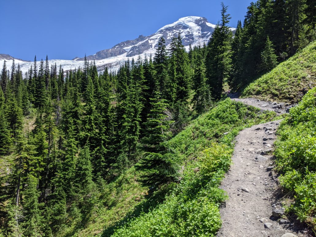
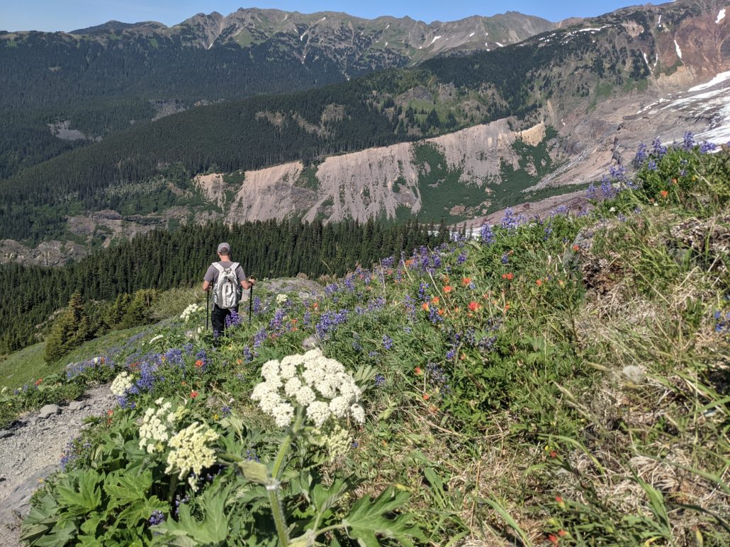
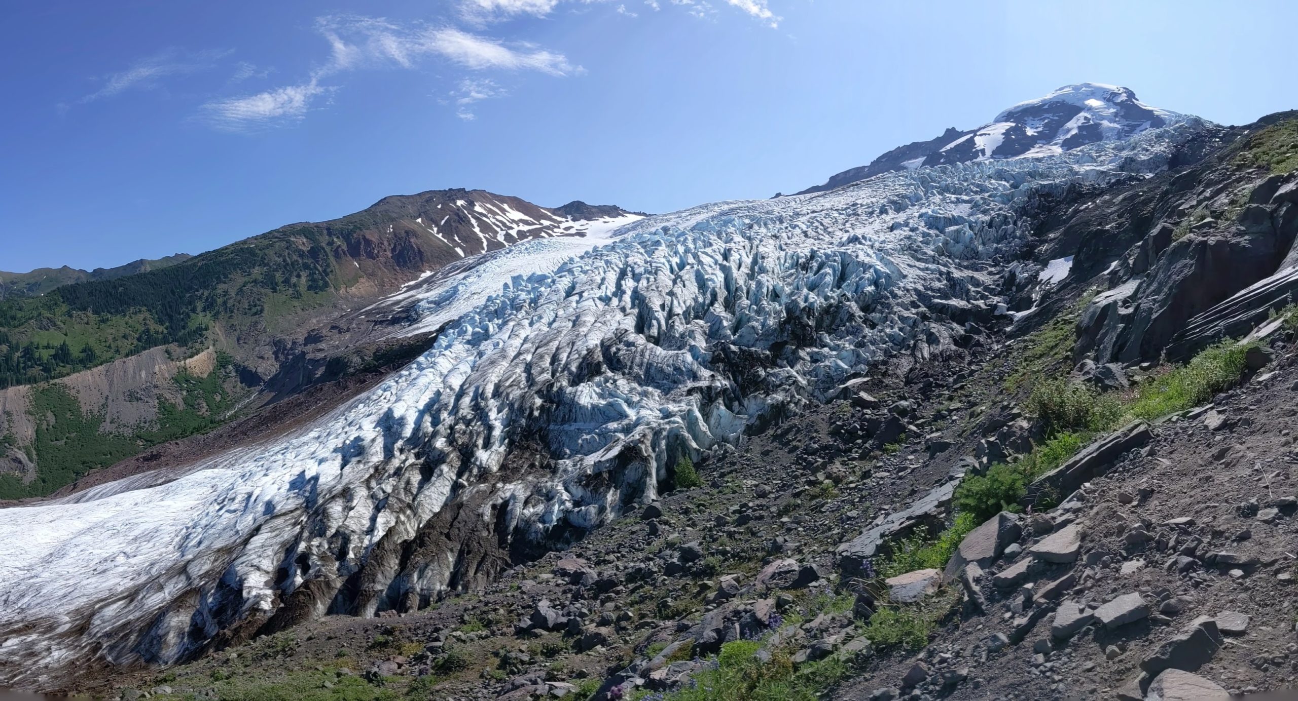
Continuing east towards Coleman Glacier, views open up to Mount Baker. Wildflowers begin to emerge as the trail leaves the forest behind and enters high meadows.

Shortly after the junction, you’ll encounter the most challenging creek crossing. Water runs fast and hard here, so only cross if you feel safe and comfortable doing so. There’s no shame in turning around and taking the climber’s trail (or simply calling it a day). If you choose to cross, you’ll be at the glacier overlook in no time.
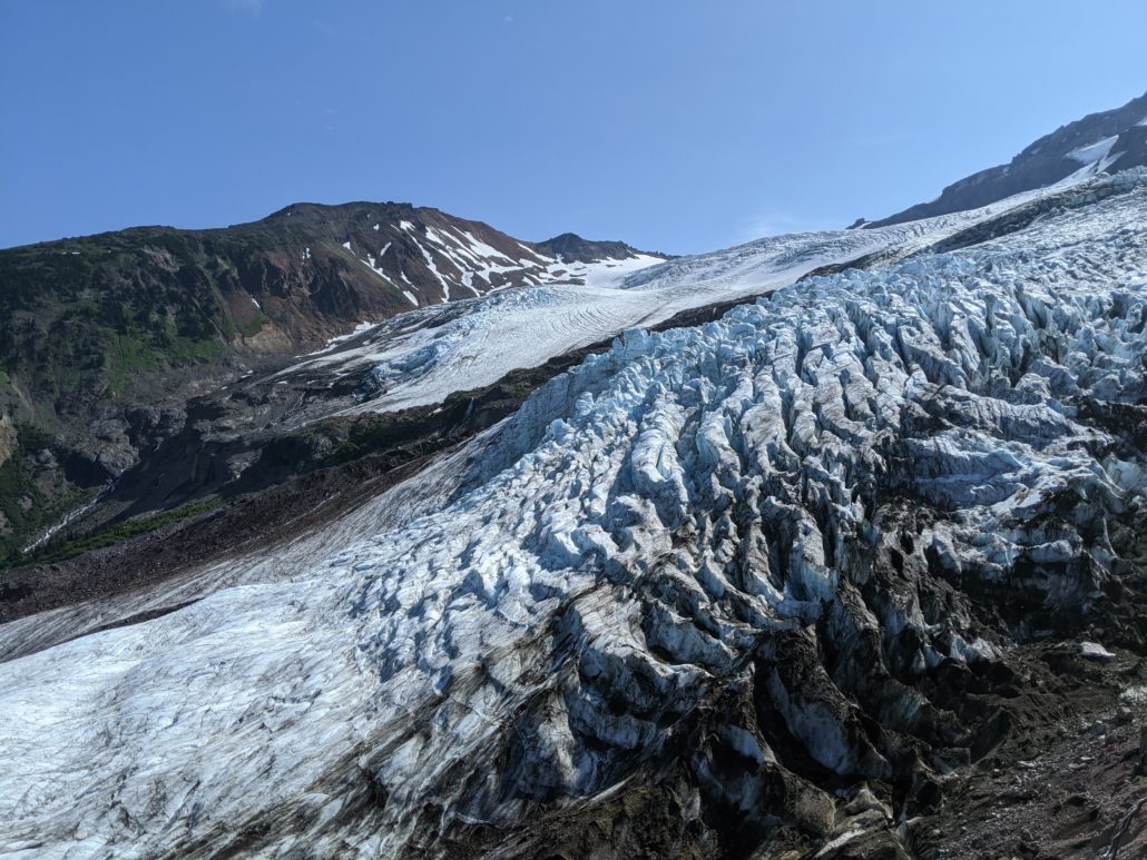
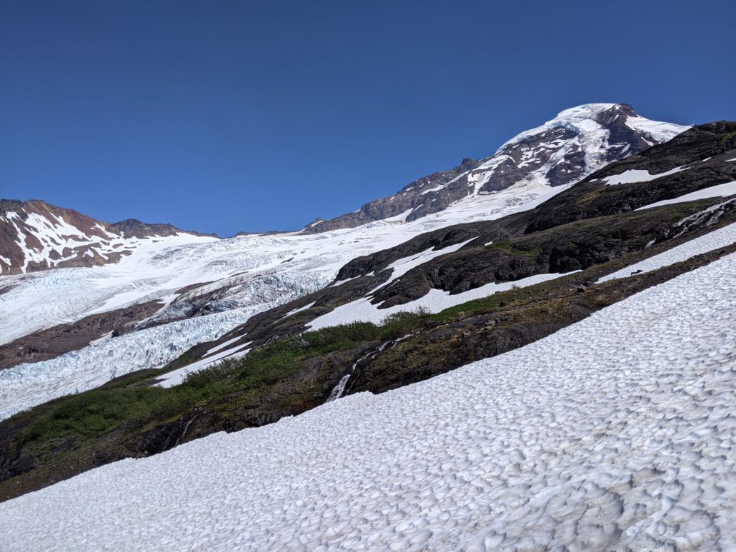
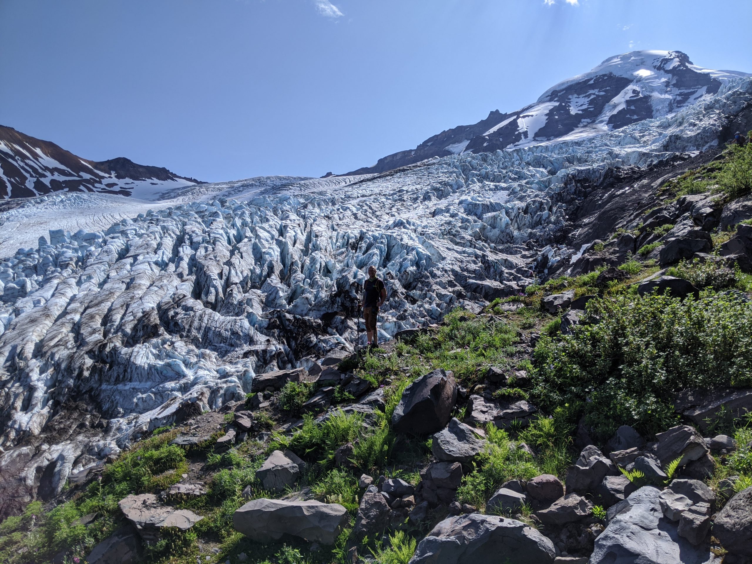
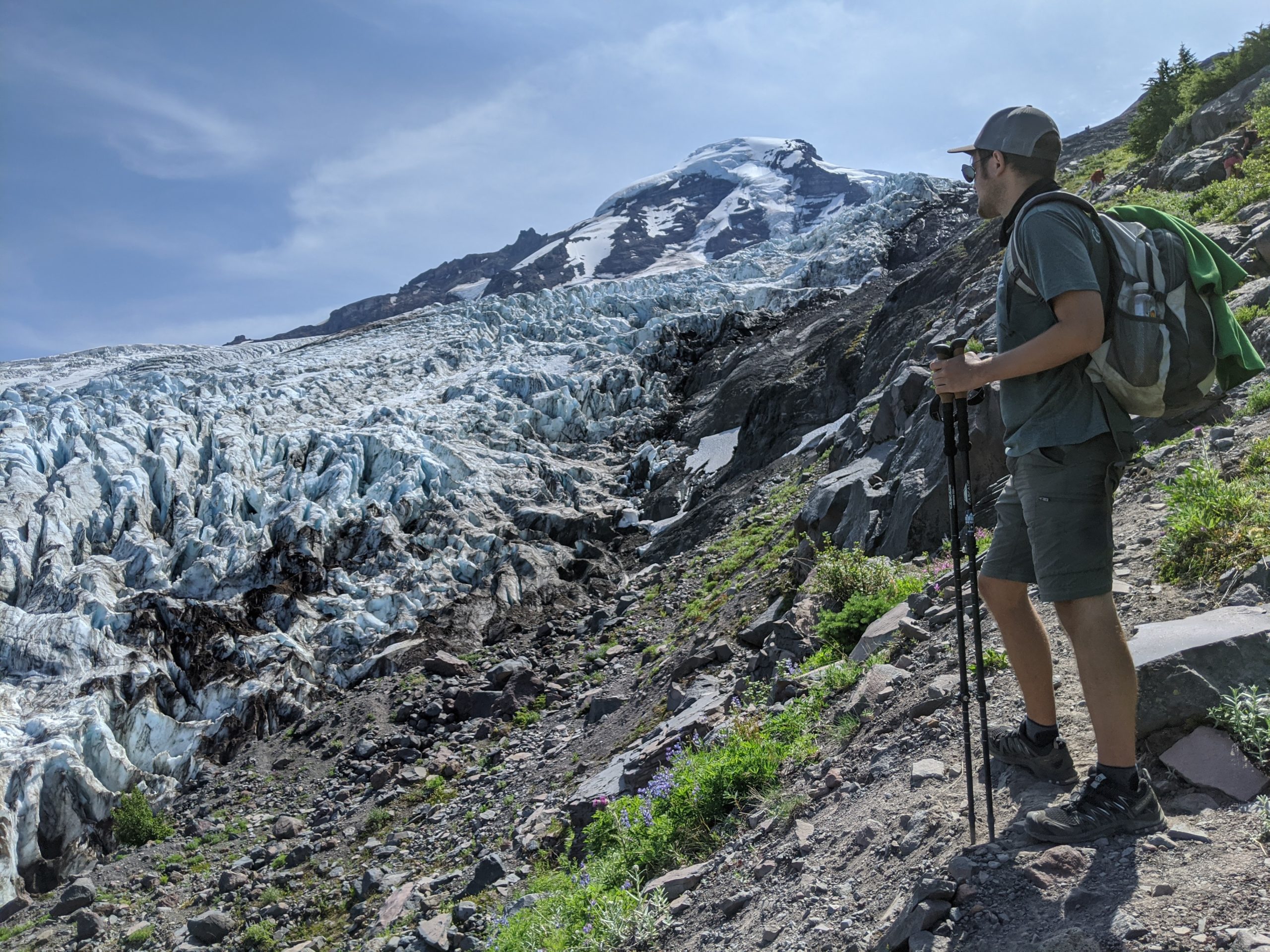
At 2.6 miles, cross the various braids of Heliotrope Creek, then continue climbing east — up steep, rocky paths — to a prominent rocky overlook at 2.75 miles. At 5,350 feet, this is a great spot to peer over the Lower Coleman Icefall, up to Coleman Glacier and the summit of 10,781’ Mt. Baker. It may look enticingly close, but you’re only halfway to the top.

From the edge of this moraine, you can peer into the icy-blue depths of the glacier. Watch and listen for icefall — sometimes car-sized chunks break off with a thunderous crack. It goes without saying, but keep well away from the edge.
Climber’s Trail Alternate
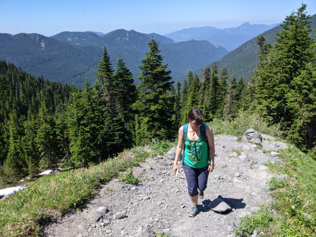
Should you decide to take the climber’s trail en route to Heliotrope Ridge, you’ll be rewarded with a higher vantage point (and a steeper climb). The trail departs from the forest and wastes no time gaining over 600 feet in 0.4 miles. Sunscreen and a hat are handy on this exposed route. At 5,680’, the trail flattens out at the foot of a steep, often snow-covered slope beneath Hogsback Camp. This is a good turnaround point for day hikers with excellent views of Mt. Baker.