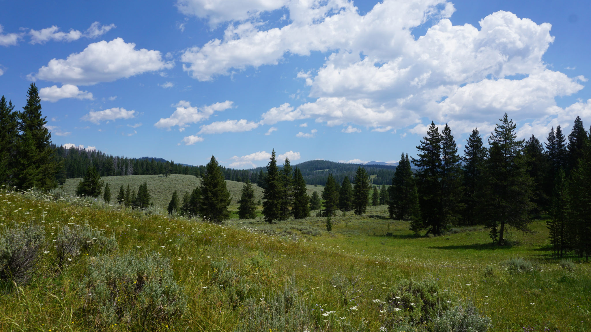
Northwestern Yellowstone’s terrain is comprised mostly of a series of alternating canyons containing creeks that feed the Gallatin River, which flows north to Bozeman. Each of these canyons has its own unique character, with similar features: coniferous forests, grasslands sprinkled with fragrant sagebrush and colorful wildflowers, rumbling creeks, and broads meadows that highlight the big skies that Montana is so famous for. This peaceful, half-day hike meanders through all of the features that make this area so beautiful on the way to a pair of peaceful backcountry camping areas.

Keep in mind that you can turn around at any point along the route. WC3, the final campsite where I end this route, is a somewhat arbitrary ending spot that assumes people will either want to camp or picnic at the campsite. However, the beauty of the route from start to finish makes the actual progression through the landscape the highlight on the route.

This is a bit unusual given that we’re accustomed to having a set destination (a lake, peak, waterfall, etc.) when we hike. However, approaching this hike with a goal-oriented attitude will probably lead to mild disappointment. The real joy is strolling through the gorgeous habitat, especially since any given point along the way would be a highlight on most other trails.

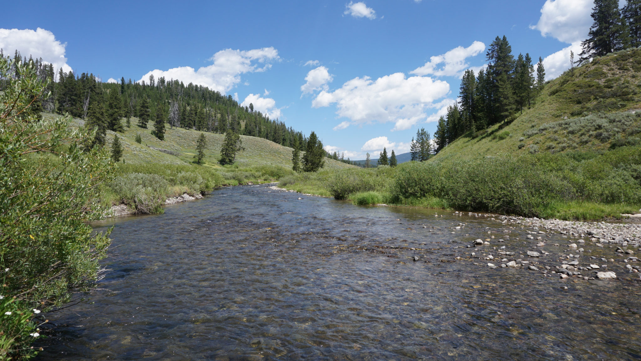
The fledgling Gallatin River
This day-hike can also double as a backpacking route. To obtain a permit, start by downloading the Backcountry Permit Reservation Application, which you can submit either by fax, mail, or in person. Given the popularity of the area, it’s best to reserve as early as possible to ensure you don’t get shut out. The park also reserves a handful of walk-up permits, but that’s less reliable for long-term planning. Once your reservation is confirmed, you can pick up your permit from the nearest visitor center (in this case, the Old Faithful Visitor Center). There’s a $25 fee for processing the reservation.
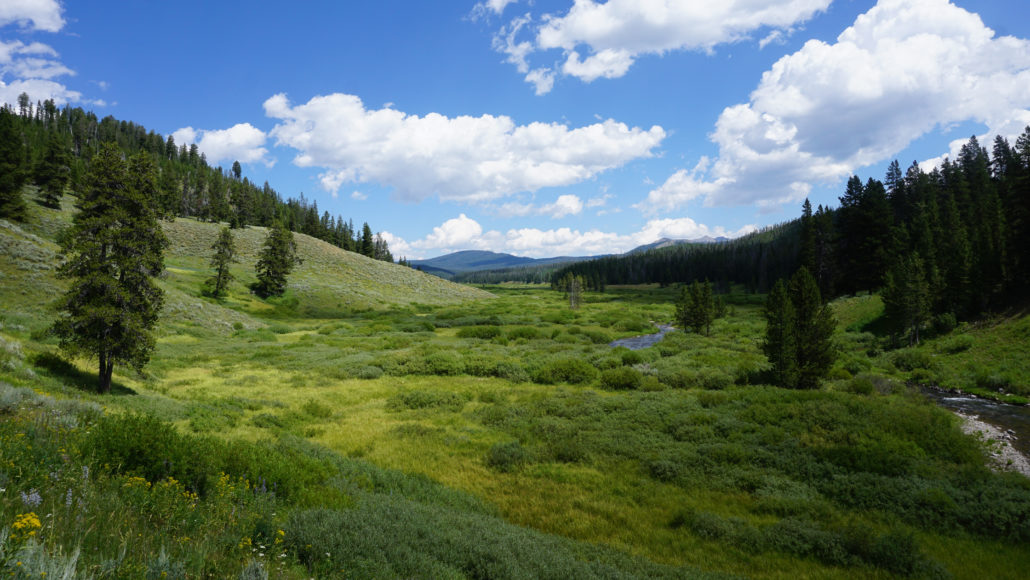
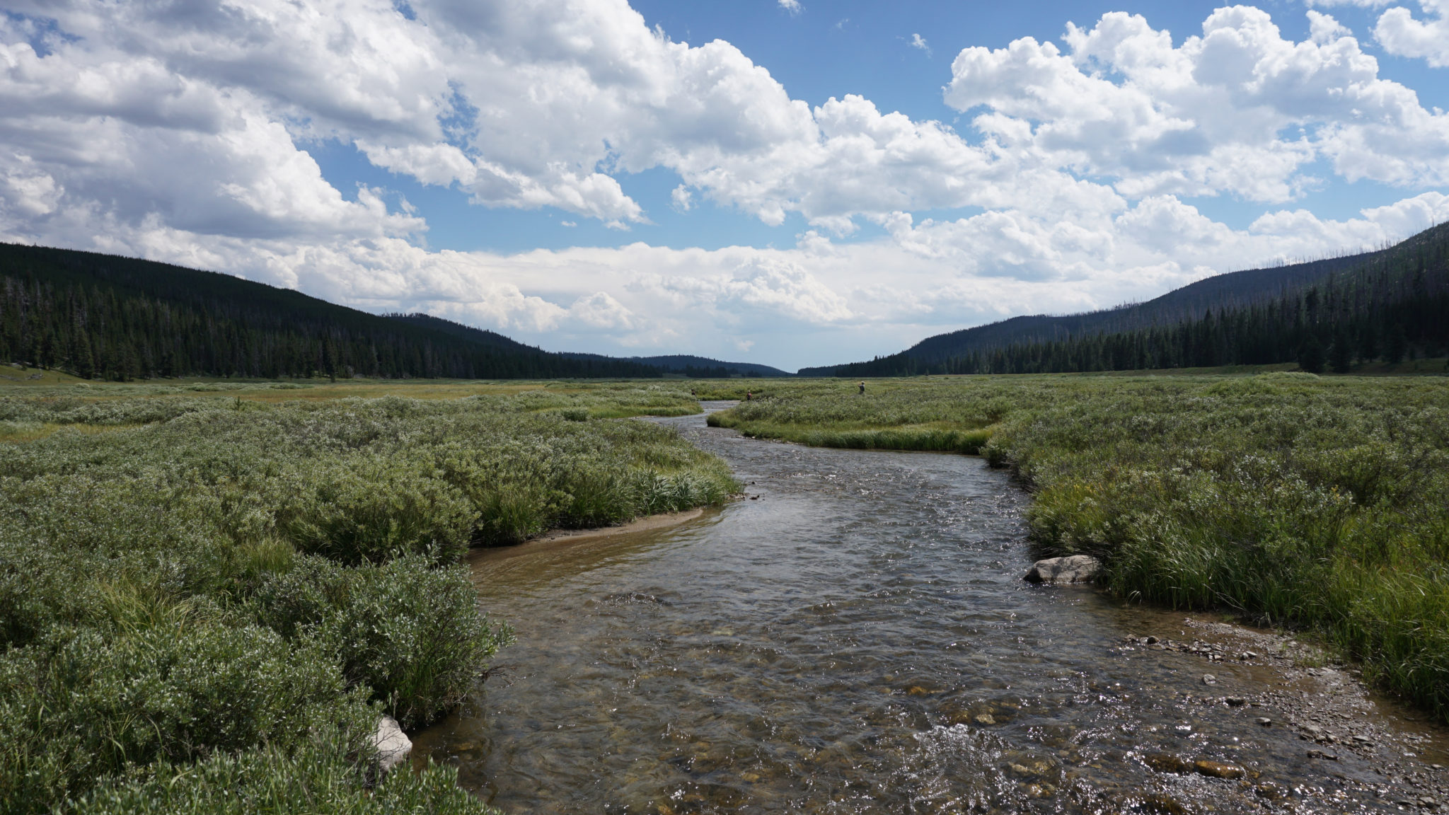
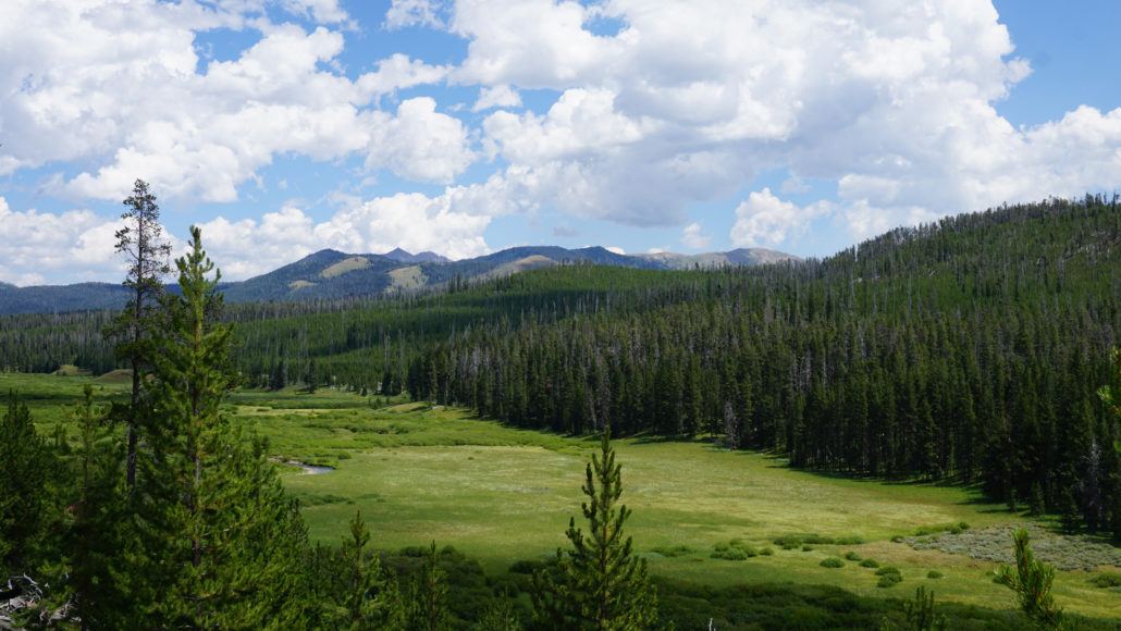
Begin by following the Fawn Pass Trail northwest on a short descent toward lush meadowlands surrounding the Gallatin River. Cross the Gallatin on a series of short footbridges while stopping on each bridge to enjoy the views up and down the Gallatin’s river valley. Rolling hills studded with coniferous forest surround the trail on all side, while puffy white cumulous clouds drift overhead on a gentle breeze.
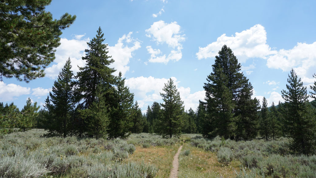
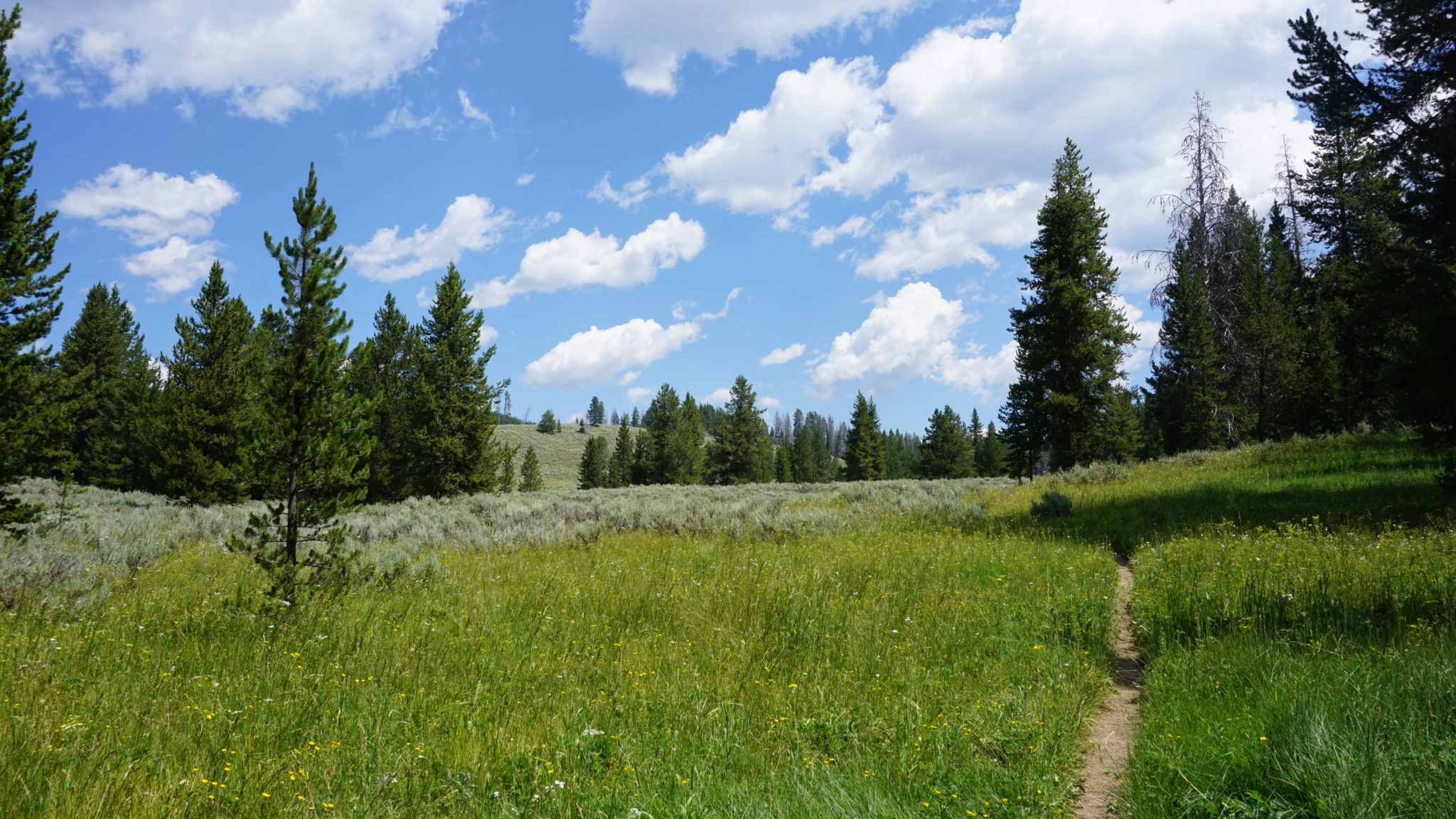
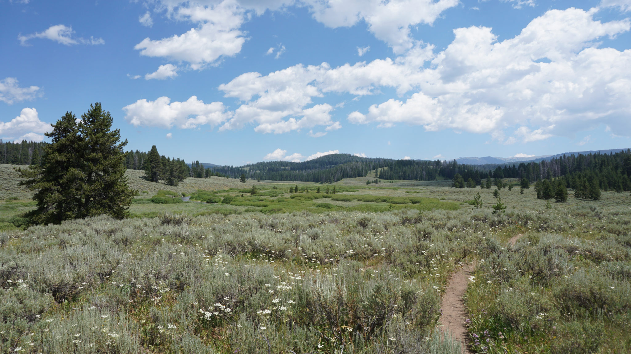
After crossing the river, begin a gentle incline that ascends toward patchy groves of lodgepole pines. The traverse through this open forest parallels Fan Creek, which rumbles along unseen on your left. A few glimpses toward meadows here and there hint at the scenery to come. At 0.8 mile, a stock trail joins the Fawn Pass Trail, and the newly merged trail continue uphill through the forest to a Y-Junction at 1.3 miles where the Fan Creek Trail splits away on the left while the Fawn Pass Trail continues climbing on the right. Keep left to begin a descent toward a broad valley containing the meandering course of Fan Creek surrounded on all side by spacious meadows.
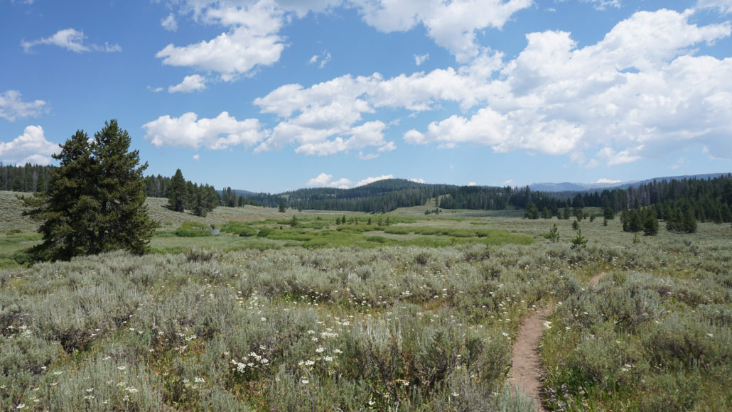
At the 1.9 mile mark, the trail makes an unimproved crossing of an unnamed tributary creek of Fan Creek. Beyond the crossing, the trail begins a gentle incline along a wooded slope on the east side of Fan Creek’s valley. Keep left at a junction at 2.5 miles with a spur trail leading north to Campsite WC2, unless you plan on camping here. This campsite lies 0.7 mile north from the junction, and it overlooks Fan Creek’s meandering course from a slightly elevated perch east of a spacious meadow.
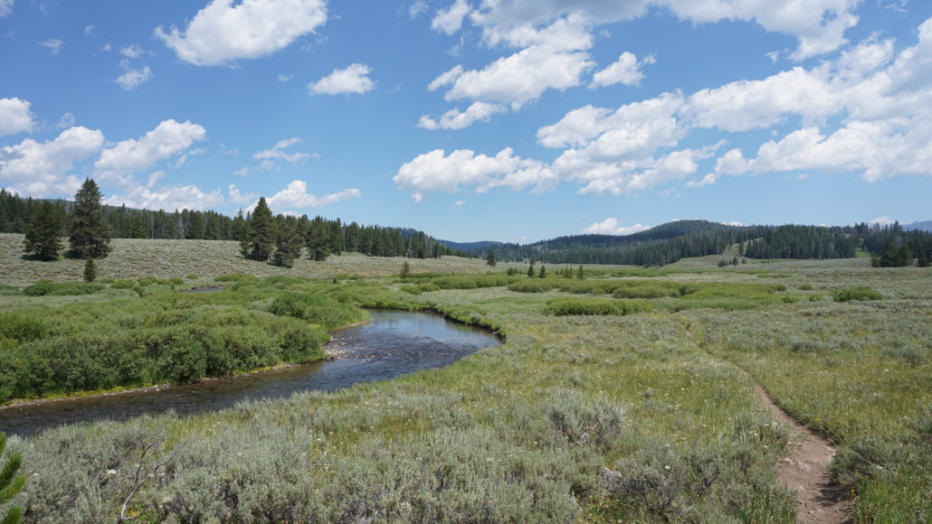
Beyond the WC2 junction, the trail dips down to cross Fan Creek at 2.9 miles. This unimproved crossing is the biggest obstacle on the route. During spring when the snow begins melting, this swollen creek could be a dangerous ford. Even during summer, you can count on having to take your shoes off in order to cross. When I hiked here in late-July, the water was knee deep, so expect it a lot deeper during June, but not nearly as deep during autumn.

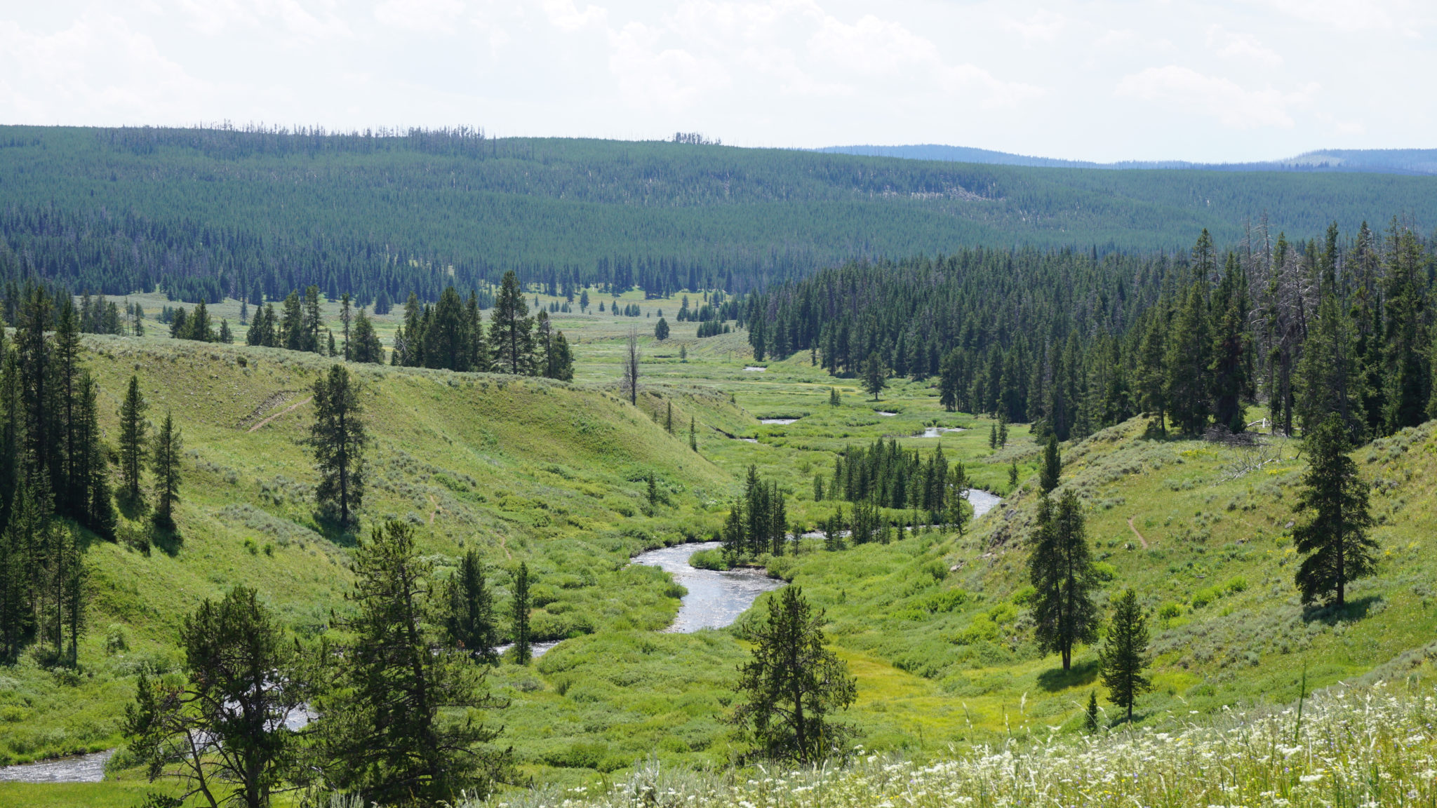
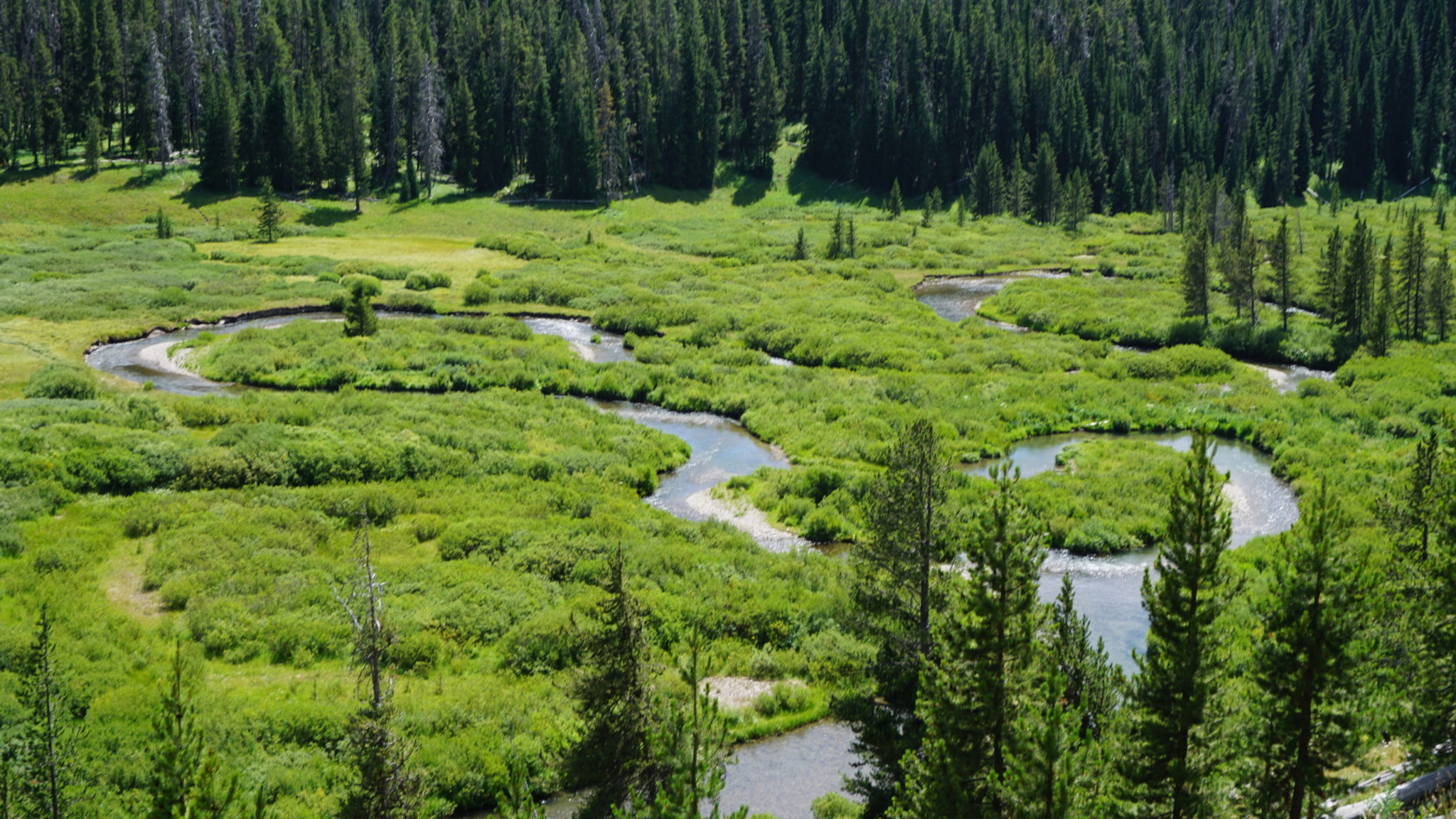
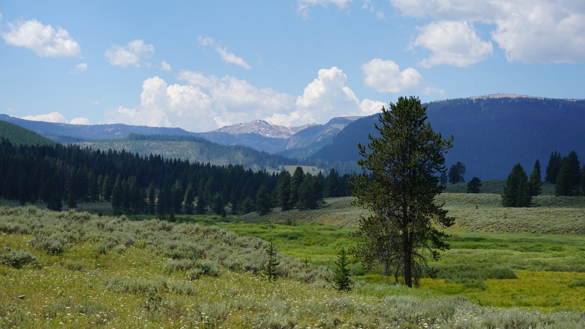
On the other side of the creek, the trail winds into and out of a wooded ravine, before straightening out on an incline along a slope that overlooks a long, nearly flat valley. Fan Creek meanders serenely through this valley, and occasional gaps in the trees allow a nice look up-valley toward wooded slopes and the heights of Joseph Peak to the east-northeast.

After the incline tops out, the trail begins a descent toward another unnamed tributary at 4.1 miles. Cross this tributary and continue along the trail as it undulates over the next 0.6 mile to your turnaround point: a junction with the spur trail leading to campsite WC3.
Tags: Bacon Rind Creek, Fan Creek, Fawn Pass, Gallatin River, Montana, Wyoming, yellowstone national park