From 200-foot high bluffs to the Salish Sea below, Ebey’s Landing offers a stunning seaside loop hike. You’ll enjoy birdwatching and beachcombing along the way, and even learn about the prairie’s bloody history. Pack plenty of layers for a potentially windy and exposed hike. Accessible year-round, Ebey’s Landing is an easy yet epic coastal hike for all ages.
Ebey’s Landing was established in 1978 as America’s first National Historical Reserve. Today, Washington State Parks, the National Park Service, Island County, and the Town of Coupeville have formed a unique land management partnership to preserve these scenic bluffs and prairies. For the hiker, this means you’ll need to be mindful of where you park. The beach parking area is managed by Washington State Parks and requires a Discover Pass. Parking above — at the end of Cemetery Road — does not require a pass. Our recommended route begins here.

From the signed trailhead near Sunnyside Cemetery, set out on a wide gravel path through the fields. At 0.3 miles you’ll reach the Jacob and Sarah Ebey house. Stop by the visitor center here (open Friday – Sunday during summer) to learn about the reserve’s namesake family. The first European settler on Whidbey Island, Colonel Isaac Neff Ebey moved here in 1850. His family soon followed, building log blockhouses to protect themselves from conflict with local tribes. However, this precaution wasn’t enough to preserve Isaac’s life. In 1857, Isaac was “slain by northern coastal Indians seeking revenge for the killing of one of their own chieftains,” according to the official National Park Service history.
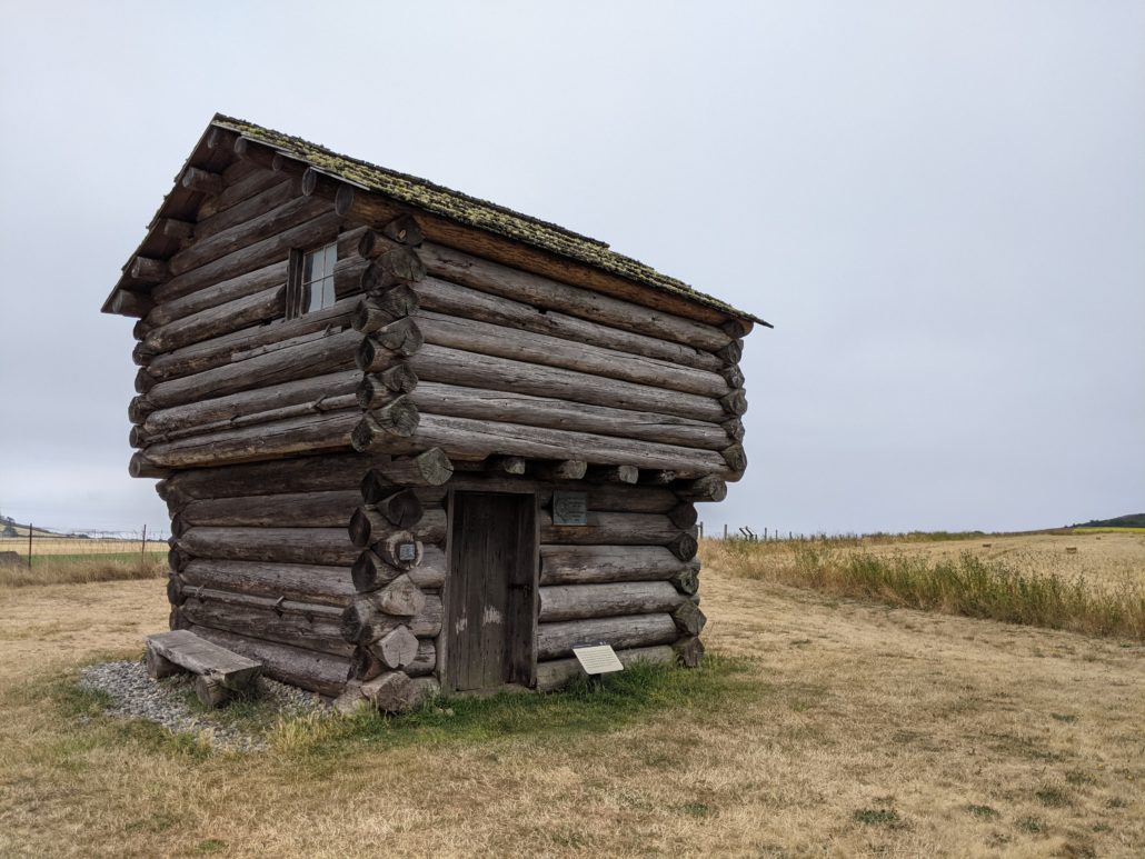
Ebey Blockhouse
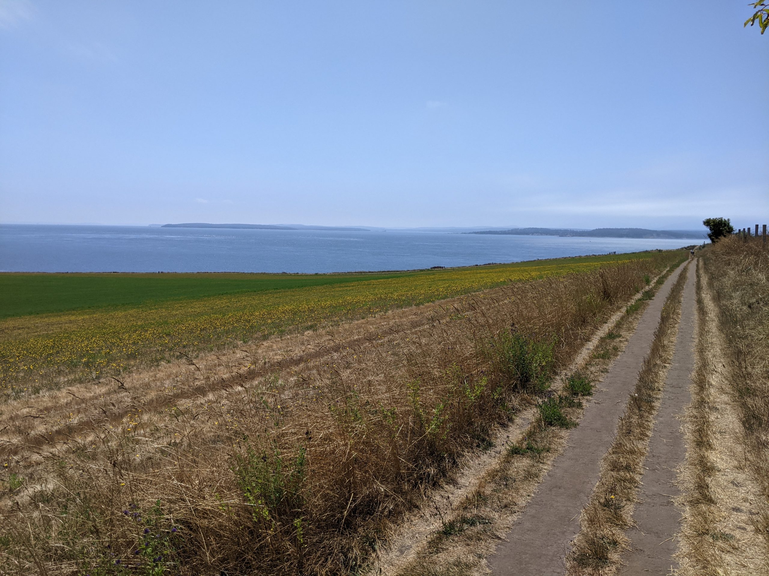
Immediately after passing the historic buildings, turn left at a signed junction for the Ridge Trail (to Bluff Trail). Follow the fence line along a gradually descending old road through the prairie.

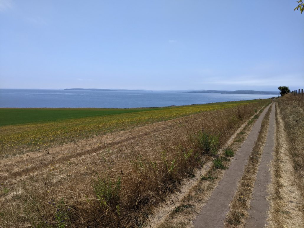
At 0.75 miles reach a junction, where you can go either way for the loop. We chose to turn left, heading east along the Bluff Trail to the beach. This section drops 150 feet in 0.5 miles to the sea. Along the way, you’ll descend a series of stairs before reaching the beach parking area (Discover Pass required for parking). Restrooms are available here. Take any of the paths leading down to the beach, then begin walking northwest along the rocky shoreline.
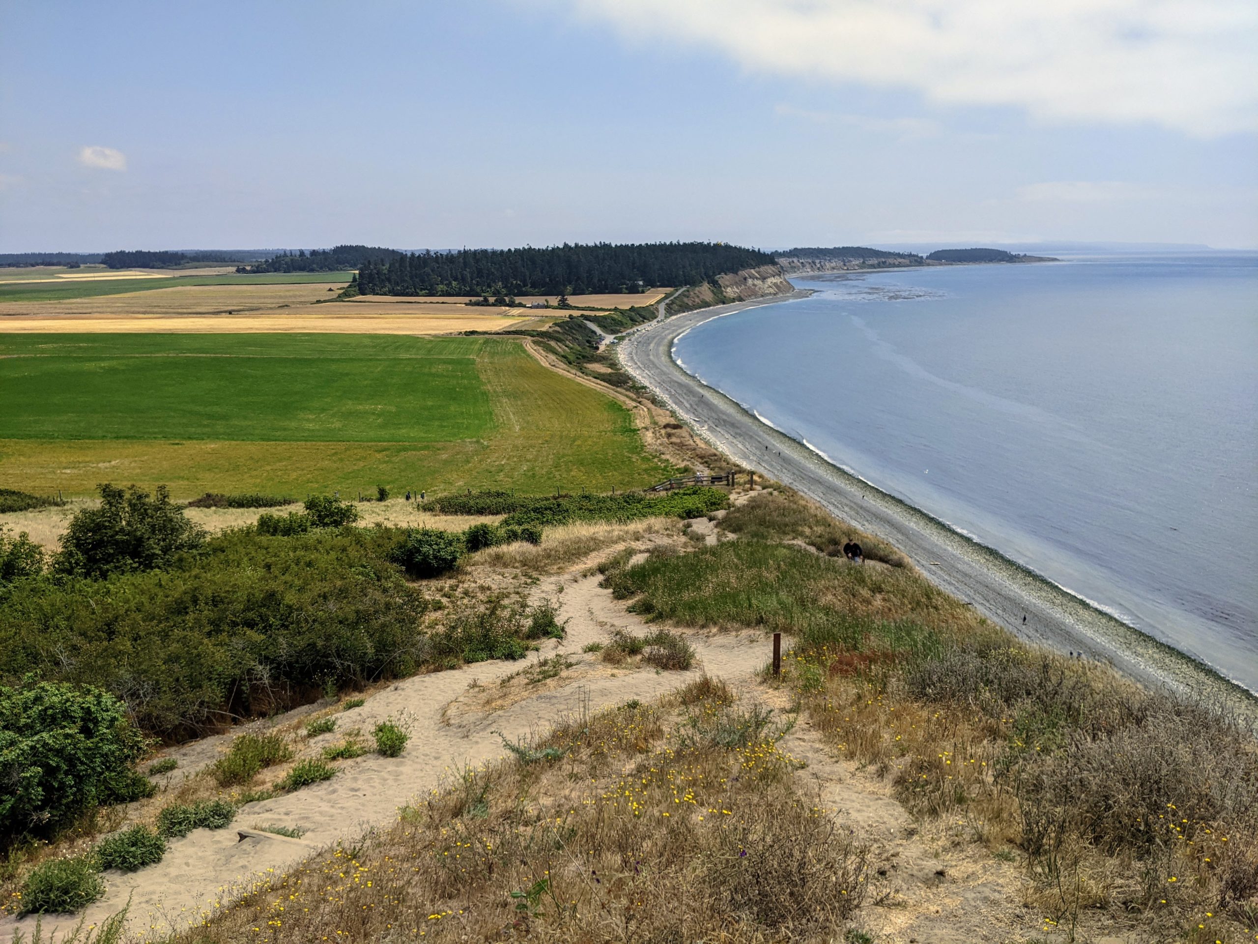
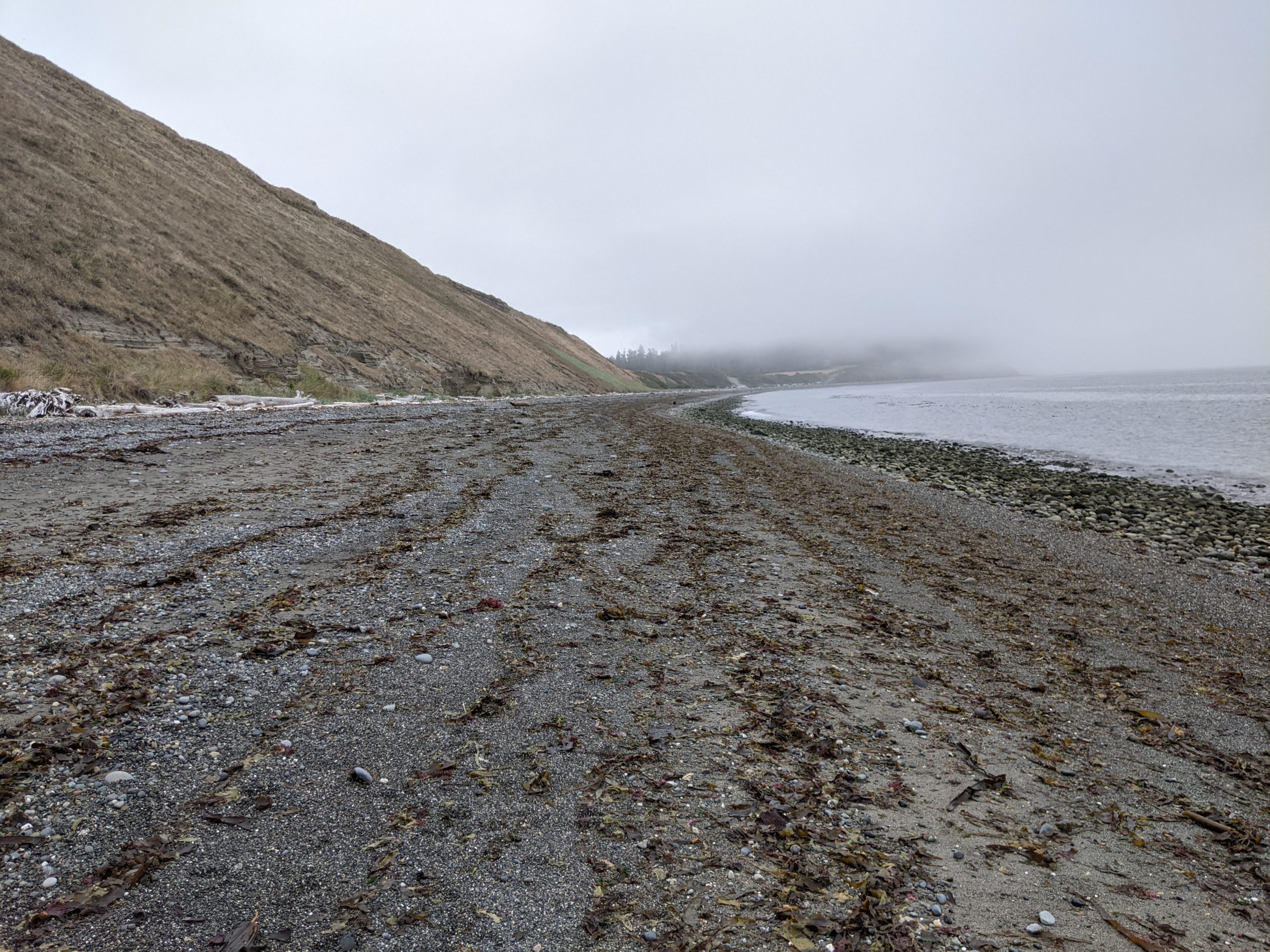
Take a long walk on the beach for 1.6 miles. Bull kelp, seashells, and driftwood are strewn about the shore. If the weather is clear you can see Port Townsend and Fort Worden across Puget Sound on the Olympic Peninsula. Watch and listen for bald eagles and military jets overhead. Known as the “Triangle of Fire,” Forts Casey, Ebey, and Worden were built to defend the Puget Sound region from warships during the early 1900s. All three forts are now state parks whose bunkers and batteries you can explore freely. Today, the sound of U.S. Navy jets from nearby Whidbey Island Naval Air Station is a reminder of this area’s military history.

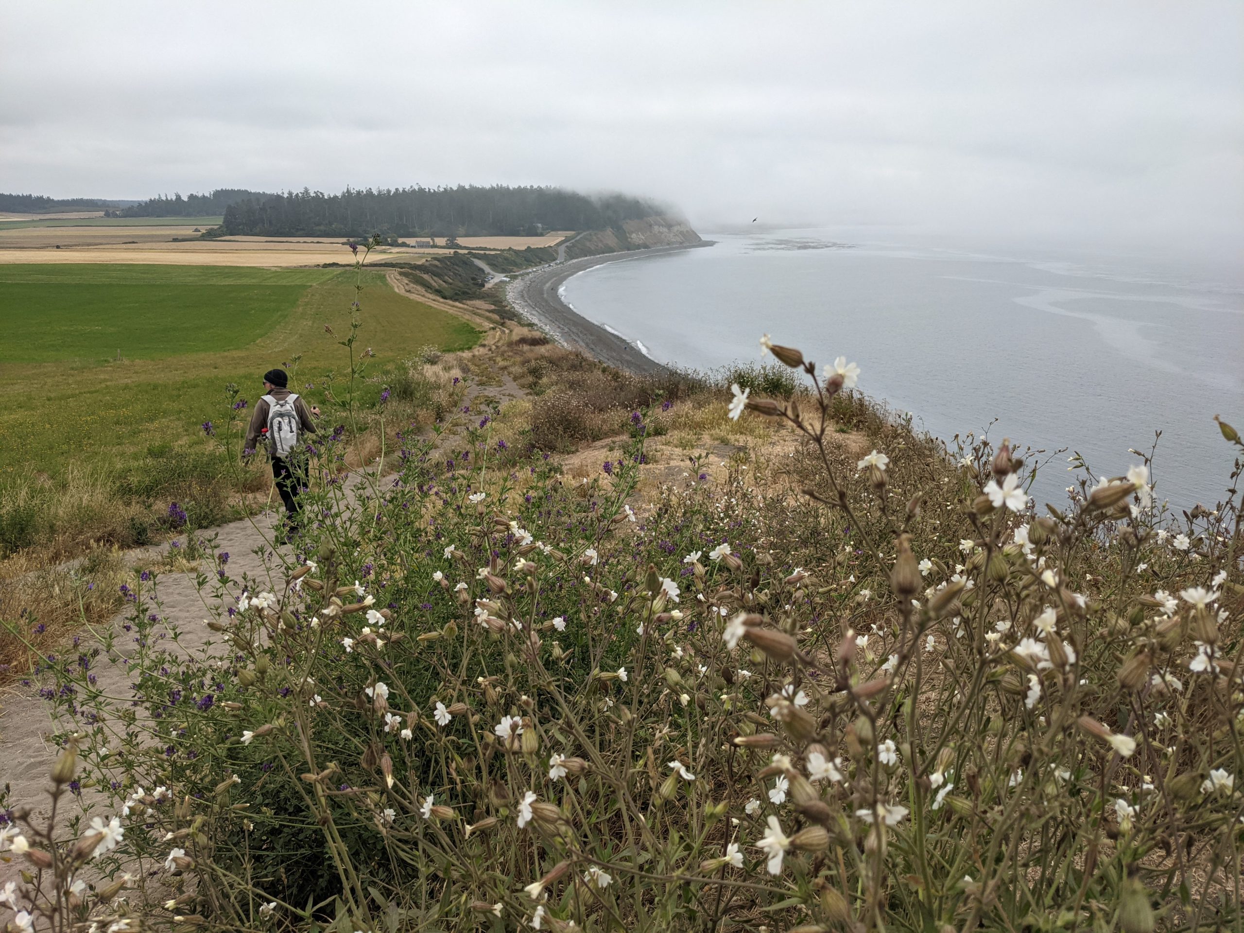
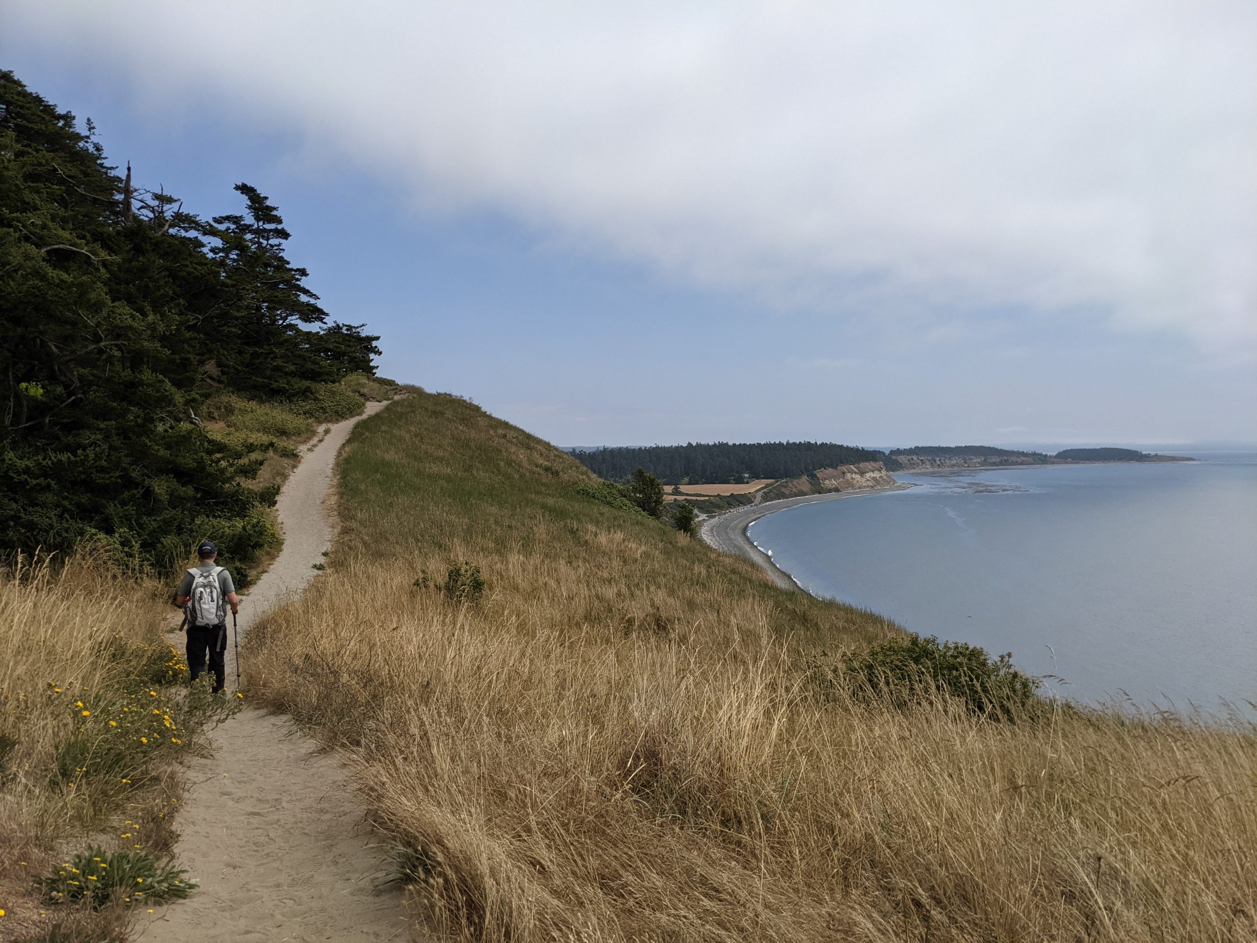
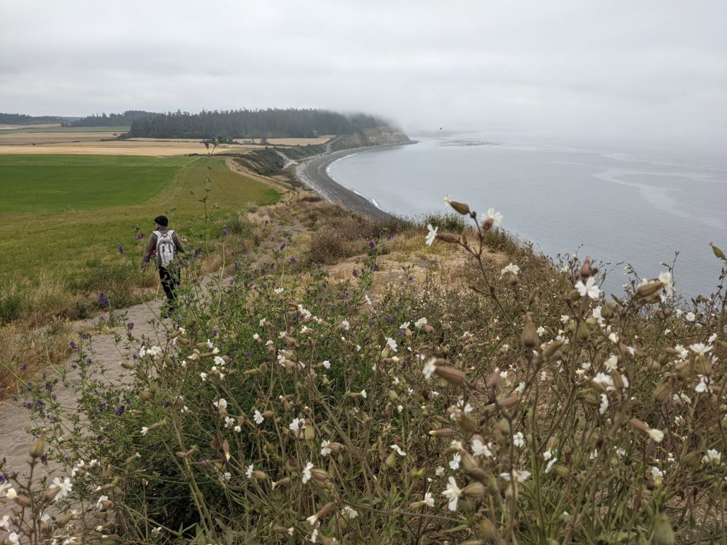
At 2.9 miles, climb over driftwood to ascend the signed Bluff Trail. Long, narrow switchbacks leave the beach behind in a hurry, gaining over 200 feet to the bluffs. Be careful when passing other hikers here, as there isn’t much room to step off the trail without trampling fragile plants.
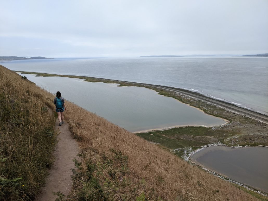
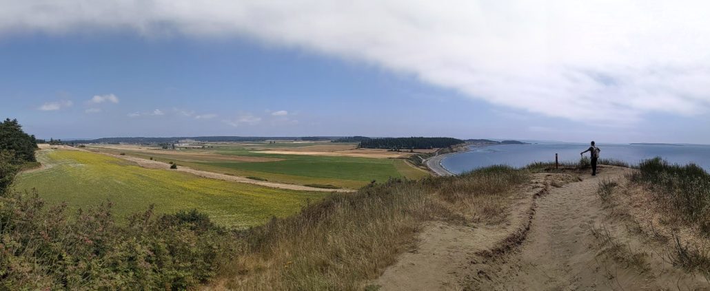
Atop the bluff, look down on Perego’s Lagoon — an estuary vital to local birds. Follow the rolling Bluff Trail southeast, past windswept Douglas firs and wildflowers back to the beginning of the loop. This is the most scenic stretch of the entire trail, with sweeping views over the saltwater and beach below. Once you reach the loop junction, retrace your steps to the upper prairie parking lot to end your day at Ebey’s Landing.

Ten-lined June beetle and Oregon Sunshine

Tags: bluff trail, ebey's landing national historical reserve, perego's lagoon, Puget Sound, Washington State