The short, steep trail to Comet Falls and Van Trump Park features the best of Mount Rainier National Park: thundering waterfalls, misty forests, masses of wildflowers, appealing wildlife, and a stellar view of several Cascade volcanoes — including the one you’re standing on. Get to the trailhead early to grab a parking spot and have this popular trail mostly to yourself.
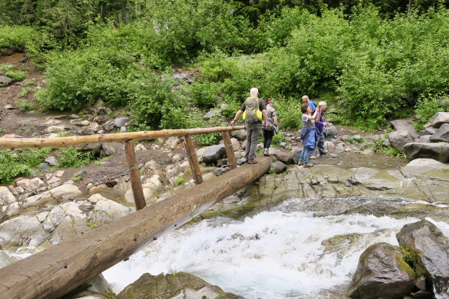
Start climbing right away, up timber-edged steps that parallel the road. Continue along the trail through the forest, and in a quarter-mile arrive at a timbered bridge. This spans Van Trump Creek, whose tumbling blue-white water will accompany you along the whole hike. Cross the sturdy log span and look downstream. You’ll glimpse the Longmire-Paradise park road a short way off as it crosses a handsome arched stone bridge built in the late 1920s. The bridge frames lovely Christine Falls, a popular stop on the road to Paradise, and although the lower falls aren’t visible from your vantage point, enjoy the view of upper Christine Falls as it rushes and pools on its way downstream.


The trail turns away from the road and continues through the forest, starting up a series of switchbacks and staying next to Van Trump Creek. Several small overlooks offer views into the creek canyon. Continue upward, climbing a wooden crib ladder and crossing a couple of rockslides. Listen for the distinctive whistle of pikas, which scurry among the rocks above and below the trail. Stand quietly for a few minutes and one of the large-eared critters is likely to come out to take a look at you. Huff and puff through a large, exposed, rocky area, then the trail eases.


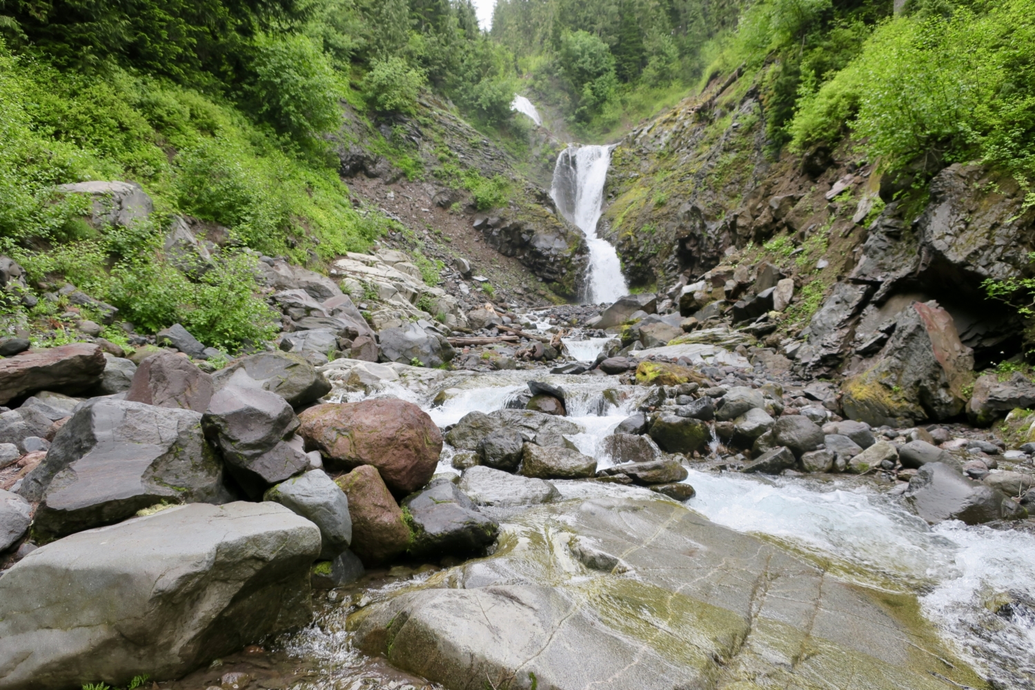
At 1.4 miles, reach a log bridge over Van Trump Creek’s east fork and look upstream at three-tiered Bloucher Falls, itself a worthy destination. The mist blowing off the water feels good after the ascent to this point. At the far end of the bridge look for a small sign reading “Comet Falls 200 feet.” The trail is well-trampled here, with several social trails climbing over the short slope separating the east and west forks of Van Trump Creek. Pick one and continue to your first view of Comet Falls.


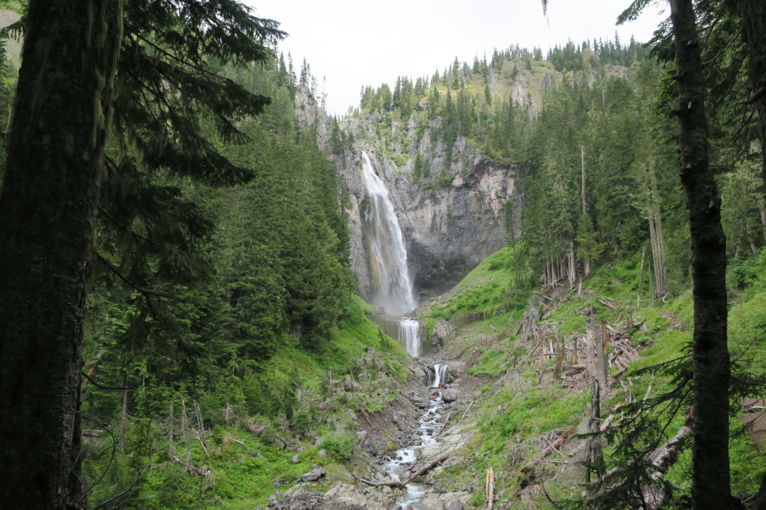
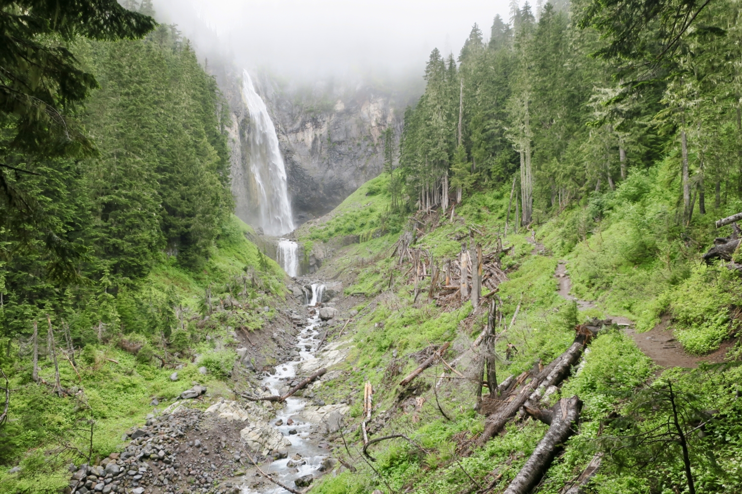
Now that you’ve arrived at Comet Falls, pretty Bloucher seems positively diminutive in comparison. At 320 feet, Comet Falls is one of the tallest in Mount Rainier National Park. It falls gracefully over a precipice into a large pool, then over a shorter falls and into Van Trump Creek’s gorge. The trail follows the east side of the creek to several excellent viewpoints, about 1.6 miles from the trailhead. Watch your footing, as the trail can be slippery and the view distracting.


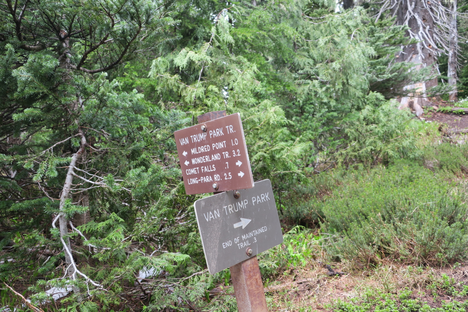
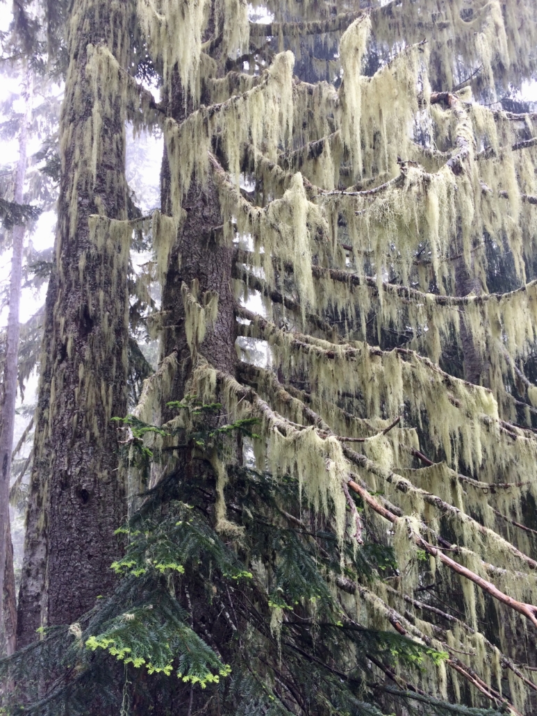
Most hikers turn around at this point, and if you choose to do so, you’ll have had an excellent day. But if you’ve got energy left, continue on the trail for another 0.8 mile, switchbacking through trees dripping with old man’s beard lichen and clumps of alpine heather blooming pink and white, to the junction for Van Trump Park.


All sorts of hiking possibilities open up at this junction, but you’re heading up a few more steps to Van Trump Park, a short 0.3 miles further. The wildflower meadows of Mount Rainier are called “parks,” likely because early visitors thought they looked like cultivated gardens. This park (as well as the creek you’ve been following and a glacier higher up) is named for Philemon Beecher Van Trump, generally credited with the first ascent of Mount Rainier by a Euro-American, in 1870. Van Trump, a rare early non-Californian member of the Sierra Club, guided John Muir to the mountain’s summit in 1888 and campaigned for Mount Rainier to be made a national park, a status granted by Congress in 1899.
Once you arrive at Van Trump Park, find expansive meadows of wildflowers, stands of subalpine trees, and, if it’s clear, stupendous views of Mount Rainier right in front of you. If it’s not clear, stick around a while. Mount Rainier makes its own weather, and clouds move constantly, filling the meadow one minute and lifting the next. Summer days in the maritime Northwest often start gray and misty, but by mid-morning the clouds start to break up. Unless the mountain is really socked in, patience is usually rewarded with a view.
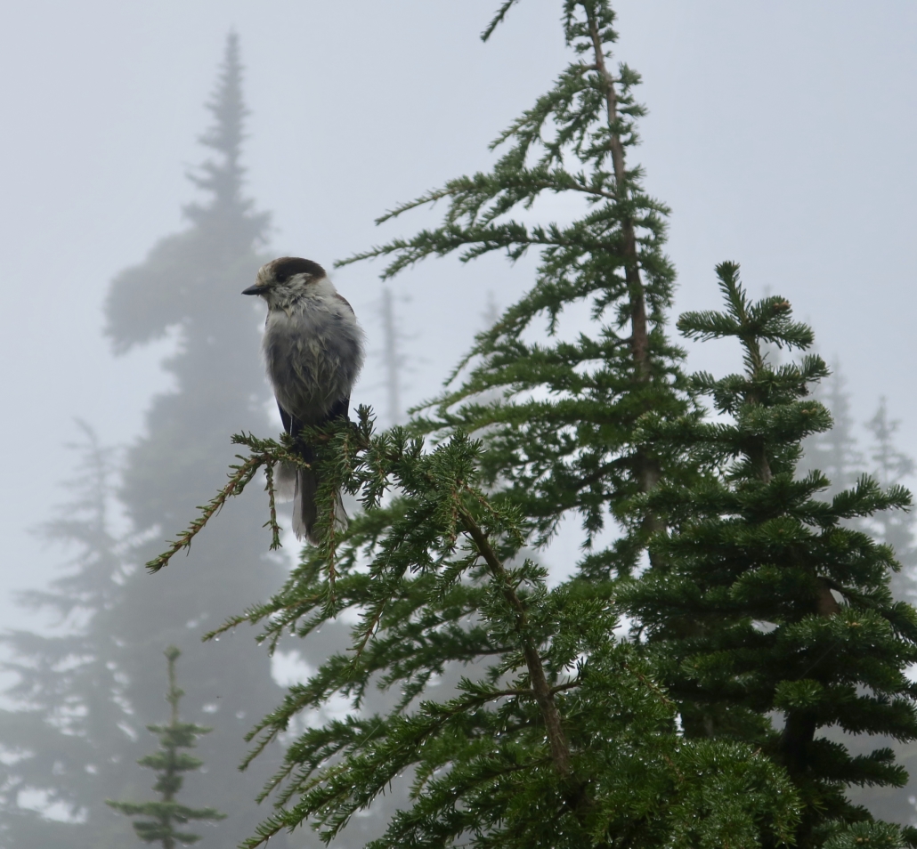
A clearing lined with logs makes a great snack stop. Expect gray jays and Clark’s nutcrackers, aka camp robbers, to pester you for food. Note they are so plump they can barely fly. Ignore their pleas.

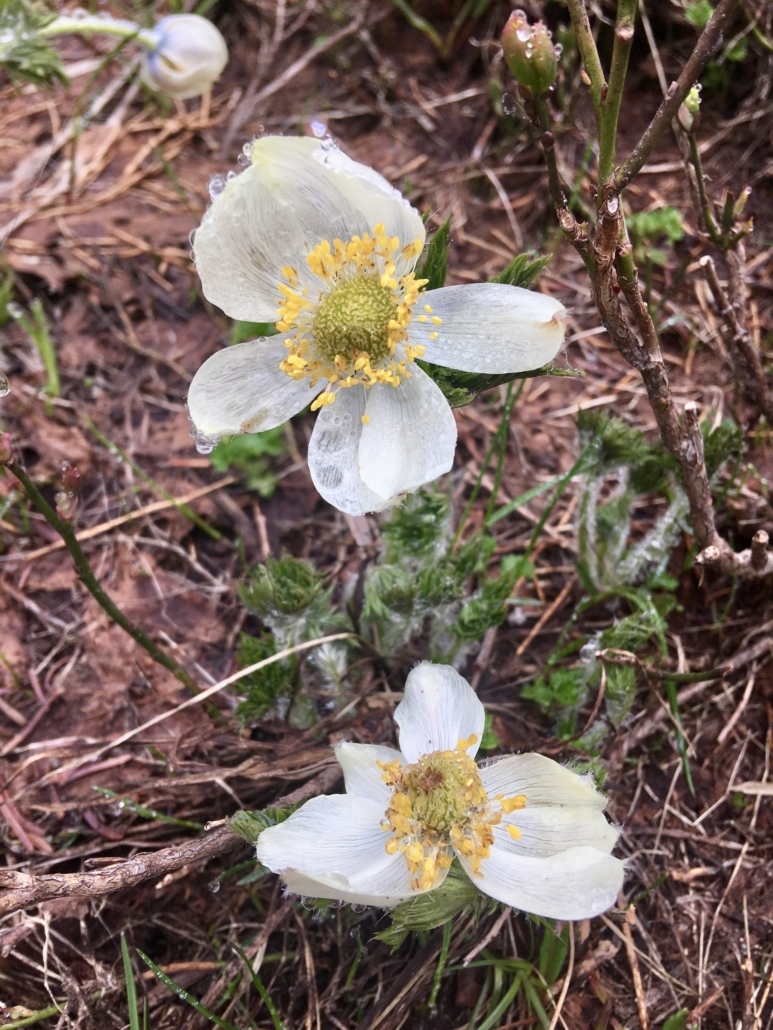
The clearing marks the end of the trail, but social trails cross the meadow to better viewpoints. Stay on the trails to avoid damaging the wildflowers, which “grow by the inch and die by the foot,” according to park publications. Keep an eye out for mountain goat tracks, and if you encounter these shaggy animals, steer well clear. Explore the park to your heart’s content, seeking out views southward of Mount Adams, Mount St. Helens, and maybe even Mount Hood. Depending on the season, you may see many of Rainier’s famous wildflowers; glacier lily, pasqueflower, and beargrass abounded on a recent trip. In the fall, huckleberries fill the meadow with red-leaved foliage, attracting bears that gorge on the fruit before hibernating.


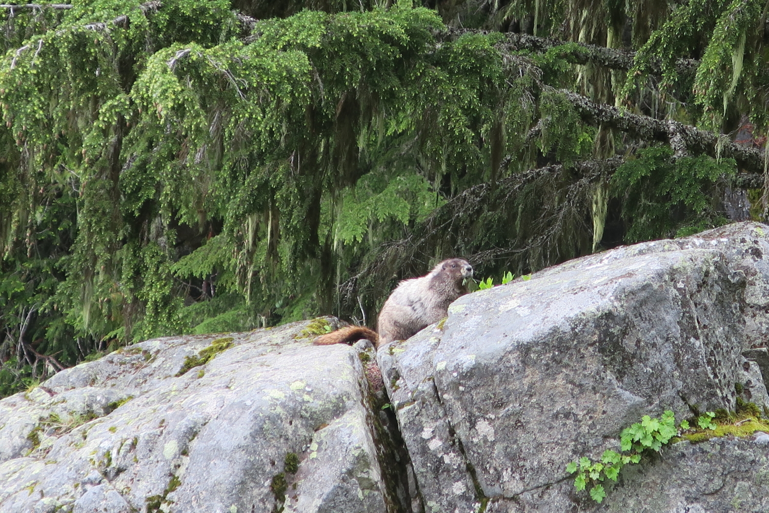
On the way down, keep an eye out for more wildflowers. Jeffrey’s shooting star, magenta paintbrush, tall bluebells, and many others line the trail, creating sparking the forest with vivid color. Stop and enjoy the roar of Comet Falls once more before crossing Van Trump Creek below Bloucher Falls and heading down the trail. You may spot a hoary marmot, Mount Rainier’s ubiquitous, adorable, and curious rodent, or hear its warning whistle as you approach.


Enjoy a last look at upper Christine Falls (named for Van Trump’s daughter) before reaching your car and relinquishing your parking spot to a grateful fellow hiker.
Tags: forest, Mount Rainier, Mount Rainier National Park, River, washington, waterfall hikes, waterfalls, wildflower hikes, wildflowers