Colchuck Lake is the gateway to the Enchantments, one of Washington’s most sought-after backcountry experiences. Formidable peaks reflected in Colchuck’s icy emerald-blue waters make for a popular and crowded trail in the summer. During fall, a fresh dusting of early winter snow and golden larches turn this fairytale scene into one of the most coveted in the Cascades. Save Colchuck Lake for a weekday if you can.
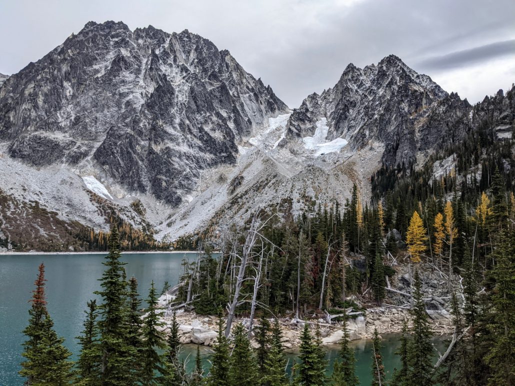
Dragontail Peak (left) and Colchuck Peak (right)
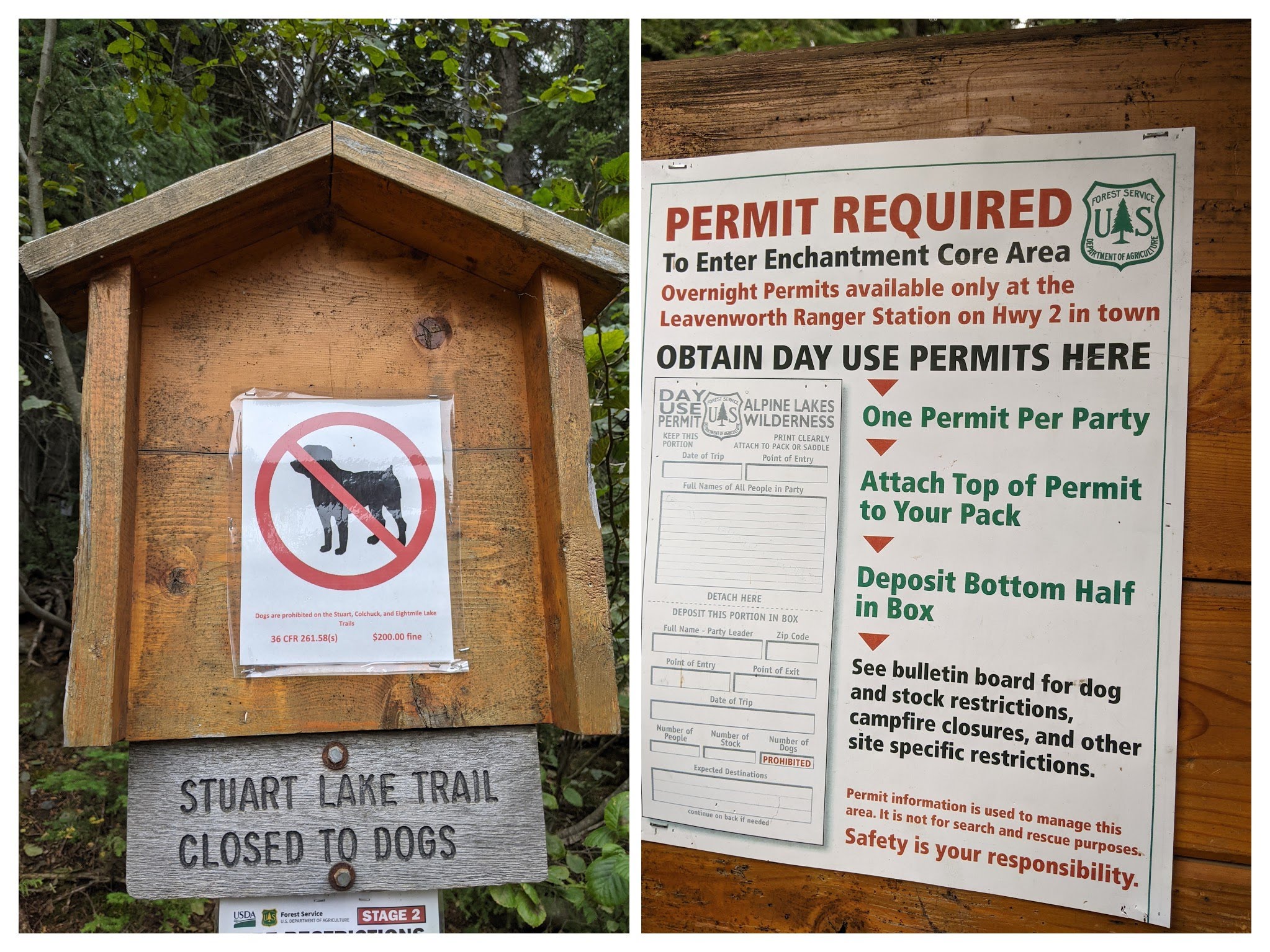
Red Tape
Before beginning your hike, there are a few rules to observe. Dogs are not allowed. Day-use permits are required for hiking here — you can fill one out for free at the trailhead. If you’re planning on backcountry camping in the Enchantments Core, you’ll need to secure an overnight permit in advance. These can be tough to obtain — check Recreation.gov for the full rundown of requirements.

Day Hiking to Colchuck Lake
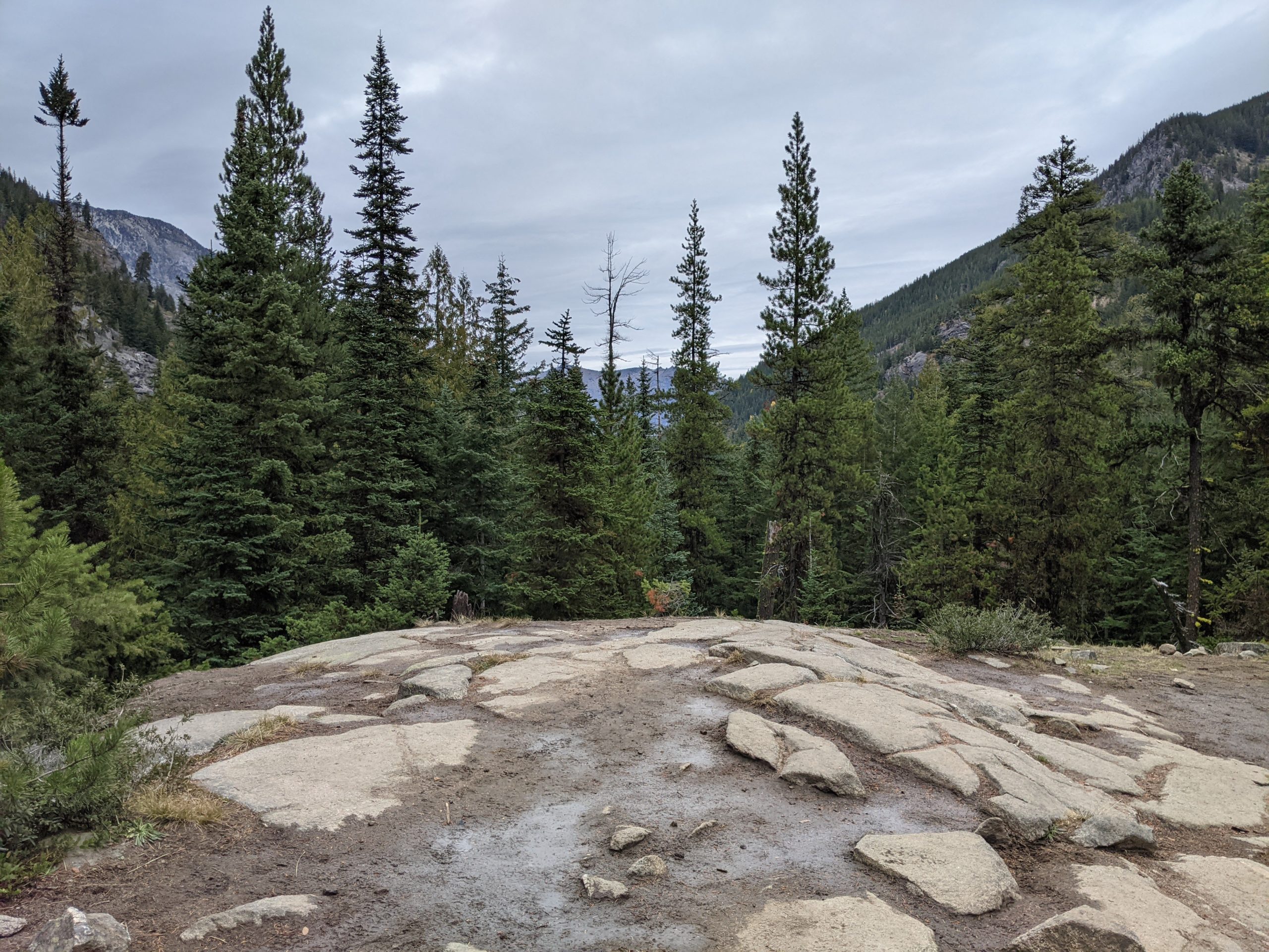
After self-registering at the trailhead, begin by hiking south on the forested Stuart Lake Trail. You’ll immediately enter the Alpine Lakes Wilderness.
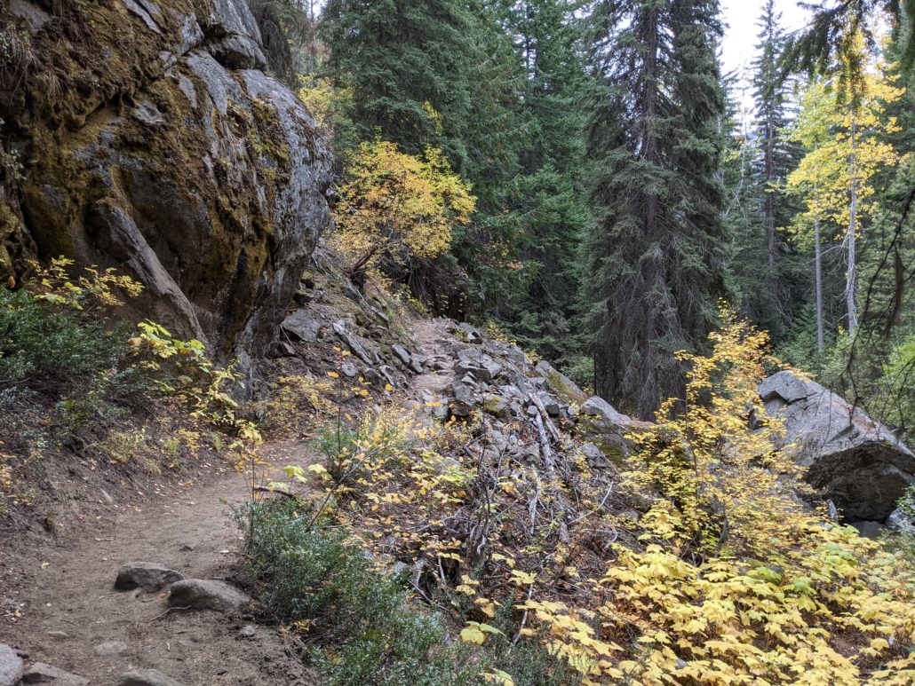
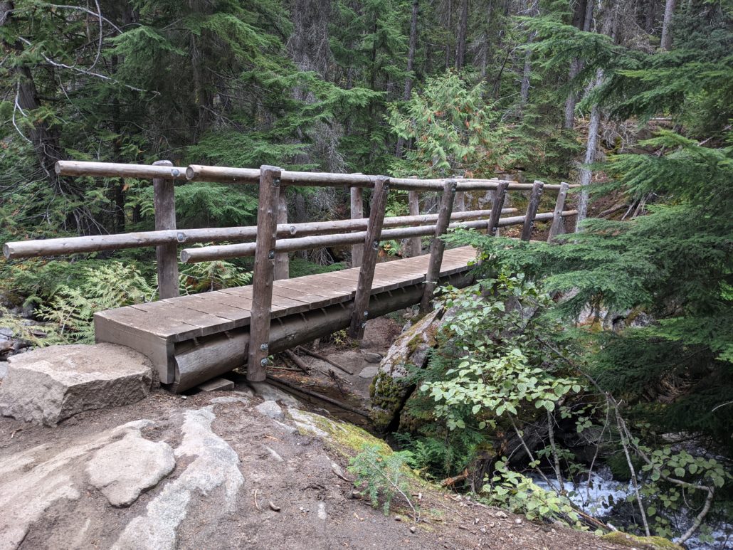
After passing some boulders at the edge of Mountaineer Creek, cross the trail’s first wooden bridge at 1.5 miles. The trail is largely unremarkable up to this point, but it’s about to get interesting.
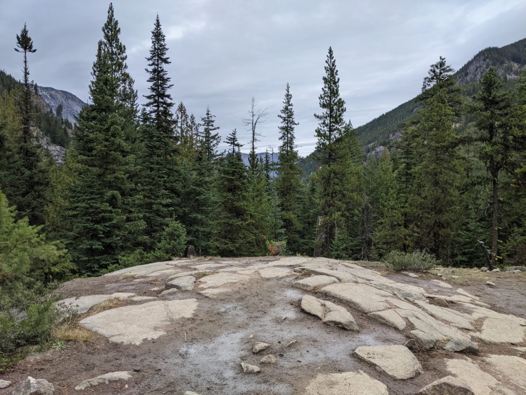
Shortly after the bridge, you’ll come to a rocky clearing with some mountain views. Then it’s time to climb. At 1.8 miles, the trail suddenly turns rocky and technical for a short, steep section before flattening out. At 2.3 miles, turn left at the junction for Colchuck Lake. The trail to the right continues to Stuart Lake — a quieter alternative if you’re not feeling the Colchuck crowds.
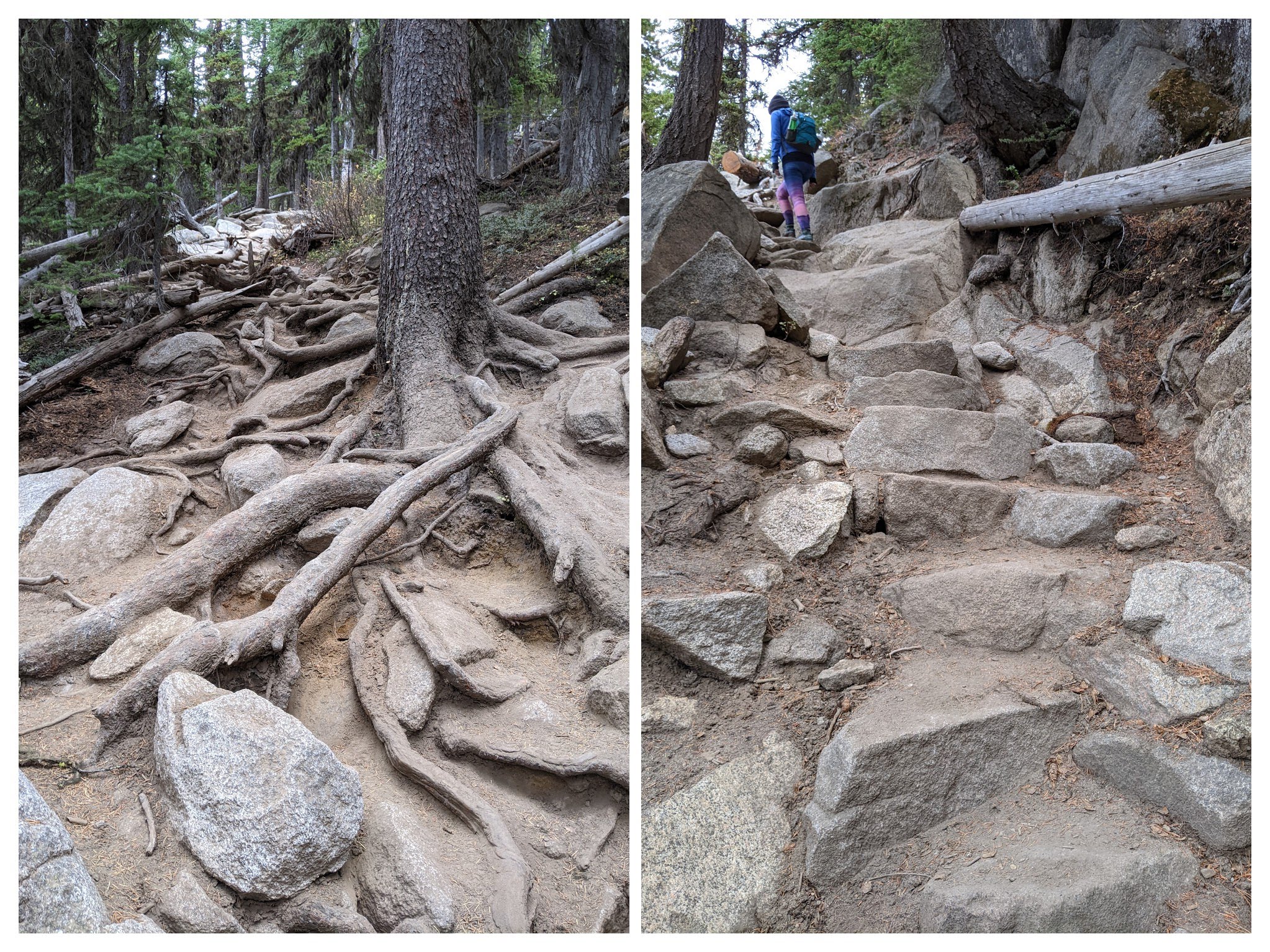
At 2.4 miles, cross Mountaineer Creek via a narrow footbridge. You’ll find yourself in a boulder field on the other side — squeeze through the talus to continue your climb.
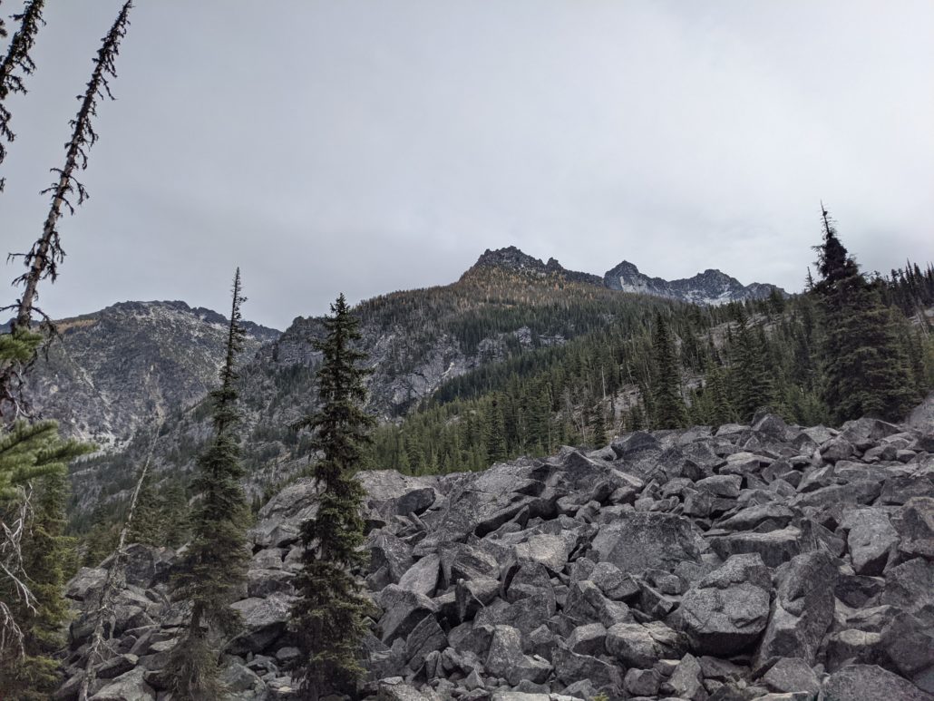
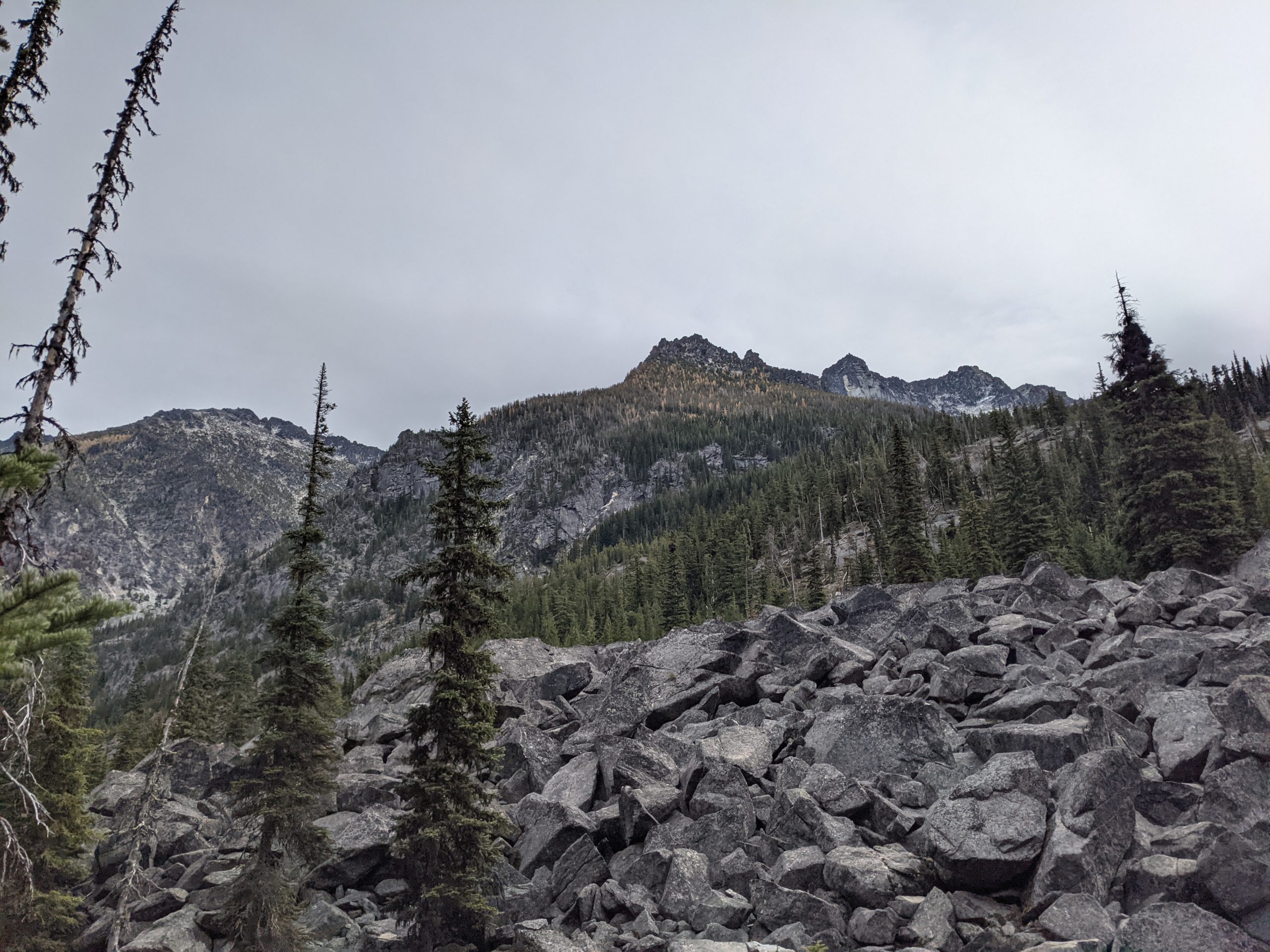
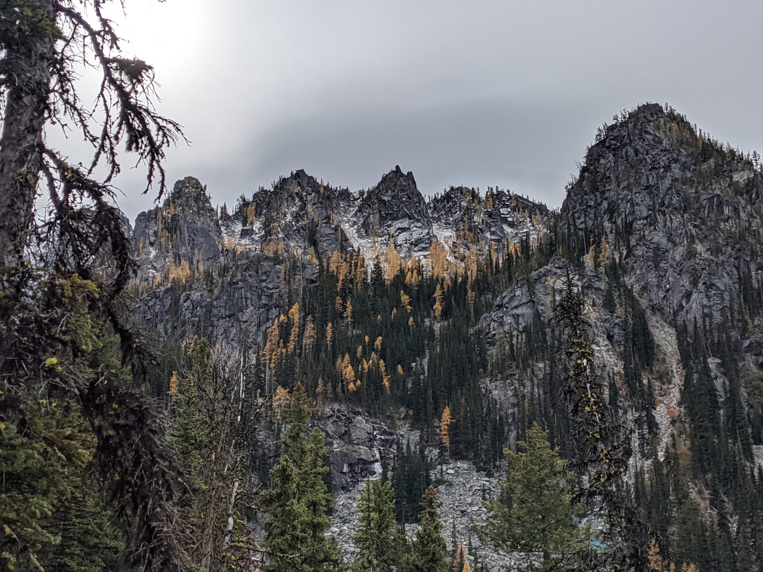
The next mile is a grind, gaining 700 feet over big rocks and roots. Fortunately, mountain views improve along the way — a taste of what’s to come at the lake.

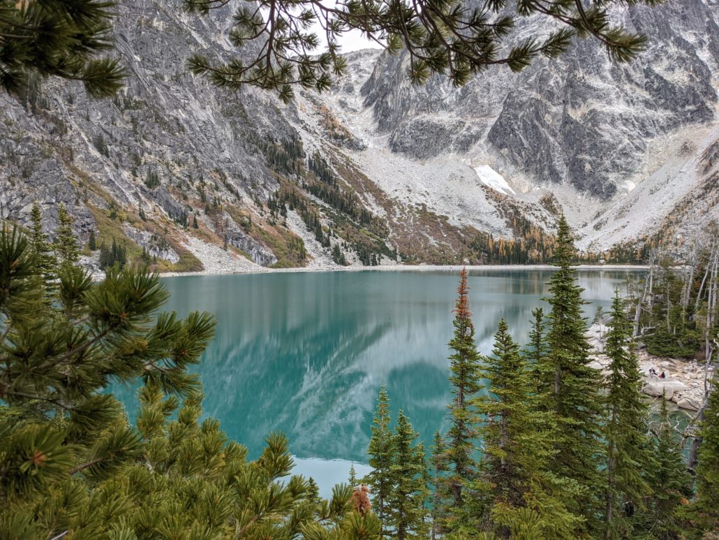
At 3.4 miles you’ll encounter a long switchback. The grade eases for a while here, then increases once again for the final push to the lake. At 4 miles, reach the north end of the lake and follow the trail south for 0.2 miles past the backcountry toilet.

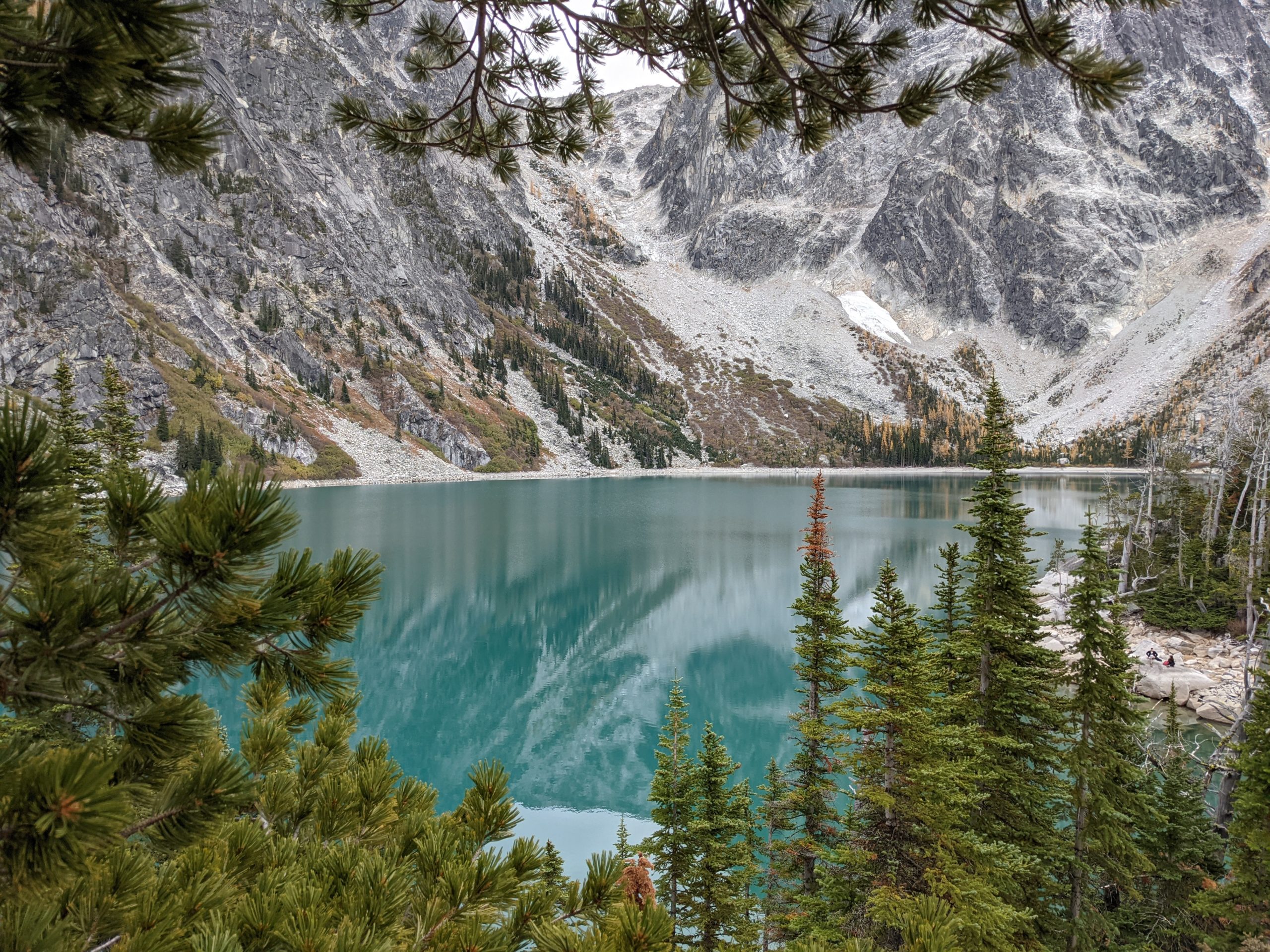
Find a spot to settle in as Dragontail and Colchuck Peaks come into view. Standing over 8,000 feet high, these granite behemoths tower over the lake. Between them, what remains of Colchuck Glacier is visible.
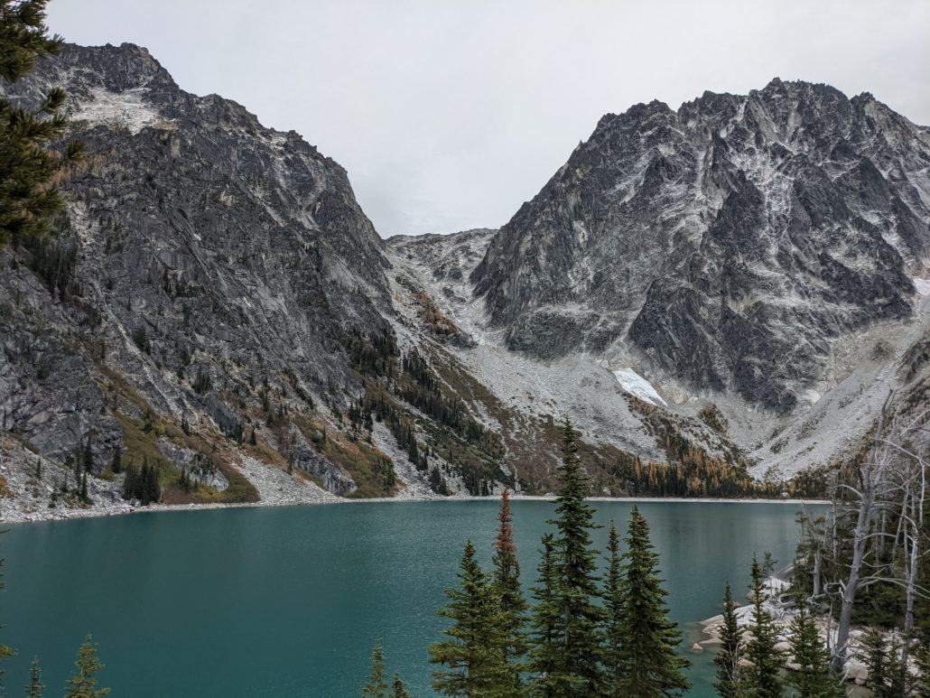
Aasgard Pass and Dragontail Peak
To the left of Dragontail Peak is Aasgard Pass — gateway to the upper Enchantment Lakes which rest some 2,200 feet above Colchuck Lake. Settle in and save the scramble for a backpacking trip — if you can snag a permit.
Colchuck Lake is especially scenic in the fall when golden larches line its southern slopes. The word “Colchuck” is Chinook jargon for “cold water”, so swim at your own risk. Soak up the views, then return the way you came.
Tags: Aasgard Pass, Colchuck Lake, Colchuck Peak, Dragontail Peak, Enchantments, Stuart Lake, Washington State