With so many visitors clamoring to see the sights within Zion Canyon, many sections of the park outside the canyon tend to receive much lighter visitation. Some of this may be lack of name recognition, since there are few equivalents to Angels Landing or the Narrows outside of the canyon. Some of explanation may be weather related; the Zion Desert section in particular can get brutally hot during the summer. And some of the explanation may rest on assumptions that the scenery outside the canyon isn’t particularly interesting and therefore shouldn’t be prioritized over hikes inside the canyon.

I could spend a thousand words picking apart why all of that is nonsense (except the heat), but let’s suffice it to say that many of the hikes outside Zion Canyon are criminally underappreciated. Case in point is this lollipop-loop where you connect Coalpits Wash and Scoggins Wash by way of the Chinle Trail. If you’ve never heard of those names, you aren’t alone. I came here on a busy May weekend and hiked this route. I saw one other group of hikes, and they did not appear to have hiked any further than Campsite 6. So, if you’re one of those folks who laments the popularity of Zion, but you still enjoy some jaw-dropping Zion scenery, this is your hike.
Hikers can also backpack this route, which is a particularly appealing option during the winter when the higher elevation backpacking destinations are generally too cold and snowy. Because this area features a lot of very sensitive habitat, the park requires campers to stick to designated campsites. There are 5 of those along the way, with one other campsite further west on the Chinle Trail. In order to obtain a permit, you’ll need to reserve a permit online within the appropriate time frame. Zion allows reservations to be made within three months of your scheduled trip, and each three month period begins on the 5th of each month. For example, if you wanted to take a trip in March, you could begin reserving permits for the month of March starting on January 5th. Although I mention each of the campsites in this write-up, you can also get a sense of where they are by reviewing this wilderness map.

The route begins just outside the park boundary along the north side of UT-9. Pass through a pipe gate, and continue over a short but confusing tangle of informal trails that heads north toward the park boundary. An information kiosk marks the official park boundary, and after passing through a gap in a fence, continue north along the informal trail that parallels Coalpits Wash anywhere from 30 to 100 yards to the west (your left).
The trail continues north, occasionally dipping into and out of tributary washes, for 1.7 miles. As you progress, you’ll approach the solid wall of a sandstone butte bound by washes on either side. The wash to the left of the butte is Coalpits Wash, and the wash to the right is Scoggins Wash. Once you reach the confluence of the two washes, you’ll turn left to continue along the informal path. Just to the west of this confluence, you’ll also find a marked spur trail leading to Campsite 6. Water runs through the cooler half of the year, and this is one of only two campsites on the route that are water-adjacent.
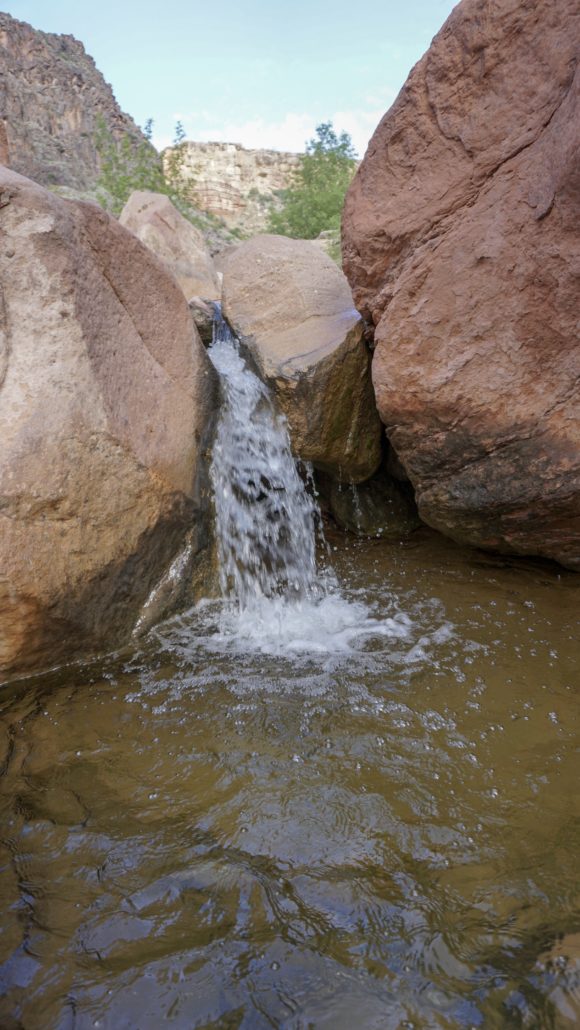
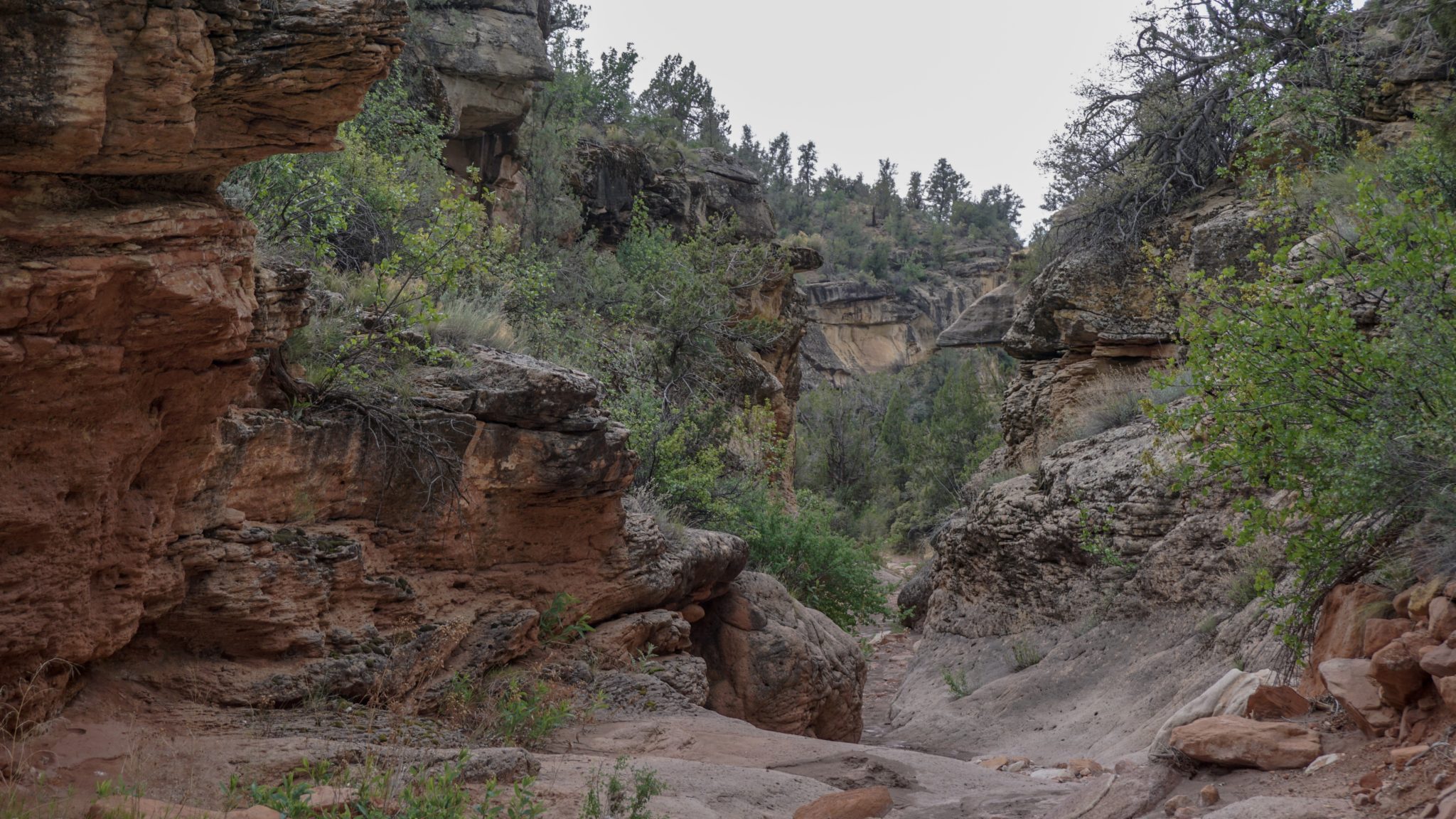
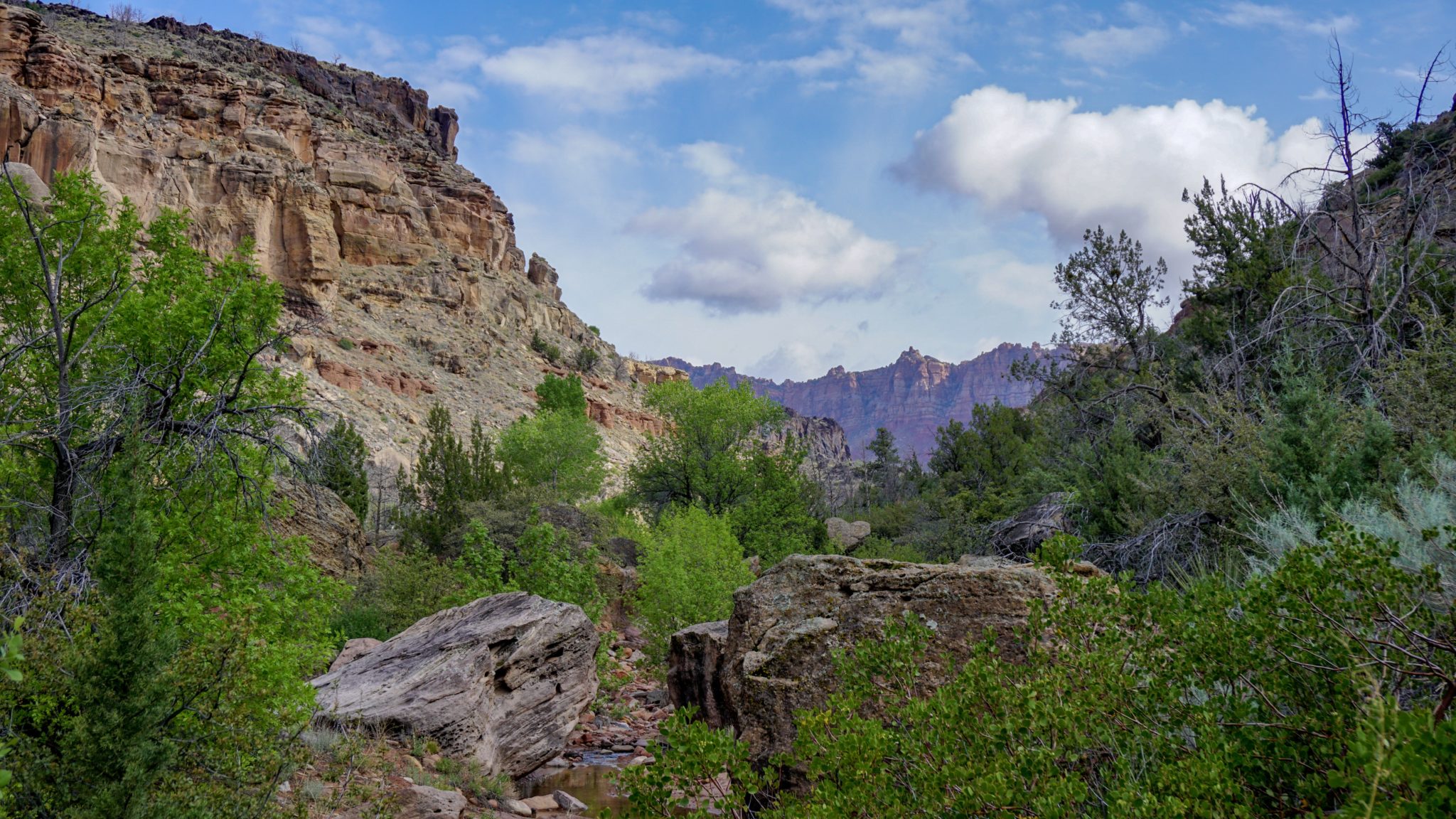
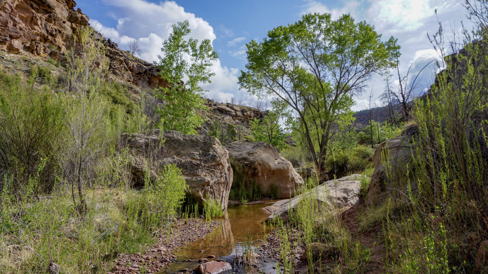
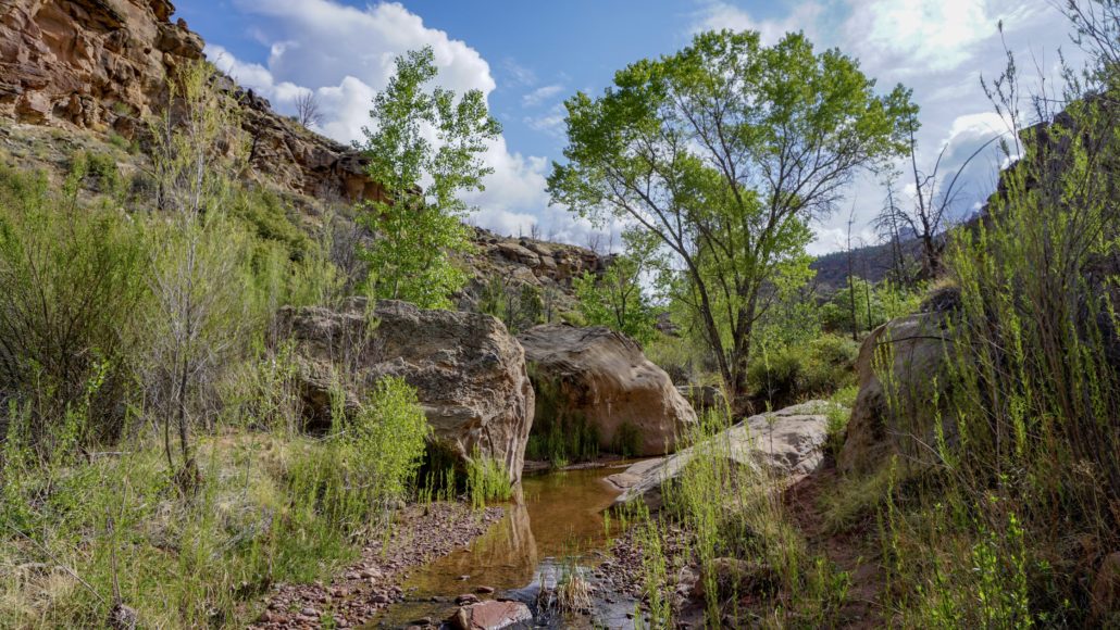
As you enter Coalpits Wash, the trail becomes a little rougher and harder to follow. Occasionally, you’ll be obliged to scramble over boulders, cross the creek several times, or pass through overgrown foliage. On the plus side, when the water is running, you’ll see several small waterfalls and tempting pools. Fremont cottonwoods and willows cast shade in deep pools, and the narrowing walls of the wash add to the scenery and solitude.
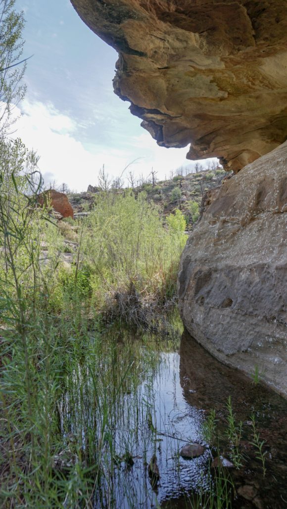
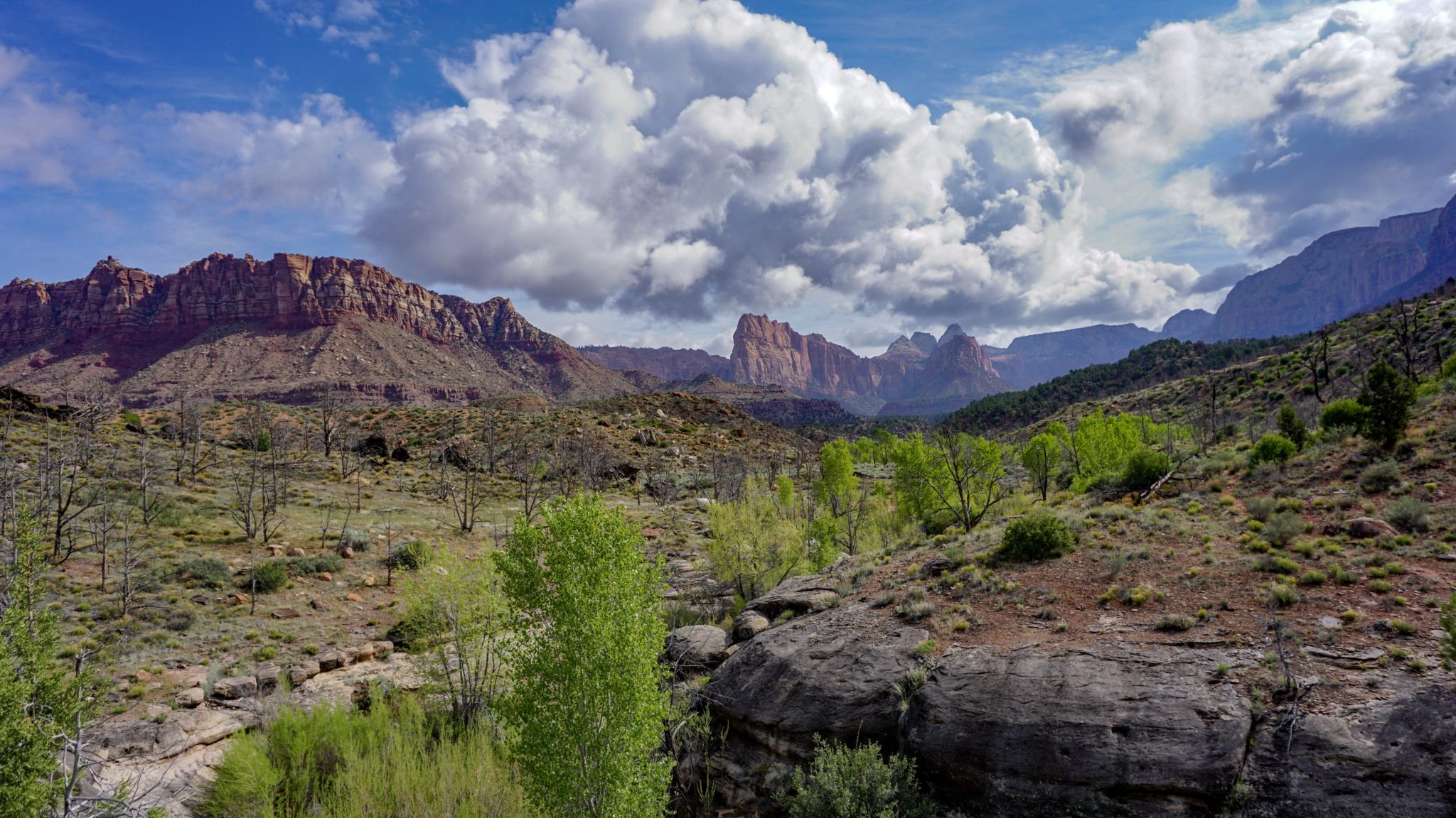
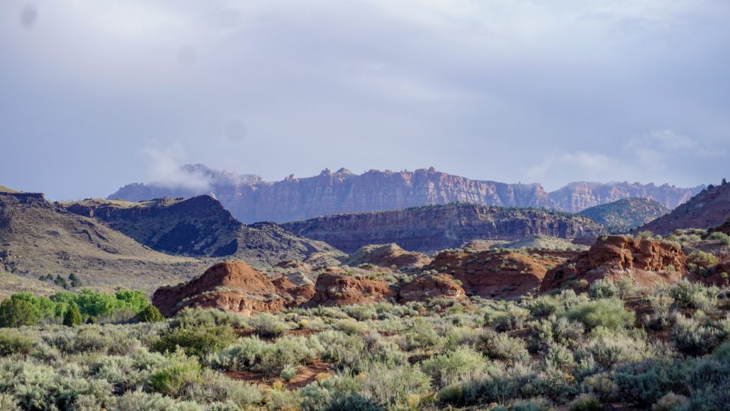
At 3.5 miles, you reach Coalpits Spring, which lies within a narrow, reedy, and swampy section of the wash. This obstacle will oblige you to climb to the wash’s south rim. Once upon the rim, you’re treated to a spectacular view up Coalpits Wash toward the convoluted drainage systems cut into the side of the Horse Pasture Plateau. Cougar Mountain is a prominent feature in this view, but even if you don’t know the particulars, you’ll be struck by the beauty of this massive wall of sandstone formations. Continue north above the spring and the creek until you reach a spur trail for Campsite 5 just before you cross Coalpits Wash for the final time. Campsite 5 is the second of the two campsites that are water-adjacent. The rest of the campsites from here will be dry.

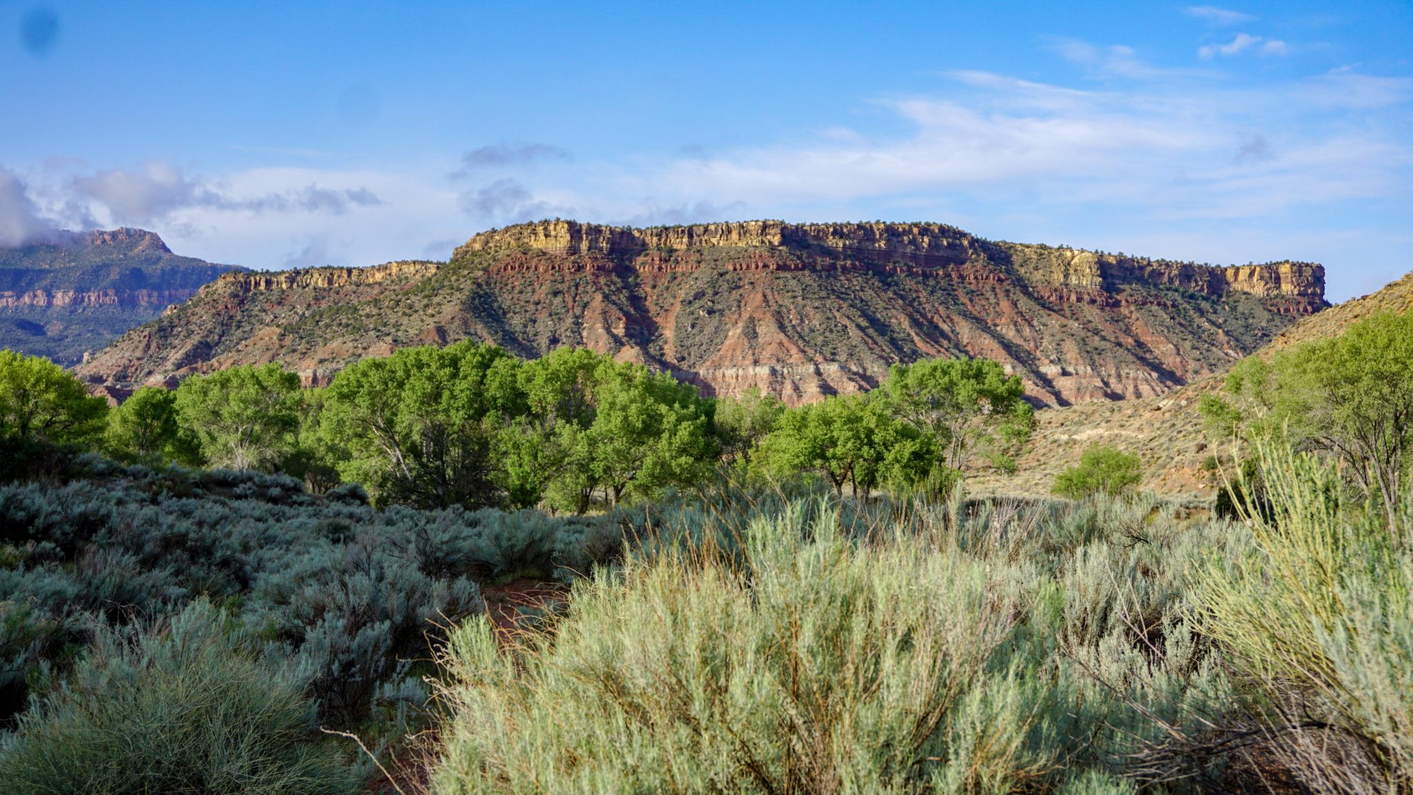
Beyond Campsite 5, you’ll continue a short way before approaching a creek crossing. Look for a sign indicating the Chinle Trail. This is the end of the Chinle Trail, which begins several miles to the west atop Rockville Bench. You will follow the Chinle Trail for the next 2.8 miles through some of its most spectacular scenery. The first mile of the trail is a bit less scenic since most of the vegetation here is still recovering from the 2006 Kolob Fire. The open views in all direction are some compensation for the charred remains of pinyons and junipers.
At 4.8 miles, you enter the unburnt section of this forest of pinyon pines and junipers as the trail undulates through a system of minor washes and drainages. Look for Campsite 4 at 4.5 miles, and Campsite 3 at 5.2 miles. Just beyond Campsite 3, you’ll reach a junction with the unmaintained Scoggins Stock Trail. If you want, you can follow this shortcut into Scoggins Wash to shave off some distance. However, you will miss out on some of the best scenery on the route if you do so.
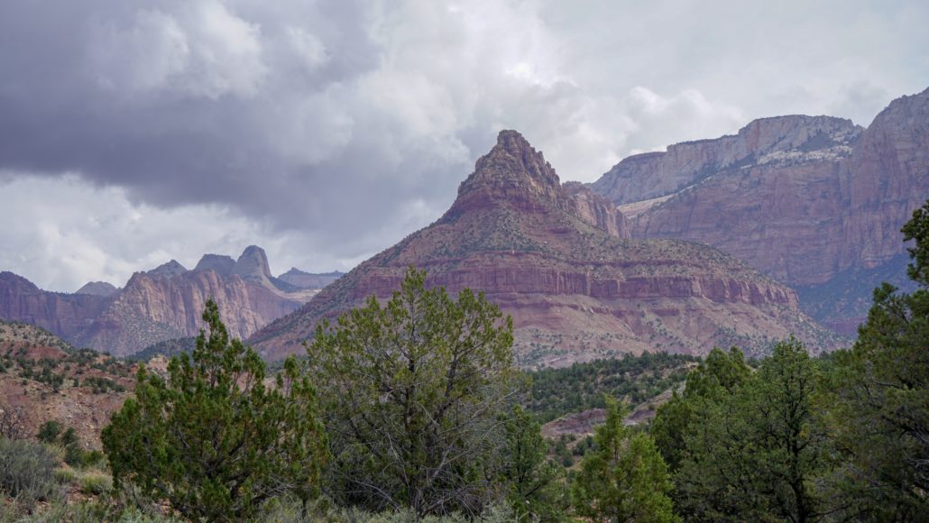
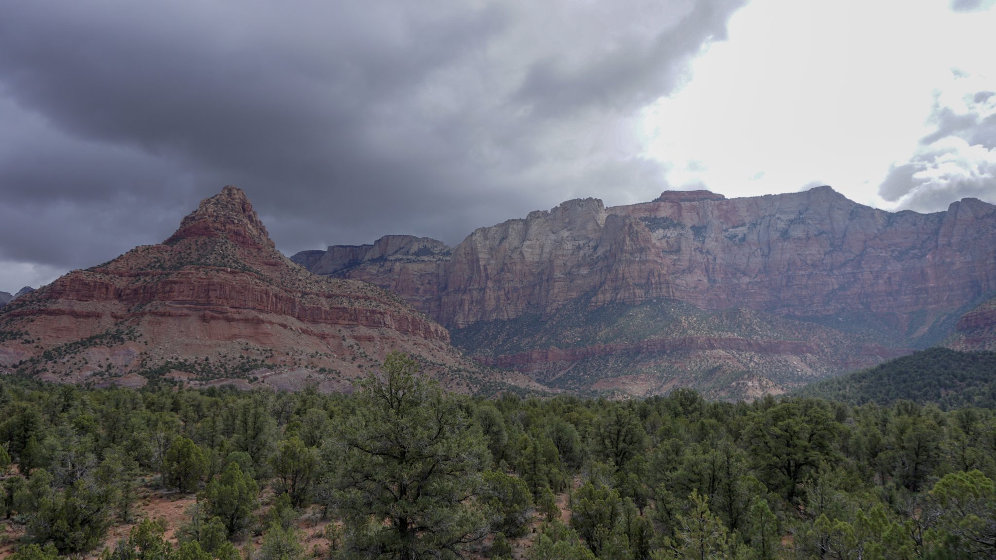
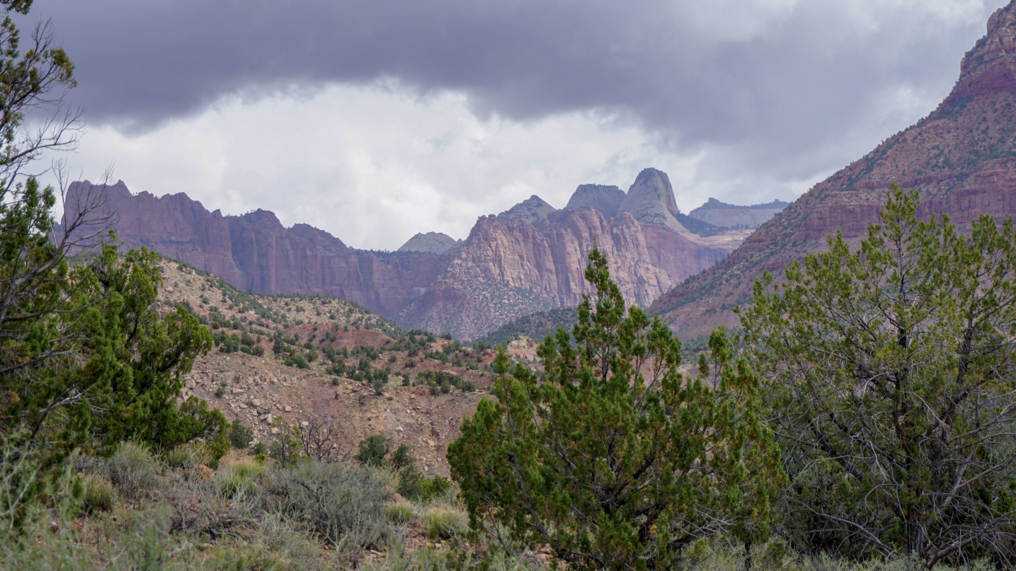
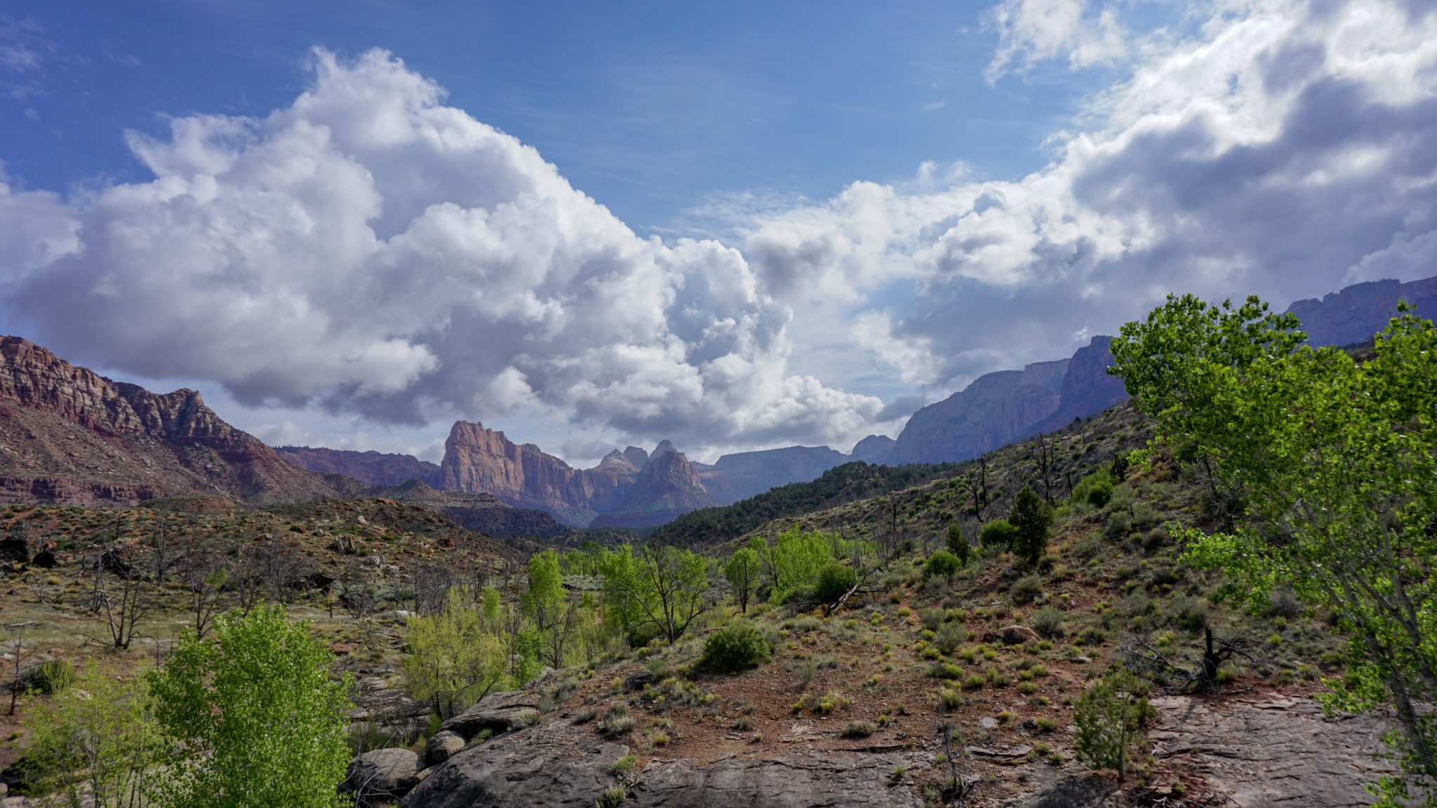
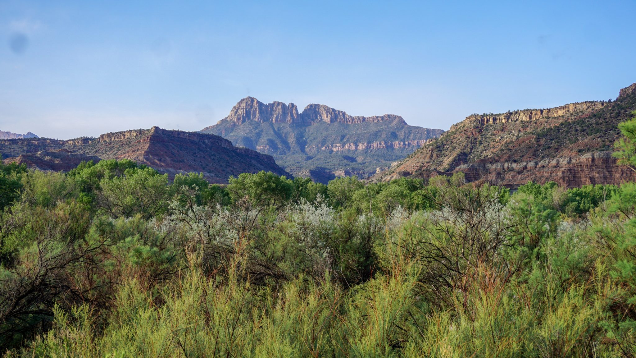
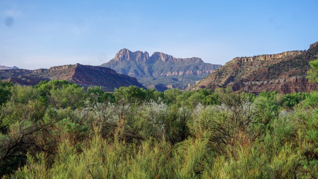
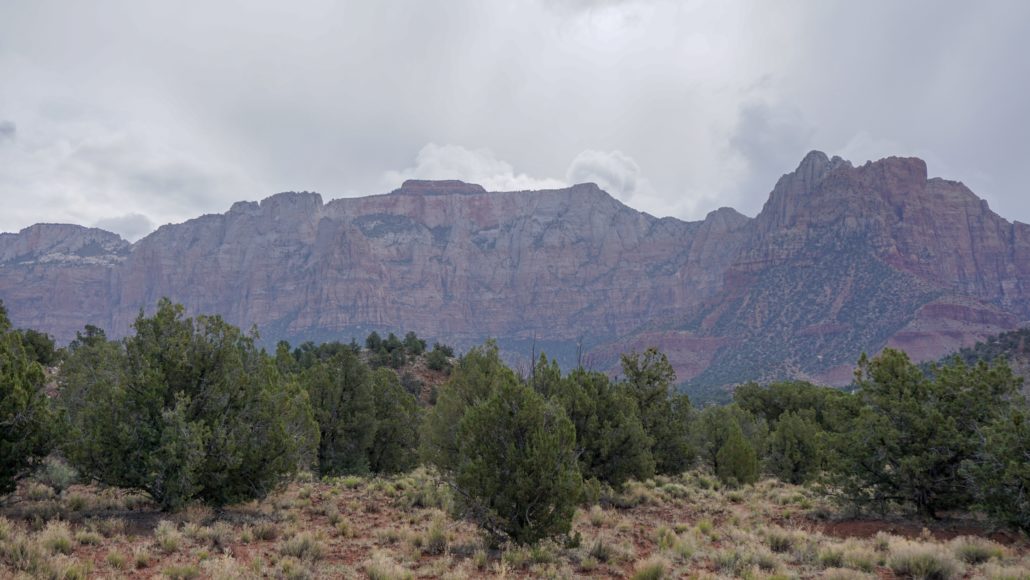
After making a short, but steep climb out of the jumble of drainages, the trail reaches a spur trail for the final campsite on the route, Campsite 2, at 6 miles. You’ll witness the best scenery of the route through this section as you find yourself gazing upon the imposing wall of the West Temple. Most people only see the West Temple from inside Zion Canyon, and from this vantage point, it is absolutely massive. Other lesser high points, including the Sundial, Towers of the Virgin, and Altar of Sacrifice are visible from this vantage, and unnamed Peak 6370 will attract a lot of regard thanks to its evocative pyramidal form. If you aren’t camping, this is an ideal place to take a break since nearly all of the climbing will be behind you, and you can enjoy the scenery at a more leisurely pace that way.

From Campsite 2, the Chinle Trail descends for 0.6 mile to a point where it crosses Scoggins Wash. Turn right to enter the wash, and begin a moderate descent through the washes sinuous confines. Through the initial section, you’ll encounter several boulder obstacles that will force you to scramble down. After you make it through these obstacles, it’s a relatively smooth descent the rest of the way as you follow the wash’s course. The high walls of the wash are dramatically different from Coalpits Wash, so don’t worry about redundancy. This section feels like a whole other world.
At 9.2 miles, your twisting and turning comes to an end as Scoggins Wash joins Coalpits Wash. Keep to the right of Scoggins Wash to locate the informal trail that leads back to the Coalpits Wash Trailhead and your awaiting vehicle.
Tags: Backpacking, Chinle Trail, Coalpits Wash, Cougar Mountain, Scoggins Wash, Towers of the Virgin, West Temple, zion, zion national park