There are only three miles of paved road inside Bandelier National Monument and more than 70 miles of trails. Over 70% of the land inside this park is also designated wilderness, with ample opportunities for dispersed backcountry camping … which means this 33,677-acre park is a much-needed haven for folks yearning to escape the relative bustle of Santa Fe or Albuquerque.
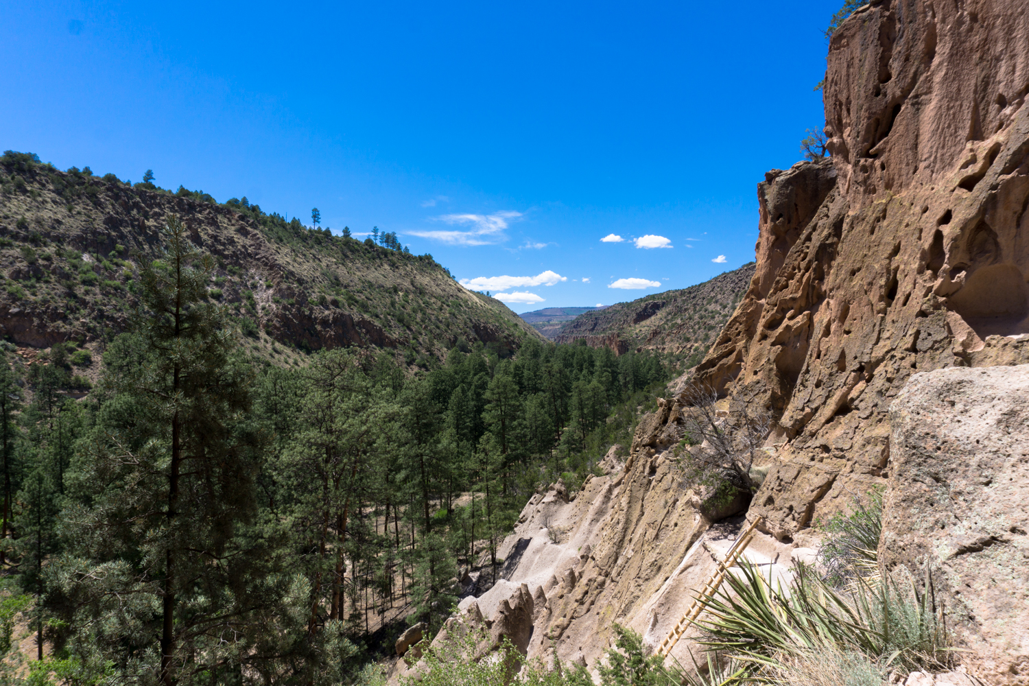
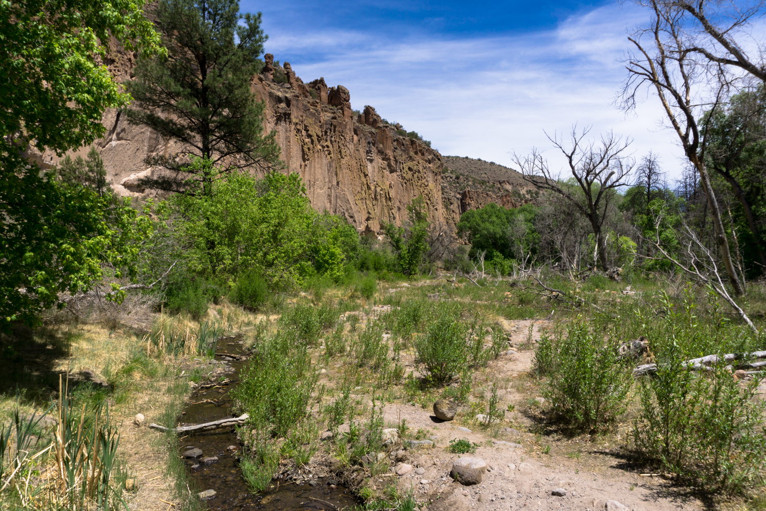
And that’s not even getting into the landscape itself! Bandelier’s extensive canyon system was formed from the soft ash remnants of a massive volcanic eruption. Wind and rain scoured this terrain, forming steep, deep canyons that eventually filled with year-round creeks and streams that flow toward the Rio Grande. The terrain here ranges from juniper savannah in the low altitudes (around 5300 feet above sea level) in the canyon floors up to piñon-juniper woodlands at 6,000 feet, ponderosa pine forest at 7,000 feet, a mixed conifer forest with huge aspen groves at 8,000 feet, and montane grasslands at 10,000 feet. All of this, plus densely-wooded riparian zones in many of the canyon floors makes it a biologically diverse (and beautiful!) landscape rich in plant and animal life.
So it’s easy to see why a branch of the Ancestral Puebloans made their home here. From 600 to about 1600 CE, the sites at Bandelier National Monument were part of the Rio Grande group of Ancestral Puebloans, who interacted extensively with Puebloans in Chaco Canyon, Mesa Verde, and other parts of the Four Corners Region.
The Main Loop Trail takes you from the Visitor Center — a monument in its own right — into Frijoles Canyon, where you’ll encounter the excavated and partially reconstructed remains of the village of Tyuonyi (pronounced QU-wee-nee) and a hair-raising climb to the lofty Alcove House.
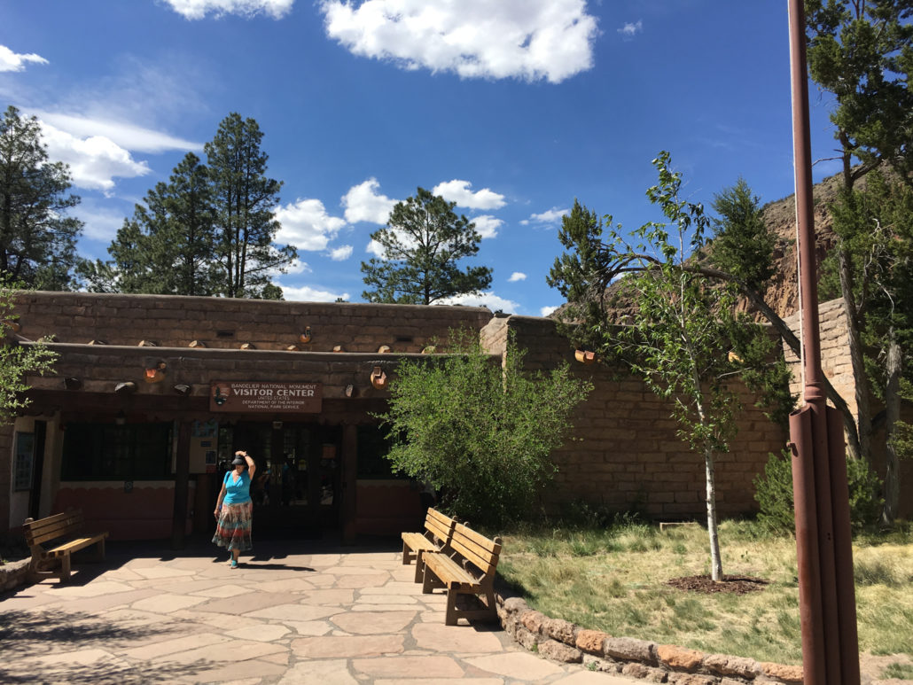
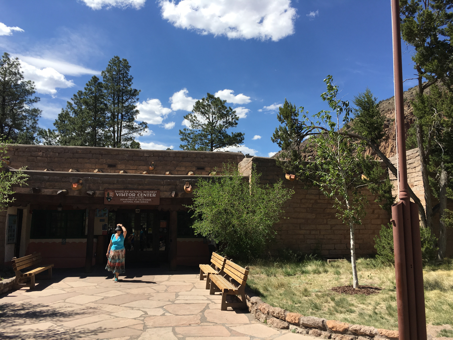
Head into the Civilian Conservation Corps-built Visitor Center to pay your entrance fee and pick up a trail guide for the Main Loop Trail, which will add lots of interpretive value to your experience. Fill up water if you need to and head to the northwest side of the building to start your hike.
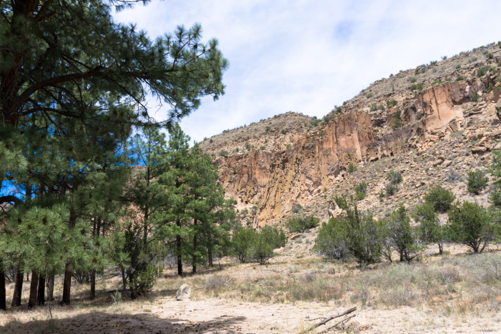
If you weren’t enchanted by the landscape on your way to the Visitor Center, it’s pretty tough to ignore once you start hiking on this paved path.
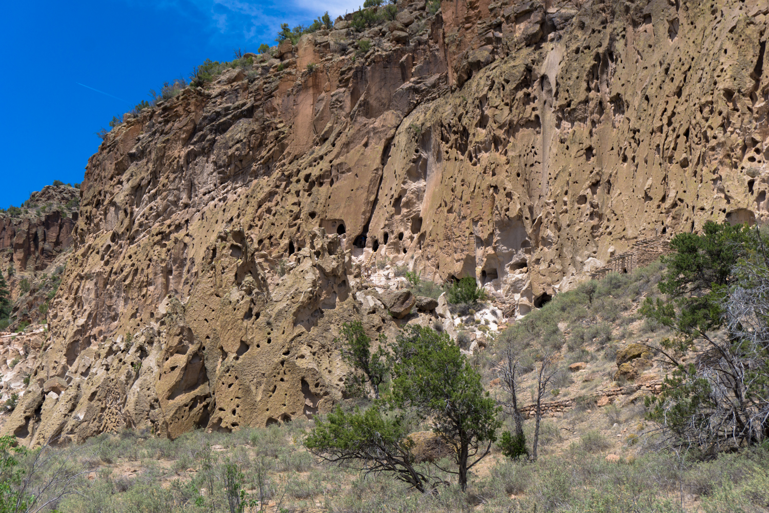
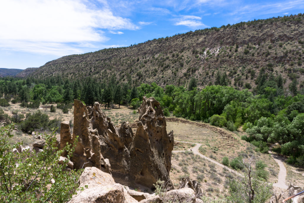
The cliffs here — riddled with holes and odd eroded features — are formed from a rock called tuff. Tuff is a soft rock made out of compacted ash, and when you’re looking up at these towering cliffs, you’ll probably think “hey, that’s a heck of a lot of ash that fell here.”
About fourteen miles to the northwest of Frijoles Canyon lay the Jemez Volcano. Over a million years ago, two separate and massive eruptions of the Jemez Volcano created the Valles Caldera (now a National Preserve). Each eruption shot upwards of 73 cubic miles of ash into the air, spreading as far away as Kansas. For reference, the 1980 eruption of Mount Saint Helens in Washington State produced 0.5 cubic mile of ash.
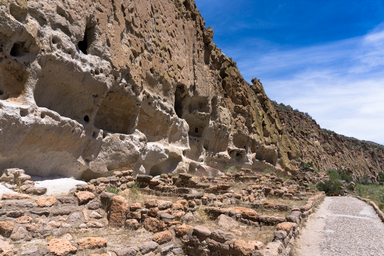
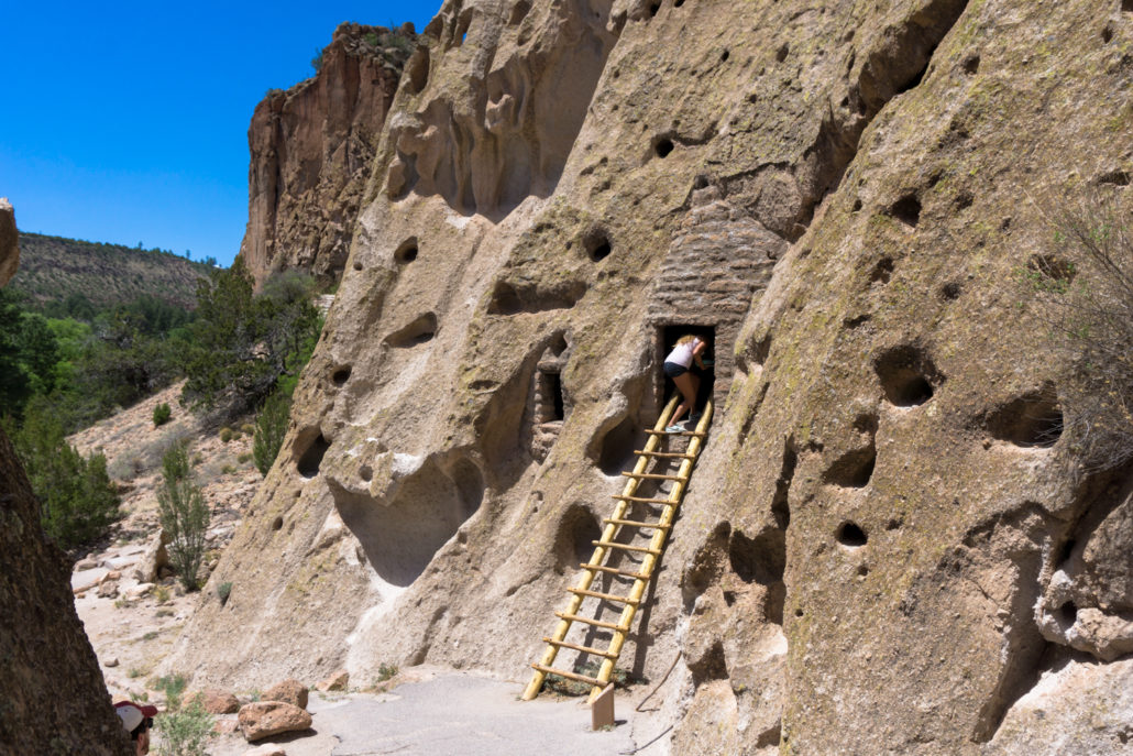
Because the tuff rock is soft, it erodes relatively quickly (and magnificently) and is also easy for people to carve structures into. The Ancestral Puebloans here at Tyuonyi took advantage of this, so in addition to the underground kivas and D-shaped multistory pueblos you’ll see at other Ancestral Puebloan sites, here the inhabitants also built what are now called “cavates” — rooms carved into the tuff rock. Both the talus houses and Pueblos were occupied at the same time.
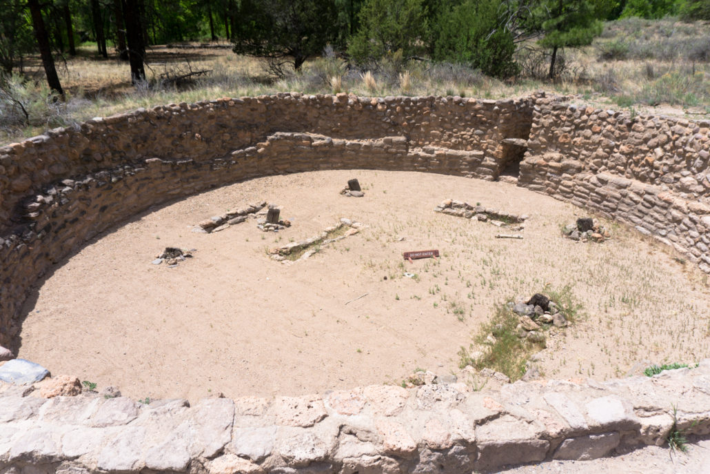
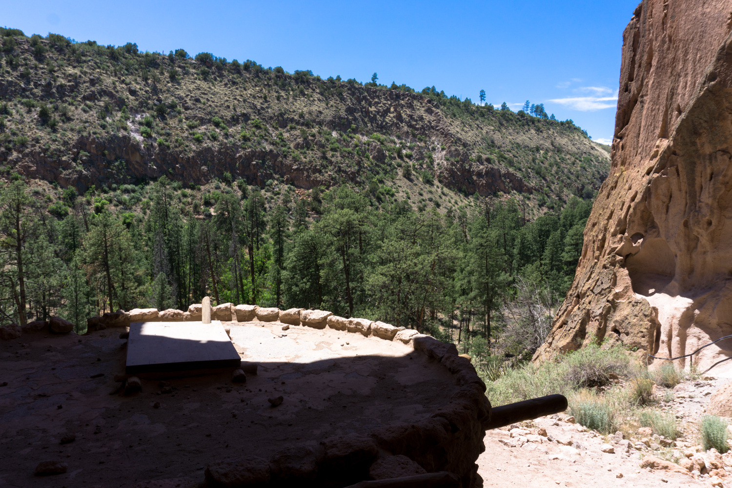
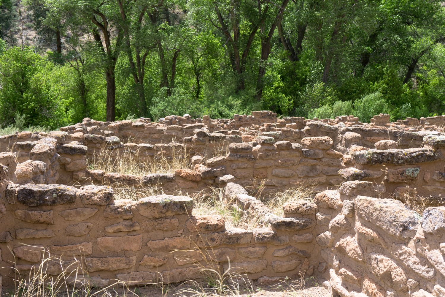
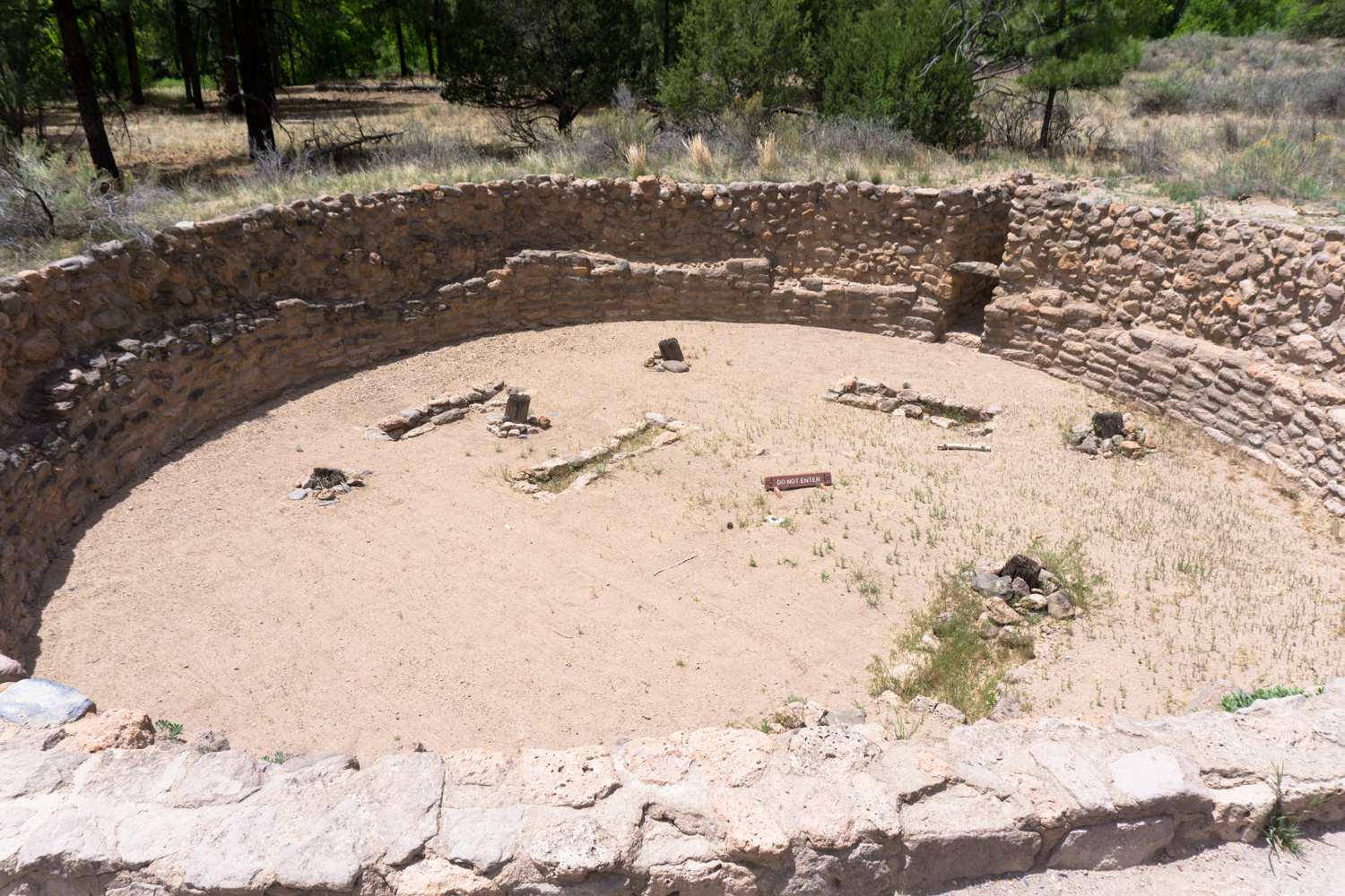
As you continue into Frijoles Canyon, you’ll first encounter a large excavated underground kiva. These structures were central to all Ancestral Pueblo sites and are thought to have spiritual and cultural importance.
Near here, the fields in the floodplain of Frijoles Creek served as a major agricultural area for the Puebloans, who used advanced farming techniques to grow corn, squash, and beans in addition to beneficial native plants like yucca. They utilized irrigation strategies like terracing and grid gardens to control water flow and even used pumice stones as mulch to help the soil retain water.
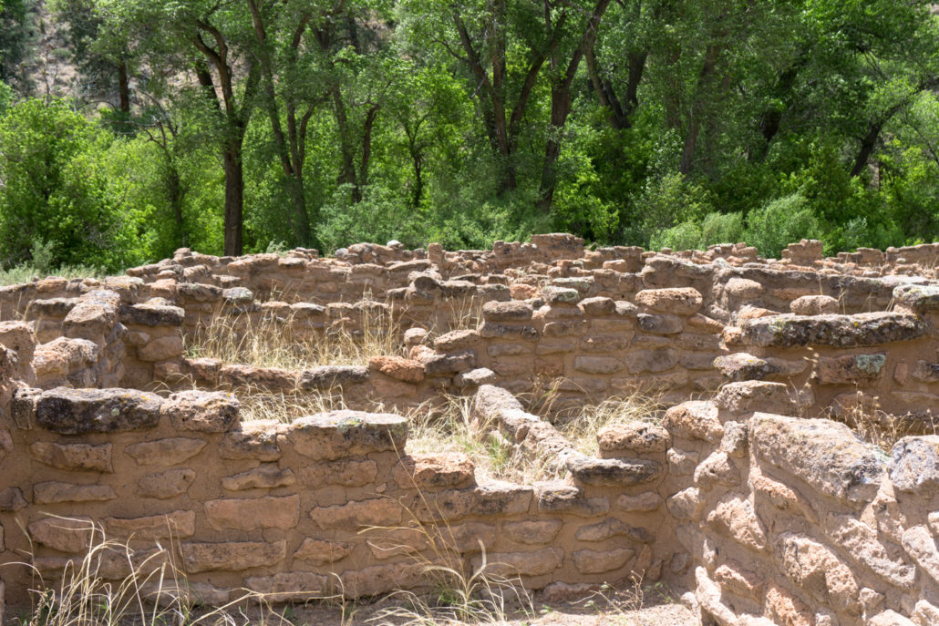
As the trail continues, you’ll pass through some of the low room ruins on the canyon floor. Keep right at 0.3 mile to head toward the cliff walls.

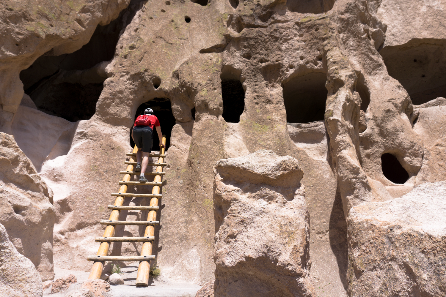
Heading up!
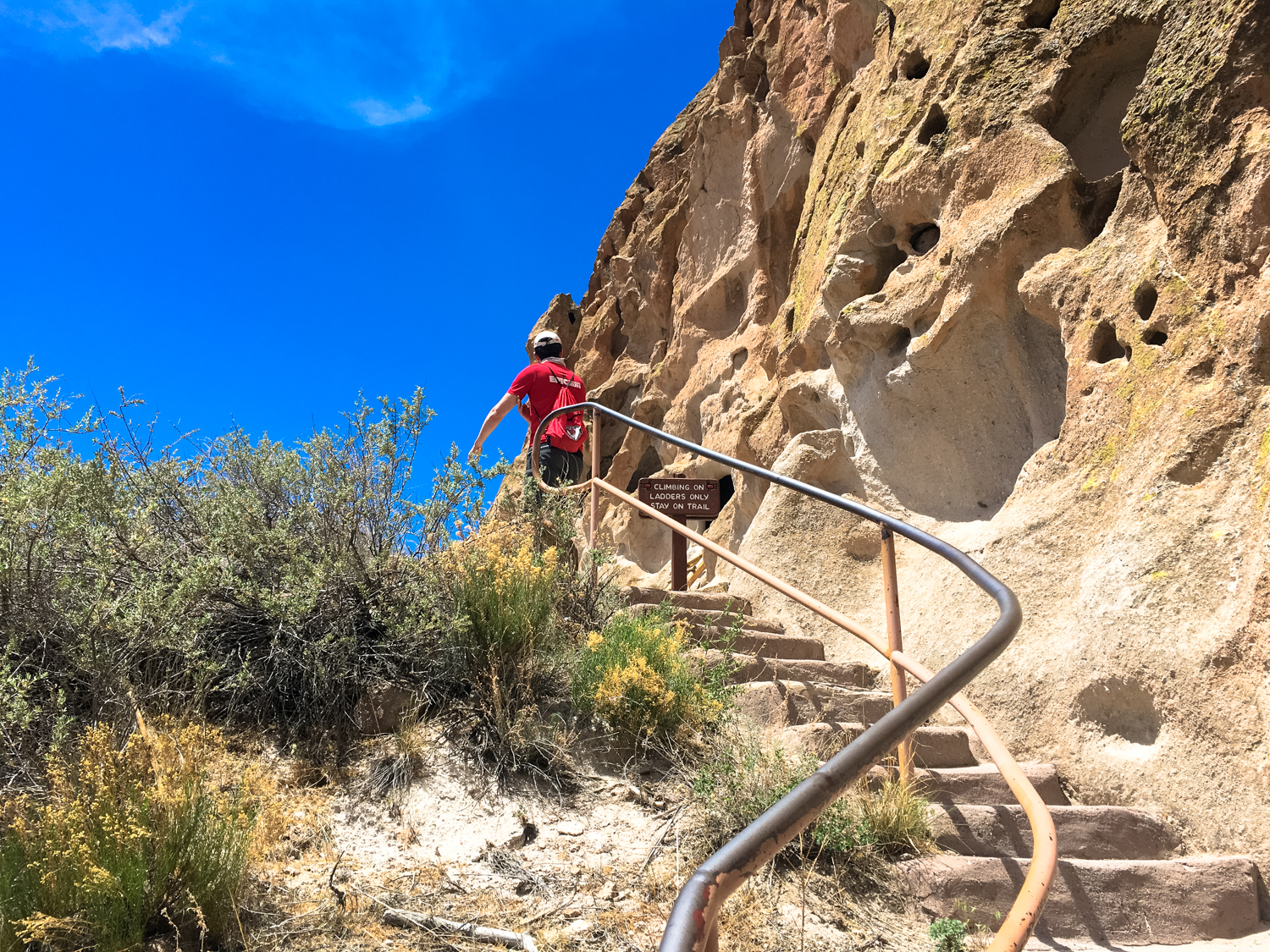
The trail hugs sections of the cliff side here, and in some cases there are ladders that will let you go inside some of these dwellings. Please only use the ladders and do not climb on the tuff or enter any other alcoves — because the rock is so soft, it is VERY easy to cause lots of damage to these sites.
You’ll get a nice view of the Pueblo site from these cliff dwellings
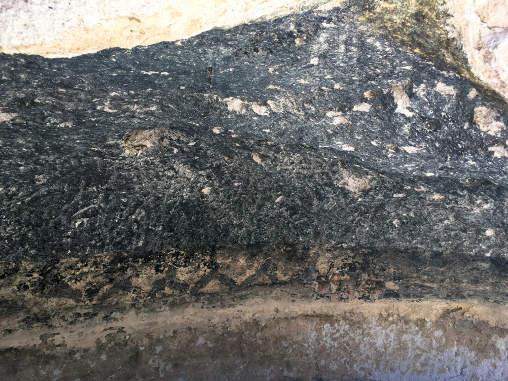
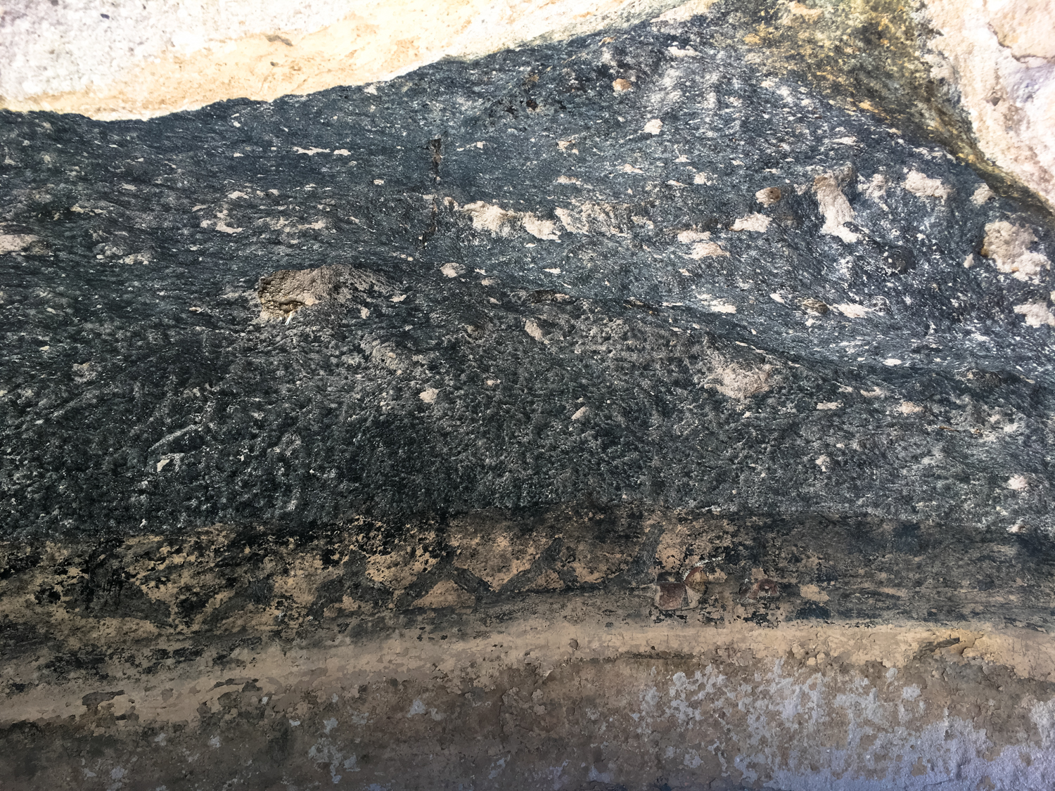
The cavate ceilings
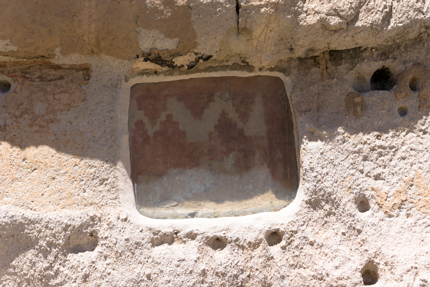
The ceilings in many of these cavates are covered in soot and occasionally have designs in them. Smoking the ceilings helped strengthen the rock and reduced the amount of crumbling and breakage that would occur while people were living here.
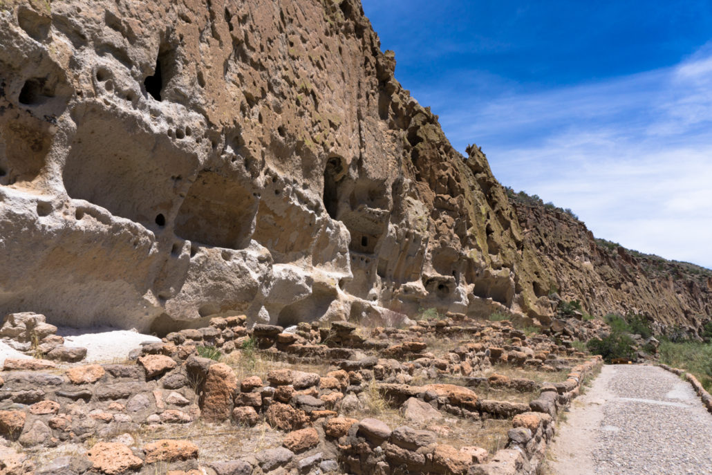
As the path progresses, you can see that the inhabited area here was built right up against and into the cliff walls — on the ground, you’ll see the Pueblo dwellings common throughout the region. Above them, cavates have been carved into the tuff rock, with circular holes indicated where lodgepole pine beams were lodged. This area is known as Long House, and there are lots of petroglyphs carved into the canyon walls above — close to where people would have been living.

Look closely above and between the rows of timber holes to see geometric designs and other petroglyphs
There are also some instances of ground-style dwellings on the cliff side, called “talus houses.” These have been reconstructed in the 1920s but more modern research indicates they probably didn’t look like this.

Ignore the steep Frey Trail at 0.5 mile and keep right at the nearby junction to continue heading northwest into Frijoles Canyon.
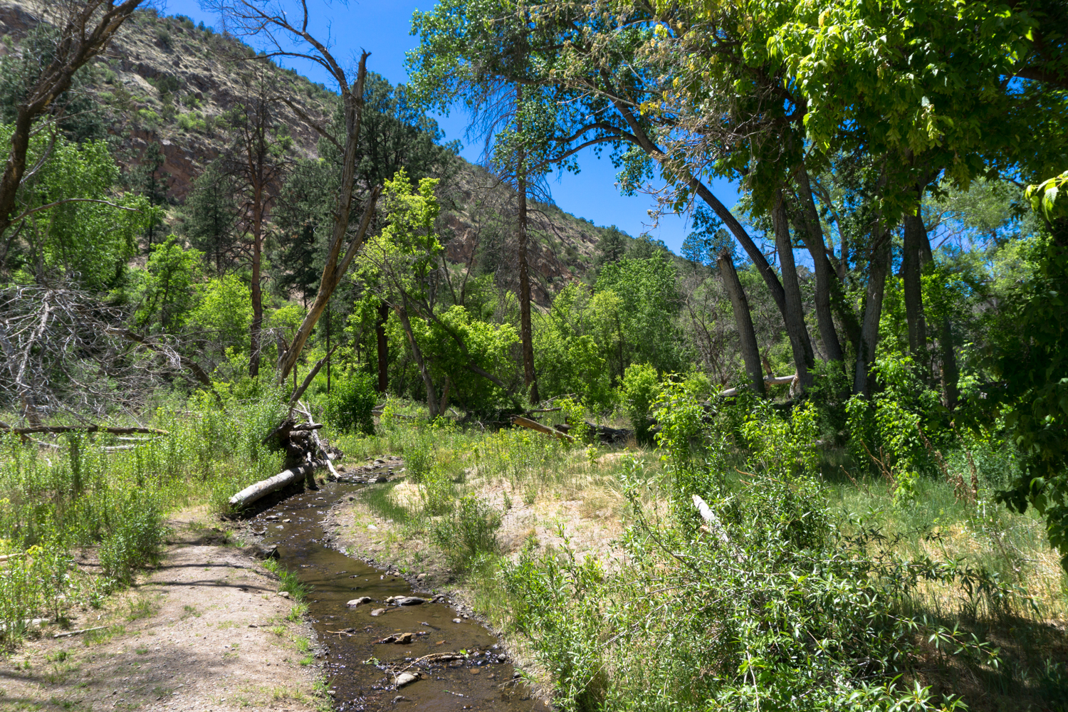
When you leave the pueblo sites behind you, you’ll enter into the riparian corridor of Frijoles Canyon, crossing Frijoles Creek at 0.8 mile.

It might not look like much, but Frijole Creek is one of the few year-round streams in this region, and it was incredibly important to the Puebloans who lived here (not to mention the plants and animals). For you, though, it provides lots of shade, a beautiful bubbling white noise, and brings some lovely birdsong to the canyon.
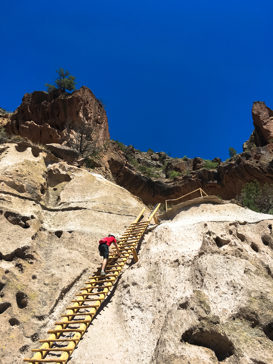
Cross the creek and keep to the right to keep heading to the northwest. You’ll hop across it a few more times and at 1.4 miles, keep right to stay on the Alcove House Trail. From here, it’s just a 140-foot ladder climb up to the ruins of the Alcove House. During winter months, this ladder section may be closed, as it tends to get extremely icy and dangerous. You can check at the Visitor Center before you head out.

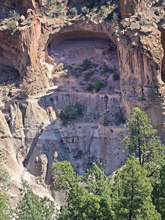
The Alcove House from above. NPS photo by Sally King.

There is an excavated kiva and a few instances of alcove dwellings here, but most of what was once in Alcove House will have to be left to your imagination. Still, I couldn’t think of a better location to sit and look out upon Frijoles Canyon to imagine what it was like to live here at the height of the Ancestral Puebloans.
When you’re done, climb back down the ladders and return back to the Visitor Center. Keep on the west side of Frijoles Creek to enjoy a change of scenery, some ruins of the old Frey lodges, and a few interpretive plaques about the region’s plant and animal life.
Tags: alcove house, Ancestral Puebloans, bandelier national monument, cliff dwellings, frijoles canyon