A short hike from the hot, dry desert flat into a narrow canyon and to a hidden waterfall oasis, full of mosses, vines, and trees. A surreal arid experience that is not to be missed if you’re in Anza-Borrego.
I picked up my hiking / camping compatriots around 6:30AM on Saturday and started the drive down in the pre-vacactioner open freeways. The journey was uneventful, but man – no matter how many times I drive through California, I’m always surprised with just how incredibly rural it gets when you start leaving the cities. Not even 90 minutes outside of Los Angeles, you start hitting towns under 10,000 people. Closer to the park, even less – we passed through a few towns and unincorporated villages with less than 200 people … one such town’s city limit sign read “population: 197 friendly people, 2 or 3 grouches.”
We eventually arrived at the park’s entrance and descended from the lush coastal ranges down into the desert, taking some time to check out the visitor center to bug some of the rangers with questions … like “what trails are the least crowded on holidays?” and “which of the dirt roads won’t destroy my Honda Accord?”
We discovered Anza-Borrego has what is probably the most liberal set of park rules anywhere — at least, of the places we’d seen in California. Hiking off-trail is permitted, there are no entrance fees, camping at primitive campgrounds is also free, and if that doesn’t work, you’re allowed to camp anywhere in the park as long as your car is a full length off the road. All they want you to do is keep your fires in metal containers, and that’s pretty much it.
So we got information on the invitingly-named Hellhole Canyon, went outside, and promptly took off in the wrong direction. Hey, the desert is confusing sometimes. We made the best of it and scrambled up a short “warm-up trail” to a low peak before heading back to the car to get to the trailhead.
Although some maps may show a cross-country trail leading from the visitor’s center to Hellhole Canyon, I don’t recommend this route unless you have orienteering experience – specifically experience in desert terrain. The ground is flat and stretches out for miles, and there are no standout landmarks to clue you in on your target canyon. Instead, hop back in your car and drive back out on the Montezuma Highway. You’ll see a marked trailhead on your right for the California Riding and Hiking Trail. Get out here, and keep straight when the CRHT takes a left-fork into the mountains. This will take you toward Hellhole Canyon and Maidenhair Falls.
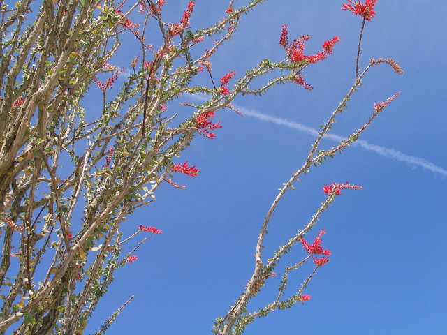
The first section of the trail winds its way through your standard low desert scrubland. Not necessarily much to look at, although we were treated to a few scattered blooming yucca plants and ocotillo cacti. That’s one of the things I really like most about the desert – there is actually a lot of color and diversity going on, you just have to keep your eyes open for it.
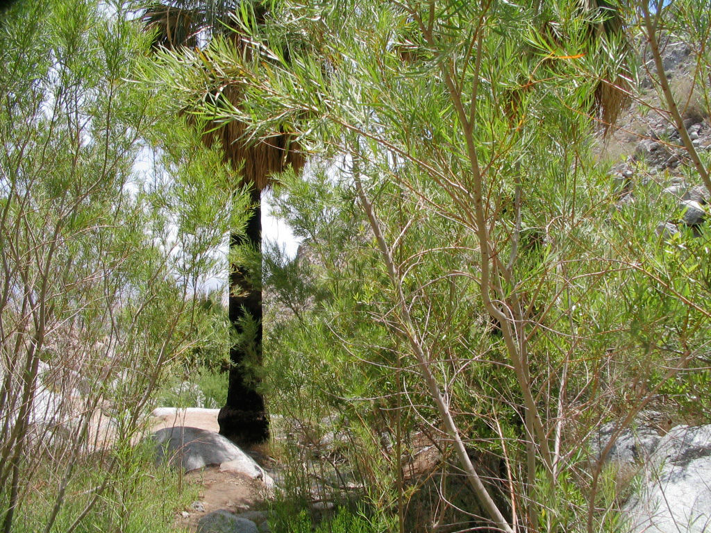
As the canyon walls closed in on us from either side, the trail started following a shallow, broad wash imprinted in the sand. The boulders that washed down from previous rainstorms let us break up the monotony with some light scrambling, and we eventually reached the first oasis. Basically a small group of two or three short palm trees and some brush, it merely encouraged us to keep hiking further into the canyon.
We started seeing a small trickle of water in the wash before the second oasis, and the plant and wildlife increased dramatically. Thicker palms, ferns and vines huddled around both sides of the stream, just a few feet away from the crackling desert. I spotted a kingsnake under some rocks we were hiking across, and we let it pass undisturbed.
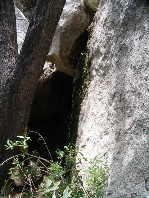
Further in the second oasis, we found a small trickle of water slipping through a crack in a boulder. The water was cool and the shade was a nice relief, so we took a few minutes to stand beneath the stream. I accidentally stepped in the pool, but my soaked boot dried out in less than a minute. That dry air sucks the moisture out of anything.
As we climbed up onto a larger boulder to continue the trail, we ran into a middle-aged man sitting next to a sizable radio/GPS unit. He asked if we’d seen the bighorn sheep on the ridge but, unfortunately, we did not. He gave us a few tips for the trail, and seemed to know every step by heart. When Will asked how many times he’d done the trail, he casually replied “oh, probably a few hundred times.”
Turns out he was a wandering naturalist studying the bighorn sheep in the canyons nearby, but as soon as I heard the phrase “wandering naturalist,” I was sold. We sat and talked for a little while, talking about the park’s sheep and the hidden waterfall in Hellhole Canyon. As you know, I’m a sucker for history on my hikes, but it turns out a biology/geology combo works just fine, too.
So we got our learn on and continued a short hike up the trail to the waterfall and third oasis. The tree cover here was lush, and provided lots of cool shade. The water sprinkled in a steady stream into a shallow pool, and the canyon walls were covered with moss and vines.


While we were only a few hundred yards from the desert, this tiny oasis felt like a world away. It definitely reminded me more of hikes in the Oregon forests than any of the other desert trails I’ve done. We took advantage of the scene, removed off our shoes and relaxed, listening to the gentle sounds of the falling water, gently puncturing the desert silence.
Tags: Anza-Borrego Desert State Park, Camping, hellhole canyon, Hiking, Hiking Anza-Borrego, Hiking Maidenhair Falls, San Diego, Trail Write-Ups