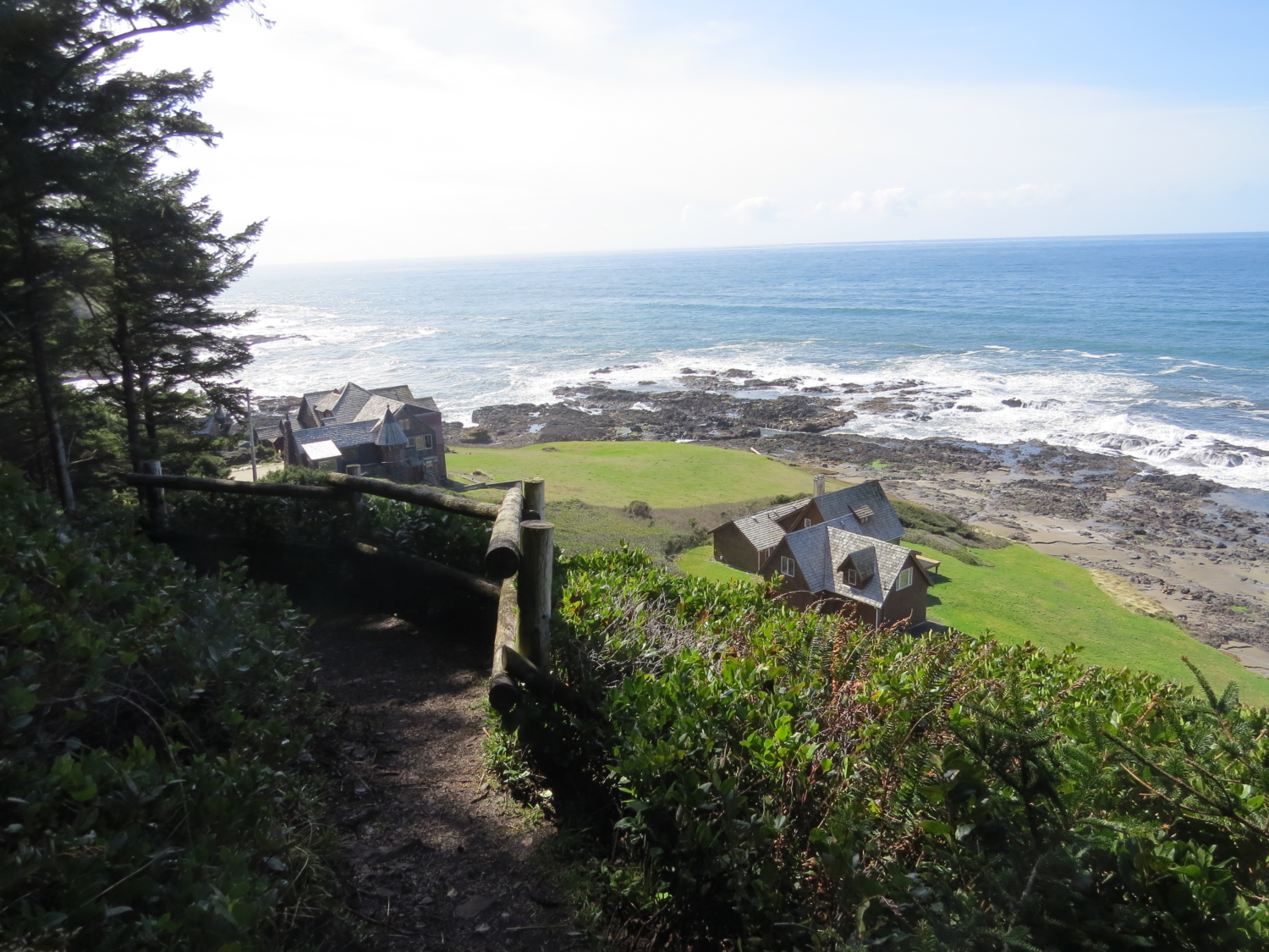
On a sunny day, the Oregon coast beckons visitors to its salty shores, and Oregonians flood from the cities to quaint coastal towns like Yachats, nestled next to Cape Perpetua. Hills of evergreen dotted with houses make Yachats particularly picturesque. The town offers all the trappings that make the Oregon coast so popular — sandy beaches, ice cream, seafood restaurants and quirky gift shops.
But you’re here for the hiking and there’s plenty of that, too. My first encounter with Cape Perpetua came the easy way, with a quick, windy drive up to the top. A short walking path takes you to shining panoramas of the Pacific Ocean. On a clear day, you can see miles upon miles of coastline.
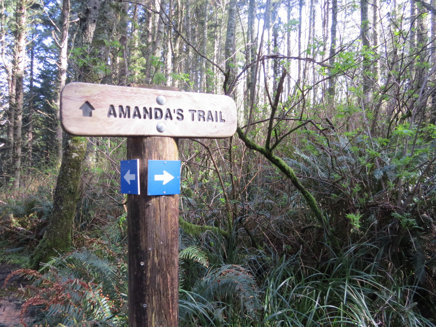
A slower but far more rewarding way to the top of Cape Perpetua involves taking the Amanda (or Amanda’s) Trail from Yachats itself on a peaceful climb up forested hillsides. I managed to hike this trail when the sun was out, making the glimpses of the ocean along the way even more spectacularly blue.
The hike starts close to the heart of Yachats. You’ll be especially happy about this as you’re emerging from your 7-mile trek on the way out, ready for a cold beer or basket of fish and chips (more on this later).

The entire trail is well-marked, so look out for signs bearing “Oregon Coast Trail” with arrows pointing you on your way. With the ocean on your right, you’ll follow a grassy path along the side of Highway 101 for a short distance.

Once you hit Windy Way, cross Highway 101. It’s a quick dash across the road, and after that, you won’t have to worry about dodging traffic any more.

On the other side of the road, you’ll ascend pleasantly up and down the hillside. A little elevation gain sets you above the ocean, which you’ll see peeking through the trees every now and then. An evergreen forest provides ample shade for the vast majority of the hike. Don’t worry too much about the highway, as you’ll leave it soon enough.


The trail pops out onto a gravel road, then continues through a conservation easement packed full of ferns and lush greenery. The bright green moss that lines the trail looks like a plush carpet.


You’ll actually go down a bit (and lament the loss of the elevation you’ve gained), emerging into an open, wooded area. Here lies the Amanda statue, commonly adorned with ferns, roses, beach agates and other tributes. Her story is a sad one — you can read the whole tale on an informational posting near the grove.

A Native American living near Cape Perpetua in the 1850s, Amanda was forced to march through the cape to her internment in Yachats, living a life pushed from one place to another at the hands of the United States Army. The trail and statue are dedicated to her, in remembrance of her terrible trek through land that once belonged to her people.

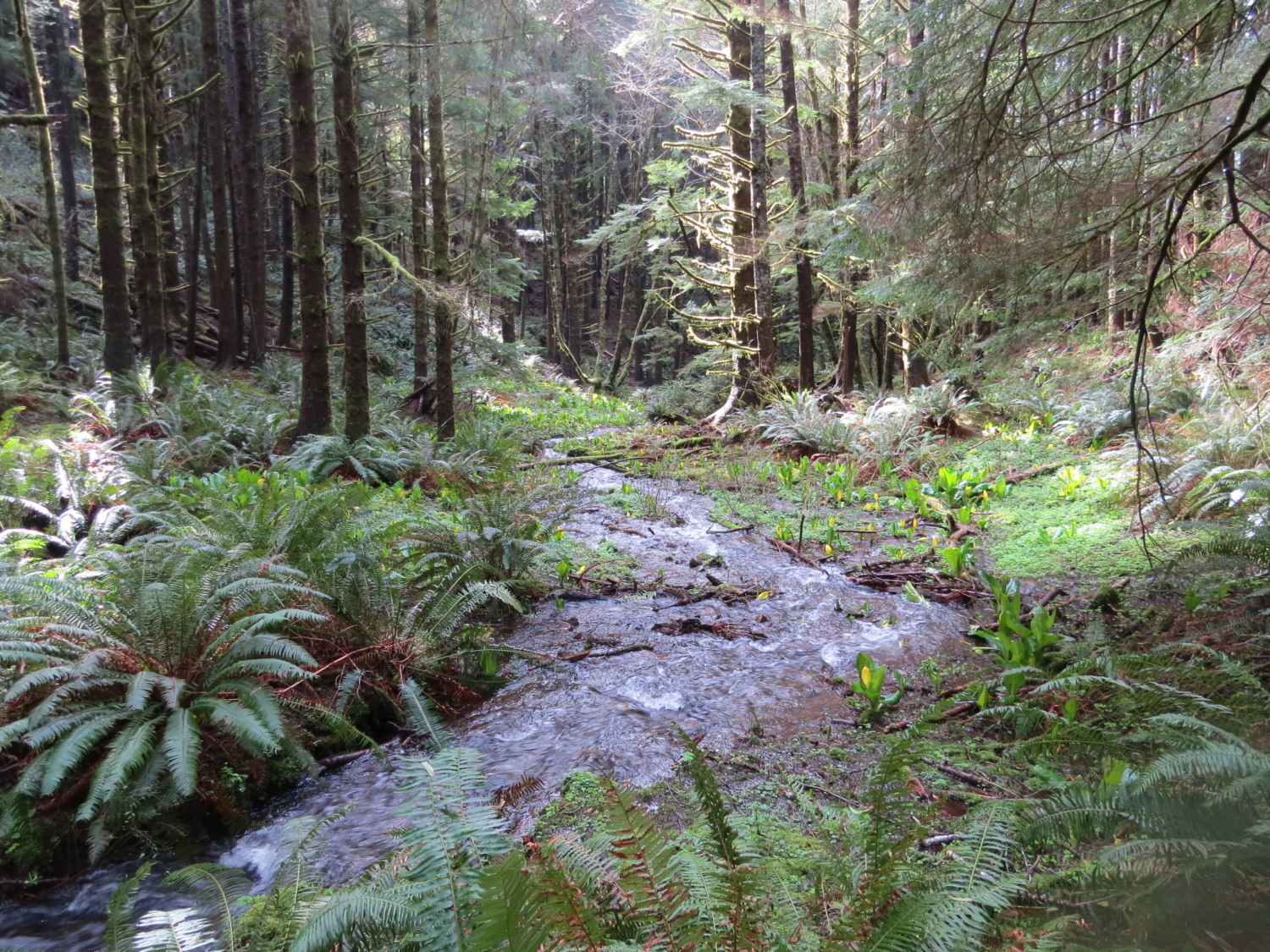
Take a wooden bridge over your first stream crossing, then get ready for a big gain in elevation. The trail makes a steep push upward, with about a mile of steep slog. At the top of this upward climb, you’ll actually be higher up than your final destination at the top of Cape Perpetua.

At this point, another stream crossing rears its head, this time without a bridge. With waterproof or water-friendly shoes, you’ll be fine, but it’s a bit of tricky rock-hopping or log-balancing if you’d like to cross without getting your feet wet. In spring, skunk cabbage shoots up yellow flowers along the bank of the creek.

The steepest part of the trail has passed, and now you’re headed up, down and around to the top. Beautiful, panoramic views of the forest make it an easy trip.


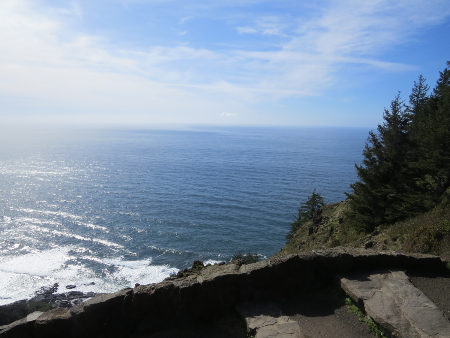
Here, the trail joins the easier loop at the very top, so you’ll see a marked increase in people. Keep going until you emerge into a parking lot. Then, follow signs to the stone shelter. On the way, you’ll get your first real look at the ocean from high above.


The stone shelter came about through a 1930s CCC project, but it’s also a vestige of WWII, when it was used as a coastal watch station. Now, it’s just a fun place to practice looking for grey whales.

When you’ve had your fill of the sights and sounds, you can mosey back down the way you came. You might even encounter some wildlife on the way.

Back in Yachats, I have a few favorite places for post-hike rejuvenation: Check out Yachats Brewing for a satisfying pint, or try Ona Restaurant for a more upscale experience. If you’re seeking a more casual setting, The Drift Inn will also treat you well with a burger and a beer.
Tags: amanda trail, dog-friendly, Hiking, history, oregon, oregon coast, Oregon Coast Trail, Pacific Ocean, views, water, Yachats