Before there was a Sequoia National Park (or a National Park system, for that matter), numerous Bay Area lumbermen set their sights on the sequoias of the western Sierra Nevada. During the latter half of the 19th century, loggers commenced wholesale logging operations in the relatively accessible upper reaches of the Kings River watershed. Further south in the Kaweah River watershed in the area that would one day be known as Giant Forest, the inhospitable terrain precluded the sort of logging that decimated Big Stump Basin, Converse Basin, and Cherry Gap.

Mariposa lily
Following John Muir and Hale Tharp’s glowing descriptions of the massive trees of Giant Forest, lumbermen began to set their sights on Giant Forest with increasing interest. The problem of access remained a significant barrier, as the forest sits upon a plateau bounded by the deep, rugged creases of the Middle and Marble Forks of the Kaweah River to the north, west, and south along with the alpine Tablelands to the east.

Dogwood
Enter the lefties. An enterprising group of socialists known as the Kaweah Cooperative Colony set up shop in 1886 along the North Fork Kaweah River at the site of the present hamlet of Kaweah just north of Three Rivers. Their intention was to establish a socialist commune whose utopian dreams would be funded by sequoia timber. In order to reach this timber, they first had to build a road, which would stretch from the North Fork all the way up to Giant Forest by way of the Ash Peaks Ridge and the Marble Fork watershed.

Colony Mill Road
From 1886 to 1890, the colony worked on their road and finally completed the stretch that reaches today’s Crystal Cave Road. Just as they were setting up their mill, President Benjamin Harrison established Sequoia National Park following a furious battle between conservationists and agricultural interests versus the timber industry. In a flash, the Federal Government dashed the socialist dream and replaced it with the newly founded Sequoia National Park. Piggy-backing off of the efforts of the Kaweah Colony, the park maintained Colony Mill Road as the sole route to Giant Forest, with rangers extending the road into Giant Forest.

Forest along Colony Mill Road
Colony Mill Road remains a viable, albeit badly overgrown hiking route leading to a magnificent and startling viewpoint at Admiration Point. Sequoia National Park no longer maintains the lower reaches of the road, but the upper reaches between Crystal Cave Road and the ruins of the ranger station receive sparse maintenance and are easy enough to follow. For a taste of history, some vibrant middle elevation vegetation, and jaw-dropping views straight down to Marble Falls, consider this historic and largely overlooked route.

Thimbleberry
Starting from the unmarked trailhead splitting off of Crystal Cave Road, plunge into a dense canopy of pines and cedars as you make a wide loop through a drainage. Beneath the canopy of conifers, lush thickets of dogwoods with their gleaming white blossoms, bigleaf maples, ceanothus, and a variety of berries thrive in the cool shade of north facing slopes. You will occasionally have to push this brush out of your way, so be wary of the possibility of ticks. They don’t usually hang out in the higher elevations, but it would still be wise to keep a lookout.

Mountain misery
At 1.5 miles, the trail reaches a divide with a hard-to-spot junction splitting off to the right to reach the ranger station and an easier to follow trail splitting off to the left to head toward Admiration Point. Turn left here and begin walking downhill toward the signed junction with the Admiration Point Trail at 2.1 miles. Turn left.

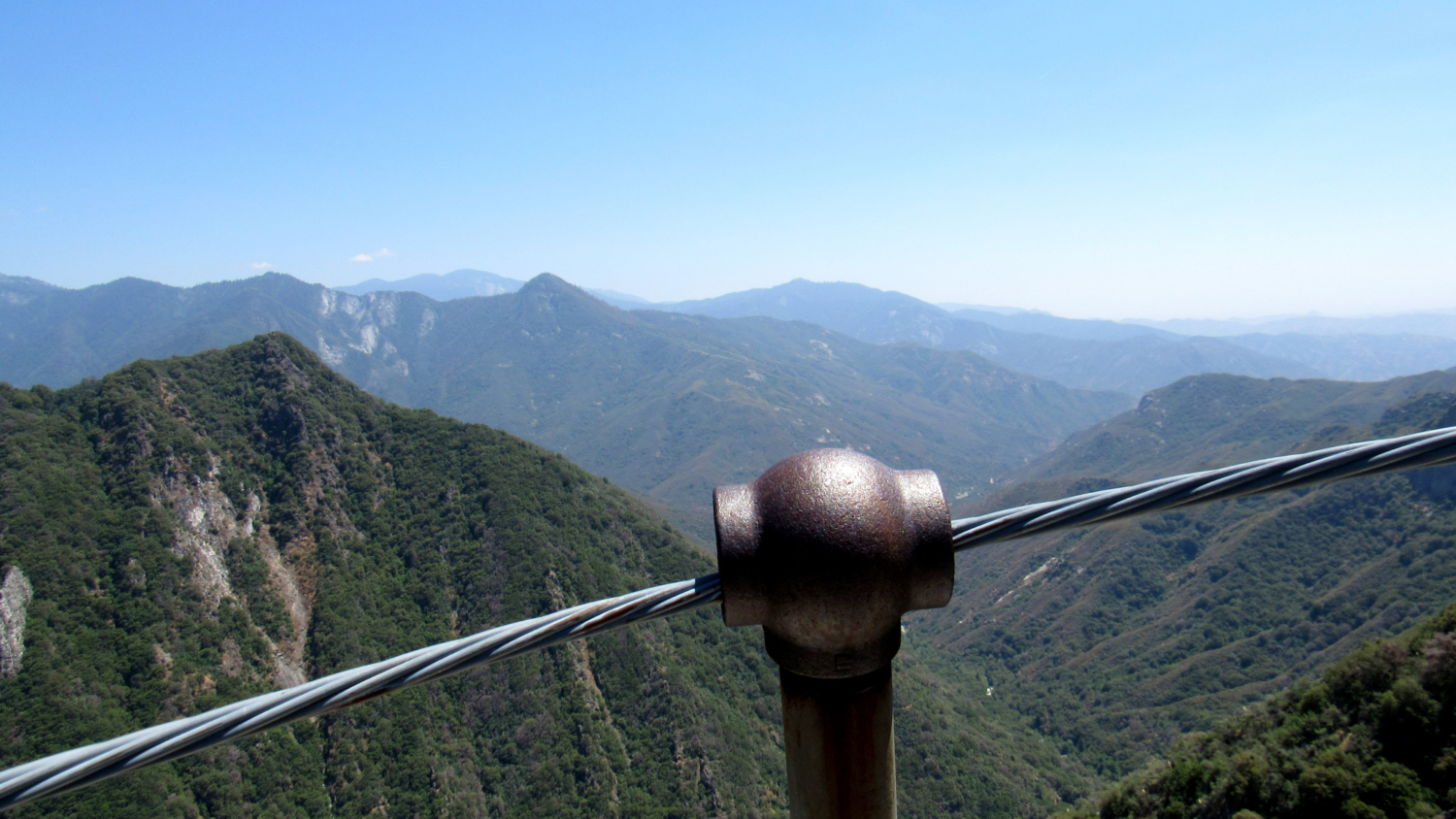
Admiration Point
The Admiration Point Trail drops a down along the northern wall of Deep Canyon, losing elevation at a startling rate. Unfortunately, you will have to regain this elevation on the way back up, which is the primary reason why this route rates a higher difficulty level than it might otherwise. Much of this trail has a neglected, unmaintained air to it, and you will be passing numerous overgrown sections before you reach Admiration Point. At 2.9 miles, the tree cover thins, and you reach an outcrop of grey-white marble.

Marble Falls
Pick your way carefully over the marble downhill to the point. You will know you’re there when you see the steel cables bounding a precipitous outcrop with 1,000’ sheer drops on all sides. If you have any level of acrophobia, this startling drop may give you a heart attack, but if you’re comfortable with such things, you will enjoy a marvelous view into Deep Canyon and across to the western edge of the Giant Forest Plateau culminating at the gleaming dome of Moro Rock. Directly below, the cascades of Marble Falls thunder below, clearly audible even at this distance.

Admiration Point looking south
When you’ve finished your survey of the geography, labor back up to Colony Mill Road, and turn right to make your way back to your car.
Tags: Admiration Point, Colony Mill, Colony Mill Road, Crystal Cave Road, KAweah Colony, Marble Falls, Marble Fork Kaweah River, Sequoia National Park