The Acid War Zone Trail is a short, moderate trail on the northwest coast of Maui that serves as an alternate viewing and access point to the popular Nakalele Blowhole. Along the way, hikers will get some stunning views of the Maui coastline and Molokai, get up close and personal with lots of exposed volcanic rock, and find themselves at a nice little perch to watch the blowhole in action.
First thing’s first — the name of the trail. ‘Acid War Zone’ makes this route sound a LOT more intense than it actually is. The name has no bearing on the trail’s difficulty, and basically is just a colorful description for the visual look of the area of the trail near the blowhole — like it was the wasteland left over from some sort of acid battle. So don’t let the name spook you off this approachable and rewarding hike!
At the trailhead, remember to hide or take any valuables with you. When I hiked this, there was a noticeable amount of shattered glass in this dirt turn-off. This is a relatively short hike, so if you’ve got something in the car, hide it or take it with you if you forgot to leave it wherever you’re staying.

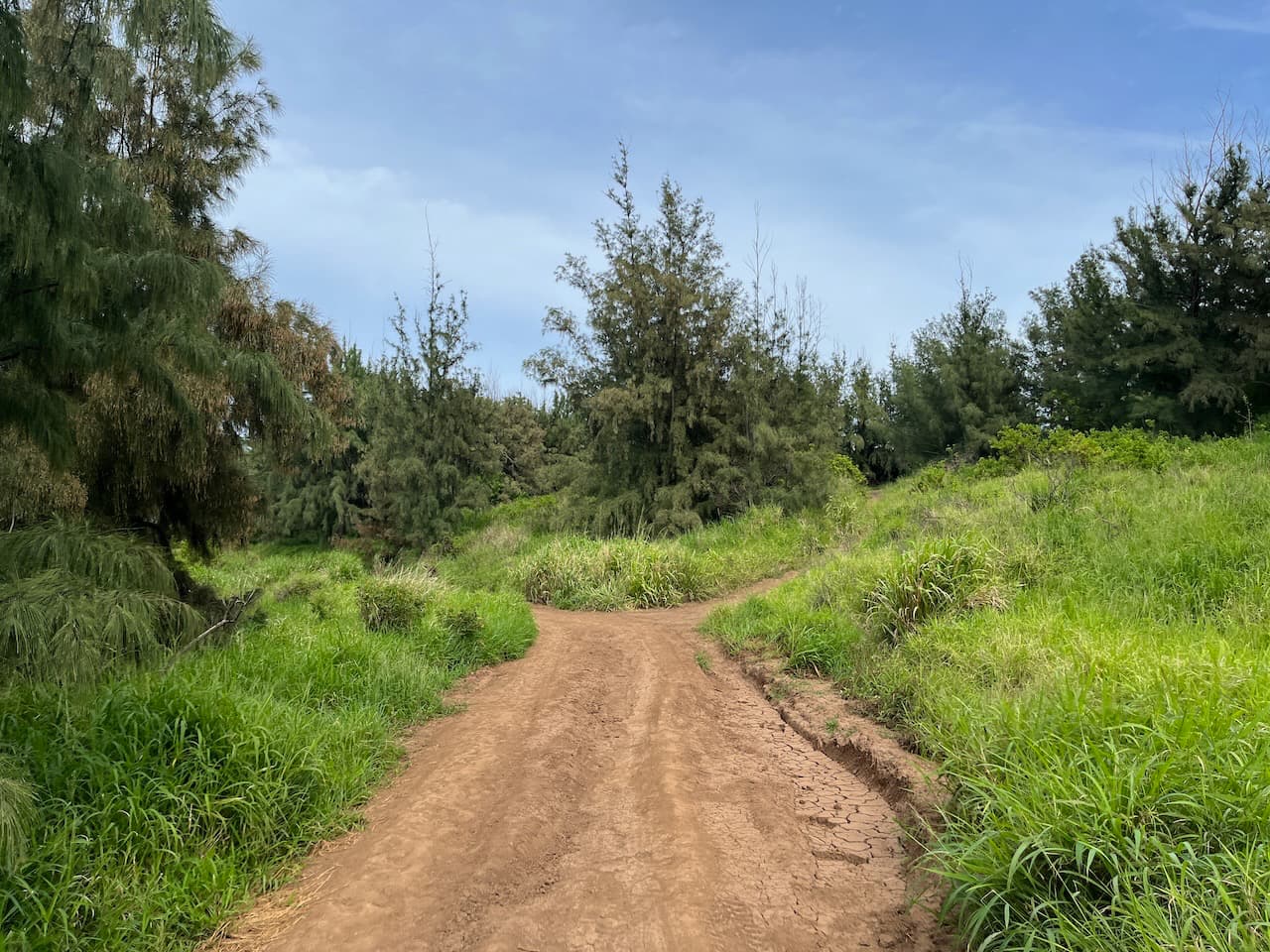
The hike begins on a network of rough dirtbike and AWD roads that were cut into the hillsides apparently without much thought or planning. Try to stick to the routes closest to the shoreline and at 0.1 mile, the trail makes a sharp turn toward the south and into a more forested area.

Follow the wide dirt road and ignore the smaller paths that duck into the trees and just before the 0.2 mile mark, the trail will make another sharp turn and head northeast again.
If it’s rained recently, expect these roads to be muddy. And whether or not they’re wet, keep an eye on where you’re stepping because these roads are very eroded and are riddled with deep tire tracks that might trip you up if you’re too enchanted by the scenery.
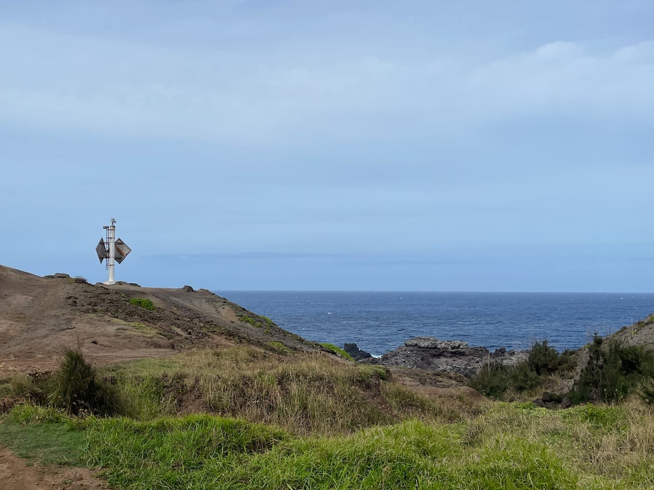
You’ll come out of the trees pretty quickly and soon you’ll spot a strange metallic structure on the edge of the cliff. It kind of looks like one of those spinning black and white things your science teachers might have had on their desks–which I just learned are called Crookes radiometers.

This is actually the Nakalele Lighthouse, and it sits on the northernmost part of the western part of the island of Maui. The original lighthouse was built in 1910 and was a small if somewhat more traditional looking lighthouse. A keeper lived nearby until 1922, when the lighthouse was automated. Today, you can walk up fairly close to the lighthouse but the structure itself is off limits (in case you needed someone to tell you that). It’s owned and operated by the U.S. Coast Guard and the area does have surveillance.

Here is where the trail enters the ‘acid war zone’ area of the hike.
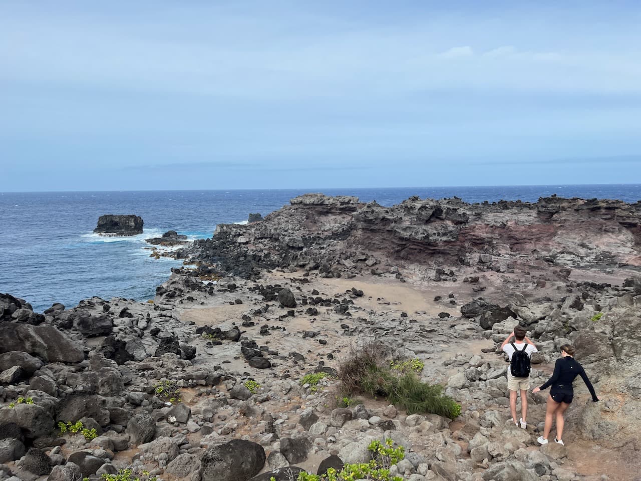
There are a few faint but established routes that head down the old lava flow and continue toward the northeast. The descents are not especially steep or tricky, but keep in mind that the paths may be slippery with small rocks and dust and the surface of the lava flow can be very sharp. If you don’t have grippy shoes or a good sense of balance, be sure to take your time here. And if you did bring kiddos with you, this is an area where you might want to give them some extra attention.

You don’t want to fall on this
All these sharp-rock warnings aside, do remember to stop and soak in the scenery every once in a while, because it is truly stunning.


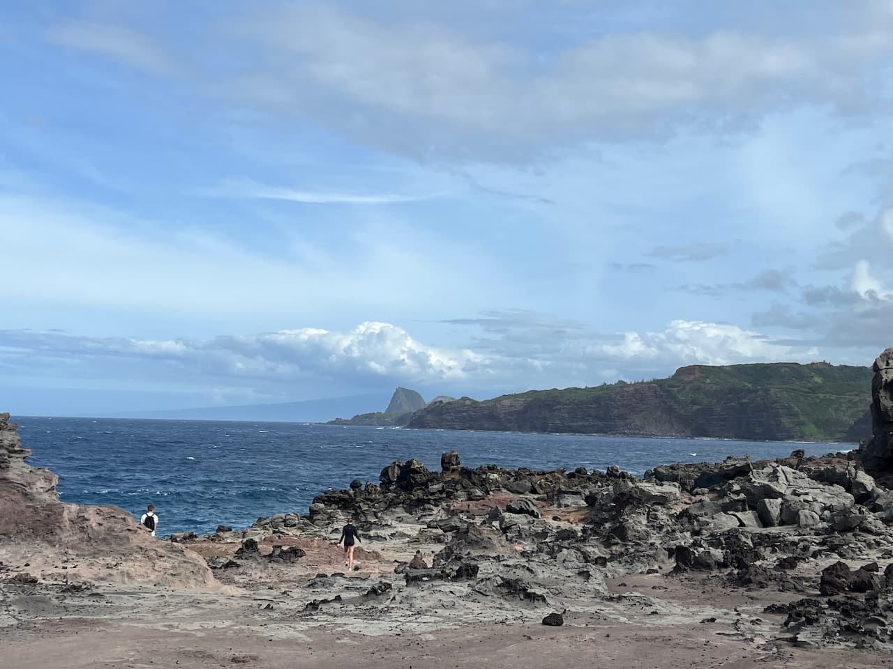
The trail drops a bit in elevation and then makes a turn toward the south, roughly following the shoreline but still a decent distance away from the actual water. Again, there isn’t necessarily an established path here, but there are routes that should be fairly visible if you’re keeping your eyes open.
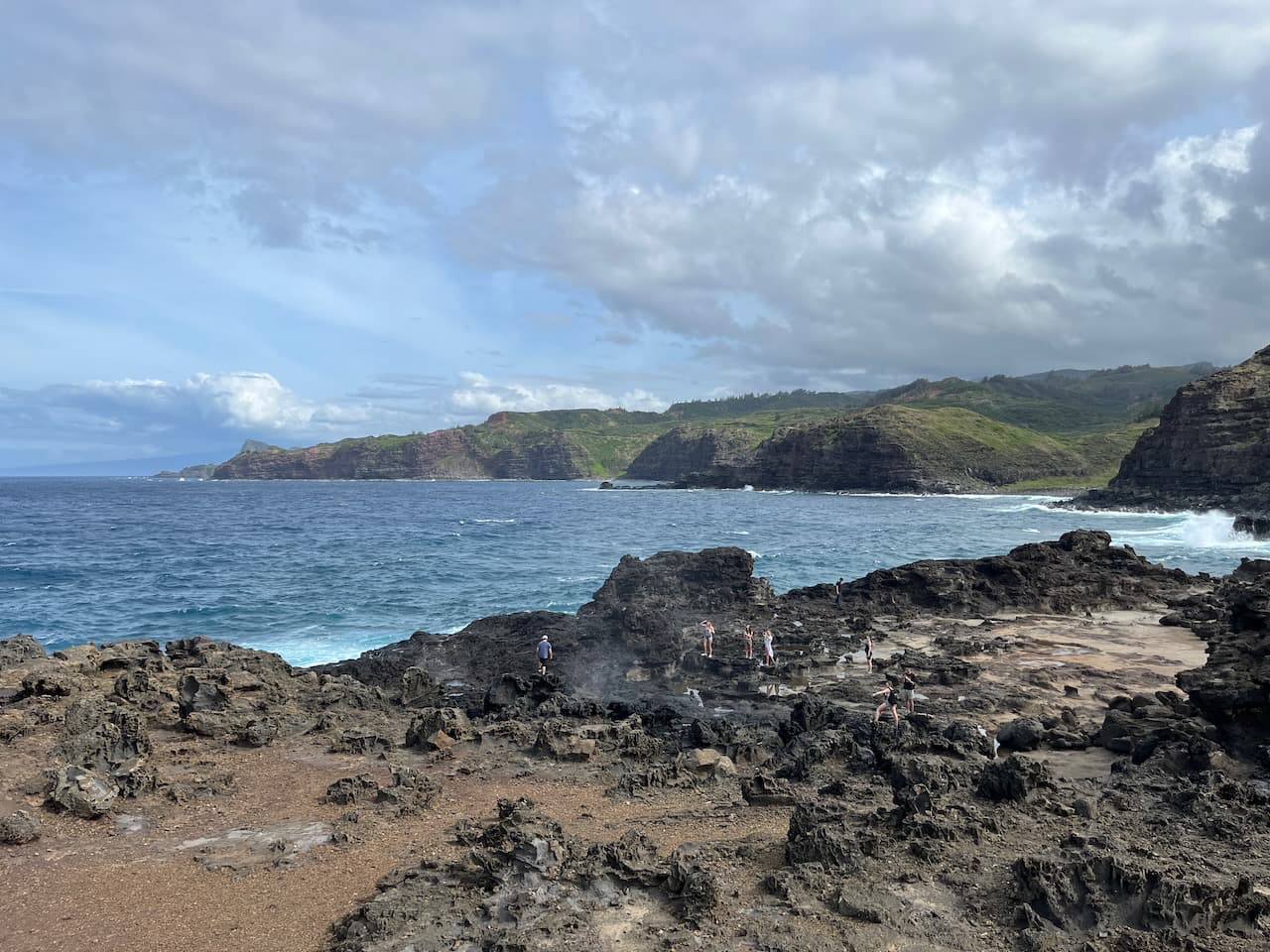
After a few minutes and some careful scrambling, you’ll reach an area that provides a really excellent view of the Nakalele Blowhole itself while still keeping you a safe distance away.

You will note in this picture that there are some people who are pretty dang close to the Nakalele Blowhole.
There are no guardrails here and nothing keeping people away, but if you do want to get a bit closer you should know that the water that shoots out of the blowhole can be unpredictable and can also strike with a good amount of force. It can reach heights over 50 feet. If someone were to get too close and fall or get knocked into the blowhole, well, you can pretty much kiss that person goodbye.
Another thing to keep a watch out for here are large waves crashing over the cliffs from the shoreline. In the photo above, the three women were posing up near where the woman in white is for some time, snapping selfies for several minutes. Without warning, a huge wave crashed behind them and gave them all a good soaking. And if that’s not enough, there are plants and animals that live near the blowhole, including some pretty active fish and crabs. Make sure to leave them alone if you’re getting close.
Find yourself a good seat and spend some time watching the blowhole in action. It’s a very beautiful and meditative place.
When you’re done enjoying the Nakalele Blowhole, head back the way you came.