It’s no secret that the East Fork of the San Gabriel River is both one of the most popular areas in the San Gabriel Mountains as well as one most in need of some TLC. The perennially overused and under-maintained region along East Fork Road and the Oaks Picnic Area are frequently cited by critics of the Forest Service as proof positive that the newly designated Monument is a non-starter. But at a meeting at the Eaton Canyon Nature Center this week, citizens saw some of the first plans to improve the region from a partnership that has been in the works since 2006.
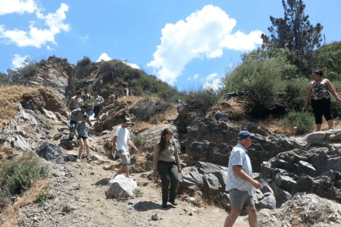
Rob Romanek, the Project Manager for the Watershed Conservation Authority, walked the audience through the early stages of his improvement project, which studied the lower area of the East Fork from roughly east of Camp Williams to Heaton Flats just past the East Fork trailhead. This first round of the project is focused on the lower canyon – the day-use area used primarily for bathing and picnicking. The study aimed to address three major problems:
- Traffic congestion on East Fork Road
- Poor access routes to the San Gabriel River
- Excessive trash and litter
In the summers of 2013 and 2014, during peak usage, the project commissioned a study and outreach program using local Conservation Corps members, who set up informational booths along the river for adults and children and patrolled the 2.5 mile stretch of the river doing trash pickup and distributing bags to users. At the same time, researchers from California State University San Marcos and Goshen College assessed that outreach and surveyed the users for demographic data.
Unsurprisingly, the visitors to the “Upper Canyon” area were primarily hikers who arrived early, usually left by the afternoon, traveled alone or in a small group, and came from pretty much all over the Los Angeles area.
The “Lower Canyon” users however were far more homogenous. They were 93% Hispanic / Latino / Mexican, primarily used the region for relaxing and spending time with their group, and 89% were there in a group with their friends and family. They were also concentrated in generally lower-income areas of the L.A. region.
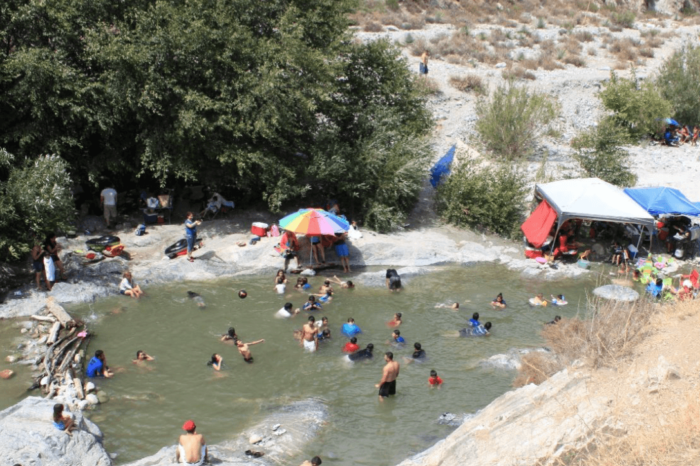
Although these two groups may seem like they’re enjoying the East Fork in vastly different ways, the end result is surprisingly similar. When asked to rate their interconnectedness with nature while at the East Fork, every group in the Lower Canyon overwhelmingly chose the closest relationship option.
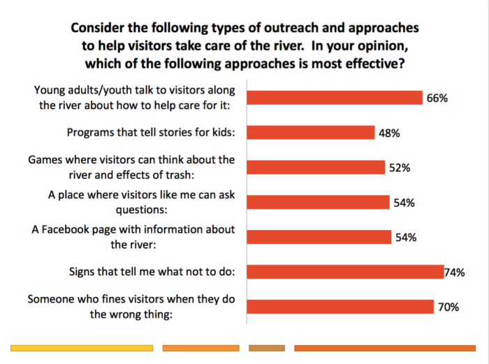
Many hikers have criticized these day-users for destructive behavior along the East Fork, and that is a fair criticism. Many users leave trash in or near the river, prepare food near the water, and build rock dams and divert the river’s flow — all things that decrease water quality and endanger the habitat of the endangered Santa Ana Sucker. Interestingly enough, the outreach program found that most users were not aware they were doing anything wrong by engaging in those activities … and in numbers that likely mirror the opinions of other users in the region, more than 70% of lower canyon users thought signs illustrating prohibited behavior and rangers enforcing those prohibited activities with fines were the most effective ways of getting people to take care of the river.
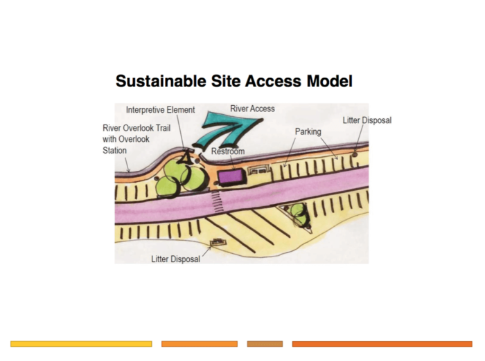
a rough guideline for access points along the river
With all this information in mind, the group set out to completely redesign the way people approach and use the river in this region, using a basic access model that increases interpretive elements (and signs), takes parking off the main road, increases visibility of restrooms and trash disposal areas, and limits the number of ways people can get to the river from the parking areas (the preliminary study found 67 use trails to the river in just 2.5 miles!)
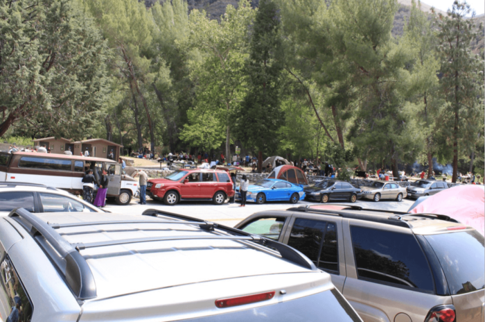
one of the 67 unofficial access points that currently exist along East Fork Road
Other improvements include increased parking near the East Fork trailhead (!), road grades and designs that will make it easier for high-occupancy shuttles to service the region, and potentially some new trails as well. All plans are also aiming to phase out non-native “plantation” plantings and replace them with natives.
Additional outreach and research will be done in the upper canyon, but the groups want to make sure that signage in that area effectively conveys wilderness ethics and the Leave No Trace principles to make it clear that part of the canyon should be treated differently than the lower area.
The finalized proposals will be presented later this year and the public will get a chance to have input. We will keep you posted as meetings are announced.
All images are courtesy Rob Romanek, from his initial presentation on the plans for the canyon.
Tags: east fork, recreation plan, restoration plan, san gabriel river