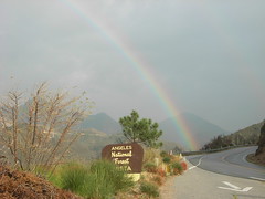
 In what I will assume is an early birthday present to me, last night the Angeles National Forest officially announced they would re-open about half of the closed areas in the Station Fire Recovery Zone.
Starting on Monday, May 16th, approximately 98,000 acres of land in the Angeles National Forest will once again be available for public use. The area includes over 100 miles of hiking trails and popular campgrounds, including Switzer’s Camp, the Silver Moccasin Trail, Sunset Ridge Trail, and the entire San Gabriel Wilderness area. Just in time for the approaching thru-hikers, the Pacific Crest Trail will also re-open, albeit with a few minor reroutes.
The burned area that remains closed is mostly within Big Tujunga Canyon, and will remain closed until further notice. The Angeles Crest Highway is still closed for repairs between La Canada Flintridge and the Clear Creek Ranger Station as well.
In a long-overdue and well-implemented feature, the ANF web site has FINALLY posted a high-resolution official map of the closure areas, as well. While the download links are currently not working, the online map is zoomable and easy to read – although several camps and trails are still on the closure boundary. I spoke with a Forest Service rep this morning who told me they would have a more detailed list of opened areas early next week – so don’t start planning that trip to Switzer’s Falls just yet.
This is a truly exciting event for the Angeles National Forest. I congratulate all of the Forest Service employees and dedicated volunteers whose hard work has enabled the ANF to re-open much, much earlier than I ever thought it would.
Tags: Angeles National Forest, closure areas, Los Angeles, re-opening, station fire