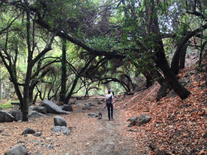
L.A. is not your ordinary metropolis. Yes, it has a thriving downtown that is an undeniable concrete jungle. But surrounding L.A.’s teeming urban core are some of the most picturesque naturescapes in the country. What makes L.A. such an extraordinary spot for the outdoors lover is the fact that so many of these wilderness areas are easily accessible from the well-developed infrastructure of our urban lives.
Modern Hiker and national real estate brokerage Redfin teamed up to find out which L.A. neighborhoods offer the best hiking opportunities. We looked at neighborhoods in L.A. that are no more than 50 miles from downtown, have at least 10,000 residents and offer some of the best hiking in the Southland. The profiles below give a rundown of the hiking culture in each town, a list of the top trails in the area along with their distance from the center of town and some key real estate market data from Redfin.
If you live in L.A. or are thinking about moving there and you want hiking to be at the center of your lifestyle, these are the neighborhoods for you.
1. PASADENA
While it’s not necessarily an outdoorsy city, Pasadena was a reader favorite for its proximity to the Angeles National Forest and San Gabriel Mountains National Monument, easy transit options and the ability to access both the front range foothills of the San Gabriels and the deeper interior via the Angeles Crest Highway.
The city’s borders snake north into the mountains, along the Arroyo Seco and into popular Eaton Canyon, which features one of the region’s most accessible waterfalls. Many of the best hikes in the San Gabriel Mountains National Monument are just a short drive away, either north on the Angeles Crest or through Altadena, or east on the Foothill Freeway.
Pasadena tops our list of best neighborhoods for urban hikers mostly due to the three ‘Ls’ of real estate: location, location, location. It is, in fact, a kind of ultimate town to live in if you’re into the outdoors since in addition to having its own trails, it is also nestled between two other locations on our list: Glendale and Sierra Madre.
Pasadena is also one of the most livable cities on our roster. While you could easily drop a couple million on real estate here, there are also more modest homes that are much more affordable. Since Pasadena is pretty spread out, its Walk Score isn’t the highest. But it has a lot of flat land in the foothills so biking is a viable alternative for local transportation. Of course, downtown is just a short drive down the 110 freeway or ride on the Gold Line, or head north on the 210 and you’re in Castaic in moments.
Notable Trails
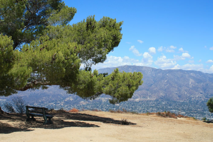
Eaton Canyon (4.8 miles from Pasadena)
Echo Mountain (4.8 miles)
Bear Canyon and Switzer Falls (16.2 miles)
Josephine Peak (15.2 miles)

Eaton Canyon Falls
Median Sale Price: $662,000
Homes for Sale as of Nov. ‘14: 327
Average Number of Offers: 6.9
Walk Score: 62
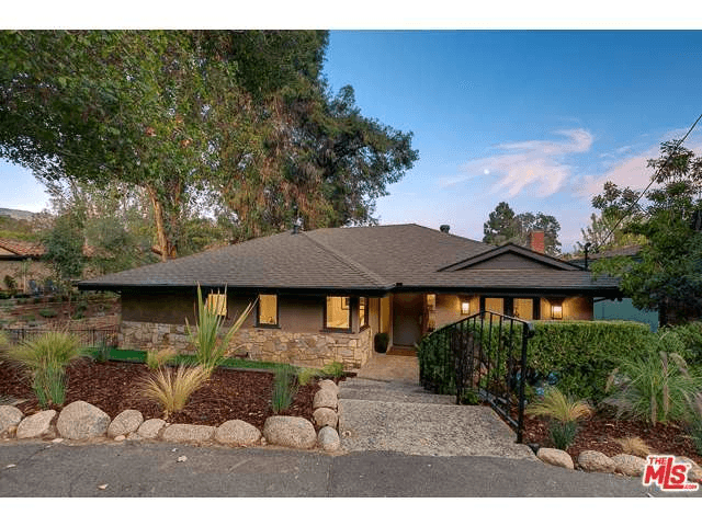
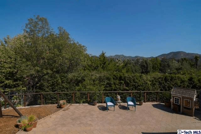
Hiker’s Dream Home: 1440 Arroyo View Dr. is a midcentury Pasadena tree house. Located in the northwest region of Pasadena, this home is a stone’s throw from the San Gabriels and just minutes from the 210 freeway. Check out the outdoor reading nook perched among the trees off one of the bedrooms.
2. SIERRA MADRE
A significantly smaller city than others on the list, the hamlet of Sierra Madre has a profound connection with the history of the San Gabriel Mountains, from the Tongva People through the historic mountain resorts built and operated in the so-called Golden Age of Hiking. Remnants of that age still stand here, from the historic Mount Wilson Trail (one of the first popular hiking destinations for Angelenos and the home of the 100-plus-year-old Mount Wilson Trail Race) to the cabins of nearby Santa Anita Canyon or the old foundations above Bailey Canyon.
Sierra Madre was the first town in Southern California to establish its own wilderness preserve and that outdoorsy spirit perseveres here alongside significant small-town charm. Plus it’s just a quick trip to neighboring cities for even more adventure in the foothills.
Due to Sierra Madre’s small size there are relatively few homes for sale here at any given time. That plus its desirable location and charming Craftsman and ranch-style homes add up to a very competitive market. The real draw to this neighborhood for the urban hiker is its high Walk Score of 79. Living in Sierra Madre is truly a hiker’s dream since it feels very remote, yet literally everything you need is located in its historic old town. Hikers here will pay the price for proximity to modern luxuries and world-class trails, though. The median price here is nearly twice that of the L.A. metro as a whole.
Notable Trails
Jones Peak via Bailey Canyon (1.1 miles from Sierra Madre)
Old Mount Wilson Trail (1.3 miles)
Santa Anita Canyon (5.1 miles)
Winter Creek Trails (5.1 miles)
Monrovia Canyon Falls (6.2 miles)
Monrovia Canyon
Sierra Madre Real Estate Profile
Median Sale Price: $813,000
Homes for Sale as of Nov. ‘14: 25
Average Number of Offers: 2.5
Walk Score: 79 (Very Walkable)
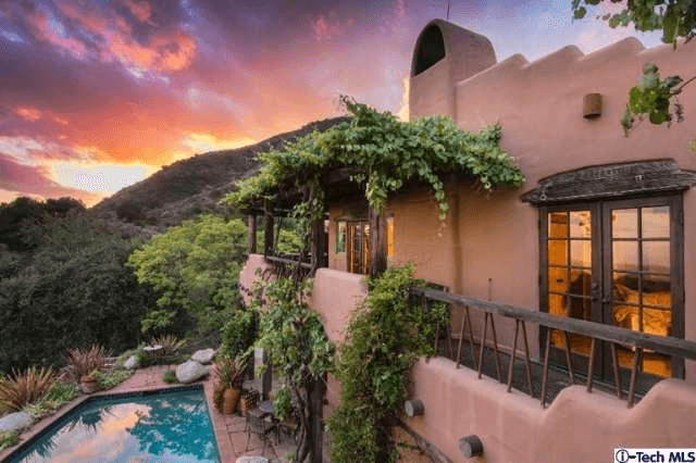
Hiker’s Dream Home: 715 Oak Crest Dr. has everything you think of when you imagine the perfect Sierra Madre homestead: rugged landscaping, Spanish-style architecture, exposed wooden beams, handcrafted tile and proximity to the some of the best trails in So Cal. This one is perched on a hill so you may not be able to take advantage of Sierra Madre’s great Walk Score, but check out the view.
3. LOS FELIZ
Los Feliz (and neighboring Thai Town) is nestled right up against the southern entrances to Griffith Park, the second largest city park in California and one of the largest in the country. The park itself is full of hiking opportunities at all levels, from easy morning strolls to challenging climbs.
The best hikes include several different routes to the notable (and gorgeous) Griffith Park Observatory, hidden-in-plain-sight peaks that few seem to visit, Mount Hollywood and Mount Lee, home of the famous Hollywood Sign. On weekends, a shuttle runs through the neighborhood and will drop hikers off inside the park and at the Observatory itself.
It now costs nearly $1 million to buy a home in Los Feliz. But if you’re an avid hiker who also works in nearby Tinseltown or in downtown L.A., having Griffith Park in your backyard may be worth the premium. Los Feliz also boasts a pretty darn respectable Walk Score, meaning you can hike to brunch after you hike to the observatory.
Notable Trails
Griffith Park Observatory (West Route, East Route, and Firebreak Trail) (2.3 or 1.2 miles)
Berlin Forest (2.3 miles)
Glendale Peak (1.5 miles)
Mount Hollywood (1.5 miles)
Mount Lee (Hollywood Sign) (3.2 miles)
Beacon Hill (1.6 miles)
View from Beacon Hill
Median Sale Price: $938,000
Homes for Sale as of Nov. ‘14: 38
Average Number of Offers: 1.5
Walk Score: 74 (Very Walkable)
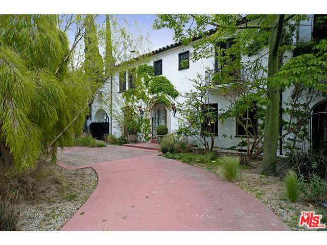
Hiker’s Dream Home: 4962 Los Feliz Blvd. is located about one mile from the entrance to the West Griffith Observatory Trail. It is also just a couple blocks from the cafes on Hillhurst Ave. Best of all, when you’re on the top floor it feels like you are already in Griffith Park.
4. GLENDALE
For Angelenos who live on the east side, there are three great mountain ranges to hike in – The Verdugos, the San Gabriels and the eastern end of the Santa Monicas in Griffith Park. Glendale borders all three regions, has a lovely botanic garden and is also more bike-friendly than most of L.A. (although the city is making slow strides).
In Griffith Park, Glendale is close to the Los Angeles Zoo, the Griffith Park Equestrian Center, and the less-visited trails on the north end of the park. Glendale also splits the Verdugo Mountains with Burbank and the Tujunga neighborhood of Los Angeles, where hikers can access an impressive and relatively quiet trail network; and the northern boundary of the city juts into the San Gabriel Mountains’ Angeles National Forest, where peak-baggers can climb to the peak of Mount Lukens – the tallest piece of land in the city of Los Angeles.
With Glendale we enter the realm of practicality. If you work in the studios of Burbank or in downtown and you can’t afford the seven-figure dream home, this is your ‘hood. Glendale is surrounded on all sides by endless hiking opportunities and has the most modestly priced homes on the list. In a city this size there are plenty of different styles of homes to choose from at various price points. Notice the Walk Score leaves a little to be desired, but this is part of the trade-off for less expensive real estate. Glendale is somewhat suburban, but much more affordable.
Notable Trails
Griffith Park’s Northside Loop (4.4 miles)
Bee Rock and the Old Los Angeles Zoo (4.2 miles)
Beaudry Loop (5 miles)
Verdugo Mountain via the Vital Link Trail (7.3 miles)
Mount Lukens via Haines Canyon (12.5 miles)
Mount Lukens via Stone Canyon (21.9 miles)
Looking north at the San Gabriels from the Vital Link Trail
Median Sale Price: $603,000
Homes for Sale as of Nov. ‘14: 217
Average Number of Offers: 2
Walk Score: 66 (Somewhat Walkable)
Hiker’s Dream Home: 1321 Imperial Dr. is located right in the middle of Glendale and surrounded on all sides by incredible hiking opportunities. It’s traditional architecture and open floor plan really make it a timeless home. Our favorite part is that the backyard looks out on Royal Canyon.
5. PACIFIC PALISADES
Just north of Santa Monica on the Pacific Coast, the Pacific Palisades neighborhood of Los Angeles hasn’t always had a great relationship with the environment — the Palisades Highlands housing development is a painful scar of sprawl that cuts into the Santa Monica Mountains — but this mostly residential area is close to many exemplary hiking trails.
Both the Los Liones Trail and popular Temescal Canyon are right at the neighborhood’s doorstep, while nearby Rustic Canyon Park offers an exceedingly weird glimpse into L.A.’s history (the area contains the ruins of a compound planned as Hitler’s California getaway by a group of Nazi sympathizers). With a bit of a drive (or hike!), you can also enter Topanga State Park or start on the hopefully soon-to-be-completed 65 mile Backbone Trail at Will Rogers State Park.
We had to include a west-side ‘hood with access to the many cherished trails in Topanga and the Santa Monica Mountains. While most folks can’t afford to live here, if you could make it happen the Palisades would be the place to do it. The median home price is high, but not as high as Malibu. The Walk Score is low, but Malibu is so remote it doesn’t even have a Walk Score! So in terms of a hiker’s paradise on the west side of L.A., Pacific Palisades puts you in the vicinity of some amazing hikes, but it’ll cost you.
Notable Trails
Los Liones Trail to Parker Mesa (3.8 miles)
Temescal Canyon to Skull Rock (2.2 miles)
Murphy Ranch (2.5 miles)
Eagle Rock and Temescal Peak (10.3 miles)
Red Rock Canyon (11.5 miles)
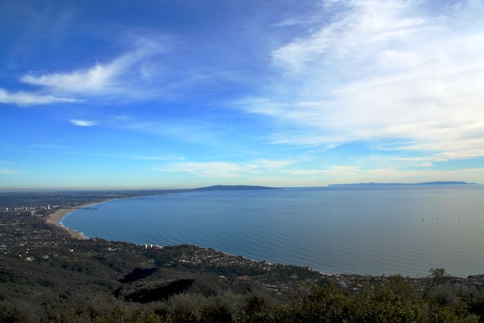
Santa Monica Bay from the Los Liones Trail
Pacific Palisades Real Estate Profile
Median Sale Price: $3.4 million
Homes for Sale as of Nov. ‘14: 86
Average Number of Offers: 5
Walk Score: 32 (car dependent)
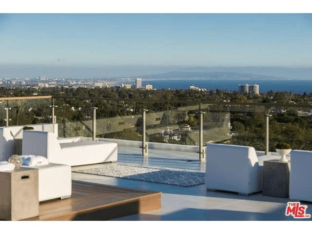
Hiker’s Dream Home: 15301 Whitfield Ave. Okay, so this place is going for nearly $7 million and living here would feel more like living in a fancy hotel than a rustic getaway, but we can dream. Plus, it’s literally steps from the Temescal Canyon hike to Skull Rock.
Featured image Photo by Chris Goldberg
Tags: Los Angeles, neighborhoods for hikers, outdoors, real estate