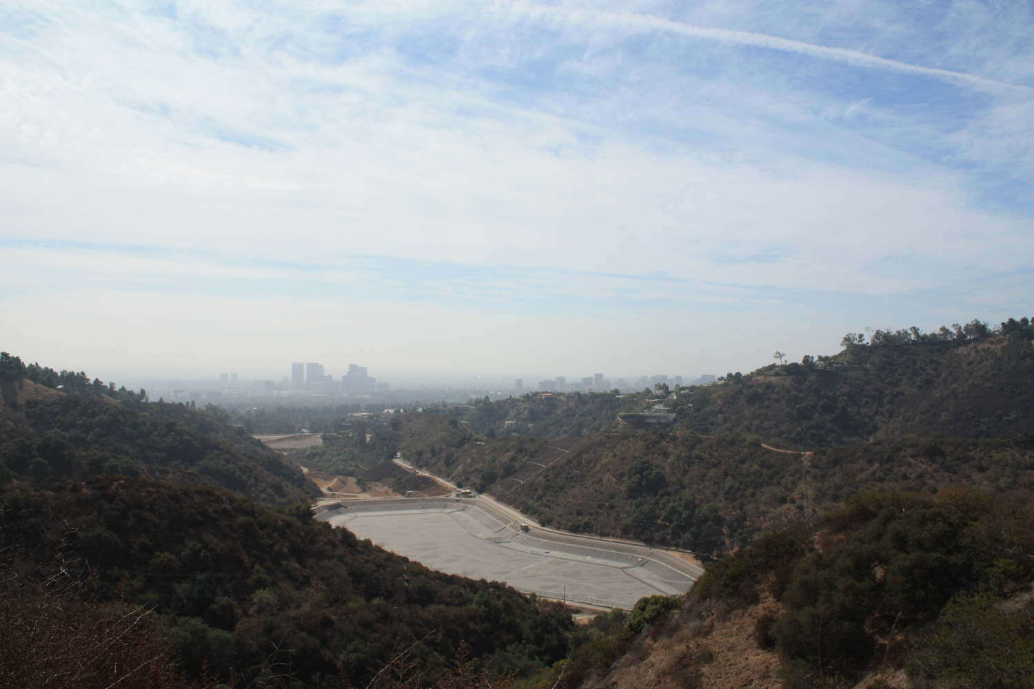
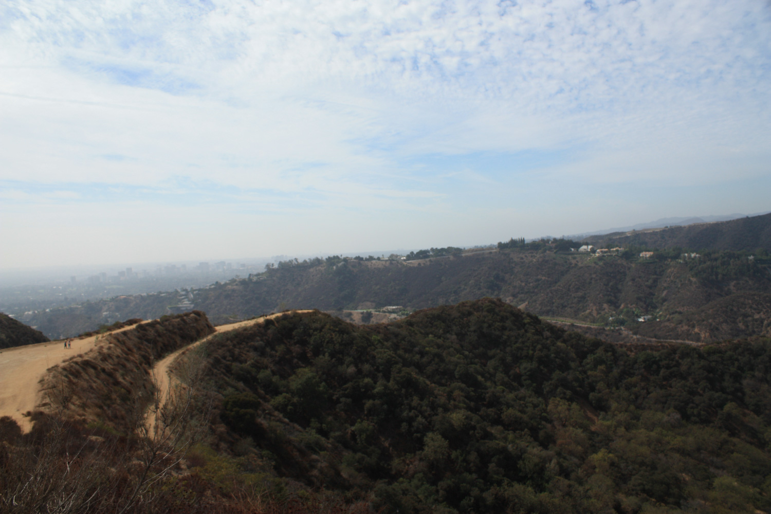
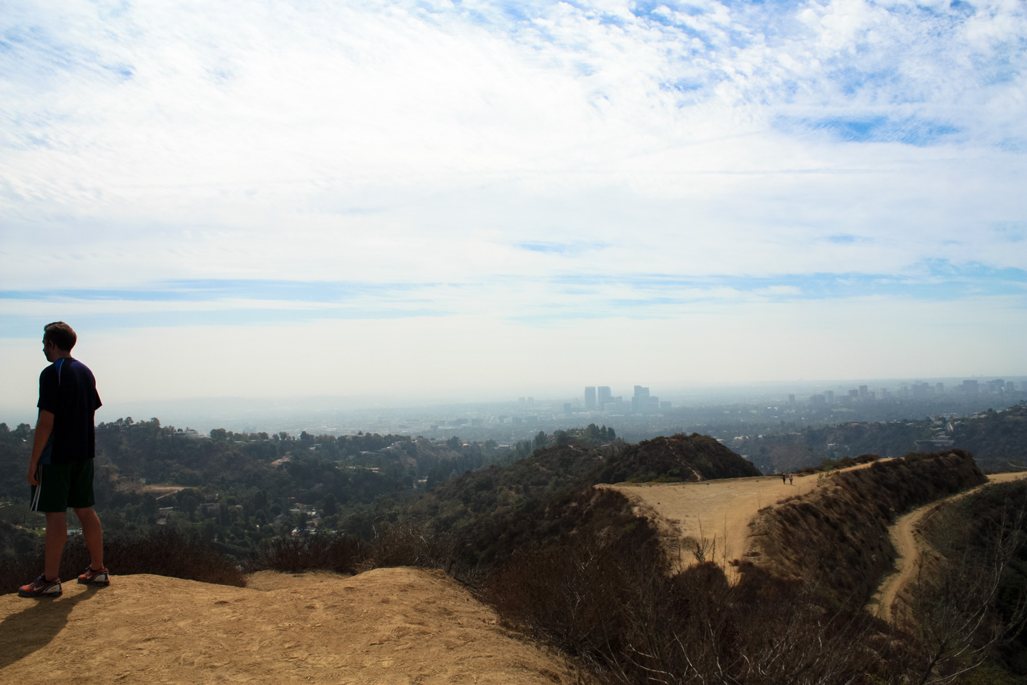
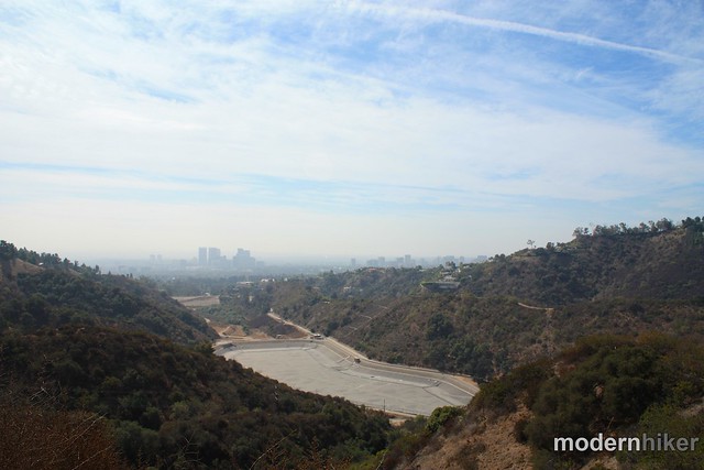
The Hastain Trail hike in Franklin Canyon Park takes you on a short loop in the southern half of the park on a rugged, hidden little canyon just outside of Beverly Hills. This is a decent workout with some really lovely canyon scenery and views of Beverly Hills and Century City – and not too crowded, either!
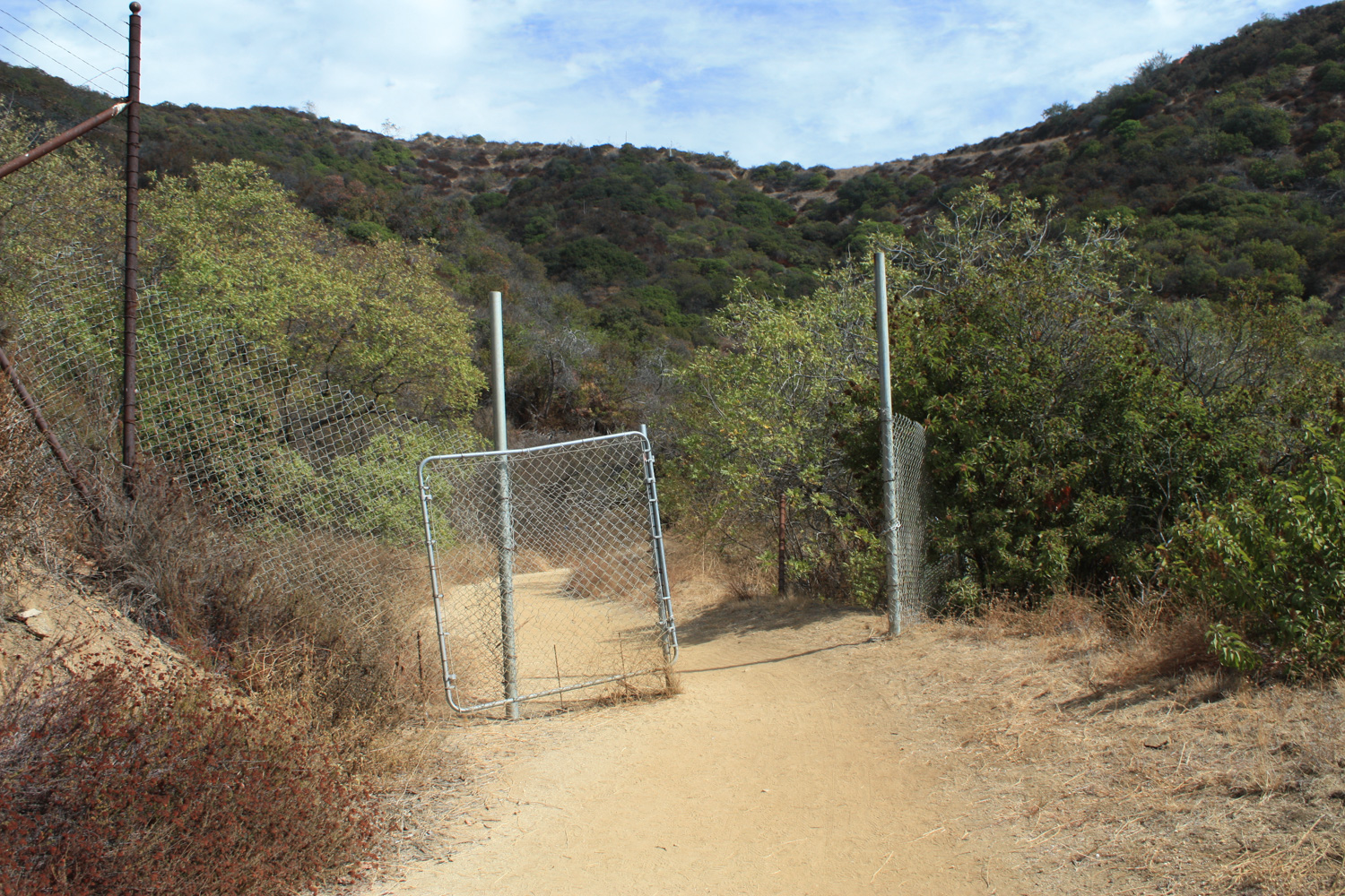
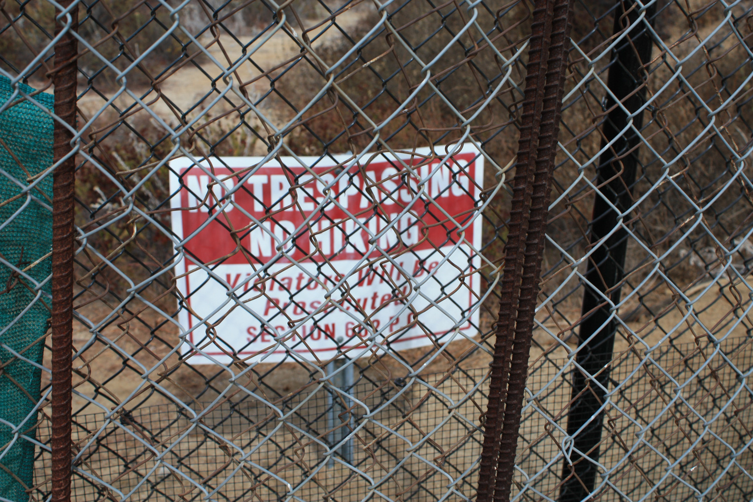
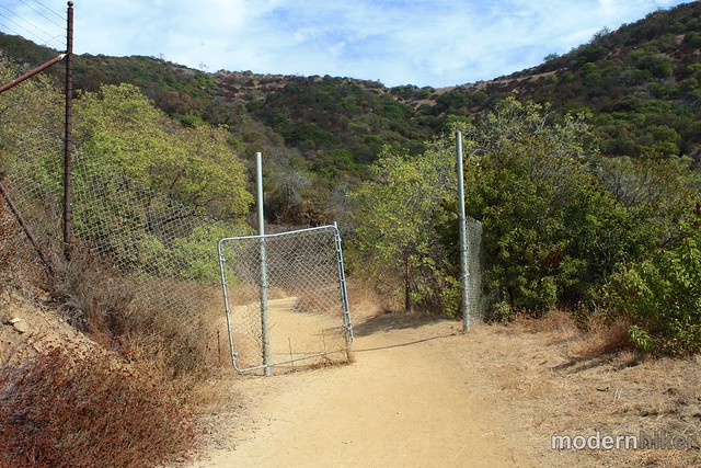
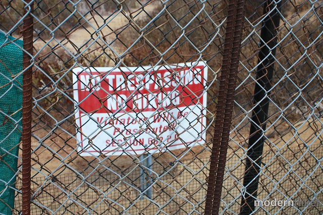
Note: Franklin Canyon Park is currently involved in an ongoing dispute with a private land developer on the eastern edge of the park, who has closed off access to hikers in the past. A series of decisions has alternately favored both sides, so check with the park or be prepared to potentially be unable to complete the route as described here.
Initially, I wanted to do a full loop hike of the entire park, but unfortunately I found the map situation to be a little lacking. The map shown on the park’s official web site (PDF) is not terrifically detailed and also differs quite a bit from the map posted on an information sign near the Upper Reservoir and Google Maps of the area – not to mention the actual posted trail names on signs inside the park. So – I’m not entirely sure I did what can be considered the ‘classic’ Hastain Loop – but it was still a fun little trail.
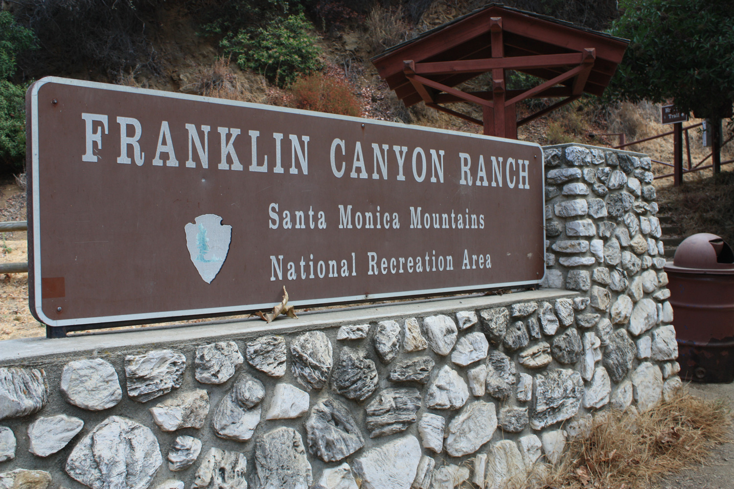
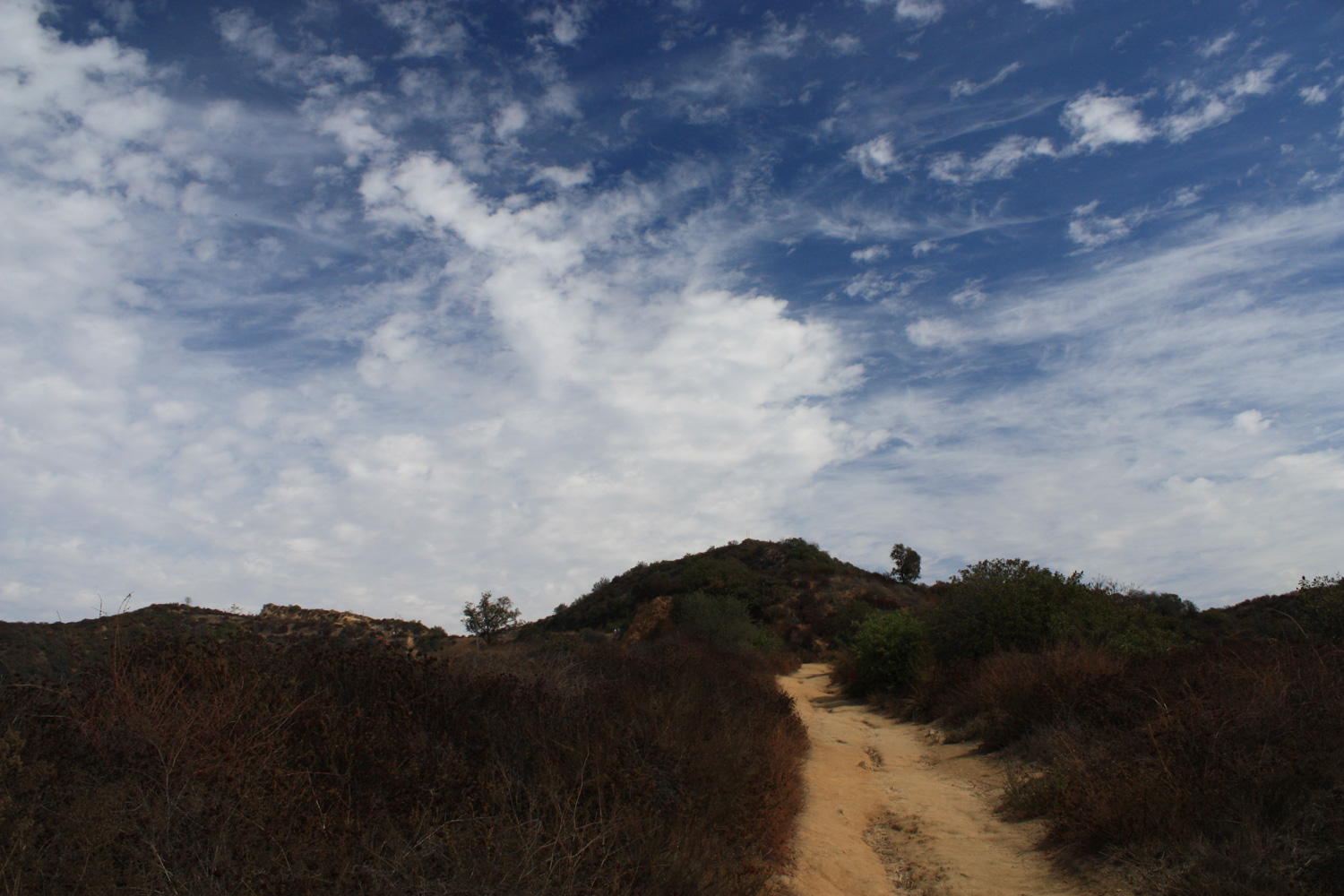
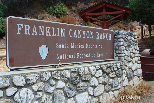
The trailhead is very easy to spot – it’s near a large Franklin Canyon Ranch sign, a staircase, information board, and trash can. There’s a small parking area near the trailhead but also plenty of room to park on the opposite side of the street if it’s full.
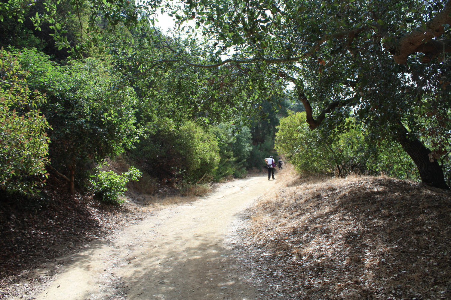
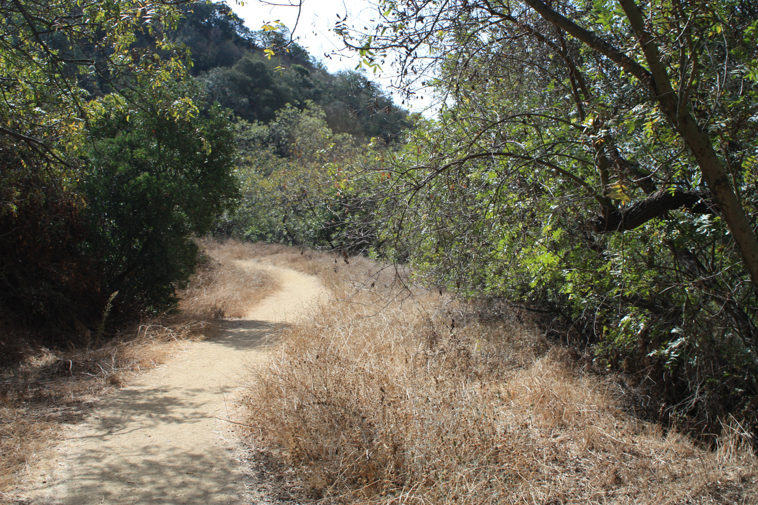
Lace up your boots, grab your water bottle, and start up the fire road Hastain Trail (which may, depending on what map you’re looking at, ACTUALLY be the Discovery Trail).
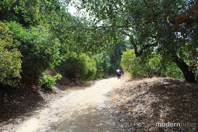

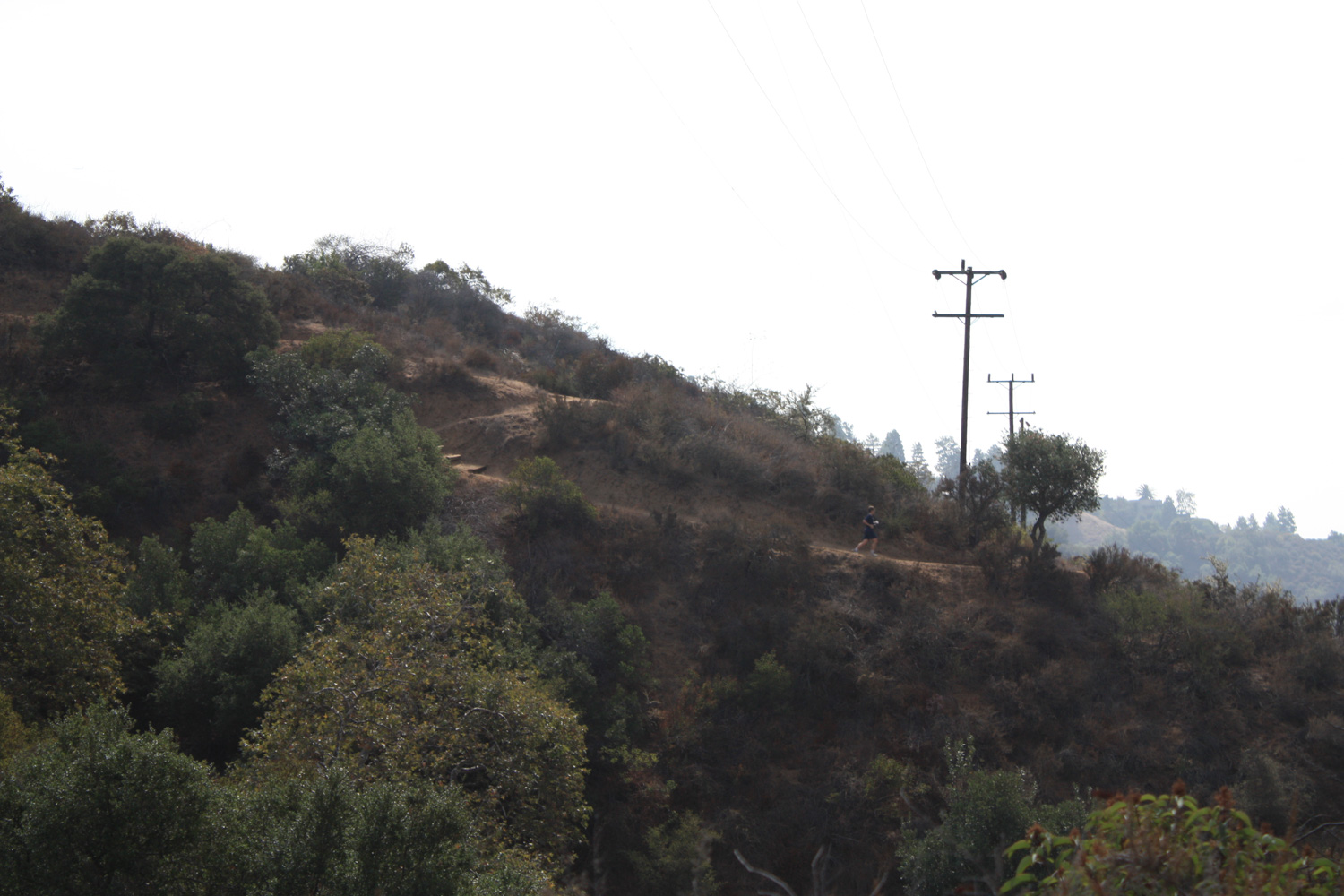
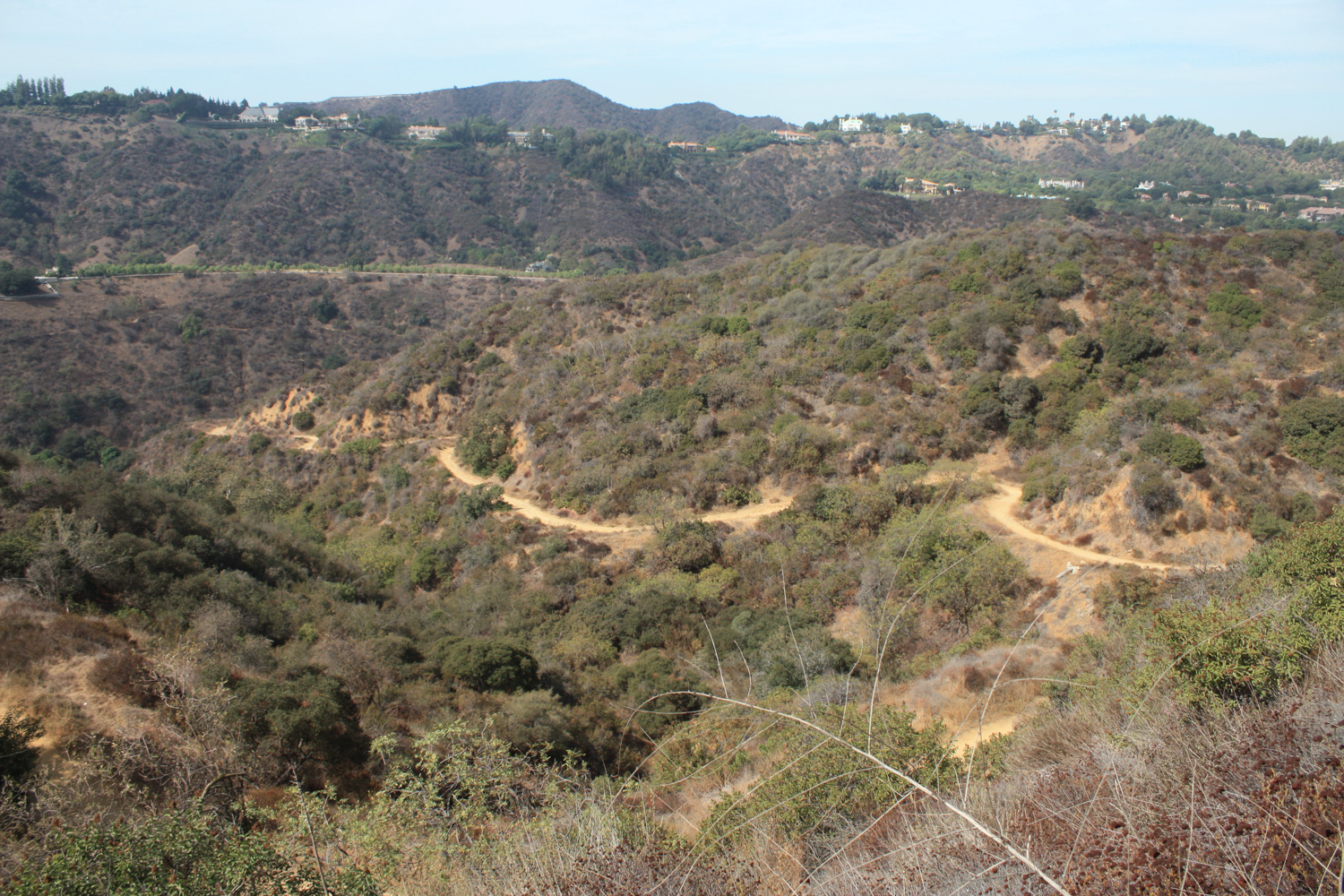
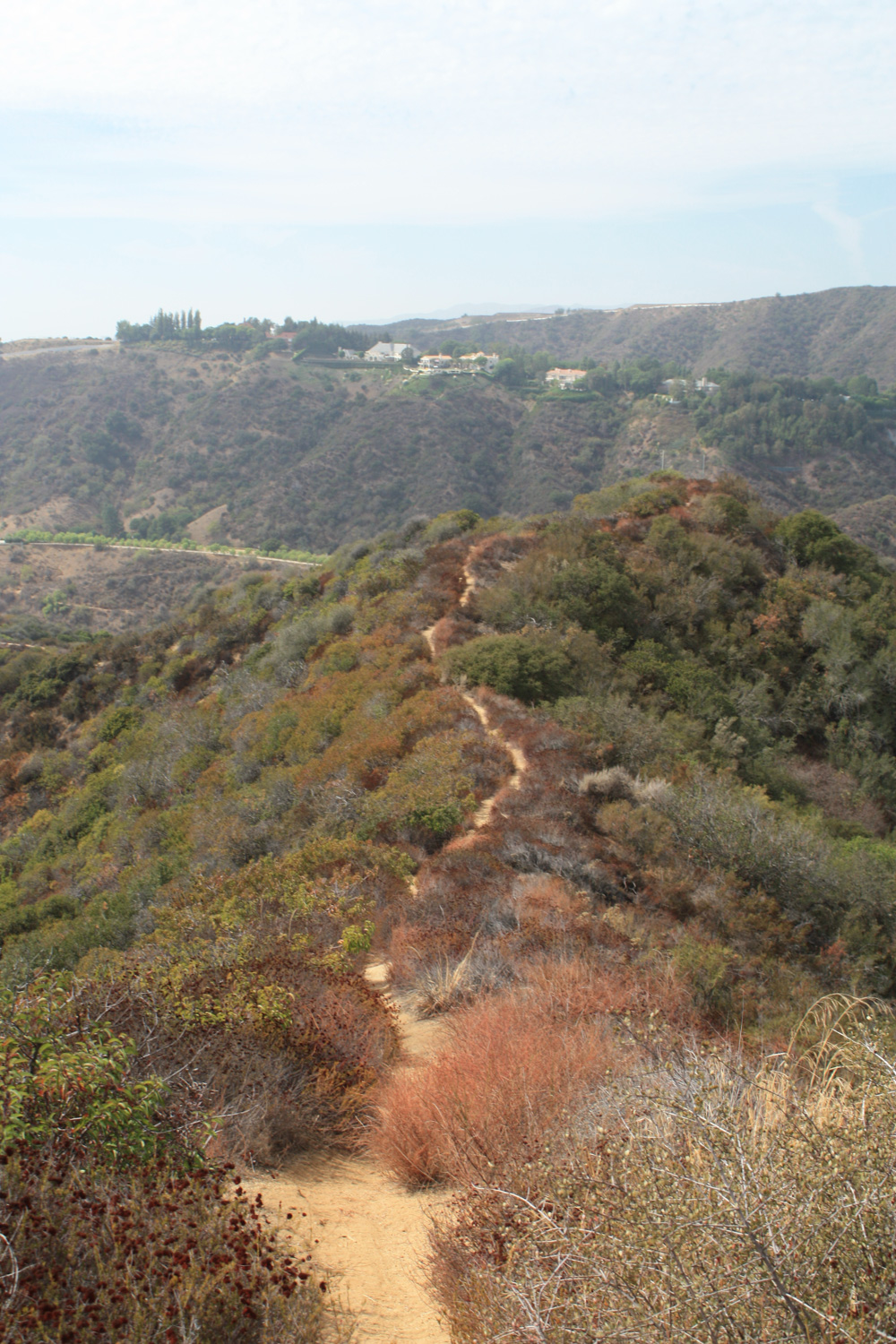
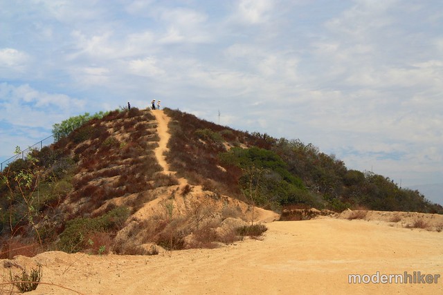
The first part of the trail is pretty easy – you only gain about 80 feet in the first quarter-mile. At that point, you get a small break, but from then on out it’s a steady 550 foot ascent over the next 1.15 miles. Nothing too crazy, but enough to make you feel like you’re getting a decent workout – especially if it’s hot outside.
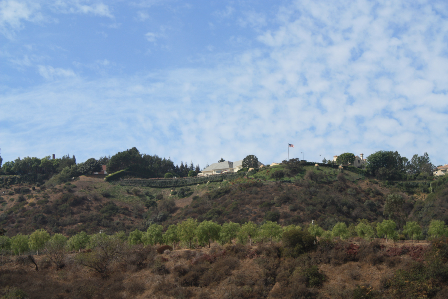
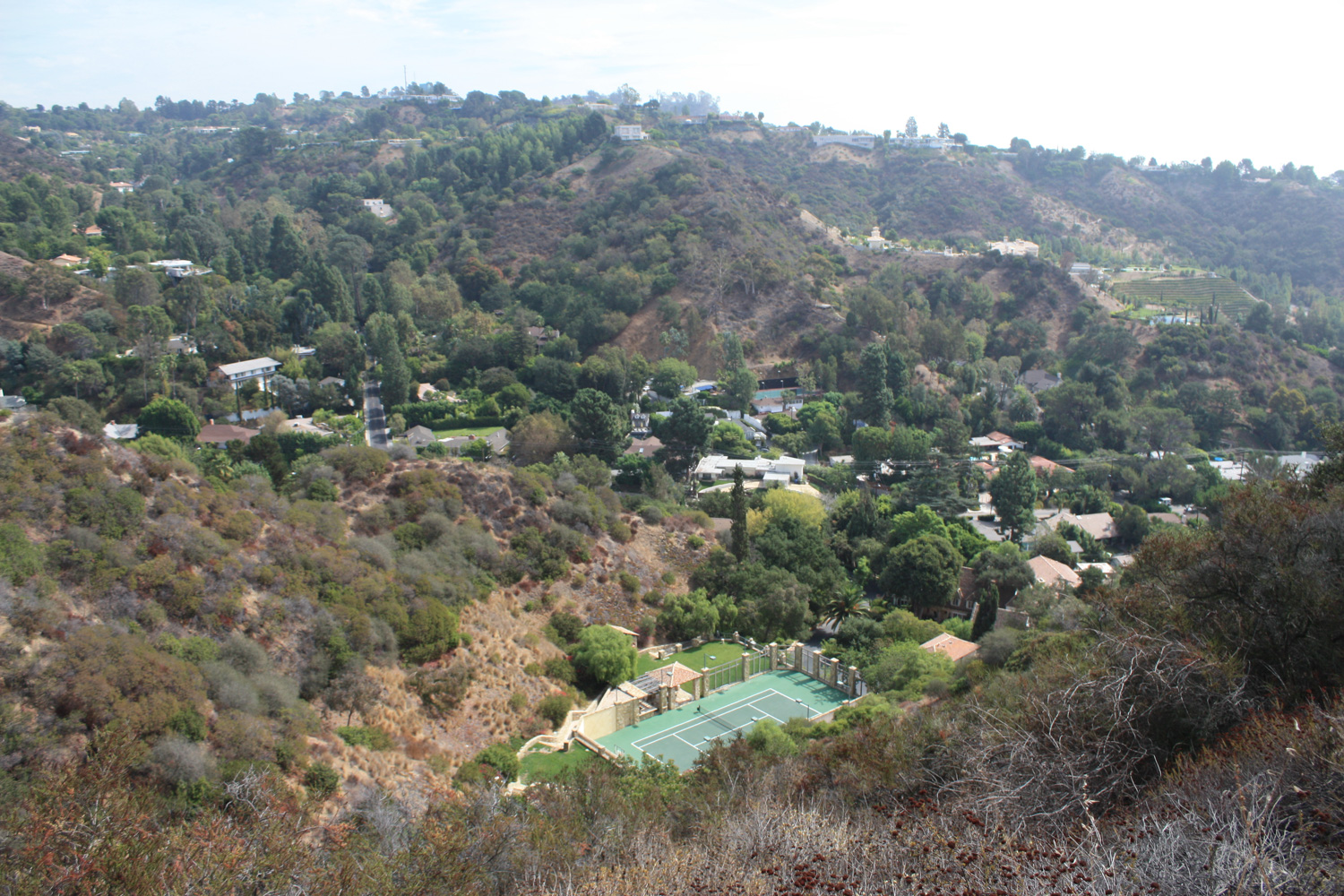
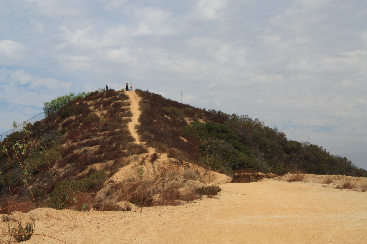
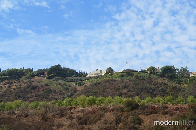
Ignore the spur trail and keep ascending on the main trail – making sure to look south toward views of Century City and Beverly Hills and being thankful that people had the foresight to preserve this canyon from further development so you could enjoy the moment.
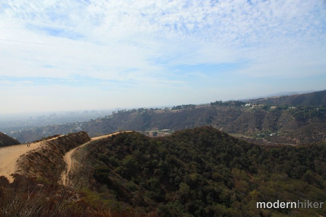
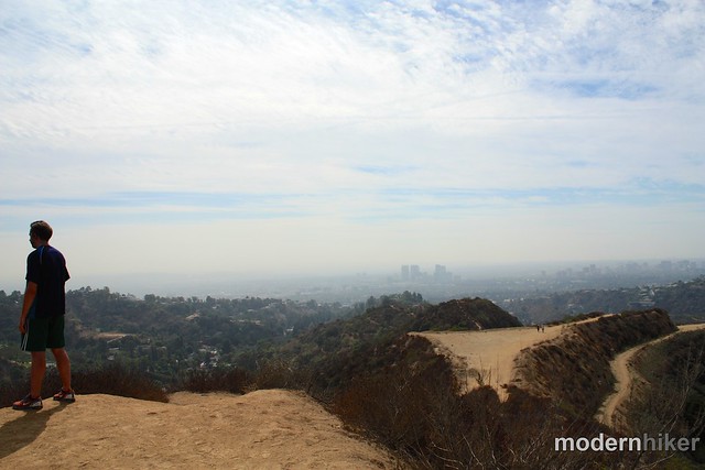
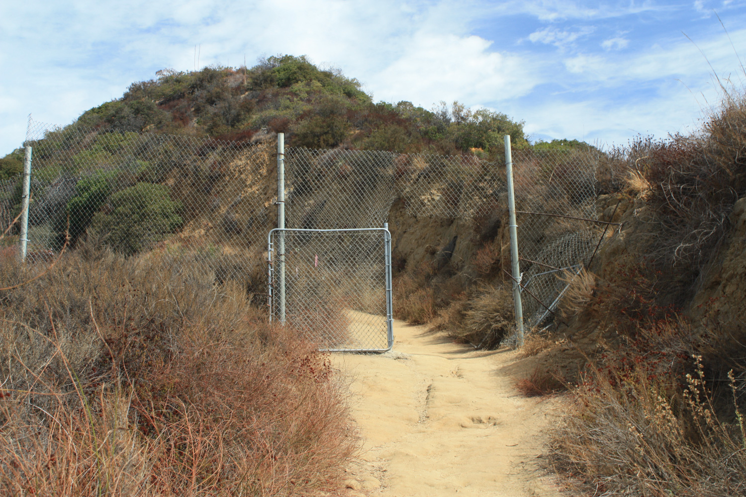
When you’re done soaking in the views, backtrack to the intersection and take the westernmost spur. On maps, this fire road continues to Beverly Ridge Terrace, where it also looks like you can rejoin another trail to descend into Franklin Canyon. In reality, this fire road hits a big ol’ fence and dead ends, with a warning sign for hikers not to try crossing into the rich folks’ neighborhood.
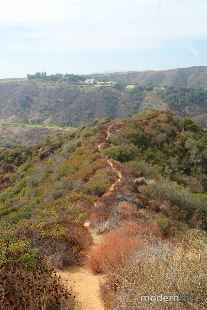
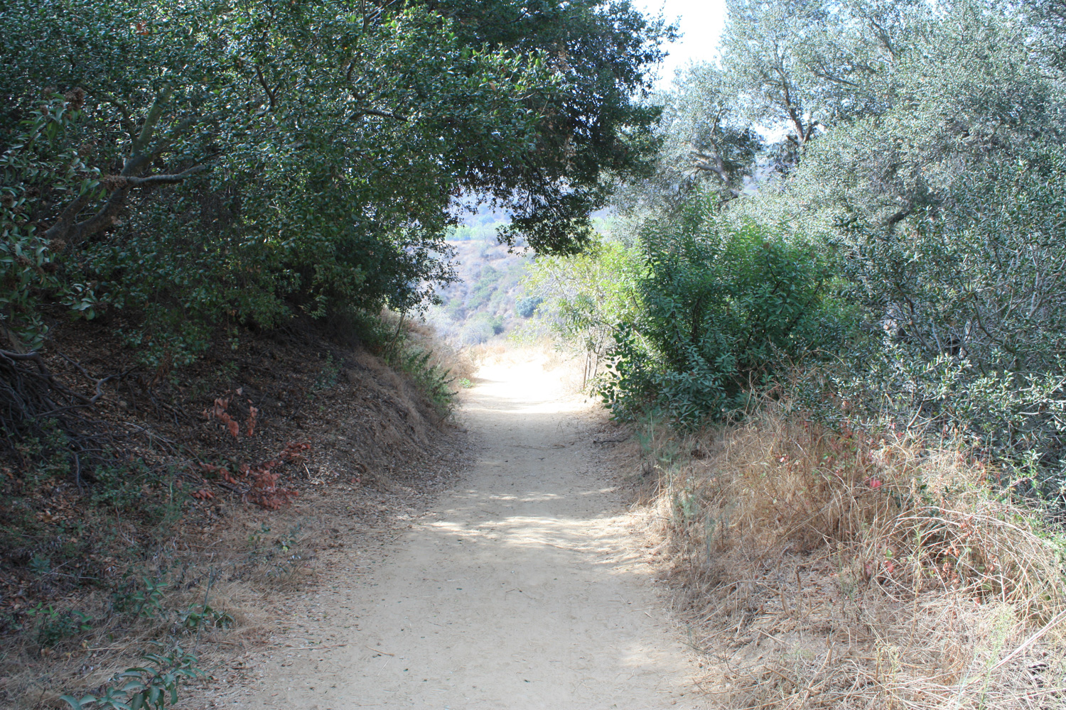
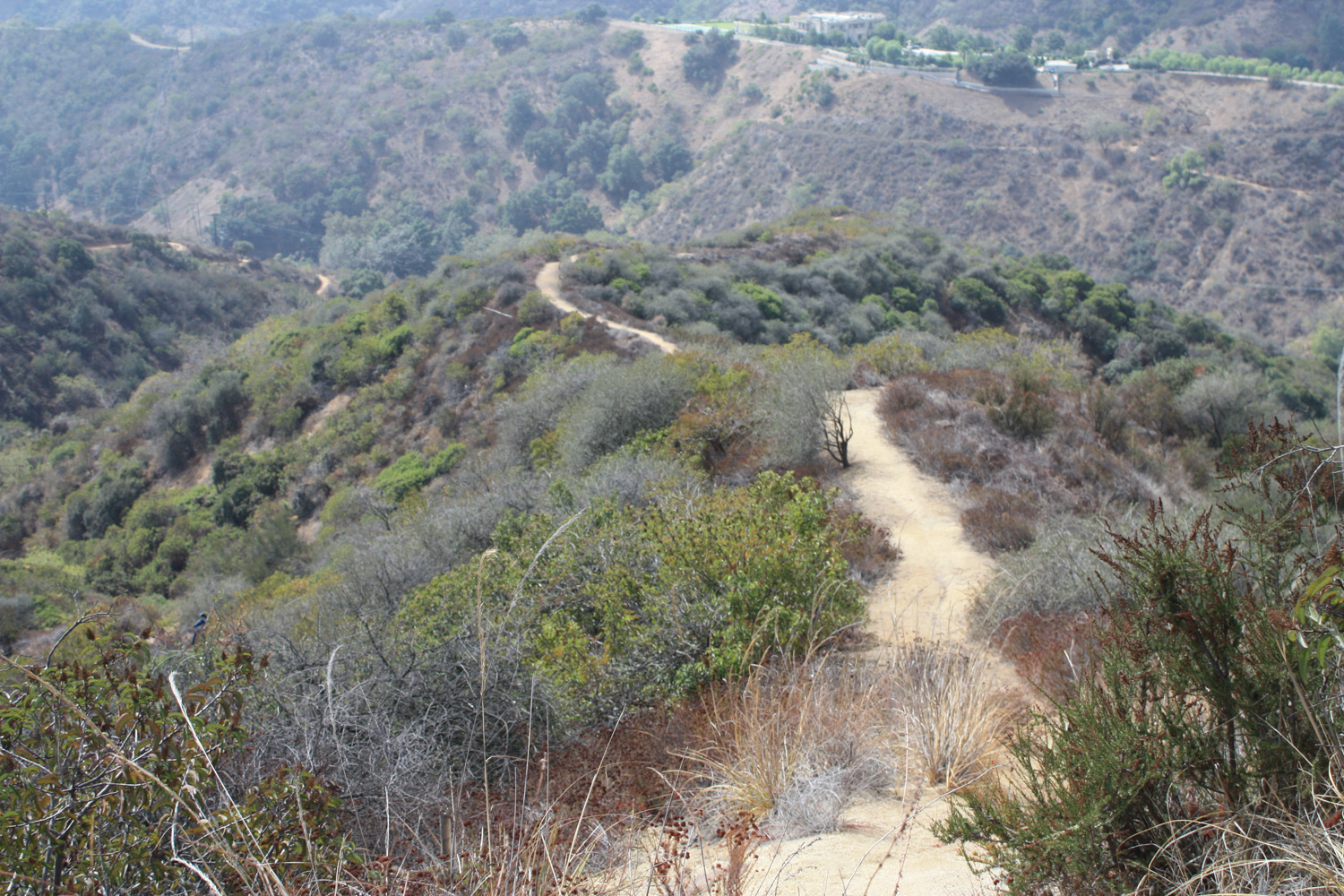
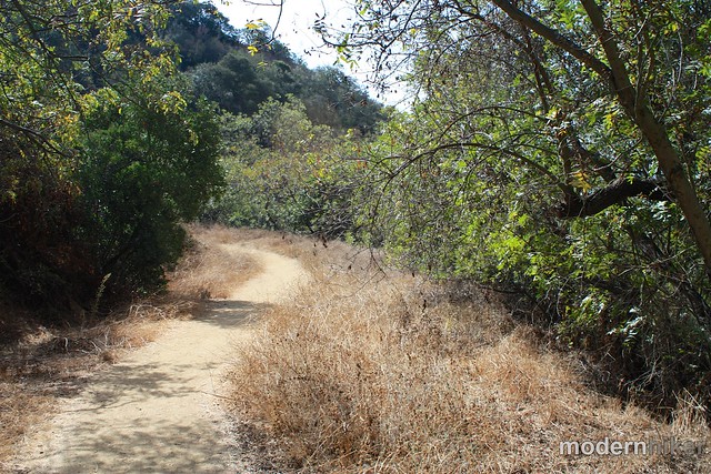
Otherwise, the firebreak descent is about 0.4 miles and is pretty fun – especially if you’re looking for more of a “full-fledged” hiking experience. It’s most steep toward the very end of the trail – but everything is easily passable if you take your time.
After that it’s just another 0.4 miles on the fire road back to the trailhead, completing the Hastain Loop.
***UPDATE***
The odd fences on this trail are leftovers from an ongoing legal battle between the park and a nearby developer. As of October 18, 2012, an LA Superior Court Judge has ordered the developer to remove the fences and guarantee hikers’ access to the trails.
Tags: beverly hills, dog-friendly, franklin canyon, hastain trail, Hiking, Los Angeles, santa monica mountains national recreation area