Sigh. The High Sierra lake.
So many of them lie scattered across the Range of Light that it’s next to impossible that any one soul will ever get to see them all. Each lake shimmers in a pristine azure reflection of the brilliant Sierra sky, and yet no two lakes are ever the same. Each lake is a miracle of time, climate, and geology, and that one can spend a lifetime in the Sierra and never see them all is both reassuring and a tiny bit tragic at the same time.

While summit ascents are generally more of a chore/obligation for me (I’m looking at you, Half Dome. Never again.), a trip to a lake basin is always a source of excitement and anticipation. Thus, this hike to the Young Lakes, which delivers three unique lakes shining in a beautiful alpine setting, stands out as such a wonderful experience. And while the lakes themselves are a fantastic destination, this hike delivers a number of other highlights that typify the Yosemite backcountry experience: dense forests, massive meadows, sweeping views of glaciated peaks, and even a healthy dose of solitude.
Backpacking
You can attack this route either as a dayhike or an overnight trip/three-day weekend. If you wish to backpack, you can reserve permits up to 24 weeks in advance and no more than two days from your hike. The Yosemite Conservancy handles the permit reservations through an online portal, through which you can select your starting trailhead, and you can choose either the Young Lakes via Dog Lake trailhead or the Young Lakes via PCT trailhead. Either trailhead will get you there, but note that this write-up is designed to lead you from the Dog Lake Trailhead on a counter-clockwise loop. Once you obtain your permit reservation, you can then pick up your paper permit from the Tuolumne Meadows Wilderness Center on the day before your hike.

Safety Considerations
The trailhead does feature food storage lockers that will allow you to store your food safely from bears. However, the Young Lakes themselves do not feature bear lockers. You will have to either bring your own approved bear canister or rent one from the Tuolumne Meadows Wilderness Center. It should also be noted that black bears are generally not aggressive. The primary danger with bears occurs when they can access your food. In those instances, bears may become aggressive in trying to get more human food, which can lead to the park having to euthanize the bear. So, bring those bear cans, folks, unless you want to risk being responsible for a dead bear.

The Hike
I present this route as a looping route that approaches the Young Lakes via the eastern branch of the Young Lakes Trail heading north from the Dog Lake/Lembert Dome Trailhead. The return route follows the western branch of the Young Lakes Trail to its junction with the Pacific Crest Trail west of Soda Springs. I describe the route this way since the eastern trail undulates over several ridges dividing the Delaney Creek, Dingley Creek, and Conness Creek watersheds. Spectacular views of the Cathedral Range compensate for the up-and-down nature of the trail on the approach, but a return route on this trail becomes tedious. For that reason, I route you back on the western branch, which doesn’t undulate as much, even if it isn’t as scenic.

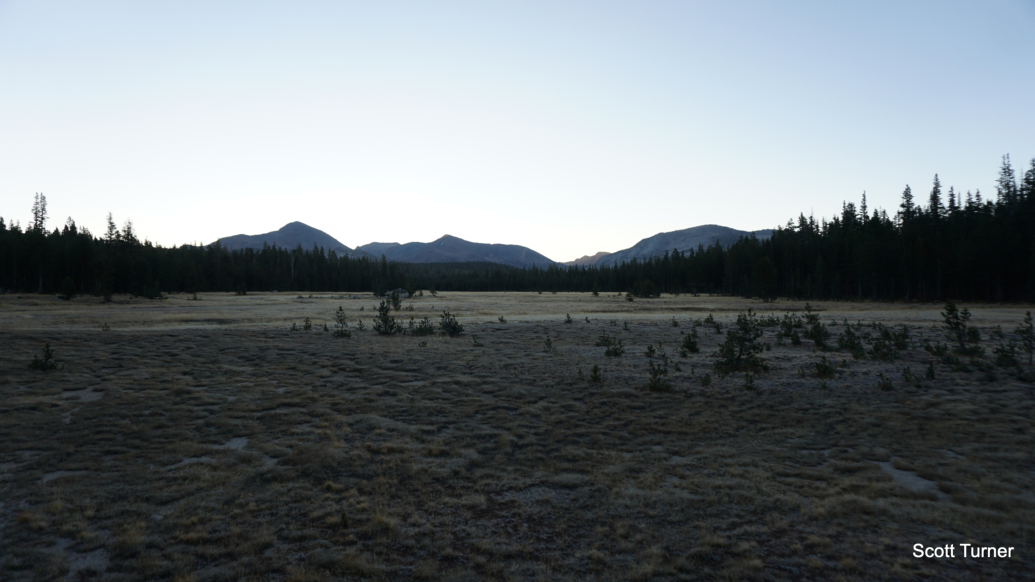
From the Dog Lake/Lembert Dome Trailhead, head north into a corridor of conifers, across a wide granite outcrop, and then across a pocket meadow. Beyond the meadow, the trail climbs through a ravine through which runs Dog Lake’s outlet creek. Continue through a junction with the Lembert Dome Trail at 0.8 mile, and continue straight again at a junction with a spur trail leading east toward Dog Lake at 1.0 mile. At this point, the trail begins a gentle, occasionally moderate climb toward the crest of a ridge before dropping down to a vast meadow fed by Delaney Creek. Cross Delaney Creek (a careful, deep ford early in the season) at 1.8 miles, and then continue to the base of another ridge on the north side of the meadow. Climbing resumes as you ascend through dense forest to the top of this next ridge (2.3 miles) separating Delaney Creek’s watershed from Dingley Creek’s watershed.

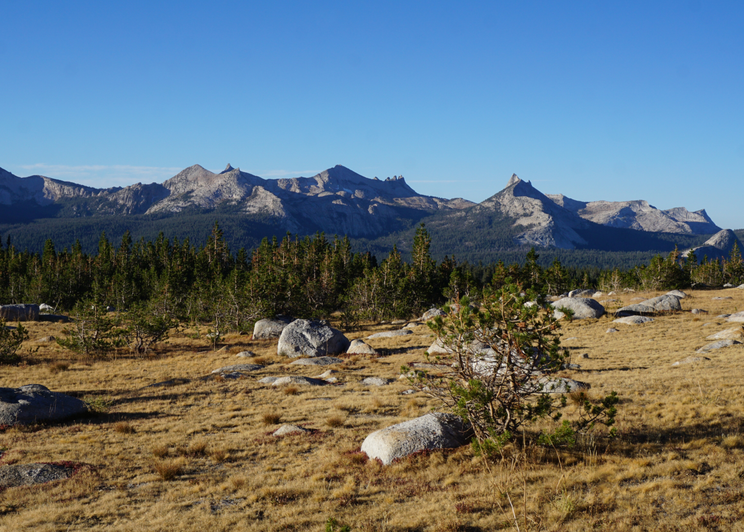
After a short descent, the trail traverses a flat stretch before resuming its climb up toward a crossing of several forks of the fledgling Dingley Creek (3.4 miles). This creek crossing heralds the beginning of a gorgeous, sloping meadow that reveals some spectacular views south toward the Cathedral Range. Several notable peaks, including Cathedral Peak, Unicorn Peak, Johnson Peak, Fletcher Peak, Vogelsang Peak, and Mt. Lyell punctuate the southern skyline. This gorgeous view is worth some consideration, so plan on taking a short break when you reach the crest of the ridge that divides Dingley Creek from Conness Creek at 3.9 miles.

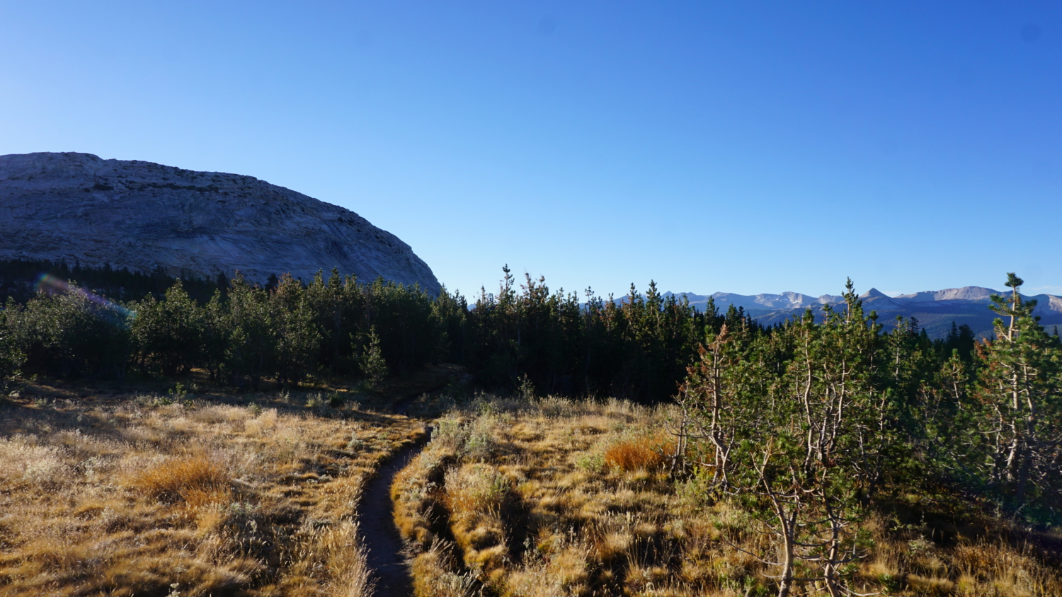
From the crest of this last ridge, the trail begins a sharp descent that should explain why I route this as a loop; climbing back up on the return journey would be somewhat unpleasant. Continue on a pleasant downhill incline that flattens out before reaching a junction where the western and eastern branches of the Young Lakes Trail merge together at 4.4 miles. Commit this spot to memory, as you will take the western branch of the Young Lakes Trail back to Tuolumne Meadows on your return route. But at this point, continue straight ahead as you traverse the western slopes of Ragged Peak, a distinctly craggy peak that stands out from the polished granite typical of the Tuolumne River basin.

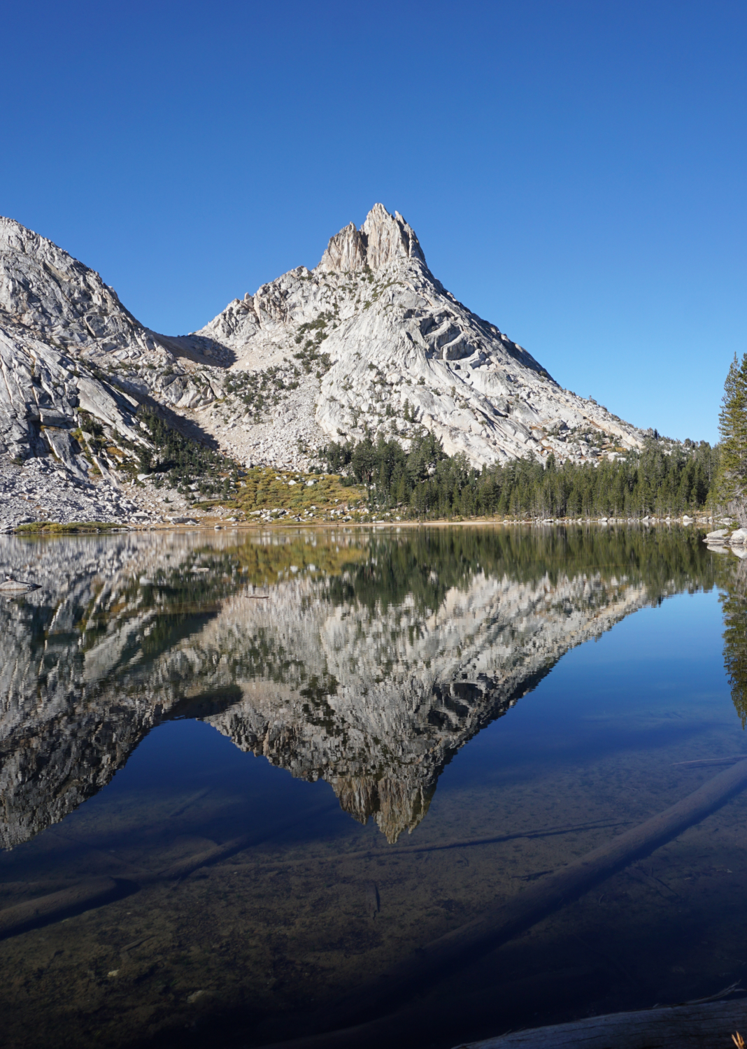
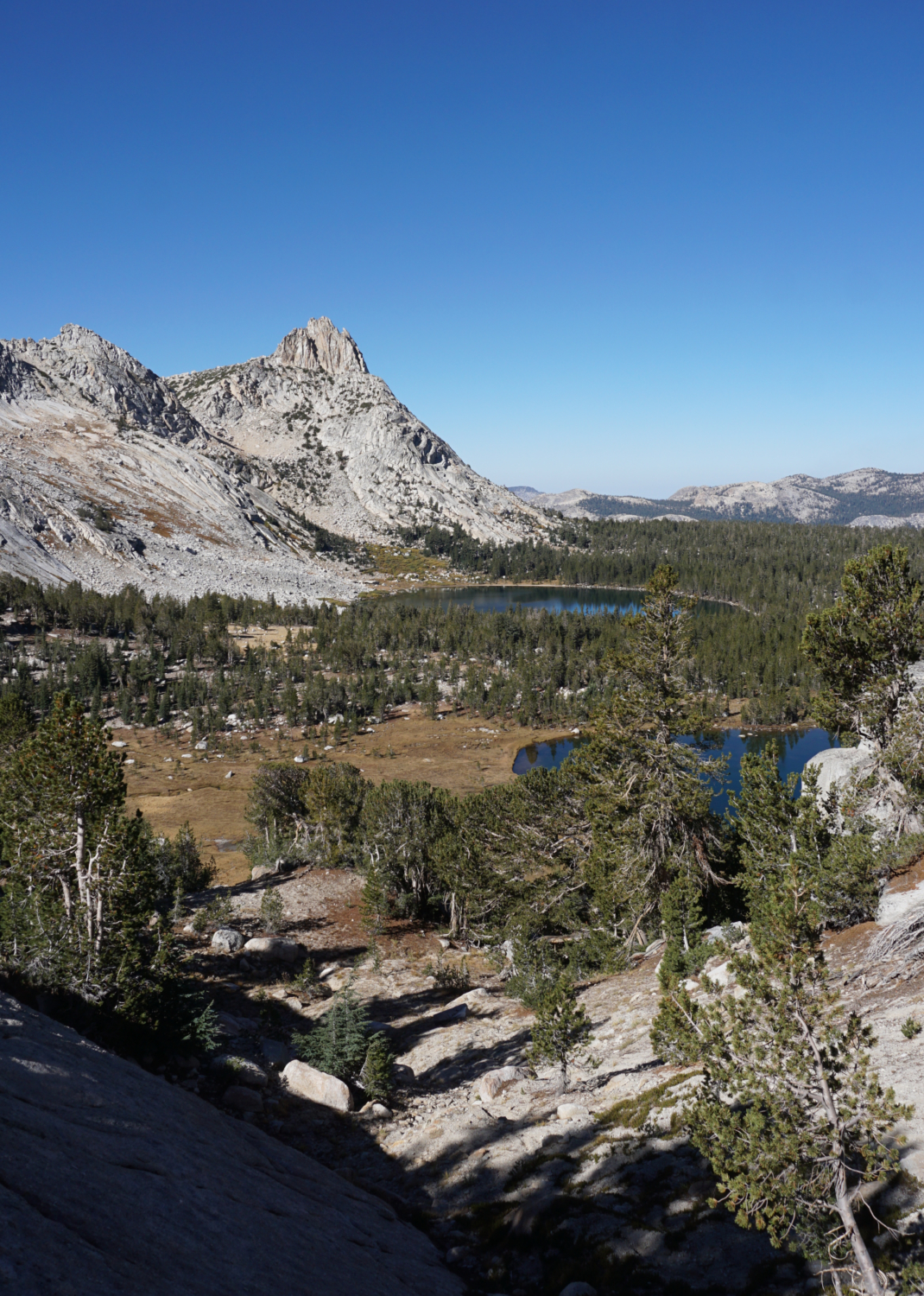
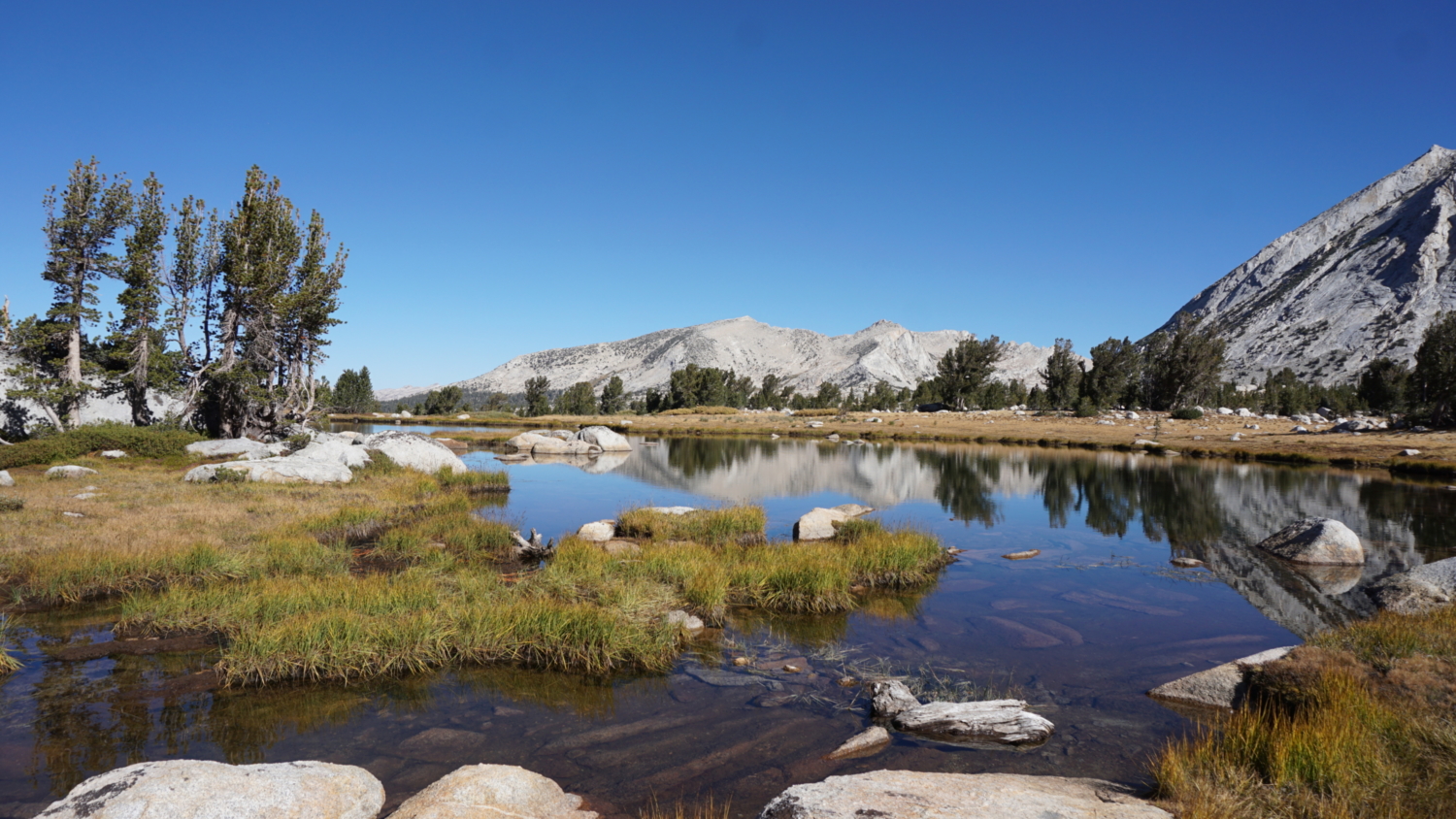
At 5.2 miles, the trail takes a hard bend to the east to begin a short climb through dense forest toward the first of the Young Lakes. Forest bounds the western and northern margins of the first lake, and it’s here that you’ll find the best campsites. A massive ridge of granite bounds the southern margins of the lake, culminating in Ragged Peak on the west end of this ridge. As you continue along the northern banks of the lake, you can enjoy a perfect mirror image of Ragged Peak held in the lake’s still waters.

As you leave the first lake, you’ll reach a bit of navigation trouble as you cross the first lake’s outlet. The trail becomes a bit vague here, and it may take a bit of trial and error to locate the continuation that leads to the second and third lakes. Once you locate the trail, commence a brief climb to reach the second lake at 6.4 miles. The second lake is much smaller than the first, but the lake’s grassy margins set it apart from the first, providing a more verdant ambiance. Like the first lake, you’ll find good camping not far from the trail on the second lake’s north shore.

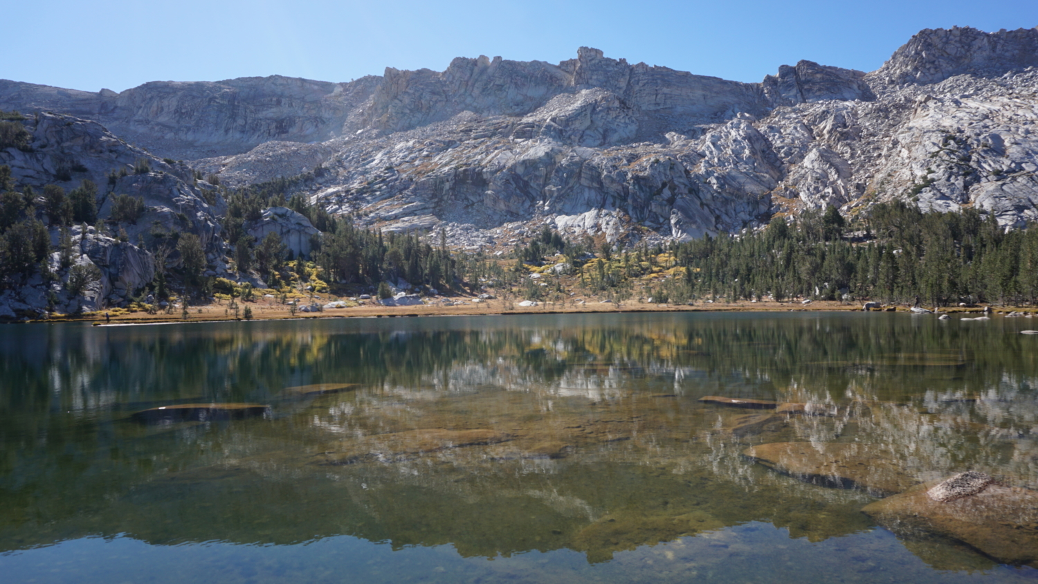
To reach the third lake, continue past the second to commence a steep, rocky climb through overgrown thickets of willow. This informal trail climbs almost directly through a stream, making it much wilder than any section of trail thus far. After a quick 230′ of climbing, the trail tops out just beyond the third lake’s moraine at the base of a broad meadow. Continue on the trail to a thicket of whitebark pines at 6.8 miles which provides some good shelter for camping. You can cross the meadow toward the banks of the third lake, which is arguably the most beautiful. If you find a sunny spot on a boulder along the bank of the lake, you can enjoy an infinity pool-style view west across the lake toward Ragged Peak. Look east, and you can admire a massive wall of granite forming the cirque containing the lake’s eastern and southern boundaries.

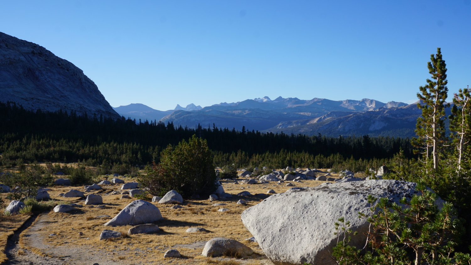
The return journey has you retracing your steps from lake 3 to the lake 1 and back to the junction where the Young Lakes Trails merge/split. When you reach the junction at 9.25 miles, keep right to follow the western leg of the Young Lakes Trail. The western leg lacks the views toward the Cathedral Range, but it compensates by not undulating as much. After one short climb up to a ridge dividing Conness Creek from Dingley Creek (the only climb on the way back), the trail begins a prolonged, eventually monotonous descent through lodgepole pine that doesn’t get interesting again until it crosses Dingley Creek at 11.5 miles and again when it reaches a spacious, view-packed granite outcrop just north of the Pacific Crest Trail at 11.75 miles. It’s worth taking another break at this point to admire the Cathedral Range and some of the domes west of Tuolumne Meadow.

At 12.4 miles, turn left onto the Pacific Crest Trail to begin the final leg of your journey back to the Lembert Dome/Dog Lake Parking area. The mostly flat PCT continues east to a crossing of Delaney Creek at 12.75 miles. Keep right at an unmarked junction just beyond Delaney Creek at 12.8 miles; a left turn would take you uphill to the Tuolumne Meadows stables. The PCT will continue to lead you east to a junction with an old access road that leads to Parsons Lodge at 13.5 miles. Cross this access road (unless you want to turn right to visit the lodge) and continue past Soda Springs, a set of natural springs famous for their carbonation, on the right at 13.6 miles.
The PCT merges into an access road at 13.6 miles, and you’ll continue due east along the margins of Tuolumne Meadows all the way back to the Lembert Dome parking area. Stop and take note at a series of interpretive signs that break down some of the natural features of Tuolumne Meadows. At 14 miles, continue past a gate and a large parking area heading east until you come to rest at the Lembert Dome/Dog Lake parking area, where your vehicle will await.

Tags: Cathedral Range, Delany Creek, Dingley Creek, Dog Lake, Lembert Dome, Mt. Conness, Pacific Crest Trail, Parsons Lodge, Ragged Peak, Soda Springs, Tuolumne Meadows, Young Lakes, Young Lakes Trail