
If you ever find yourself on the north shore of Maui and itching for a solid early-morning hike with some truly spectacular views of the interior of the island, pack a lunch, set your alarm, and head out early to the Waihe’e Ridge Trailhead for a popular Maui hike that truly earns its reputation as a show-stopper.
Pro tip: you will want to get here early. The parking area for the trailhead is fairly small, and the overflow lot is a long way down a not-that-interesting-to-hike paved road through active ranchland that adds a decent amount of distance and elevation to your day. This is a popular trail, and that first lot will fill up quickly even on weekdays.
Now that you’ve arrived, don’t forget to give your boots a good solid scrub before you get going:

Odds are you’re from out of town, and you most likely didn’t wash your hiking boots before you packed either. Brushing off the dirt will help prevent you from accidentally trekking any invasive seeds or critters into this part of Maui. Don’t forget to brush on your way out, either!
OK, now that that’s all set, you’ll squeeze through a tight gate in the fence and start your hike with a pretty gnarly little incline up a gravel and concrete road. It doesn’t look especially bad in this photo, but it will definitely wake your legs up.

The incline on this trail is overall pretty steady, but this steep kickoff will definitely make you set a healthy pace instead of trying to rush up quickly. Thankfully, once you reach the crest of this short road near a water tower, the route turns into a dirt single track and you’ll become surrounded by forest — which is especially nice on hot sunny days.

The forest is a mix of different native and introduced species, including guava, kukui, the iconic ohia, and others. It’s also alternately dense and low and shrubby, so you will have a nice variety of shady green forest tunnels and wide open vistas. Make sure to stop and take a break in those shady spots if the incline is getting to you!

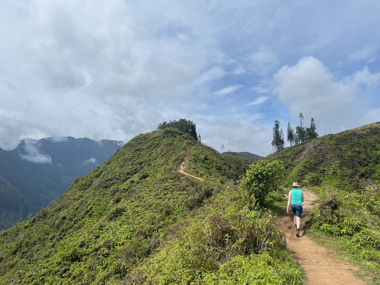
The trail makes a few switchbacks before hitting the Waihe’e Ridge proper at around 0.7 mile. It’s pretty much a straight shot for the rest of the hike, with moderate to gradual inclines and really stunning views in every direction — especially as you get to see deeper into the interior of Maui.

At about the 1.1 mile mark, the incline picks up again — which also happens to be near a spot where you leave most of the forest shade behind (yet another reason to get going early on this one!). There are a few more steep switchbacks here, and the trail gets noticeably more steep and narrow. It’s still not technical, but you will want to watch your footing — especially coming back down. I did see a lot of people hiking this in shoes without a lot of grip, and they did not seem very excited about the declines heading back to their cars.


At about the 2.1 mile mark, you’ll hit the summit of Lanilili and a well-built vista structure.

This is as far as the Waihe’e Ridge Trail takes you, so grab a seat if you can and soak in the views before you head back the way you came. And don’t forget to take it slow on the way down — some of those sections of trail can be deceptively steep!
Tags: hawaii, lanilili, Maui, Waihee Ridge


