Hiking in Anza-Borrego Desert State Park can be an intimidating prospect for hikers unfamiliar or inexperienced with the sundry challenges associated with desert exploration. Those challenges can include sun exposure, high temperatures, long stretches of trail-less route finding with unfamiliar landmarks, challenging terrain, and vindictive vegetation hellbent on puncturing your skin. Such conditions seem to prohibit a number of hikers from digging in to the wonders tucked away in the desert’s austere, forbidding folds. However, not every route in the desert is out to kill you. For novices or even just those looking to find a cool place to kick back and relax, I give you the Truckhaven Rocks.

This cluster of sandstone boulders protrudes from the relatively flat slope surrounding Arroyo Salada as it ascends toward the southeastern extension of the Santa Rosa Mountains. You can see them clearly from the S22, and all that is required to reach them is the ability to walk in a straight line. While the terrain is rougher than it appears at first, you won’t have to burden yourself with the anxiety of deciding which unnamed, similar-looking ridge or canyon you need to turn onto.

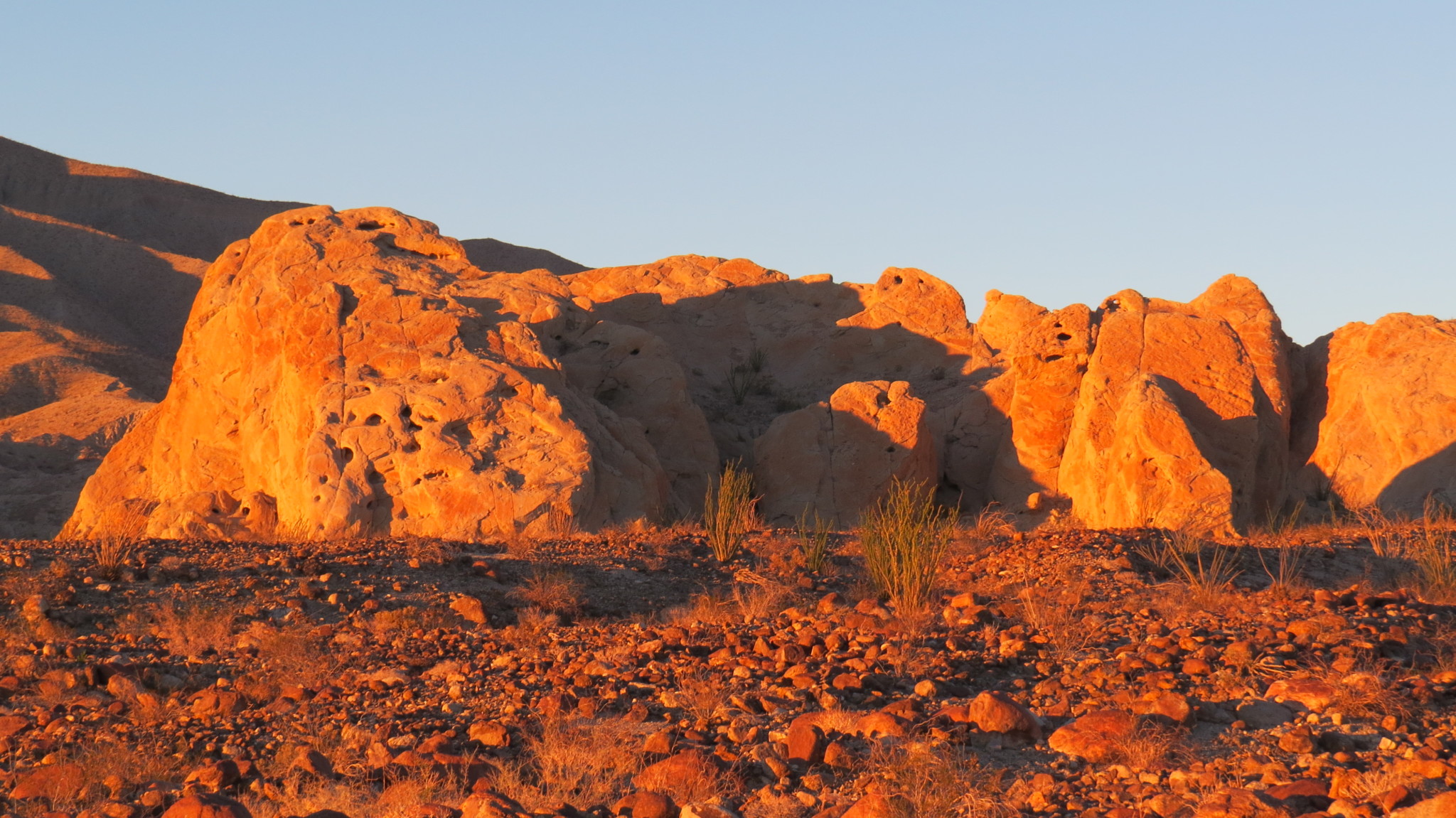
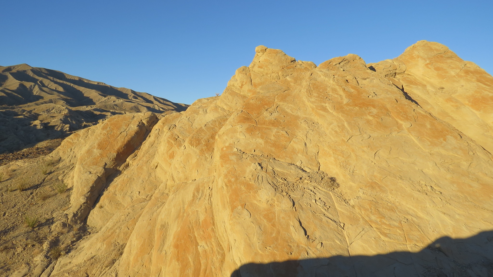
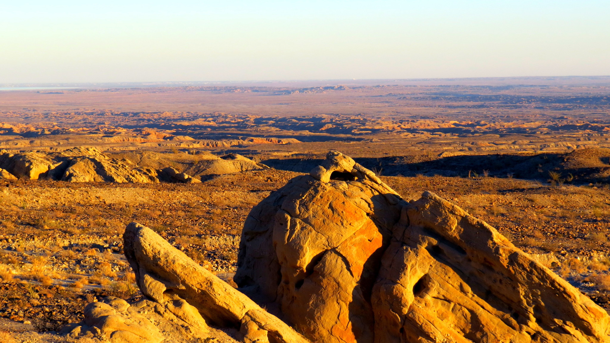
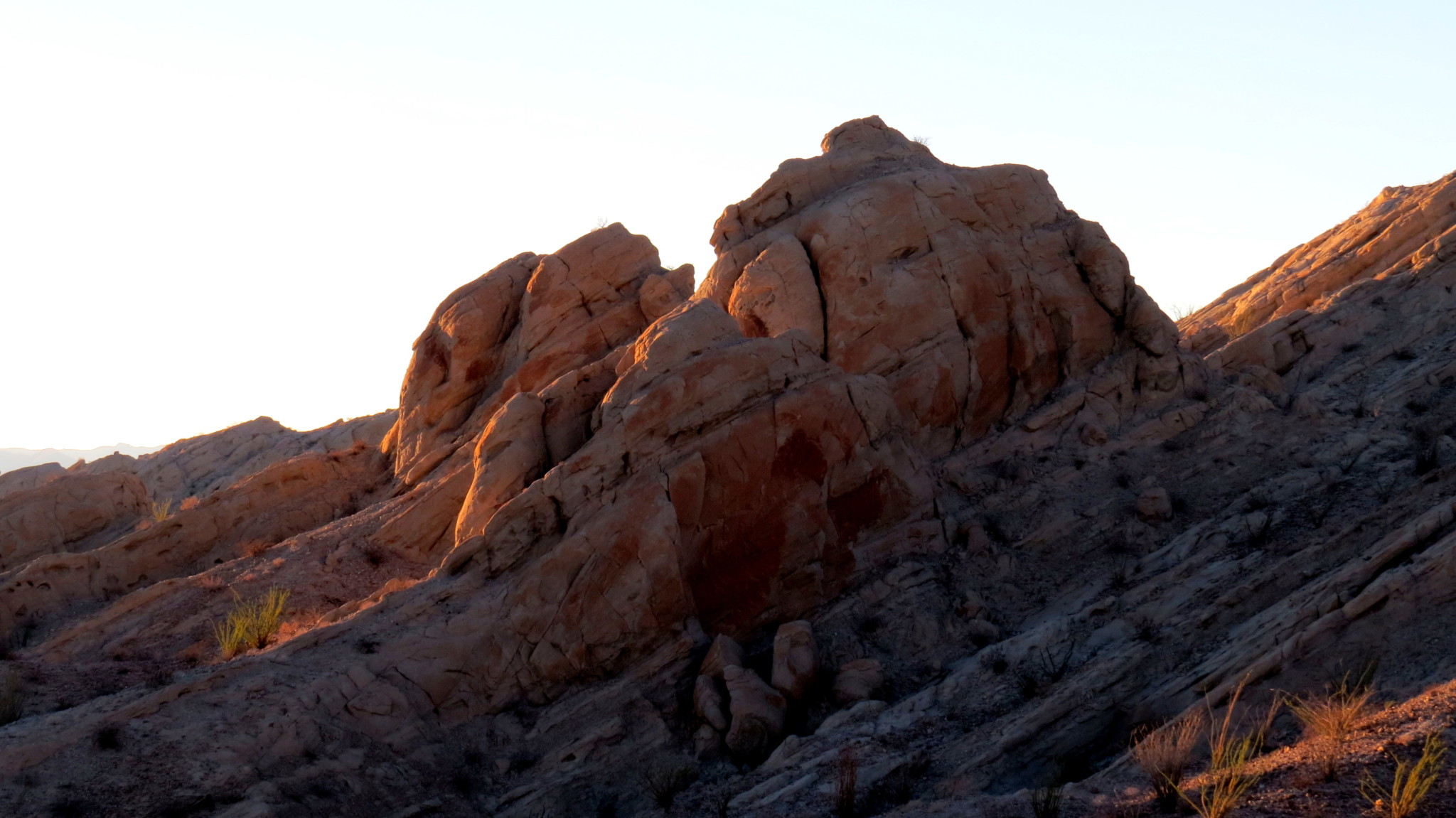
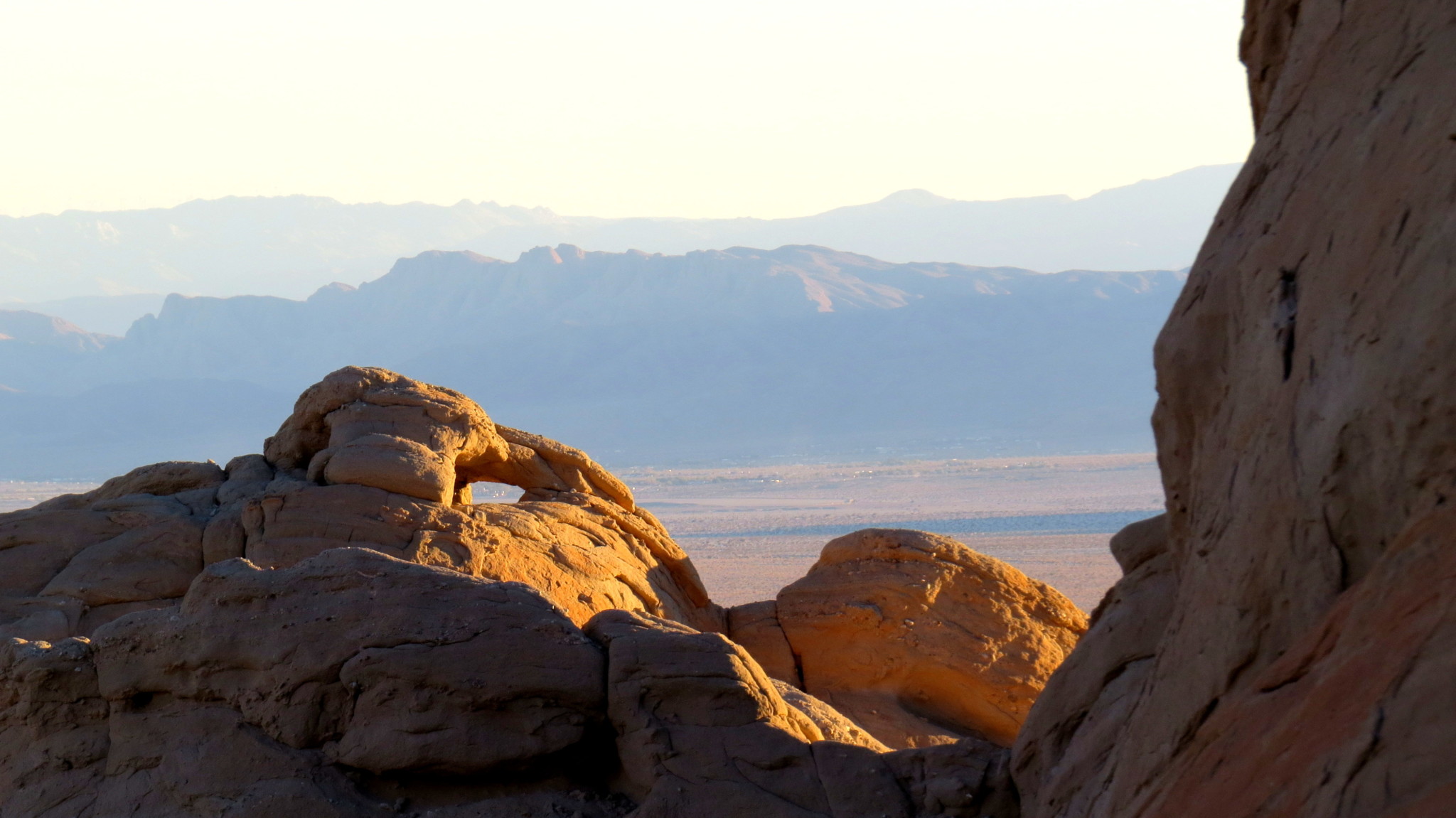
The rocks themselves are beautifully eroded, and they offer an array of opportunities for casual exploration and enjoyment. Kids and the young at heart can enjoy some easily scrambling to explore the nooks, crannies, and arches scattered about the various outcrops. Photographers will feast on seemingly unlimited opportunities to capture the desert at its best, especially during the morning and evening golden hours. And those simply looking to soak in the glory of the Borrego Badlands and Santa Rosa Mountains may be content to find a comfortable bit of sandstone from which to survey the confines of Borrego Valley.

Here follow three possible options – all easy enough for novices – for reaching the rocks:
Option 1: Walk in a straight line directly toward the rocks. The only navigation you will need to perform will be dodging cacti, progressing over gently rolling landscape punctuated by occasional washes, and perhaps a bit of pushing through some uneven terrain. After about a mile of this, you will find yourself at the base of the rocks. One note about the terrain: those firm surfaces of sandstone pebbles are known as “desert pavement.” Desert pavement usually tops alluvial fans (those big sloping fields where erosional forces have deposited ground up bits of mountain), and the tightly packed rocks jam close together. The wind blows the sand away, leaving a surface that resembles old paved roads.
Option 2: For a slightly more circuitous route with a bit of meandering and a touch of scrambling, head roughly northwest from the parking area into the wash, and follow it first northwest then north. After 0.75 miles, find a spot where you can climb out of the wash and navigate your way east toward the rocks.
Option 3: Combine the straightforward approach and the wash for a short loop.

Tags: Anza-Borrego Desert State Park, Santa Rosa Mountains, Truckhaven Rocks