The Zion desert’s only formal footpath traverses several pinyon-carpeted plateaus and benches beneath the stern gaze of Mt. Kinesava and the towering West Temple formation. This quiet section of the park receives light visitation owing to a combination of searing summer heat and, possibly, a lack of awareness of the scenic pleasures that await. Because of the heat, this route is a great option for winter travel when many of Zion Canyon’s trails are iced over. Likewise, in spring and fall when the canyon bustles with activity, hikers can find tranquility on the arid desert steppes. Finally, this route works as an overnight route, with six designated sites situated at intervals between Huber and Coalpits Washes.

In order to obtain a permit, you’ll need to reserve a permit online within the appropriate time frame. Zion allows reservations to be made within three months of your scheduled trip, and each three month period begins on the 5th of each month. For example, if you wanted to take a trip in March, you could begin reserving permits for the month of March starting on January 5th. Although I mention each of the campsites in this write-up, you can also get a sense of where they are by reviewing this wilderness map.

If you aren’t backpacking, you have two options for hiking the Chinle Trail. First, you can hike it as an out-and-back, turning around wherever you see fit. Campsite 1 at 4.7 miles is a good turnaround point for a challenging, half-day hike. Second, you can leave a car at the Chinle Trailhead and another car at the Coalpits Wash Trailhead and complete this route as a one-way trip, returning either through Scoggins or Coalpits Washes.

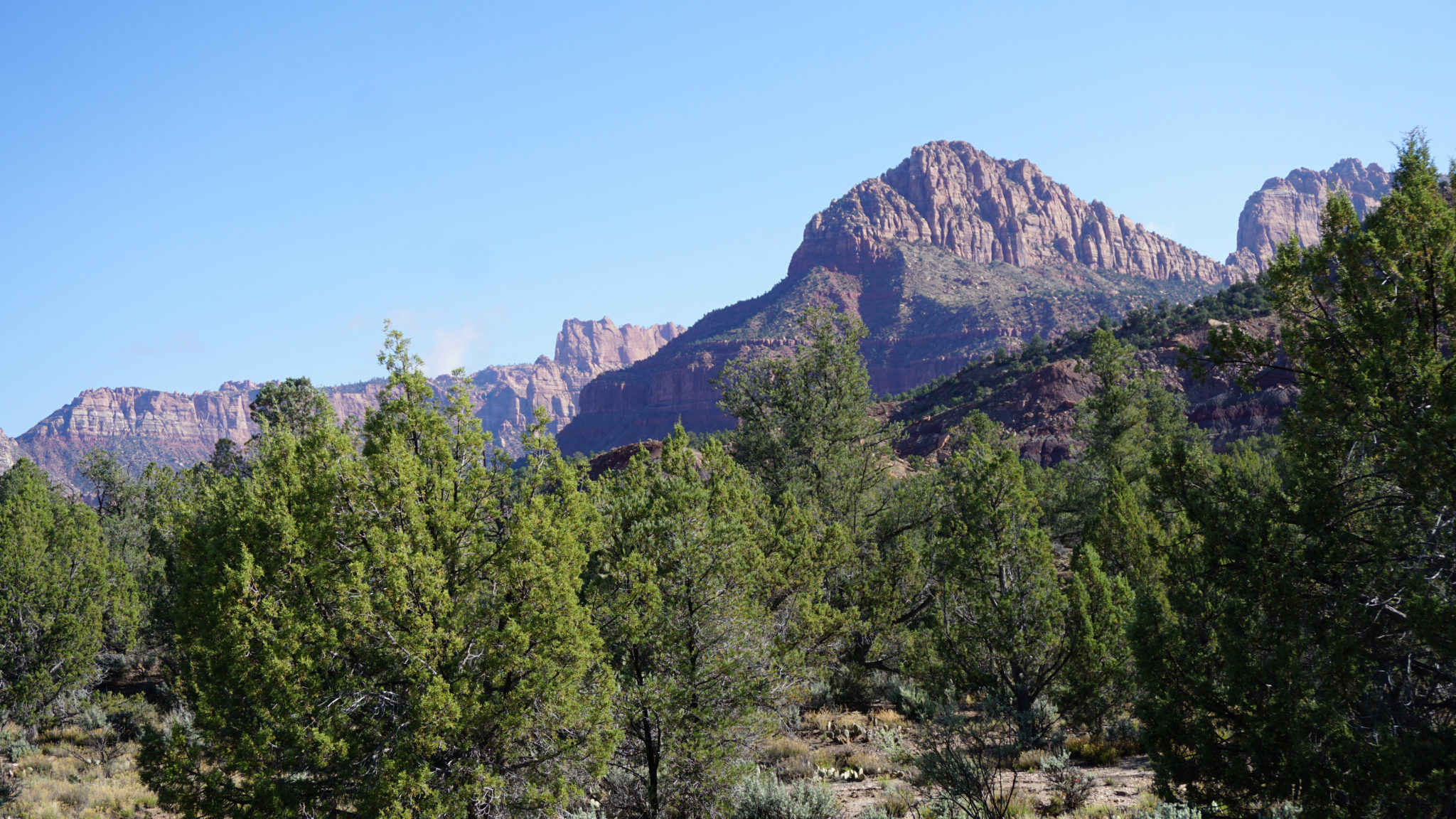
Mt. Kinesava (center) and the West Templer (right)
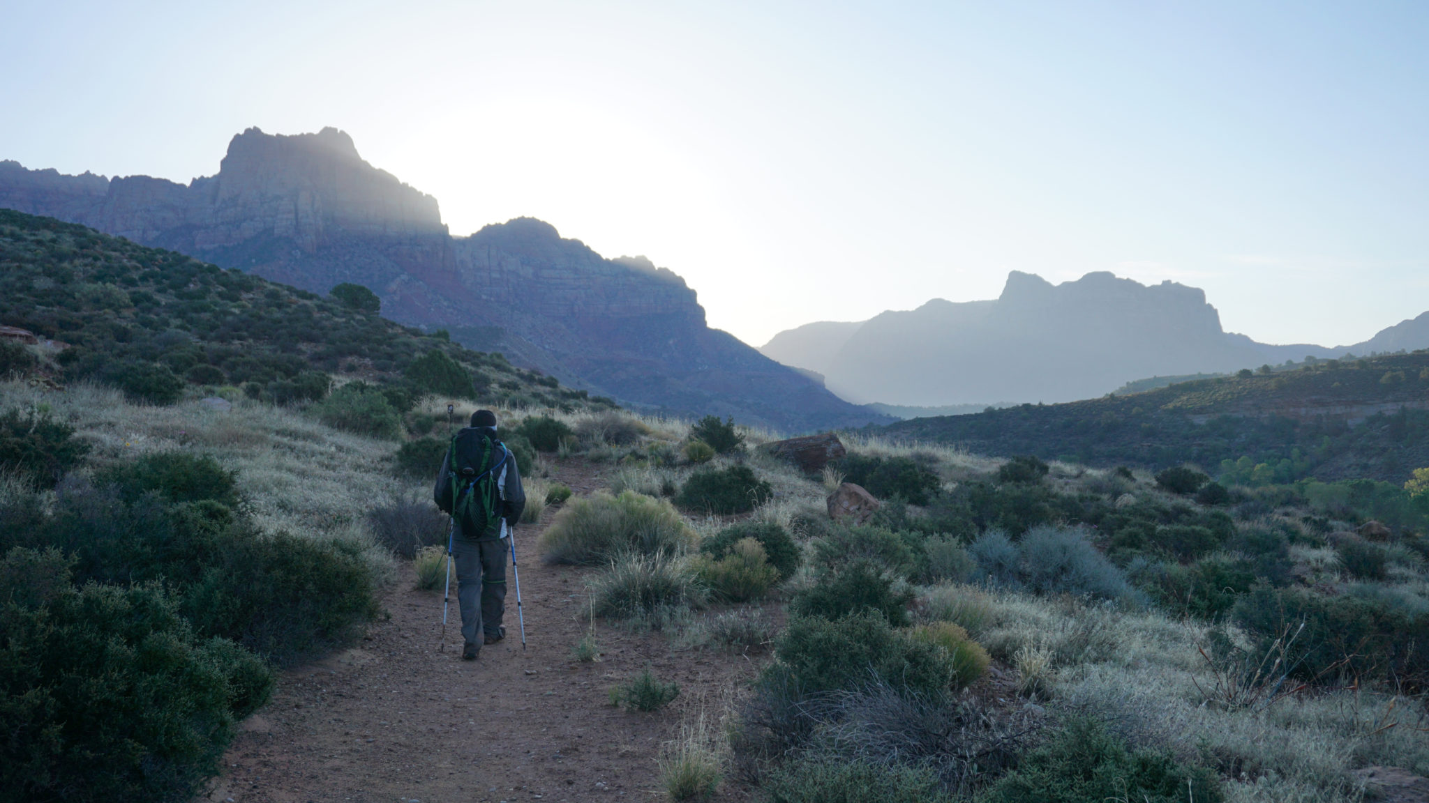
The first segment of the trail features a few minor navigational challenges as the Chinle Trail threads through the sprawling, high-dollar Anasazi subdivision on an easement. After 0.6 mile, the trail crosses Anasazi Way and soon reaches a gate marking the Zion National Park boundary at 1.1 miles. Pass through the gate, and begin a long, gentle ascent across a scrubby plateau. This section of hiking remains relatively uneventful until you reach Huber Wash, with the exception being views of the towering ramparts of Mt. Kinesava to your north, and several picturesquely eroded buttes on the south end of the Virgin River Valley.

From the lip of Huber Wash
Things start to get a bit more interesting when the trail makes a hard bend to the north at the rim of Huber Wash at 2.6 miles. Views into the depths of Huber Wash open up as the trail progresses, and more impressive views north and northwest into the upper reaches of the West Temple formation and beyond toward the receding wilderness along the west edge of the Horse Pasture Plateau come into view for the first time.

Petrified wood
The trail begins a moderate descent toward a crossing of Huber Wash at 3.2 miles. Once beyond the wash, the vegetation transitions from desert scrub to predominantly pinyon-juniper woodland. The rich, red soil underneath is soon dotted with unusual white rock formations. Look closer and discover that the rock is actually fragments of petrified wood. At some points, you may find entire logs up to 15-feet long along the side of the trail. Be sure to admire everything from the trail, as the soil surrounding the path contains cryptobiotic crust, a living community of algae, bacteria, lichens, and fungi that is exceptionally sensitive to trampling. The crusts aren’t always easily identifiable, so you may not know whether you’re walking on it if you leave the trail.

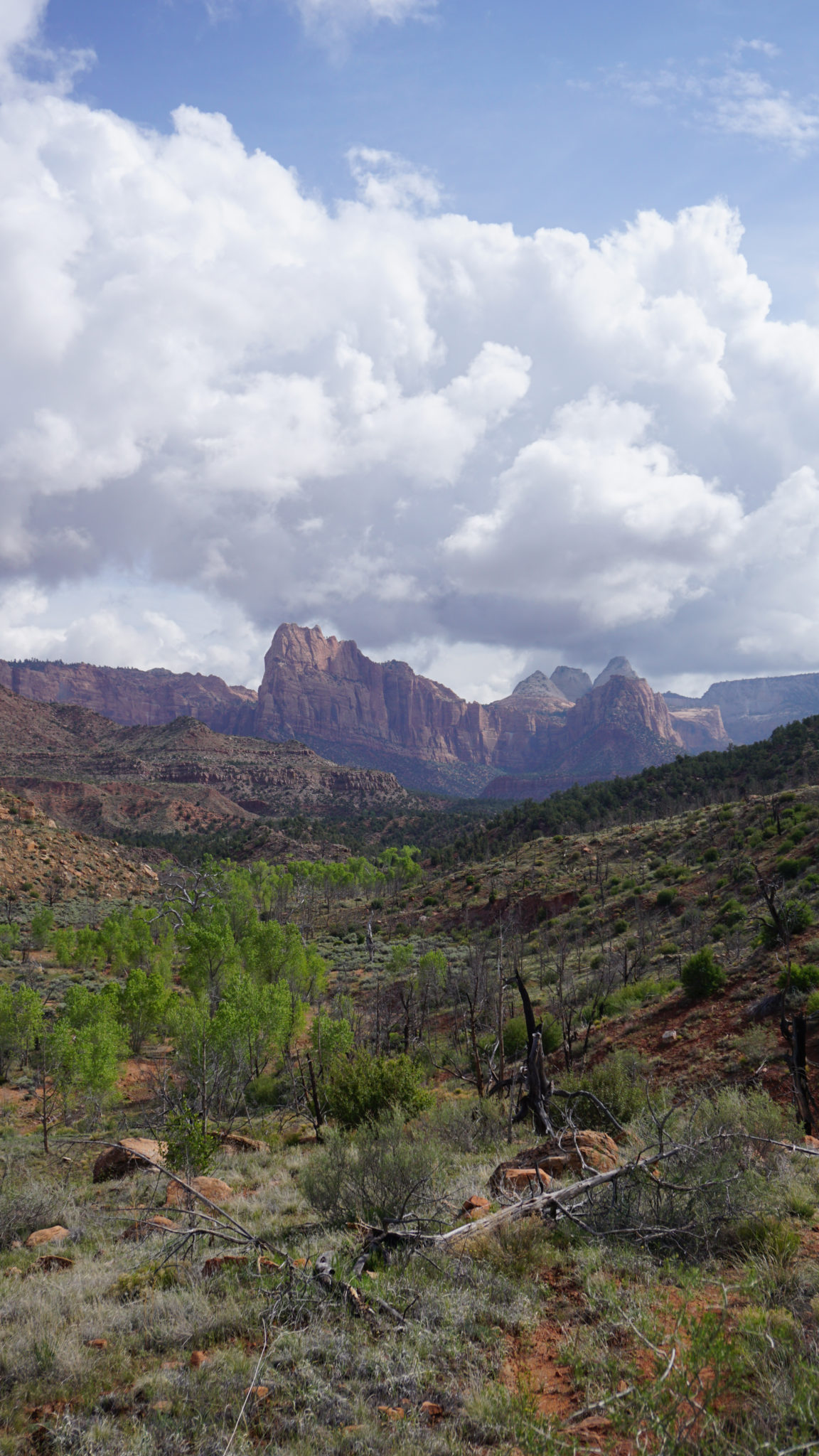
After 3.6 miles, the trail passes through a sequence of grassy meadows with open views northwest toward Cougar Mountain. The imposing West Temple looms to the northeast in clear view from here until Coalpits Wash, presenting a unique vantage that people who only visit the canyon never get to enjoy. Day hikers will reach their most logical turnaround point at a spur trail that leads to the first campsite on the route at 4.7 miles. If you follow the spur trail a short distance south, you will reach several open areas with views west and north that are perfect for a leisurely lunch break before you turn back.

If you are backpacking, or if you established a shuttle hike by leaving one vehicle at the Coalpits Wash Trailhead, continue on the Chinle Trail heading north as it descends toward Scoggins Wash. Upon reaching Scoggins Wash at 5.2 miles, you have your first option for a return back to Coalpits Wash, as well as a shortcut to Campsite 6 at the confluence of Scoggins and Coalpits Washes. If you are camping at any of campsites 2-5, continue past the wash as the Chinle Trail undulates into an out of a series of washes, with stops at campsite 2 (5.5 miles), campsite 3 (6.5 miles), and campsite 4 (7.4 miles). Keep in mind that campsites 1-4 have no adjacent water source, which means you’ll either have to hike to Coalpits Wash for a refill or carry all the water you need.

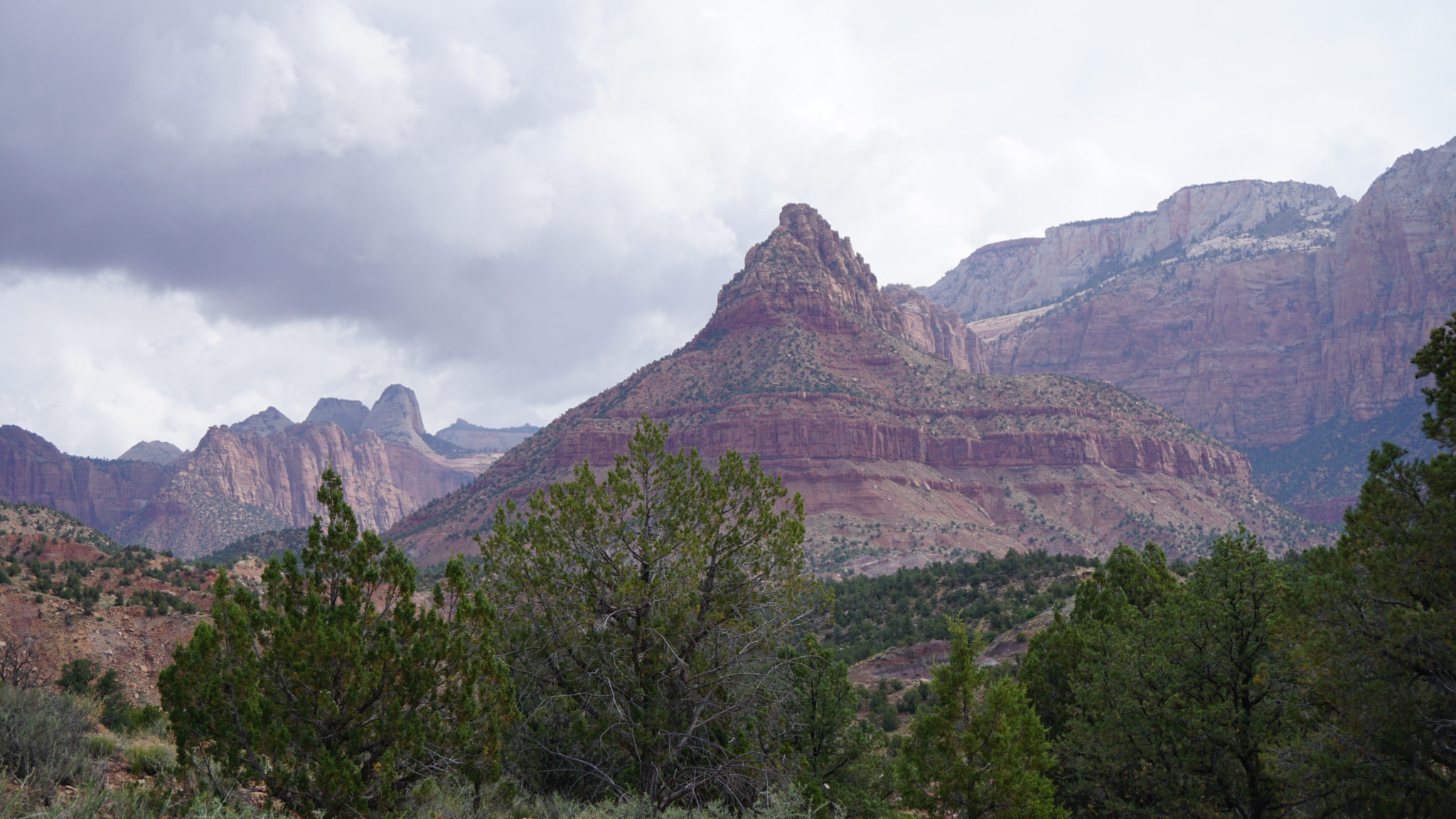
Coalpits Wash and Cougar Mountain
At 6.9 miles, the Chinle Trail reaches the edge of a 2006 burn zone. The devastation to the formerly dense pinyon-juniper woodland is a bit sad, as the trees aren’t showing many signs of recovery. However, open views of the surrounding terrain are some compensation. The final stretch of the Chinle Trail bends north on a brief descent into Coalpits Wash. The trail ends at 8.25 miles. If you are camping, cross Coalpits Wash’s stream to find a spur trail leading to campsite 5.

If you are taking this route as a point-to-point route to Coalpits Wash’s trailhead along UT-9, continue south from the spur trail to campsite 5 on the rocky shelf above Coalpits Spring. Once past the spring, drop in the wash and follows its rocky, cottonwood lined course to a confluence with Scoggins Wash at 9.9 miles. From the confluence, head south again along an informal trail that leads to the Coalpits Wash Trailhead, 11.6 miles from the beginning of the Chinle Trail.
Tags: Anasazi Drive, Chinle Formation, Chinle Trail, Coalpits Wash, Cougar Mountain, Huber Wash, Mt. Kinesava, petrified wood, Rockville Bench, Scoggins Wash, West Temple, zion national park