This two-for-one odyssey explores some of Yosemite’s most beautiful and accessible high country surrounding historic Mono Pass. The moderate elevation, outstanding scenery, and high starting point make this area an outstanding destination for fans of alpine scenery, as you can easily access a beautiful lake, Mono Pass, and other surrounding destinations in a full day’s worth of hiking. History buffs will also enjoy the prehistoric and recent historic legacy on display at Mono Pass, and even wildflower buffs who time their hikes well are in for a treat.
History

Human activity at the Mono Pass region goes back many millennia, as the pass (not to be confused with the Mono Pass in Inyo National Forest), was a primary migratory route for the Paiute and Miwok peoples inhabiting the Sierra. Trade occurred across this route, as did seasonal migrations from the Mono Basin to the Yosemite high country and beyond to Yosemite Valley itself. To this day, the remaining members of the Paiute tribes relocated to reservations near Bishop make an annual trek from Mono Lake, up Bloody Canyon, and over the Pass to the Tuolumne Meadows area.
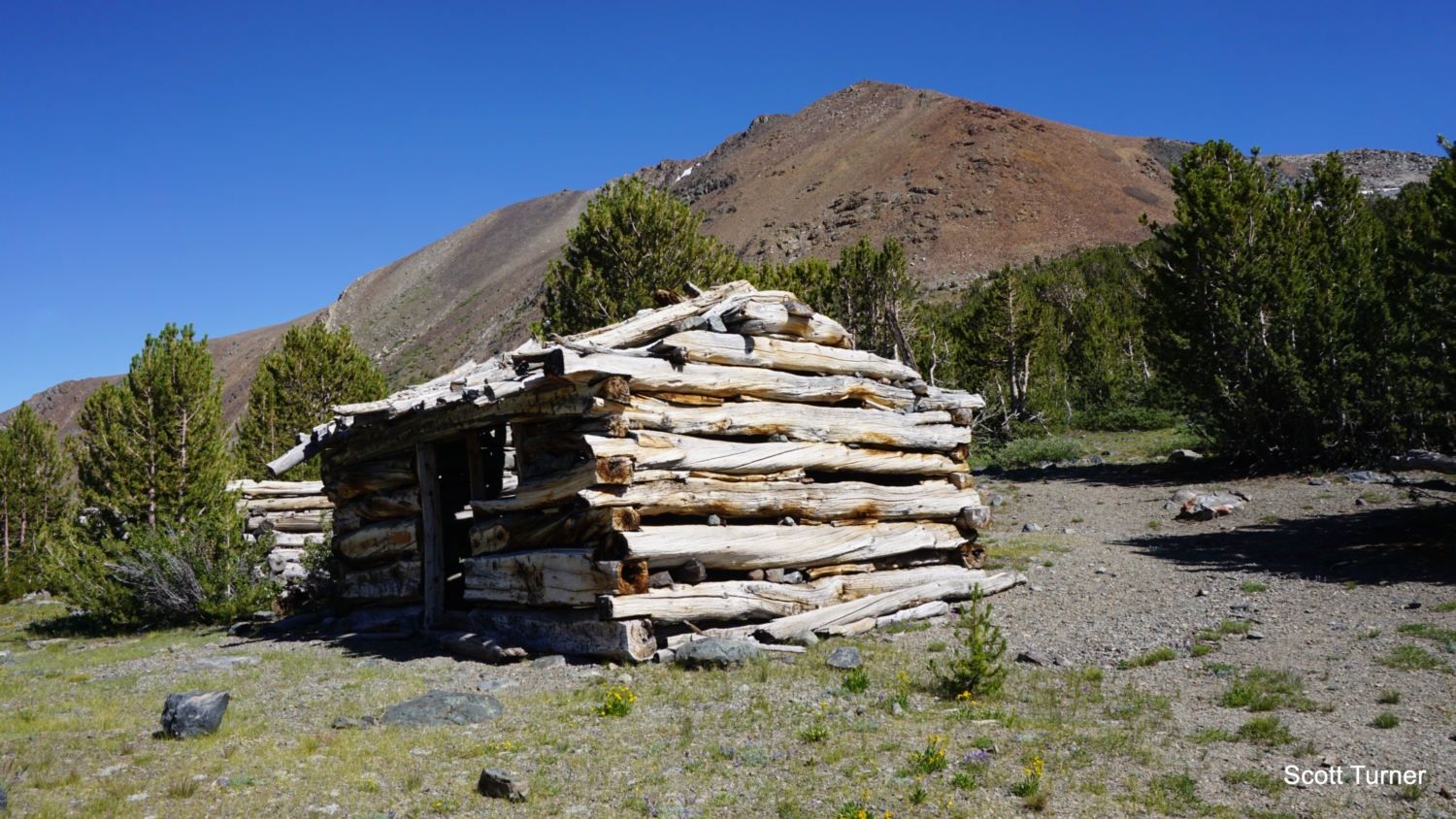
Following a massive wave of indigenous displacement, a mining operation known as the Golden Crown Mine set up shop at Mono Pass in search of rich veins of silver believed to be buried beneath the strikingly red metamorphic slopes of Mt. Lewis and Mt. Gibbs. Much like similar colonies at Bennettville near Tioga Pass and the Great Sierra Mine above the Gaylor Lakes, the Golden Crown Mine never made much profit or found much silver. The colony was abandoned, but the park service still maintains some Lincoln Log-esque cabins south from the handful of tarns that sit atop Mono Pass.
Red Tape

There are no permits needed to hike this route, but an entry fee to Yosemite National Park is required. You can use the Mono Pass Trail as a backcountry access portal, although there’s no camping allowed on this route within Yosemite National Park boundaries. You can push just beyond the park boundary into Inyo National Forest territory to camp on the east side of Mono Pass, which will set you up for an enjoyable overnight exploration of the entire area, including Spillway Lake, Parker Pass, and Mt. Lewis.
If you wish to backpack, you can reserve permits up to 24 weeks in advance and no more than two days from your hike. The Yosemite Conservancy handles the permit reservations through an online portal, through which you can select your starting trailhead. Select Tuolumne Meadows for your region and Mono Pass/Parker Pass for the specific trailhead. Yosemite Conservancy processes your request and rewards it per availability. If they grant the reservation, you will need to pick up your permit from the Tuolumne Meadows Wilderness Center prior to your hike.
The Opening Stretch

Mammoth Peak
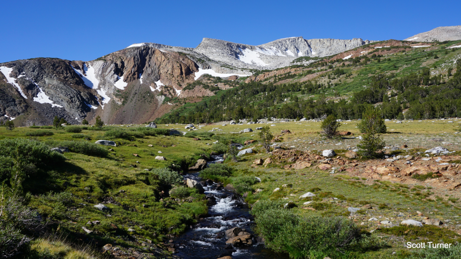
The combined route to Spillway Lake and Mono Pass begins from the Mono Pass Trailhead, and for the first 2.3 miles they run concurrently until they diverge at the first junction. The Mono Pass Trail is easy to follow, with only a couple of creek crossings to consider and a reasonable amount of elevation gain to slow your progress. The primary challenge is the altitude at the trailhead, which sits at 9,690 feet. If you haven’t acclimated, you may struggle with that elevation as you progress.

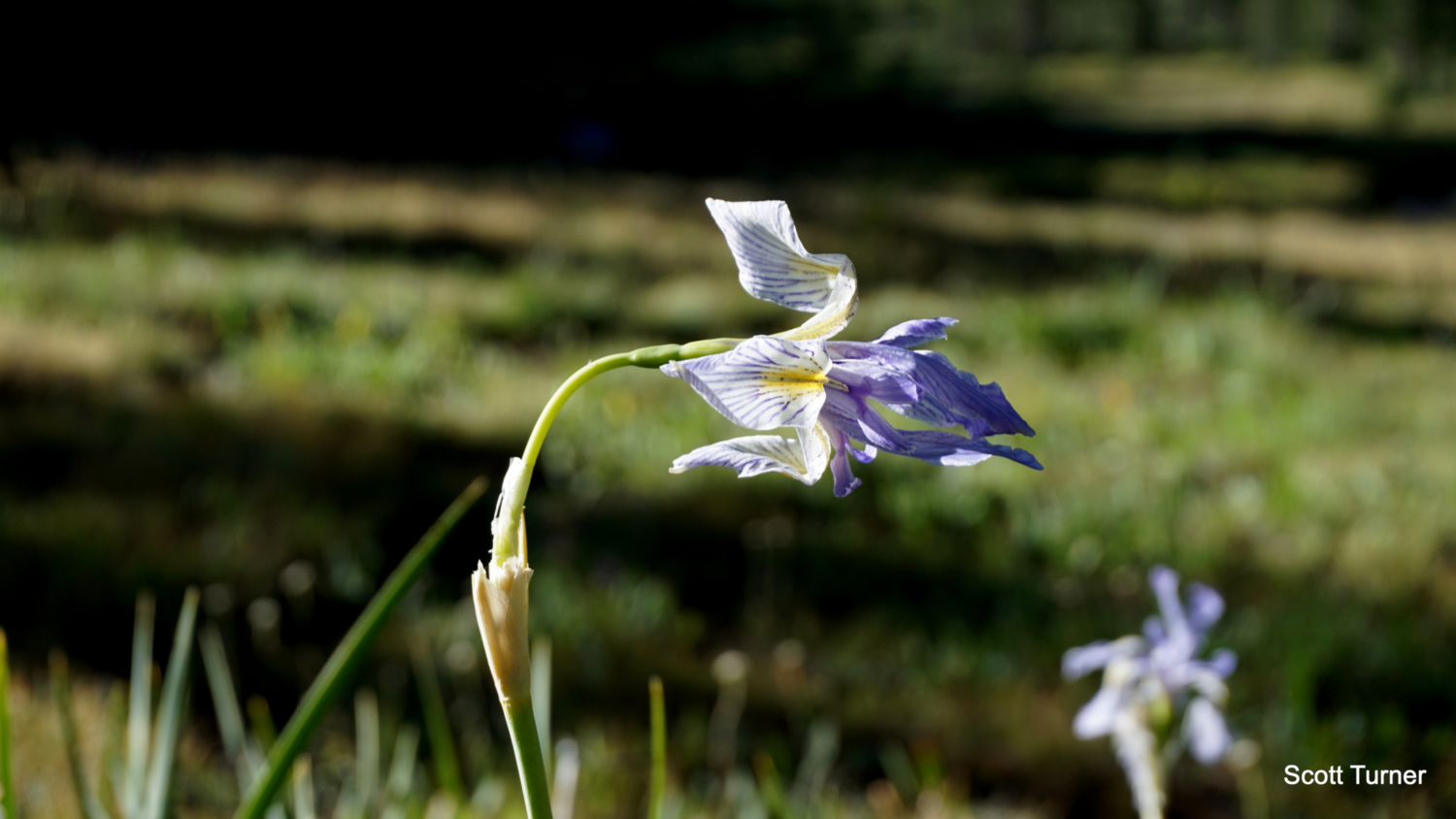
Sierra blue flag
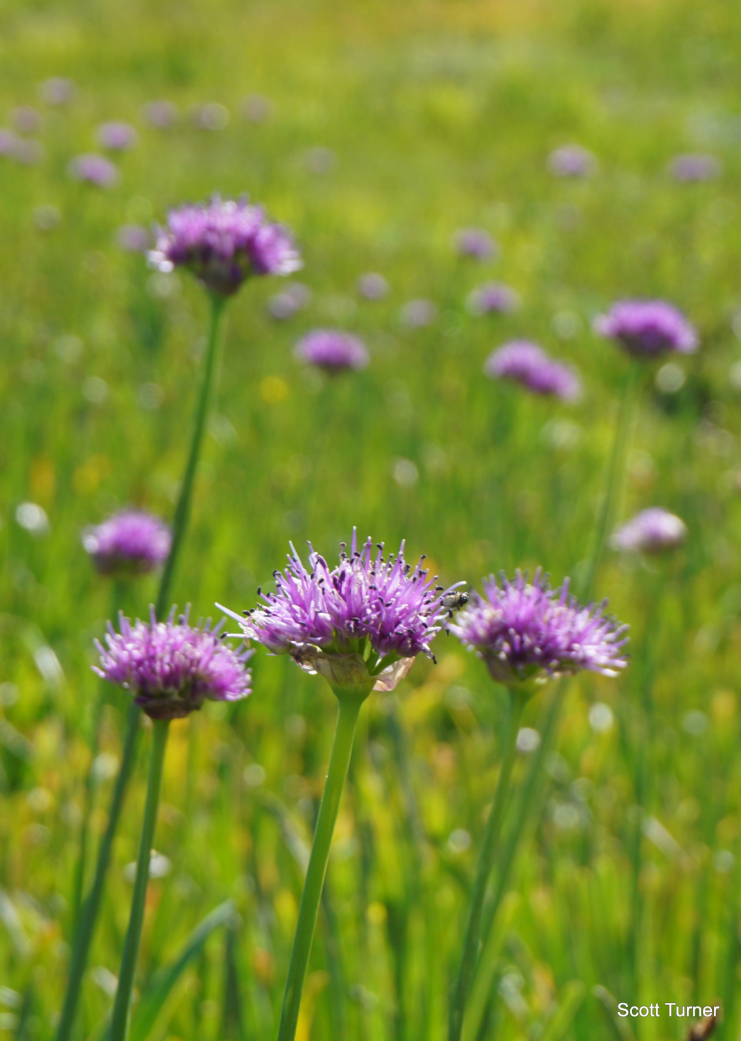
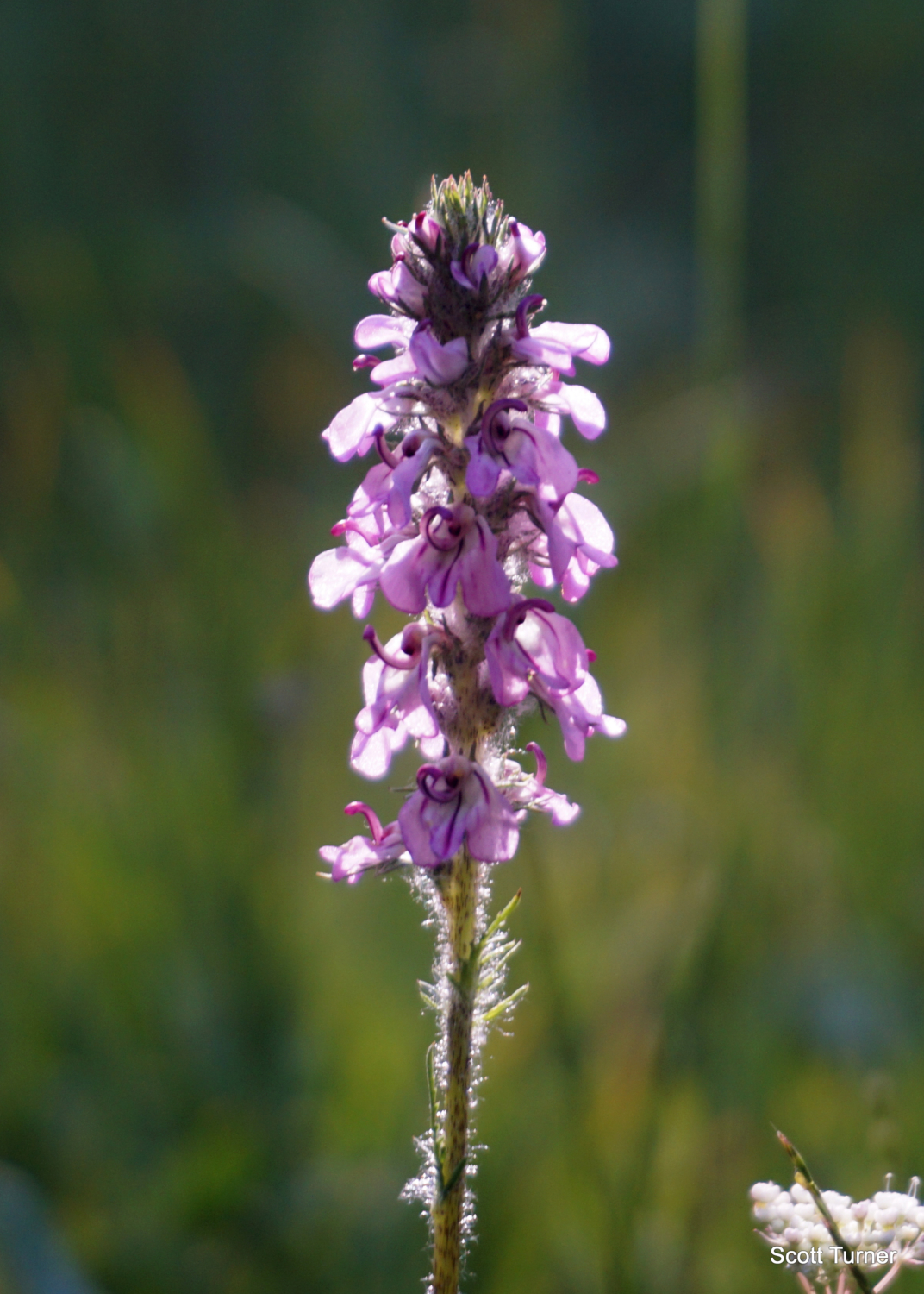
After a short drop into dense lodgepole forest, the trail cross an unnamed creek draining Tioga Pass’s small collections of tarns followed almost immediately by a crossing of the nascent Dana Fork of the Tuolumne River. Both crossings might require caution early in the season, but by mid-summer, the crossings require only an easy rock hop. After the river, the trail climbs for a bit before settling into a measured ascent heading southeast along the flanks of Mt. Gibbs, which rises unseen on your left. Views to the west of Mammoth Peak, which marks the northern end of the Kuna Crest, punctuate the forest canopy in dramatic fashion. After about 1.5 miles of hiking, the trail approaches but does not enter a linear meadow nourished by Parker Pass Creek, which rumbles along audibly on the right. As you progress along the meadow, look for an array of flowers, including Sierra blue flag, swamp onion, arnica, lupine, owls clover, a variety of penstemons, and many more.

Little elephant heads
Continue your mild ascent until 2.3 miles, where you reach a junction where the Mono Pass Trail diverges on the left from the Spillway Lake Trail diverging on the right.
Spillway Lake

After bearing right at the junction, the trail to Spillway Lake soon enters and then crosses a wide-open, grassy valley. Views toward the Kuna Crest to the west dazzle, while views of the Sierra Crest crowned by Gaylor Peak, White Mountain, and Mt. Conness open up to the south. After reaching the southern end of the grassy valley, the trail nears the banks of Parker Pass Creek, which you will follow closely the rest of the way to Spillway Lake.

Parker Pass Creek and the Kuna Crest
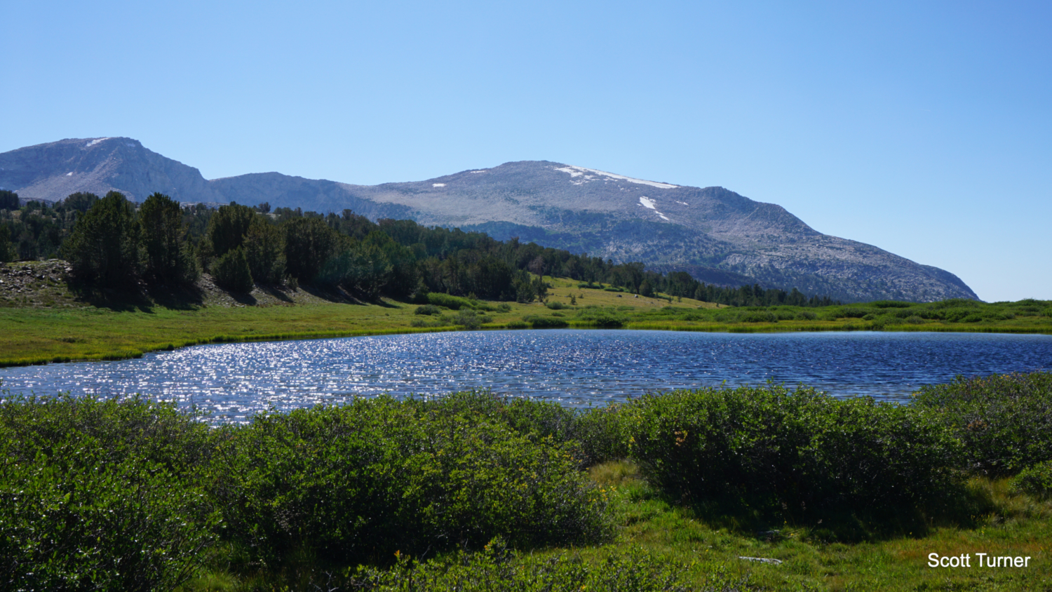
The climb steepens considerably as you climb parallel to the creek, but even then the climbing ratio is only a mild 450 feet per mile until the 4 mile mark where you begin to approach Spillway Lake. At this point, the trail leaves the forest to enter a vast, grassy depression nestled beneath the Kuna Crest, which presents an intriguing contrast between rust colored metamorphic peaks and shelves contrasted against the higher granitic peaks atop the crest.

Looking south across Spillway Lake toward the Sierra Crest
The trail doesn’t lead directly to Spillway Lake, and it actually fizzles out entirely around 4.25 miles. From here, you can walk cross country toward the banks of the lake. Be sure to enjoy the views north toward the Sierra Crest as well as the views south and west toward the Kuna Crest. The setting for the lake is inspired, and the grassy surroundings punctuated by wildflowers set it apart from the more typical sculpted lake basins you find in the Sierra.
Mono Pass

If you’re choosing the Mono Pass option, or perhaps if you backtracked from Spillway Lake and wish to complete the Mono Pass Trail from the junction at 2.3 miles, head southeast and soon east on the Mono Pass Trail as it begins a prolonged climb through dense lodgepole forest. Scenery is unremarkable for the first mile from the junction, but around 3.3 miles (reckoned from the trailhead), a grassy valley with views toward the Kuna Crest opens up the right, providing some much-needed scenery after a somewhat tedious climb through the forest. The trail continues its wide arc to the east as it wraps around the southern flank of Mt. Gibbs, and at 3.5 miles, keep left at a junction with the Parker Pass Trail, which diverges on the right to cross the meadow and to begin a long ascent toward its namesake pass.

The views toward open meadows and rust-colored peaks improves as you approach Mono Pass, and by 3.6 miles the climbing also comes to an end. As you continue due east along the base of Mt. Gibbs, look ahead for a handful of tarns that herald the arrival to the pass. Just as you pass the first tarn at 3.7 miles, keep an eye out for an unmarked trail leading south through the meadow and uphill into the trees. This path will continue south for another 0.2 mile to a set of preserved cabins marking the spot of the Golden Crown Mine colony. Mine shafts can also be found nearby, and if you poke around the area, you’ll earn yourself a nice view east down Bloody Canyon and toward Mono Lake.

Mono Lake and Bloody Canyon
After returning to the Mono Pass Trail, turn right and continue a short distance to Mono Pass itself. A pair of signs (one the classic Yosemite metal stencil sign and another the wooden Inyo National Forest sign) mark the park boundary and the high point of the pass. However, aside from a nice view of Summit Lake, there’s still a bit further to go. Continue heading east on a gentle descent around the banks of Summit Lake, pass a mine shaft at the 4.4 mile mark, and round a bend to get a spectacular view down Bloody Canyon toward the Mono Basin and the blue waters of Mono Lake.

This is about as far as it’s sensible to go into Bloody Canyon, as the steep climb down means an equally steep climb back up to Mono Pass. However, if you’re willing to do a bit of car shuttling, you can arrange to leave a car at the Bloody Canyon Trailhead . This allows you to hike part of the historic migratory route (albeit in reverse) while enjoying some of the beautiful features in Bloody Canyon – seasonal fall color, the Sardine Lakes, the towering red canyon walls.
If you don’t have the shuttle option available, or you don’t want that kind of hike, retrace your steps back to the Mono Pass Trailhead to wrap up your day.

Swamp onion
Tags: Bloody Canyon, Dana Fork Tuolumne River, Golden Crown Mine, Inyo National Forest, Mining Colonies, Mono Lake, Mono Pass, Mono Pass Trailhead, Mono People, Mt. Gibbs, Mt. Lewis, Parker Pass Creek, Sierra Crest, Spillway Lake, Tioga Pass, Yosemite, Yosemite National Park