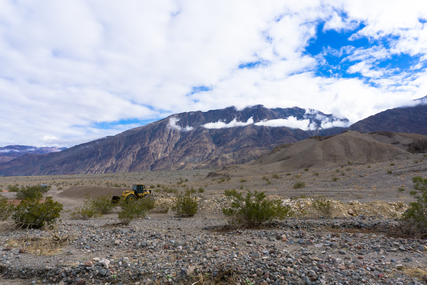
South of Badwater Basin, in a nondescript turnout off Badwater Road lies a small ditch with a pile of gravel. Most visitors to the park drive past this without ever even noticing it — either on their way toward the attractions of Furnace Creek or on their way south back to the freeways of Southern California. But those with keen eyes who spot this side-trip will gain access to one of the most fun, most adventurous hikes in all of Death Valley National Park — an unmaintained, unmarked trail that leads to three spectacular slot canyons.
Please note that to do this hike, you will be required to use your hands, knees, and elbows, or other parts of your limbs to climb vertical ledges over 6 feet tall, and at times you’ll have to squeeze into dark, narrow sections about 1.5 feet wide. There is a short (but optional) stretch that is completely in the dark and will require a flashlight or headlamp. Of course, you are also hiking in a canyon in Death Valley — so you’ll also want to make sure you have the standard desert hiking kit with lots of water, sunscreen, and salty snacks. As with many other hikes in Death Valley, you are also hiking through federal wilderness here — so please make sure to practice the principles of Leave No Trace and be mindful of your surroundings and your fellow hikers.
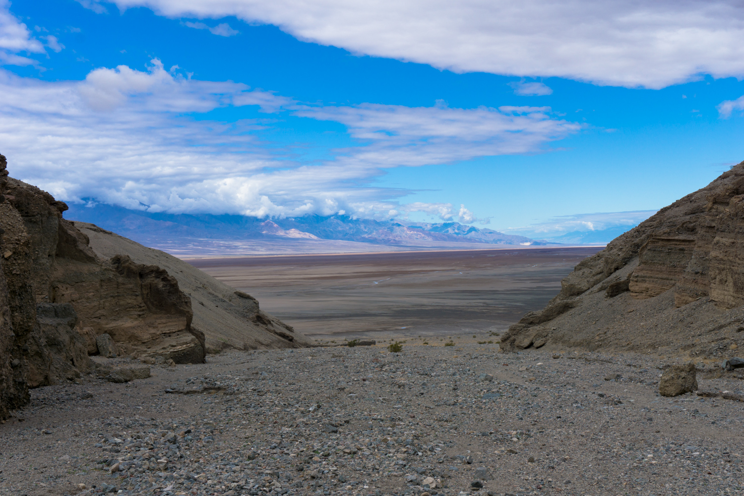
At the end of a short dirt road (usually passable for passenger cars), a small parking area provides access to two canyons — Willow and Sidewinder. For Sidewinder, head south from the lot and look for a faint use trail that climbs up a rough, rocky, and gravely alluvial fan toward the Canyon’s mouth.

As you’re ascending this route, it’s not entirely clear which canyon you’ll be entering … but by 0.3 mile, the mouth of Sidewinder Canyon becomes clearly evident. Just remember — if you’re not climbing up to get to the canyon, you’re headed to the wrong place.

the mouth of Sidewinder Canyon
From the mouth of the canyon, it’s about 0.6 mile to the first major slot canyon — although there are several other side spurs that offer up opportunities for exploration if you’re so inclined. The three slot canyons mentioned here all have their entrances on the south side of the canyon (the right hand side if you’re trekking into it).
Although it’s not especially difficult hiking on that initial 0.6 mile journey, you are walking steadily uphill on some soft gravel, which means each step forward will take a bit more gas out of your system than a trail on solid ground would.
Around 0.6 mile from the mouth of the canyon, look to the south and you’ll see this side canyon:

The side canyon splits into two main branches, and although the branch to the right looks like it’s where you’d expect more of a trail to be, you’re going to want to head to the boulder-strewn side instead.
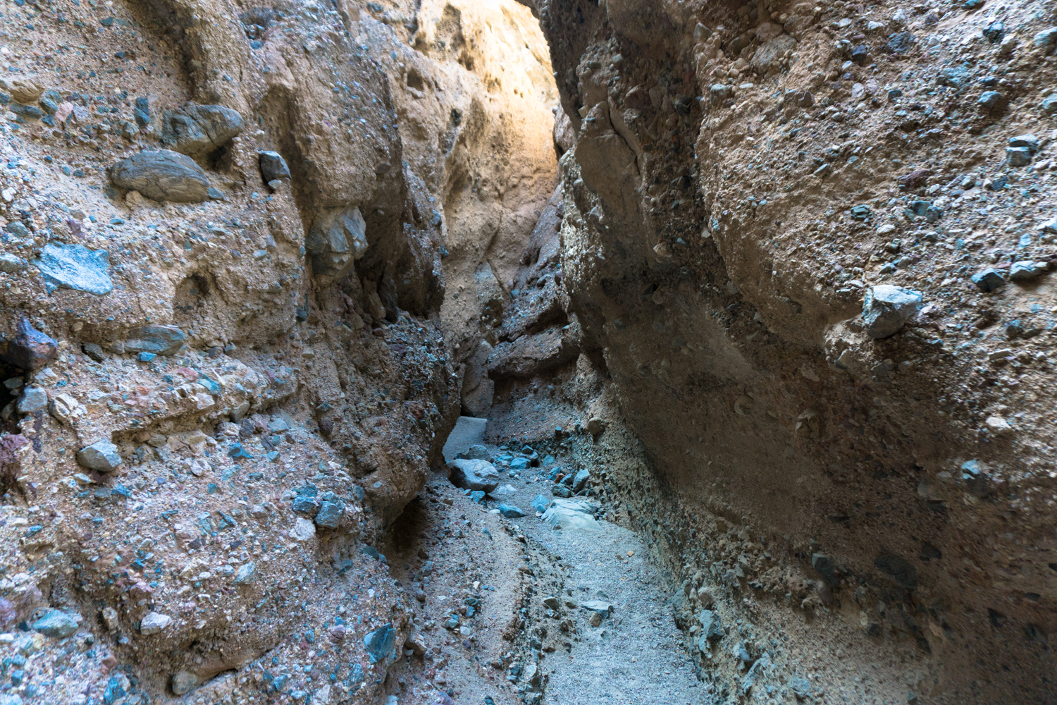
Look for an opening on the left hand side of the boulder pile, then climb up and over the first boulder, where you’ll have to climb above another boulder that’s not visible until you’re inside the cavern. From here, there’s a short but very tight section where you’ll probably have to remove your backpack to sidestep through.
Once you get through this very small doorway, you’ll find yourself in the first slot canyon.
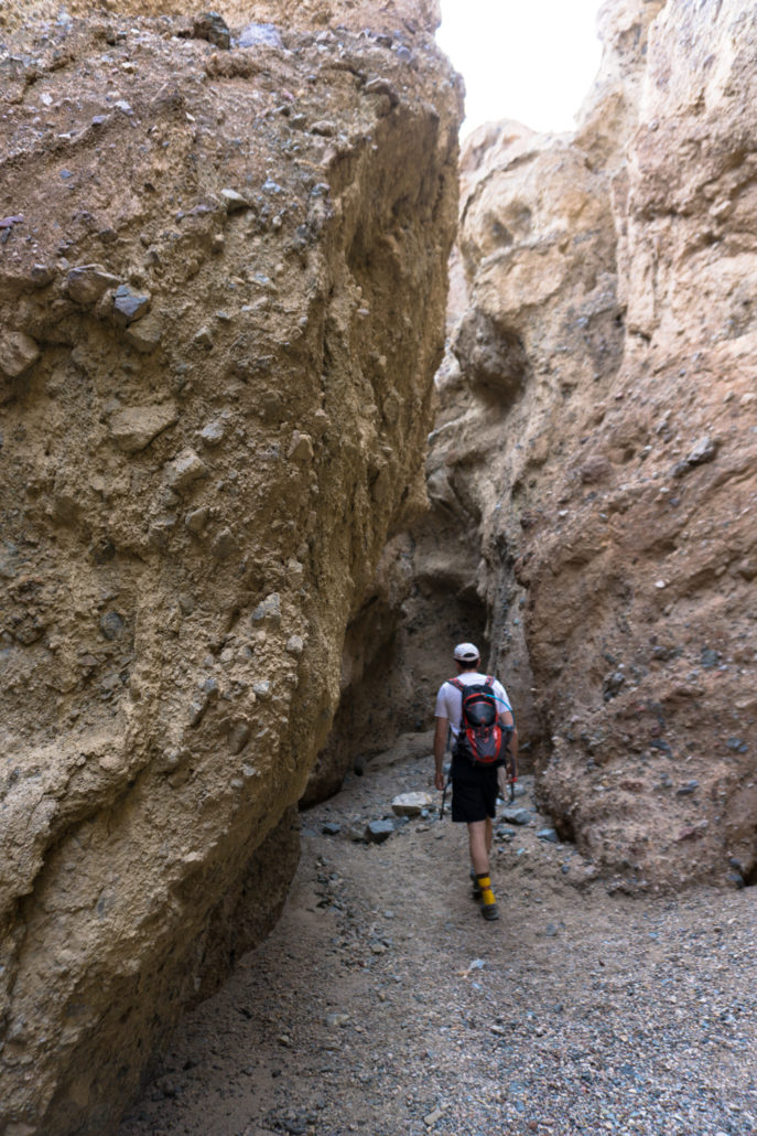
This first slot canyon is the shortest of the three in Sidewinder — only about 0.1 mile from start to finish — but the scenery is still pretty dang spectacular.

At the very end of the first slot canyon, the walls narrow considerably and all light is blocked from entering above. If you want to reach the final stretch of the first slot, you’ll need a headlamp or flashlight to climb up the last few small dryfalls and into the shady alcove at the very end.
Return back to the main branch of Sidewinder Canyon and continue another 0.1 mile up the canyon toward the mountains. Look on the south side of the canyon wall for another clearly visible slot canyon entrance.

The Second Slot Canyon from the main branch of Sidewinder
The Second Slot doesn’t require any squeezing or climbing to enter — you just walk right in (and maybe watch your head).

Come on in!
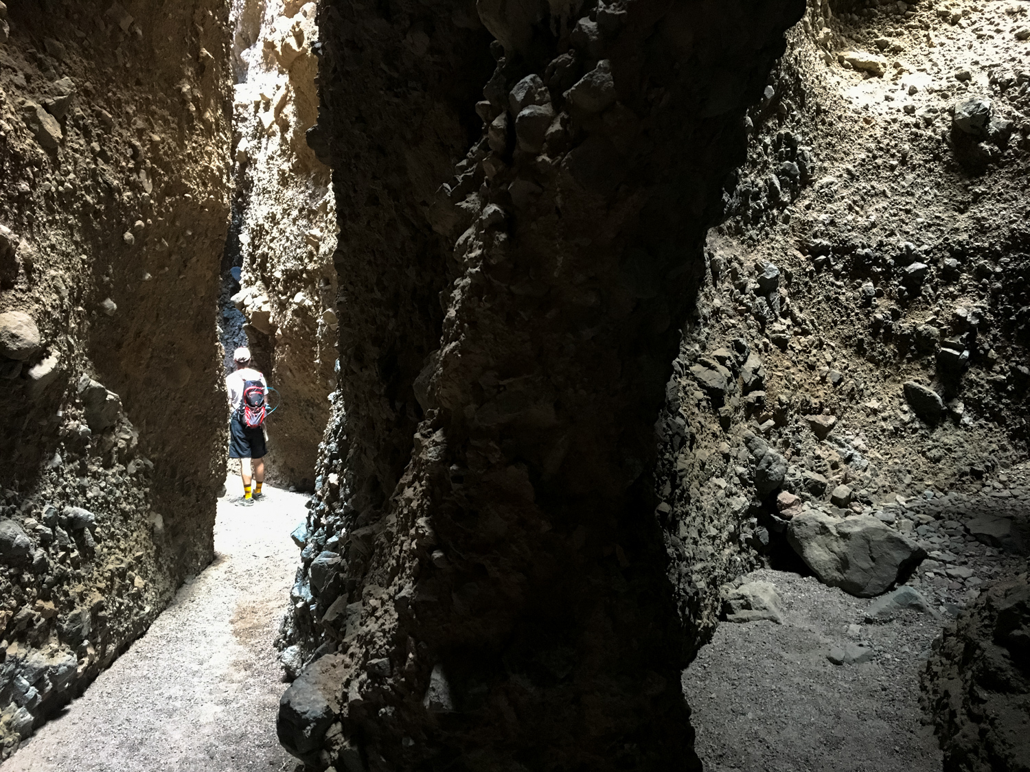
The Second Slot Canyon does require significantly more rock climbing and scrambling than the First Slot does — and it’s also significantly longer. In fact, there isn’t an official end to the canyon. The official NPS GPS track for this section goes 0.5 miles in, but there is great scenery along the way (and an opportunity to go even further inside if you’re in the mood for it).
This slot canyon has a few sections that open up, allowing lots of light to stretch down into all the nooks and crannies of the canyon.


A large amphitheater in the Second Slot
We went about 0.4 mile into the Second Slot before turning around and heading back to the main canyon.
To reach the Third and final slot, continue up Sidewinder Canyon for another 0.25 mile and once again look at the south side of the wall for the obvious entrance to the side slot canyon.
The Third Slot is probably a bit easier than the Second Slot in terms of difficulty, but it does pack more short climbs into a shorter overall distance and there is one exceptionally tight squeeze toward the end.
It also has the most spectacular scenery of the three, with tall, narrow canyon walls and even a few arch formations, too:


The Third Slot also has no official ending, but just before the 0.2 mile mark, you can enter one final very tight tunnel. You’ll have to remove your pack and throw it in front of you to continue, crawling on your hands and knees (and avoiding the jagged edges of the rocks on the walls, too).

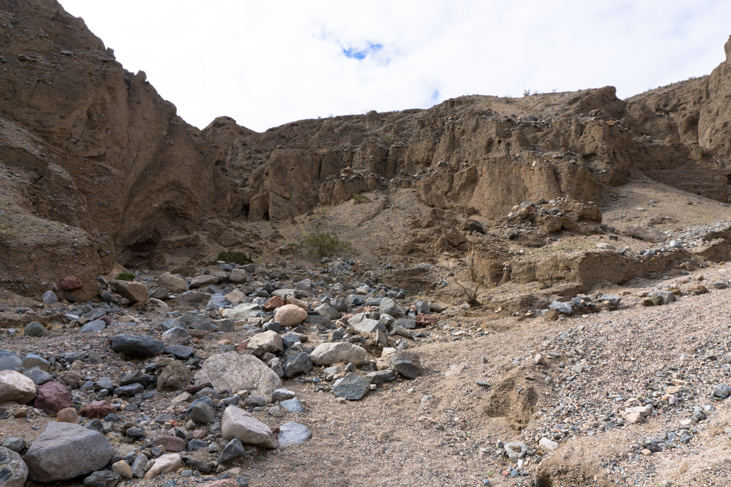
Just past this short, tight squeeze, the canyon opens up into a beautiful amphitheater where enormous boulders are lodged above you in every direction. A tall, almost sheer dryfall enters from the south side — and the canyon does keep on going if you’re so inclined.
If you’re not, though, it’s also a great place to have a lunch or snack before returning back to the trailhead the way you came in — making sure to enjoy the exceptional views of Death Valley from inside Sidewinder Canyon as you descend.