With dozens of named points along the north and south walls of Yosemite Valley, and with many more dozens of accessible peaks, there are more opportunities to survey this legendary landscape than most hikers will ever have time for. So, how to prioritize? Well, I can think of one particular destination that offers remarkable 360-degree views spanning Yosemite National Park from El Portal to Mt. Conness featuring outstanding sunset, sunrise, and night sky views. And, that destination requires only a modest amount of effort to attain.

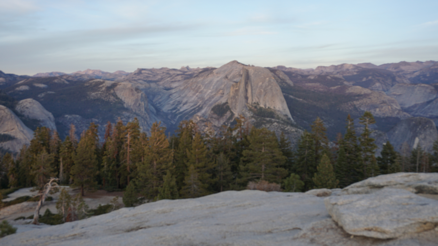
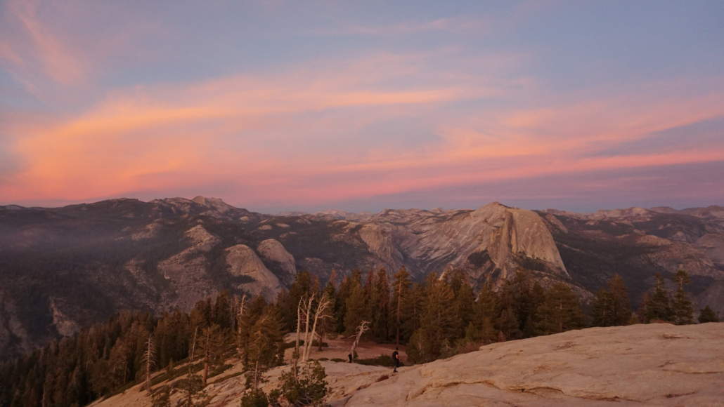
That destination is Sentinel Dome, a rounded granite outcrop rising from a dense forest on the slopes above Glacier Point. At 8,122 feet of elevation, Sentinel Dome offers unobstructed views that take in the Clark Range, Half Dome, Tenaya Canyon, Mt. Hoffman, the Sierra Crest crowned by White Mountain and Mt. Conness, North Dome, Yosemite Falls, Eagle Peak, and perhaps most stunningly, El Capitan. Come here in the evening or the morning, and you are likely to walk away with an unforgettable wilderness experience that showcases everything that makes Yosemite great.

Note that Glacier Point Road closes from late fall to late spring in most years. You can check current road conditions by following this link.
Starting from the combined trailhead for Sentinel Dome and Taft Point, follow a short connecting trail downhill from the parking area/restroom to a signed junction. Turn right at this junction to travel northeast and then north toward Sentinel Dome. The first 0.25 mile of the trip passes through open forest with minimal views before settling into an occasionally rugged climb that picks up 450 feet over the next 0.8 mile to the summit.

At 0.75 mile, keep left when the trail reaches and then merges with a dirt road. Continue along this dirt road for about 100 yards, and then veer left onto the trail indicating that Sentinel Dome lies ahead. Turn left at an additional junction that lies another 100 yards or so north, which places you on the final approach to the summit of Sentinel Dome. The last stretch of this climb occurs on bare granite, but the way to the top is obvious.

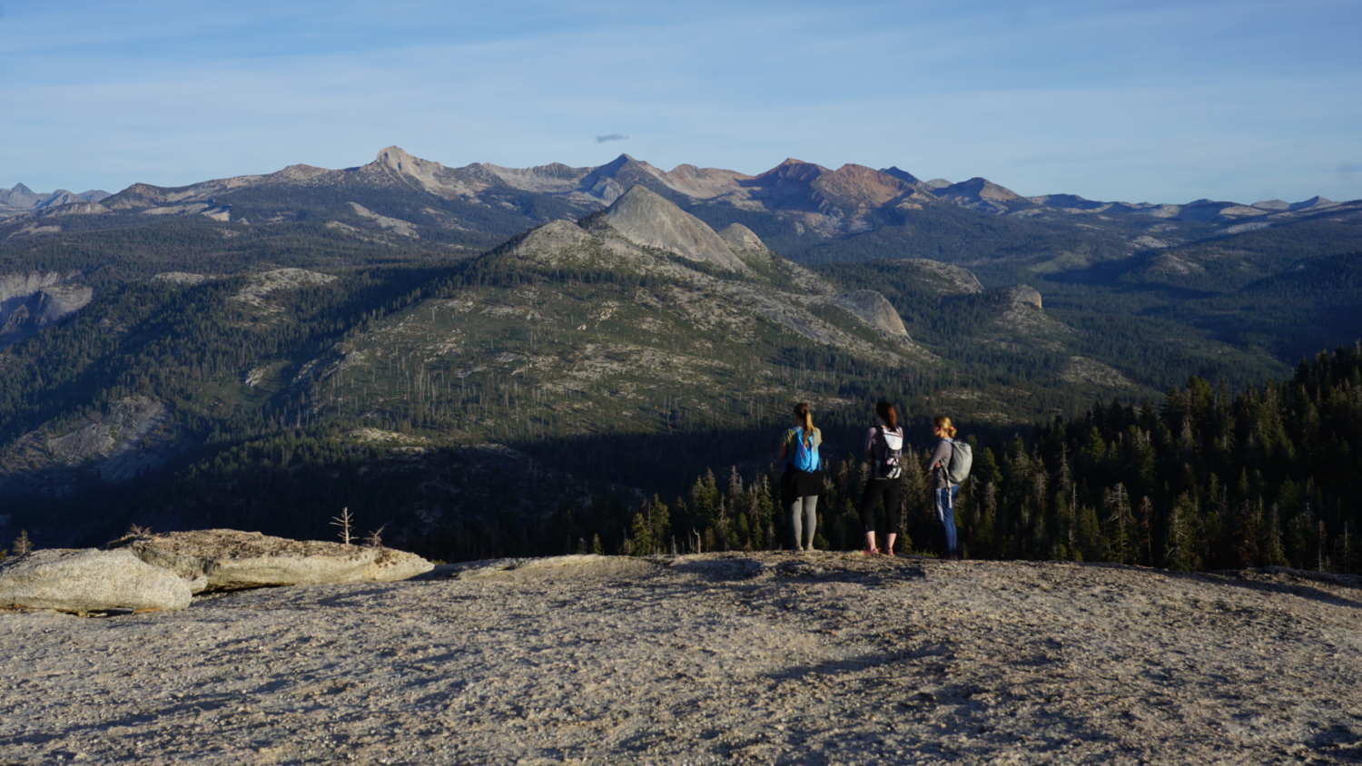
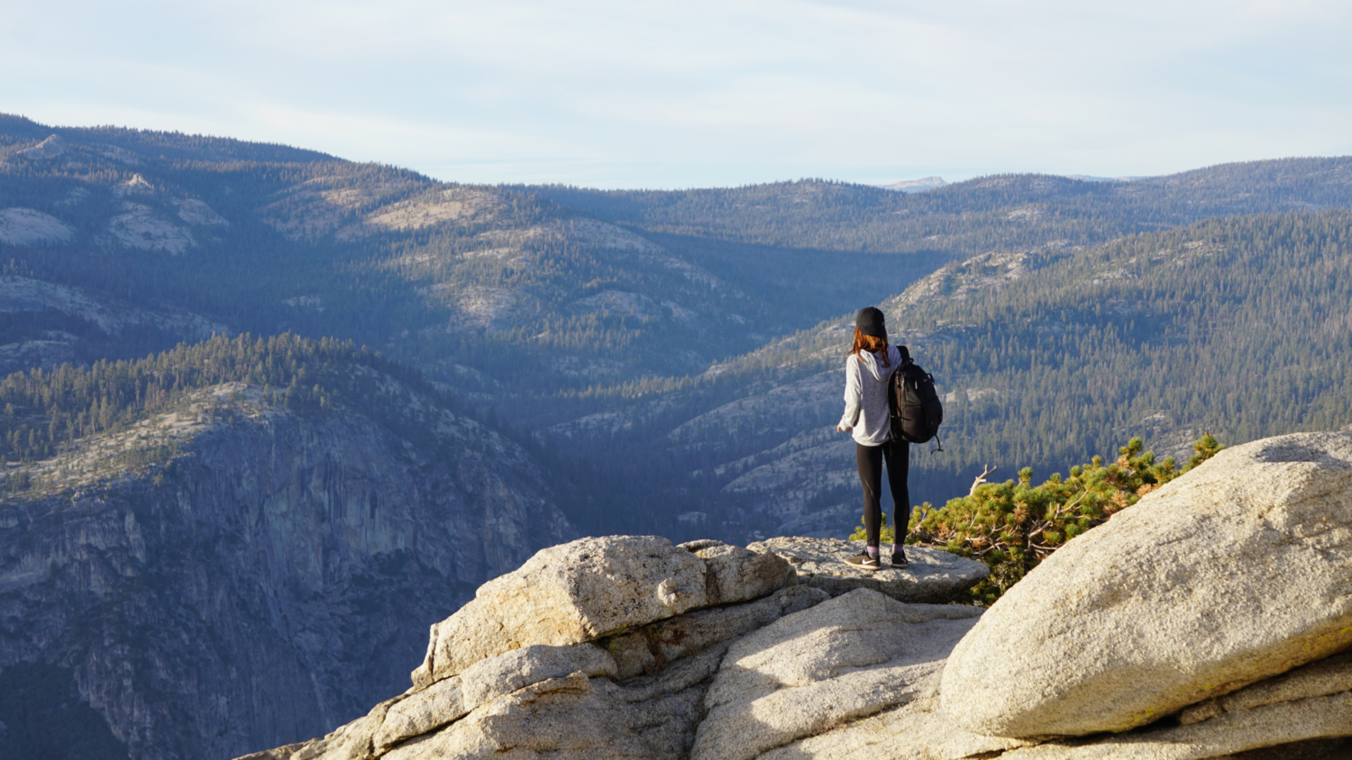
The spacious, rounded summit offers a number of places to consider views in every direction. You will also find the remains of the old Jeffrey pine made famous by Ansel Adams. The tree succumbed to drought in 1976, but its remains still sit near the summit. Rock outcrops offer places to set up shot if you’re waiting out a sunrise or sunset, but be prepared for a crowd of people here to do the exact same thing. Photographers often jockey for position near the summit, and a little courtesy goes a long way in making sure that everybody has a chance to enjoy the scene.

To achieve the aforementioned 360 degree views, you will have to take a short stroll encircling the summit. If you come with a good map in hand, you’ll have no trouble picking out notable landmarks such as Mt. Starr King, Liberty Cap, Mt. Broderick, Mt. Clark, Tenaya Canyon, Mt. Watkins, Mt. Hoffman, North Dome, Mt. Conness, White Mountain, Yosemite Point, Yosemite Falls, Eagle Peak and the Three Brothers, El Capitan, the Cathedral Rocks, and most obvious of all, Half Dome. With the right kind of atmospheric conditions (high clouds, departing storm, clarity), the sunsets and sunrises can be superb. Likewise, a clear sky yields superb stargazing, which is a great summer options thanks in part to the short hike to the top.

Note that you can pair this with an additional easy out-and-back hike to Taft Point. It’s easy enough to complete both, but you will face a choice between destinations if you’re chasing the sunset. I give Sentinel Dome the nod here. It doesn’t see quite as much of Yosemite Valley as is visible from Taft Point, but the 360 degree view is difficult to top.
Tags: El Capitan, Glacier Point Road, half dome, Sentinel Dome, Sunrise, sunset, Taft Point, Yosemite, Yosemite Falls, Yosemite Valley