Anza-Borrego Desert State Park’s Carrizo Badlands and Split Mountain regions feature a bewildering maze of canyons cut through the sedimentary remnants of ancient seas, lagoons, deltas, and lakes. Millions of years of aquatic incursions from the Gulf of California and the prehistoric Sea of Cortez combined with periodic flooding of the Colorado River have left a richly varied sedimentary layer cake ringed by granitic mountains. As the land has risen, fallen, and shaken, this layer cake has been thrust up, dragged down, and tilted in countless directions. And as is usually the case where sedimentary rock is concerned, the true artistry comes courtesy of falling and rushing water as it carves out sinuous canyons and washes.

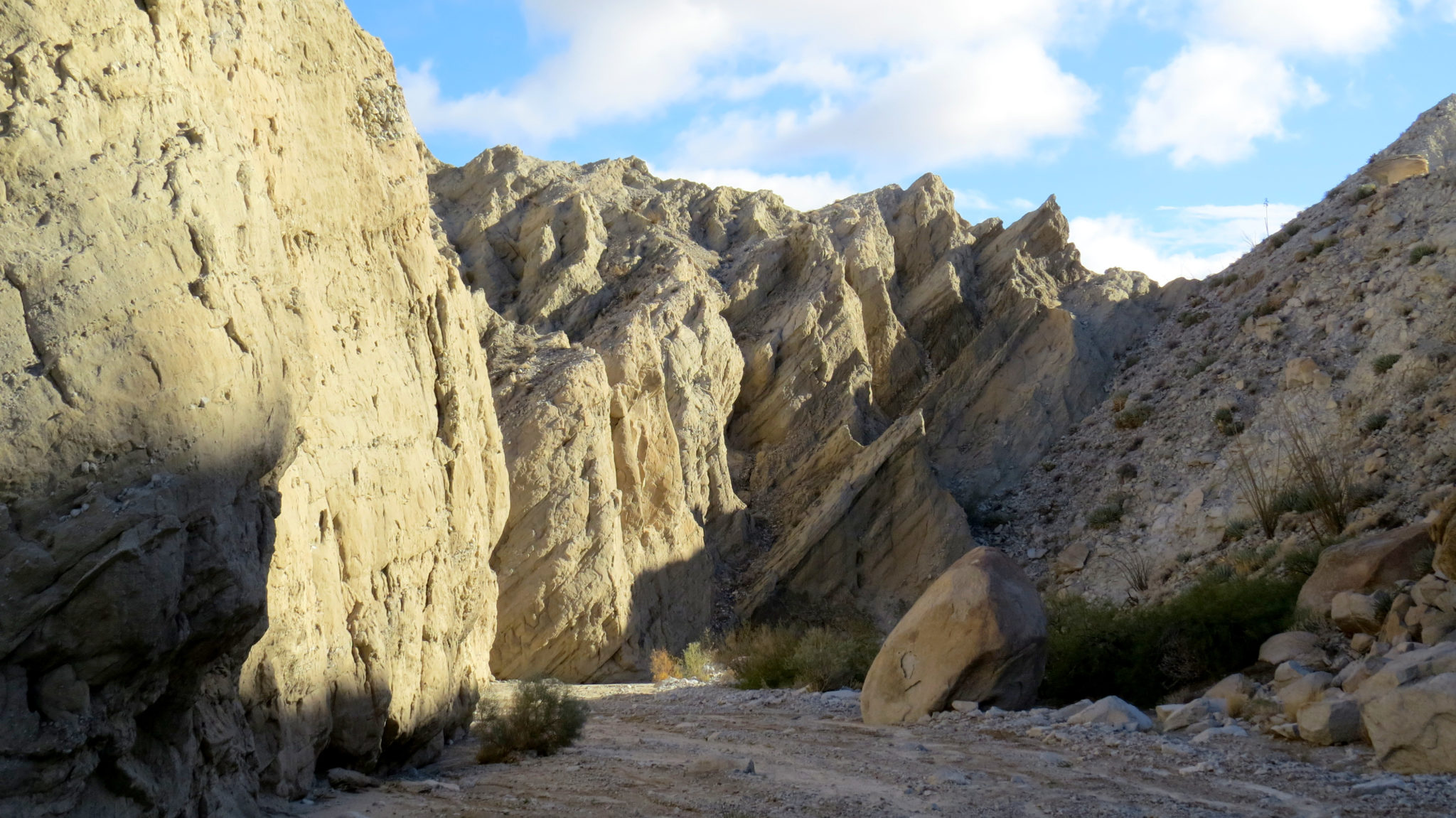
Of all of these canyons and washes, Sandstone Canyon on the western reaches of the badlands has earned a reputation as one of the most beautiful and most impressive. The canyon’s towering walls and numerous tributaries provide hours, even days of exploration for desert enthusiasts. Periodic flooding has cut through several layers of sandstone to create the sheer walls and sandy canyon floor. The walls of the canyon contain sandstone composed of sediment deposited over millions of years by the Colorado River as it gouged out the Grand Canyon (yes, the contents of the Grand Canyon had to go somewhere). The floor of the canyon, surprisingly, contains granitic sand composed of new and old granite washed down from mountains to the north and west. The scope of the canyon impresses on a grand scale, while the geologically curious will find many fascinating mysteries embedded in the canyon’s walls.

One important consideration for hikers looking to explore the canyon is the question of getting here. The road to Sandstone Canyon is unpaved and suitable only for 4WD vehicles. This puts the hike out of reach for all other passenger vehicles unless you want to take a much longer approach from June Wash. Although non-4WD passenger cars can navigate a ways up the road to June Wash, you will still need to take a very long walk (8 miles round-trip) just to reach the headwaters of Sandstone Canyon. At a minimum, the entire route would be 15 miles, provided your car can reach the start point of June Wash. If the conditions aren’t favorable for passenger vehicles on the road to June Wash, you may be looking at more like 17-19 miles.

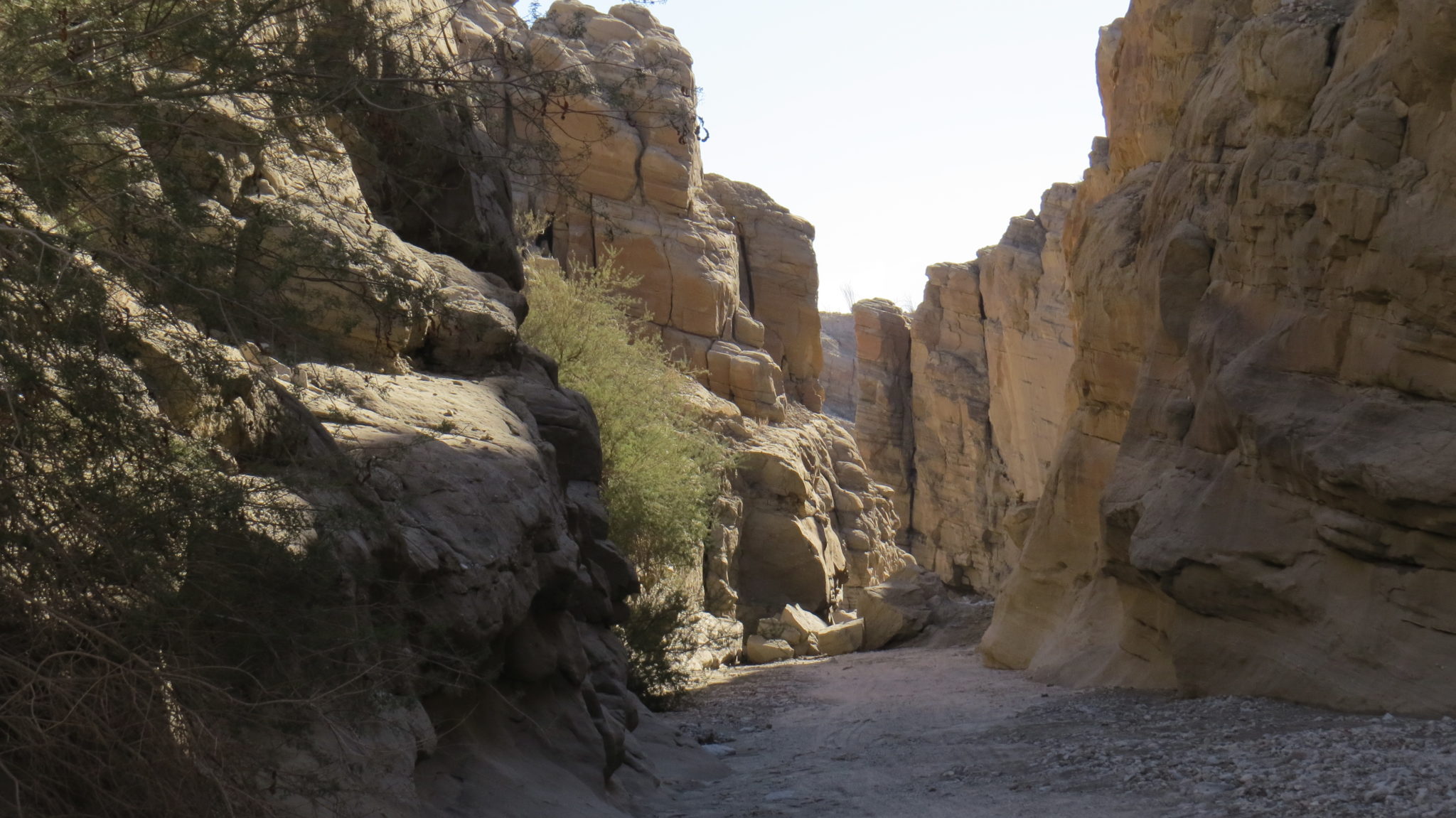
From the confluence of Sandstone Canyon and Fish Creek Wash, commence travel up-canyon over coarse granitic sand. You’re following a road here that receives sporadic Jeep traffic and occasional motorbike traffic. If you’re here later in the day, you can count on seeing at least a few vehicles, but if you hike early in the morning or during the week, you will enjoy supreme quiet and tranquility. The canyon quickly narrows with often sheer sandstone walls rising 40-100′ above you. Although the canyon never narrows to the point of achieving “Slot” status, some impressively narrow segments block out the outside world to create a cool, cloistered seclusion.

If you only have time or inclination to explore the canyon, navigation is as simple as sticking to the road until it peters out while making lefts at every junction with feeder canyons joining from the north. The route ends atop the aforementioned saddle that separates the canyon from June Wash to the west. If you’ve got the time, there are several worthwhile diversions to consider.

The first side trip arrives at 1.0 mile in the form of a narrow, rocky canyon feeding in from the north/right. Follow this twisting, almost slot-like defile a short way to discover a tinaja, a depression that holds a modest amount of water following rain storms. Such depressions occur throughout the badlands to provide a source of water for resident bighorn sheep. A steep dry waterfall impedes further progress.

The second side trip lies about 0.3 mile further upcanyon. Like the previous side canyon, this one also feeds in from the right. Follow the canyon over jumbles of boulders before encountering a short slot with a climbable dry fall. Skillful climbers can work their way up to the rim of the canyon to wander around the flatlands above. Rumor has it that there is a network of old Indian trails tracing many of the ridges dividing the various washes and ridges in the area, but I have not been able to find them.

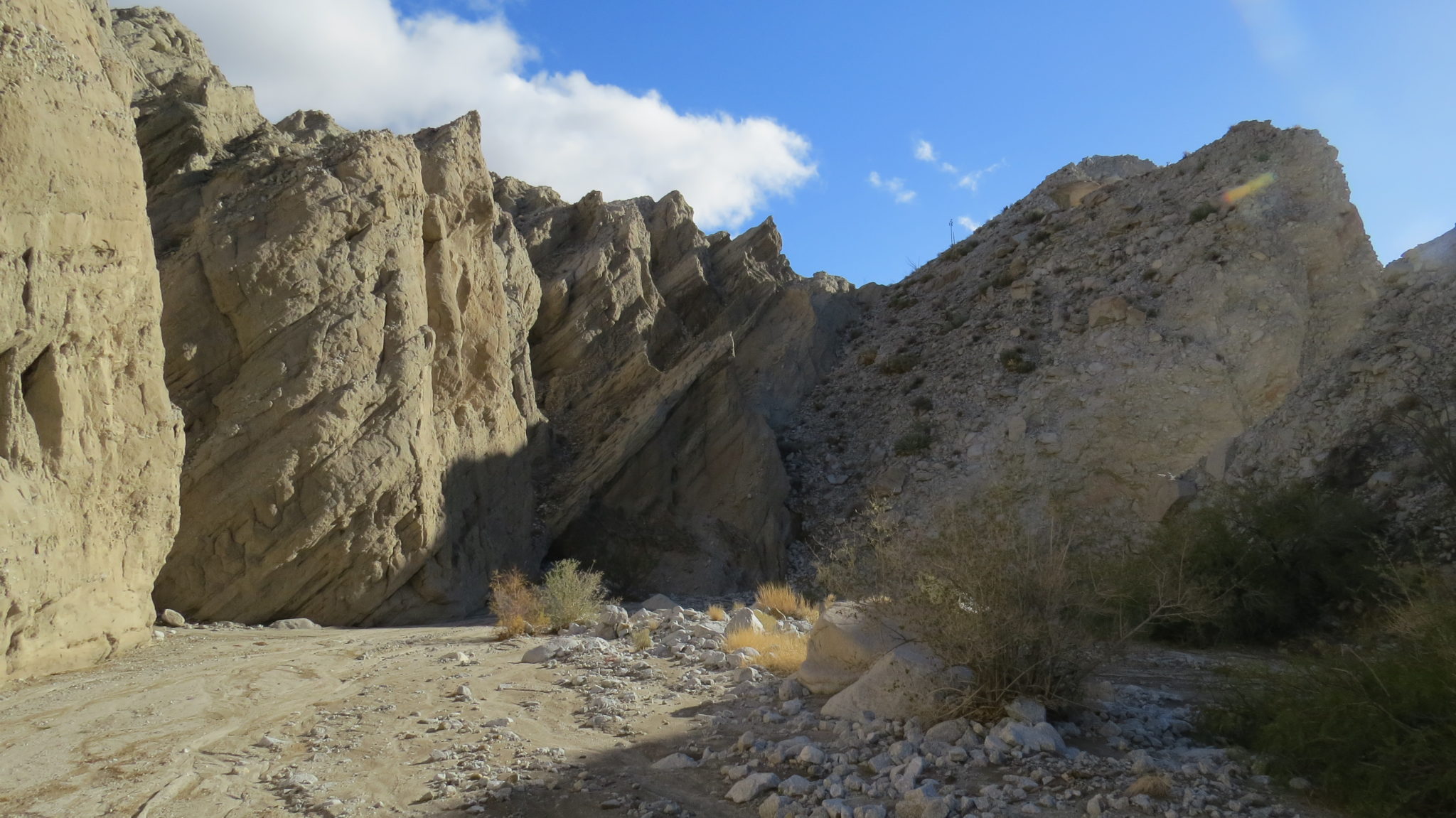
The third side trip and final diversion within the canyon arrives 2.4 miles in at a very pronounced and obvious confluence where a feeder canyon joins Sandstone Canyon. If you turn right into wider, sandier canyon, you can continue for a little over 0.5 mile while keeping right at junction about 0.3 mile in. After about 0.5 mile, pick a reasonable slope on your right to climb out of the canyon for a view of the Mud Palisades where a soft outcrop of sedimentary rock has been “melted” by years of erosion.

Diablo Benchmark, a triple-divide peak presiding over the June Wash, Sandstone Canyon, and Arroyo Tapiado watersheds, is your final opportunity for continued exploration. From the saddle dividing Sandstone Canyon and June Wash, turn southeast and work your way up the steep, cactus infested slope. If you continue east/southeast uphill, you will eventually top out at Diablo benchmark indicated by a USGS survey marker. The views from this modest peak far outweigh the reasonable amount of effort it takes to get here. The views in all directions are astounding, especially those that survey the entirety of the Carrizo Badlands.
Tags: Anza-Borrego Desert State Park, Carrizo Badlands, Diablo Peak, Fish Creek Wash, Mud Pallisades, Sandstone Canyon, Split Mountain