Given the close proximity of such a beautiful destination to a highly visited area, you might expect the banks of Robinson Lake to be teeming with people. The surprise with this route is that a relatively small percentage of people take the short, steep, lightly maintained trail up to the lake despite the hundreds of daily summertime visitors who pass through Onion Valley.

Perhaps the explanation is that most visitors here have their sights set on high country access by way of Kearsarge Pass. Or perhaps the steep grade of the climb coupled with a high altitude starting point (9,200’) steers people away. Whatever the case, you can get a bit of peace and quiet at this lovely subalpine destination, provided you’re willing to do the hard work to reach the lake.
From the entrance of Onion Valley Campground, walk east past campsites 2, 4, and 6 until you find the path leading away from near campsite 7 into a grove of quaking aspen. Just beyond the campsite, you will cross Independence Creek before continuing through forest of lodgepole pine and fir.
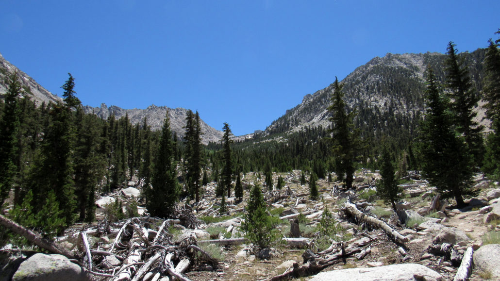
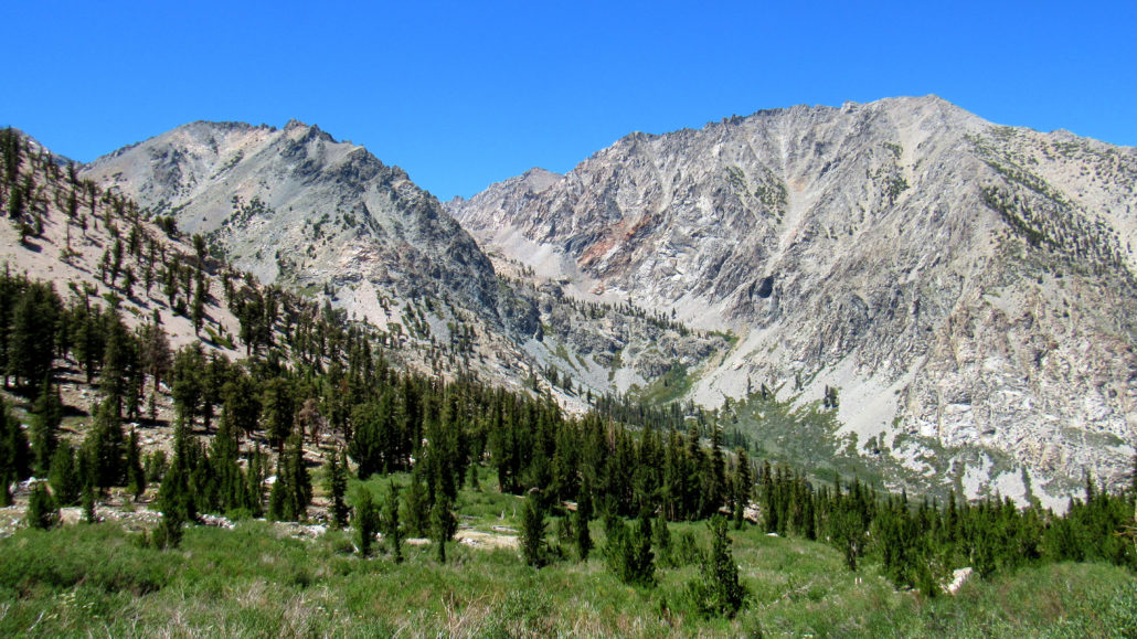
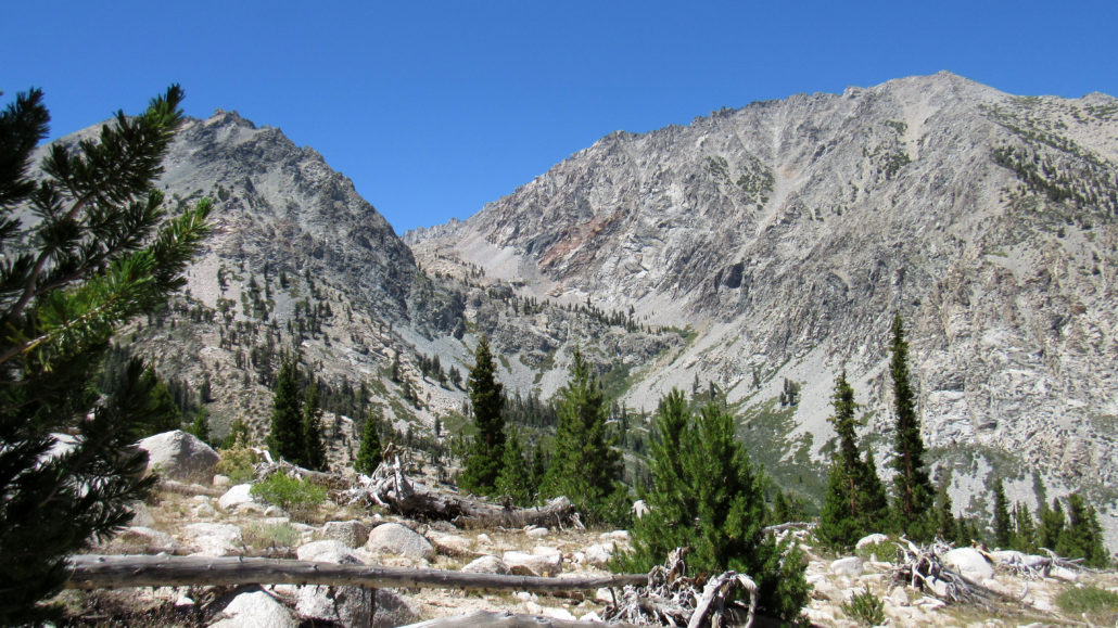
At 0.25 mile, the trail switches back three times before settling into a steep, unrelenting grade in excess of 1,000’ per mile. Fortunately, you don’t have much further to than a mile, or else the hike would rapidly become too challenging to enjoy. As you climb, you will pass through occasionally sparse forest before entering a burn zone above Independence Creek. The sparse recovering forest allows views north into Onion Valley that improve as you climb.
The further you go, the less maintained the trail becomes. Although the Forest Service pays scant attention to this particular trail, enough people walk it to keep it relatively easy to follow. That said, a handful of sandy sections and scrambles may make the upper reaches of the trail less appealing to novices.

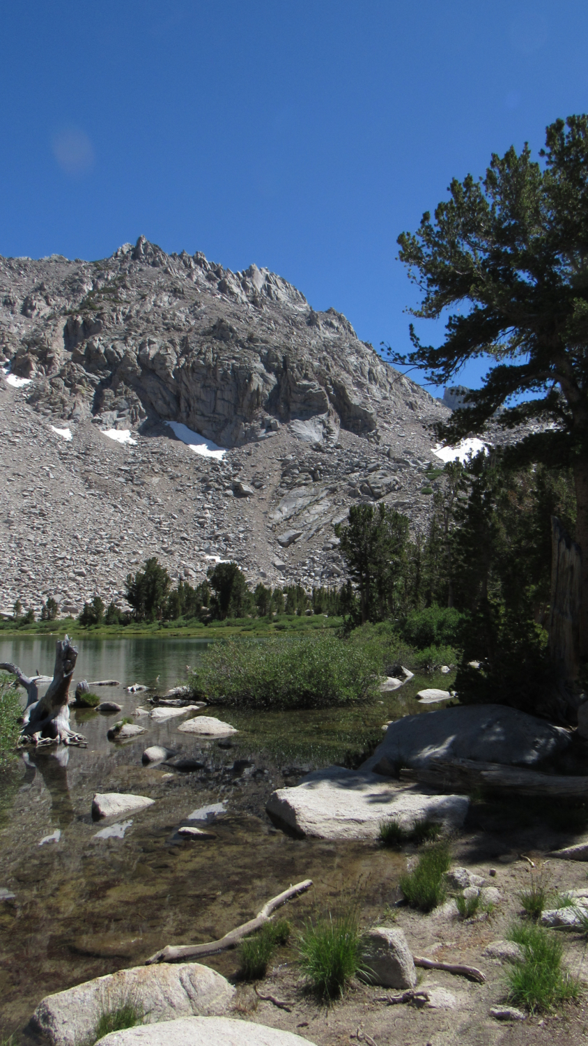
After dipping down to the banks of Independence Creek for a hot minute, the trail veers away and climbs through a rocky section that may be a bit difficult to navigate. If you continue moving south, however, you will gradually leave the rocky section before bottoming out about 50 yards north of the lake.

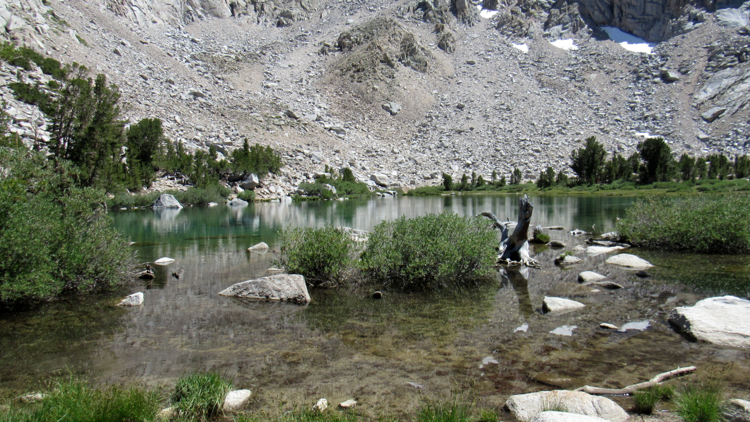
Once at the banks of the lake, you can continue to wander along the west and east banks. Or, if you find yourself taxed from the steep climb, you can plop down and doze for a bit next to Robinson Lake. Whether you are camping or simply settling in for a long, relaxing picnic lunch, the pristine, translucent waters of the lake are eminently peaceful.
Tags: aspens, Independence, Independence Creek, Inyo National Forest, John Muir Wilderness, Kearsarge Pass, Onion Valley, Onion Valley Campground, Robinson Lake