A stroll through Ring Mountain Preserve, a 387-acre preserve on the northern end of the 4.5-mile long Tiburon Peninsula north of San Francisco, reveals the rare Tiburon mariposa lily, petroglyphs, metamorphic rocks, and 360-degree views of the North Bay. This hike follows the Phyllis Ellman Loop Trail, a short, 1.76-mile loop, with side trips to Ring Mountain, Turtle Rock, petroglyphs, and the John Thomas Howell Bench.

Stellar views from Ring Mountain Preserve to Angel Island, Belvedere Island, Richardson Bay, and the Marin Headlands
The Tiburon mariposa lily (Calochortus tiburonensis) is the crown jewel of the Ring Mountain Preserve, typically blooming in late May. It grows in Marin County and nowhere else in the world! The tiger stripe petals are surprisingly difficult to spot against the warm browns and yellows in the preserve. The Tiburon mariposa lily is rated 1B.1 on the California Native Plant Society’s rare plant ranking system, one step away from the 1A rating, assigned to species that are either presumed extinct or no longer growing in California. Please help preserve the Tiburon mariposa lily by treading gently, posting consciously on social media, and leaving no trace.

Tiburon mariposa lily (Calochortus tiburonensis) has a California Rare Plant Rank of 1B.1
Begin your hike at the entrance gate. A welcome kiosk presents an overview map of the trails. The trailhead is a scant 10 feet elevation, just across the street from the Tiburon Peninsula’s northeastern shore and the northern boundary of the San Francisco Bay. Cars whiz by on Paradise Road, circling the forested peninsula on stomach-curling turns. Housing developments are a reality around Ring Mountain Preserve, but no worries, your overall nature experience is stellar thanks to local citizens and environmental groups that fought to preserve this open space.

Oak and bay woodland provide occasional shade on the slopes of Ring Mountain Preserve.
Hike south past the Phyllis Ellman Trail signpost, named for a Tiburon resident who helped save Ring Mountain from development in the late 1970s. The Nature Conservancy purchased this land in mid-1980 and Marin County took over its management in 1995. Today, The Nature Conservancy still supports the park through grants. Those, combined with proceeds from Measure A, a quarter-cent sales tax passed in 2012, fund stewardship, habitat restoration, and maintenance projects in the preserve.


Arrive at a fork in 0.25 miles. Here you can take the eastern (left) or western (right) leg of the loop to the ridge. I chose the left (eastern) leg because it takes you directly to Turtle Rock, and it saves the western leg’s panoramic views for the return.

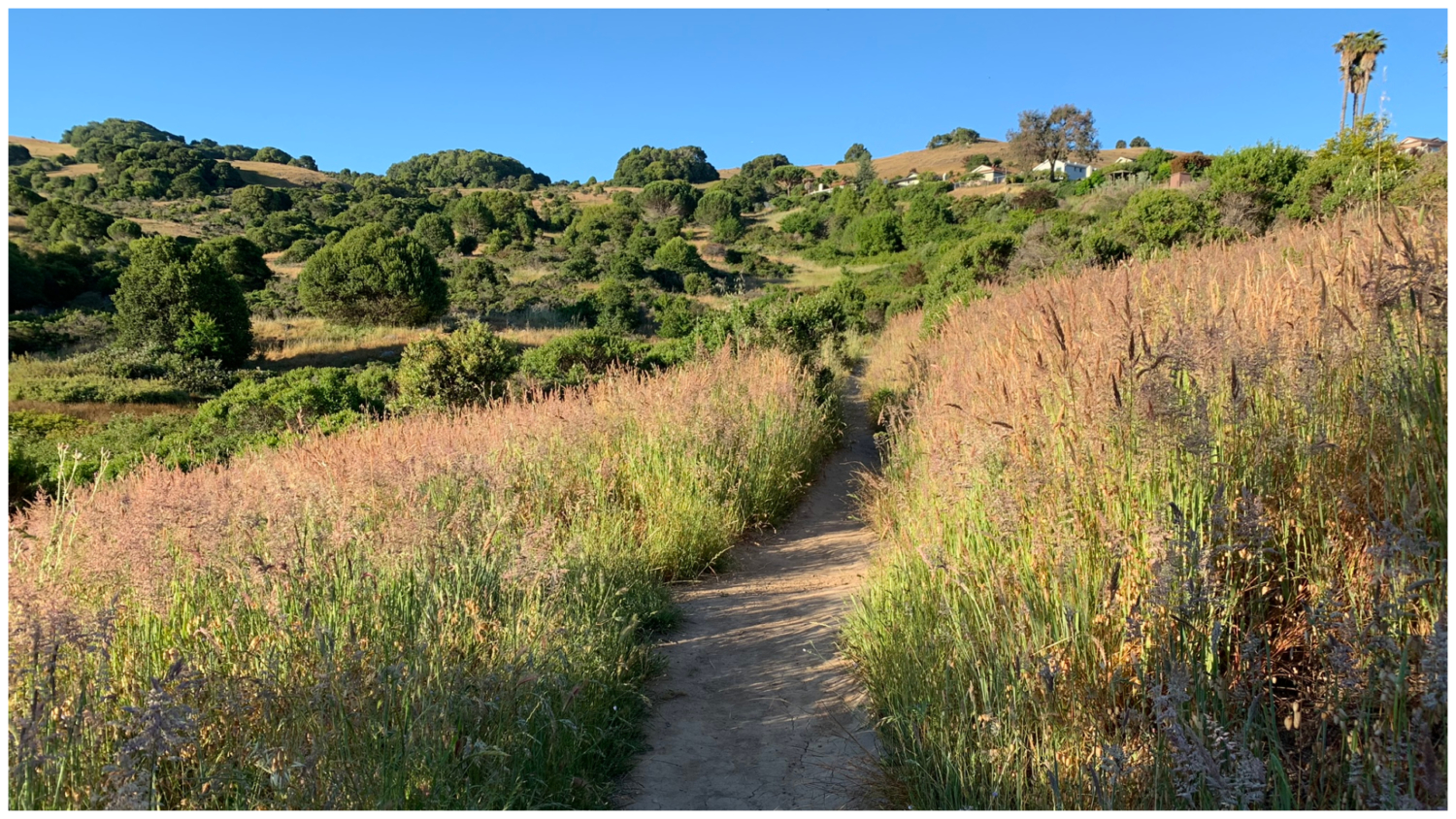
Turn left onto the Phyllis Ellman Loop Trail, ascending a narrow dirt path on a moderate incline through grasslands with live oak, coyote brush, and California bay. Seasonal streams run down the mountain, and you can catch yellow monkey flower (Erythranthe guttata) growing near the the stream’s bank in spring. Narrow, unofficial trails break off from the main trail, but happily, these confusing junctions are signed. Mostly you are in the sun, although there is occasional shade.


Unofficial trails spread out from the main trail, but the main trail is well signed at these junctions.
As you climb, take a moment to look back at the view unfolding to the northeast. Ferries motor through the bay on their way to the Larkspur Ferry Terminal from the San Francisco Ferry Building. San Quentin State Prison, built in 1852, is easily visible across the bay on Point San Quentin. Beyond it to the northeast are the Richmond-San Rafael Bridge, West Marin and East Marin Islands, Point San Pedro, Point San Pablo, and the East Brother Light Station, an active light station that hosts a Victorian B&B. To the northwest, Mount Tamalpais rises into view as you climb.

View of the Richmond-San Rafael Bridge, Point San Pedro, and Point San Pablo.

View of Mount Tamalpais from the Phyllis Ellman Loop Trail.
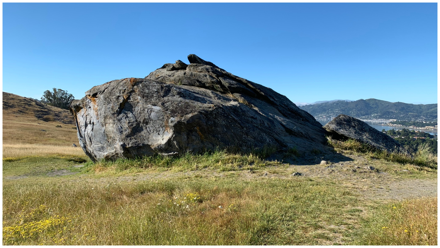
At 1.0 mile, arrive at Ring Mountain Road, which runs east-west like a backbone through the preserve. The ridgeline is scattered with serpentinite, California’s state rock. Turtle Rock, a blue schist metamorphic rock, is straight ahead in 200 feet, resting in a saddle between Ring Mountain to the east and a high ridge to the west. We’ll return to Turtle Rock in a moment, but for now, let’s turn left to go to the summit of Ring Mountain.


Hike east on Ring Mountain Fire Road for 0.1 miles, and then turn right onto Taylor Fire Road. In 500 feet, bear left to stay on Taylor Fire Road to a flattened out landing. At 1.4 miles, you are officially standing on the summit of Ring Mountain, elevation 602 feet. In 1951, during the Cold War, the U.S. Army leased this land and added four anti-aircraft cannons. Ultimately, the site never engaged in enemy fire, and the structures were torn down in the late 1950s and early 1960s. Today, you can see remains of foundations from the military’s aircraft installation at the end of Taylor Road.


Looking east, spot Mount Diablo above the skyline. Just south of the Richmond-San Rafael Bridge is Red Rock Island, the only privately owned island in the San Francisco Bay. Its 5.8 acres are uninhabited, and its primary claim to fame—aside from its $22 million price tag in 2011—is that it was designated a triangulation point in 1850, officially bordering Marin, San Francisco, and Contra Costa counties.

Mount Diablo across the bay to the east

Red Rock Island just south of the Richmond-San Rafael Bridge

Golden Gate Bridge towers peaking out to the southwest.
When ready, retrace your steps west towards Turtle Rock. At the Ring Mountain Road and Phyllis Ellman Loop junction, turn left and take the short spur south to Turtle Rock at 1.8 miles. It is easy to see how Turtle Rock got its name with its smallish rock head and round shell outline.


Scramble to the top of Turtle Rock and take care, the rock is worn and slippery from the eager shoes before you. The view really is spectacular. Directly south, boats are scattered like grains of sand in Richardson Bay. The tips of the Golden Gate Bridge towers just barely peek out to the south, and Belvedere Island juts into the bay to the southeast.

Beautiful views of Richardson Bay, Sausalito, and the Marin Headlands from Turtle Rock.
Retrace your steps to Ring Mountain Road and turn left, heading west to see the petroglyphs. At the 2.0 mile-mark, turn left onto Reed Ranch Fire Road, taking the grassy road south for 0.1 miles to Petroglyph Rock. An interpretive sign at Petroglyph Rock describes the round carvings, thought to have been made hundreds of years ago by Coast Miwok. Unfortunately, they are a bit tricky to see among scratches and vandalism.


Return once again to Ring Mountain Road, heading west. Pass the western leg of the Phyllis Ellman Trail on your right, climbing 130 feet in the next 0.2 miles to the ridge. We will return to the Phyllis Ellman Trail to head back to the trailhead.

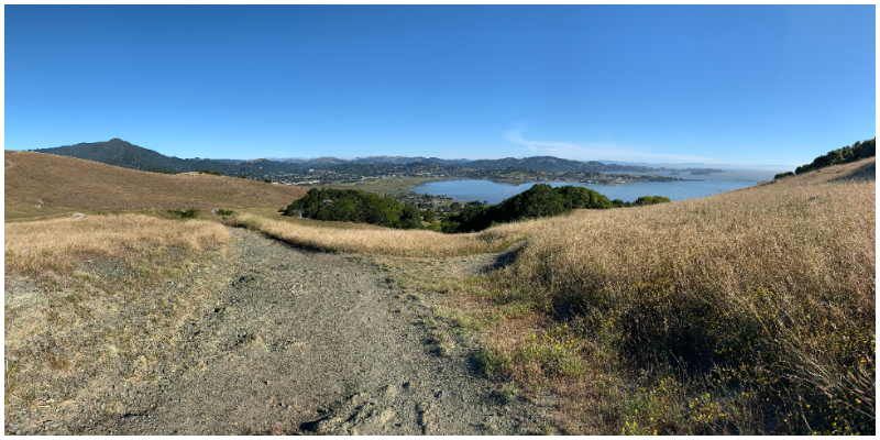
Bear left to stay on Ring Mountain Road at the Green Tank Fire Road junction, and then turn left again at a spur in 150 feet. Here, at the 2.4-mile mark, the John Thomas Howell stone bench rests on a grassy overlook amidst cardinal catchfly and quirky bluff lettuce. Take a seat and enjoy your snack, soaking in the southern panorama of the Tiburon Peninsula, Angel Island, the Bay Bridge, Alcatraz, Tiburon Island, Richardson Bay, and the Marin Headlands. Wow!

The John Thomas Howell bench is a great spot for a snack break, surrounded by views and wildflowers.
When ready, retrace your steps back to the western leg of the Phyllis Ellman Trail on Ring Mountain Road. At the 2.6 mile-mark, turn left to take trail north for 1.0 mile back to the trailhead. This leg is similar to the first in that it is mostly grassland dotted with boulders, coyote brush, live oak, and wildflowers in spring. However, the northern panoramas are particularly swoon-worthy now that you are actually facing them! The view washes over the shoreline of Corte Madera Marsh Ecological Reserve up to the southern reaches of the San Pablo Bay. Descend to the Phyllis Ellman Loop Trail junction you passed earlier in the hike, and then turn left to head back to the parking area.


Notes:
- Ring Mountain Preserve is open during daylight hours.
- Parking is free.
- There are no restrooms at the trailhead.
- Leashed dogs are allowed in Ring Mountain Preserve.
- A map of Ring Mountain Preserve is available online on the Ring Mountain Preserve webpage.
- Downtown Tiburon is located on the southern tip of the Tiburon Peninsula, 5.5 miles south of the Ring Mountain Preserve. It makes a nice day trip out of your hike. Take a walk along Shoreline Park to Elephant Rock Pier for sweeping views of San Francisco, Angel Island, and the Golden Gate Bridge.
Tags: Marin County, Marin County Parks, North Bay, san francisco, San Francisco Bay Area, South Marin, Tiburon Peninsula, wildflowers