This year-round hike on the Chirico Trail to Poo Poo Point on Tiger Mountain is short and steep, but you’ll likely be rewarded by paragliders floating through the sky above expansive views of the Issaquah Alps, Lake Sammamish, and Bellevue, with Mount Baker peeking over the far horizon. Bonus: from a vantage point just beneath the summit, you can spot Mount Rainier hovering in the distance.

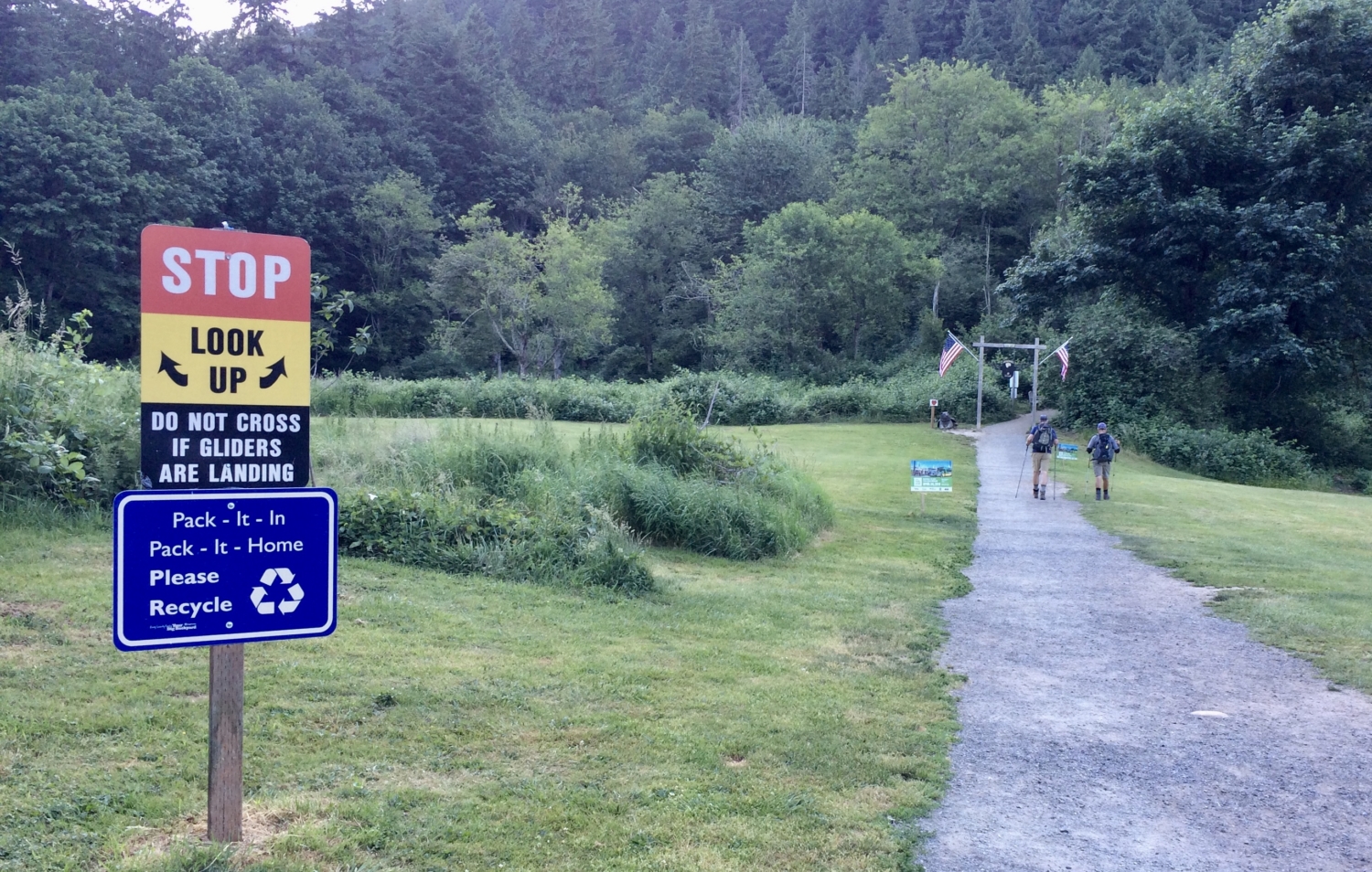
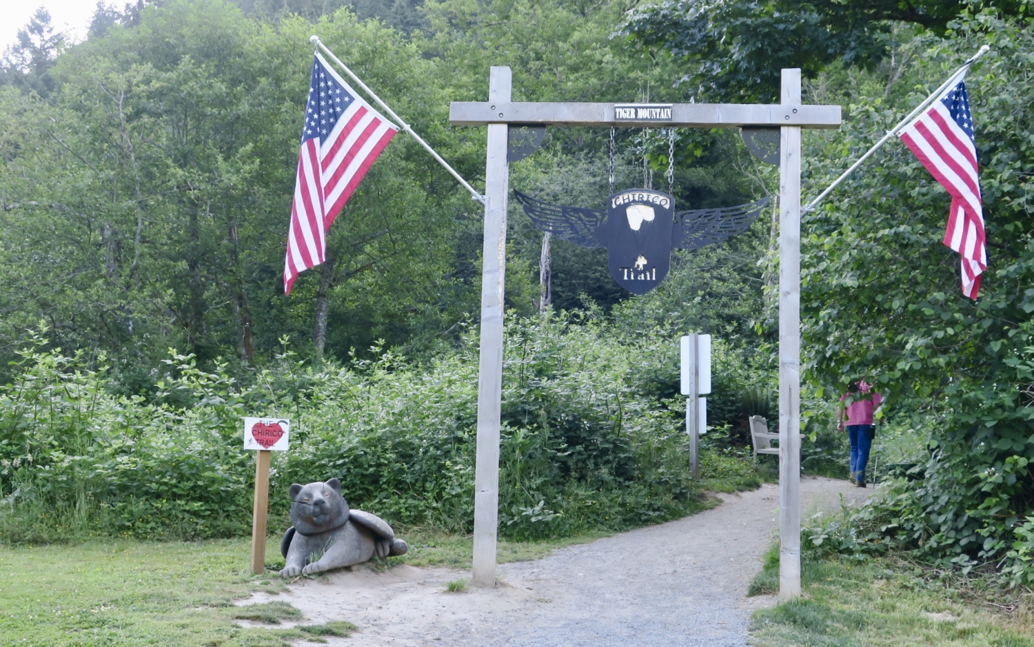
Before you even reach the official trailhead, signs warn you to look skyward. This is a popular landing field for paragliders and hang gliders, who climb the same trail you’re about to start only to take a flying leap off at the top. You’re most likely to see them in early morning or late afternoon, when the wind picks up. Crane your neck, then head across the landing field on the gravel pathway to the wooden portal where a sign marks the beginning of the Chirico Trail, the shortest and steepest route to Poo Poo Point. Don’t be alarmed by the carved winged lion guarding the trail. This mythological creature, symbol of the city of Venice, Italy, and associated with St. Mark, gazes benevolently at passing hikers, wishing them strength for the climb ahead.


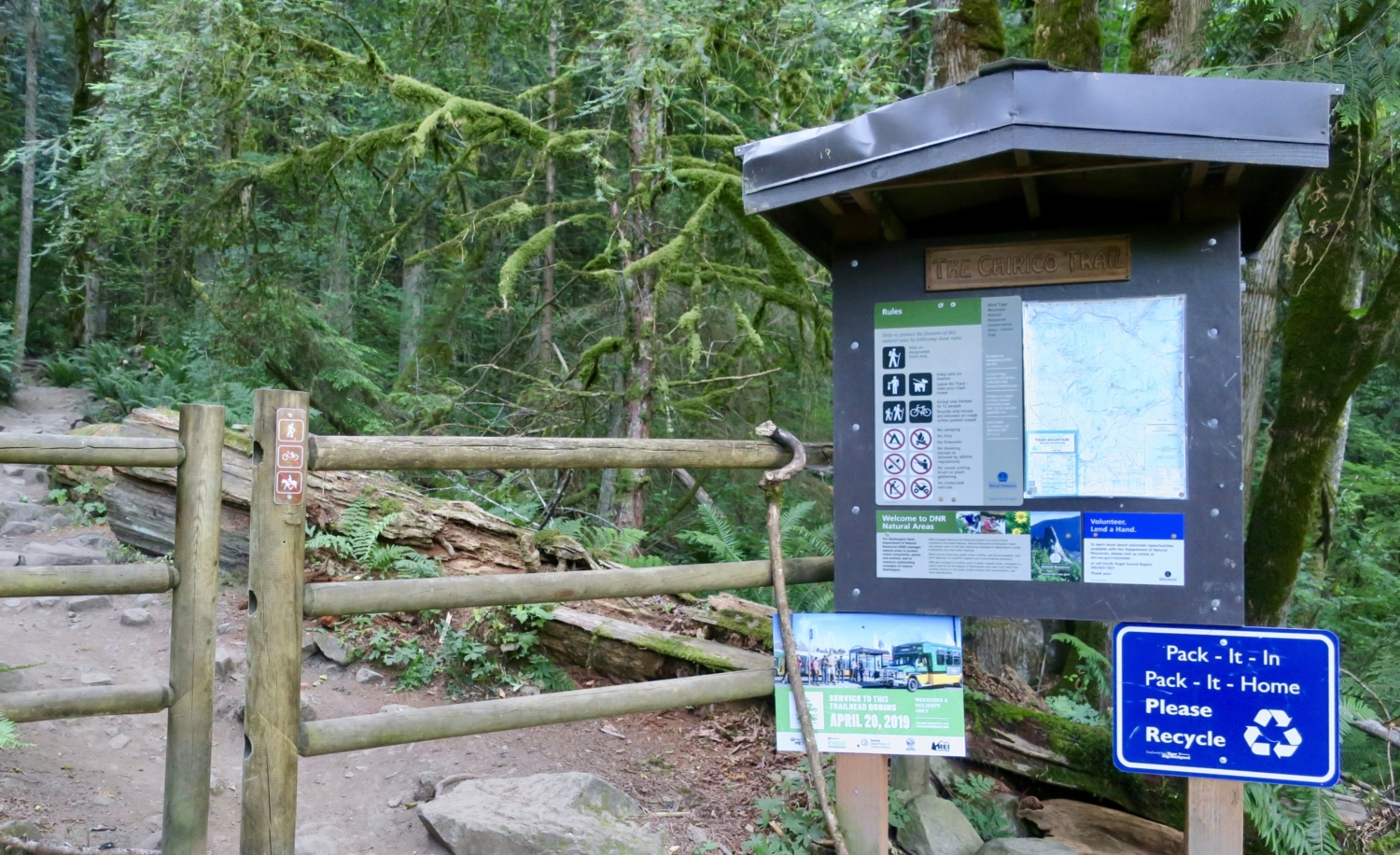
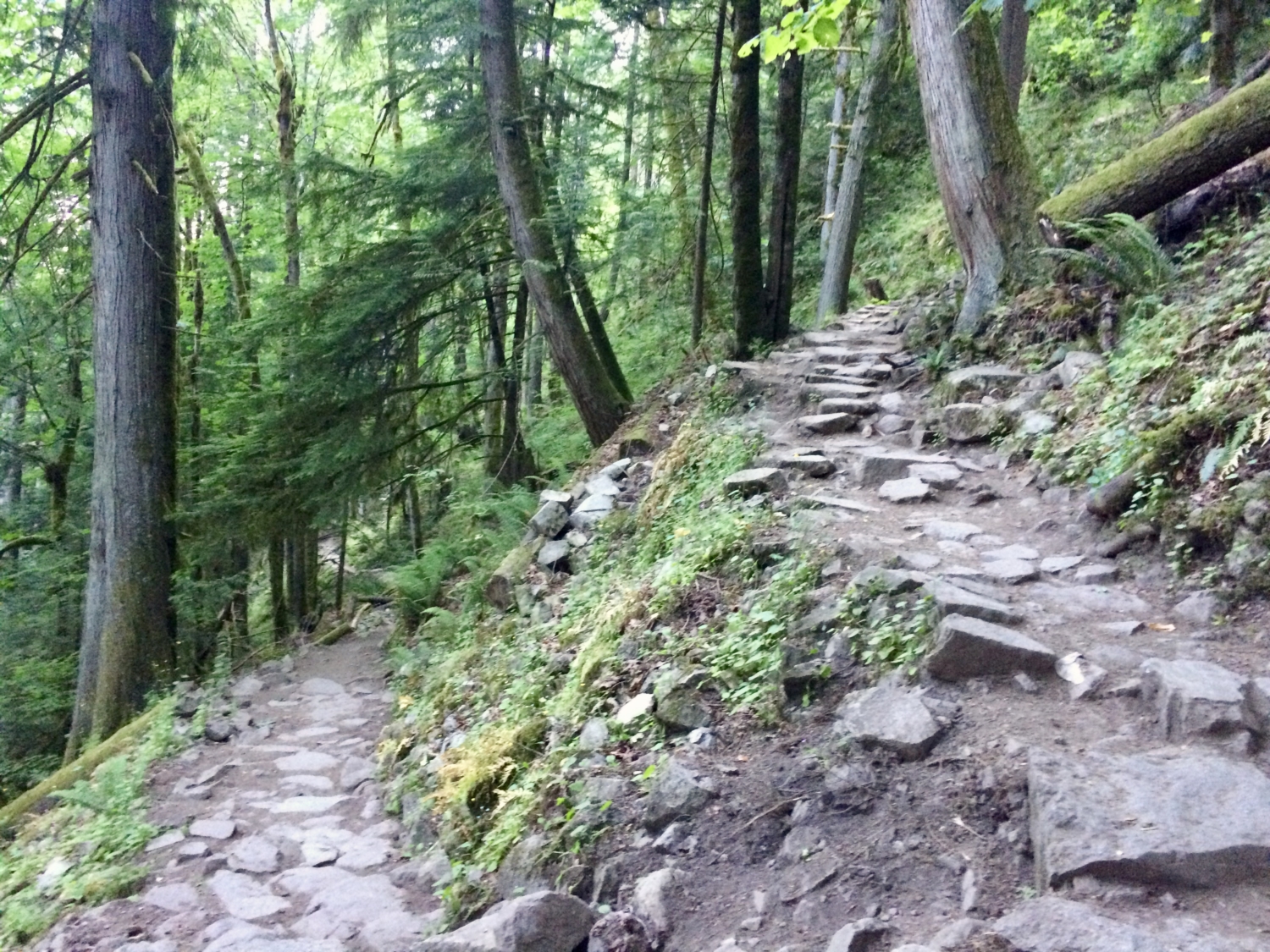
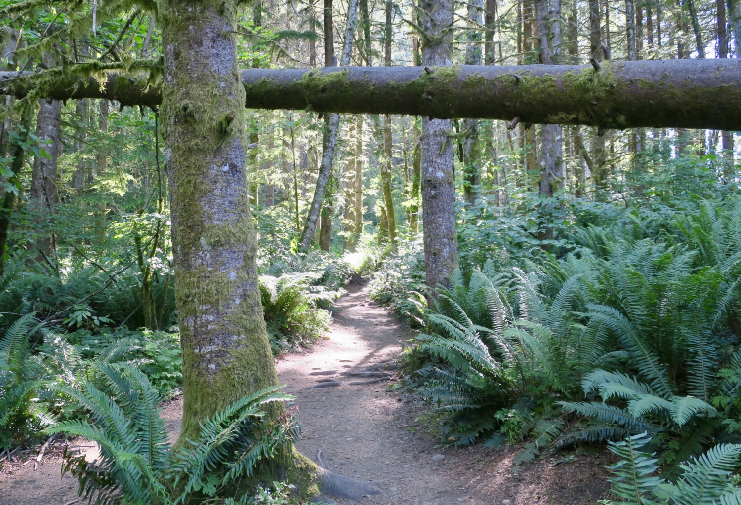
Pass through the opening in the fence, perhaps grabbing a conveniently placed walking stick, and hike through a brushy area to an open field with picnic tables. The trail quickly turns into the forest and the climb begins in earnest. Much of the trail here is stone steps, and it’s steep, gaining 500 feet in the first half-mile as you toil up the Yah-Er Wall. This is a heavily used trail, and even on a weekday you will see dozens of other hikers. Please help maintain the trail for all users and don’t cut the switchbacks. Enjoy the morning mist draping the treetops and cooling the air. Keep climbing through mixed evergreens, some of them impressively large, and vine maples that will light up the forest come fall. Ferns and salal line the sides of the path and moss softens rocks and trees.


At about 1.1 miles, the trail levels out slightly. At 1.4 miles, choose between a very steep uphill shortcut or a gentler grade on a better trail. Shortly after the trails reconverge, leave the forest and step out onto a south-facing promontory. Whatever breath you have left will probably be taken by the view of the Queen of the Cascades, Mount Rainier, squatting on the horizon. The Mountain, as locals affectionately call it, is so massive that it dwarfs 11,138-foot Little Tahoma, a volcanic remnant of Rainier which, if considered as a separate peak, would be Washington’s third-highest.
This area is a also a popular takeoff spot for paragliders. Watch as they test the wind currents and double-check their gear. The flight down to the landing field at the trailhead takes about six minutes, a few more if they catch some drafts. Their sails contrast brightly against the snow-covered mountains, dark green forests, and blue horizon.


Once you’ve had your fill of the view, keep going up the trail to Poo Poo Point. There is a gravel road here, but keep left and stay on the trail. The road provides access for service vehicles and is not for public use. The trail continues for another quarter-mile through the woods up to Poo Poo Point, less a true summit than a prominent knoll atop Tiger Mountain. Now the view looks northwest, with the corporate towers of Bellevue visible beyond Lake Sammamish and Issaquah High School’s track and football field.


Note the artificial turf launch pad, the strategically placed wind socks, and the benches and picnic tables inviting you to sit and grab a snack. Directly to your left is Squak Mountain, and beyond that Cougar Mountain. Along with Tiger Mountain, atop whose westernmost high point you now stand, Taylor Mountain, and Rattlesnake Ridge, these are the Issaquah Alps, a group of Cascade Range foothills laced with popular hiking trails. Just beyond the ridge to your right (also part of Tiger Mountain), look for 10,781-foot Mount Baker. It looks a lot closer than 90 miles away.

There’s a bathroom if you need a rest stop before heading down. When you can tear yourself away from the scenic panorama, head back down the trail to the first viewpoint, then into the forest and back to your car. If you started early, expect to pass dozens of hikers heading up.


At the trailhead once more, scan the skies. You may spot paragliders and hang gliders landing in the field between the trailhead and the parking lot. It will be the perfect cap to an excellent hike.

Tags: Chirico Trail, hang glide, Issaquah, Issaquah Alps, paraglide, Tiger Mountain, Tiger Mountain State Forest, washington