On the north shore of the Island of Hawaii, a rough peninsula juts to the northwest as if reaching toward the Island of Maui and Haleakala National Park. This is Kohala, and it is divided into two administrative units. South Kohala is the relatively dry volcanic semi-desert, home to sprawling, uneroded lava fields and the tony resorts of the Kohala Coast. North Kohala is geographically close, but feels a world away — the lava rocks are replaced by verdant grassland that transitions into a dense tropical rainforest, with undulating hills dropping off into stunning cliffs on black sand beaches. You won’t find resorts here, but you will find vibrant and colorful towns like Hawi and Kapauu, where island life seems little changed from the post-sugarcane days.
Driving down HI-270 through these towns is a wonderful experience in and of itself, and if you travel the road until it ends at a dramatic cliff, you can also take in a short hike to the western edge of the stunning Polulu Valley — a rugged, sparsely populated part of the Island that was home to some of its first settlements.

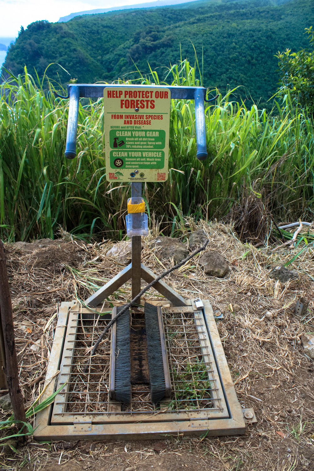
Lots of warnings at the trailhead
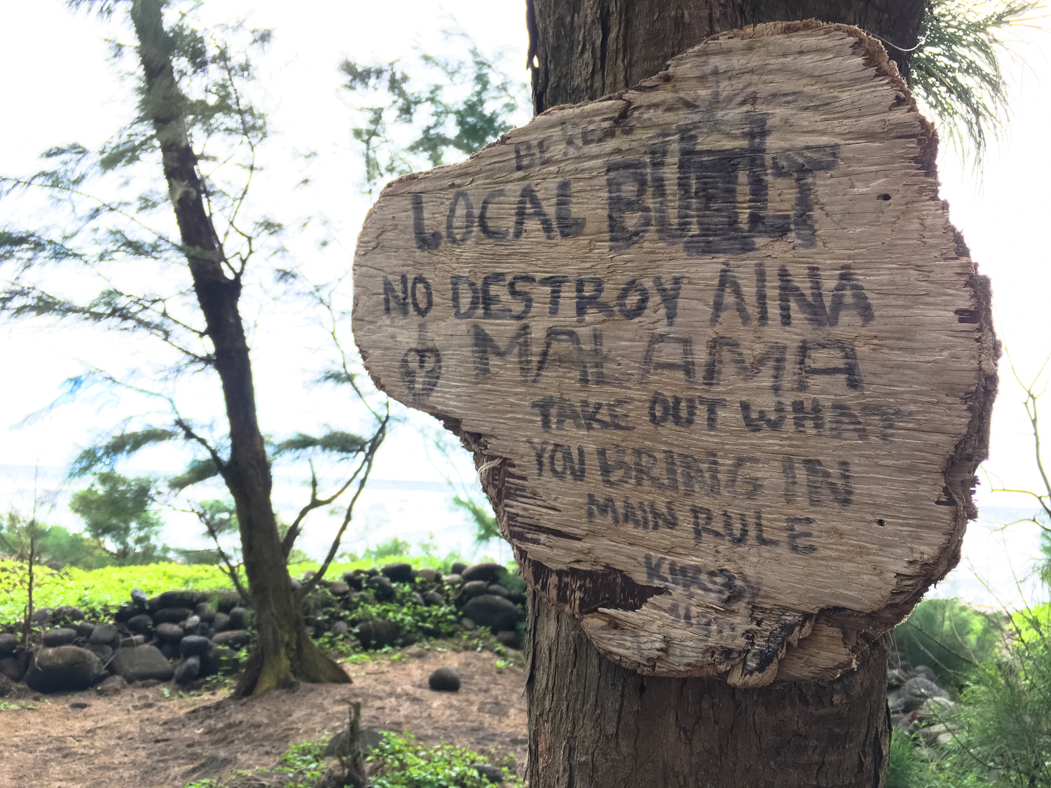
Although this hike short, there are some significant environmental dangers that you should take into account while you’re on the trail. The route meanders down a steep cliffside with exposed drops and very uneven ground, and because the trail is right on the coastline this area is often damp and can be slippery. Rocks can fall due to erosion or hikers above you (or earthquakes), and although the water at the beach looks very inviting, currents here can be strong, swift, and sometimes deadly. If you’re going to swim, do so at your own risk and know what to do if you get caught in a riptide.
Before you get going on this hike, also be sure to brush off your boots, especially if you’re travelling from somewhere outside the Island of Hawaii. Ideally, you’ll also wipe down your gear with an alcohol solution before you hit the trail to help prevent invasive species from getting a foothold in this fragile landscape.

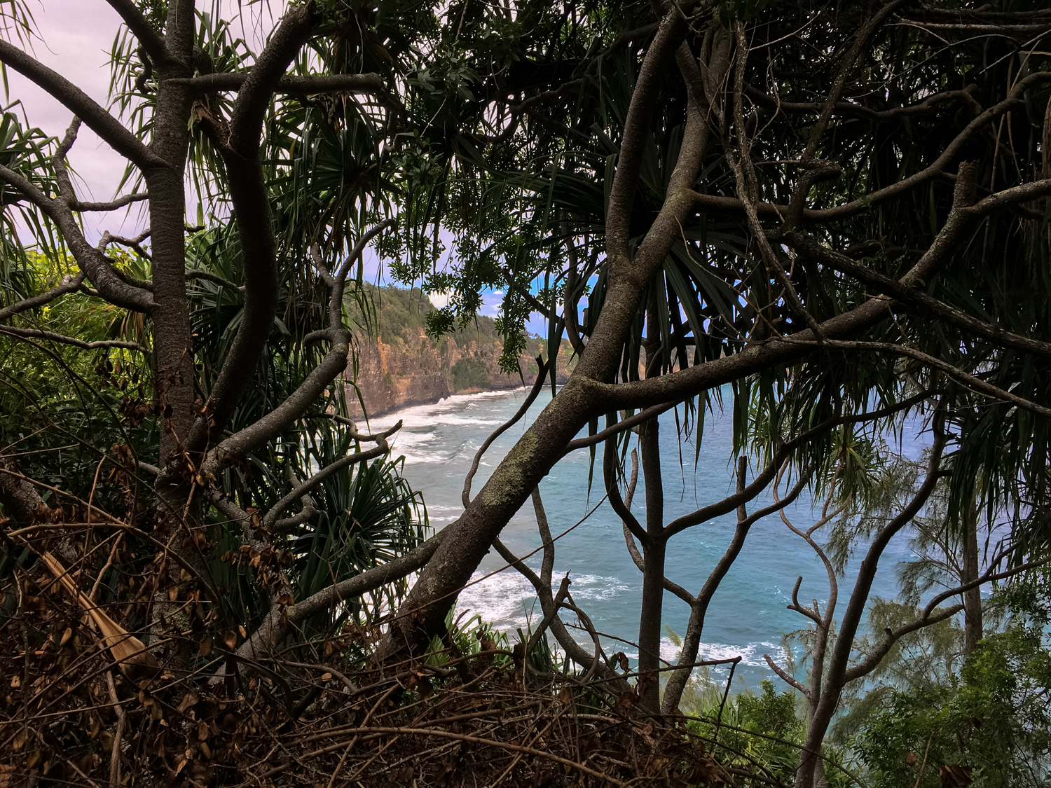
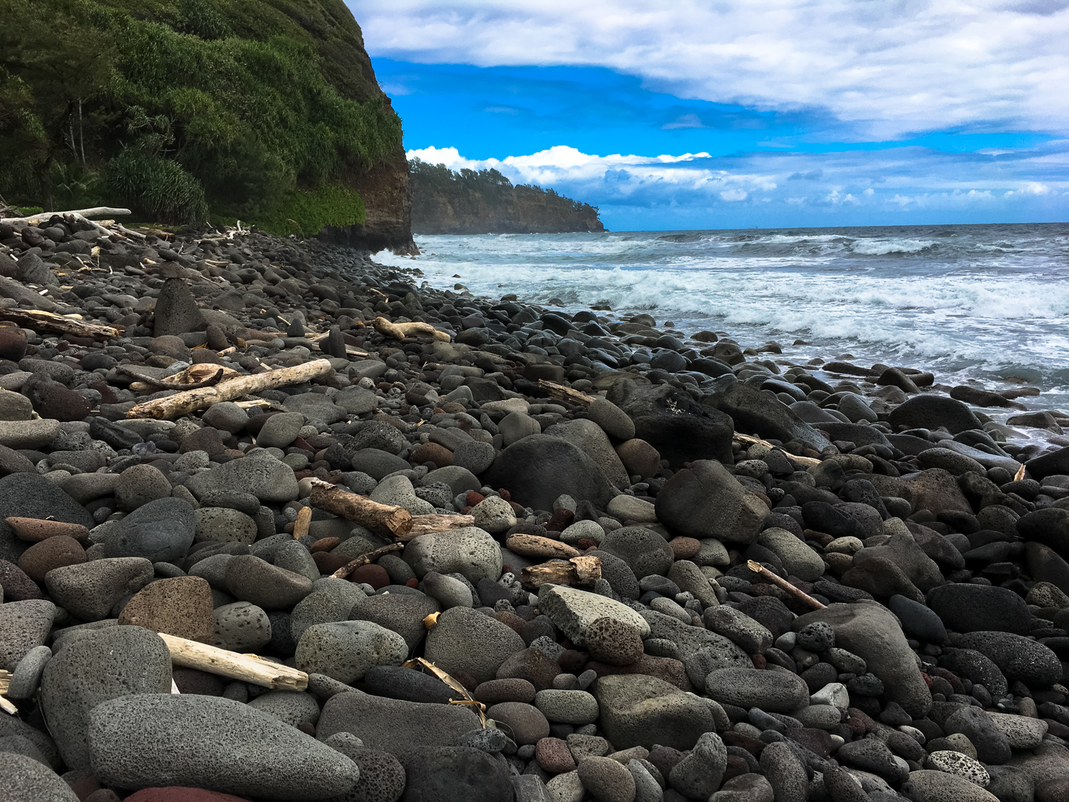
The coastline from the overlook
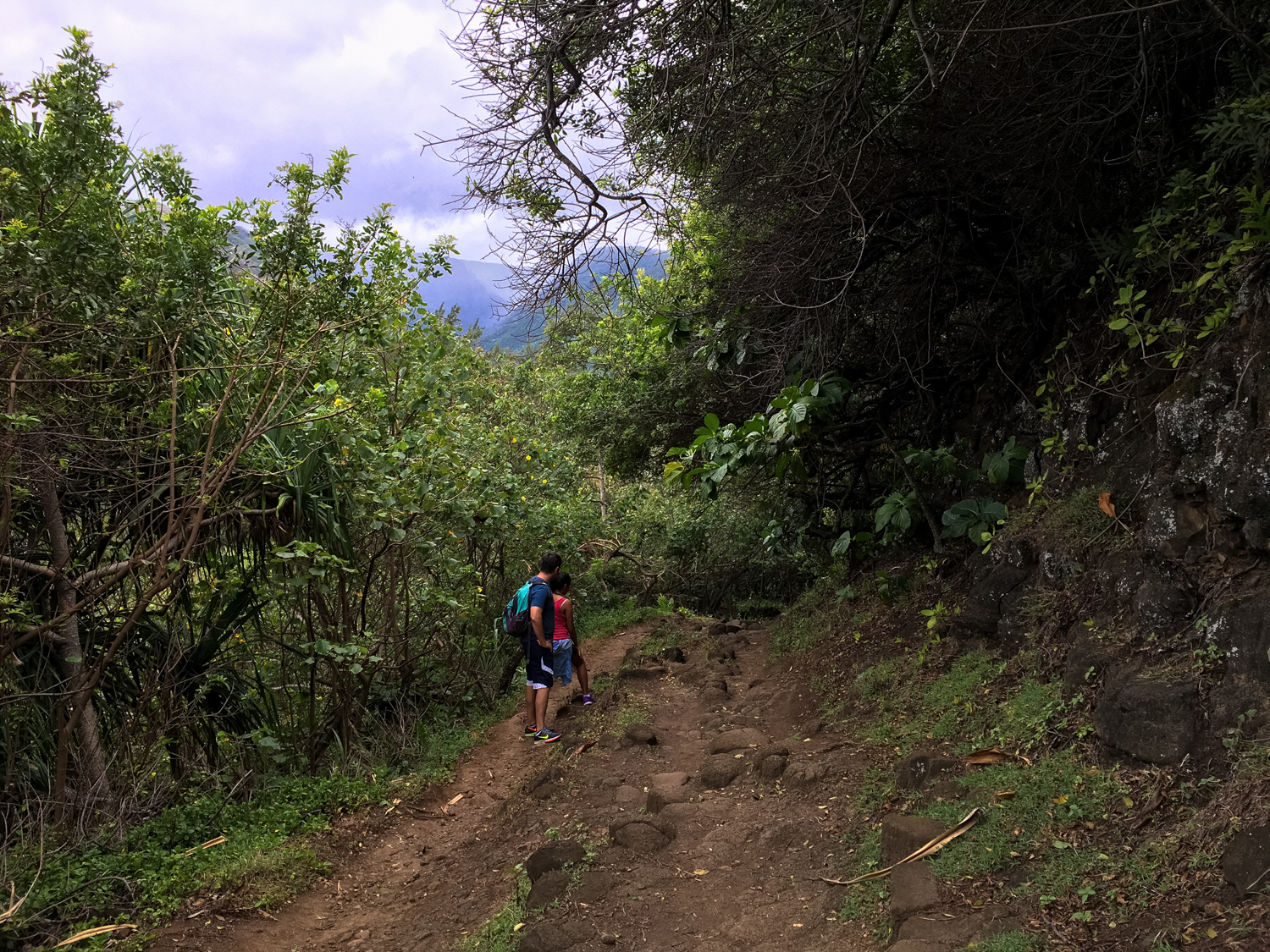
The hike begins by heading down a series of four broad switchbacks. At times, you’ll be in what is nearly a total tunnel of dense vegetation, while at other times you’ll get glimpses of the gorgeous coastline you’re about to set foot on. It’s a good motivator to keep going! If you’re visiting the region from the Kohala Coast, the increased density of the plant life here is a nice first-hand indicator of just how much a little rainfall can change a landscape.


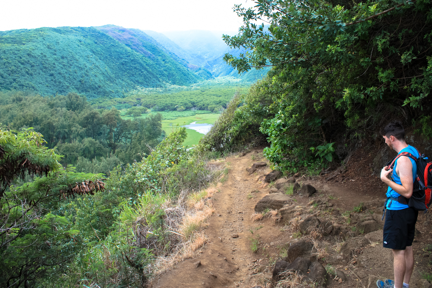
Looking south into the Polulu Valley
You’ll reach the end of the maintained trail at 0.5 mile, but that doesn’t mean the hike is over. From here, you are free to explore the surrounding region and spend as much time as you’d like. To the south, a freshwater Polulu Stream meets the ocean in a calm estuary surrounded by a broad, sweeping valley.
Valleys like this are sacred to Hawaiians — and due to the Island of Hawaii’s relatively young geologic age, there aren’t that many of them on ‘the Big Island.’ Early Hawaiians prized this region for settlement and for growing sweet potato. Although much of the valley is still privately-owned, most residents left after irrigation projects in the early 1900s made settlement in more arable land possible.

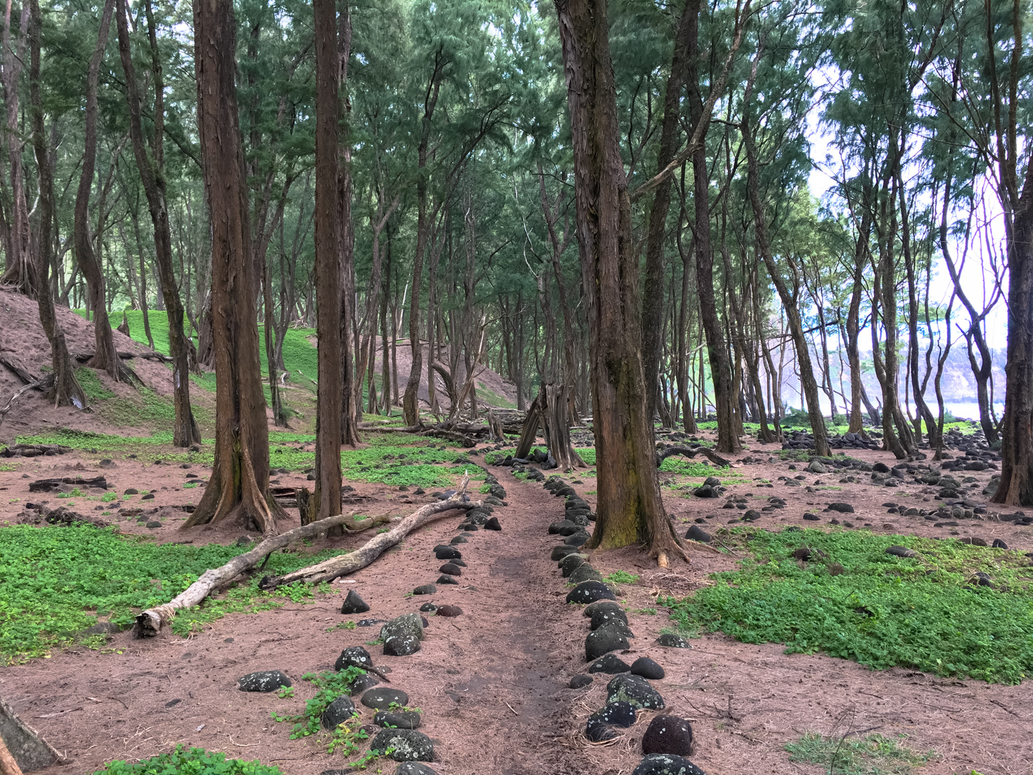
cultivated ironwood trees help protect the sand dunes from erosion
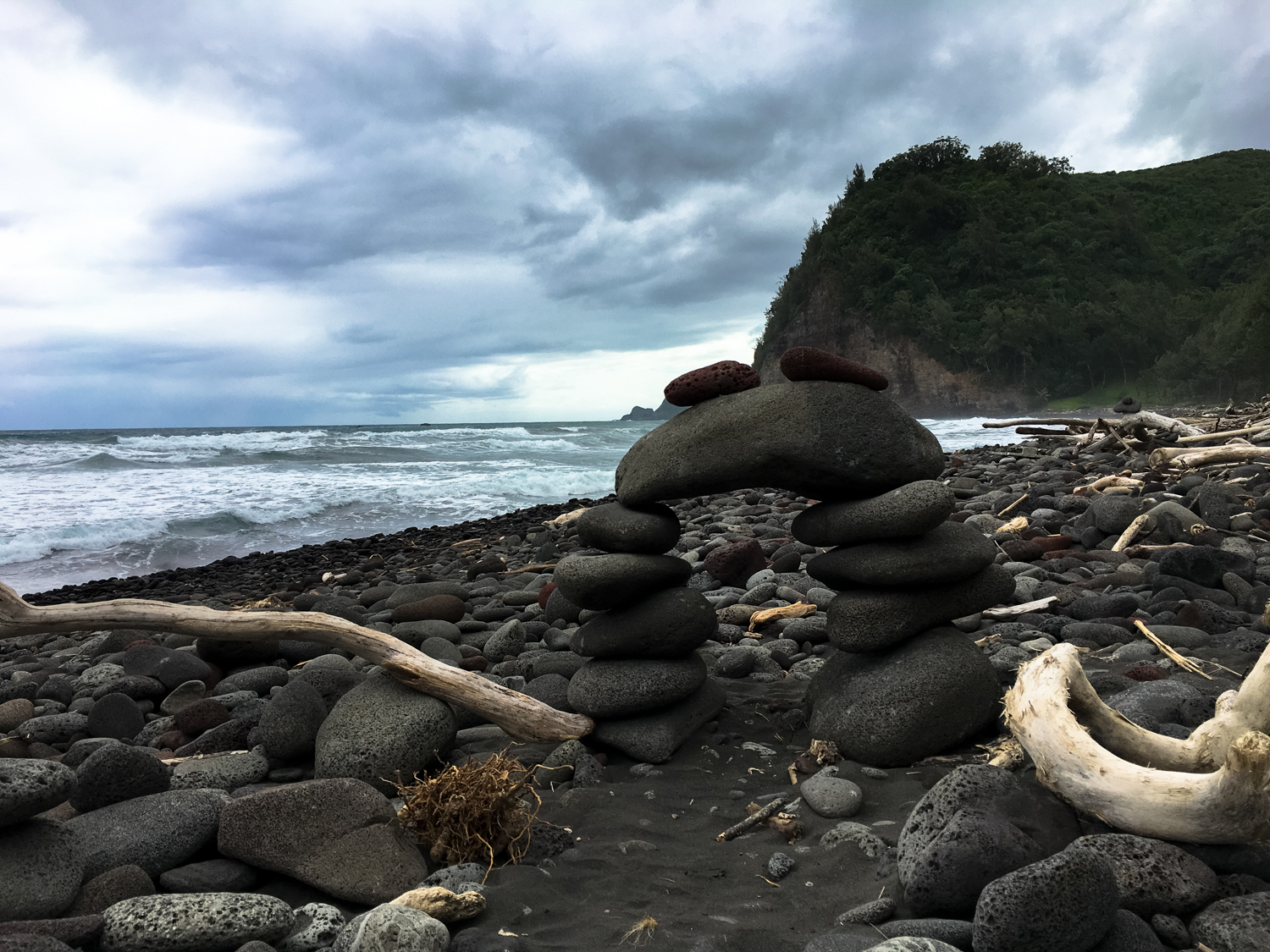
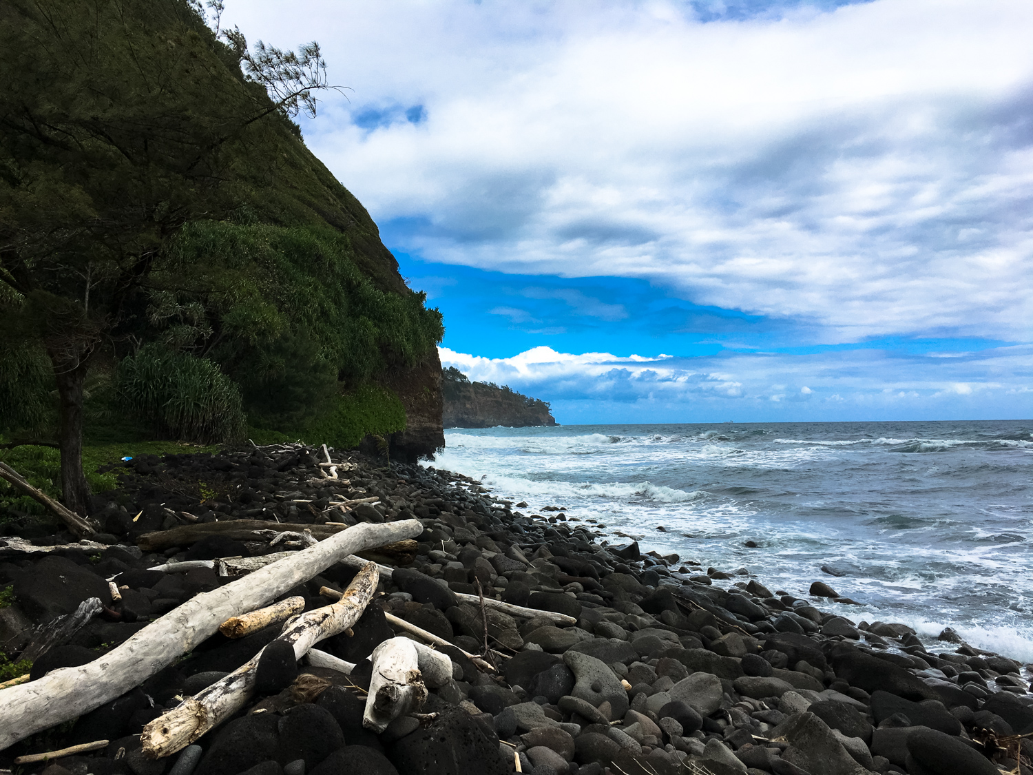
Head north and you’ll quickly reach the black sand shoreline, where driftwood is scattered all along the coast, along with smooth stones worn down from the relentless action of the surf.


Makeshift picnic areas, hammocks, and not-technically-legal campfire rings built by locals dot the landscape along the shoreline. Enjoy the great resting spots and soak in some lovely sea air.

If you’re in for further exploration (and extra elevation gain), the unmaintained Awini Trail continues along the coast and tackles the next ridge, reaching a viewpoint overlooking the more remote and more rugged valley to the immediate east.
This trail starts off looking nice and easy, but its unmaintained nature becomes extremely apparent once it starts climbing up away from the coastline again.

Awini Trail near the coast

… and just a bit further away from the coast, the same trail.
This section of the route does get very dense and slow-going, and is at times almost a bush-whack hike. When we visited, we didn’t make it all the way up because of some pretty intense mud along the way. If you do decide to make it all the way to the next overlook, it’s 0.6 mile from the beach (near the estuary) to a split in the trail. Keep left at that junction and hike another 0.3 mile to the overlook.
The trail does continue further to the east but does not connect to Waipo to the east, and earthquake activity has damaged sections of the already unmaintained route, so hike at your own risk and only with proper equipment and training.
Otherwise, enjoy a picnic lunch at the coast and then return back the way you came in.
Tags: beach, hawaii, hawi, kohala, polulu trail