The Pass Mountain Loop trail is a long but easy hike in the Phoenix area. This 7-mile round trip is one of those easy, flowing trails where you don’t have to think too hard about how to navigate and can easily get lost in the views. Also, this trail is not crowded making this a peaceful stroll in the desert mountains.
I had heard from locals that hiking this trail clockwise is better because the incline is more gradual, and that’s how I’ll describe the route in this guide. If you’d prefer a steeper hike up, just reverse these directions and hike counter-clockwise instead.
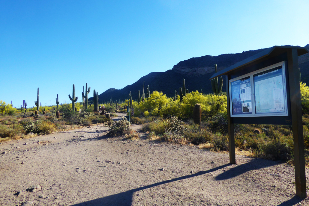
Since this is a loop trail there are numerous trailheads you can use to get onto Pass Mountain Loop Trail. The most convenient access point is at the Wind Cave Trailhead in Usery Mountain Regional Park, where there is a $7 vehicle feet to enter the park.
When I first got to the Wind Cave trailhead, it was packed full of cars. But if you’re here looking for solitude, don’t let this scare you off. The nearby Wind Cave trail is popular and the majority of hikers you see in the parking area are likely going on that trail.
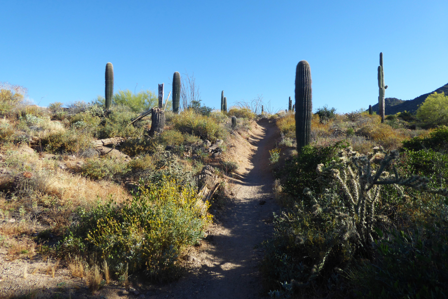
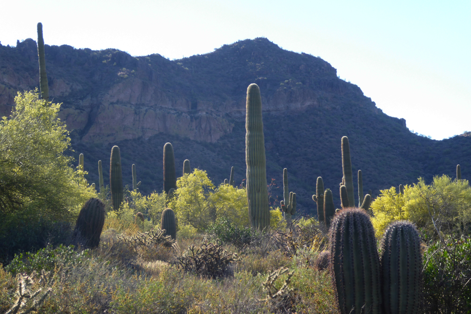
As I veered towards the right onto this trail, it only took a few steps until I felt as if I was in a children’s popup book. Bright plumped green cacti spring up from the ground beaming with pride, welcoming you onto the trail. It was like walking through a forest of these tall saguaro’s cactuses. The further back I went … the more cactuses seemed to be popping up.


The dirt trail remains relatively flat and easy to hike on as it is leads toward the back side of Pass Mountain. When you look at the mountain it seems like it has a porous texture like a sponge and a greenish glow of moss along certain areas that really stand out. Only a few mountains in the Phoenix area has this type of texture making you feel for a second like you’re exploring a sea floor and not the dry desert.


At this point as you look back you can see some of the parks roads and buildings along the side of you with these amazing cactuses sprawled out between you and them. There is even a foothill peak with “Phoenix” painted onto it with an arrow pointing in the direction of the city. So, while you look out in front you feel like your one with nature but to the side you feel the city life still right besides you. Of course, this will all completely change.
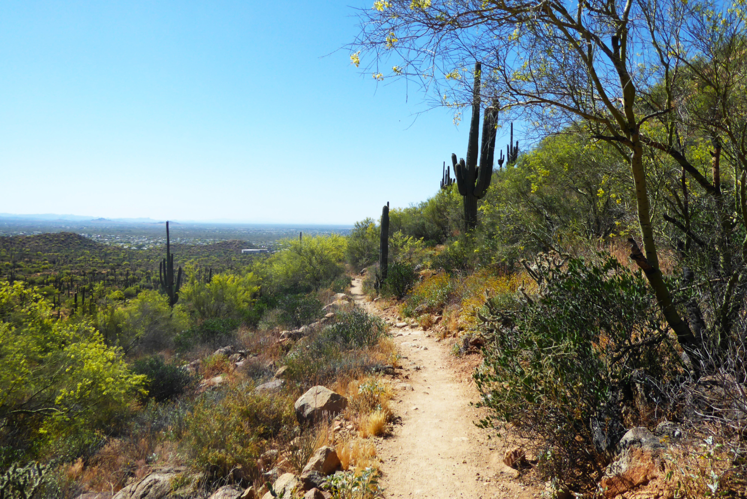
As you start to veer right, heading east the city quickly fades behind you and you will be looking at nothing but desert wilderness for what seems like an eternity. Various mountain ranges with their unique peaks are sprawled out before your eyes with that bright blue sky accompanied with a bird gliding through every so often.
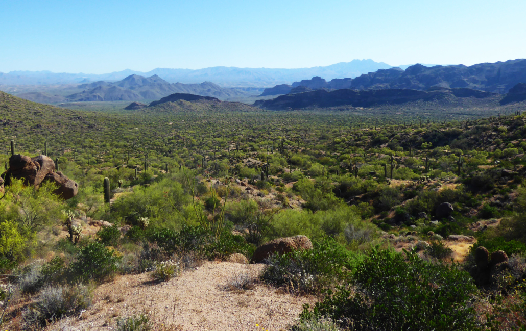
While hiking, it’s hard to take your eyes away from the picture laid out in front of you. Which is why this trail is perfect because the path is flat and clear where you almost don’t need to look at anything else but the view.

Every now and then there will also be side trails leading towards lookout points, where you can see the perfect panoramic desert scene.
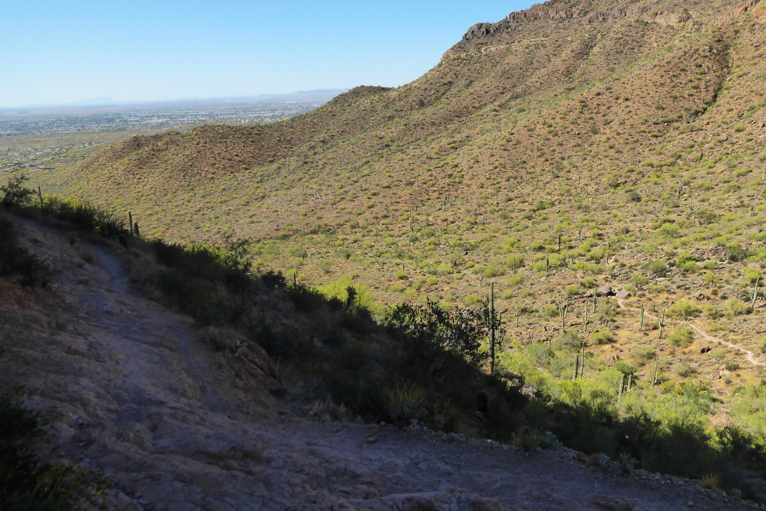
At around the 4 mile mark, as you begin heading back towards the south, this flat trail begins to transform a little, with some loose rocks. Nothing too bad, just note to occasionally take your eyes off the view and watch your step once you reach this area.

Once the trail fully turns towards the south you will first come to a shady area that is located under a boulder. From this viewpoint, you realize that you actually did gain some elevation while hiking, because you will be looking down at the continuation of the trail below you.

Looking down onto the trail from the shady boulder
When hiking down this area, the images of the pop-up book cactuses are now just a memory. The path ahead has turned rocky and desolate with blooming palo verde trees all around. Once back on the ground level, there are some areas where the trail follows a fence bordering the park from the neighborhood. Yes, the city is back.

The blooming palo verde greens have this bright green and yellowish hue to left
Along this portion of the route you will see some smaller side trails, which ultimately leads into the surrounding neighborhoods. There is a clear separation from the size of the main trail verses the neighborhood trails, so just stay on the bigger trail. Remember as well, that this is a loop so you’re going to keep heading back toward the place you started.

Blooming Prickly Pear Cactus along the hiking trail
After completing this hike and heading home, I felt like I discovered a secret in the Phoenix desert. Here I was on this hiking trail feeling the magic and wonder of nature and there was hardly anyone on this trail. I loved every second of it and I’m sure you will too.
So be sure to pack water and some snacks and get ready to take in some amazing desert views!

Tags: Arizona, easy, hike, Hiking, Loop, Phoenix, trails, wildflowers